
Werden and Essen, by Georg Braun and Frans Hogenberg. 1588

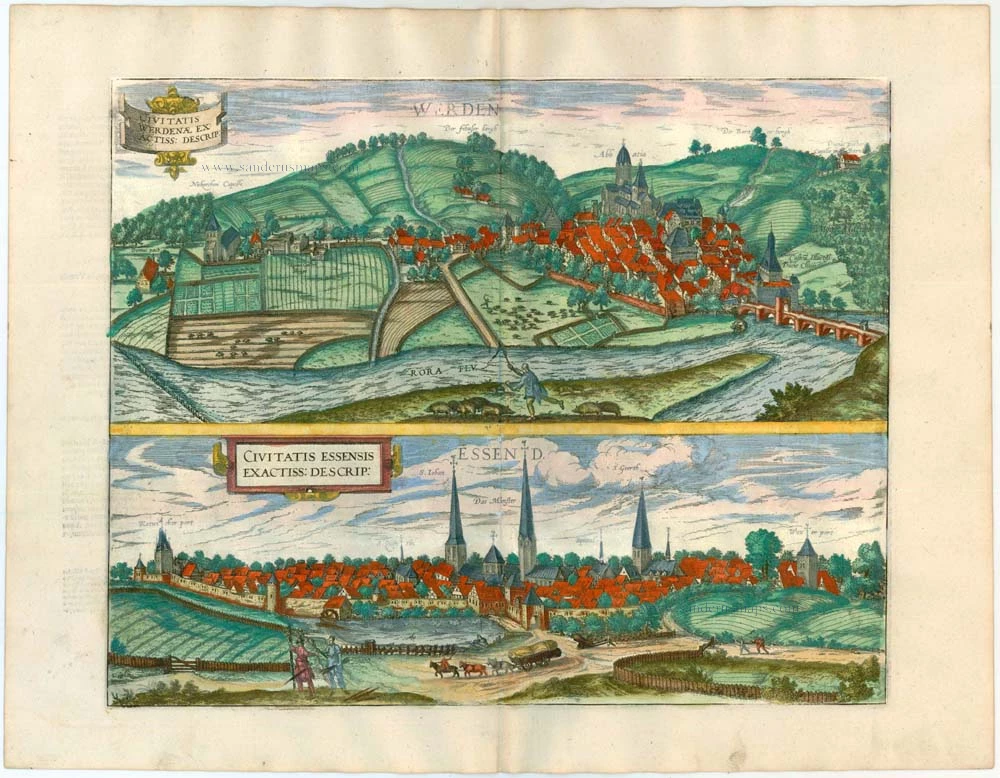
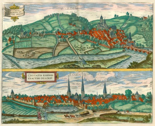


WERDEN
CARTOUCHE: A faithful view of the town of Werden.
COMMENTARY BY BRAUN: "Like many other German towns, the city of Werden arose out of a monastery, which was founded there by St Ludger and built by the 42nd Abbot, William of Hardenberg, in 1370, and vested by Engelbert, Count of the Mark, with civic privileges and freedoms that it still holds today. The town owes the importance that it still possesses to this day wholly to this imposing and widely famed abbey."
Werden is seen from the northwest, coming from the direction of Essen, in its location nestled between the hills above the Ruhr. The castle, constructed around 1479, lies directly beside the bridge on the right. Werden's most striking building is the Benedictine abbey (here labelled Abbatia) around which the town originally sprang up. Founded by St Ludger c. AD 799, the monastery first, Carolingian church was replaced in 1256-1275 by a new Romanesque abbey. Werden was chartered around 1317 and was subsequently fortified with ramparts and towers. Until 1803 the abbotts of the monastery were also the lords of the city, to whom the surrounding lands also belonged. Today Werden is a district of the city of Essen with some 10,000 inhabitants. Since coal has been extracted here since the 16th century, Werden is also considered the birthplace of mining in the Ruhr.
ESSEN
CARTOUCHE: A faithful view of the city of Essen.
COMMENTARY BY BRAUN: "Essen is an imperial city under the rule of the Duke of Berg; it is famous for its nunnery and monastery, which the fourth bisshop of Hildesheim, Altfrid, had erected on his paternal estates, so that 52 holy virgins under the direction of a devout abbess could be instructed in devotion and held to it. Twenty canons also live there with their abbot, according to the rules adopted by the monks."
The plate shows a view of Essen from the southeast, seen in cavalier perspective. The skyline is dominated by the church spires soaring above the densely packed houses inside the city walls, constructed in 1244: in the centre the Gothic cathedral (Das Munster), which replaced the original convent church of c. AD 852; to the left the former parish church of St John the Baptist (S. Iohan); and to the right St Gertrude's (S. Geerth). Essen arose in the year 845 following the founding of the convent by Altfrid, the later bishop of Hildesheim. The convent was a religious community of unmarried noblewomen, of whom only the abbess had to take a vow of chastity. The abbesses were of high social rank: the daughters and nieces of German emperors and kings. In 1216 they were made imperial princesses and thereby accorded the same status as the abbot of nearby Werden abbey. In 1377 Essen became a Free Imperial City, which led to a 200-year feud between the city and the abbesses for dominance in the region. Essen lies at the heart of the Ruhr Valley and from the late 1700s until the 1900s was shaped by coal mining. (Taschen)
Braun G. & Hogenberg F. and the Civitates Orbis Terrarum.
The Civitates Orbis Terrarum, or the "Braun & Hogenberg", is a six-volume town atlas and the most excellent book of town views and plans ever published: 363 engravings, sometimes beautifully coloured. It was one of the best-selling works in the last quarter of the 16th century. Georg Braun wrote the text accompanying the plans and views on the verso. Many plates were engraved after the original drawings of a professional artist, a professional artist, Joris Hoefnagel (1542-1600). The first volume was published in Latin in 1572, and the sixth in 1617. Frans Hogenberg created the tables for volumes I through IV, and Simon van den Neuwel made those for volumes V and VI. Other contributors were cartographers Daniel Freese and Heinrich Rantzau. Works by Jacob van Deventer, Sebastian Münster, and Johannes Stumpf were also used. Translations appeared in German and French.
Following the original publication of Volume 1 of the Civitates in 1572, seven further editions of 1575, 1577, 1582, 1588, 1593, 1599 and 1612 can be identified. Vol.2, first issued in 1575, was followed by further editions in 1597 and 1612. The subsequent volumes appeared in 1581, 1588, 1593, 1599 and 1606. The German translation of the first volume appeared from 1574 on, and the French edition from 1575 on.
Several printers were involved: Theodor Graminaeus, Heinrich von Aich, Gottfried von Kempen, Johannis Sinniger, Bertram Buchholtz and Peter von Brachel, who all worked in Cologne.
Georg Braun (1541-1622)
Georg Braun was born in Cologne in 1541. After his studies in Cologne, he entered the Jesuit Order as a novice. 1561, he obtained his bachelor's degree, and in 1562, he received his Magister Artium. Although he left the Jesuit Order, he studied theology, gaining a licentiate in theology.
Frans Hogenberg (1535-1590)
Frans Hogenberg was a Flemish and German painter, engraver, and mapmaker. He was born in Mechelen as the son of Nicolaas Hogenberg.
By the end of the 1560s, Frans Hogenberg was employed upon Abraham Ortelius's Theatrum Orbis Terrarum, published in 1570; he is named an engraver of numerous maps. In 1568, he was banned from Antwerp by the Duke of Alva and travelled to London, where he stayed a few years before emigrating to Cologne. He immediately embarked on his two most important works, the Civitates, published in 1572 and the Geschichtsblätter, which appeared in several series from 1569 until about 1587.
Thanks to large-scale projects like the Geschichtsblätter and the Civitates, Hogenberg's social circumstances improved with each passing year. He died as a wealthy man in Cologne in 1590.
Civitatis Werdenae Exactiss: Descrip: [on sheet with:] Civitatis Essensis Exactiss. Descrip.
Item Number: 11151 Authenticity Guarantee
Category: Antique maps > Europe > Germany - Cities
Antique map with two bird's-eye views by Braun and Hogenberg: Werden and Essen.
Title: Civitatis Werdenae Exactiss: Descrip: [on sheet with:] Civitatis Essensis Exactiss. Descrip.
Date of the first edition: 1581.
Date of this map: 1588.
Copper engraving, printed on paper.
Size (not including margins): 340 x 520mm (13.39 x 20.47 inches).
Verso: Latin text.
Condition: Original coloured, excellent.
Condition Rating: A+.
From: Civitates Orbis Terrarum. . Liber tertius. Cologne, Gottfried von Kempen, 1588. (Van der Krogt 4, 41:1.3)
WERDEN
CARTOUCHE: A faithful view of the town of Werden.
COMMENTARY BY BRAUN: "Like many other German towns, the city of Werden arose out of a monastery, which was founded there by St Ludger and built by the 42nd Abbot, William of Hardenberg, in 1370, and vested by Engelbert, Count of the Mark, with civic privileges and freedoms that it still holds today. The town owes the importance that it still possesses to this day wholly to this imposing and widely famed abbey."
Werden is seen from the northwest, coming from the direction of Essen, in its location nestled between the hills above the Ruhr. The castle, constructed around 1479, lies directly beside the bridge on the right. Werden's most striking building is the Benedictine abbey (here labelled Abbatia) around which the town originally sprang up. Founded by St Ludger c. AD 799, the monastery first, Carolingian church was replaced in 1256-1275 by a new Romanesque abbey. Werden was chartered around 1317 and was subsequently fortified with ramparts and towers. Until 1803 the abbotts of the monastery were also the lords of the city, to whom the surrounding lands also belonged. Today Werden is a district of the city of Essen with some 10,000 inhabitants. Since coal has been extracted here since the 16th century, Werden is also considered the birthplace of mining in the Ruhr.
ESSEN
CARTOUCHE: A faithful view of the city of Essen.
COMMENTARY BY BRAUN: "Essen is an imperial city under the rule of the Duke of Berg; it is famous for its nunnery and monastery, which the fourth bisshop of Hildesheim, Altfrid, had erected on his paternal estates, so that 52 holy virgins under the direction of a devout abbess could be instructed in devotion and held to it. Twenty canons also live there with their abbot, according to the rules adopted by the monks."
The plate shows a view of Essen from the southeast, seen in cavalier perspective. The skyline is dominated by the church spires soaring above the densely packed houses inside the city walls, constructed in 1244: in the centre the Gothic cathedral (Das Munster), which replaced the original convent church of c. AD 852; to the left the former parish church of St John the Baptist (S. Iohan); and to the right St Gertrude's (S. Geerth). Essen arose in the year 845 following the founding of the convent by Altfrid, the later bishop of Hildesheim. The convent was a religious community of unmarried noblewomen, of whom only the abbess had to take a vow of chastity. The abbesses were of high social rank: the daughters and nieces of German emperors and kings. In 1216 they were made imperial princesses and thereby accorded the same status as the abbot of nearby Werden abbey. In 1377 Essen became a Free Imperial City, which led to a 200-year feud between the city and the abbesses for dominance in the region. Essen lies at the heart of the Ruhr Valley and from the late 1700s until the 1900s was shaped by coal mining. (Taschen)
Braun G. & Hogenberg F. and the Civitates Orbis Terrarum.
The Civitates Orbis Terrarum, or the "Braun & Hogenberg", is a six-volume town atlas and the most excellent book of town views and plans ever published: 363 engravings, sometimes beautifully coloured. It was one of the best-selling works in the last quarter of the 16th century. Georg Braun wrote the text accompanying the plans and views on the verso. Many plates were engraved after the original drawings of a professional artist, a professional artist, Joris Hoefnagel (1542-1600). The first volume was published in Latin in 1572, and the sixth in 1617. Frans Hogenberg created the tables for volumes I through IV, and Simon van den Neuwel made those for volumes V and VI. Other contributors were cartographers Daniel Freese and Heinrich Rantzau. Works by Jacob van Deventer, Sebastian Münster, and Johannes Stumpf were also used. Translations appeared in German and French.
Following the original publication of Volume 1 of the Civitates in 1572, seven further editions of 1575, 1577, 1582, 1588, 1593, 1599 and 1612 can be identified. Vol.2, first issued in 1575, was followed by further editions in 1597 and 1612. The subsequent volumes appeared in 1581, 1588, 1593, 1599 and 1606. The German translation of the first volume appeared from 1574 on, and the French edition from 1575 on.
Several printers were involved: Theodor Graminaeus, Heinrich von Aich, Gottfried von Kempen, Johannis Sinniger, Bertram Buchholtz and Peter von Brachel, who all worked in Cologne.
Georg Braun (1541-1622)
Georg Braun was born in Cologne in 1541. After his studies in Cologne, he entered the Jesuit Order as a novice. 1561, he obtained his bachelor's degree, and in 1562, he received his Magister Artium. Although he left the Jesuit Order, he studied theology, gaining a licentiate in theology.
Frans Hogenberg (1535-1590)
Frans Hogenberg was a Flemish and German painter, engraver, and mapmaker. He was born in Mechelen as the son of Nicolaas Hogenberg.
By the end of the 1560s, Frans Hogenberg was employed upon Abraham Ortelius's Theatrum Orbis Terrarum, published in 1570; he is named an engraver of numerous maps. In 1568, he was banned from Antwerp by the Duke of Alva and travelled to London, where he stayed a few years before emigrating to Cologne. He immediately embarked on his two most important works, the Civitates, published in 1572 and the Geschichtsblätter, which appeared in several series from 1569 until about 1587.
Thanks to large-scale projects like the Geschichtsblätter and the Civitates, Hogenberg's social circumstances improved with each passing year. He died as a wealthy man in Cologne in 1590.
Related items
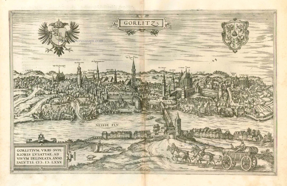
Gorlitz - Gorlitium, Urbs Superioris Lusatiae, ad vivum delineata, Anno Salutis MDLXXV 1576
Gorlitz, by Georg Braun and Frans Hogenberg.
[Item number: 4057]
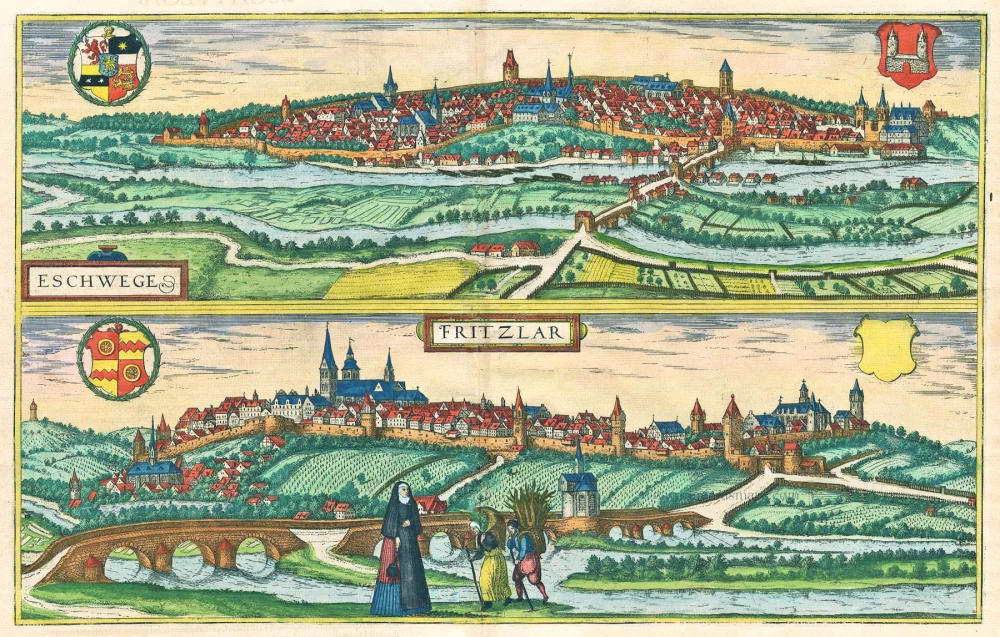
Eschwege [on sheet with] Fritzlar. 1616
Eschwege and Fritzlar, by Braun & Hogenberg.
[Item number: 18533]