
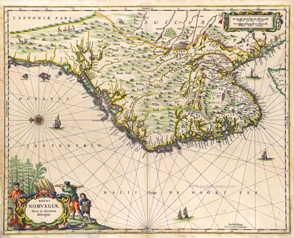
Norway & Denmark by J. Van Keulen. 1681-83
The House of Van Keulen
For more than two centuries, the chart makers firm of Van Keulen was established in the house with the name of “De Gekroonde Lootsman” (The Crowned Pilot). In 1678, the founder of the firm, Johannes I Van Keulen (1634-1689), registered with the Amsterdam booksellers’ guild. He had enlisted the aid of the well-known Mathematical Practitioner Claas Janz Vooght in the preparation of his nautical publications. In 1680 he published the first edition of the Zee-Atlas with 40 charts, all issued for the first time. In the short period of four years, they produced the five volumes of the Nieuwe Groote Ligtende Zee-Fakkel (1681-85). His acquisition of the stock of the bookseller Hendrik Doncker was an essential factor in the development of the firm.
In 1678 a son, Gerard Van Keulen (1678-1726), was born out of Johannes’s first marriage. This son was endowed with talent. He was a skilful engraver and proficient in mathematics and navigational science. Gerard was responsible for establishing the scientific basis of the firm of Van Keulen. In 1714 he was appointed to the office of hydrographer to the Dutch East India Company. The Van Keulens remained chart makers to the East India Company until the Company’s liquidation.
With the introductions to the Zee-Fakkel and Zee-Atlas, Gerard van Keulen gave a new impetus to the firm. Unfortunately, he did not live long, dying when he was 49. The business was carried on by his widow Ludwina Konst. Shortly before Gerard’s death, his son Johannes II had entered the bookseller’s guild, and in 1726 he assumed the management of the firm, though his mother retained her financial interests in the business.
Johannes II Van Keulen (1704-1755) is known in particular for his publication in 1753 of a sixth volume of the Zee-Fakkel, the volume containing the charts of the route to the East Indies.
Johannes II had two sons; they joined the firm as partners in 1757. A considerable number of books appeared in the period 1778-1801. New issues of the Zee-Fakkel again saw the light. The firm flourished under different names until 1885.
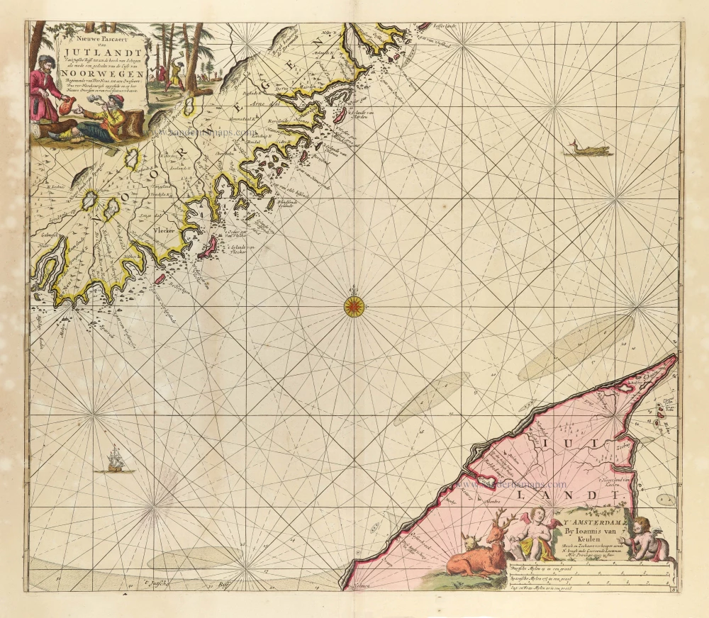
Nieuwe Pascaert van Jutlandt van't Jutsche Riff: Tot aen de Hoeck van Schagen als Mede een Gedeelte van de Cust van Noorwegen Beginnende van der Neus, tot aen Oxefoort ...
Item Number: 11262 Authenticity Guarantee
Category: Antique maps > Europe > Northern Europe
Sea chart of Sweden & Denmark by J. Van Keulen.
Title: Nieuwe Pascaert van Jutlandt van't Jutsche Riff: Tot aen de Hoeck van Schagen als Mede een Gedeelte van de Cust van Noorwegen Beginnende van der Neus, tot aen Oxefoort ...
Oriented to the east.
Date: 1681-83.
Copper engraving, printed on paper.
Image size: 500 x 570mm (19.69 x 22.44 inches).
Sheet size: 625 x 770mm (24.61 x 30.31 inches).
Verso: Blank.
Condition: Original coloured, on heavy paper with wide margins, paper slightly age-toned and stained.
Condition Rating: B.
From: De Nieuwe Groote Lichtende Zee-Fakkel. Amsterdam, 1681-83.
The House of Van Keulen
For more than two centuries, the chart makers firm of Van Keulen was established in the house with the name of “De Gekroonde Lootsman” (The Crowned Pilot). In 1678, the founder of the firm, Johannes I Van Keulen (1634-1689), registered with the Amsterdam booksellers’ guild. He had enlisted the aid of the well-known Mathematical Practitioner Claas Janz Vooght in the preparation of his nautical publications. In 1680 he published the first edition of the Zee-Atlas with 40 charts, all issued for the first time. In the short period of four years, they produced the five volumes of the Nieuwe Groote Ligtende Zee-Fakkel (1681-85). His acquisition of the stock of the bookseller Hendrik Doncker was an essential factor in the development of the firm.
In 1678 a son, Gerard Van Keulen (1678-1726), was born out of Johannes’s first marriage. This son was endowed with talent. He was a skilful engraver and proficient in mathematics and navigational science. Gerard was responsible for establishing the scientific basis of the firm of Van Keulen. In 1714 he was appointed to the office of hydrographer to the Dutch East India Company. The Van Keulens remained chart makers to the East India Company until the Company’s liquidation.
With the introductions to the Zee-Fakkel and Zee-Atlas, Gerard van Keulen gave a new impetus to the firm. Unfortunately, he did not live long, dying when he was 49. The business was carried on by his widow Ludwina Konst. Shortly before Gerard’s death, his son Johannes II had entered the bookseller’s guild, and in 1726 he assumed the management of the firm, though his mother retained her financial interests in the business.
Johannes II Van Keulen (1704-1755) is known in particular for his publication in 1753 of a sixth volume of the Zee-Fakkel, the volume containing the charts of the route to the East Indies.
Johannes II had two sons; they joined the firm as partners in 1757. A considerable number of books appeared in the period 1778-1801. New issues of the Zee-Fakkel again saw the light. The firm flourished under different names until 1885.
Related items
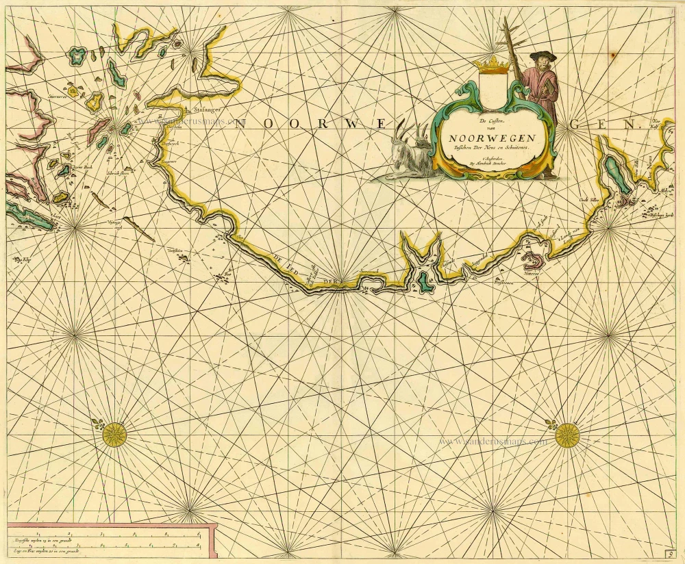
De Custen van Noorwegen tusschen Der Neus en Schuitenes. 1686
Sea chart of Norway, by Doncker H.
[Item number: 15775]
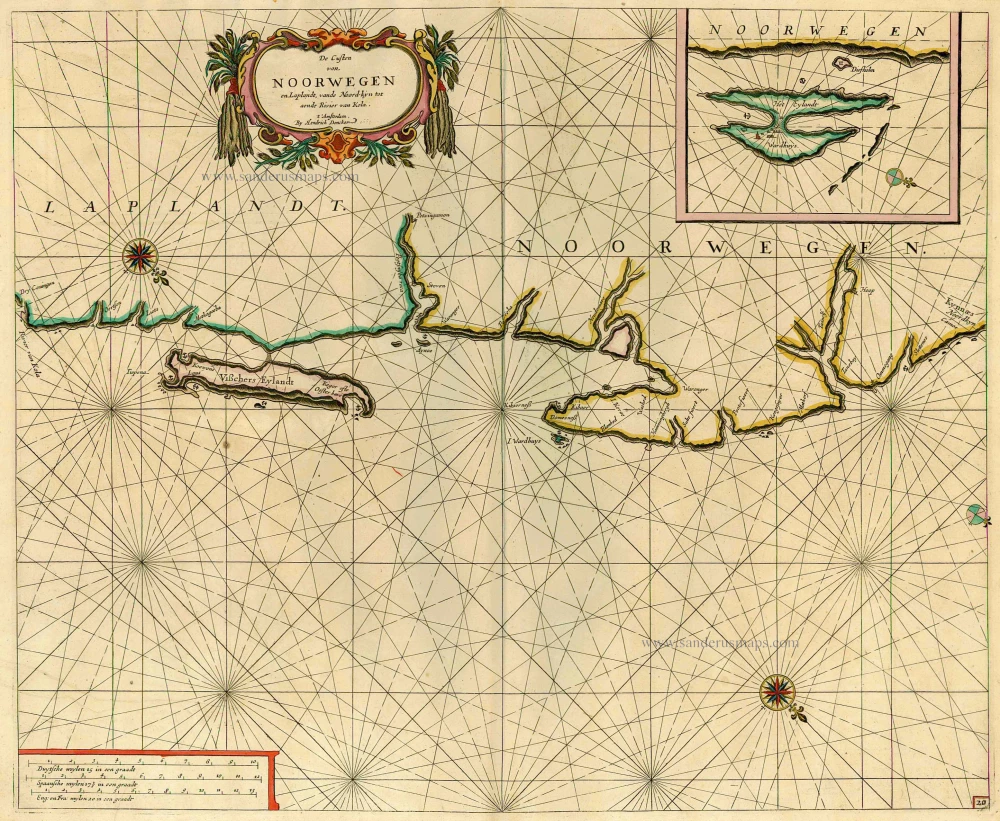
De Custen van Noorwegen en Laplandt, vande Noord-kyn tot aende Rivier van Kola. 1686
Sea chart of the coast of Norway, by Doncker H.
[Item number: 12920]
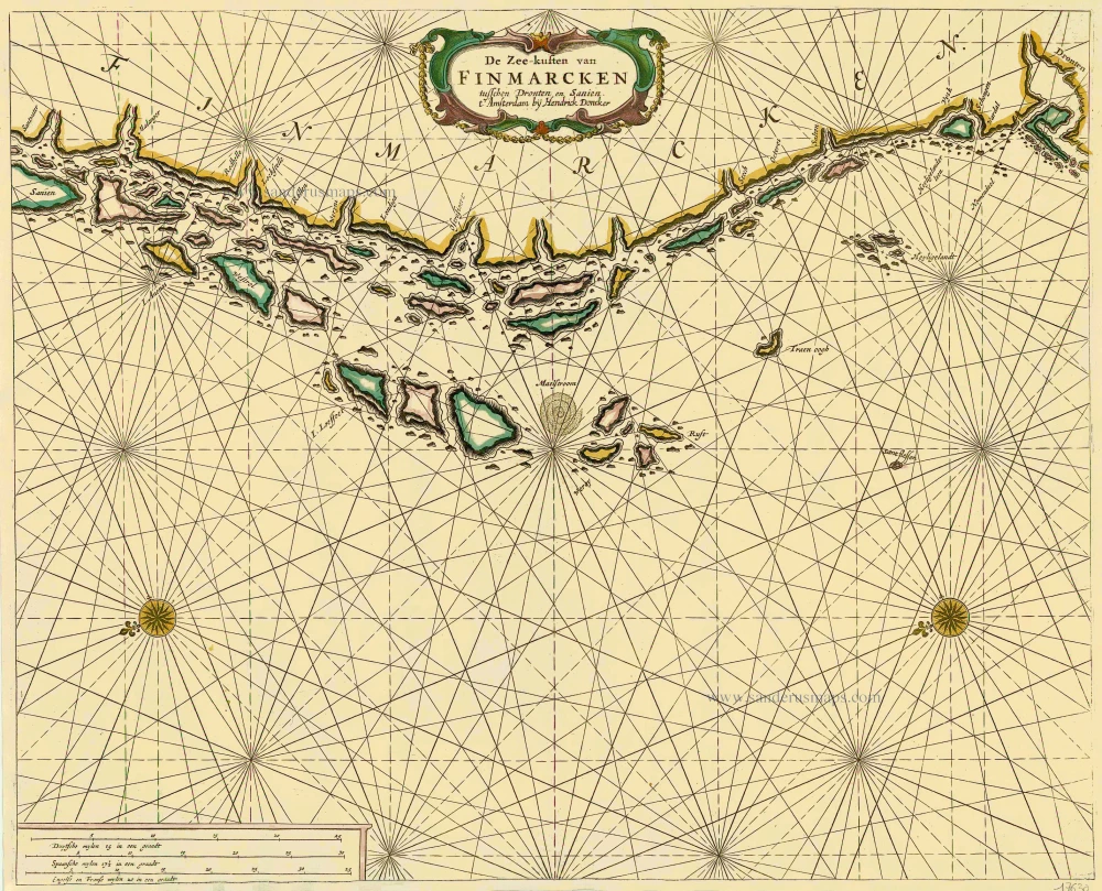
De Zee-kusten van Finmarcken tusschen Dronten en Sanien. 1686
Sea chart of Norway - Finnmark, by Doncker H.
[Item number: 17630]

Caarte van Finmargken van 't Eylandt Sanien tot Noordkyn. 1686
Sea chart of Norway - Finnmark, by Doncker H.
[Item number: 17900]
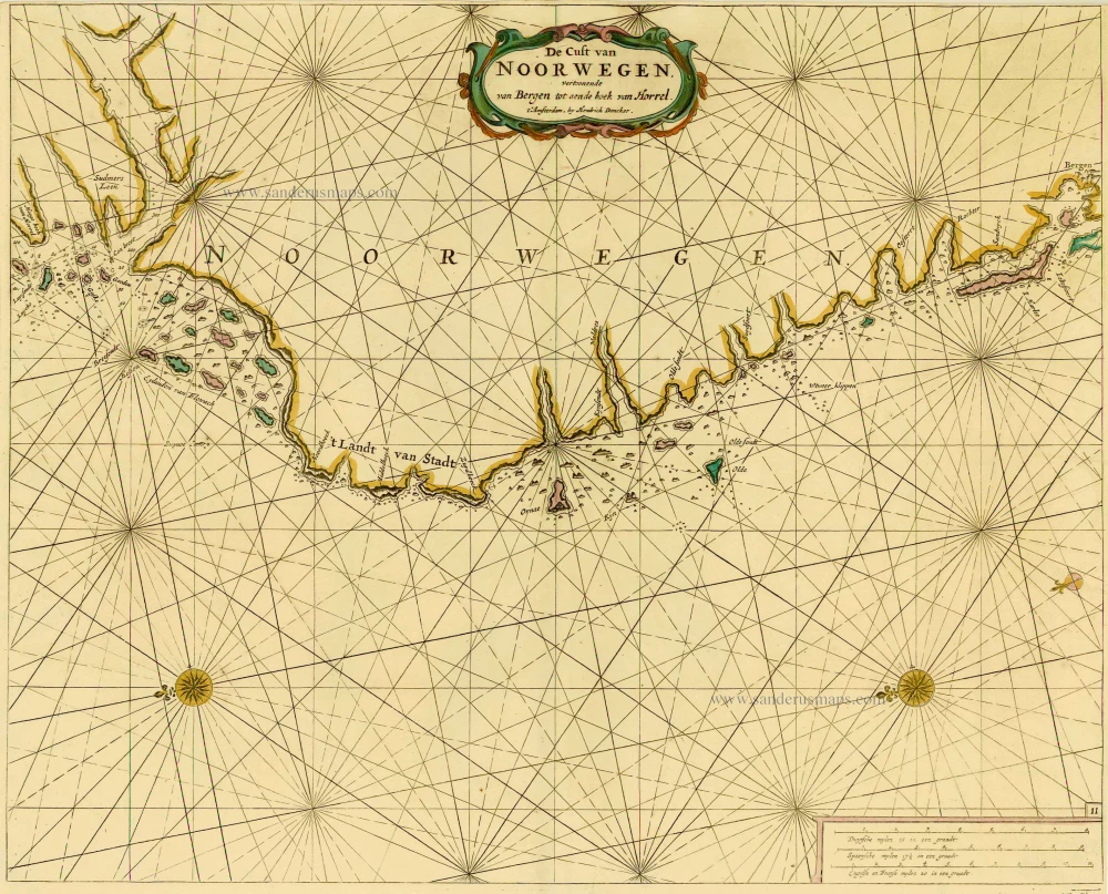
De Cust van Noorwegen vertoonende van Bergen tot aen de hoek van Horrel. 1686
Norway, by Doncker H.
[Item number: 17064]
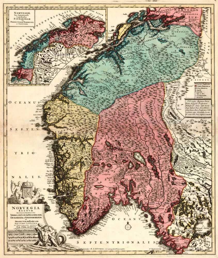
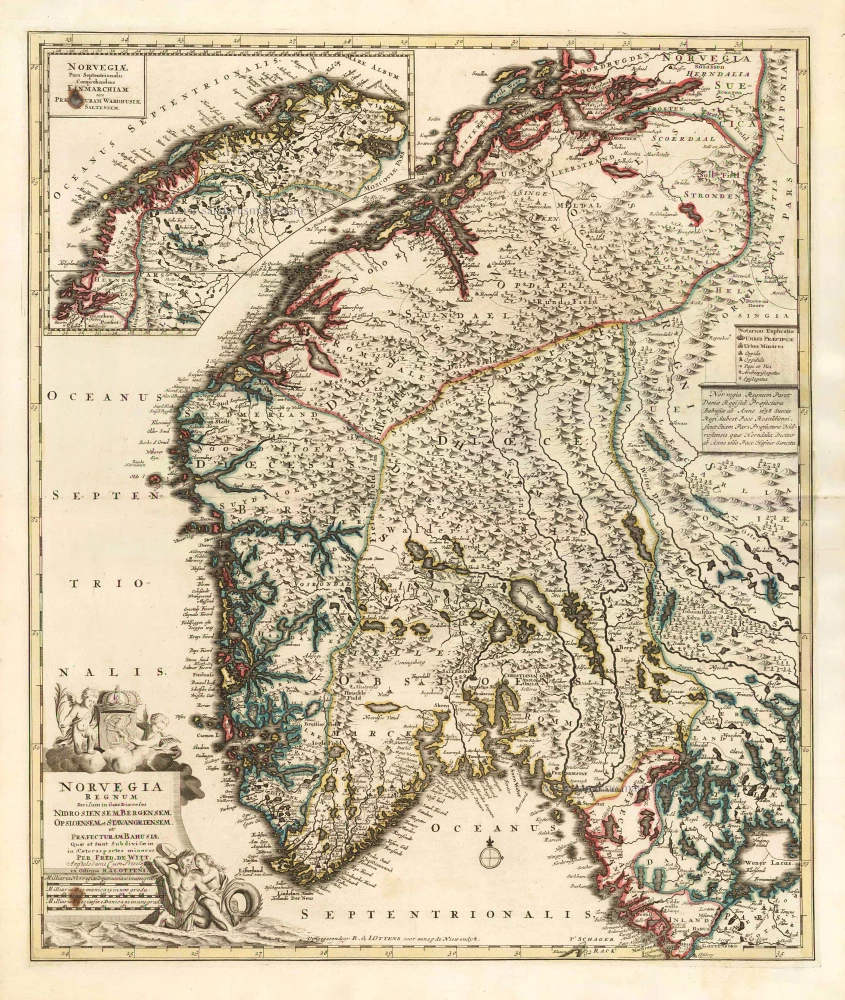
Norvegia Regnum Divisum in suos Dioeceses Nidrosiensem, Bergensem, Opsloensem, et Stavangriensem et Praefecturam Bahusiae ... 1756
Norway by F. de Wit - R. & J. Ottens.
[Item number: 23499]
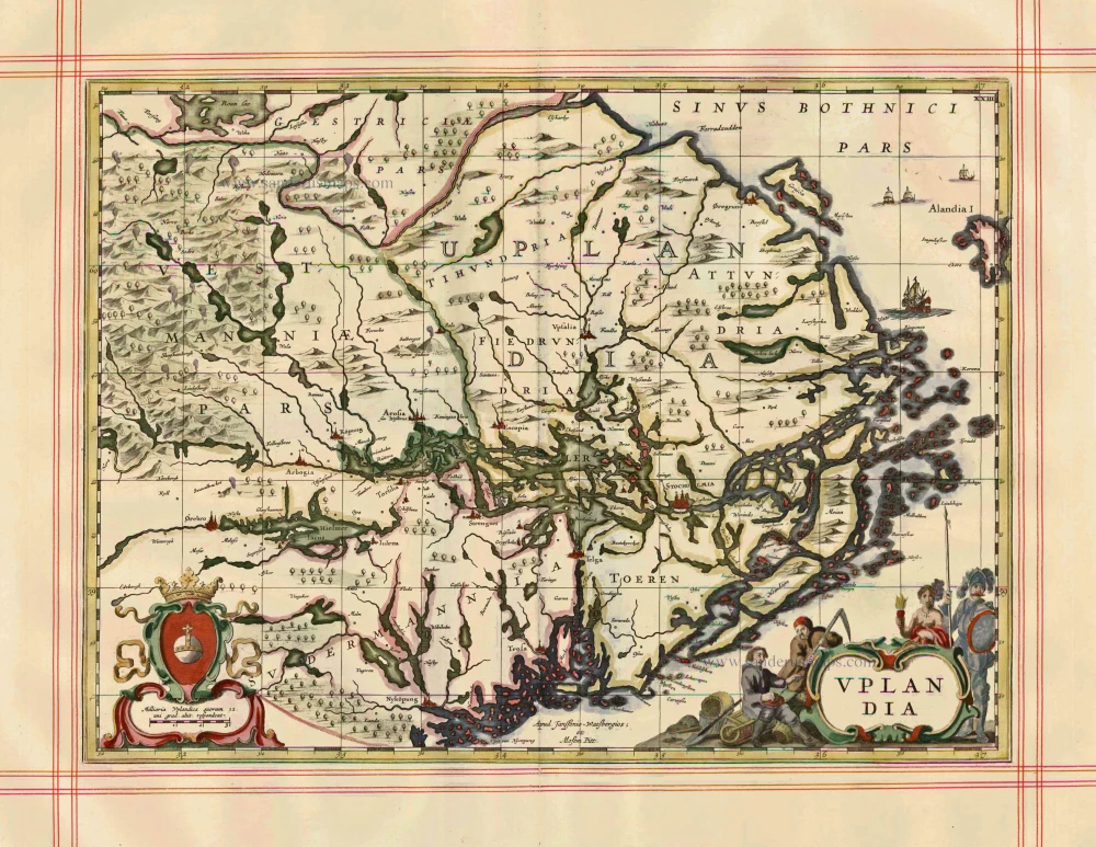
Uplandia 1680
Uppland by J. Janssonius, published by Moses Pitt and J. Janssonius-Waesberge.
[Item number: 1246]
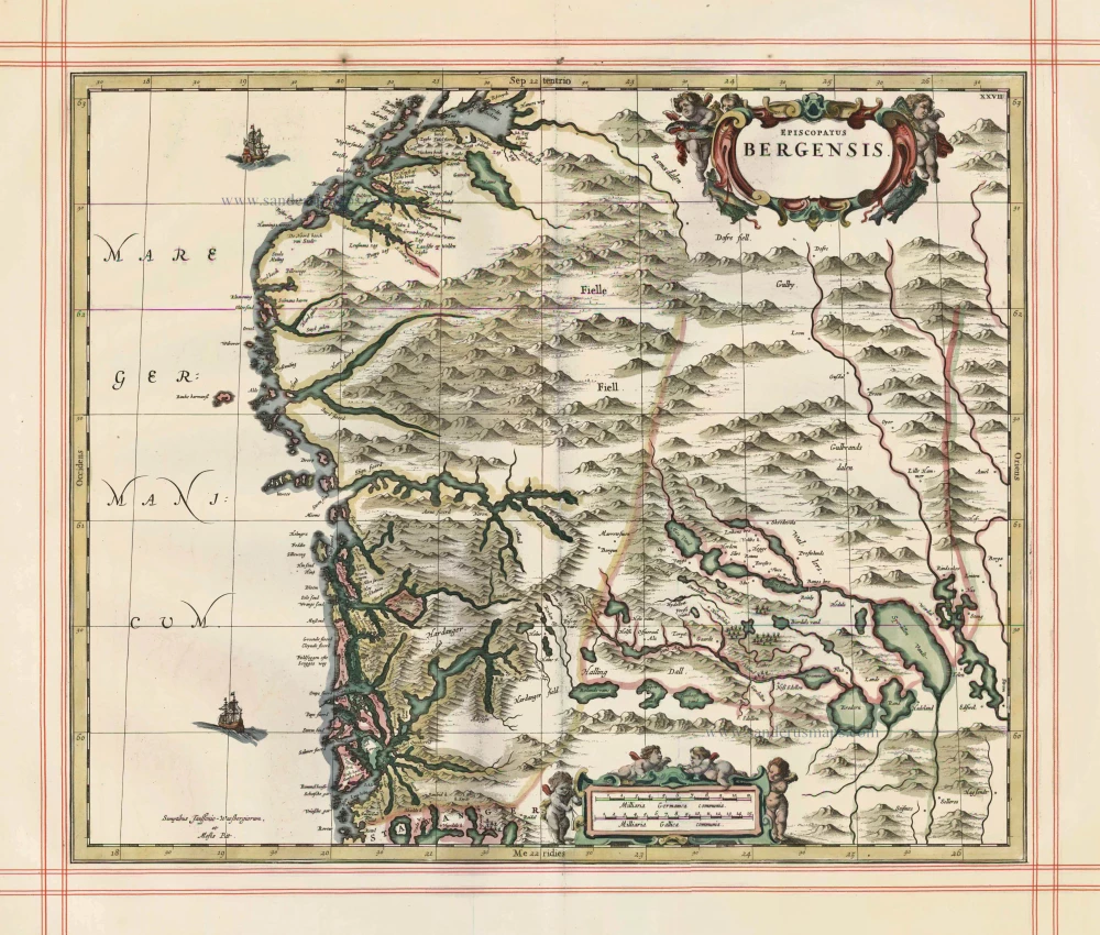
Episcopatus Bergensis 1680
Norway - Bergen, by J. Janssonius, published by Moses Pitt and J. Janssonius-Waesberge.
[Item number: 25068]
Norvegia Regnum Divisum in suos Dioeceses Nidrosiensem, Bergensem, Opsloensem, et Stavangriensem et Praefecturam Bahusiae ... 1756
Norway by F. De Wit, published by R. & J. Ottens.
[Item number: 25857]
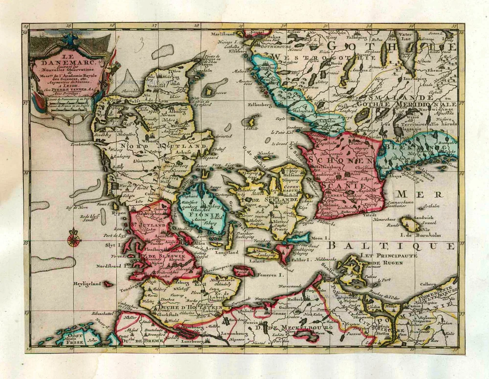
Le Danemarc, Suivant les Nouvelles Observations de Mess.rs de L'Academie Royale des Sciences, etc. 1713
Denmark, by Pieter van der Aa
[Item number: 26044]
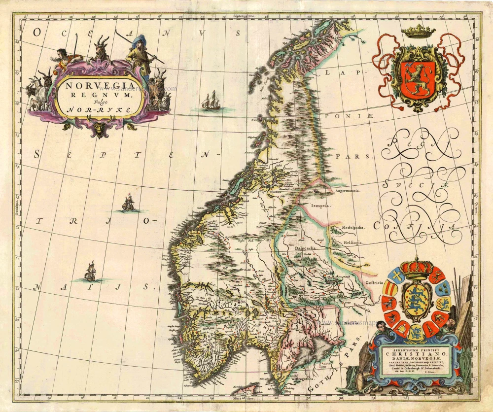
Norvegia Regnum, Vulgo Nor-Ryke. 1667
Norway, by J. Blaeu.
[Item number: 26585]
Regni Norvegiae. 1666
Norway by Joannes Janssonius.
[Item number: 29724]
Extremely rare complete series.
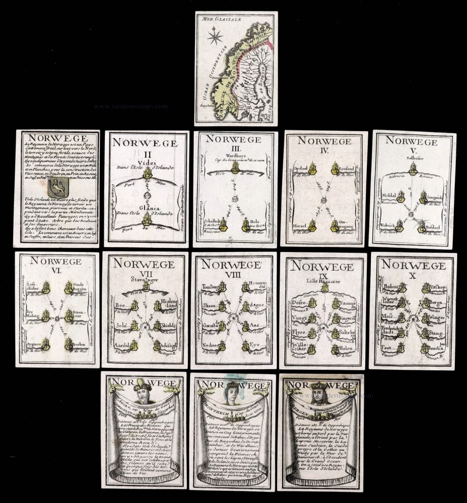
Norwege. c. 1763
Norway, 14 playing cards, a complete series forming the Norway set, designed by Nicolas Jean Baptiste de Poilly, printed by Jean-Baptiste Mitoire.
[Item number: 30104]