
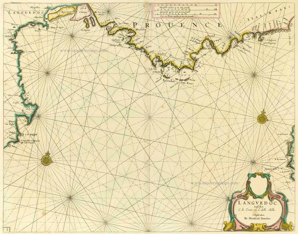
Provence by Doncker H., sea chart. 1664
Hendrick Doncker (1625-1699)
Hendrick Doncker became a member of the bookseller's guild in 1647 and ran his shop successfully for fifty years. He was able to develop one of the most popular sets of maritime works published in Amsterdam during the Golden Age.
In 1651 he bought a house in the Nieuwe Brugsteeg in Amsterdam. It was called 'in 't Stuurmans gereetschap' (in the mariners' instruments) and stood opposite the house where Johannes van Keulen later settled.
Apart from the sea atlases, charts and pilot books, Hendrik Doncker published various editions of textbooks on the art of navigation.
After the death of Hendrick Doncker, the son, Hendrick II (c. 1664-c.1739), continued publishing the sea atlases Zeeatlas and Zeespiegel until 1708.
Doncker's charts were the most up-to-date in the second half of the 17th century. Although there is some similarity to those charts published by Van Loon, Goos, Lootsman, and Doncker, the latter's charts are original.
In 1655, Hendrick Doncker had begun with the publication of a pilot guide, the Lichtende Columne ofte Zeespiegel. In 1659 he published his first sea atlas, the Zee-Atlas of Waeter-waereld, with 19 maps. Between 1659 and 1669, he increased the number of charts from 19 to 30 and in 1669 he came with an edition containing 50, which was soon to be followed by an edition with large maps: the Nieuwe Groote Vermeerderde Zeeatlas, also with 50 charts. This beautiful atlas was reprinted and continually improved for more than 25 years. After the death of Hendrick Doncker in 1699, his son continued the publication and even enlarged and enhanced the sea-atlas.
Languedoc tusschen C. de Creos en C. delle Melle.
Item Number: 13696 Authenticity Guarantee
Category: Antique maps > Europe > France
Antique sea chart of the Provence and the Languedoc, by Doncker H.
Title: Languedoc tusschen C. de Creos en C. delle Melle.
Date: 1664.
Copper engraving, printed on paper.
Size (not including margins): 395 x 510mm (15.55 x 20.08 inches).
Verso: Blank.
Condition: Old coloured, excellent.
Condition Rating: .
From: Nieuw Groot Stuurmans Straets-Boeck, Inhoudende De Middellantze Zee . . . T' Amsterdam, By Hendrick Doncker Boeckverkoper en Graadbooghmaker, inde Nieuwbrug steeg In 't Stuurmans gereedschap, ... 1664. (Koeman IV, Don 47 A)
Hendrick Doncker (1625-1699)
Hendrick Doncker became a member of the bookseller's guild in 1647 and ran his shop successfully for fifty years. He was able to develop one of the most popular sets of maritime works published in Amsterdam during the Golden Age.
In 1651 he bought a house in the Nieuwe Brugsteeg in Amsterdam. It was called 'in 't Stuurmans gereetschap' (in the mariners' instruments) and stood opposite the house where Johannes van Keulen later settled.
Apart from the sea atlases, charts and pilot books, Hendrik Doncker published various editions of textbooks on the art of navigation.
After the death of Hendrick Doncker, the son, Hendrick II (c. 1664-c.1739), continued publishing the sea atlases Zeeatlas and Zeespiegel until 1708.
Doncker's charts were the most up-to-date in the second half of the 17th century. Although there is some similarity to those charts published by Van Loon, Goos, Lootsman, and Doncker, the latter's charts are original.
In 1655, Hendrick Doncker had begun with the publication of a pilot guide, the Lichtende Columne ofte Zeespiegel. In 1659 he published his first sea atlas, the Zee-Atlas of Waeter-waereld, with 19 maps. Between 1659 and 1669, he increased the number of charts from 19 to 30 and in 1669 he came with an edition containing 50, which was soon to be followed by an edition with large maps: the Nieuwe Groote Vermeerderde Zeeatlas, also with 50 charts. This beautiful atlas was reprinted and continually improved for more than 25 years. After the death of Hendrick Doncker in 1699, his son continued the publication and even enlarged and enhanced the sea-atlas.
Related items
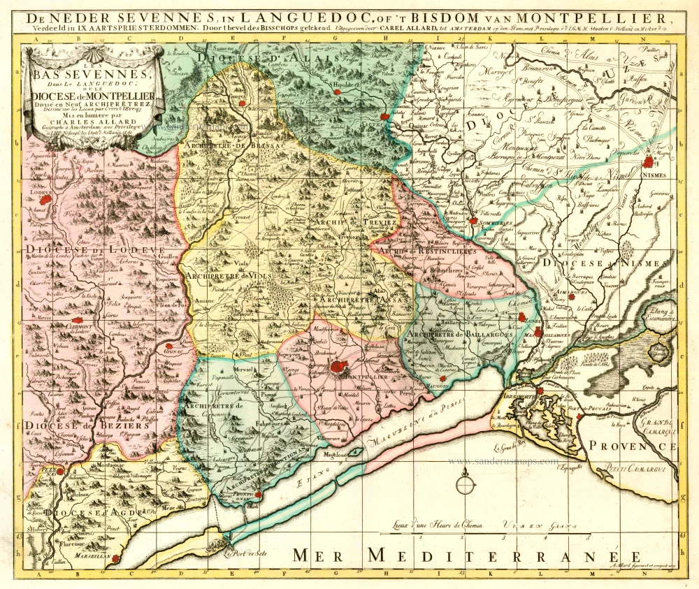
Les Bas Cevennes, Dans le Languedoc, ou le Diocese de Montpellier Divisé en Neuf Archiprêtrez 1721-41
The Cévennes with the bishopric of Montpellier, by C. Allard - Covens & Mortier.
[Item number: 23791]
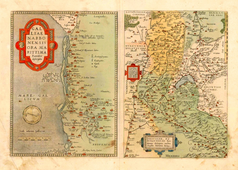
Galliae Narbonensis Ora Marittima Recenter descripta. [on sheet with:] Sabaudiae, et Burgundiae Comitatus descriptio; auctore Aegidio Bulionio Belga. 1572
Languedoc and Savoie, by A. Ortelius.
[Item number: 25437]
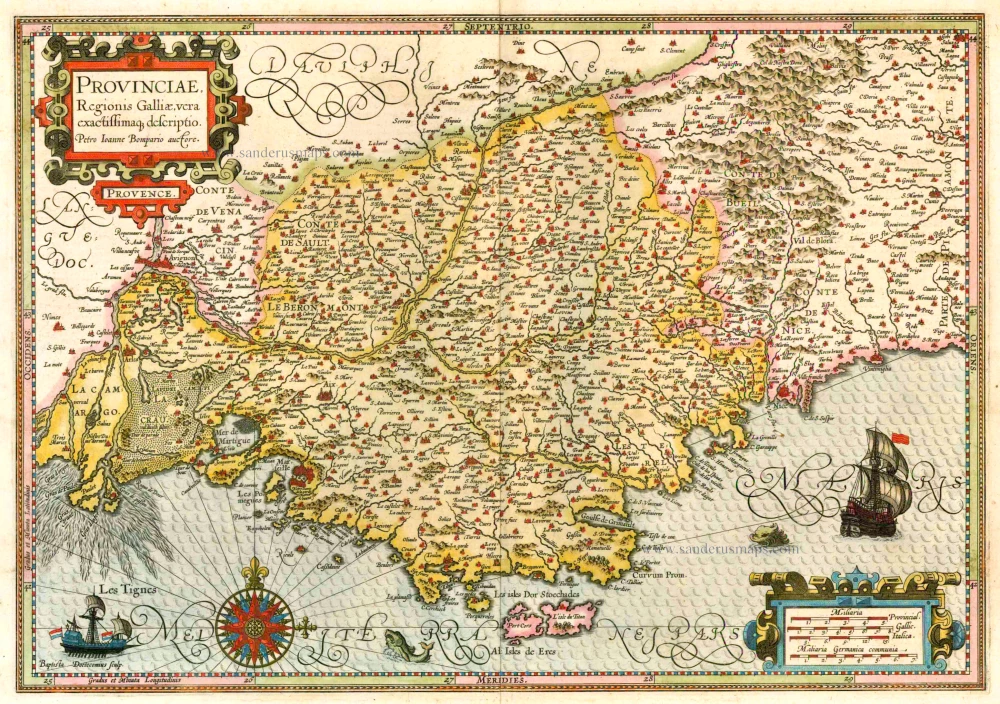
Provinciae, Regionis Galliae, vera exactissimaq. descriptio. 1613
Provence by Jodocus Hondius
[Item number: 25595]
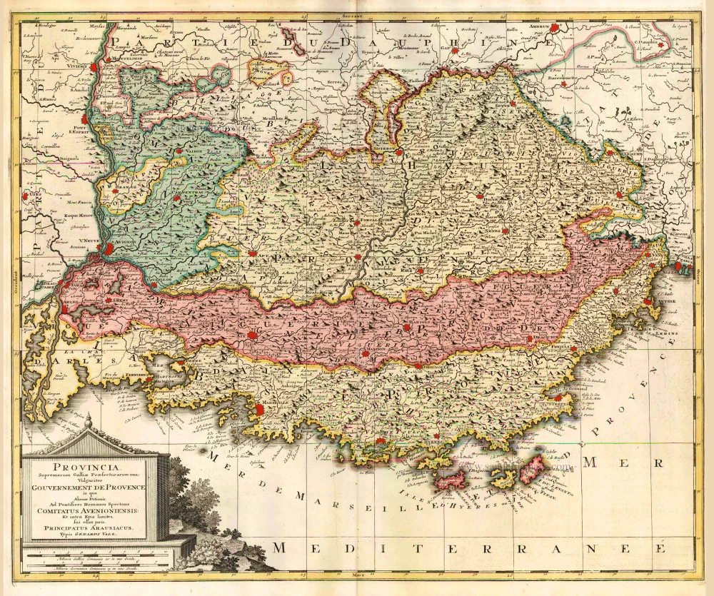
Provincia. Supremarum Galliae Praefecturarum una; Vulgariter Gouvernement de Provence in qua Alienae Ditionis. ... c. 1700
The Provence, by G. Valk.
[Item number: 25679]

Praefectura Generalis Languedociae ... c. 1700
Languedoc, by G. & L. Valck.
[Item number: 26217]
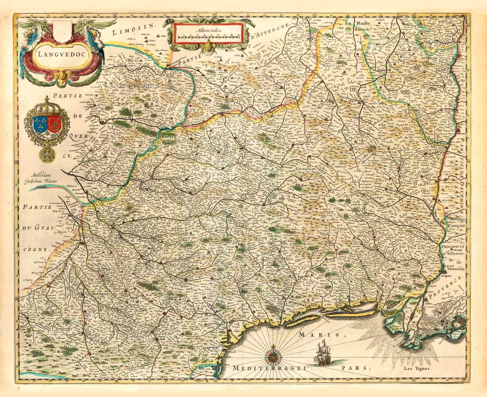
Languedoc. 1640
Languedoc, by Willem Blaeu.
[Item number: 27155]
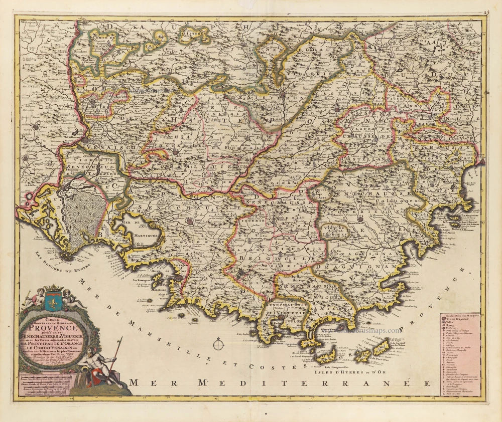
Comté et Gouvernement General de Provence. c. 1705
The Provence, by Frederick de Wit.
[Item number: 28933]

Comté, et Gouvernement de Provence. 1652
La Provence by Nicolas Sanson.
[Item number: 29669]
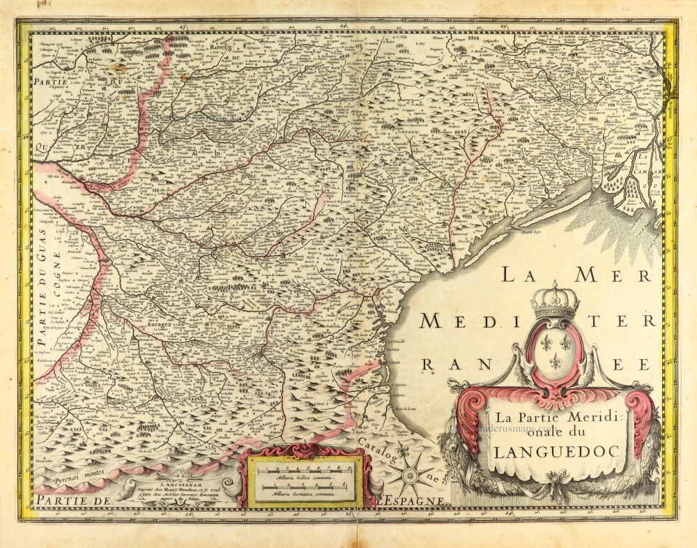
La Partie Meridionale du Languedoc. 1631
Languedoc (South) by Henricus Hondius.
[Item number: 30093]
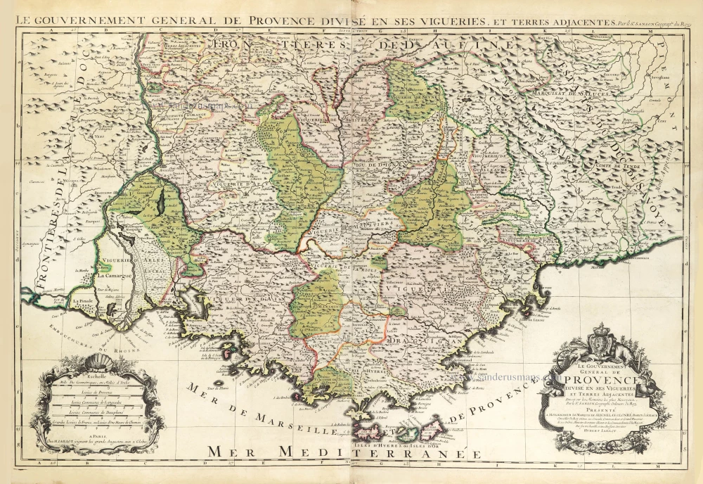
Le Gouvernement General de Provence divisé en ses Vigueries, et Terres Adjacentes. 1692
The Provence par Hubert Jaillot, after Nicolas Sanson.
[Item number: 30407]
new