
Zamosc in Poland, by Georg Braun and Frans Hogenberg. c. 1625
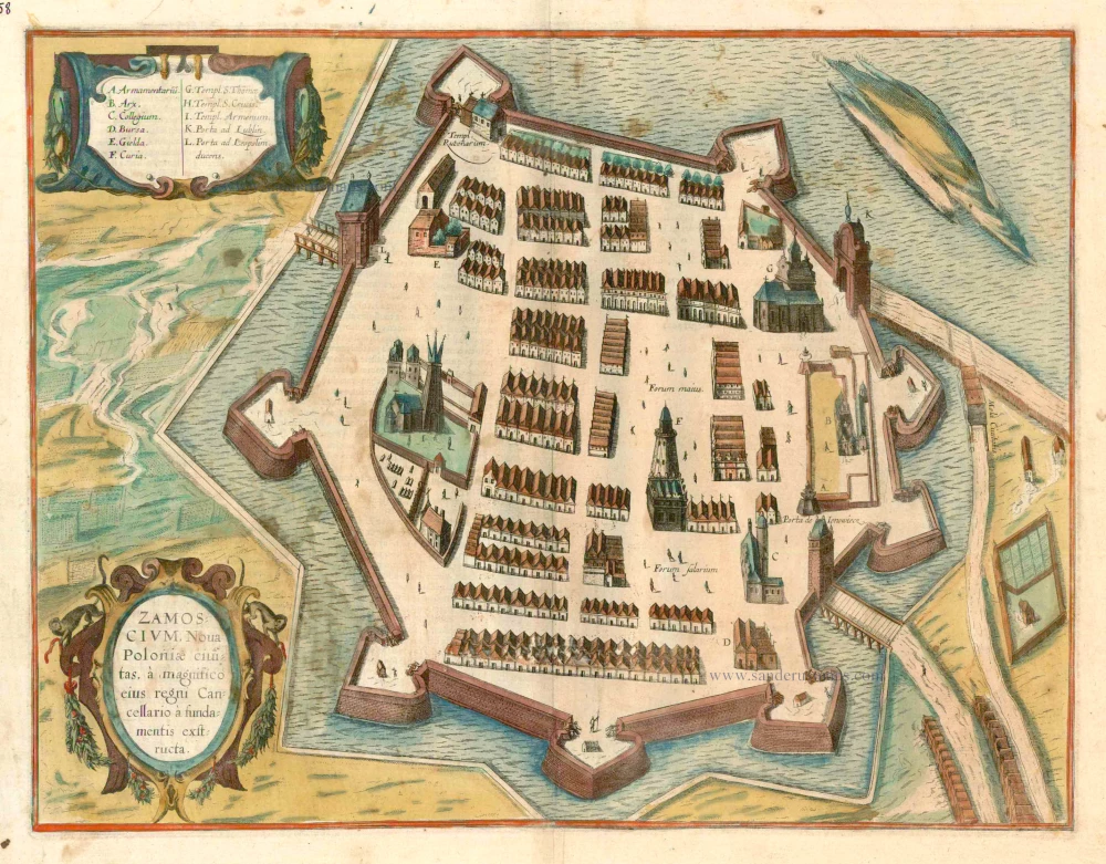


CARTOUCHE BOTTOM: Zamosc, a new city in Poland, was built from the foundation by its great chancellor.
COMMENTARY BY BRAUN (on verso): "After returning from the war, Jan Zamoyski built a new town in a fair plain beside the River Labunka, with a broad and deep moat around it. [...] He set up a splendid academy in his town to satisfy his love of learning. He appointed skilled professors in all possible faculties, such as theology, jurisprudence, medicine, and other liberal arts and languages. [...] And it is hard to find words to describe how this town became filled in the shortest time with people from all over the world, whether Poles, Greeks, Armenians, Spaniards, Germans or Italians, who all settled here, each bringing his craft and practising it here to the advantage and benefit of all."
This plate of Zamosc is an unusually static bird's-eye view with unrealistic proportions. The geometrically laid-out, fortified town in the southeast of Poland is shown here from the north. It was built in the late 16th and early 17th centuries as a total work of art, in the Renaissance manner, by the Italian architect Bernardo Morando and soon became known as the Padua of the North. It was named after its founder, Jan Zamoyski, the Grand Chancellor of Poland, who built it as an ideal city - a centre of culture and learning, an ecclesiastical centre, a residence, a trade centre and a fortress all in one. Right from the start, the city had a humanist academy (C) to train a political elite. Zamosc immediately became a prosperous centre of science, arts and trade. (Taschen)
Braun G. & Hogenberg F. and the Civitates Orbis Terrarum.
The Civitates Orbis Terrarum, or the "Braun & Hogenberg", is a six-volume town atlas and the most excellent book of town views and plans ever published: 363 engravings, sometimes beautifully coloured. It was one of the best-selling works in the last quarter of the 16th century. Georg Braun wrote the text accompanying the plans and views on the verso. Many plates were engraved after the original drawings of a professional artist, a professional artist, Joris Hoefnagel (1542-1600). The first volume was published in Latin in 1572, and the sixth in 1617. Frans Hogenberg created the tables for volumes I through IV, and Simon van den Neuwel made those for volumes V and VI. Other contributors were cartographers Daniel Freese and Heinrich Rantzau. Works by Jacob van Deventer, Sebastian Münster, and Johannes Stumpf were also used. Translations appeared in German and French.
Following the original publication of Volume 1 of the Civitates in 1572, seven further editions of 1575, 1577, 1582, 1588, 1593, 1599 and 1612 can be identified. Vol.2, first issued in 1575, was followed by further editions in 1597 and 1612. The subsequent volumes appeared in 1581, 1588, 1593, 1599 and 1606. The German translation of the first volume appeared from 1574 on, and the French edition from 1575 on.
Several printers were involved: Theodor Graminaeus, Heinrich von Aich, Gottfried von Kempen, Johannis Sinniger, Bertram Buchholtz and Peter von Brachel, who all worked in Cologne.
Georg Braun (1541-1622)
Georg Braun was born in Cologne in 1541. After his studies in Cologne, he entered the Jesuit Order as a novice. 1561, he obtained his bachelor's degree, and in 1562, he received his Magister Artium. Although he left the Jesuit Order, he studied theology, gaining a licentiate in theology.
Frans Hogenberg (1535-1590)
Frans Hogenberg was a Flemish and German painter, engraver, and mapmaker. He was born in Mechelen as the son of Nicolaas Hogenberg.
By the end of the 1560s, Frans Hogenberg was employed upon Abraham Ortelius's Theatrum Orbis Terrarum, published in 1570; he is named an engraver of numerous maps. In 1568, he was banned from Antwerp by the Duke of Alva and travelled to London, where he stayed a few years before emigrating to Cologne. He immediately embarked on his two most important works, the Civitates, published in 1572 and the Geschichtsblätter, which appeared in several series from 1569 until about 1587.
Thanks to large-scale projects like the Geschichtsblätter and the Civitates, Hogenberg's social circumstances improved with each passing year. He died as a wealthy man in Cologne in 1590.
Zamoscium. Nova Poloniae civitas, à magnifico eius regni Cancellaro à fundamentis exstructa.
Item Number: 16505 Authenticity Guarantee
Category: Antique maps > Europe > Eastern Europe
Antique map - Bird's-eye view of Zamosc in Poland, by Braun and Hogenberg. Key to 11 locations.
Date of the first edition: 1617
Date of this map: c. 1625
Copper engraving
Size: 35.5 x 46cm (13.8 x 17.9 inches)
Verso text: French
Condition: Contemporary coloured, stained.
Condition Rating: B
References: Van der Krogt 4, 4914, State 1 (without imprint); Taschen, Braun and Hogenberg, p. 486
From: Théatre des Principales Villes de tout l'Univers Vol. VI. c. 1625. (Van der Krogt 4, 41:3.6)
CARTOUCHE BOTTOM: Zamosc, a new city in Poland, was built from the foundation by its great chancellor.
COMMENTARY BY BRAUN (on verso): "After returning from the war, Jan Zamoyski built a new town in a fair plain beside the River Labunka, with a broad and deep moat around it. [...] He set up a splendid academy in his town to satisfy his love of learning. He appointed skilled professors in all possible faculties, such as theology, jurisprudence, medicine, and other liberal arts and languages. [...] And it is hard to find words to describe how this town became filled in the shortest time with people from all over the world, whether Poles, Greeks, Armenians, Spaniards, Germans or Italians, who all settled here, each bringing his craft and practising it here to the advantage and benefit of all."
This plate of Zamosc is an unusually static bird's-eye view with unrealistic proportions. The geometrically laid-out, fortified town in the southeast of Poland is shown here from the north. It was built in the late 16th and early 17th centuries as a total work of art, in the Renaissance manner, by the Italian architect Bernardo Morando and soon became known as the Padua of the North. It was named after its founder, Jan Zamoyski, the Grand Chancellor of Poland, who built it as an ideal city - a centre of culture and learning, an ecclesiastical centre, a residence, a trade centre and a fortress all in one. Right from the start, the city had a humanist academy (C) to train a political elite. Zamosc immediately became a prosperous centre of science, arts and trade. (Taschen)
Braun G. & Hogenberg F. and the Civitates Orbis Terrarum.
The Civitates Orbis Terrarum, or the "Braun & Hogenberg", is a six-volume town atlas and the most excellent book of town views and plans ever published: 363 engravings, sometimes beautifully coloured. It was one of the best-selling works in the last quarter of the 16th century. Georg Braun wrote the text accompanying the plans and views on the verso. Many plates were engraved after the original drawings of a professional artist, a professional artist, Joris Hoefnagel (1542-1600). The first volume was published in Latin in 1572, and the sixth in 1617. Frans Hogenberg created the tables for volumes I through IV, and Simon van den Neuwel made those for volumes V and VI. Other contributors were cartographers Daniel Freese and Heinrich Rantzau. Works by Jacob van Deventer, Sebastian Münster, and Johannes Stumpf were also used. Translations appeared in German and French.
Following the original publication of Volume 1 of the Civitates in 1572, seven further editions of 1575, 1577, 1582, 1588, 1593, 1599 and 1612 can be identified. Vol.2, first issued in 1575, was followed by further editions in 1597 and 1612. The subsequent volumes appeared in 1581, 1588, 1593, 1599 and 1606. The German translation of the first volume appeared from 1574 on, and the French edition from 1575 on.
Several printers were involved: Theodor Graminaeus, Heinrich von Aich, Gottfried von Kempen, Johannis Sinniger, Bertram Buchholtz and Peter von Brachel, who all worked in Cologne.
Georg Braun (1541-1622)
Georg Braun was born in Cologne in 1541. After his studies in Cologne, he entered the Jesuit Order as a novice. 1561, he obtained his bachelor's degree, and in 1562, he received his Magister Artium. Although he left the Jesuit Order, he studied theology, gaining a licentiate in theology.
Frans Hogenberg (1535-1590)
Frans Hogenberg was a Flemish and German painter, engraver, and mapmaker. He was born in Mechelen as the son of Nicolaas Hogenberg.
By the end of the 1560s, Frans Hogenberg was employed upon Abraham Ortelius's Theatrum Orbis Terrarum, published in 1570; he is named an engraver of numerous maps. In 1568, he was banned from Antwerp by the Duke of Alva and travelled to London, where he stayed a few years before emigrating to Cologne. He immediately embarked on his two most important works, the Civitates, published in 1572 and the Geschichtsblätter, which appeared in several series from 1569 until about 1587.
Thanks to large-scale projects like the Geschichtsblätter and the Civitates, Hogenberg's social circumstances improved with each passing year. He died as a wealthy man in Cologne in 1590.
Related items
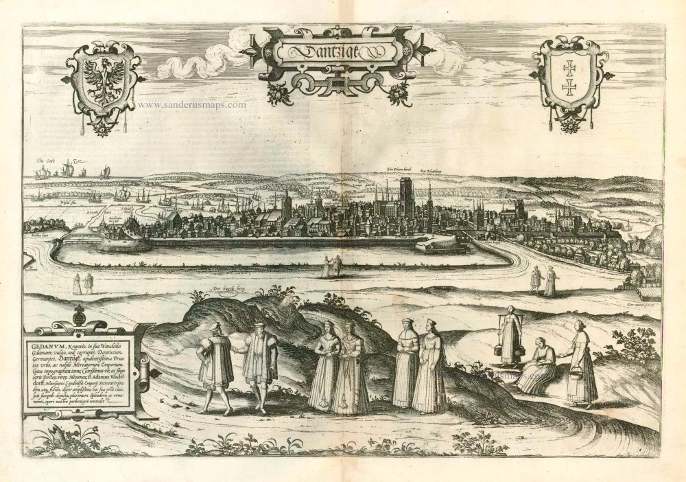
Dantzigk - Gedanum, Krantio, in sua Wandalia Gdanum; . . . 1576
Gdansk, by Georg Braun and Frans Hogenberg.
[Item number: 4056]
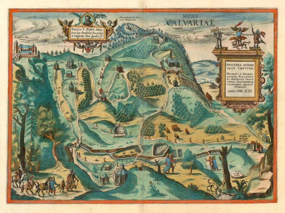
Mons Calvariae. c. 1625
Kalwarya Zebrzydowska (Poland) by Georg Braun & Frans Hogenberg.
[Item number: 10510]
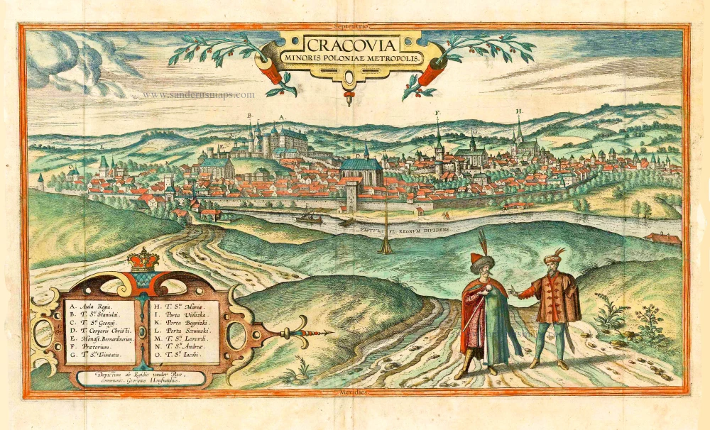
Cracovia Minoris Poloniae Metropolis. 1617-18
Krakow, by Georg Braun and Frans Hogenberg. after G. Hoefnagel and E. vander Rye.
[Item number: 25150]
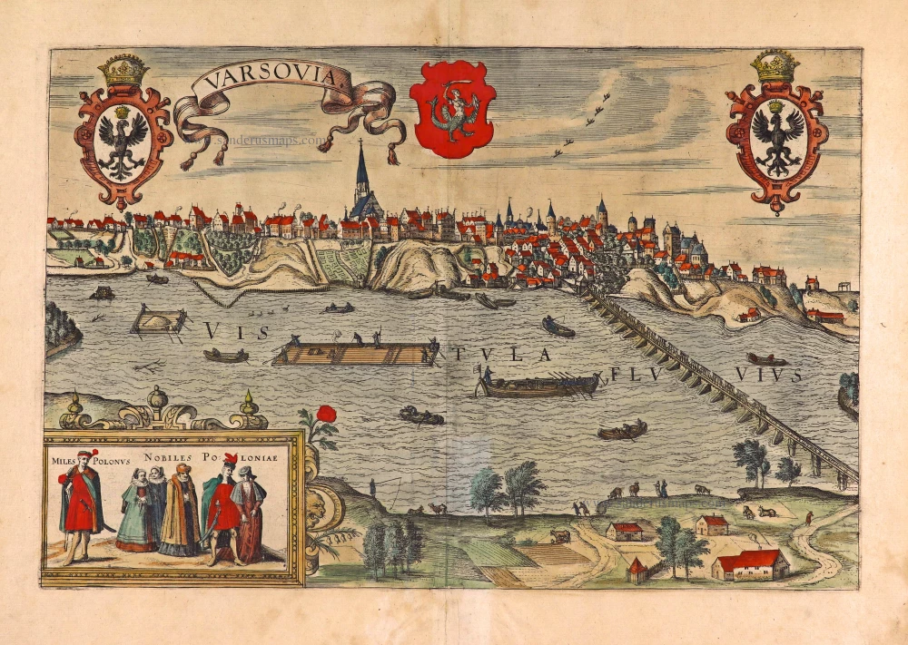
Varsovia. 1618
Warsaw (Warszawa), by Georg Braun & Frans Hogenberg.
[Item number: 27942]

Alten Stettin 1588
Szczecin in Poland, by Georg Braun and Frans Hogenberg.
[Item number: 29161]
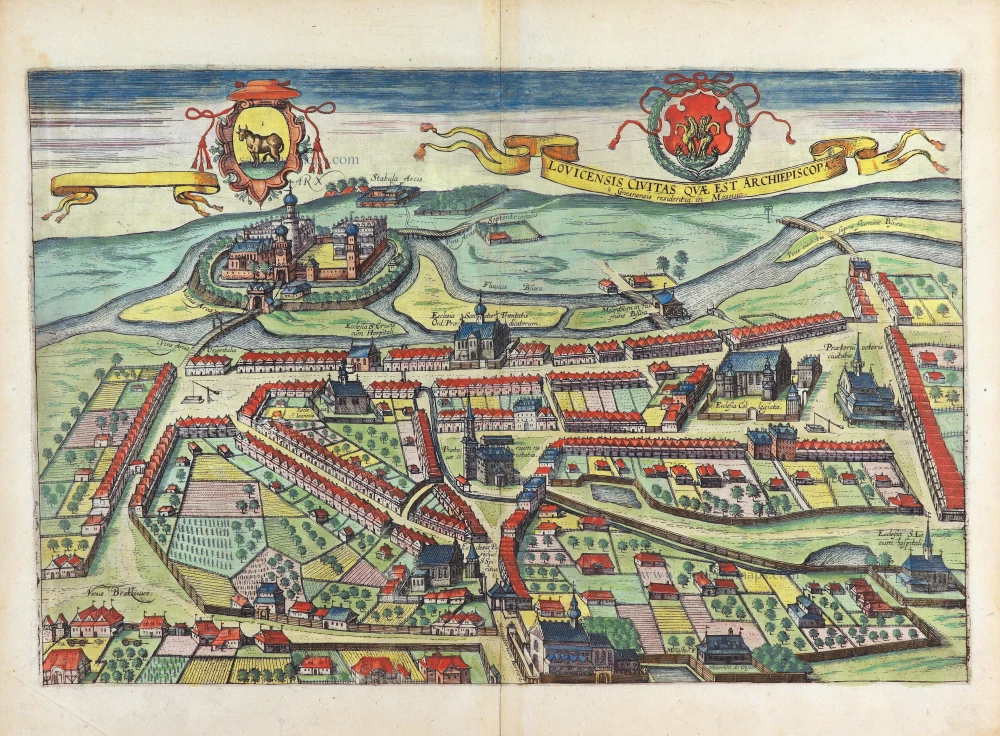
Lovicensis Civitas quae est Archiepiscopa. 1617-18
Lowicz by Georg Braun & Frans Hogenberg
[Item number: 29282]