
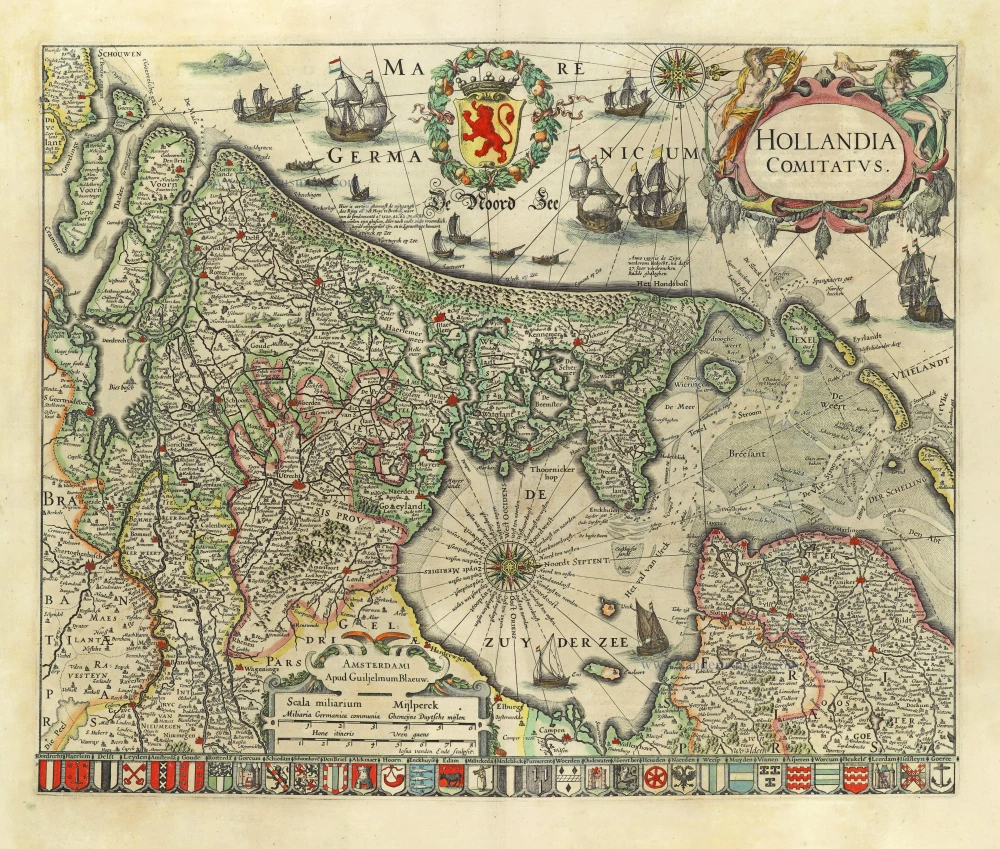
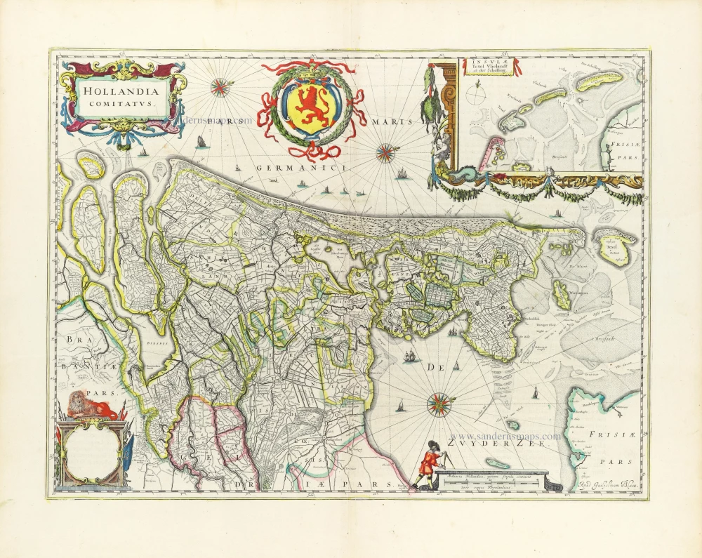
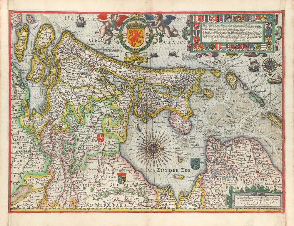
Holland, by Janssonius J. 1638
The Janssonius Family
Joannes Janssonius (Arnhem, 1588-1664), son of the Arnhem publisher Jan Janssen, married Elisabeth Hondius, daughter of Jodocus Hondius, in Amsterdam in 1612. After his marriage, he settled down in this town as a bookseller and publisher of cartographic material. In 1618, he established himself in Amsterdam next door to Blaeu’s bookshop. He entered into serious competition with Willem Jansz. Blaeu when copying Blaeu’s Licht der Zeevaert after the expiration of the privilege in 1620. His activities concerned the publication of atlases, books, single maps, and an extensive book trade with branches in Frankfurt, Danzig, Stockholm, Copenhagen, Berlin, Koningsbergen, Geneva, and Lyon. In 1631, he began publishing atlases together with Henricus Hondius.
In the early 1640s, Henricus Hondius left the atlas publishing business to Janssonius. Competition with Joan Blaeu, Willem’s son and successor, in atlas production, prompted Janssonius to enlarge his Atlas Novus finally into a work of six volumes, into which a sea atlas and an atlas of the Old World were inserted. Other atlases published by Janssonius are Mercator’s Atlas Minor, Hornius’s historical atlas (1652), the townbooks in eight volumes (1657), Cellarius’s Atlas Coelestis and several sea atlases and pilot guides.
After the death of Joannes Janssonius, the shop and publishing firm were continued by the heirs under the direction of Johannes van Waesbergen (c. 1616-1681), son-in-law of Joannes Janssonius. Van Waesbergen added Janssonius's name to his own.
In 1676, Joannes Janssonius’s heirs sold by auction “all the remaining Atlases in Latin, French, High and Low German, as well as the Stedeboecken in Latin, in 8 volumes, bound and unbound, maps, plates belonging to the Atlas and Stedeboecken.” The copperplates from Janssonius’s atlases were afterwards sold to Schenk and Valck.
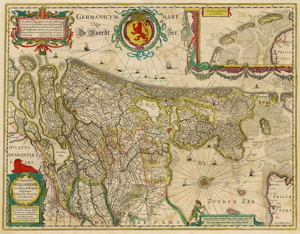
Comitatus Hollandiae novissima descriptio.
Item Number: 19020 Authenticity Guarantee
Category: Antique maps > Europe > The Netherlands
Old, antique map of Holland by Janssonius J. - Hondius H., oriented to the West
Date of the first edition: 1629
Date of this map: 1638
Copper engraving, printed on paper.
Size (not including margins): 40 x 51cm (15.5 x 19.8 inches)
Verso text: German
Condition: Original coloured, some light offsetting.
Condition Rating: A+
References: Van der Krogt 1, 3400:1B; Blonk D.I., 43.
From: Newer Atlas, Oder Weltbeschreibung, .... Amsterdam, J. Janssonius, 1638. (Van der Krogt 1, 421.1A)
First folio size map after Balthasar Florisz. van Berckenrode.
The Janssonius Family
Joannes Janssonius (Arnhem, 1588-1664), son of the Arnhem publisher Jan Janssen, married Elisabeth Hondius, daughter of Jodocus Hondius, in Amsterdam in 1612. After his marriage, he settled down in this town as a bookseller and publisher of cartographic material. In 1618, he established himself in Amsterdam next door to Blaeu’s bookshop. He entered into serious competition with Willem Jansz. Blaeu when copying Blaeu’s Licht der Zeevaert after the expiration of the privilege in 1620. His activities concerned the publication of atlases, books, single maps, and an extensive book trade with branches in Frankfurt, Danzig, Stockholm, Copenhagen, Berlin, Koningsbergen, Geneva, and Lyon. In 1631, he began publishing atlases together with Henricus Hondius.
In the early 1640s, Henricus Hondius left the atlas publishing business to Janssonius. Competition with Joan Blaeu, Willem’s son and successor, in atlas production, prompted Janssonius to enlarge his Atlas Novus finally into a work of six volumes, into which a sea atlas and an atlas of the Old World were inserted. Other atlases published by Janssonius are Mercator’s Atlas Minor, Hornius’s historical atlas (1652), the townbooks in eight volumes (1657), Cellarius’s Atlas Coelestis and several sea atlases and pilot guides.
After the death of Joannes Janssonius, the shop and publishing firm were continued by the heirs under the direction of Johannes van Waesbergen (c. 1616-1681), son-in-law of Joannes Janssonius. Van Waesbergen added Janssonius's name to his own.
In 1676, Joannes Janssonius’s heirs sold by auction “all the remaining Atlases in Latin, French, High and Low German, as well as the Stedeboecken in Latin, in 8 volumes, bound and unbound, maps, plates belonging to the Atlas and Stedeboecken.” The copperplates from Janssonius’s atlases were afterwards sold to Schenk and Valck.
Related items
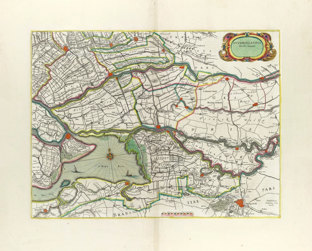
Zuydhollandia stricte sumta. 1662
Southern Holland by Willem Blaeu.
[Item number: 5358]

Rhenolandiae et Amstellandiae exactißima Tabula. 1662
Central Holland by Willem Blaeu.
[Item number: 5359]
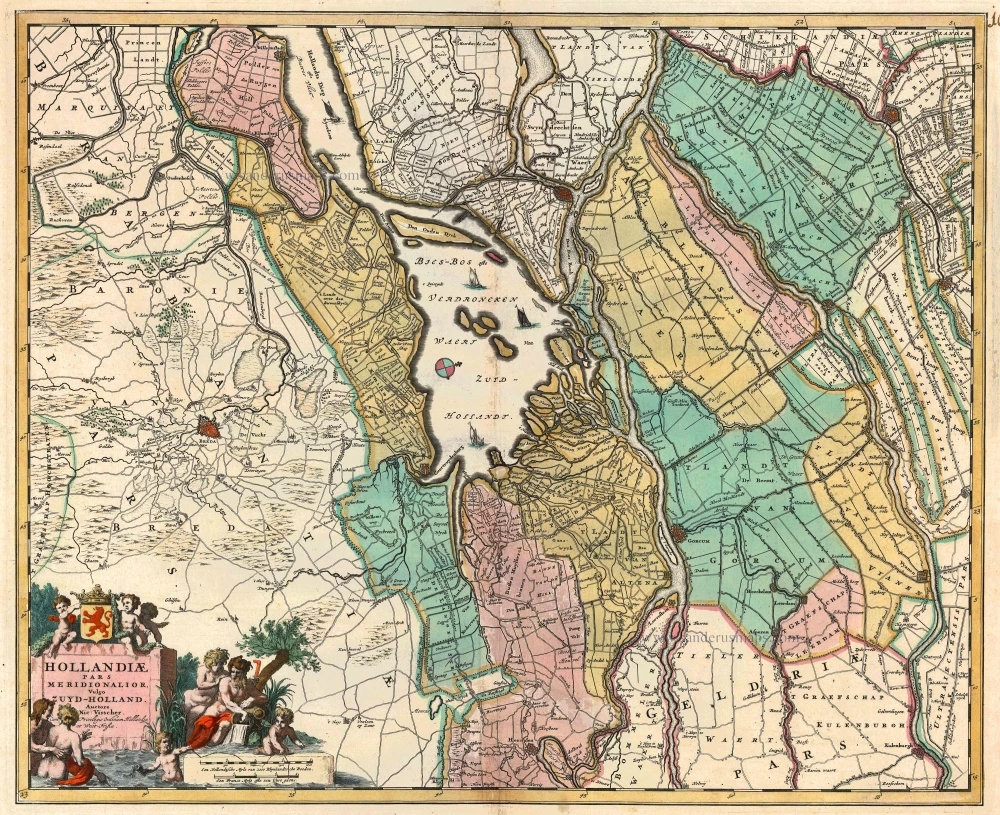
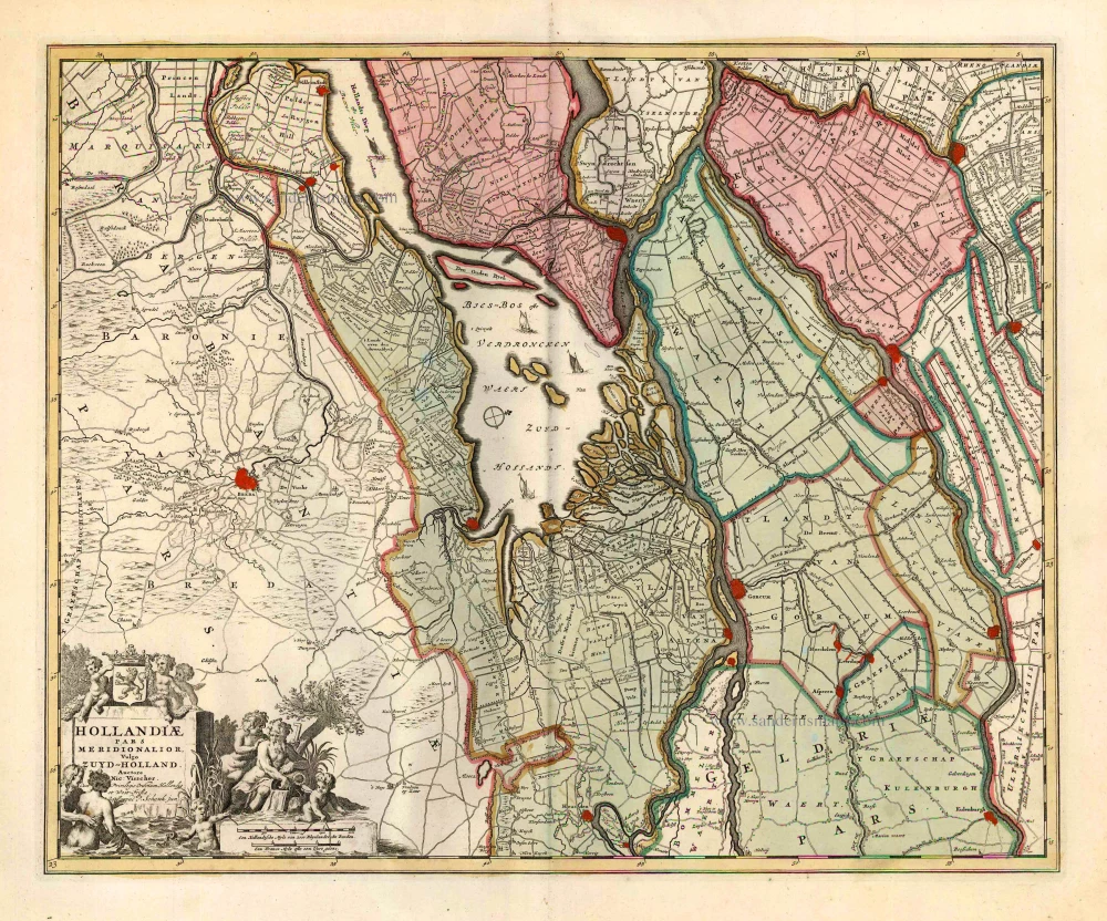
Hollandiae pars Meridionalis, vulgo Zuyd-Holland 1683-1696
Holland (South), by N. Visscher.
[Item number: 10962]
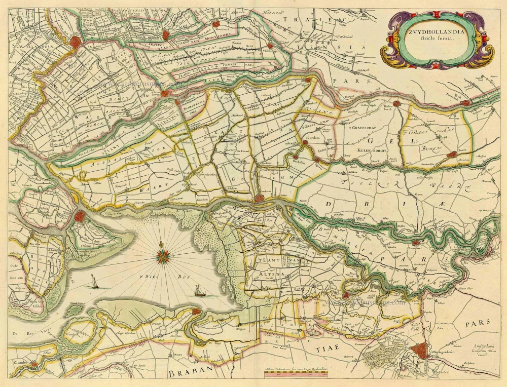
Zuydhollandia stricte sumta. 1643-50
Holland (South), by Willem & Joan Blaeu.
[Item number: 21071]
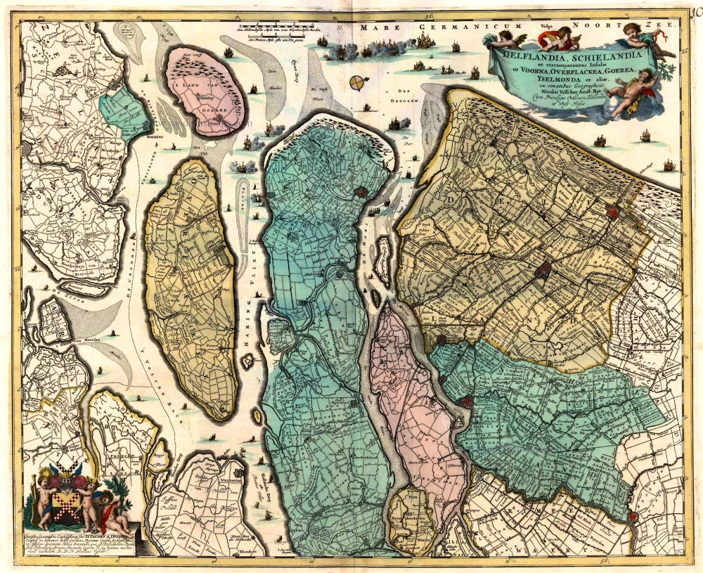
Delflandia, Schielandia et circumjacentes Insulae ... 1680-1710
Holland, by N. Visscher
[Item number: 24417]
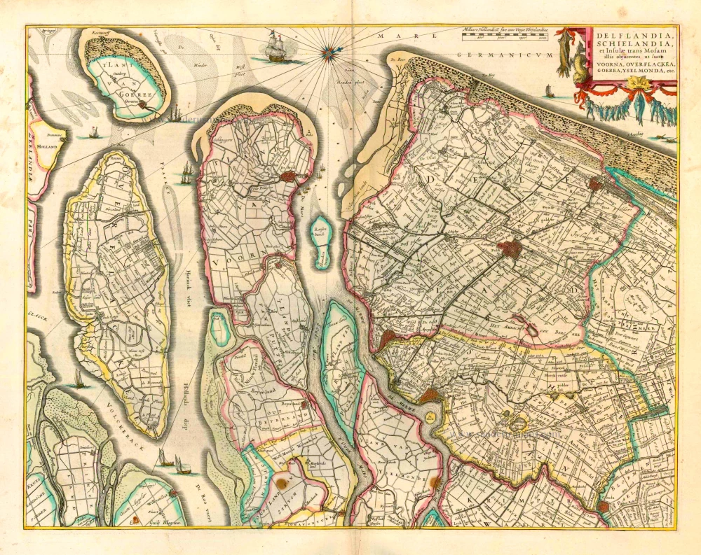
Delflandia, Schielandia et Insulae trans Mosam et Insulae trans Mosam illis objacentes ut sunt Voorna, Overflackea, Goerea, Yselmonda, etc. 1635
Holland (Southwest), by Willem Blaeu.
[Item number: 25352]
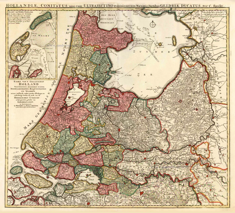
Kaart van 't Graafschap Holland Naauwkeurig Afgedeelt in zyne Heemraadschappen, Baljuwschappen en Waarden, 1730-45
Holland by C. Specht, published by R. & J. Ottens.
[Item number: 25706]
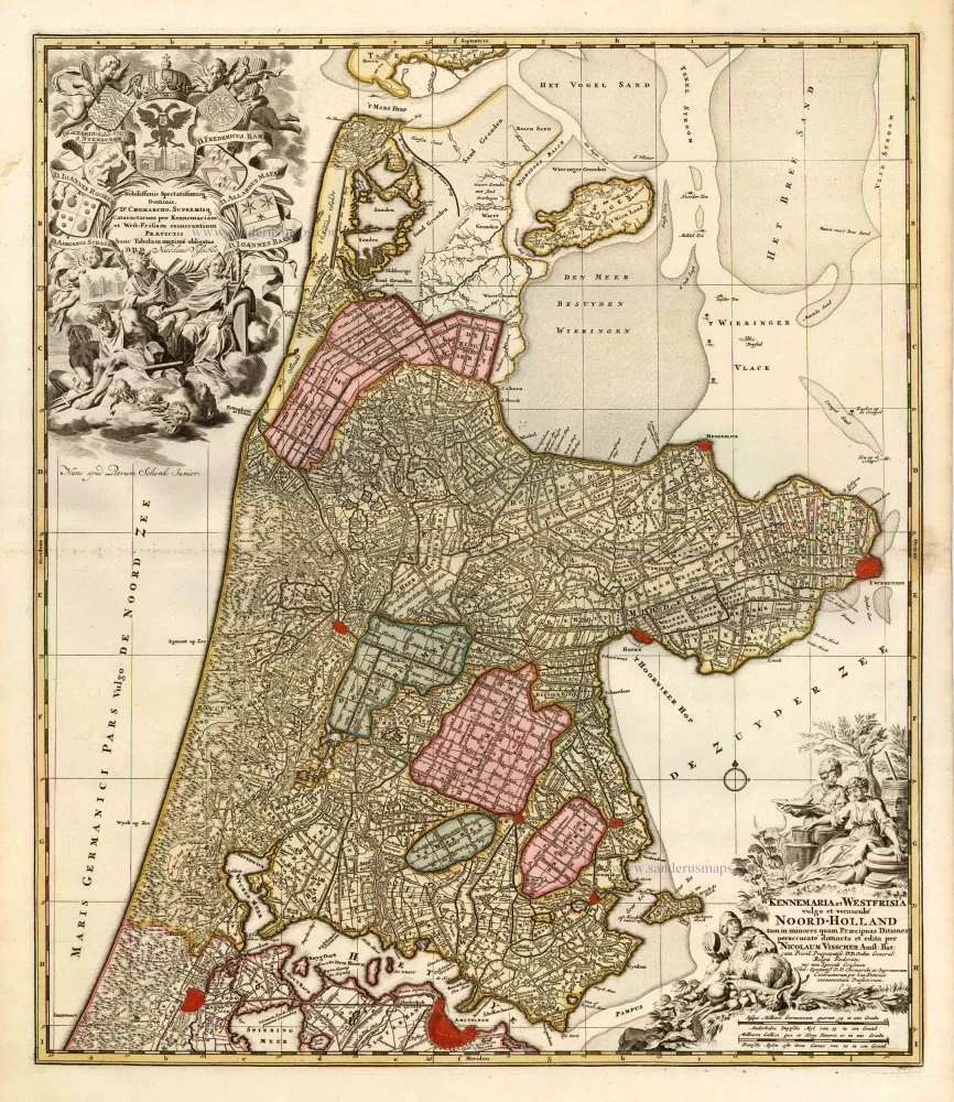
Kennemaria et Westfrisia vulgo et vernaculé Noord-Holland. c. 1700
Noord Holland by Nicolaas Visscher I, published by Petrus Schenk.
[Item number: 25707]
Hollandiae Pars Meridionalior, Vulgo Zuyd-Holland. c. 1740
Southern Holland by Nicolaas Visscher II, published by Petrus Schenk.
[Item number: 25721]
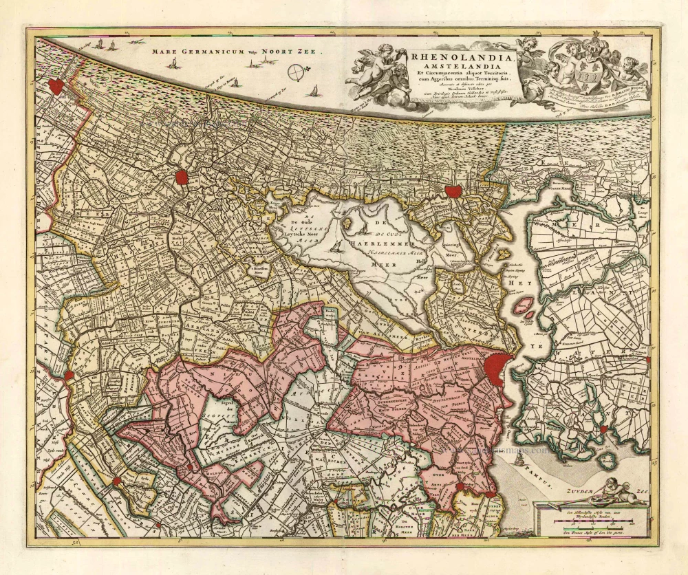
Rhenolandia, Amstelandia et Circumjacentia aliquot Territoria, cum Aggeribus omnibus, Terminiqz fuis. c. 1740
Central Holland by Nicolaas Visscher II, published by Petrus Schenk.
[Item number: 25722]
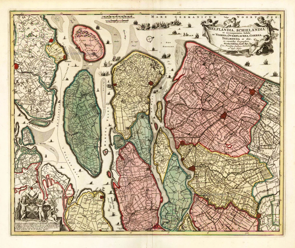
Delflandia, Schielandia et circumjacentes Insulae et circumjacentes Insulae ut Voorna, Overflackea, Goerea, Yselmonda et aliae, 1683-1696
Southwest Holland by Nicolaas Visscher II.
[Item number: 25729]
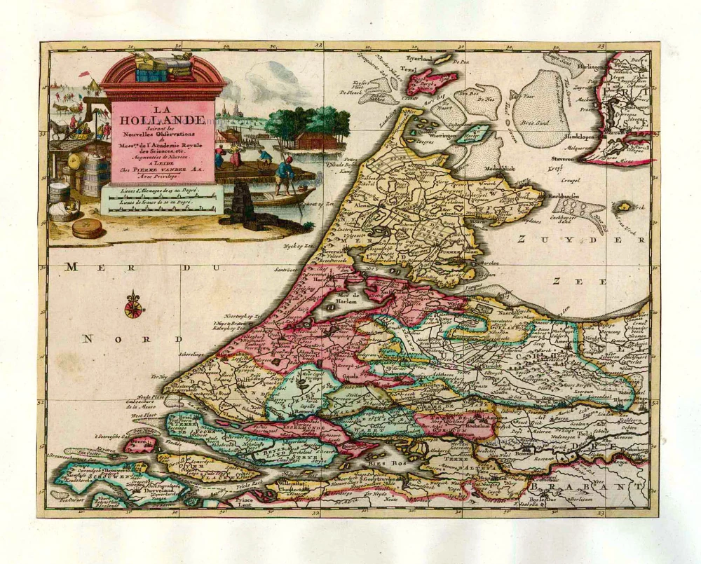
La Hollande. 1713
Holland by Pieter Van der Aa.
[Item number: 26059]
First edition, first state. Dutch text. Important map!
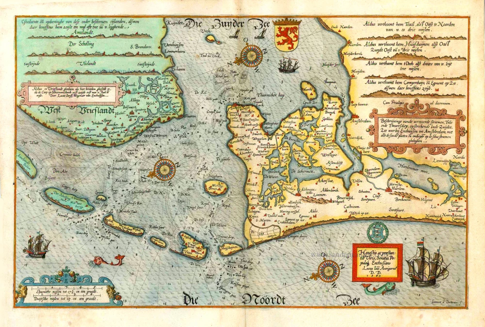
Beschrijvinge vande vermaerde stroemen, Tvlie ende Tmaersdiep; opstreckende Inde Zuijder Zee voerbij Enchuijsen tot Amstelredam, met alle de sande plaeten eñ ondiepte op de selve stroemen gheleghen. 1584
Lucas Janszoon Waghenaer, Holland.
[Item number: 27007]
Big and spectacular map
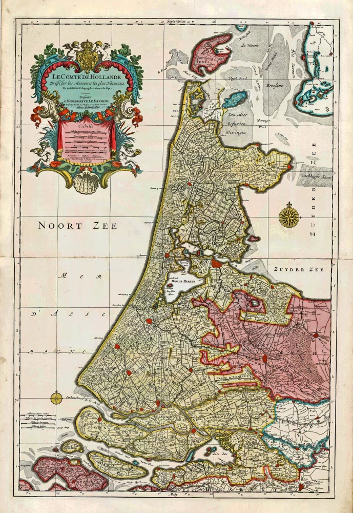
Le Comté de Hollande. c. 1705
Holland, by Pieter Mortier.
[Item number: 27807]
Rare
Hollandia Comitatus. 1631
Holland by Willem Blaeu.
[Item number: 28471]
Scarce map
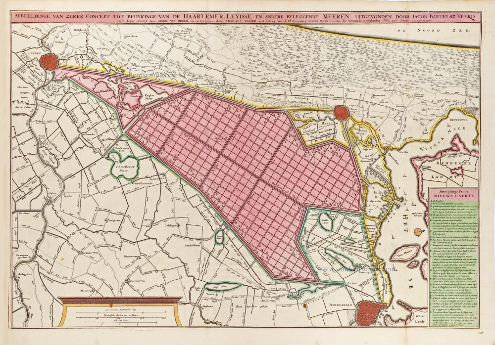
Afbeeldinge van zeker concept tot bedykinge van de Haarlemer, Leydse en andere byleggende Meeren. c. 1750
Polder map of Holland, by Nicolaas Visscher, published by Petrus Schenk Jr.
[Item number: 28918]
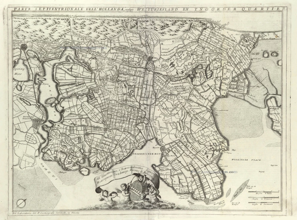
Parte Septentrionale del'Hollanda, vulgo Westuriesland en Tnoorder Quartier. 1696
Northern Holland, by Vincenzo Coronelli.
[Item number: 29432]
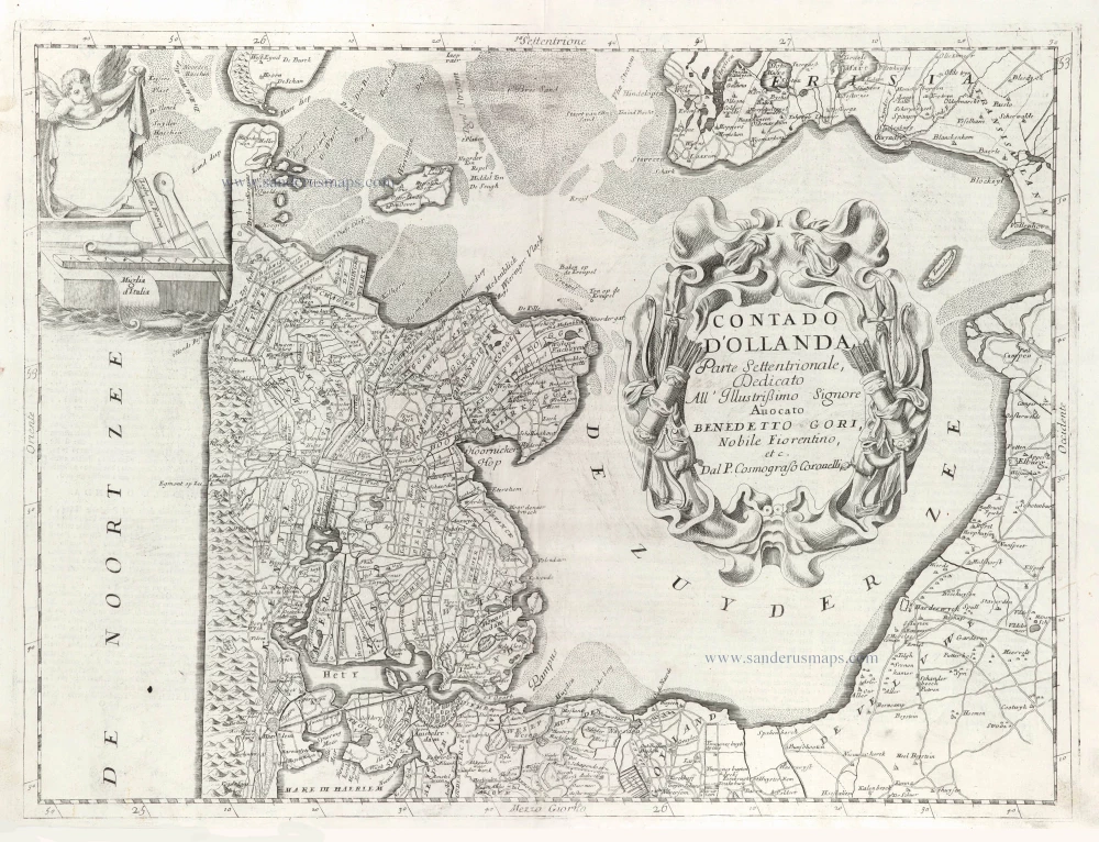
Contado d'Hollanda, Parte Settentrionale, 1696
Northern Holland, by Vincenzo Coronelli.
[Item number: 29433]
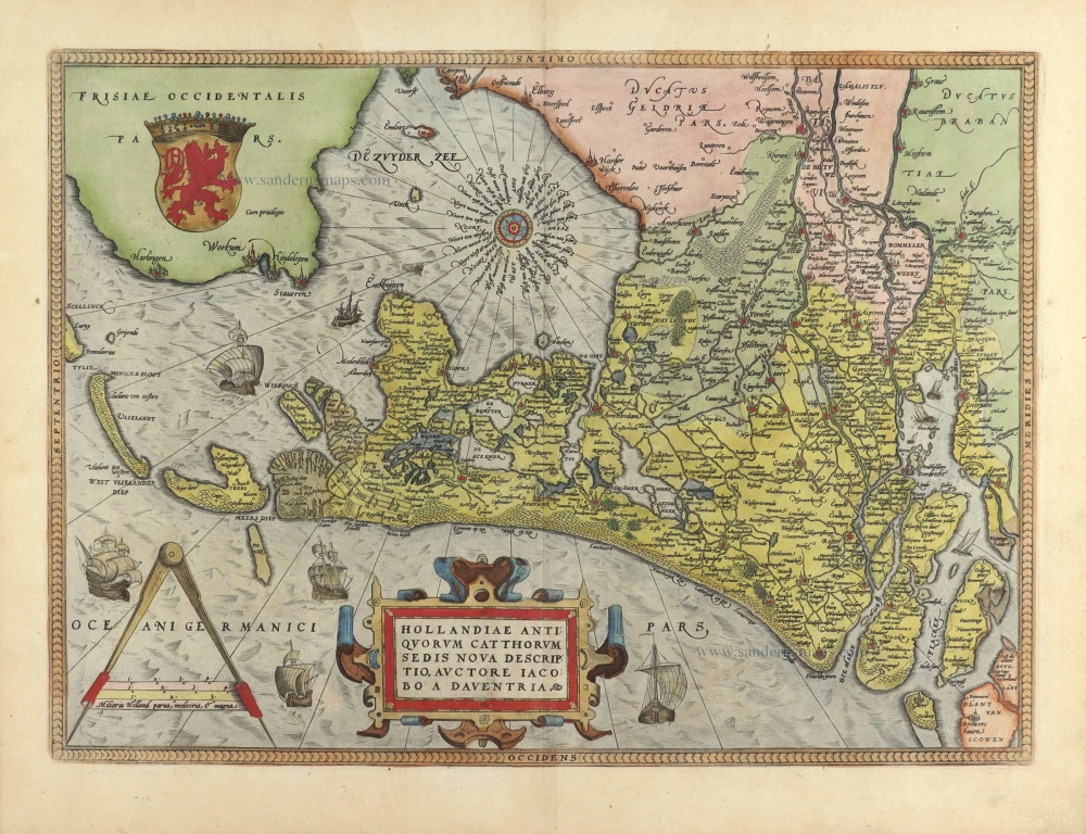
Hollandiae Antiquorum Catthorum Sedis Nova Descriptio. 1584
Holland, by Abraham Ortelius.
[Item number: 29547]
Hollandia Comitatus. 1643
Holland by Willem Blaeu
[Item number: 30182]
Hollandia. 1617
Holland by Petrus Kaerius (Pieter Van den Keere).
[Item number: 30257]