
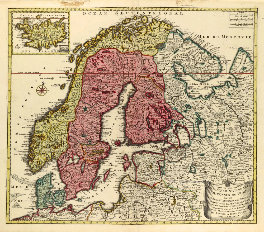
SCANDINAVIA by Schenk P. c. 1700
The Schenk Family
Petrus Schenk (1660-1718), the founder of one of the best-known publishing firms of Amsterdam in the 18th century, was born in Elberfeld, Germany, in 1660. He went to Amsterdam where he became a pupil of the engraver Gerard Valck. On 19 Nov. 1686, a privilegio was granted to Petrus Schenk and Gerard Valk for the manufacturing and selling of their prints. Schenk’s contribution to cartography dates from c. 1695. In 1706 he moved to the Vijgendam in Amsterdam, ‘in Sanson’s Atlas’. After he died in 1718 his son, Leonardus Schenk, continued the art and print shop. The second son, Petrus II, settled in another famous house: ‘in Visscher’s Atlas’ where he continued the association with Gerard and Leonarus Valck.
The Schenk family produced general geographical atlases and special atlases. Apart from seventy original maps, several hundred are known with the name of Schenk, which were printed from plates obtained from Janssonius and Visscher. Schenk and Valck acquired all the plates of the Janssonius Heir’s Novus Atlas, Celestial atlas included. Many of Janssonius’ plates were reworked and amended.
The republishing of the maps from Janssonius’ Novus Atlas since c. 1680 was followed by the engraving of new maps, copied from Sanson’s better and more modern maps. Petrus Schenk published these maps in his Atlas Contractus sive mapparum geographicarum Sansoniarum auctarum et correctum Nova Congeries, also called Atlas Minor. After 1719, Petrus Schenk II continued the Atlas Contractus.
Petrus Schenk, the elder, enjoyed great fame as a print-seller and artist among art-and print-dealers in the whole of Europe. The great activity in map publishing, displayed by Petrus Schenk, the elder, was continued by his son and grandson. But the number of original atlas-maps is small. Like his father, who bought the copperplates of Janssonius’ atlas, Petrus Schenk II bought many of the plates formerly owned by Nicolaas Visscher.
Apart from the globes, maps and atlases, Petrus Schenk II published many books. He was older men of the booksellers guild in 1733.
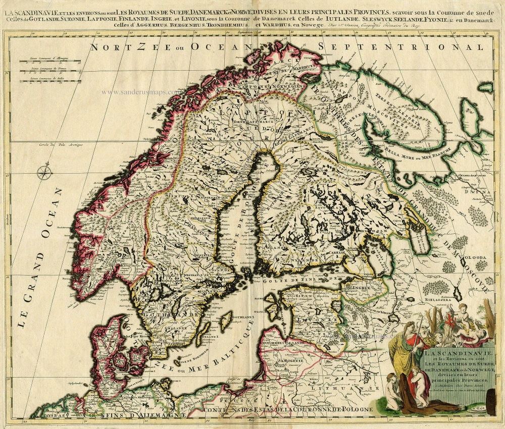
La Scandinavie, et les Environs, ou sont les Royaumes de Suede, de Danemark et de Norwege, divises en leurs principales Provinces.
Item Number: 19145 Authenticity Guarantee
Category: Antique maps > Europe > Northern Europe
Old, antique map of Scandinavia by P. Schenk.
Copper engraving
Size: 48.5 x 58cm (18.9 x 22.6 inches)
Verso: Blank
Condition: Old coloured, a few stains.
Condition Rating: B
From: Atlas Contractus sive Mapparum Geographicarum Sansoniarum auctarum et correctarum Nova Congeries. Amsterdam, P. Schenk, c. 1700. (Koeman, Sche 1)
The Schenk Family
Petrus Schenk (1660-1718), the founder of one of the best-known publishing firms of Amsterdam in the 18th century, was born in Elberfeld, Germany, in 1660. He went to Amsterdam where he became a pupil of the engraver Gerard Valck. On 19 Nov. 1686, a privilegio was granted to Petrus Schenk and Gerard Valk for the manufacturing and selling of their prints. Schenk’s contribution to cartography dates from c. 1695. In 1706 he moved to the Vijgendam in Amsterdam, ‘in Sanson’s Atlas’. After he died in 1718 his son, Leonardus Schenk, continued the art and print shop. The second son, Petrus II, settled in another famous house: ‘in Visscher’s Atlas’ where he continued the association with Gerard and Leonarus Valck.
The Schenk family produced general geographical atlases and special atlases. Apart from seventy original maps, several hundred are known with the name of Schenk, which were printed from plates obtained from Janssonius and Visscher. Schenk and Valck acquired all the plates of the Janssonius Heir’s Novus Atlas, Celestial atlas included. Many of Janssonius’ plates were reworked and amended.
The republishing of the maps from Janssonius’ Novus Atlas since c. 1680 was followed by the engraving of new maps, copied from Sanson’s better and more modern maps. Petrus Schenk published these maps in his Atlas Contractus sive mapparum geographicarum Sansoniarum auctarum et correctum Nova Congeries, also called Atlas Minor. After 1719, Petrus Schenk II continued the Atlas Contractus.
Petrus Schenk, the elder, enjoyed great fame as a print-seller and artist among art-and print-dealers in the whole of Europe. The great activity in map publishing, displayed by Petrus Schenk, the elder, was continued by his son and grandson. But the number of original atlas-maps is small. Like his father, who bought the copperplates of Janssonius’ atlas, Petrus Schenk II bought many of the plates formerly owned by Nicolaas Visscher.
Apart from the globes, maps and atlases, Petrus Schenk II published many books. He was older men of the booksellers guild in 1733.
Related items
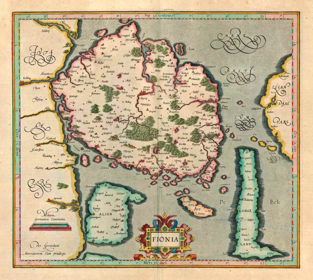
Fionia 1623
Denmark - Fyn, by Gerard Mercator.
[Item number: 12559]
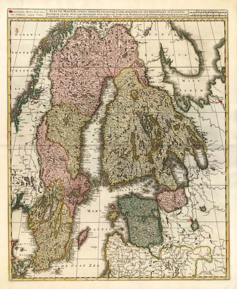
Sueciae Magnae, totius Orbis Regniantiquissimi, hodierna in sex Principales suas partes, Gothiam nempe, Sueciam propriam sive stricté Sumptam, Nordlandiam, Finniam, Ingriam, Livoniam, ... c. 1745
Finland, Sweden, Latvia, by Valk G. & L. - Ottens R. & I.
[Item number: 25846]
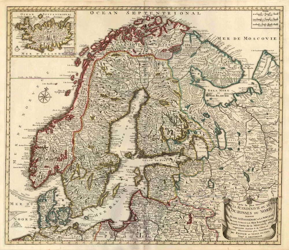
Carte la Plus Nouvelle de la Scandinivie ou les Couronnes du Nord Scavoir La Suede le Dannemarc et La Norvege Ou Lon Trouve La Mer Baltique et une Grande Partie de la Moscovie etc. 1730-45
Scandinavia par R. & I. Ottens.
[Item number: 25858]
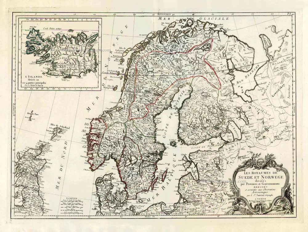
Les Royaumes de Suede et Norwege Divisés par Provinces et Gouvernements. 1776-79
Scandinavia, by Francesco Santini.
[Item number: 26964]
Rare and important map.
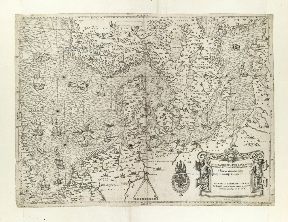
Septemtrionalium Regionum Svetiae Gothiae Norvegiae Daniae et terrarum adiacentium recens exactaq[ue] descriptio. 1558
Scandinavia, by Michele Tramezini.
[Item number: 27045]
Carte la Plus Nouvelle de la Scandinivie ou les Couronnes du Nord Scavoir La Suede le Dannemarc et La Norvege Ou Lon Trouve La Mer Baltique et une Grande Partie de la Moscovie etc. 1730-45
Scandinavia par R. & I. Ottens.
[Item number: 28269]
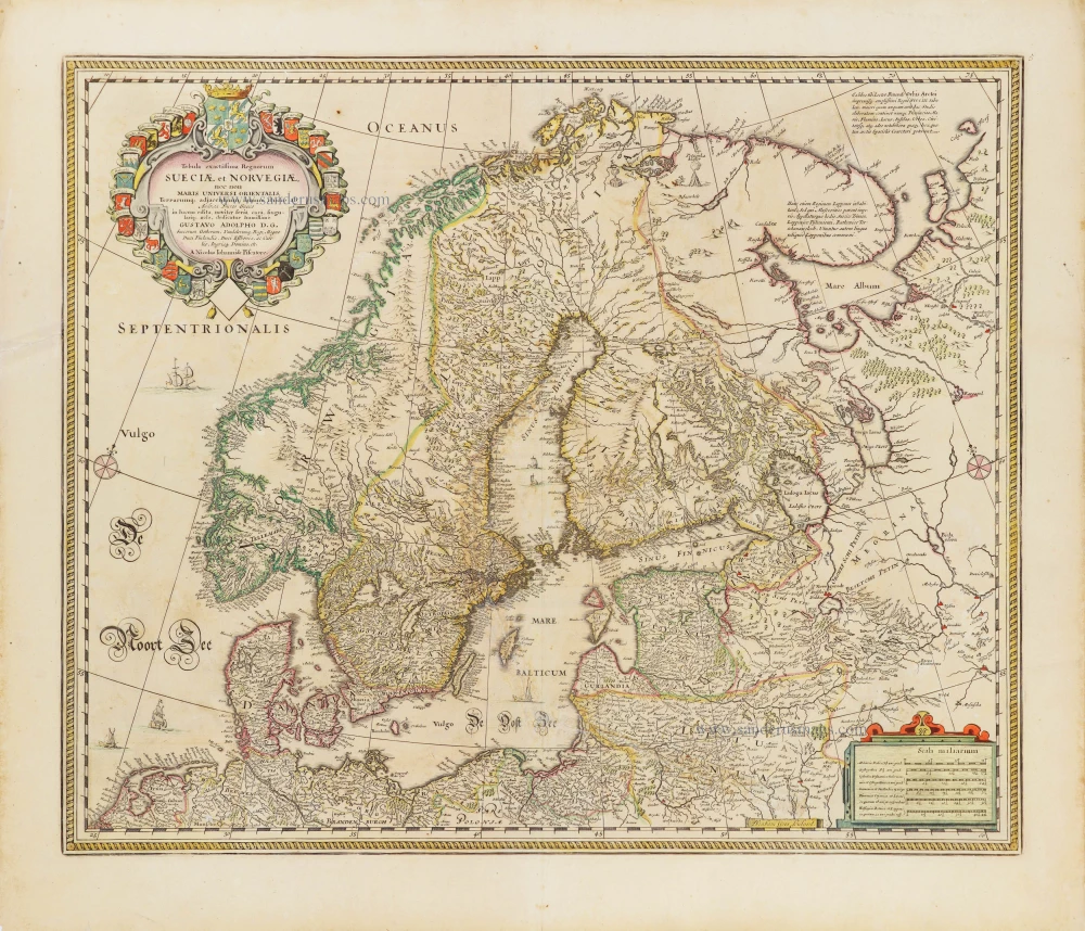
Tabula exactissima Regnorum Sueciae et Norvegiae, nec non Maris Universi Orientalis, 1656-80
Scandinavia by Nicolaas Visscher.
[Item number: 28742]
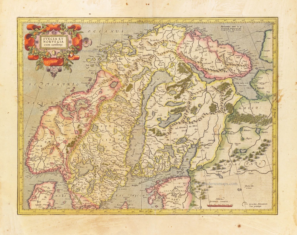
Svecia et Norvegia cum confinijs. 1628
Scandinavia, by Gerard Mercator.
[Item number: 28815]

Finmarchiae et Laplandiae Maritima. = Nieuwe Pascaert vande kusten Finmarcken en Lapland Streckende van Dronten tot Archangel. ca. 1680
The Coast of Lapland, by Frederick de Wit.
[Item number: 29219]
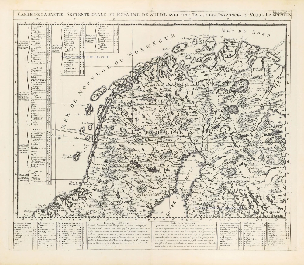
Carte de la Partie Septentrionale du Royaume de Suède avec une Table des Provinces et Villes Principales. 1714
Northern Scandinavia by Zacharias Châtelain.
[Item number: 29412]
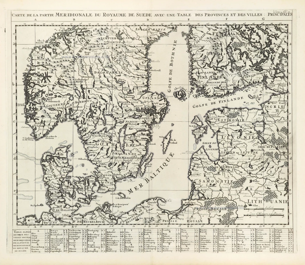
Carte de la Partie Meridionale du Royaume de Suède avec une Table des Provinces et Villes Principales. 1714
Southern Scandinavia by Zacharias Châtelain.
[Item number: 29413]
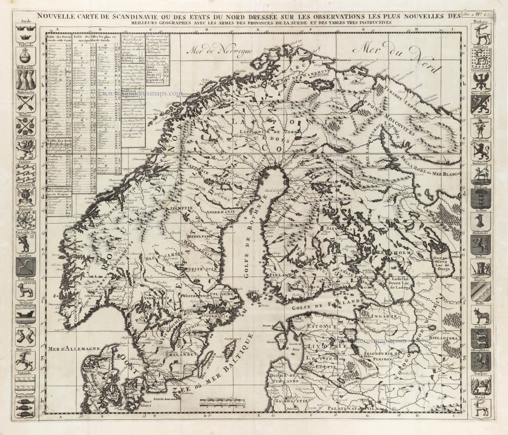
Nouvelle Carte de Scandinavie ou des Etats du Nord Dressée sur les observations les plus nouvelles des meilleurs Géographes avec les Armes des Provinces de la Suède et des Tables tres instructives. 1714
Scandinavia, by Zacharias Châtelain.
[Item number: 29499]

La Scandinavie et les environs ou sont les Estats et Royaumes de Danemarck Norwegue et Suede. 1652
Scandinavia by Nicolas Sanson.
[Item number: 29607]
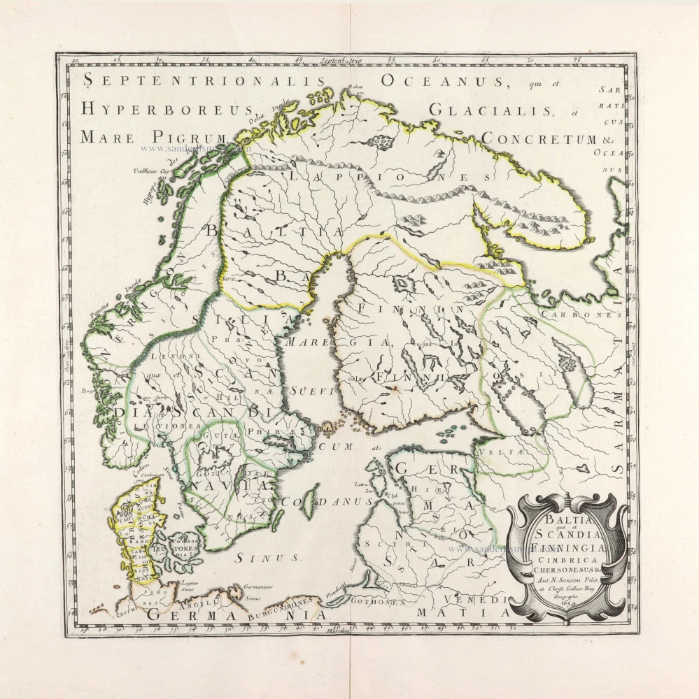
Baltia, quae et Scandia, Cimbrica Chersonesus &c. 1654-58
Scandinavia by Nicolas Sanson.
[Item number: 29608]
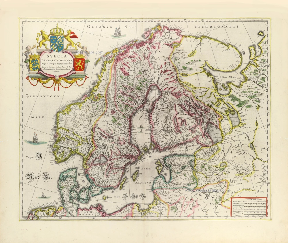
Suecia, Dania et Norvegia, Regna Europae Septentrionalia. 1643
Scandinavia by Joan Blaeu.
[Item number: 29998]
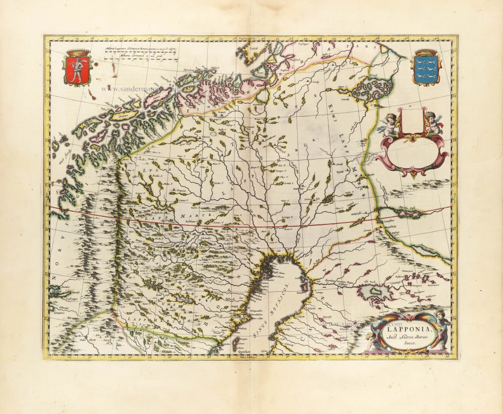
Lapponia. 1659
Lappland by Joan Blaeu.
[Item number: 30252]
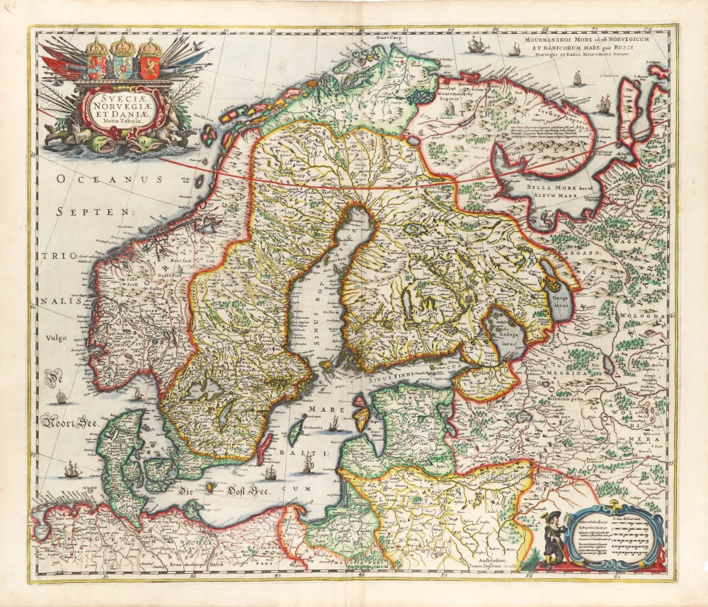
Sueciae, Norvegiae, et Daniae, Nova Tabula. 1666
Scandinavia, by Johannes Janssonius.
[Item number: 30290]