
Denmark by Schenk P. c. 1700
The Schenk Family
Petrus Schenk (1660-1718), the founder of one of the best-known publishing firms of Amsterdam in the 18th century, was born in Elberfeld, Germany, in 1660. He went to Amsterdam where he became a pupil of the engraver Gerard Valck. On 19 Nov. 1686, a privilegio was granted to Petrus Schenk and Gerard Valk for the manufacturing and selling of their prints. Schenk’s contribution to cartography dates from c. 1695. In 1706 he moved to the Vijgendam in Amsterdam, ‘in Sanson’s Atlas’. After he died in 1718 his son, Leonardus Schenk, continued the art and print shop. The second son, Petrus II, settled in another famous house: ‘in Visscher’s Atlas’ where he continued the association with Gerard and Leonarus Valck.
The Schenk family produced general geographical atlases and special atlases. Apart from seventy original maps, several hundred are known with the name of Schenk, which were printed from plates obtained from Janssonius and Visscher. Schenk and Valck acquired all the plates of the Janssonius Heir’s Novus Atlas, Celestial atlas included. Many of Janssonius’ plates were reworked and amended.
The republishing of the maps from Janssonius’ Novus Atlas since c. 1680 was followed by the engraving of new maps, copied from Sanson’s better and more modern maps. Petrus Schenk published these maps in his Atlas Contractus sive mapparum geographicarum Sansoniarum auctarum et correctum Nova Congeries, also called Atlas Minor. After 1719, Petrus Schenk II continued the Atlas Contractus.
Petrus Schenk, the elder, enjoyed great fame as a print-seller and artist among art-and print-dealers in the whole of Europe. The great activity in map publishing, displayed by Petrus Schenk, the elder, was continued by his son and grandson. But the number of original atlas-maps is small. Like his father, who bought the copperplates of Janssonius’ atlas, Petrus Schenk II bought many of the plates formerly owned by Nicolaas Visscher.
Apart from the globes, maps and atlases, Petrus Schenk II published many books. He was older men of the booksellers guild in 1733.
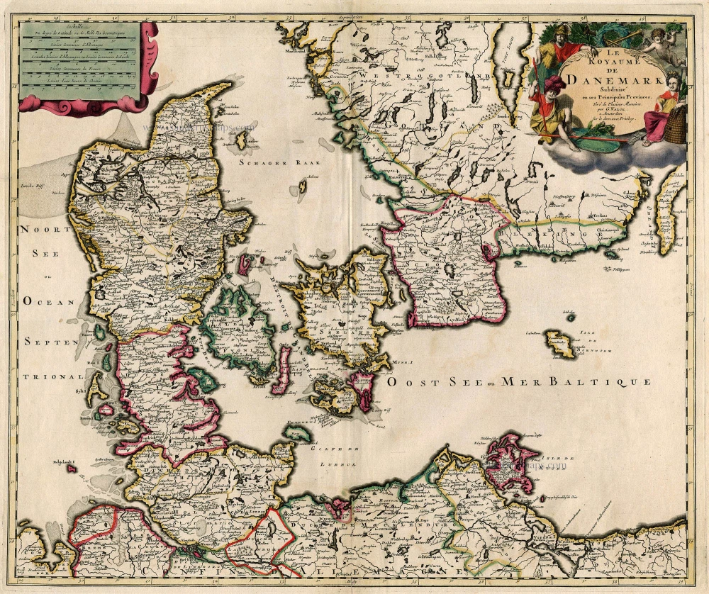
Le Royaume de Danemark Subdivisé en ses Principales Provinces.
Item Number: 19157 Authenticity Guarantee
Category: Antique maps > Europe > Northern Europe
Denmark by Schenk P.
Title: Le Royaume de Danemark Subdivisé en ses Principales Provinces.
Date: c. 1700.
Copper engraving, printed on paper.
Image size: 490 x 580mm (19.29 x 22.83 inches).
Sheet size: 520 x 610mm (20.47 x 24.02 inches).
Verso: Blank.
Condition: Original coloured, excellent.
Condition Rating: A.
From: Atlas Contractus sive Mapparum Geographicarum Sansoniarum auctarum et correctarum Nova Congeries. Amsterdam, P. Schenk, c. 1700. (Koeman, Sche 1)
The Schenk Family
Petrus Schenk (1660-1718), the founder of one of the best-known publishing firms of Amsterdam in the 18th century, was born in Elberfeld, Germany, in 1660. He went to Amsterdam where he became a pupil of the engraver Gerard Valck. On 19 Nov. 1686, a privilegio was granted to Petrus Schenk and Gerard Valk for the manufacturing and selling of their prints. Schenk’s contribution to cartography dates from c. 1695. In 1706 he moved to the Vijgendam in Amsterdam, ‘in Sanson’s Atlas’. After he died in 1718 his son, Leonardus Schenk, continued the art and print shop. The second son, Petrus II, settled in another famous house: ‘in Visscher’s Atlas’ where he continued the association with Gerard and Leonarus Valck.
The Schenk family produced general geographical atlases and special atlases. Apart from seventy original maps, several hundred are known with the name of Schenk, which were printed from plates obtained from Janssonius and Visscher. Schenk and Valck acquired all the plates of the Janssonius Heir’s Novus Atlas, Celestial atlas included. Many of Janssonius’ plates were reworked and amended.
The republishing of the maps from Janssonius’ Novus Atlas since c. 1680 was followed by the engraving of new maps, copied from Sanson’s better and more modern maps. Petrus Schenk published these maps in his Atlas Contractus sive mapparum geographicarum Sansoniarum auctarum et correctum Nova Congeries, also called Atlas Minor. After 1719, Petrus Schenk II continued the Atlas Contractus.
Petrus Schenk, the elder, enjoyed great fame as a print-seller and artist among art-and print-dealers in the whole of Europe. The great activity in map publishing, displayed by Petrus Schenk, the elder, was continued by his son and grandson. But the number of original atlas-maps is small. Like his father, who bought the copperplates of Janssonius’ atlas, Petrus Schenk II bought many of the plates formerly owned by Nicolaas Visscher.
Apart from the globes, maps and atlases, Petrus Schenk II published many books. He was older men of the booksellers guild in 1733.
Related items
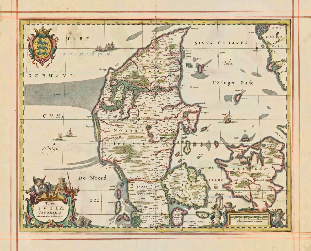
Totius Iutiae Generalis Accurata delineatio. 1680
Denmark - Jylland, by J. Janssonius, published by Moses Pitt and J. Janssonius-Waesberge.
[Item number: 1337]
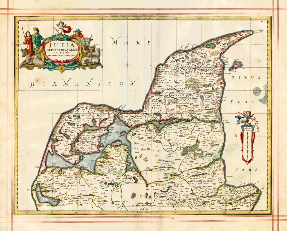
Iutia Septentrionalis, in qua Dioeceses Alburgensis et Viburgensis 1680
Denmark - Jylland (North) by J. Janssonius, published by Moses Pitt and J. Janssonius-Waesberge.
[Item number: 1353]
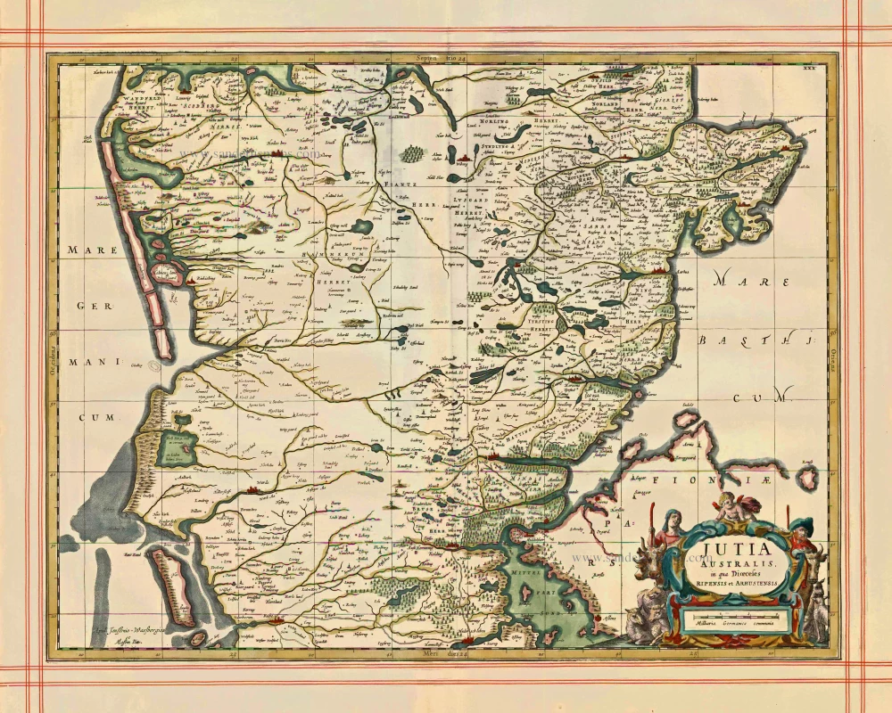
Jutia Australis, in qua Dioecesis Ripensis et Arhusiensis. 1680
Jutia Australis, in qua Dioecesis Ripensis et Arhusiensis. - Janssonius J. - Pitt Moses, 1680.
[Item number: 1373]
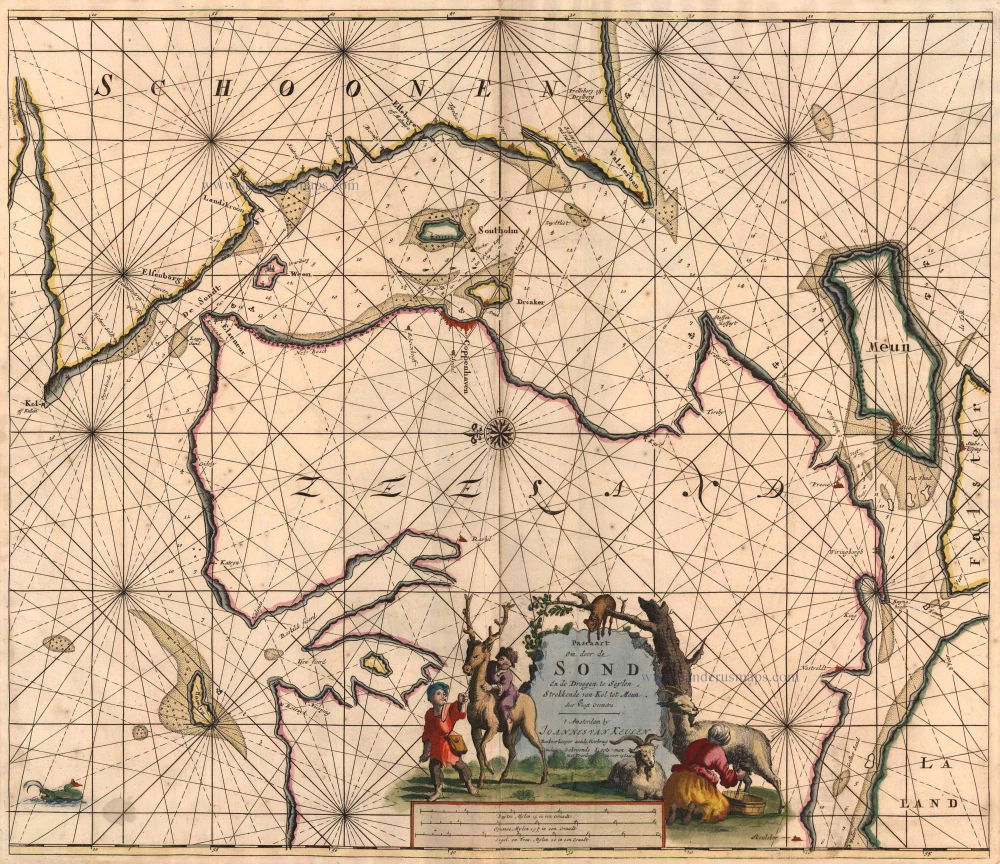
Pascaart om Door de Sond en de Droogen te Seylen Strekkende van Kol tot Meun 1697-1709
Denmark - Sjaelland, by J. Van Keulen Johannes.
[Item number: 4495]

Paskaert van t' Schager-Rak 1697-1709
Denmark - Skagerrak and Kattegat, by Van Keulen Johannes.
[Item number: 5394]
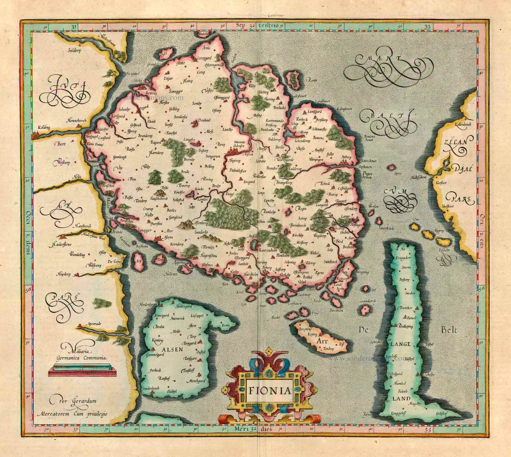
Fionia 1623
Denmark - Fyn, by Gerard Mercator.
[Item number: 12559]

Nouvelle Carte Géographique du Royaume de Dannemarck avec une Table des Villes les plus remarquables. 1714
Denmark, by Zacharias Châtelain.
[Item number: 21341]
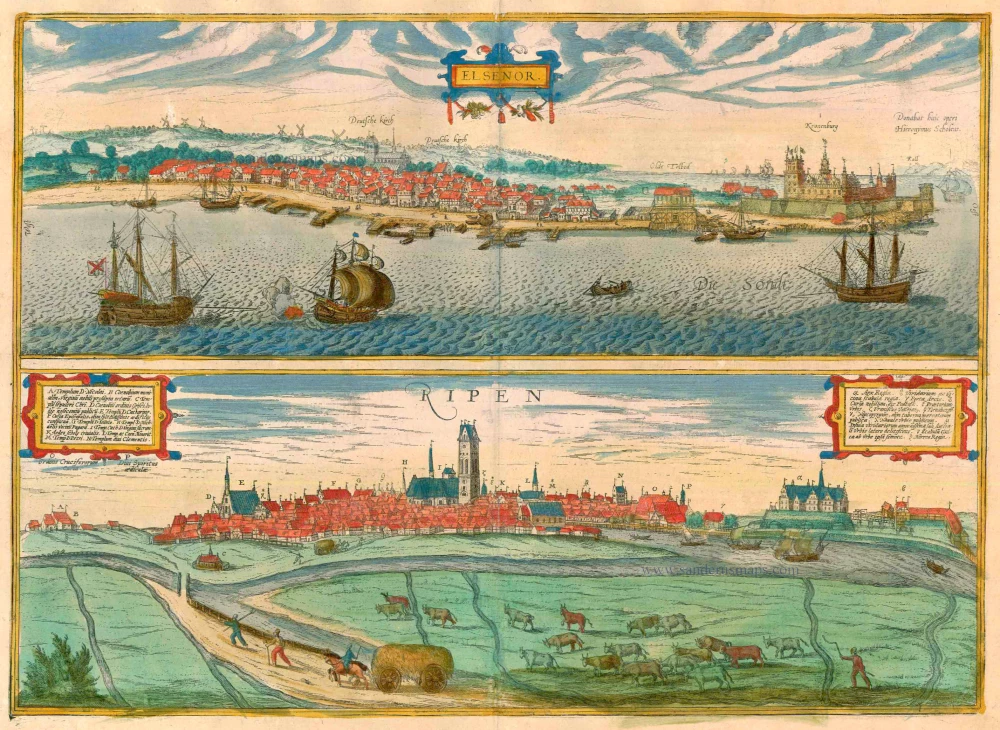
Elsenor [on sheet with] Ripen 1596-1640
Helsingør (Sjaelland) & Ribe (Jutland), by Georg Braun and Frans Hogenberg.
[Item number: 23375]
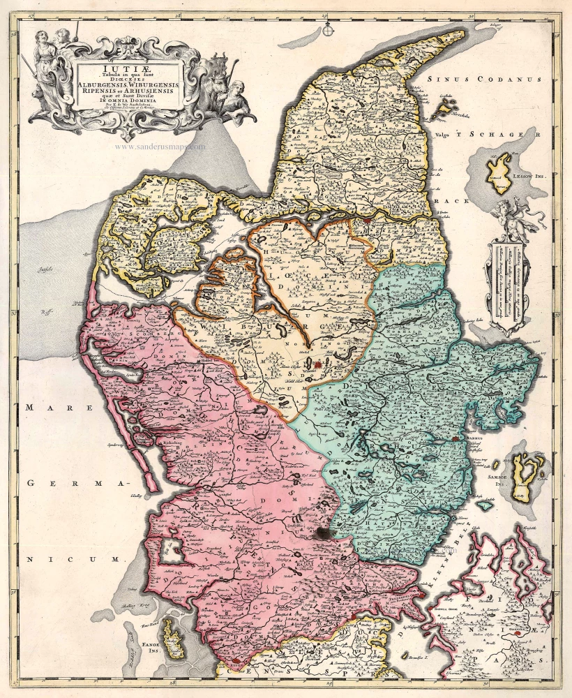
Iutiae Tabula in qua sunt Dioecesis Alburgensis, Wiburgensis, Ripensis et Arhusiensis quae et sunt divisae in Omnia Dominia. 1721-41
Denmark - Jutland, by Covens & Mortier.
[Item number: 23738]
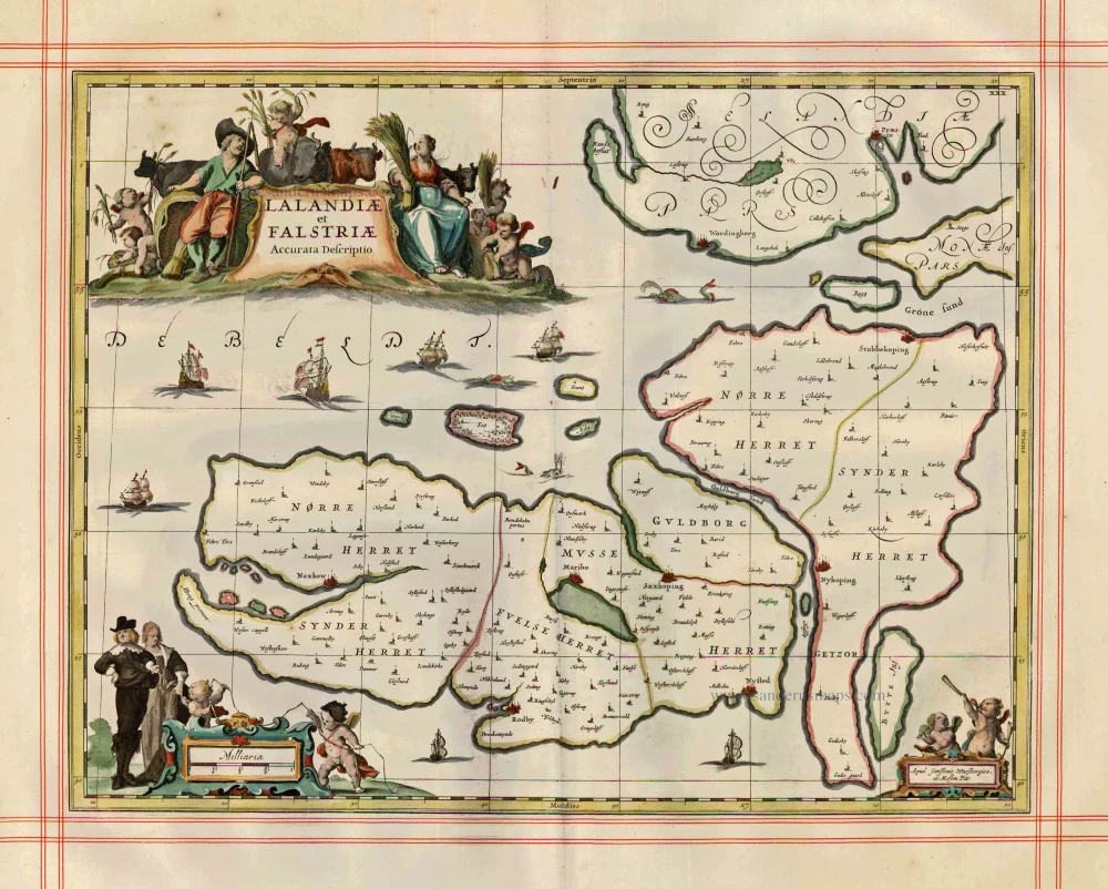
Lalandiae et Falstriae Accurata Descriptio. 1680
Denmark - Laaland and Falster by J. Janssonius, published by Moses Pitt and J. Janssonius-Waesberge.
[Item number: 25066]
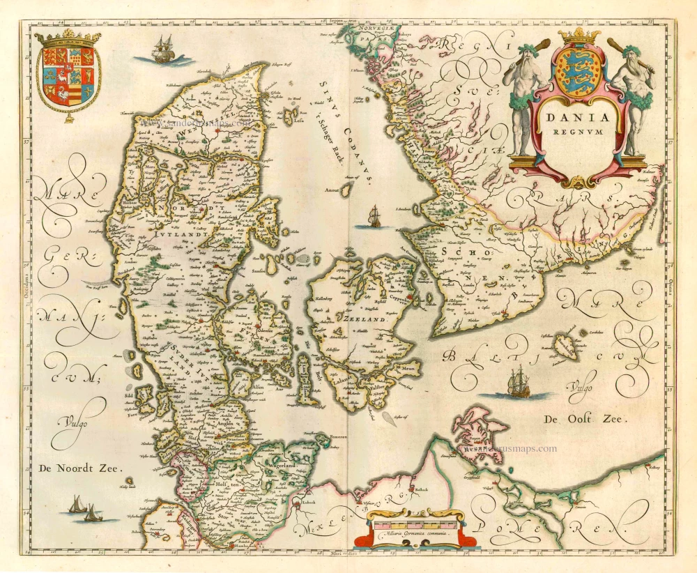
Dania Regnum. 1649-55
Denmark, by W. & J. Blaeu.
[Item number: 25266]
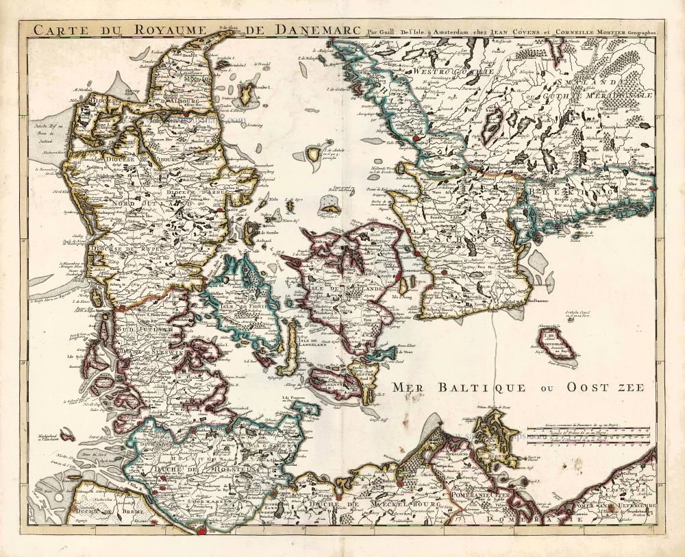
Carte du Royaume de Danemarc. 1730
Denmark by Guillaume Delisle, published by Covens & Mortier.
[Item number: 25900]
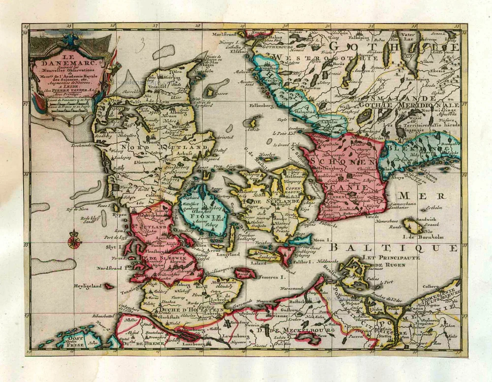
Le Danemarc, Suivant les Nouvelles Observations de Mess.rs de L'Academie Royale des Sciences, etc. 1713
Denmark, by Pieter van der Aa
[Item number: 26044]
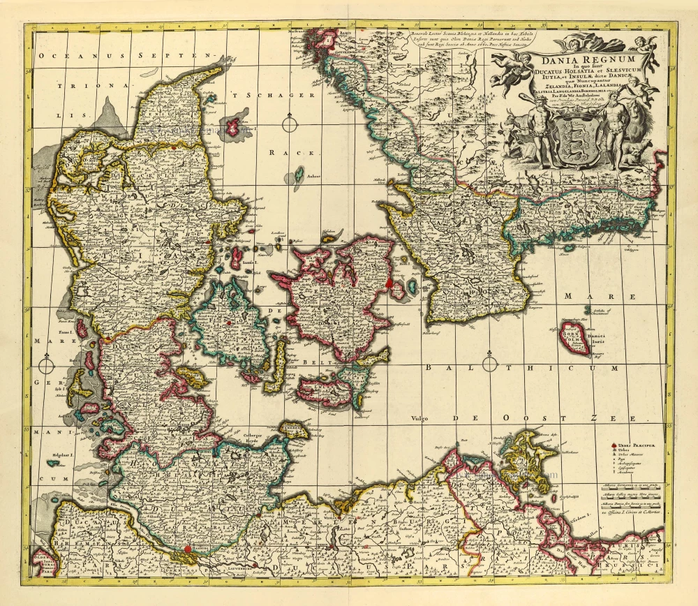
Dania Regnum In quo sunt Ducatus Holsatia et Slesvicum Iutia, et Insulae, dictae Danicae, quae Nuncupantur Zelandia, Fionia, Lalandia, Falstria, Langelandia Bornholmia etc. after 1721
Denmark by Frederik de Wit, published by Covens & Mortier.
[Item number: 28268]

Regni Daniae, Novißima at Accuratißima Tabula. c. 1678
Denmark by Nicolaes Visscher I.
[Item number: 28521]
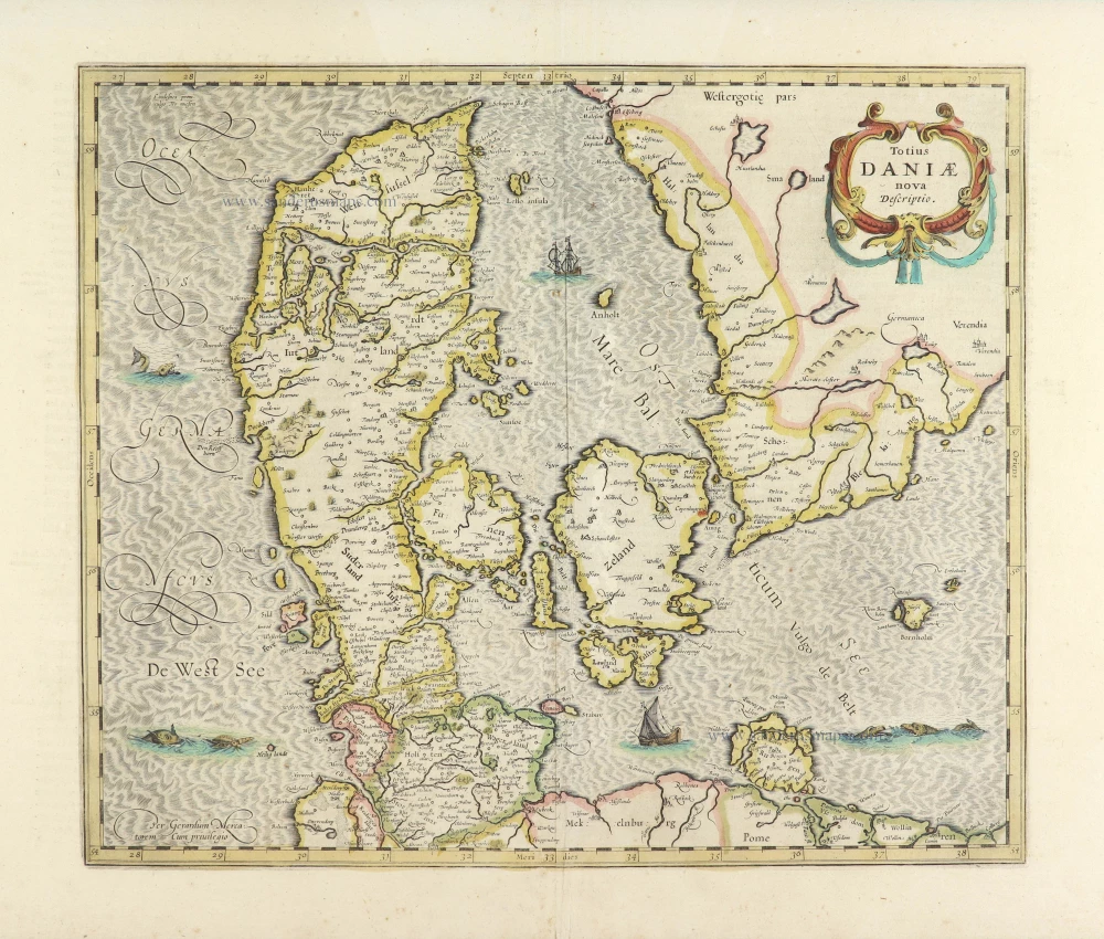
Totius Daniae nova descriptio. 1639-42
Denmark by Henricus Hondius.
[Item number: 28699]
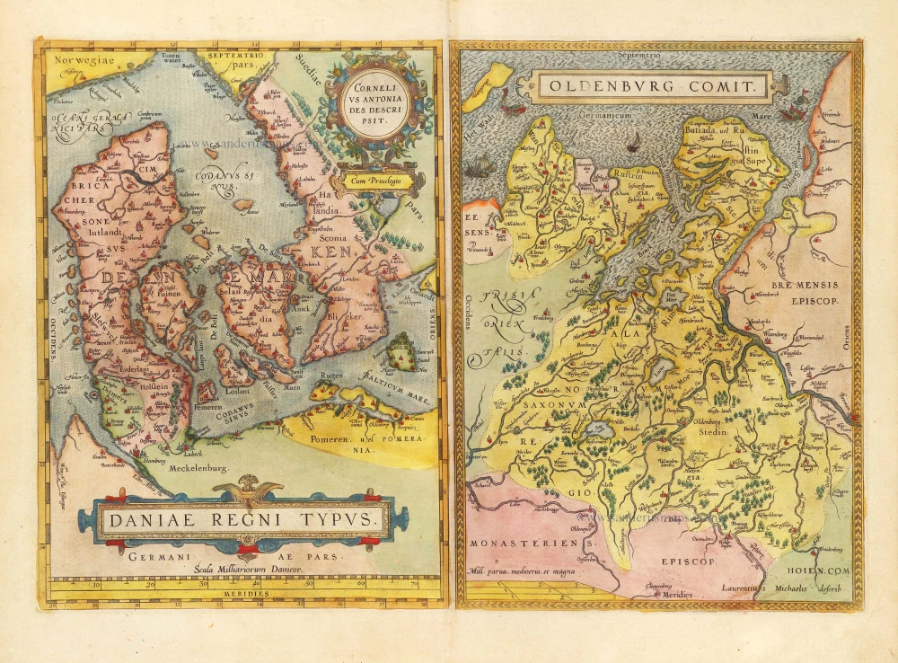
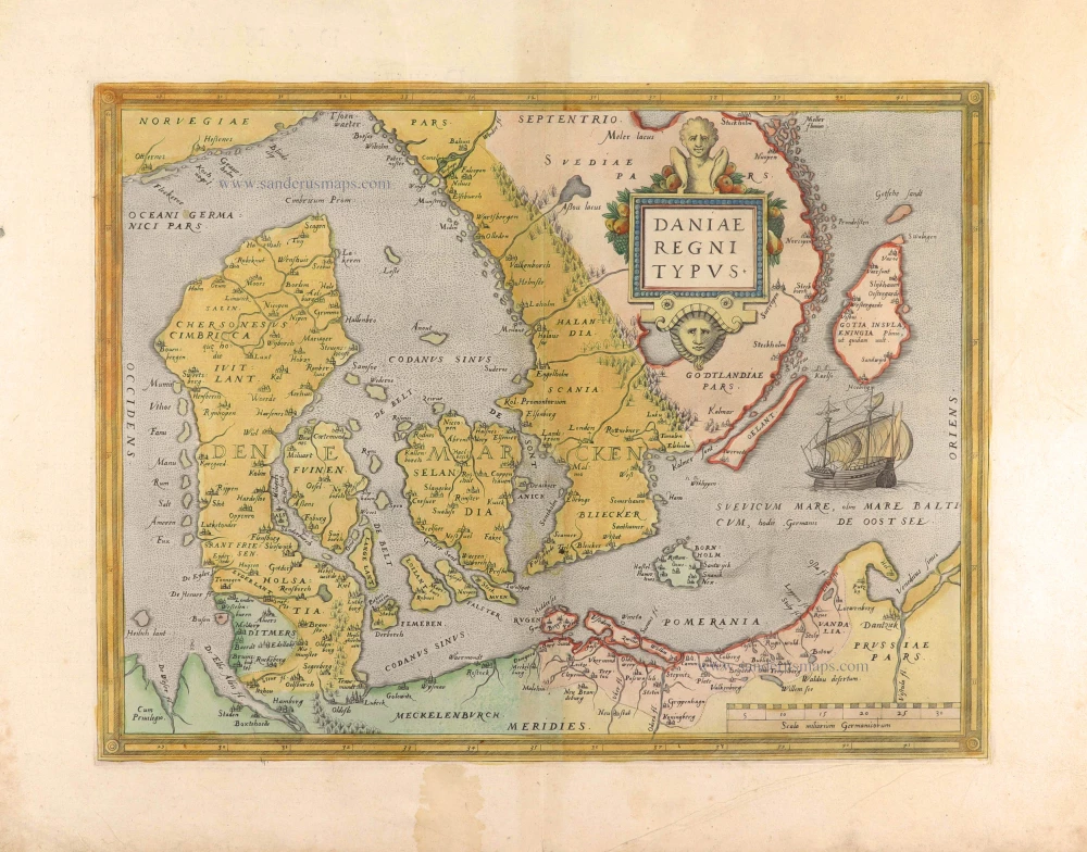
Daniae Regni Typus Cornelius Antoniades Descripsit; [On sheet with:] Oldenburg Comit. 1584
Denmark and Jutland by Abraham Ortelius.
[Item number: 29133]

Nouvelle Carte Géographique du Royaume de Dannemarck avec une Table des Villes les plus remarquables. 1714
Denmark by Zacharias Châtelain.
[Item number: 29430]
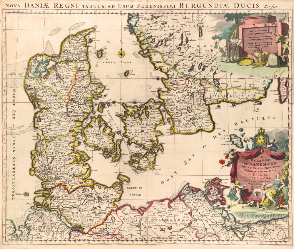
Le Royaume de Danemark, Divisé en ses Provinces. c. 1709
Denmark by Hubert Jaillot.
[Item number: 29589]
Daniae Regni Typus. 1574
Denmark by Abraham Ortelius.
[Item number: 29601]
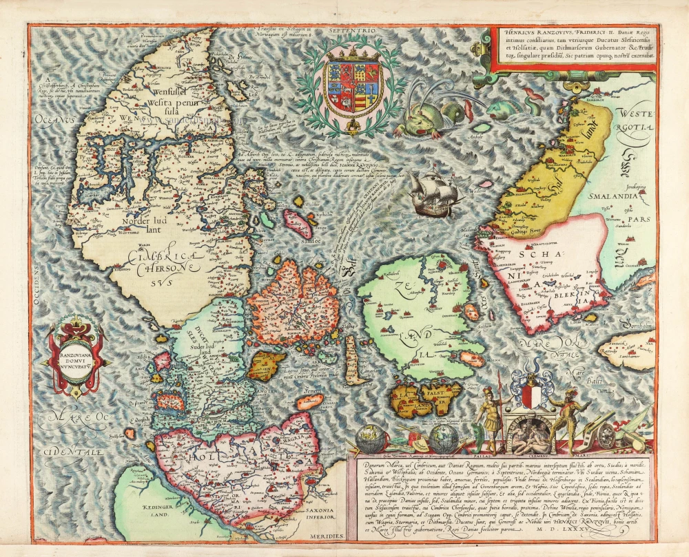
First edition, first state of this famous map of Denmark by Marcus Jordan, published by Braun & Hogenberg.
Danorum Marca, vel Cimbricum, aut Daniae Regnum ... 1588
Denmark, by Georg Braun & Frans Hogenberg.
[Item number: 30175]