
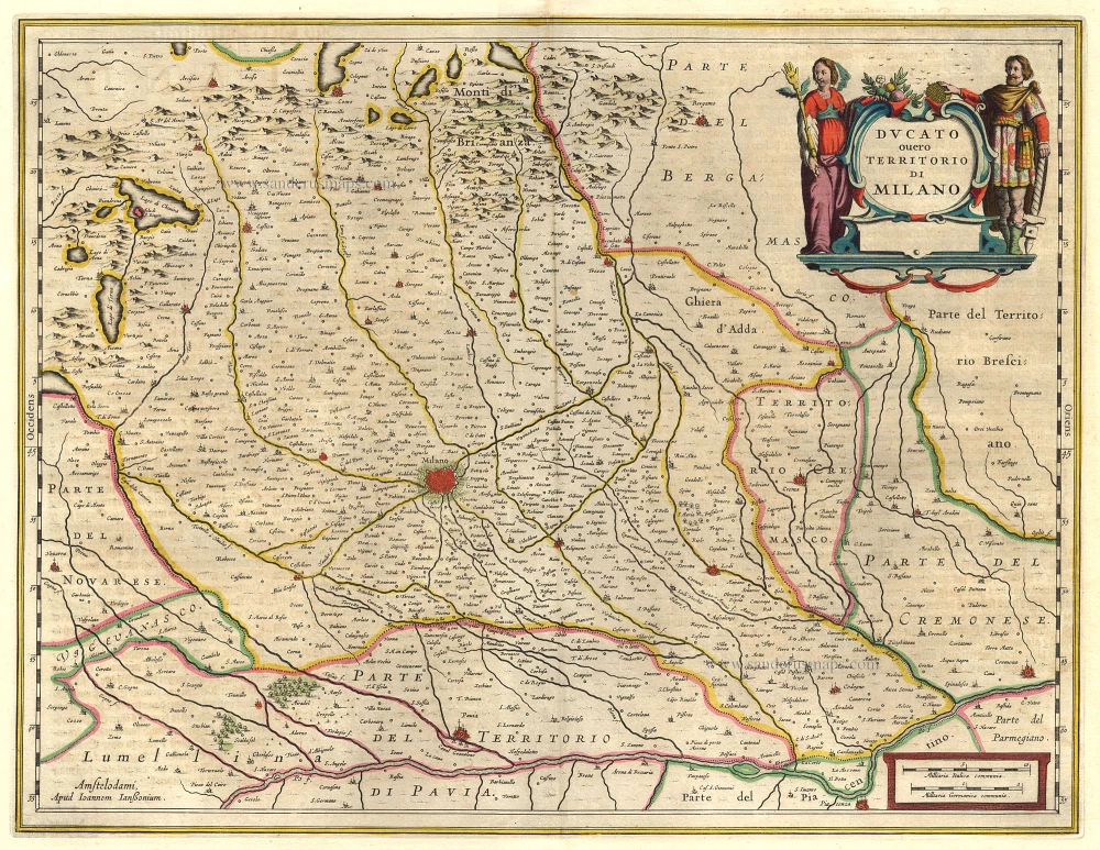
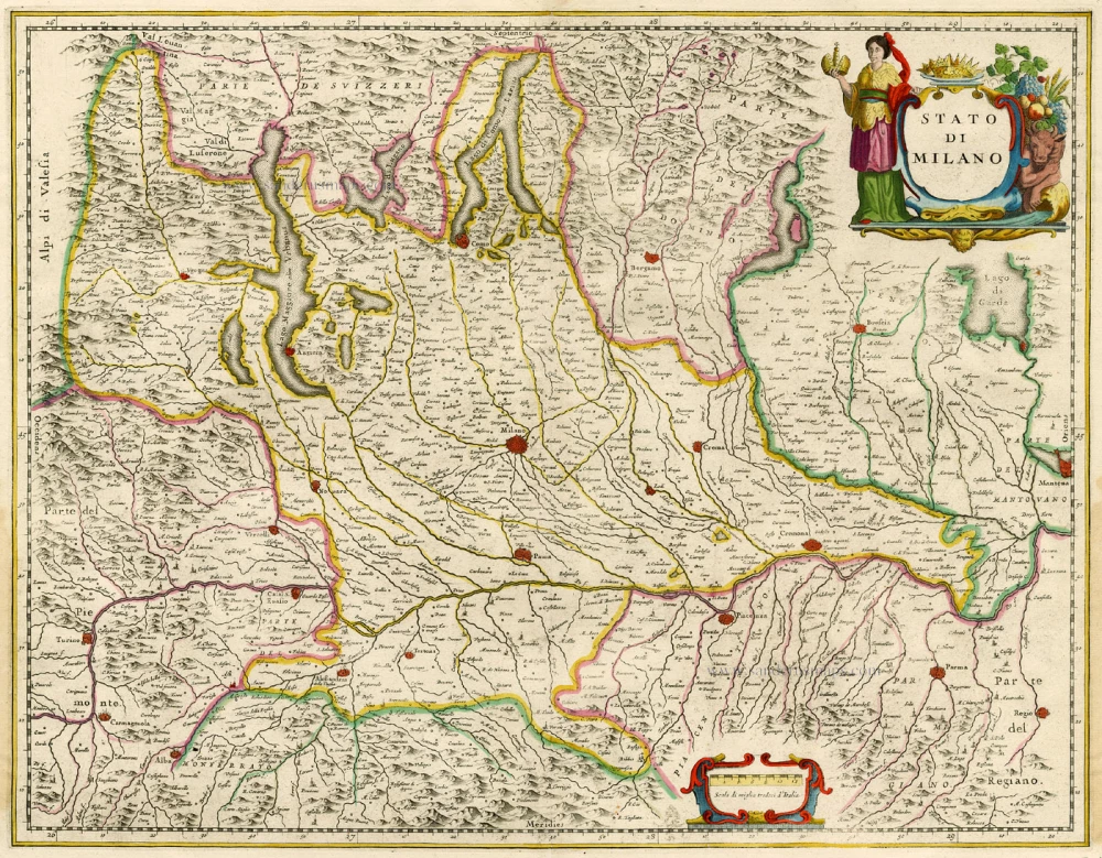
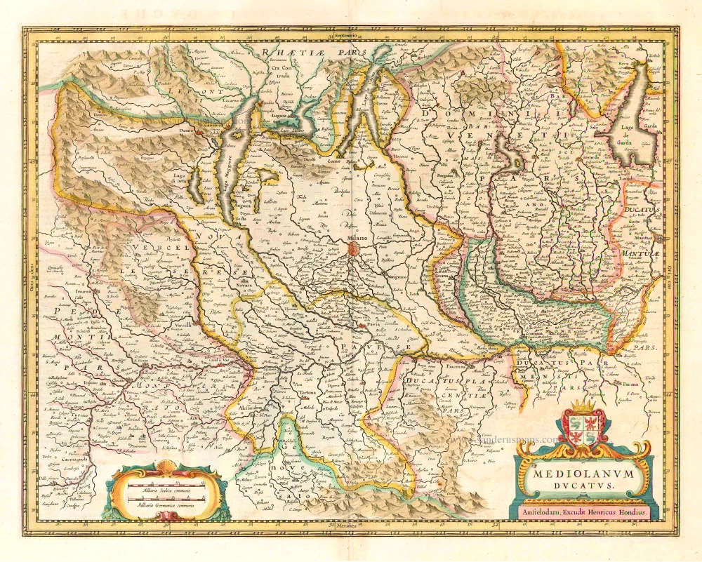
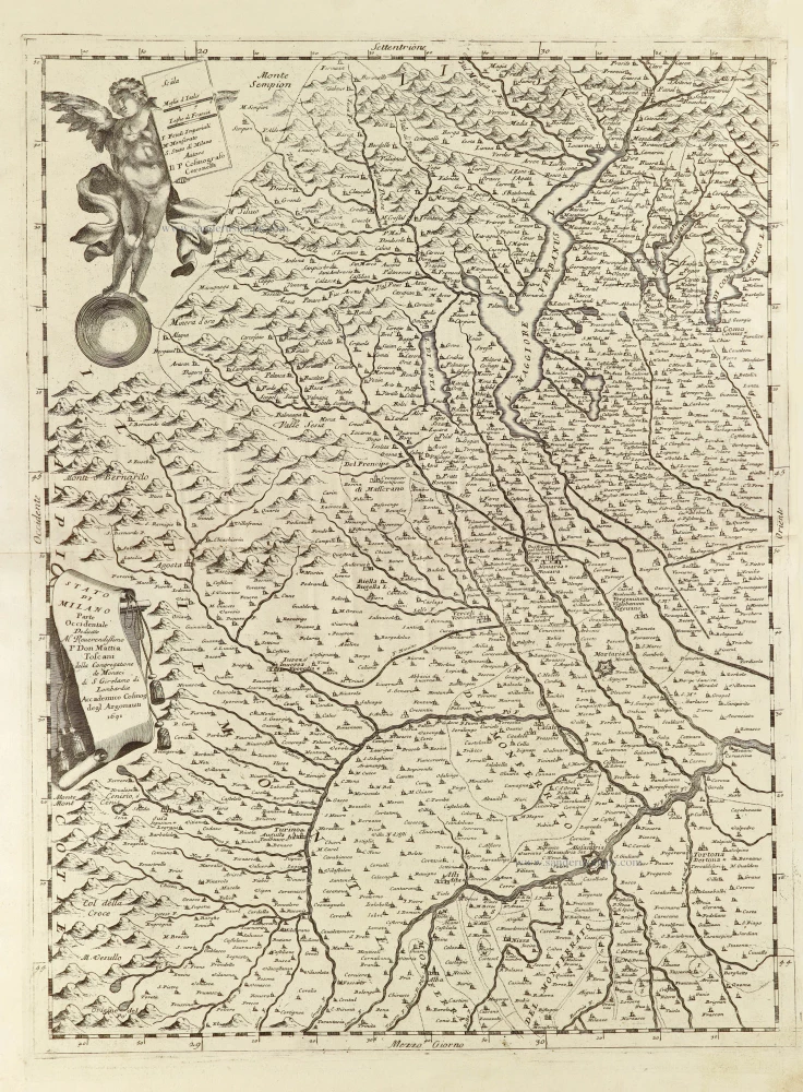
Milano, by Janssonius J. - Hondius H. 1644-58
The Janssonius Family
Joannes Janssonius (Arnhem, 1588-1664), son of the Arnhem publisher Jan Janssen, married Elisabeth Hondius, daughter of Jodocus Hondius, in Amsterdam in 1612. After his marriage, he settled down in this town as a bookseller and publisher of cartographic material. In 1618, he established himself in Amsterdam next door to Blaeu’s bookshop. He entered into serious competition with Willem Jansz. Blaeu when copying Blaeu’s Licht der Zeevaert after the expiration of the privilege in 1620. His activities concerned the publication of atlases, books, single maps, and an extensive book trade with branches in Frankfurt, Danzig, Stockholm, Copenhagen, Berlin, Koningsbergen, Geneva, and Lyon. In 1631, he began publishing atlases together with Henricus Hondius.
In the early 1640s, Henricus Hondius left the atlas publishing business to Janssonius. Competition with Joan Blaeu, Willem’s son and successor, in atlas production, prompted Janssonius to enlarge his Atlas Novus finally into a work of six volumes, into which a sea atlas and an atlas of the Old World were inserted. Other atlases published by Janssonius are Mercator’s Atlas Minor, Hornius’s historical atlas (1652), the townbooks in eight volumes (1657), Cellarius’s Atlas Coelestis and several sea atlases and pilot guides.
After the death of Joannes Janssonius, the shop and publishing firm were continued by the heirs under the direction of Johannes van Waesbergen (c. 1616-1681), son-in-law of Joannes Janssonius. Van Waesbergen added Janssonius's name to his own.
In 1676, Joannes Janssonius’s heirs sold by auction “all the remaining Atlases in Latin, French, High and Low German, as well as the Stedeboecken in Latin, in 8 volumes, bound and unbound, maps, plates belonging to the Atlas and Stedeboecken.” The copperplates from Janssonius’s atlases were afterwards sold to Schenk and Valck.
Ducato ouero Territorio di Milano.
Item Number: 19231 Authenticity Guarantee
Category: Antique maps > Europe > Italy
Old map of the vicinity of Milano, by J. Janssonius.
Mappa antica delle vicinanze di Milano, di J. Janssonius.
Copper engraving
Size: 38 x 49cm (14.7 x 19 inches)
Verso text: German
Condition: Old coloured, slightly age-toned.
Condition Rating: A
References: Van der Krogt 1, 7020:1B.2.
From: Novus Atlas, das ist Welt-beschreibung mit schönen newen aussführlichen Taffeln inthaltende die Königreiche und Länder des gatntzen Erdreichs. Amsterdam, J. Janssonius, 1644-58. (Van der Krogt 1, 424)
The Janssonius Family
Joannes Janssonius (Arnhem, 1588-1664), son of the Arnhem publisher Jan Janssen, married Elisabeth Hondius, daughter of Jodocus Hondius, in Amsterdam in 1612. After his marriage, he settled down in this town as a bookseller and publisher of cartographic material. In 1618, he established himself in Amsterdam next door to Blaeu’s bookshop. He entered into serious competition with Willem Jansz. Blaeu when copying Blaeu’s Licht der Zeevaert after the expiration of the privilege in 1620. His activities concerned the publication of atlases, books, single maps, and an extensive book trade with branches in Frankfurt, Danzig, Stockholm, Copenhagen, Berlin, Koningsbergen, Geneva, and Lyon. In 1631, he began publishing atlases together with Henricus Hondius.
In the early 1640s, Henricus Hondius left the atlas publishing business to Janssonius. Competition with Joan Blaeu, Willem’s son and successor, in atlas production, prompted Janssonius to enlarge his Atlas Novus finally into a work of six volumes, into which a sea atlas and an atlas of the Old World were inserted. Other atlases published by Janssonius are Mercator’s Atlas Minor, Hornius’s historical atlas (1652), the townbooks in eight volumes (1657), Cellarius’s Atlas Coelestis and several sea atlases and pilot guides.
After the death of Joannes Janssonius, the shop and publishing firm were continued by the heirs under the direction of Johannes van Waesbergen (c. 1616-1681), son-in-law of Joannes Janssonius. Van Waesbergen added Janssonius's name to his own.
In 1676, Joannes Janssonius’s heirs sold by auction “all the remaining Atlases in Latin, French, High and Low German, as well as the Stedeboecken in Latin, in 8 volumes, bound and unbound, maps, plates belonging to the Atlas and Stedeboecken.” The copperplates from Janssonius’s atlases were afterwards sold to Schenk and Valck.
Related items
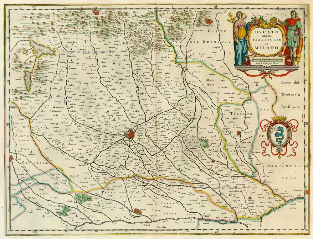
Ducato ouero Territorio di Milano 1664-65
Milano, by J. Blaeu.
[Item number: 7057]
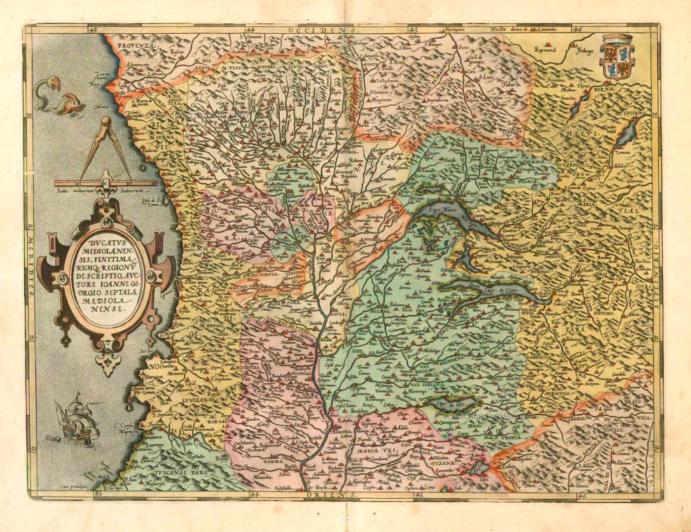
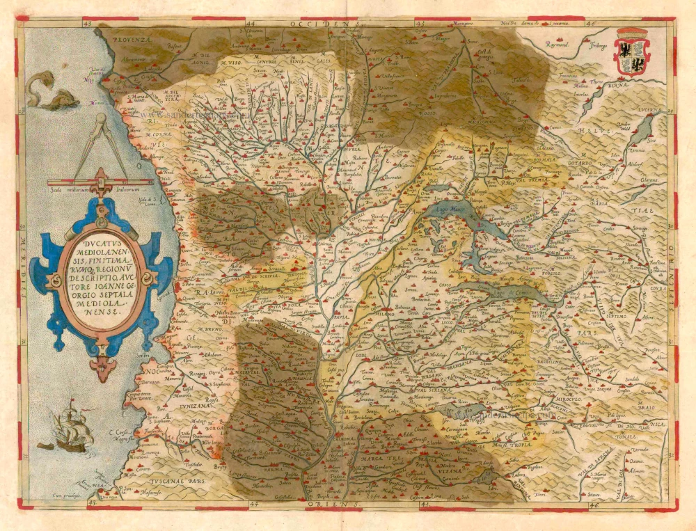
Ducatus Mediolanensis, finitimarumq, Regionu descriptio, auctore Ioanne Georgio Septala Mediolanense. 1601
Milano by A. Ortelius.
[Item number: 8062]
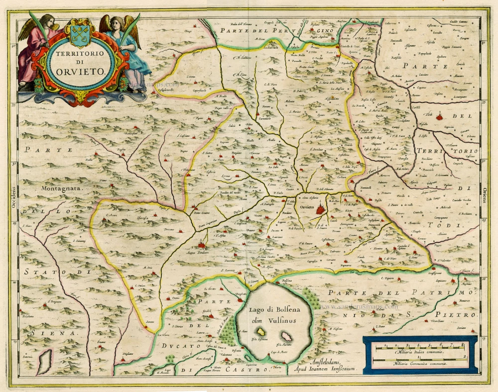
Territorio di Orvieto. 1644-58
Orvieto, by Janssonius J.
[Item number: 15378]
Stato di Milano. 1656-80
Milano by Johannes Janssonius.
[Item number: 15712]
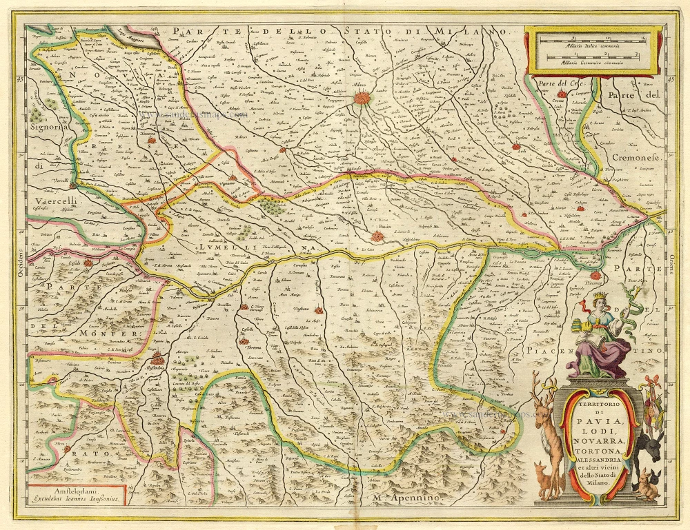
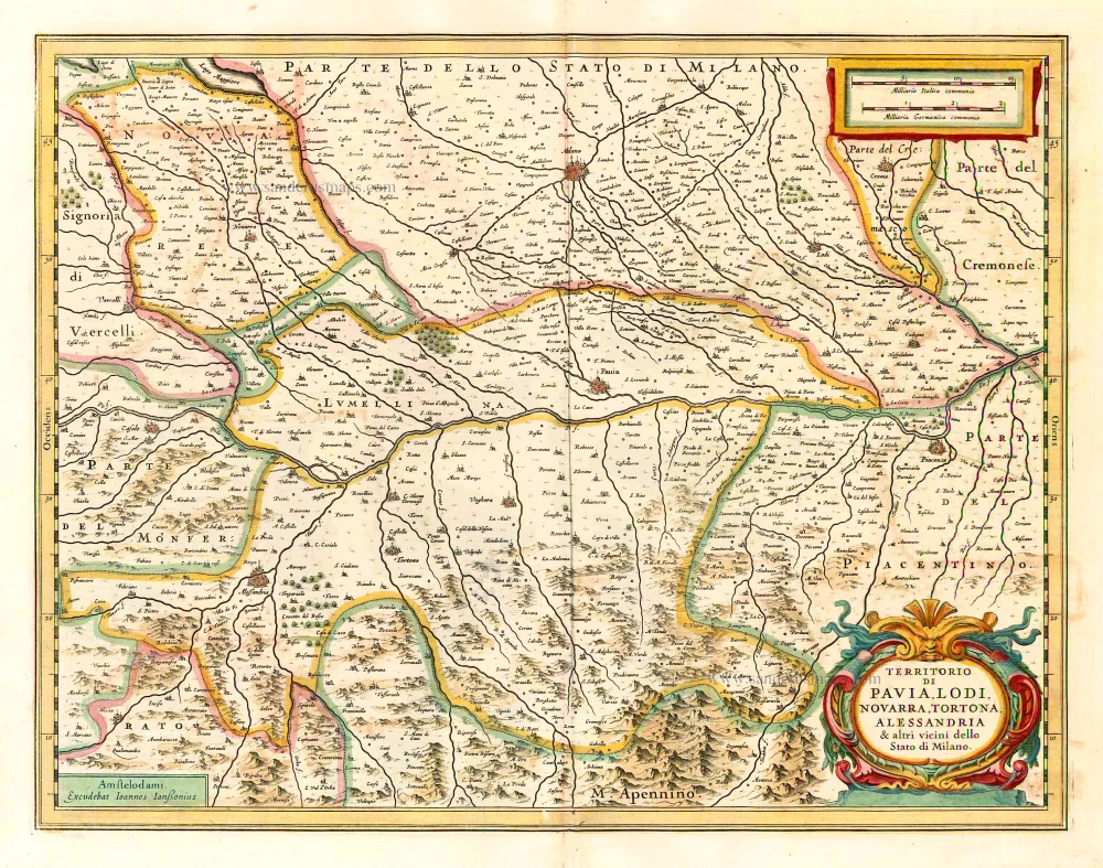
Territorio di Pavia, Lodi, Noavarra, Tortona, Allessandria et altri vicini dello Stato di Milano. 1644-58
Milano (South), by Janssonius J. - Hondius H.
[Item number: 19238]
Ducatus Mediolanensis, finitimarumq, Regionu descriptio, auctore Ioanne Georgio Septala Mediolanense. 1579
Milano by Abraham Ortelius.
[Item number: 23348]
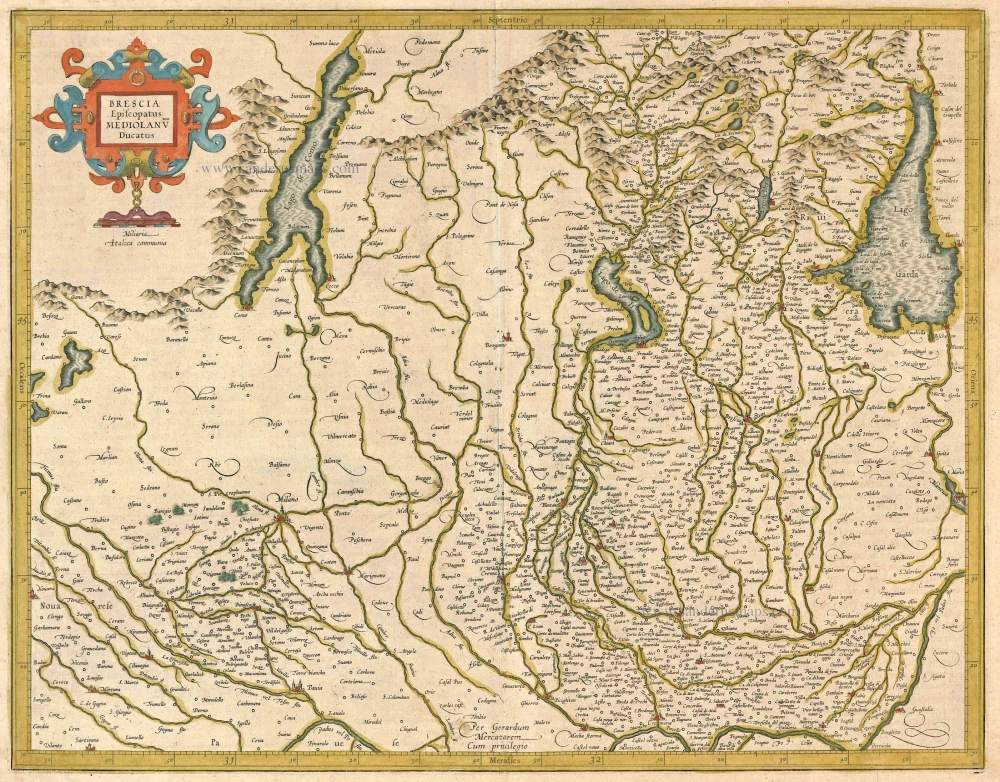
Brescia Episcopanus Mediolanu Ducatus. 1613
Brescia - Milano, by Gerard Mercator.
[Item number: 24513]
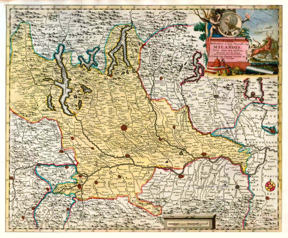
Carte Particuliere et toute Nouvelle du Milanois. Avec tous ses confins. 1713
Milano, by P. Van der Aa.
[Item number: 26084]

Carte Nouvelle et exacte de la Gaule Cisalpine et sur tout de la Ligurie, de l'Insubrie et des Pays voisins, suivant l'Ancienne Geographie. 1713
Northern Italy, by Pieter Van der Aa.
[Item number: 26089]
Mediolanum Ducatus. 1641
The Duchy of Milan by Henricus Hondius.
[Item number: 26376]
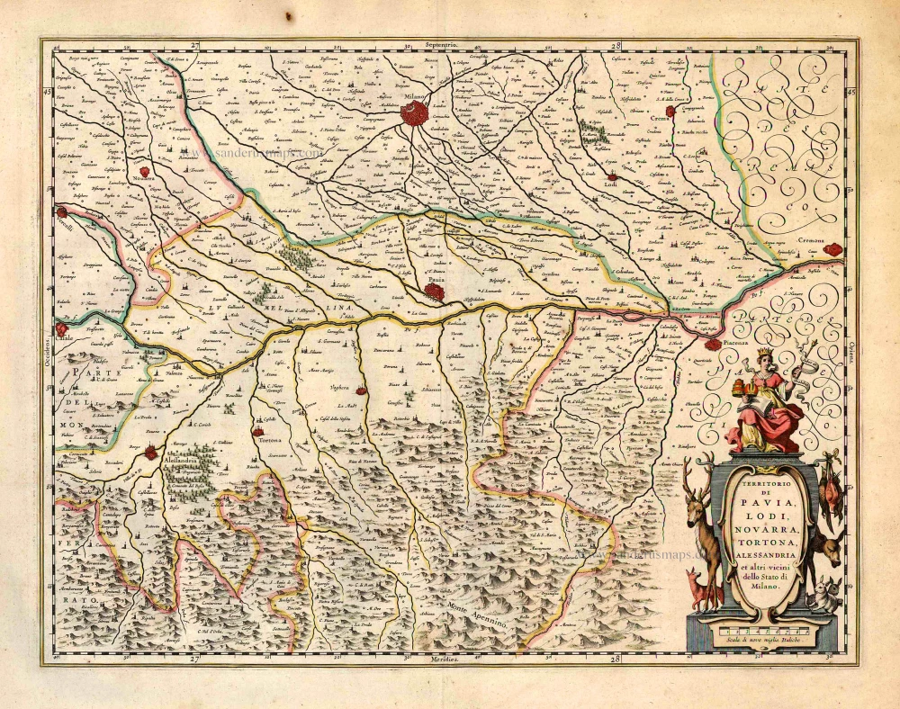
Territorio di Pavia, Lodi, Noavarra, Tortona, Allessandria et altri vicini dello Stato di Milano. 1641
Milan (South), by Johannes Janssonius.
[Item number: 26380]
Territorio di Pavia, Lodi, Noavarra, Tortona, Allessandria et altri vicini dello Stato di Milano. 1640
Milan (South), by Willem & Joan Blaeu
[Item number: 27211]
Stato di Milano Parte Occidentale. 1696
Western part of the State of Milan with a plan of Como on verso, by Vincenzo Coronelli.
[Item number: 28734]
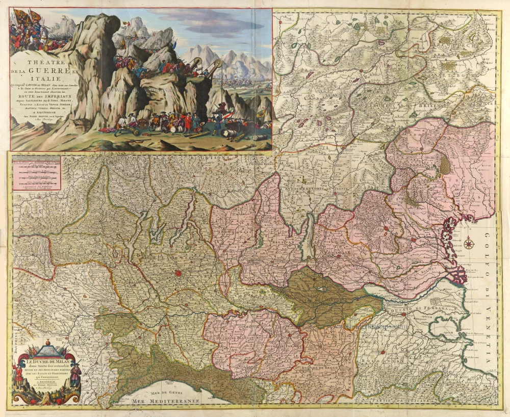
Spectacular wall map of North Italy. Heightened in gold.
Théatre de la Guerre en Italie Qui comprend le Duché de Milan, dans toute son Estendue & les Estats et Frontières qui l'environnent 1703
Duchy of Milan by Pierre Mortier.
[Item number: 29507]
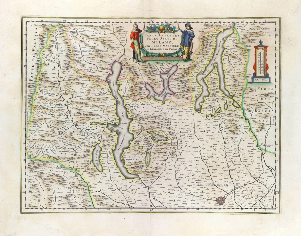
Parte Alpestre dello Stato di Milano Con il Lago Maggiore di Lugano, é di Como. 1640
Northern Milan by Willem & Joan Blaeu
[Item number: 29715]