
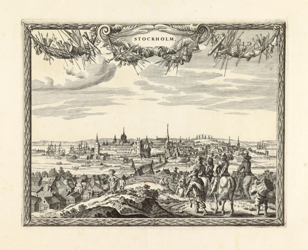
Sweden - Stockholm, by Zacharias Châtelain. 1713-1719

The Châtelain Family
Zacharias Châtelain (1684-1743) was a bookseller and publisher of Amsterdam. He was succeeded by his sons Zacharias jr and Henry Abraham. The Châtelain family was best known for the historical atlas Atlas Historique, ou nouvelle introduction à l’histoire…, a major work of its time. It was an encyclopaedia in seven volumes, including geography as one of its main subjects. The atlas was published in Amsterdam in seven volumes in various editions with different imprints from 1705 to 1739. An anonym person (Mr. C***) compiled the work with compositions of text, maps, plates and chronological and genealogical tables by Gueudeville, except volume 7, where H.P. Limiers took over this task. The maps were made mainly after the work of Guillaume de l'Isle.
The 1705 edition was published with the imprint “L’Honoré & Châtelain”. Later editions had the imprint: “les Frères Châtelain Libraires” or “L’Honoré & Châtelain Libraires”.
Carte de la Maison du Roy, des Etats, des Conseils et du Gouvernement Civil, Ecclesiastique, et militaire de Suède.
Item Number: 21340 Authenticity Guarantee
Category: Antique maps > Europe > Northern Europe
Old, antique map of Sweden - Stockholm by Châtelain.
Title: Carte de la Maison du Roy, des Etats, des Conseils et du Gouvernement Civil, Ecclesiastique, et militaire de Suède.
Date: 1713-1719.
Copper engraving, printed on paper.
Size (not including margins): 345 x 450mm (13.58 x 17.72 inches).
Verso: Blank.
Condition: Coloured.
Condition Rating: A+.
From: Atlas Historique. Amsterdam, Châtelain, 1713-1719.
The Châtelain Family
Zacharias Châtelain (1684-1743) was a bookseller and publisher of Amsterdam. He was succeeded by his sons Zacharias jr and Henry Abraham. The Châtelain family was best known for the historical atlas Atlas Historique, ou nouvelle introduction à l’histoire…, a major work of its time. It was an encyclopaedia in seven volumes, including geography as one of its main subjects. The atlas was published in Amsterdam in seven volumes in various editions with different imprints from 1705 to 1739. An anonym person (Mr. C***) compiled the work with compositions of text, maps, plates and chronological and genealogical tables by Gueudeville, except volume 7, where H.P. Limiers took over this task. The maps were made mainly after the work of Guillaume de l'Isle.
The 1705 edition was published with the imprint “L’Honoré & Châtelain”. Later editions had the imprint: “les Frères Châtelain Libraires” or “L’Honoré & Châtelain Libraires”.
Related items

Nieuwe Paskaert van het Stockholmse Liet 1697-1709
Sweden - Stockholm, by Johannes Van Keulen.
[Item number: 12460]

Carte de l'Etat du Royaume de Dannemarck et diverses observations pour conduire à l'Intelligence de l'Histoire et du Gouvernement de ce Royaume. 1714
Denmark - Copenhagen, by Zacharias Châtelain.
[Item number: 21339]
Carte de la Maison du Roy, des Etats, des Conseils et du Gouvernement Civil, Ecclesiastique, et militaire de Suède. 1713-1719
Sweden - Stockholm, by Zacharias Châtelain.
[Item number: 21340]

Nouvelle Carte Géographique du Royaume de Dannemarck avec une Table des Villes les plus remarquables. 1714
Denmark, by Zacharias Châtelain.
[Item number: 21341]
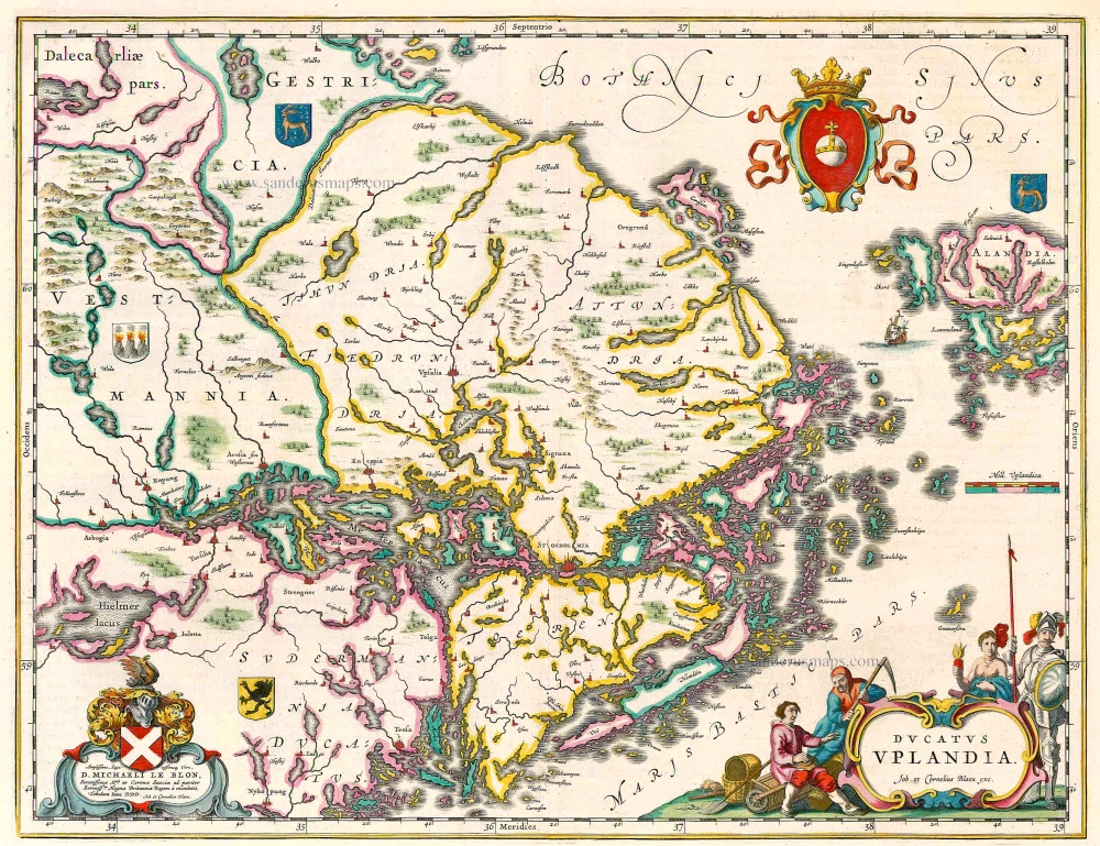
Ducatus Uplandia 1644
Uppland (Sweden), by Joan Blaeu.
[Item number: 21398]
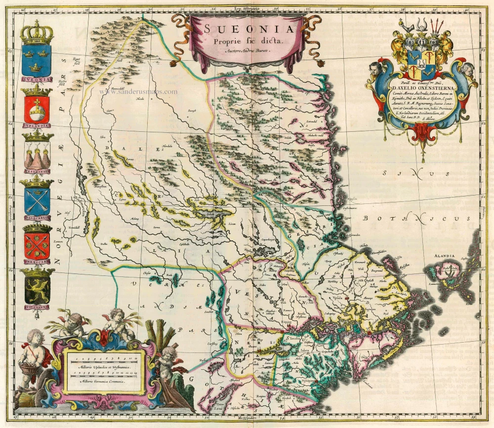
Sueonia Proprie sic dicta. 1662
Sweden - Svealand, by Blaeu J.
[Item number: 22827]
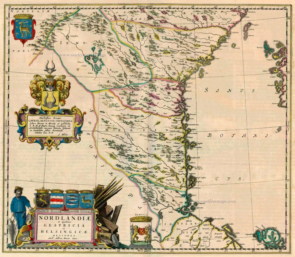
Nordlandiae et quibies Gestricia et Helsingicae 1662
Sweden - Norrland by Blaeu J.
[Item number: 23141]
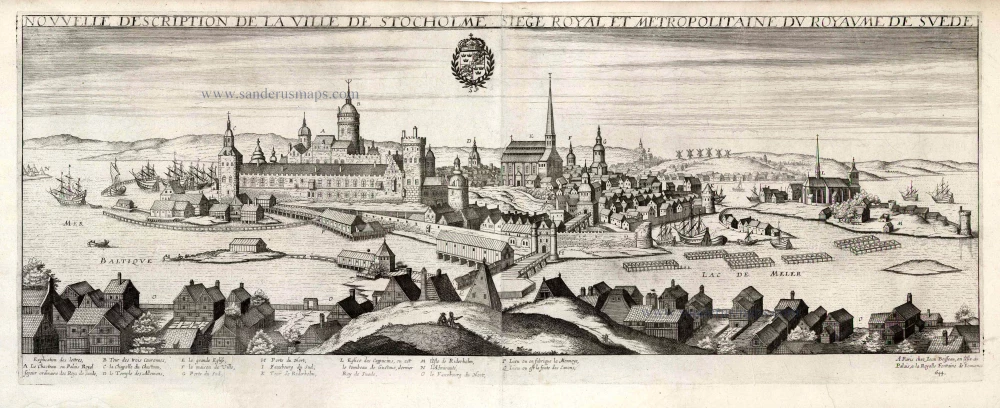
Nouvelle Description de la Ville de Stockholme Siege Royal et Metropolitaine du Royaume de Suede. 1648
Stockholm by Jean Boisseau
[Item number: 25690]
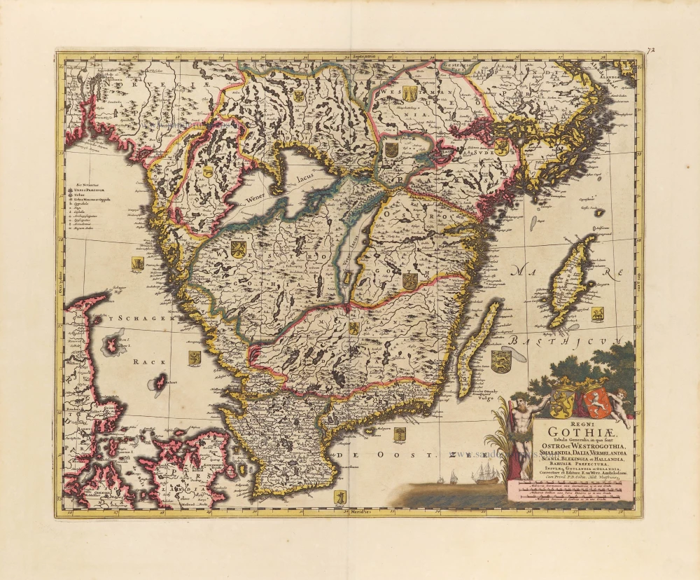
Regni Gothiae, Tabula Generalis, in qua sont Ostro et Westrogothia, Smalandia, Dalia, Vermelandia, Scania, Blekingia et Hallandia, Bahusiae, Prefectura, Insulae q. Gotandia et Oelandia, c. 1690
Southern Sweden by Frederick de Wit.
[Item number: 28812]

Accurata Scaniae, Blekingiae, et Hallandiae Descriptio. c. 1705
Southern Sweden by Frederick De Wit.
[Item number: 28832]
Only in the Atlas Maior.
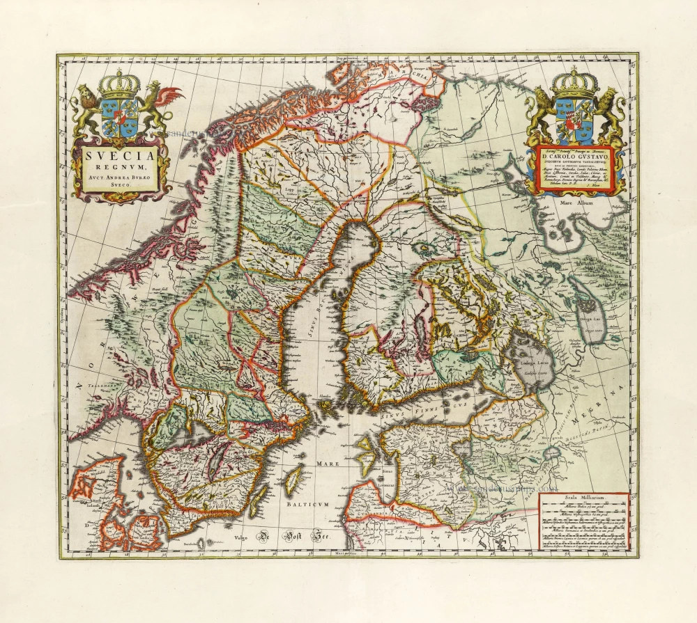
Suecia Regnum, 1663
Sweden, by Joan Blaeu.
[Item number: 30098]
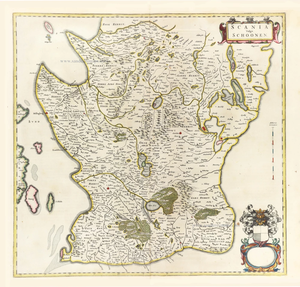
Scania Vulgo Schoonen. 1659
Sweden - Skane by Joan Blaeu
[Item number: 30263]
Unrecorded variant of Allard's view of Stockholm
Stockholm. 1673
View of Stockholm by Carel Allard.
[Item number: 30555]
new