
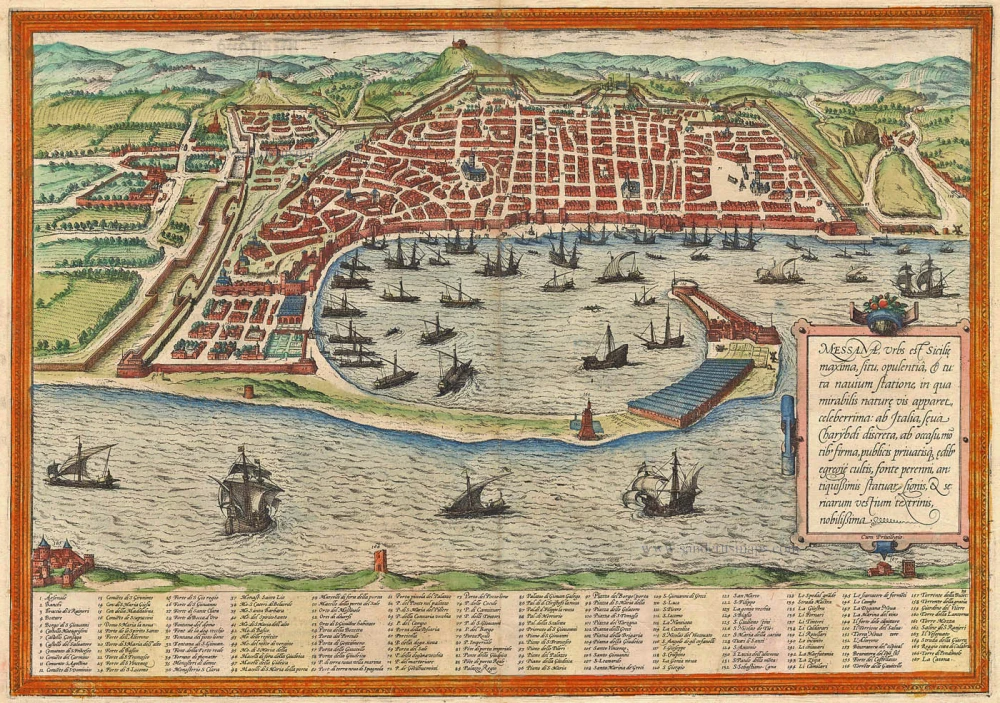
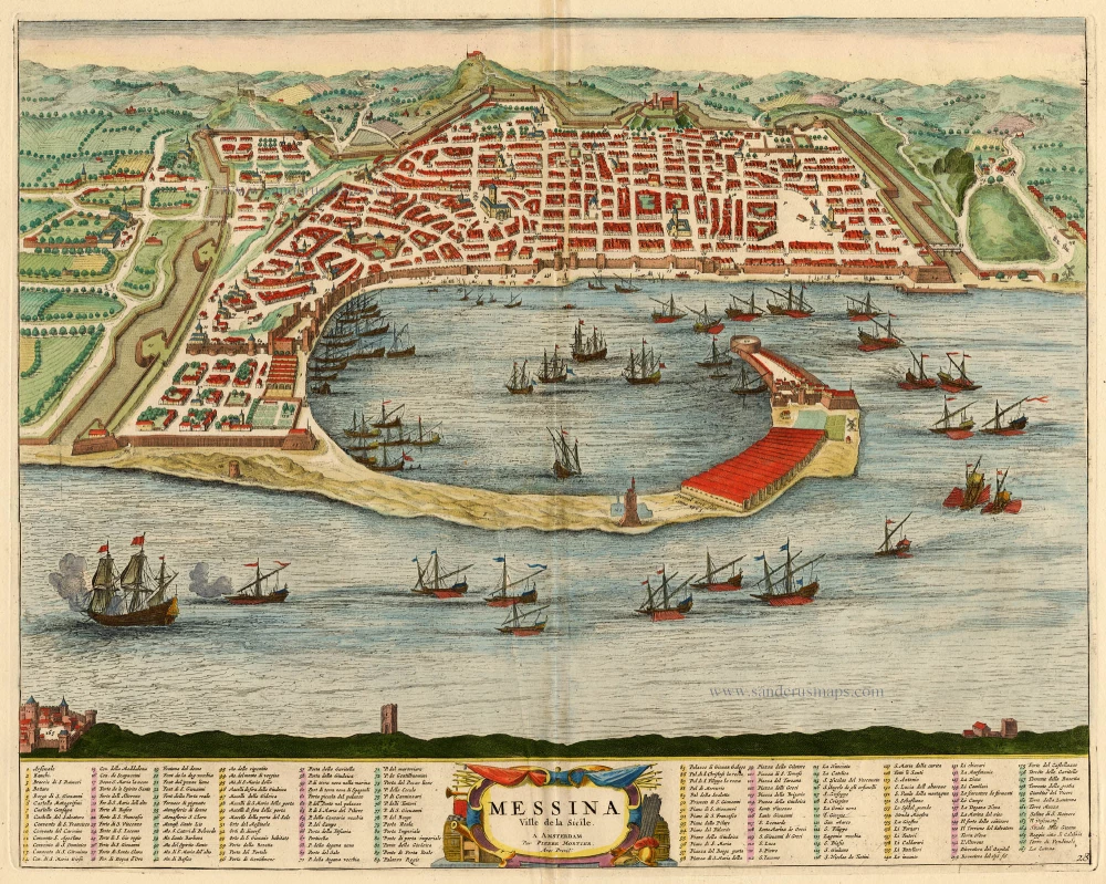
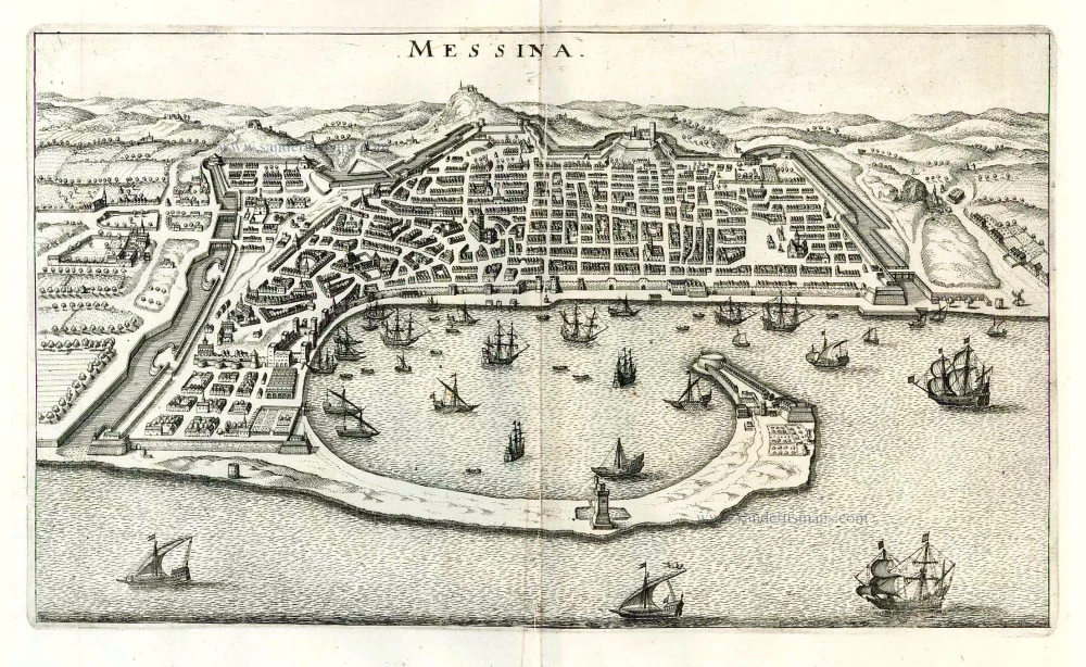
Sicily - Messina, by Braun & Hogenberg 1572-1624
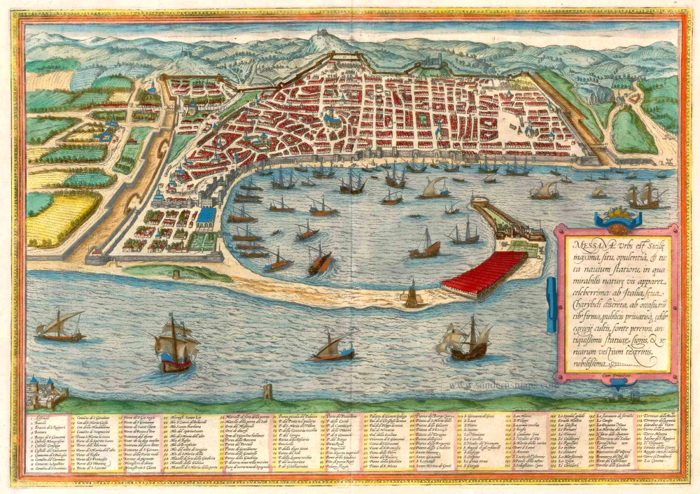
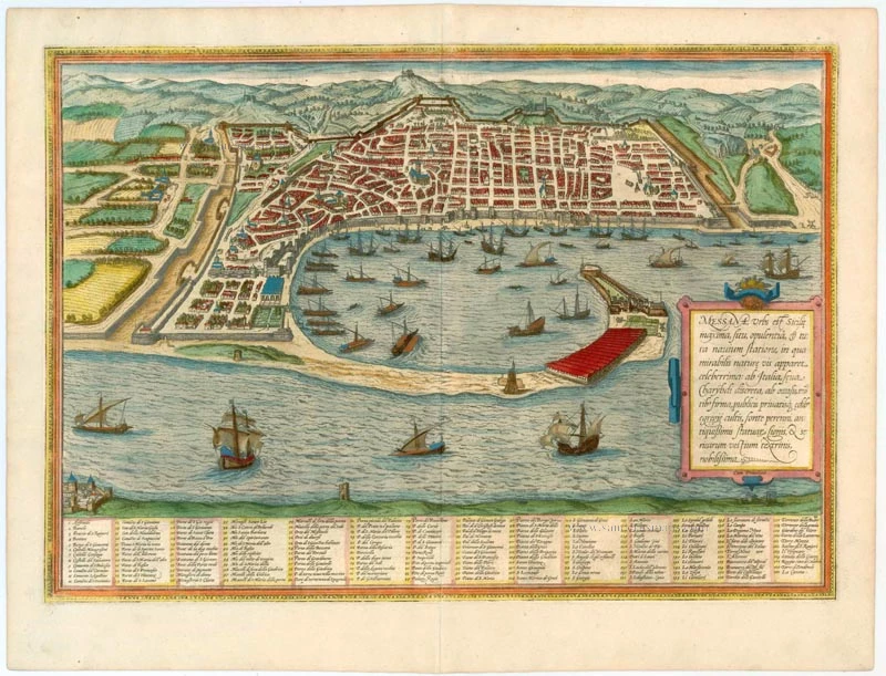


TRANSLATION OF CARTOUCHE TEXT: Messina, the largest city in Sicily, famed for its position, wealth and natural harbour. Separated from Italy by the wild Charybdis. Known for its well-kept public and private buildings, a perennial spring, the remains of ancient statues and the weaving of silk cloth.
COMMENTARY BY BRAUN: "Messina is a splendid and wealthy city separated from Italy by a stormy sea and which possesses a harbour that was not built by human hands but was carefully contrived by nature. Along the coast, shaped like a bow, the sea between Messina and Reggio di Calabria is very tempestuous, raging and extremely dangerous for seafarers. Very little wheat grows here, for the city is surrounded by mountains and the sea, but there are many bushes and trees whose best harvest is obtained from the mulberry leaves because the silkworms are fed from these. For the best silk in Europe is made in this city."
Messina is shown from the east, looking down upon the crescent-shaped natural harbour and the city with its geometric plan. The image of Messina is dominated by the busy shipping in the harbour and the huge warehouses in the foreground. The city is well fortified and protected by citadels, particularly on its landward side. In the city stands the 12th-century cathedral of Maria Santissima Assunta (17), with the fountain of Orion (29) in front of it by Giovanni Angelo Montorsoli. The Strait of Messina remains treacherous for shipping today. According to Greek mythology, its narrow channel held two sea monsters deadly to seafarers: Scylla, who dwelt in a rock on one side, and Charybdis, with his gaping whirlpool mouth on the other side. Since a tectonic fault runs through the Strait, Messina has regularly experienced seismic activity. (Taschen)
Braun G. & Hogenberg F. and the Civitates Orbis Terrarum.
The Civitates Orbis Terrarum, or the "Braun & Hogenberg", is a six-volume town atlas and the most excellent book of town views and plans ever published: 363 engravings, sometimes beautifully coloured. It was one of the best-selling works in the last quarter of the 16th century. Georg Braun wrote the text accompanying the plans and views on the verso. Many plates were engraved after the original drawings of a professional artist, a professional artist, Joris Hoefnagel (1542-1600). The first volume was published in Latin in 1572, and the sixth in 1617. Frans Hogenberg created the tables for volumes I through IV, and Simon van den Neuwel made those for volumes V and VI. Other contributors were cartographers Daniel Freese and Heinrich Rantzau. Works by Jacob van Deventer, Sebastian Münster, and Johannes Stumpf were also used. Translations appeared in German and French.
Following the original publication of Volume 1 of the Civitates in 1572, seven further editions of 1575, 1577, 1582, 1588, 1593, 1599 and 1612 can be identified. Vol.2, first issued in 1575, was followed by further editions in 1597 and 1612. The subsequent volumes appeared in 1581, 1588, 1593, 1599 and 1606. The German translation of the first volume appeared from 1574 on, and the French edition from 1575 on.
Several printers were involved: Theodor Graminaeus, Heinrich von Aich, Gottfried von Kempen, Johannis Sinniger, Bertram Buchholtz and Peter von Brachel, who all worked in Cologne.
Georg Braun (1541-1622)
Georg Braun was born in Cologne in 1541. After his studies in Cologne, he entered the Jesuit Order as a novice. 1561, he obtained his bachelor's degree, and in 1562, he received his Magister Artium. Although he left the Jesuit Order, he studied theology, gaining a licentiate in theology.
Frans Hogenberg (1535-1590)
Frans Hogenberg was a Flemish and German painter, engraver, and mapmaker. He was born in Mechelen as the son of Nicolaas Hogenberg.
By the end of the 1560s, Frans Hogenberg was employed upon Abraham Ortelius's Theatrum Orbis Terrarum, published in 1570; he is named an engraver of numerous maps. In 1568, he was banned from Antwerp by the Duke of Alva and travelled to London, where he stayed a few years before emigrating to Cologne. He immediately embarked on his two most important works, the Civitates, published in 1572 and the Geschichtsblätter, which appeared in several series from 1569 until about 1587.
Thanks to large-scale projects like the Geschichtsblätter and the Civitates, Hogenberg's social circumstances improved with each passing year. He died as a wealthy man in Cologne in 1590.
Messana, Urbs est Sicilie maxima, situ, opulentia, & tuta navium statione, ...
Item Number: 21463 Authenticity Guarantee
Category: Antique maps > Europe > Italy - Cities
Old, antique map - bird's-eye view of Messina in Sicily by Braun and Hogenberg,
With a key to locations.
Title: Messana, Urbs est Sicilie maxima, situ, opulentia, & tuta navium statione, ...
Date of the first edition: 1572.
Date of this map: 1572-1624.
Copper engraving, printed on paper.
Size (not including margins): 340 x 485mm (13.39 x 19.09 inches).
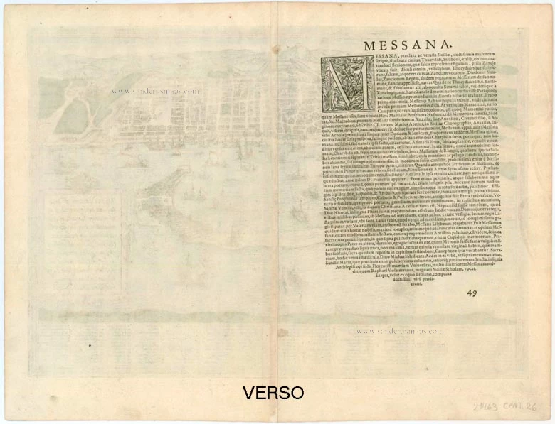
Verso: Latin text.
Condition: Original coloured, excellent.
Condition Rating: A+
From: Civitates Orbis Terrarum, ... Part 1. Köln, 1572-1624. (Van der Krogt 4, 41:1.1)
TRANSLATION OF CARTOUCHE TEXT: Messina, the largest city in Sicily, famed for its position, wealth and natural harbour. Separated from Italy by the wild Charybdis. Known for its well-kept public and private buildings, a perennial spring, the remains of ancient statues and the weaving of silk cloth.
COMMENTARY BY BRAUN: "Messina is a splendid and wealthy city separated from Italy by a stormy sea and which possesses a harbour that was not built by human hands but was carefully contrived by nature. Along the coast, shaped like a bow, the sea between Messina and Reggio di Calabria is very tempestuous, raging and extremely dangerous for seafarers. Very little wheat grows here, for the city is surrounded by mountains and the sea, but there are many bushes and trees whose best harvest is obtained from the mulberry leaves because the silkworms are fed from these. For the best silk in Europe is made in this city."
Messina is shown from the east, looking down upon the crescent-shaped natural harbour and the city with its geometric plan. The image of Messina is dominated by the busy shipping in the harbour and the huge warehouses in the foreground. The city is well fortified and protected by citadels, particularly on its landward side. In the city stands the 12th-century cathedral of Maria Santissima Assunta (17), with the fountain of Orion (29) in front of it by Giovanni Angelo Montorsoli. The Strait of Messina remains treacherous for shipping today. According to Greek mythology, its narrow channel held two sea monsters deadly to seafarers: Scylla, who dwelt in a rock on one side, and Charybdis, with his gaping whirlpool mouth on the other side. Since a tectonic fault runs through the Strait, Messina has regularly experienced seismic activity. (Taschen)
Braun G. & Hogenberg F. and the Civitates Orbis Terrarum.
The Civitates Orbis Terrarum, or the "Braun & Hogenberg", is a six-volume town atlas and the most excellent book of town views and plans ever published: 363 engravings, sometimes beautifully coloured. It was one of the best-selling works in the last quarter of the 16th century. Georg Braun wrote the text accompanying the plans and views on the verso. Many plates were engraved after the original drawings of a professional artist, a professional artist, Joris Hoefnagel (1542-1600). The first volume was published in Latin in 1572, and the sixth in 1617. Frans Hogenberg created the tables for volumes I through IV, and Simon van den Neuwel made those for volumes V and VI. Other contributors were cartographers Daniel Freese and Heinrich Rantzau. Works by Jacob van Deventer, Sebastian Münster, and Johannes Stumpf were also used. Translations appeared in German and French.
Following the original publication of Volume 1 of the Civitates in 1572, seven further editions of 1575, 1577, 1582, 1588, 1593, 1599 and 1612 can be identified. Vol.2, first issued in 1575, was followed by further editions in 1597 and 1612. The subsequent volumes appeared in 1581, 1588, 1593, 1599 and 1606. The German translation of the first volume appeared from 1574 on, and the French edition from 1575 on.
Several printers were involved: Theodor Graminaeus, Heinrich von Aich, Gottfried von Kempen, Johannis Sinniger, Bertram Buchholtz and Peter von Brachel, who all worked in Cologne.
Georg Braun (1541-1622)
Georg Braun was born in Cologne in 1541. After his studies in Cologne, he entered the Jesuit Order as a novice. 1561, he obtained his bachelor's degree, and in 1562, he received his Magister Artium. Although he left the Jesuit Order, he studied theology, gaining a licentiate in theology.
Frans Hogenberg (1535-1590)
Frans Hogenberg was a Flemish and German painter, engraver, and mapmaker. He was born in Mechelen as the son of Nicolaas Hogenberg.
By the end of the 1560s, Frans Hogenberg was employed upon Abraham Ortelius's Theatrum Orbis Terrarum, published in 1570; he is named an engraver of numerous maps. In 1568, he was banned from Antwerp by the Duke of Alva and travelled to London, where he stayed a few years before emigrating to Cologne. He immediately embarked on his two most important works, the Civitates, published in 1572 and the Geschichtsblätter, which appeared in several series from 1569 until about 1587.
Thanks to large-scale projects like the Geschichtsblätter and the Civitates, Hogenberg's social circumstances improved with each passing year. He died as a wealthy man in Cologne in 1590.
Related items
Messana, Urbs est Sicilie maxima, situ, opulentia, & tuta navium statione, ... 1574
Messina by Braun & Hogenberg
[Item number: 5497]
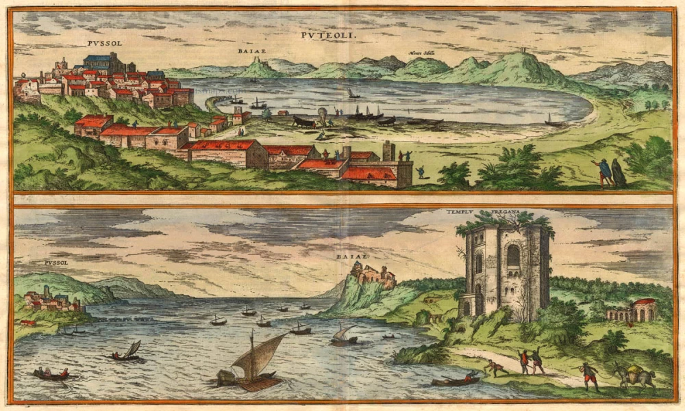
Puteoli - Baiae 1575
Pozzuoli - Baia, by Braun & Hogenberg.
[Item number: 17963]

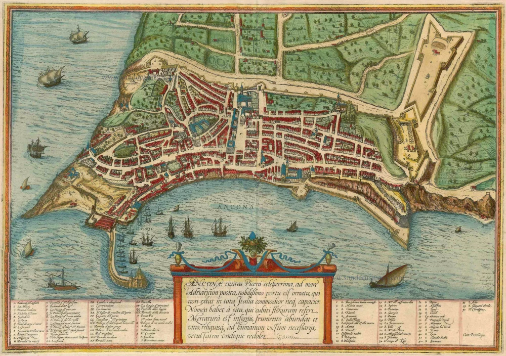
Ancona Civitas Piceni Celeberrima, ad Mare Adriaticum Posita 1572-1624
Old, antique map - Bird's-eye plan of Ancona by Braun and Hogenberg
[Item number: 17778]
Messina Ville de la Sicile. 1704
Sicily - Messina, by Blaeu - Mortier.
[Item number: 18139]
Ancona Civitas Piceni Celeberrima, ad Mare Adriaticum Posita 1593
Ancona by Braun and Hogenberg.
[Item number: 17620]
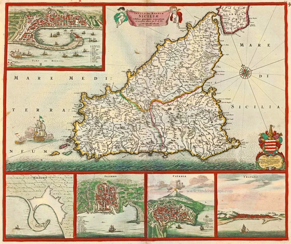
Insula sive Regnum Siciliae Urbibus praecipuis exornatum c. 1682
Sicily by Frederick de Wit.
[Item number: 24517]
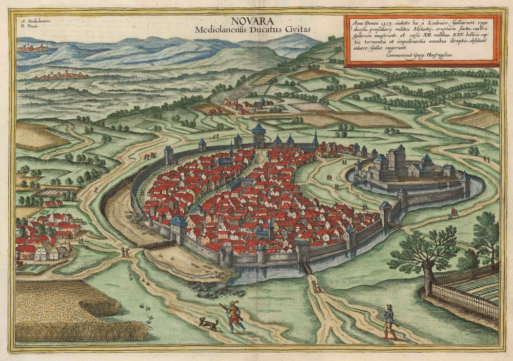
Novara Mediolanensis Ducatus Civitas c. 1625
Novara by Braun and Hogenberg.
[Item number: 24530]
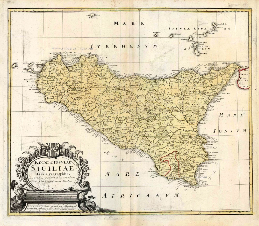
Regni & Insulae Siciliae Tabula Geographica ... c. 1720-65
Sicily, by Homann Heirs.
[Item number: 25478]
Messina. 1638
Messina, by M. Merian.
[Item number: 26033]
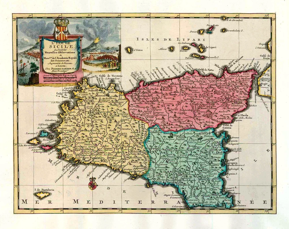
L'Ile de Sicile. 1713
Sicily, by Pieter Van der Aa.
[Item number: 26077]
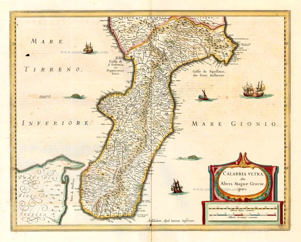
Calabria Ultra Olim Altera Magnae Graeciae Pars. 1641
Calabria Ultra, by Johannes Janssonius.
[Item number: 26415]

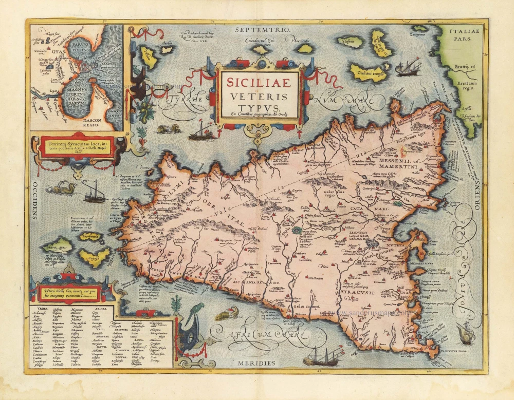
Siciliae Veteris Typus. 1641
Ancient Sicily, by Johannes Janssonius.
[Item number: 26426]
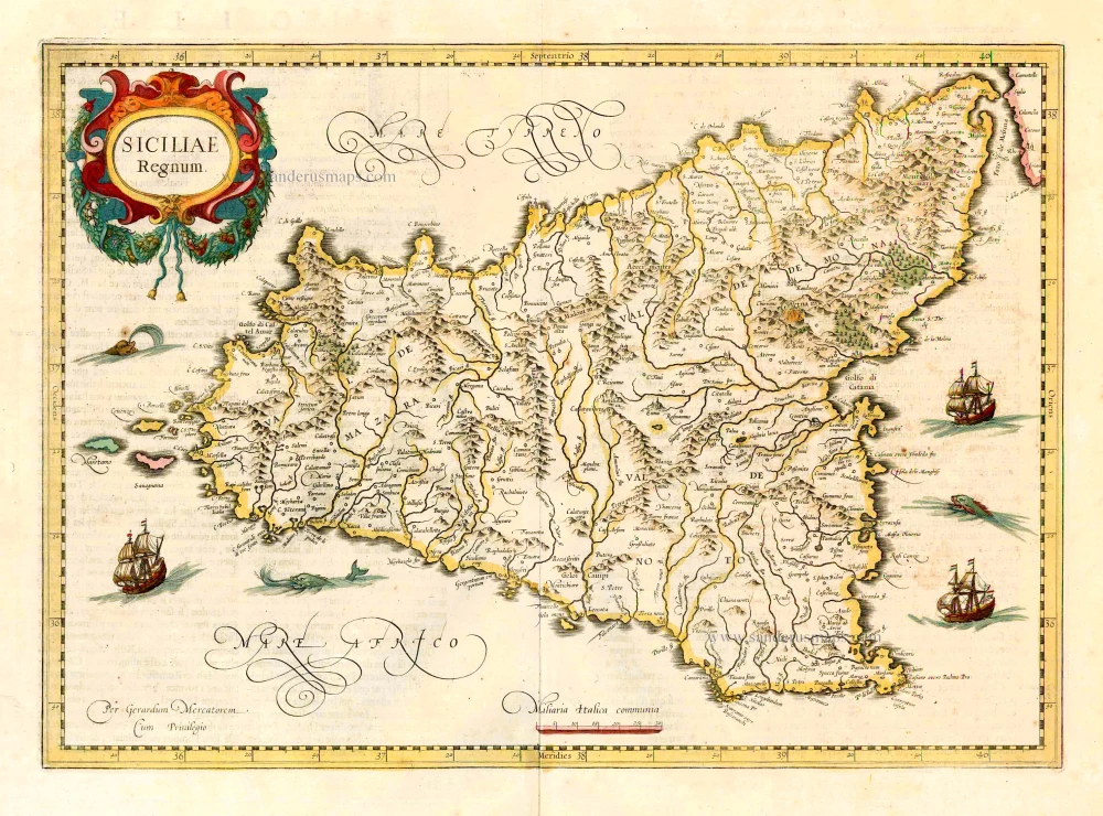
Siciliae Regnum. 1641
Sicily, by Henricus Hondius.
[Item number: 26427]
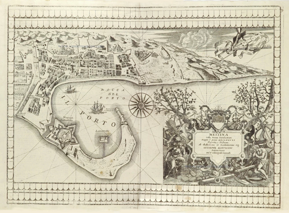
Messina Colle Nuove Fortificationi. 1696
Messina by Vincenzo Coronelli.
[Item number: 28714]
Parergon map
Siciliae Veteris Typus. 1584
Ancient Sicily, by Abraham Ortelius.
[Item number: 29146]
Isle et Royaume de Sicile. 1652
Sicily, by N. & G. Sanson.
[Item number: 29720]
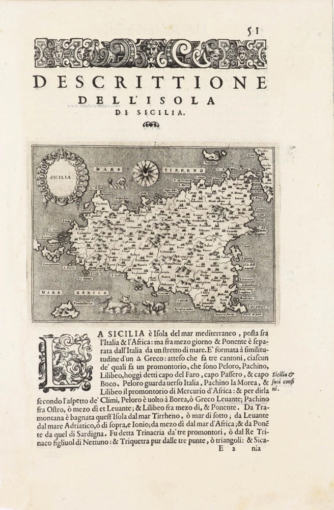
Sicilia - [Above map :] Descrittione dell'Isola di Sicilia. 1590
Sicily (Sicilia) by Thomaso Porcacchi.
[Item number: 29766]