
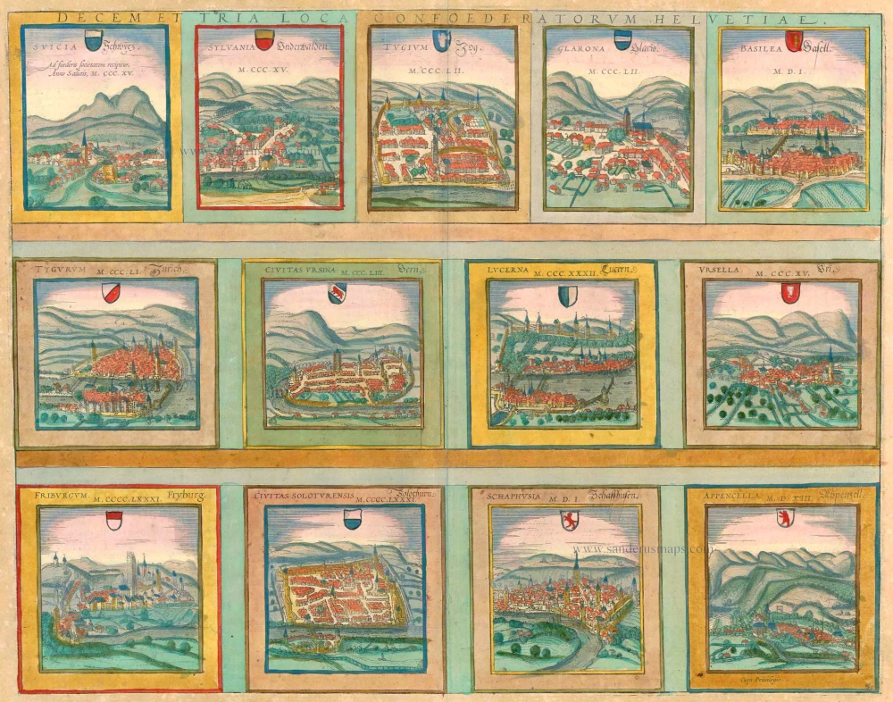
13 bird's-eye views of Swiss cities by Braun and Hogenberg: Schwyz, Unterwalden, Zug, Glarus, Basel, Zurich, Bern, Lucerne, Uri, Fribourg, Solothurn, Schaffhausen and Appenzell. 1572
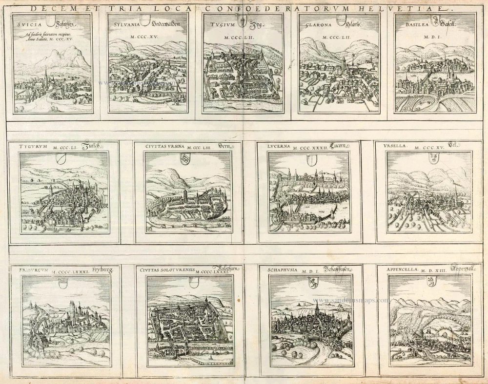
Between 1291 and 1512, the 13 original Swiss cantons slowly forged a single alliance, the Old Swiss Confederation, which lasted until 1798. The 13 cantons are illustrated across a double page in relatively small views, accompanied by the year they joined the Confederation. According to Swiss national legend, the three cantons of Schwyz, Unterwalden and Uri were the first to pledge their mutual allegiance in what is known as the "Rütli oath", taken in August 1291 on the Rütli meadow on the shores of Lake Lucerne. Braun's sources date the birth of the Confederation to 9 December 1315, when the original three cantons signed the Pact of Brunnen after the victorious battle of Morgarten against the Habsburgs.
SOURCE: Eleven of the 13 views derive from a single set of sources: the woodcuts from the Schweytzer Chronick of Johannes Stumpff, 1548. Each rectangular illustration in a horizontal format takes up half a folio page: here, they have been considerably reduced in scale, and, most noticeably, the proportions have been changed. There are no reliable sources for Zug and Unterwalden; consequently, Zug is erroneously shown by a river instead of the lake at Zug and Unterwalden as a mountain village without distinguishing features. (Taschen)
SCHWYZ
COMMENTARY BY BRAUN: "The town of Schwyz has given its name to the whole land of Switzerland, for it was the first to be established by those who came here from Sweden to find a place to settle. It is one of the three villages that allied against the despotism of the nobles."
The village is in front of the Hakenberg peaks, with the church of St Martin left of the centre. Schwyz lies east of Lake Lucerne and is the capital of the eponymous canton, which, in German, gave its name to Switzerland (Germ. Schweiz) as a whole. Schwyz is one of the three original cantons of the Old Swiss Confederation. It is first documented in AD 972 as Suittes: two Alemannic brothers named Suit and Sven are supposed to have settled here. Due to the route over the Gotthard, Schwyz soon acquired greater importance and, in 1240, was made directly subordinate to the Emperor. The village square, with its church and town hall, is today considered one of the loveliest in Switzerland.
UNTERWALDEN
Unterwalden, a free village allied with Schwyz and Uri in 1315, is surrounded by the high Alps as if by a wall and possesses fertile grazing pastures for cattle, which bring the people of Unterwalden great wealth. Unterwalden is a mountain canton comprising Obwalden and Niderwalden, independent half cantons with full rights. In 1291, Niderwalden formed the pact with Uri and Schwyz on the Rütli meadow, followed soon by Obwalden.
ZUG
BRAUN: "Zug is the name of the town and the entire area bordering on Schwyz to the north and lying on Lacus Tuginus, or Lake Zug."
Among the medieval centre's important buildings, with its old towers and manors, are the late Gothic St Oswald's church (top right) and the town hall (bottom centre), beside which is the Zytturm tower, Zug's landmark. The Counts of Kyburg founded the town at the start of the 13th century. In 1352, the Confederates conquered it and forced it to join the alliance.
GLARUS
BRAUN: "Glarus, in Latin Glarona, allied itself with the other Swiss in 1352. The inhabitants live from milk, cheese, butter and meat. The lakes provide them with fish, the forested mountains with birds and other game."
The engraving shows a somewhat characterless, unfortified village with gabled houses in front of Vorderglärnisch Mountain. Glarus is the capital of the eponymous canton in eastern Switzerland, which formed a pact with the Old Swiss Confederation in 1352 and became a full member in 1473. The famous 1570 map of Switzerland by Aegidius Tschudi is housed in the Glarus archives.
BASLE (BASEL)
BRAUN: "The splendid city of Basle arose like the phoenix out of the ashes of the destroyed Roman city of Augusta Raurica and lies on both banks of the Rhine. The part on the Gallic side is called Greater Basle, the old episcopal city; the other, on the German side, is called Lesser Basle; a bridge over the Rhine links them. [...] Pope Pius II founded its renowned university."
The name Basilea is first mentioned in AD 374. Basle was recorded as a bishopric in 740. In 1356, one of the most significant earthquakes north of the Alps destroyed most of the city; a disastrous fire also broke out. In 1460, Pope Pius II endowed the University of Basle, the oldest university in Switzerland. This attracted many scholars and humanists (Erasmus of Rotterdam, Hans Holbein the Younger, Paracelsus), and Basle became a centre of printing and publishing (Froben). In 1471, Emperor Friedrich III granted Basle the right to hold fairs. After the Swabian War against Emperor Maximilian I in 1499, Basle became independent from the Empire, joining the Old Swiss Confederation with Schaffhausen in 1501. In 1529, the city accepted the reformed faith, and the bishop had to leave the city. Around 1600, Basle had about 12,000 inhabitants, but between 1550 and 1611, there were several outbreaks of the plague, and a third of the population died.
ZÜRICH
BRAUN: "Zurich is an ancient settlement on a favourable site at the outflow of the large lake, at whose end the River Limmat, which flows into the lake not far from Glarus, branches off. [...] The city holds a big corn market every week [...]. The city obtains plenty of fish from Lake Zurich."
BERNE (BERN)
BRAUN: "Berthold V. Duke of Zähringen built Berne and took its name from the first bear caught here. It lies on a peninsula within the navigable Aare. Fertile fields surround it, but it does not produce its wine. It possesses three dead-straight roads leading through the city from east to west."
View from the north, looking across the River Aare, which runs around three sides of the city. On the left is the Untertorbrücke, the city's oldest bridge. In front of the river bend, near where the bridge reaches the town, is the Nydeggkirche, followed in the centre by the late Gothic St Vincent's minster and, to its right, the church of SS Peter and Paul. To the west, at the end of the long central street lined with houses, is the Zeitglockenturm, a clock tower that is part of the first city wall and still stands today. Further west lies the second outer wall built following the city's westward expansion (after 1250). Berne joined the Confederation in 1353, bringing the number of members to eight (the Eight Places).
LUCERNE (LUZERN)
BRAUN: "Lucerne arose out of a monastery and gradually grew into a town; it takes the name from the lighthouse that stands on a bridge on the lake and in which, in the old days, a fire was lit to show the boatmen the right way."
Lucerne, the capital of the eponymous canton, lies in central Switzerland on the northwest end of Lake Lucerne, at the outflow of the Reuss, which divides the city into the Old Town and the New Town. The two halves were linked by the Spreuerbrücke (left) and the Kapellbrücke (right), with the water tower halfway along. In front of the middle bridge is the Gothic Franciscan church. The Old Town lies on the far side of the river. The nine towers on the hillside form part of the Musegg rampart, which still runs for over 800 m today. In 1332, Lucerne entered into a perpetual league with the three original cantons of the Old Swiss Confederation. The council and citizens rejected the Reformation, and Lucerne became a centre of Catholic Switzerland.
URI
BRAUN: "Its natural location well protects Uri, for the south, it is bounded by the Gotthard massif, to the east by the Crispalt, to the west by the mountain with thin summits, called the Furka, which is very difficult to climb, and to the north by Lake Lucerne. The Reuss flows past the town."
Uri is a central Swiss canton between Lake Lucerne to the north and the Gotthard to the south. Along with Schwyz and Unterwalden, it was one of the three original cantons to swear the "Rütli oath" in 1291.
FRIBOURG
BRAUN: "Fribourg was founded in Üechtland by Duke Berthold IV of Zähringen and had an unusual location since it lies partly on high cliffs and partly in the valley, where the little Sarine River flows through it. The town hall stands on a rocky hill where once there was a fortress, out of which the city grew."
The engraving presents Fribourg in its setting on a bend in the Sarine. We see a city wall across the river with numerous towers and groups of houses. In the centre, it is possible to identify the Gothic cathedral of St Nicholas with its 76-m-high, unfinished tower. Fribourg is the capital of the eponymous canton in western Switzerland. It was founded in 1157 by Duke Berthold IV of Zähringen. In 1478, Fribourg became a Free Imperial City and, in 1481, joined the Old Swiss Confederation.
SOLOTHURN
BRAUN: "Solothurn is one of the oldest and most important Swiss cities, situated on the gold-bearing River Aare, and is supposed to have been built very soon after Trier, so some say."
The view shows the Aare in the foreground and a bridge linking a small suburb near the river with the central part of the town. Set against the Jura Mountains, the city is almost square and is fortified by ramparts. Solothurn is the capital of the eponymous canton and is today known as the most beautiful Baroque city in Switzerland. Solothurn joined the Old Swiss Confederation in 1481.
SCHAFFHAUSEN
BRAUN: "Schaffhausen lies on the right-hand German side of the Rhine and is linked to Swiss territory by three bridges. It allegedly derives its origins from a large Benedictine monastery that was founded in 1052."
Schaffhausen, whose Old Town lies on the right bank of the Rhine, is the capital of the eponymous canton in northern Switzerland. Its name is probably derived from the Old High German scaffa, or "ship". It lies above the Rhine Falls, which interrupts navigation on the Rhine. Schaffhausen today has a picturesque Old Town, at the top of which lies Munot fortress, built in 1564-1589 based on Albrecht Dürer's treatise on fortifications; its large tower is visible against the skyline. The Romanesque minster can be seen in the centre of the engraving. In 1045, Emperor Henry III granted Schaffhausen the right to mint its coins; the building of the All Saints' monastery dates from this same period. Schaffhausen joined the Old Swiss Confederation in 1501, and in 1529, its citizens embraced the Protestant faith.
APPENZELL
BRAUN: "Appenzell means "Abbot's cell" since the Benedictine abbots owned Clanx castle here. It provided protection and shelter for the inhabitants at that time. And as its power grew with time, the name was applied to this place and the whole area. Since good soldiers come from here, in 1513, Appenzell was accepted into the Old Swiss Confederation as the thirteenth member."
The unfortified settlement, which lies at an elevation of 780 m, is illustrated amidst fertile countryside at the foot of the Alpstein massif. The Catholic parish church of St. Maurice rises above the left bank of the River Sitter, while the ruins of Clanx castle, destroyed in 1402, are still visible on a hill behind the town. Appenzell derives from the Latin abbatis cella since the Abbey of St Gallen owned several estates here. 1411 Appenzell became an associate member of the Old Swiss Confederation of Eight Places in 1513 and was granted full membership. In the wake of confessional conflicts in 1597, the canton was divided into Catholic Innerhoden and Protestant Ausserhoden. (Taschen)
Braun G. & Hogenberg F. and the Civitates Orbis Terrarum.
The Civitates Orbis Terrarum, or the "Braun & Hogenberg", is a six-volume town atlas and the most excellent book of town views and plans ever published: 363 engravings, sometimes beautifully coloured. It was one of the best-selling works in the last quarter of the 16th century. Georg Braun wrote the text accompanying the plans and views on the verso. Many plates were engraved after the original drawings of a professional artist, a professional artist, Joris Hoefnagel (1542-1600). The first volume was published in Latin in 1572, and the sixth in 1617. Frans Hogenberg created the tables for volumes I through IV, and Simon van den Neuwel made those for volumes V and VI. Other contributors were cartographers Daniel Freese and Heinrich Rantzau. Works by Jacob van Deventer, Sebastian Münster, and Johannes Stumpf were also used. Translations appeared in German and French.
Following the original publication of Volume 1 of the Civitates in 1572, seven further editions of 1575, 1577, 1582, 1588, 1593, 1599 and 1612 can be identified. Vol.2, first issued in 1575, was followed by further editions in 1597 and 1612. The subsequent volumes appeared in 1581, 1588, 1593, 1599 and 1606. The German translation of the first volume appeared from 1574 on, and the French edition from 1575 on.
Several printers were involved: Theodor Graminaeus, Heinrich von Aich, Gottfried von Kempen, Johannis Sinniger, Bertram Buchholtz and Peter von Brachel, who all worked in Cologne.
Georg Braun (1541-1622)
Georg Braun was born in Cologne in 1541. After his studies in Cologne, he entered the Jesuit Order as a novice. 1561, he obtained his bachelor's degree, and in 1562, he received his Magister Artium. Although he left the Jesuit Order, he studied theology, gaining a licentiate in theology.
Frans Hogenberg (1535-1590)
Frans Hogenberg was a Flemish and German painter, engraver, and mapmaker. He was born in Mechelen as the son of Nicolaas Hogenberg.
By the end of the 1560s, Frans Hogenberg was employed upon Abraham Ortelius's Theatrum Orbis Terrarum, published in 1570; he is named an engraver of numerous maps. In 1568, he was banned from Antwerp by the Duke of Alva and travelled to London, where he stayed a few years before emigrating to Cologne. He immediately embarked on his two most important works, the Civitates, published in 1572 and the Geschichtsblätter, which appeared in several series from 1569 until about 1587.
Thanks to large-scale projects like the Geschichtsblätter and the Civitates, Hogenberg's social circumstances improved with each passing year. He died as a wealthy man in Cologne in 1590.
Decem et Tria Loca Confoederatorum Helvetiae.
Item Number: 21654 Authenticity Guarantee
Category: Antique maps > Europe > Switzerland
Antique map with 13 bird's-eye views of Swiss cities by Braun and Hogenberg: Schwyz, Unterwalden, Zug, Glarus, Basel, Zurich, Bern, Lucerne, Uri, Fribourg, Solothurn, Schaffhausen and Appenzell.
Title: Decem et Tria Loca Confoederatorum Helvetiae.
Date of the first edition: 1572.
Date of this map: 1572.
Copper engraving, printed on paper.
Size (not including margins): 370 x 475mm (14.57 x 18.7 inches).
Verso: Latin text.
Condition: Uncoloured, lower centrefold split reinforced.
Condition Rating: A
From: Civitates Orbis Terrarum, Liber Primus. Cologne, Theodor Graminaeus, 1572.. (Van der Krogt 4, 41:0)
Between 1291 and 1512, the 13 original Swiss cantons slowly forged a single alliance, the Old Swiss Confederation, which lasted until 1798. The 13 cantons are illustrated across a double page in relatively small views, accompanied by the year they joined the Confederation. According to Swiss national legend, the three cantons of Schwyz, Unterwalden and Uri were the first to pledge their mutual allegiance in what is known as the "Rütli oath", taken in August 1291 on the Rütli meadow on the shores of Lake Lucerne. Braun's sources date the birth of the Confederation to 9 December 1315, when the original three cantons signed the Pact of Brunnen after the victorious battle of Morgarten against the Habsburgs.
SOURCE: Eleven of the 13 views derive from a single set of sources: the woodcuts from the Schweytzer Chronick of Johannes Stumpff, 1548. Each rectangular illustration in a horizontal format takes up half a folio page: here, they have been considerably reduced in scale, and, most noticeably, the proportions have been changed. There are no reliable sources for Zug and Unterwalden; consequently, Zug is erroneously shown by a river instead of the lake at Zug and Unterwalden as a mountain village without distinguishing features. (Taschen)
SCHWYZ
COMMENTARY BY BRAUN: "The town of Schwyz has given its name to the whole land of Switzerland, for it was the first to be established by those who came here from Sweden to find a place to settle. It is one of the three villages that allied against the despotism of the nobles."
The village is in front of the Hakenberg peaks, with the church of St Martin left of the centre. Schwyz lies east of Lake Lucerne and is the capital of the eponymous canton, which, in German, gave its name to Switzerland (Germ. Schweiz) as a whole. Schwyz is one of the three original cantons of the Old Swiss Confederation. It is first documented in AD 972 as Suittes: two Alemannic brothers named Suit and Sven are supposed to have settled here. Due to the route over the Gotthard, Schwyz soon acquired greater importance and, in 1240, was made directly subordinate to the Emperor. The village square, with its church and town hall, is today considered one of the loveliest in Switzerland.
UNTERWALDEN
Unterwalden, a free village allied with Schwyz and Uri in 1315, is surrounded by the high Alps as if by a wall and possesses fertile grazing pastures for cattle, which bring the people of Unterwalden great wealth. Unterwalden is a mountain canton comprising Obwalden and Niderwalden, independent half cantons with full rights. In 1291, Niderwalden formed the pact with Uri and Schwyz on the Rütli meadow, followed soon by Obwalden.
ZUG
BRAUN: "Zug is the name of the town and the entire area bordering on Schwyz to the north and lying on Lacus Tuginus, or Lake Zug."
Among the medieval centre's important buildings, with its old towers and manors, are the late Gothic St Oswald's church (top right) and the town hall (bottom centre), beside which is the Zytturm tower, Zug's landmark. The Counts of Kyburg founded the town at the start of the 13th century. In 1352, the Confederates conquered it and forced it to join the alliance.
GLARUS
BRAUN: "Glarus, in Latin Glarona, allied itself with the other Swiss in 1352. The inhabitants live from milk, cheese, butter and meat. The lakes provide them with fish, the forested mountains with birds and other game."
The engraving shows a somewhat characterless, unfortified village with gabled houses in front of Vorderglärnisch Mountain. Glarus is the capital of the eponymous canton in eastern Switzerland, which formed a pact with the Old Swiss Confederation in 1352 and became a full member in 1473. The famous 1570 map of Switzerland by Aegidius Tschudi is housed in the Glarus archives.
BASLE (BASEL)
BRAUN: "The splendid city of Basle arose like the phoenix out of the ashes of the destroyed Roman city of Augusta Raurica and lies on both banks of the Rhine. The part on the Gallic side is called Greater Basle, the old episcopal city; the other, on the German side, is called Lesser Basle; a bridge over the Rhine links them. [...] Pope Pius II founded its renowned university."
The name Basilea is first mentioned in AD 374. Basle was recorded as a bishopric in 740. In 1356, one of the most significant earthquakes north of the Alps destroyed most of the city; a disastrous fire also broke out. In 1460, Pope Pius II endowed the University of Basle, the oldest university in Switzerland. This attracted many scholars and humanists (Erasmus of Rotterdam, Hans Holbein the Younger, Paracelsus), and Basle became a centre of printing and publishing (Froben). In 1471, Emperor Friedrich III granted Basle the right to hold fairs. After the Swabian War against Emperor Maximilian I in 1499, Basle became independent from the Empire, joining the Old Swiss Confederation with Schaffhausen in 1501. In 1529, the city accepted the reformed faith, and the bishop had to leave the city. Around 1600, Basle had about 12,000 inhabitants, but between 1550 and 1611, there were several outbreaks of the plague, and a third of the population died.
ZÜRICH
BRAUN: "Zurich is an ancient settlement on a favourable site at the outflow of the large lake, at whose end the River Limmat, which flows into the lake not far from Glarus, branches off. [...] The city holds a big corn market every week [...]. The city obtains plenty of fish from Lake Zurich."
BERNE (BERN)
BRAUN: "Berthold V. Duke of Zähringen built Berne and took its name from the first bear caught here. It lies on a peninsula within the navigable Aare. Fertile fields surround it, but it does not produce its wine. It possesses three dead-straight roads leading through the city from east to west."
View from the north, looking across the River Aare, which runs around three sides of the city. On the left is the Untertorbrücke, the city's oldest bridge. In front of the river bend, near where the bridge reaches the town, is the Nydeggkirche, followed in the centre by the late Gothic St Vincent's minster and, to its right, the church of SS Peter and Paul. To the west, at the end of the long central street lined with houses, is the Zeitglockenturm, a clock tower that is part of the first city wall and still stands today. Further west lies the second outer wall built following the city's westward expansion (after 1250). Berne joined the Confederation in 1353, bringing the number of members to eight (the Eight Places).
LUCERNE (LUZERN)
BRAUN: "Lucerne arose out of a monastery and gradually grew into a town; it takes the name from the lighthouse that stands on a bridge on the lake and in which, in the old days, a fire was lit to show the boatmen the right way."
Lucerne, the capital of the eponymous canton, lies in central Switzerland on the northwest end of Lake Lucerne, at the outflow of the Reuss, which divides the city into the Old Town and the New Town. The two halves were linked by the Spreuerbrücke (left) and the Kapellbrücke (right), with the water tower halfway along. In front of the middle bridge is the Gothic Franciscan church. The Old Town lies on the far side of the river. The nine towers on the hillside form part of the Musegg rampart, which still runs for over 800 m today. In 1332, Lucerne entered into a perpetual league with the three original cantons of the Old Swiss Confederation. The council and citizens rejected the Reformation, and Lucerne became a centre of Catholic Switzerland.
URI
BRAUN: "Its natural location well protects Uri, for the south, it is bounded by the Gotthard massif, to the east by the Crispalt, to the west by the mountain with thin summits, called the Furka, which is very difficult to climb, and to the north by Lake Lucerne. The Reuss flows past the town."
Uri is a central Swiss canton between Lake Lucerne to the north and the Gotthard to the south. Along with Schwyz and Unterwalden, it was one of the three original cantons to swear the "Rütli oath" in 1291.
FRIBOURG
BRAUN: "Fribourg was founded in Üechtland by Duke Berthold IV of Zähringen and had an unusual location since it lies partly on high cliffs and partly in the valley, where the little Sarine River flows through it. The town hall stands on a rocky hill where once there was a fortress, out of which the city grew."
The engraving presents Fribourg in its setting on a bend in the Sarine. We see a city wall across the river with numerous towers and groups of houses. In the centre, it is possible to identify the Gothic cathedral of St Nicholas with its 76-m-high, unfinished tower. Fribourg is the capital of the eponymous canton in western Switzerland. It was founded in 1157 by Duke Berthold IV of Zähringen. In 1478, Fribourg became a Free Imperial City and, in 1481, joined the Old Swiss Confederation.
SOLOTHURN
BRAUN: "Solothurn is one of the oldest and most important Swiss cities, situated on the gold-bearing River Aare, and is supposed to have been built very soon after Trier, so some say."
The view shows the Aare in the foreground and a bridge linking a small suburb near the river with the central part of the town. Set against the Jura Mountains, the city is almost square and is fortified by ramparts. Solothurn is the capital of the eponymous canton and is today known as the most beautiful Baroque city in Switzerland. Solothurn joined the Old Swiss Confederation in 1481.
SCHAFFHAUSEN
BRAUN: "Schaffhausen lies on the right-hand German side of the Rhine and is linked to Swiss territory by three bridges. It allegedly derives its origins from a large Benedictine monastery that was founded in 1052."
Schaffhausen, whose Old Town lies on the right bank of the Rhine, is the capital of the eponymous canton in northern Switzerland. Its name is probably derived from the Old High German scaffa, or "ship". It lies above the Rhine Falls, which interrupts navigation on the Rhine. Schaffhausen today has a picturesque Old Town, at the top of which lies Munot fortress, built in 1564-1589 based on Albrecht Dürer's treatise on fortifications; its large tower is visible against the skyline. The Romanesque minster can be seen in the centre of the engraving. In 1045, Emperor Henry III granted Schaffhausen the right to mint its coins; the building of the All Saints' monastery dates from this same period. Schaffhausen joined the Old Swiss Confederation in 1501, and in 1529, its citizens embraced the Protestant faith.
APPENZELL
BRAUN: "Appenzell means "Abbot's cell" since the Benedictine abbots owned Clanx castle here. It provided protection and shelter for the inhabitants at that time. And as its power grew with time, the name was applied to this place and the whole area. Since good soldiers come from here, in 1513, Appenzell was accepted into the Old Swiss Confederation as the thirteenth member."
The unfortified settlement, which lies at an elevation of 780 m, is illustrated amidst fertile countryside at the foot of the Alpstein massif. The Catholic parish church of St. Maurice rises above the left bank of the River Sitter, while the ruins of Clanx castle, destroyed in 1402, are still visible on a hill behind the town. Appenzell derives from the Latin abbatis cella since the Abbey of St Gallen owned several estates here. 1411 Appenzell became an associate member of the Old Swiss Confederation of Eight Places in 1513 and was granted full membership. In the wake of confessional conflicts in 1597, the canton was divided into Catholic Innerhoden and Protestant Ausserhoden. (Taschen)
Braun G. & Hogenberg F. and the Civitates Orbis Terrarum.
The Civitates Orbis Terrarum, or the "Braun & Hogenberg", is a six-volume town atlas and the most excellent book of town views and plans ever published: 363 engravings, sometimes beautifully coloured. It was one of the best-selling works in the last quarter of the 16th century. Georg Braun wrote the text accompanying the plans and views on the verso. Many plates were engraved after the original drawings of a professional artist, a professional artist, Joris Hoefnagel (1542-1600). The first volume was published in Latin in 1572, and the sixth in 1617. Frans Hogenberg created the tables for volumes I through IV, and Simon van den Neuwel made those for volumes V and VI. Other contributors were cartographers Daniel Freese and Heinrich Rantzau. Works by Jacob van Deventer, Sebastian Münster, and Johannes Stumpf were also used. Translations appeared in German and French.
Following the original publication of Volume 1 of the Civitates in 1572, seven further editions of 1575, 1577, 1582, 1588, 1593, 1599 and 1612 can be identified. Vol.2, first issued in 1575, was followed by further editions in 1597 and 1612. The subsequent volumes appeared in 1581, 1588, 1593, 1599 and 1606. The German translation of the first volume appeared from 1574 on, and the French edition from 1575 on.
Several printers were involved: Theodor Graminaeus, Heinrich von Aich, Gottfried von Kempen, Johannis Sinniger, Bertram Buchholtz and Peter von Brachel, who all worked in Cologne.
Georg Braun (1541-1622)
Georg Braun was born in Cologne in 1541. After his studies in Cologne, he entered the Jesuit Order as a novice. 1561, he obtained his bachelor's degree, and in 1562, he received his Magister Artium. Although he left the Jesuit Order, he studied theology, gaining a licentiate in theology.
Frans Hogenberg (1535-1590)
Frans Hogenberg was a Flemish and German painter, engraver, and mapmaker. He was born in Mechelen as the son of Nicolaas Hogenberg.
By the end of the 1560s, Frans Hogenberg was employed upon Abraham Ortelius's Theatrum Orbis Terrarum, published in 1570; he is named an engraver of numerous maps. In 1568, he was banned from Antwerp by the Duke of Alva and travelled to London, where he stayed a few years before emigrating to Cologne. He immediately embarked on his two most important works, the Civitates, published in 1572 and the Geschichtsblätter, which appeared in several series from 1569 until about 1587.
Thanks to large-scale projects like the Geschichtsblätter and the Civitates, Hogenberg's social circumstances improved with each passing year. He died as a wealthy man in Cologne in 1590.
Related items
Decem et Tria Loca Confoederatorum Helvetiae. 1572-1624
13 bird's-eye views of Swiss cities by Braun and Hogenberg: Schwyz, Unterwalden, Zug, Glarus, Basel, Zurich, Bern, Lucerne, Uri, Fribourg, Solothurn, Schaffhausen and Appenzell.
[Item number: 23230]
Novissima et Acuratissima Helvetiae, Rhaetiae, Valesiae et Partis Sabaudiae Tabula 1756
Antique map of Switzerland by Ottens R. & J.
[Item number: 23506]
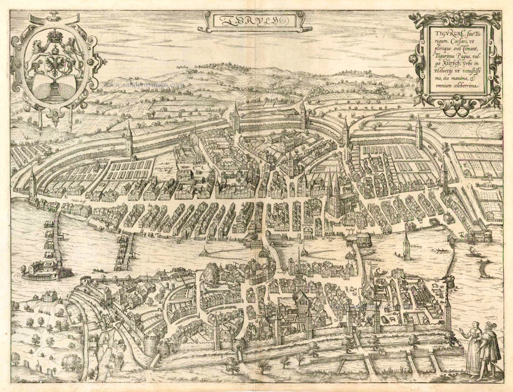
Zurych - Tigurum, sive Turegum, Caesari, ut Plerique Existimant, Tigurinus Pagus, vulgo Zurych, Urbs in Helvetijs 1588
Zürich, by Braun & Hogenberg.
[Item number: 25148]
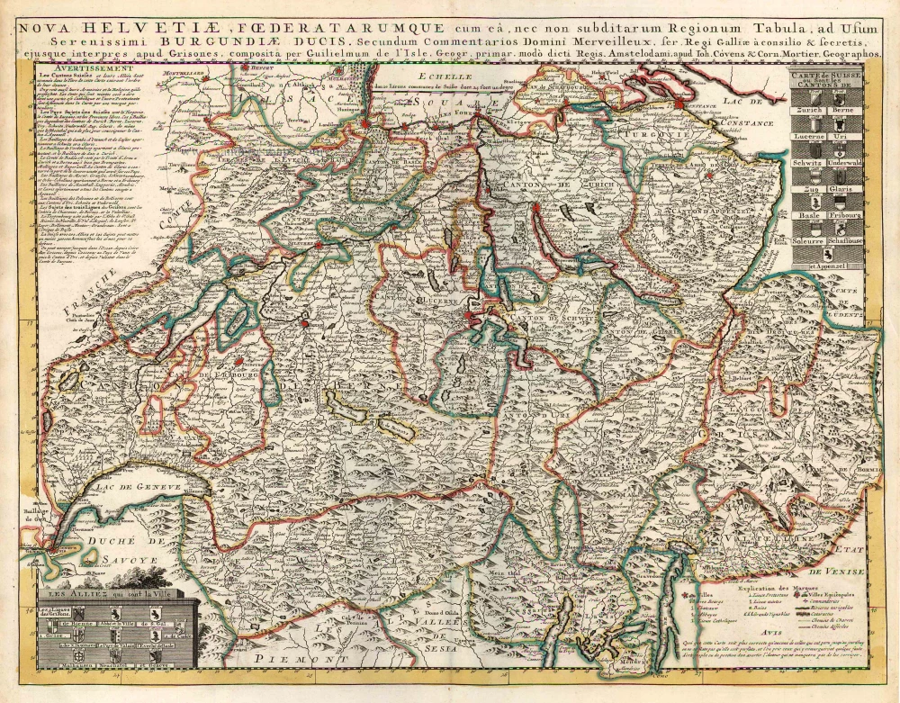
Nova Helvetiae, Foederatarumque cum ea, nec non Subditarum Regionum Tabula ... 1730
Switzerland by Guillaume Delisle, published by Covens & Mortier.
[Item number: 25699]
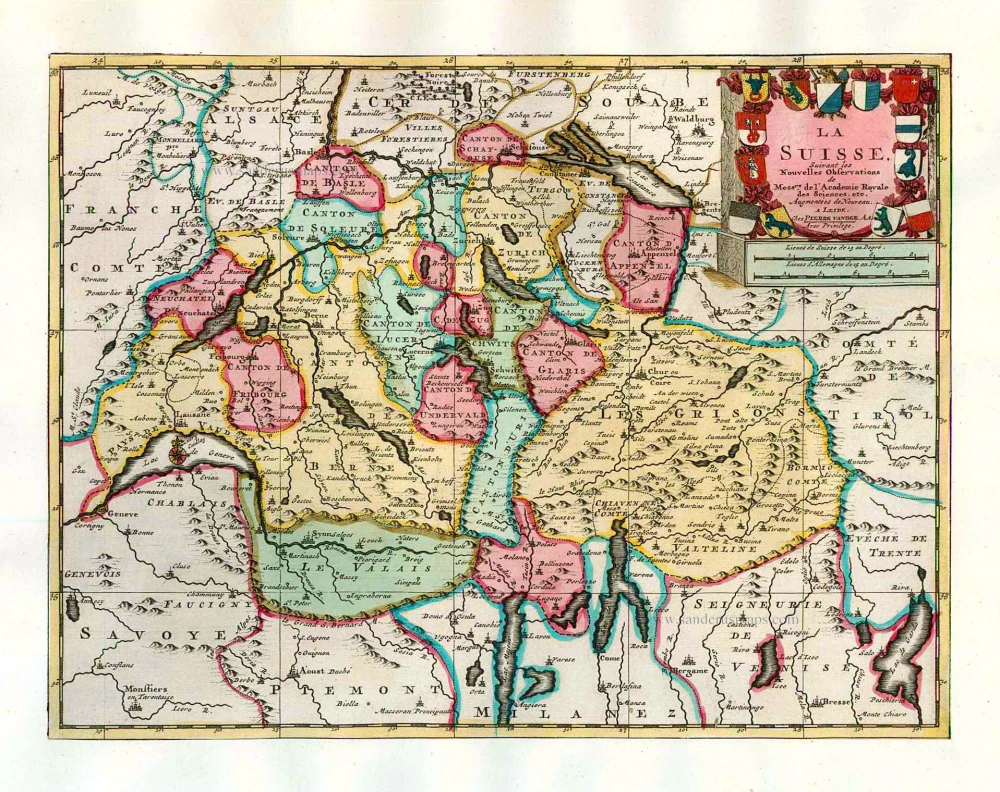
La Suisse. 1713
Switzerland, by Pieter Van der Aa.
[Item number: 26174]
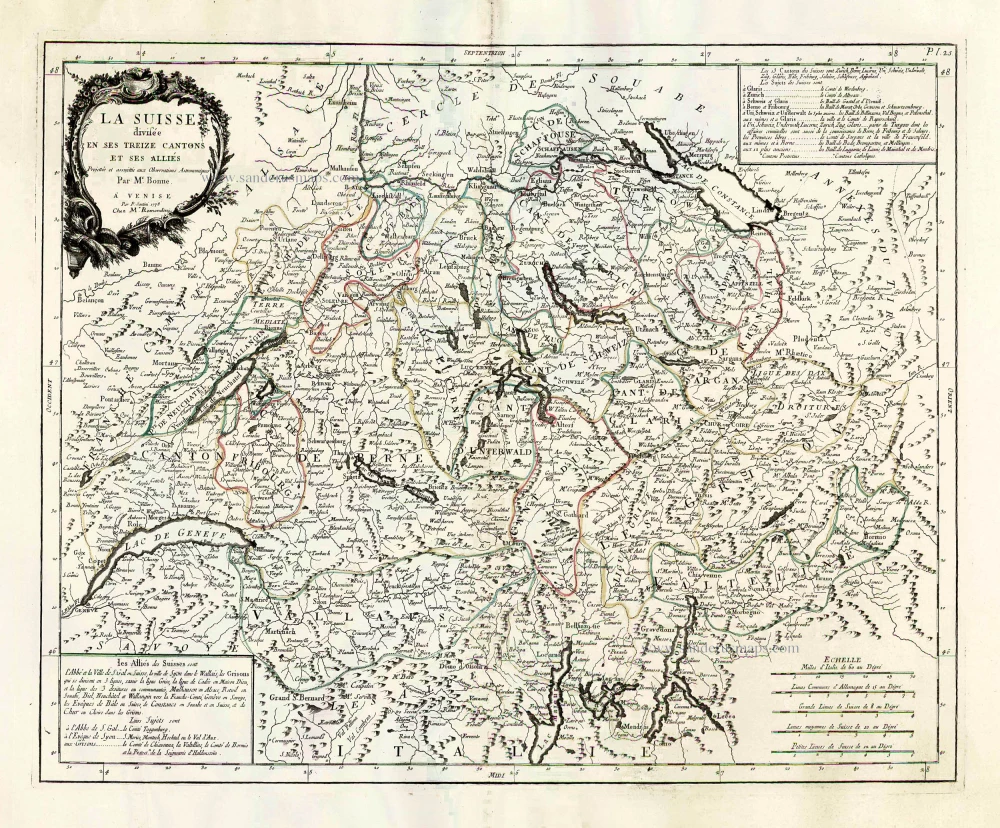
La Suisse Divisee en ses Treize Cantons et ses Allies. 1776-79
Switzerland, by Francesco Santini.
[Item number: 26957]

Zurych - Tigurum, sive Turegum, Caesari, ut Plerique Existimant, Tigurinus Pagus, vulgo Zurych, Urbs in Helvetijs 1582
Zürich by Georg Braun & Frans Hogenberg.
[Item number: 28827]
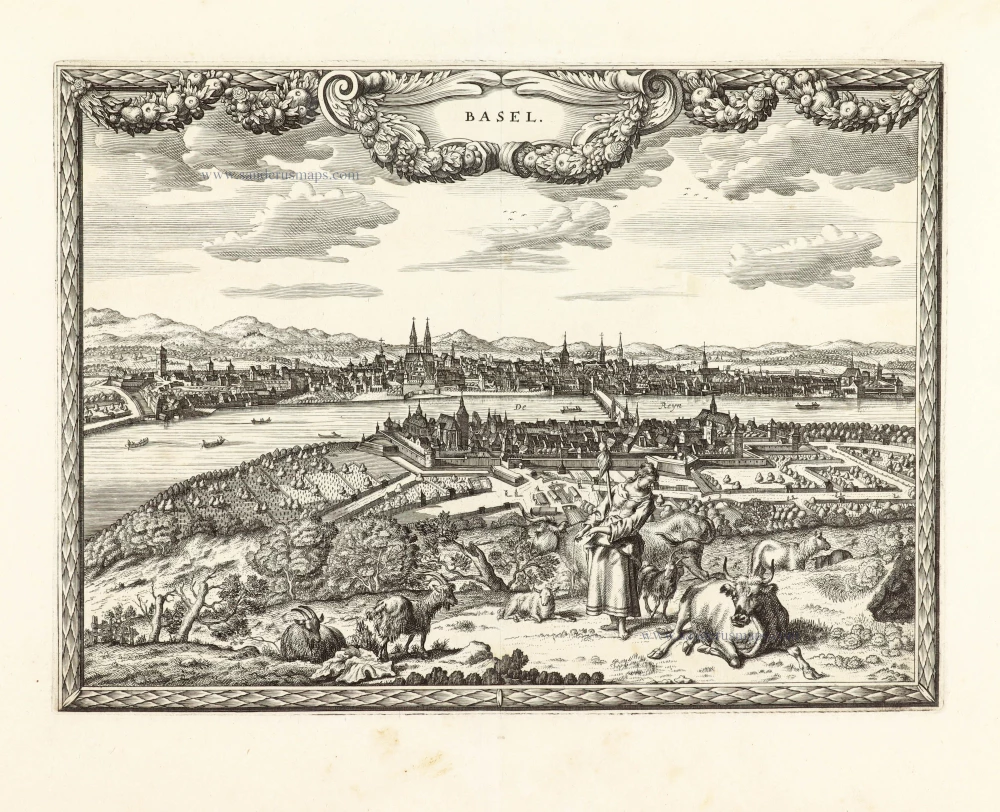
Unrecorded view of Basel by Carel Allard
Basel. 1673
View of Basel by Carel Allard.
[Item number: 30573]
new