
Tivoli by Braun and Hogenberg. 1581-88
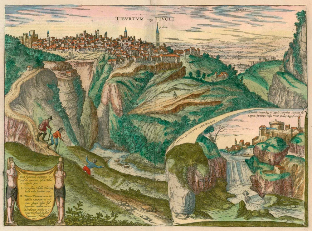
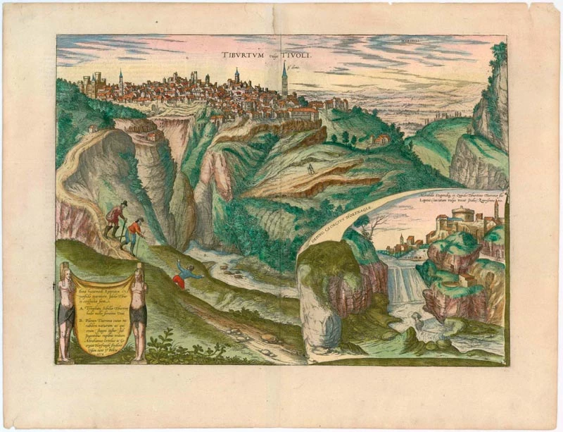


CAPTION: Tiburtum, in Italian Tivoli.
COMMENTARY BY BRAUN: "Tivoli is a beautiful city in Latium with mild and temperate air. For this reason, even long ago, wealthy Romans liked to stay here during the heat of the summer. There are also several stone quarries from which the stone named after Tivoli comes. Many of the splendid houses in Rome were made with this stone. Below Tivoli and the River Aniene, many cool streams have therapeutic effects, from drinking the water and bathing in it."
This is a view from the northeast of Tivoli, situated on a plateau above the gorge of the River Aniene. The spire of the cathedral of San Lorenzo rises above the city; on the left is the castle, known as the Roca Pia. From the first century BC, Tivoli was a resort for the Romans during the summer months; some important ancient monuments have been preserved, such as the Villa Adriana outside the city walls, which, together with the Villa d'Este, is a UNESCO World Heritage Site. On the left are Abraham Ortelius and Georg Hoefnagel descending the slope during their visit to Tivoli in 1578. Hoefnagel directs the viewer's attention to the impressive waterfall of the Aniene. (Taschen)
Braun G. & Hogenberg F. and the Civitates Orbis Terrarum.
The Civitates Orbis Terrarum, or the "Braun & Hogenberg", is a six-volume town atlas and the most excellent book of town views and plans ever published: 363 engravings, sometimes beautifully coloured. It was one of the best-selling works in the last quarter of the 16th century. Georg Braun wrote the text accompanying the plans and views on the verso. Many plates were engraved after the original drawings of a professional artist, a professional artist, Joris Hoefnagel (1542-1600). The first volume was published in Latin in 1572, and the sixth in 1617. Frans Hogenberg created the tables for volumes I through IV, and Simon van den Neuwel made those for volumes V and VI. Other contributors were cartographers Daniel Freese and Heinrich Rantzau. Works by Jacob van Deventer, Sebastian Münster, and Johannes Stumpf were also used. Translations appeared in German and French.
Following the original publication of Volume 1 of the Civitates in 1572, seven further editions of 1575, 1577, 1582, 1588, 1593, 1599 and 1612 can be identified. Vol.2, first issued in 1575, was followed by further editions in 1597 and 1612. The subsequent volumes appeared in 1581, 1588, 1593, 1599 and 1606. The German translation of the first volume appeared from 1574 on, and the French edition from 1575 on.
Several printers were involved: Theodor Graminaeus, Heinrich von Aich, Gottfried von Kempen, Johannis Sinniger, Bertram Buchholtz and Peter von Brachel, who all worked in Cologne.
Georg Braun (1541-1622)
Georg Braun was born in Cologne in 1541. After his studies in Cologne, he entered the Jesuit Order as a novice. 1561, he obtained his bachelor's degree, and in 1562, he received his Magister Artium. Although he left the Jesuit Order, he studied theology, gaining a licentiate in theology.
Frans Hogenberg (1535-1590)
Frans Hogenberg was a Flemish and German painter, engraver, and mapmaker. He was born in Mechelen as the son of Nicolaas Hogenberg.
By the end of the 1560s, Frans Hogenberg was employed upon Abraham Ortelius's Theatrum Orbis Terrarum, published in 1570; he is named an engraver of numerous maps. In 1568, he was banned from Antwerp by the Duke of Alva and travelled to London, where he stayed a few years before emigrating to Cologne. He immediately embarked on his two most important works, the Civitates, published in 1572 and the Geschichtsblätter, which appeared in several series from 1569 until about 1587.
Thanks to large-scale projects like the Geschichtsblätter and the Civitates, Hogenberg's social circumstances improved with each passing year. He died as a wealthy man in Cologne in 1590.
Tiburtum vulgo Tivoli.
Item Number: 22237 Authenticity Guarantee
Category: Antique maps > Europe > Italy - Cities
Old, antique view of Tivoli by Braun and Hogenberg after a drawing by Georg Hoefnagel.
With an inset view of cascading waterfalls.
Title: Tiburtum vulgo Tivoli.
Date: 1581-88.
Copper engraving, printed on paper.
Size (not including margins): 330 x 457mm (12.99 x 17.99 inches).
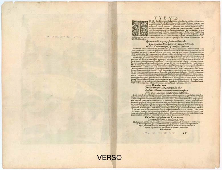
Verso: Latin text.
Condition: Original coloured, excellent.
Condition Rating: A+.
From: Civitates Orbis Terrarum. . Liber tertius. Köln, G. Kempen, 1581-88. (Koeman, B&H3)
CAPTION: Tiburtum, in Italian Tivoli.
COMMENTARY BY BRAUN: "Tivoli is a beautiful city in Latium with mild and temperate air. For this reason, even long ago, wealthy Romans liked to stay here during the heat of the summer. There are also several stone quarries from which the stone named after Tivoli comes. Many of the splendid houses in Rome were made with this stone. Below Tivoli and the River Aniene, many cool streams have therapeutic effects, from drinking the water and bathing in it."
This is a view from the northeast of Tivoli, situated on a plateau above the gorge of the River Aniene. The spire of the cathedral of San Lorenzo rises above the city; on the left is the castle, known as the Roca Pia. From the first century BC, Tivoli was a resort for the Romans during the summer months; some important ancient monuments have been preserved, such as the Villa Adriana outside the city walls, which, together with the Villa d'Este, is a UNESCO World Heritage Site. On the left are Abraham Ortelius and Georg Hoefnagel descending the slope during their visit to Tivoli in 1578. Hoefnagel directs the viewer's attention to the impressive waterfall of the Aniene. (Taschen)
Braun G. & Hogenberg F. and the Civitates Orbis Terrarum.
The Civitates Orbis Terrarum, or the "Braun & Hogenberg", is a six-volume town atlas and the most excellent book of town views and plans ever published: 363 engravings, sometimes beautifully coloured. It was one of the best-selling works in the last quarter of the 16th century. Georg Braun wrote the text accompanying the plans and views on the verso. Many plates were engraved after the original drawings of a professional artist, a professional artist, Joris Hoefnagel (1542-1600). The first volume was published in Latin in 1572, and the sixth in 1617. Frans Hogenberg created the tables for volumes I through IV, and Simon van den Neuwel made those for volumes V and VI. Other contributors were cartographers Daniel Freese and Heinrich Rantzau. Works by Jacob van Deventer, Sebastian Münster, and Johannes Stumpf were also used. Translations appeared in German and French.
Following the original publication of Volume 1 of the Civitates in 1572, seven further editions of 1575, 1577, 1582, 1588, 1593, 1599 and 1612 can be identified. Vol.2, first issued in 1575, was followed by further editions in 1597 and 1612. The subsequent volumes appeared in 1581, 1588, 1593, 1599 and 1606. The German translation of the first volume appeared from 1574 on, and the French edition from 1575 on.
Several printers were involved: Theodor Graminaeus, Heinrich von Aich, Gottfried von Kempen, Johannis Sinniger, Bertram Buchholtz and Peter von Brachel, who all worked in Cologne.
Georg Braun (1541-1622)
Georg Braun was born in Cologne in 1541. After his studies in Cologne, he entered the Jesuit Order as a novice. 1561, he obtained his bachelor's degree, and in 1562, he received his Magister Artium. Although he left the Jesuit Order, he studied theology, gaining a licentiate in theology.
Frans Hogenberg (1535-1590)
Frans Hogenberg was a Flemish and German painter, engraver, and mapmaker. He was born in Mechelen as the son of Nicolaas Hogenberg.
By the end of the 1560s, Frans Hogenberg was employed upon Abraham Ortelius's Theatrum Orbis Terrarum, published in 1570; he is named an engraver of numerous maps. In 1568, he was banned from Antwerp by the Duke of Alva and travelled to London, where he stayed a few years before emigrating to Cologne. He immediately embarked on his two most important works, the Civitates, published in 1572 and the Geschichtsblätter, which appeared in several series from 1569 until about 1587.
Thanks to large-scale projects like the Geschichtsblätter and the Civitates, Hogenberg's social circumstances improved with each passing year. He died as a wealthy man in Cologne in 1590.
Related items

Ancona Civitas Piceni Celeberrima, ad Mare Adriaticum Posita 1572-1624
Old, antique map - Bird's-eye plan of Ancona by Braun and Hogenberg
[Item number: 17778]
Bononia Alma Studior Mater 1588-97
Bologna by Braun and Hogenberg.
[Item number: 22602]
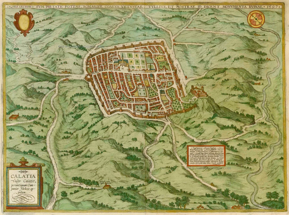
Calatia vulgo Caiazo, perantiquum Campaniae foelicis oppidum. 1596
Caiazzo, by Braun & Hogenberg.
[Item number: 22118]

Vetustiss. Ad Mare Thyrrhenum Terracinae Oppidum 1623
Terracina by Braun and Hogenberg after G. Hoefnagel.
[Item number: 23334]