
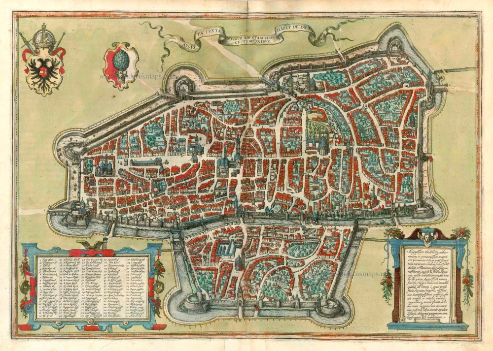
Augsburg, by Georg Braun and Frans Hogenberg. 1612
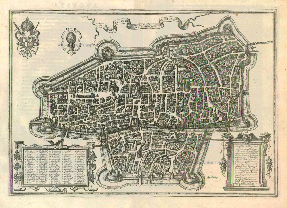
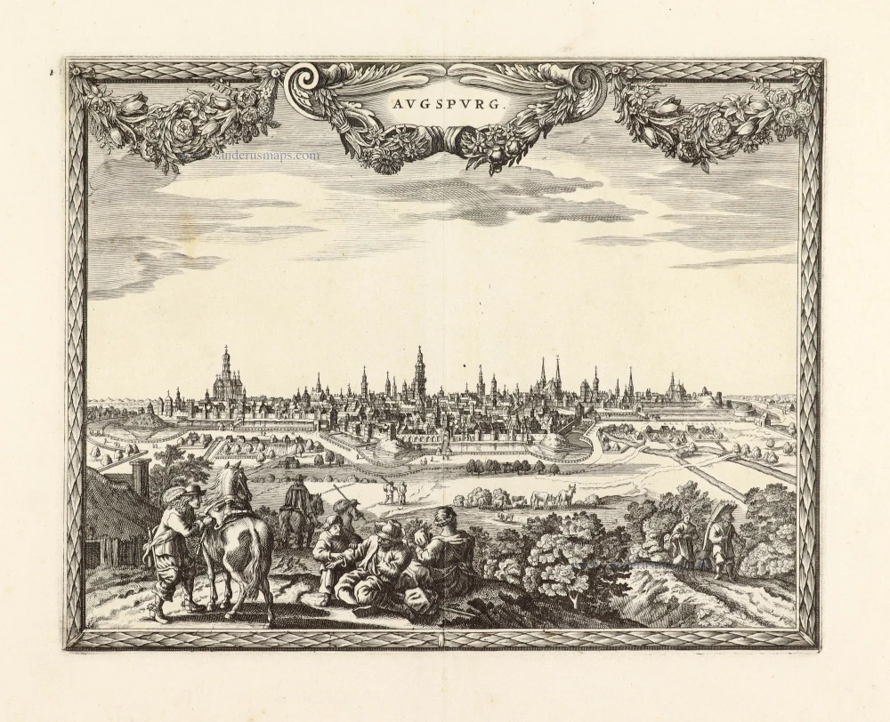
TRANSLATION OF CARTOUCHE TEXT: Following the catastrophic defeat of Varus and the subjugation of the Vandals, Octavianus Augustus conquered, rebuilt and enlarged Augusta Vindelicorum [Augsburg], a widely famed and very ancient city in Upper Germany. According to Strabo, he settled 3,000 Romans here, from which the city took the name Augusta. Otto I, repulsed a Hungarian attack in a heavy battle and restored Augsburg to the Empire. Augsburg's glory is based on lavish buildings, spacious and magnificent squares, extremely defensive walls, moats and embankments, its significant turnover of goods, its internal constitution, its wealthy inhabitants and its care for the poor as well as its episcopal see, among other things.
COMMENTARY BY BRAUN: "The city's authorities dedicate themselves to caring for the poor. As well as maintaining a hospice and an orphanage, in periods when the plague or syphilis was raging, they also established a hospital, the Blatterhaus, to tend to and accommodate the afflicted. Furthermore, in 1519 and at their own expense, the Fugger family built about 100 houses for needy but respectable citizens in the suburb of St James, in effect a distinct quarter called the Fuggerei."
The bird's-eye view of Augsburg clearly shows the individual groups of buildings, including the Fuggerei (72, bottom left), mentioned by Braun and founded in 1514 as an enclosed housing complex for impoverished citizens. The cathedral (32, right) is a Romanesque building with Gothic elements. Directly beside the town hall (52) in the city's centre lies the church of St Peter am Perlach (35). Its tall tower, called the Perlachturm, was remodelled in the 17th century and is a city landmark. The present town hall was begun in 1615 in the Renaissance style. The church of St Anne houses the burial chapel of the Fugger family; Martin Luther stayed at the affiliated monastery (23, above St Peter, am Perlach) when he was summoned to Augsburg to defend his theses before the imperial diet in 1518. The Benedictine abbey of SS Ulrich and Afra (17) on the left-hand edge of the map dates from the 15th century, when Augsburg was home to some 30,000 inhabitants. During this period, Augsburg was a centre of German economic and intellectual life and frequently played host to imperial diets. (Taschen)
Braun G. & Hogenberg F. and the Civitates Orbis Terrarum.
The Civitates Orbis Terrarum, or the "Braun & Hogenberg", is a six-volume town atlas and the most excellent book of town views and plans ever published: 363 engravings, sometimes beautifully coloured. It was one of the best-selling works in the last quarter of the 16th century. Georg Braun wrote the text accompanying the plans and views on the verso. Many plates were engraved after the original drawings of a professional artist, a professional artist, Joris Hoefnagel (1542-1600). The first volume was published in Latin in 1572, and the sixth in 1617. Frans Hogenberg created the tables for volumes I through IV, and Simon van den Neuwel made those for volumes V and VI. Other contributors were cartographers Daniel Freese and Heinrich Rantzau. Works by Jacob van Deventer, Sebastian Münster, and Johannes Stumpf were also used. Translations appeared in German and French.
Following the original publication of Volume 1 of the Civitates in 1572, seven further editions of 1575, 1577, 1582, 1588, 1593, 1599 and 1612 can be identified. Vol.2, first issued in 1575, was followed by further editions in 1597 and 1612. The subsequent volumes appeared in 1581, 1588, 1593, 1599 and 1606. The German translation of the first volume appeared from 1574 on, and the French edition from 1575 on.
Several printers were involved: Theodor Graminaeus, Heinrich von Aich, Gottfried von Kempen, Johannis Sinniger, Bertram Buchholtz and Peter von Brachel, who all worked in Cologne.
Georg Braun (1541-1622)
Georg Braun was born in Cologne in 1541. After his studies in Cologne, he entered the Jesuit Order as a novice. 1561, he obtained his bachelor's degree, and in 1562, he received his Magister Artium. Although he left the Jesuit Order, he studied theology, gaining a licentiate in theology.
Frans Hogenberg (1535-1590)
Frans Hogenberg was a Flemish and German painter, engraver, and mapmaker. He was born in Mechelen as the son of Nicolaas Hogenberg.
By the end of the 1560s, Frans Hogenberg was employed upon Abraham Ortelius's Theatrum Orbis Terrarum, published in 1570; he is named an engraver of numerous maps. In 1568, he was banned from Antwerp by the Duke of Alva and travelled to London, where he stayed a few years before emigrating to Cologne. He immediately embarked on his two most important works, the Civitates, published in 1572 and the Geschichtsblätter, which appeared in several series from 1569 until about 1587.
Thanks to large-scale projects like the Geschichtsblätter and the Civitates, Hogenberg's social circumstances improved with each passing year. He died as a wealthy man in Cologne in 1590.
Augusta Iuxta Figuram ...
Item Number: 22337 Authenticity Guarantee
Category: Antique maps > Europe > Germany - Cities
Old, antique bird’s-eye view plan of Augsburg, by Georg Braun and Frans Hogenberg.
Title: Augusta Iuxta Figuram ...
Date of the first edition: 1572.
Date of this map: 1612.
Copper engraving, printed on paper.
Size (not including margins): 330 x 470mm (12.99 x 18.5 inches).
Verso: Latin text.
Condition: Uncoloured, excellent.
Condition Rating: A+.
From: Civitates Orbis Terrarum, Liber Primus. Cologne, Petrus von Brachel, 1612. (Van der Krogt 4, 41:1.1(1612))
TRANSLATION OF CARTOUCHE TEXT: Following the catastrophic defeat of Varus and the subjugation of the Vandals, Octavianus Augustus conquered, rebuilt and enlarged Augusta Vindelicorum [Augsburg], a widely famed and very ancient city in Upper Germany. According to Strabo, he settled 3,000 Romans here, from which the city took the name Augusta. Otto I, repulsed a Hungarian attack in a heavy battle and restored Augsburg to the Empire. Augsburg's glory is based on lavish buildings, spacious and magnificent squares, extremely defensive walls, moats and embankments, its significant turnover of goods, its internal constitution, its wealthy inhabitants and its care for the poor as well as its episcopal see, among other things.
COMMENTARY BY BRAUN: "The city's authorities dedicate themselves to caring for the poor. As well as maintaining a hospice and an orphanage, in periods when the plague or syphilis was raging, they also established a hospital, the Blatterhaus, to tend to and accommodate the afflicted. Furthermore, in 1519 and at their own expense, the Fugger family built about 100 houses for needy but respectable citizens in the suburb of St James, in effect a distinct quarter called the Fuggerei."
The bird's-eye view of Augsburg clearly shows the individual groups of buildings, including the Fuggerei (72, bottom left), mentioned by Braun and founded in 1514 as an enclosed housing complex for impoverished citizens. The cathedral (32, right) is a Romanesque building with Gothic elements. Directly beside the town hall (52) in the city's centre lies the church of St Peter am Perlach (35). Its tall tower, called the Perlachturm, was remodelled in the 17th century and is a city landmark. The present town hall was begun in 1615 in the Renaissance style. The church of St Anne houses the burial chapel of the Fugger family; Martin Luther stayed at the affiliated monastery (23, above St Peter, am Perlach) when he was summoned to Augsburg to defend his theses before the imperial diet in 1518. The Benedictine abbey of SS Ulrich and Afra (17) on the left-hand edge of the map dates from the 15th century, when Augsburg was home to some 30,000 inhabitants. During this period, Augsburg was a centre of German economic and intellectual life and frequently played host to imperial diets. (Taschen)
Braun G. & Hogenberg F. and the Civitates Orbis Terrarum.
The Civitates Orbis Terrarum, or the "Braun & Hogenberg", is a six-volume town atlas and the most excellent book of town views and plans ever published: 363 engravings, sometimes beautifully coloured. It was one of the best-selling works in the last quarter of the 16th century. Georg Braun wrote the text accompanying the plans and views on the verso. Many plates were engraved after the original drawings of a professional artist, a professional artist, Joris Hoefnagel (1542-1600). The first volume was published in Latin in 1572, and the sixth in 1617. Frans Hogenberg created the tables for volumes I through IV, and Simon van den Neuwel made those for volumes V and VI. Other contributors were cartographers Daniel Freese and Heinrich Rantzau. Works by Jacob van Deventer, Sebastian Münster, and Johannes Stumpf were also used. Translations appeared in German and French.
Following the original publication of Volume 1 of the Civitates in 1572, seven further editions of 1575, 1577, 1582, 1588, 1593, 1599 and 1612 can be identified. Vol.2, first issued in 1575, was followed by further editions in 1597 and 1612. The subsequent volumes appeared in 1581, 1588, 1593, 1599 and 1606. The German translation of the first volume appeared from 1574 on, and the French edition from 1575 on.
Several printers were involved: Theodor Graminaeus, Heinrich von Aich, Gottfried von Kempen, Johannis Sinniger, Bertram Buchholtz and Peter von Brachel, who all worked in Cologne.
Georg Braun (1541-1622)
Georg Braun was born in Cologne in 1541. After his studies in Cologne, he entered the Jesuit Order as a novice. 1561, he obtained his bachelor's degree, and in 1562, he received his Magister Artium. Although he left the Jesuit Order, he studied theology, gaining a licentiate in theology.
Frans Hogenberg (1535-1590)
Frans Hogenberg was a Flemish and German painter, engraver, and mapmaker. He was born in Mechelen as the son of Nicolaas Hogenberg.
By the end of the 1560s, Frans Hogenberg was employed upon Abraham Ortelius's Theatrum Orbis Terrarum, published in 1570; he is named an engraver of numerous maps. In 1568, he was banned from Antwerp by the Duke of Alva and travelled to London, where he stayed a few years before emigrating to Cologne. He immediately embarked on his two most important works, the Civitates, published in 1572 and the Geschichtsblätter, which appeared in several series from 1569 until about 1587.
Thanks to large-scale projects like the Geschichtsblätter and the Civitates, Hogenberg's social circumstances improved with each passing year. He died as a wealthy man in Cologne in 1590.
Related items
Nieuwe kaart van 't Land Donawert, en Hochstett &c. ... 1604 or later
Donauwörth, by Visscher N. II.
[Item number: 10558]
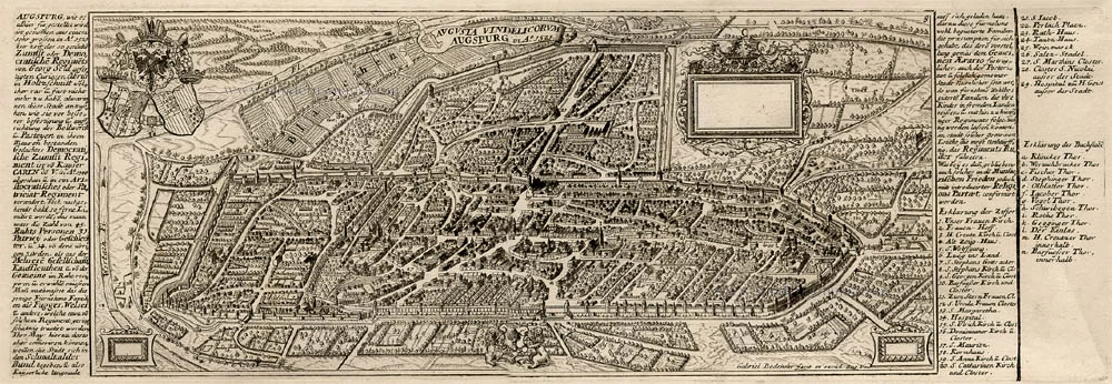
Augusta Vindelicorum Augspurg c.1716
Augsburg, by Bodenehr G.
[Item number: 13413]
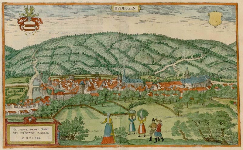
Budingen. 1617
Budingen, by Braun & Hogenberg.
[Item number: 22133]
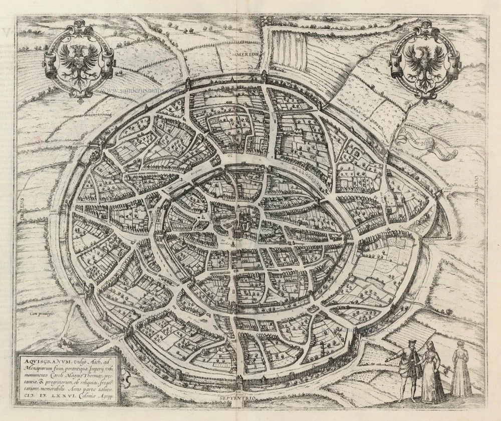
Aquisgranum, vulgo Aich, ad Menapiorum fines, perantiqua Imperij Urbs, M0onumento Caroli Magni, ... 1599
Aachen, by Georg Braun and Frans Hogenberg.
[Item number: 23907]
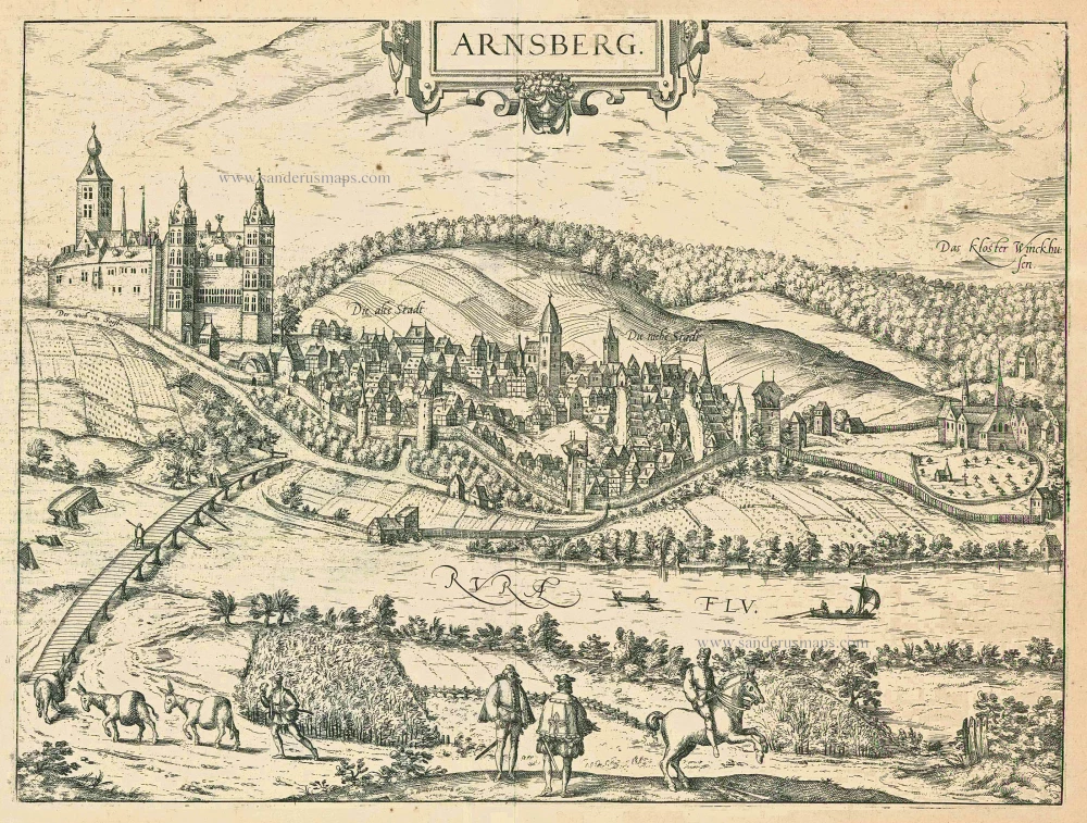
Arnsberg. 1599
Arnsberg by Braun and Hogenberg.
[Item number: 24096]
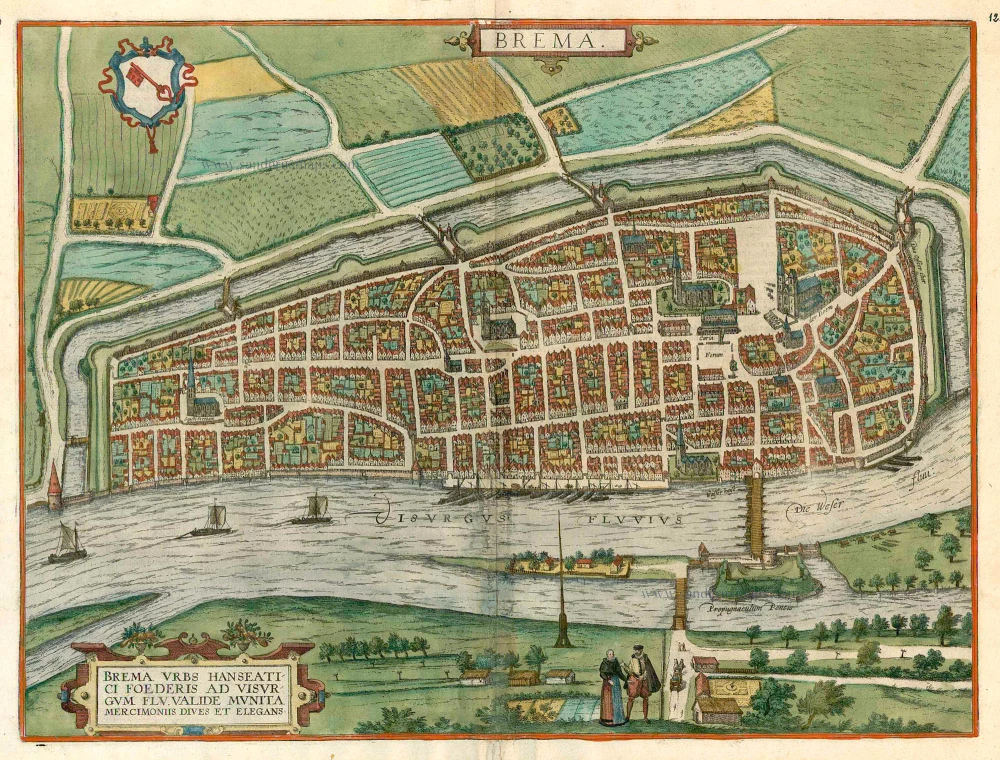
Brema. c. 1610
Bremen, by Georg Braun and Frans Hogenberg.
[Item number: 16673]
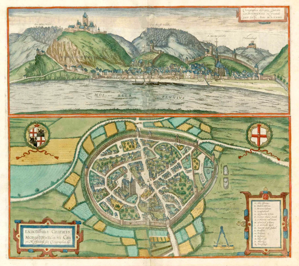
Chorographica Descriptio Civitatis Cocheimensis [on sheet with] Exactissima Civitatis Monasteriensis in Campo Meyfeldensi Chorographica Des. c. 1610
Cochem and Münstermaifeld, by Georg Braun and Frans Hogenberg.
[Item number: 16747]
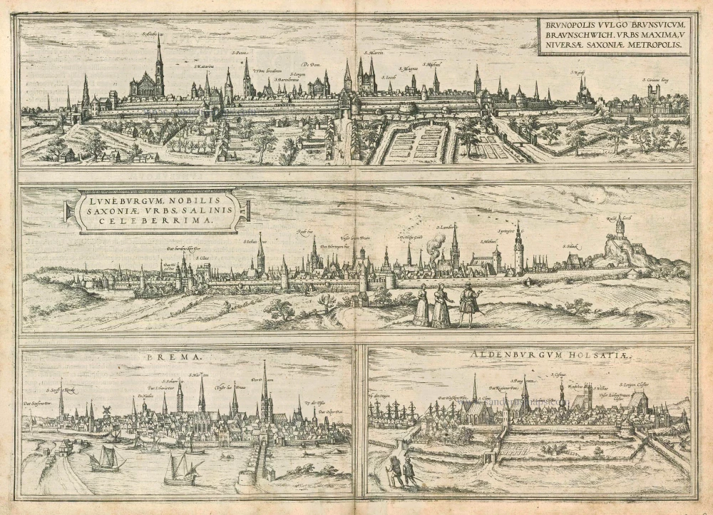
Brunopolis vulgo Brunsvicum, ... [on sheet with] Luneburgum, Nobilis Saxoniae Urbs, ... [and] Brema [and] Aldenburgum Holsatiae. 1572
Braunschweig, Luneburg, Bremen, and Stade, by Georg Braun and Frans Hogenberg.
[Item number: 21609]
Augusta Iuxta Figuram ... 1582
Augsburg by Braun & Hogenberg
[Item number: 25462]
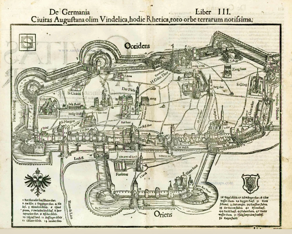
Civitas Augustana olim Vindelica, hodie Rhetica, toto orbe terrarum notissima. 1552
Augsburg, by Sebastian Münster.
[Item number: 26846]
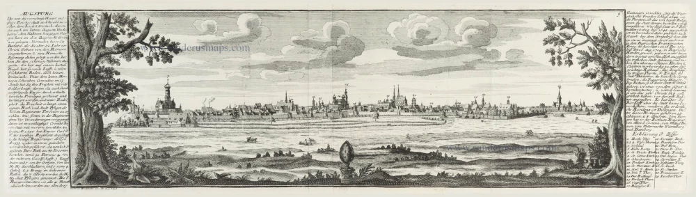
Augspurg. c.1716
Panoramic view of Augsburg by G. Bodenehr.
[Item number: 30261]
Unrecorded variant of Schut's view of Augsburg, by Carel Allard
Augsburg. 1673
View of Augsburg by Carel Allard.
[Item number: 30574]
new