
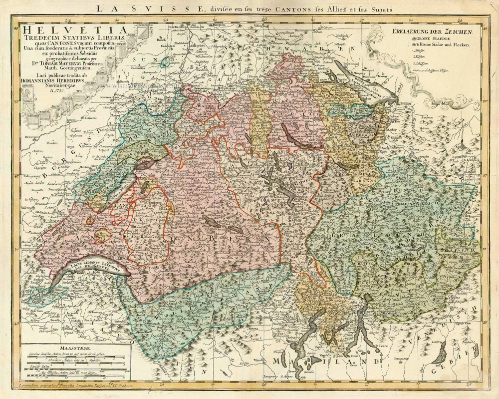
Switzerland, by Homann Heirs. c. 1757.
The Homann Family
Johann Baptist Homann (1664-1724) was born in Oberkammlach in Southern Germany. Around 1693 Homann moved to Vienna, where he lived and studied printing and copper plate engraving until 1695. In 1702 he founded a map publishing company in Nuremberg, which is recognized as one of the most important German map publishers of the eighteenth century. In the next five years, Homann produced hundreds of maps and developed a distinctive style characterized by heavy detailed engraving, elaborate allegorical cartouche work, and vivid hand colour. He published his first atlas in 1707. Homann's company successfully competed with leading European mapmakers. By 1715 Homann's rising star caught the attention of the Holy Roman Emperor Charles the VI, who appointed him Imperial Cartographer. In the same year, he was also appointed a member of the Royal Academy of Sciences in Berlin. Homann's prestigious title came with several significant advantages, including access to the most up to date cartographic information as well as the "Privilege". In 1716 Homann published his masterpiece Grosser Atlas über die ganze Welt (Grand Atlas of all the World).
After Johann Baptist Homann's death in 1724, Johan Christoph Homann (1703-1730) and other heirs continued the company under the name Homann's Erben (Homann's Heirs) until 1852.
Helvetia Tredecim Statibus Liberis quos Cantones vocant Composita ...
Item Number: 22480 Authenticity Guarantee
Category: Antique maps > Europe > Switzerland
Antique map of Switzerland by Homann Heirs.
Title: Helvetia Tredecim Statibus Liberis quos Cantones vocant Composita ...
Date: c. 1757.
Copper engraving, printed on paper.
Size (not including margins): 420 x 530mm (16.54 x 20.87 inches).
Verso: Blank.
Condition: Old coloured.
Condition Rating: A.
From: Grosser Atlas. Nürnberg, c. 1757.
The Homann Family
Johann Baptist Homann (1664-1724) was born in Oberkammlach in Southern Germany. Around 1693 Homann moved to Vienna, where he lived and studied printing and copper plate engraving until 1695. In 1702 he founded a map publishing company in Nuremberg, which is recognized as one of the most important German map publishers of the eighteenth century. In the next five years, Homann produced hundreds of maps and developed a distinctive style characterized by heavy detailed engraving, elaborate allegorical cartouche work, and vivid hand colour. He published his first atlas in 1707. Homann's company successfully competed with leading European mapmakers. By 1715 Homann's rising star caught the attention of the Holy Roman Emperor Charles the VI, who appointed him Imperial Cartographer. In the same year, he was also appointed a member of the Royal Academy of Sciences in Berlin. Homann's prestigious title came with several significant advantages, including access to the most up to date cartographic information as well as the "Privilege". In 1716 Homann published his masterpiece Grosser Atlas über die ganze Welt (Grand Atlas of all the World).
After Johann Baptist Homann's death in 1724, Johan Christoph Homann (1703-1730) and other heirs continued the company under the name Homann's Erben (Homann's Heirs) until 1852.
Related items
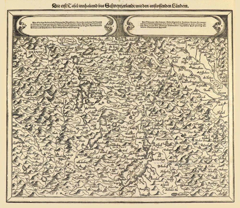
Die erst Tafel innhaltend das Schweytzerlandt mit den anstossenden Ländern. 1588
Switzerland by Sebastian Münster.
[Item number: 14631]
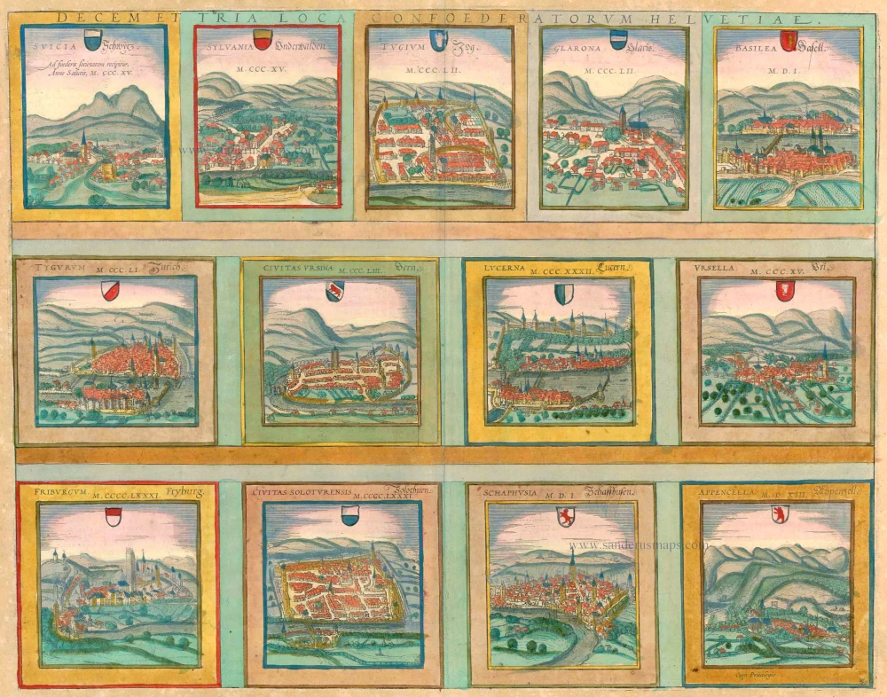
Decem et Tria Loca Confoederatorum Helvetiae. 1572-1624
13 bird's-eye views of Swiss cities by Braun and Hogenberg: Schwyz, Unterwalden, Zug, Glarus, Basel, Zurich, Bern, Lucerne, Uri, Fribourg, Solothurn, Schaffhausen and Appenzell.
[Item number: 23230]
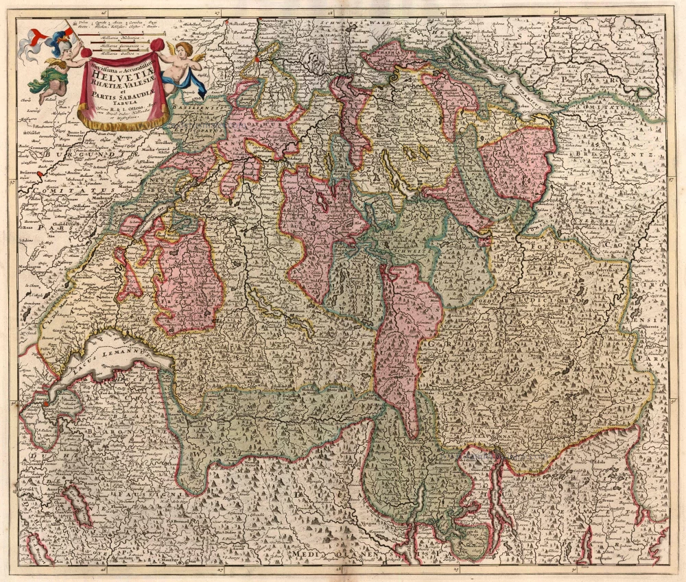
Novissima et Acuratissima Helvetiae, Rhaetiae, Valesiae et Partis Sabaudiae Tabula 1756
Antique map of Switzerland by Ottens R. & J.
[Item number: 23506]
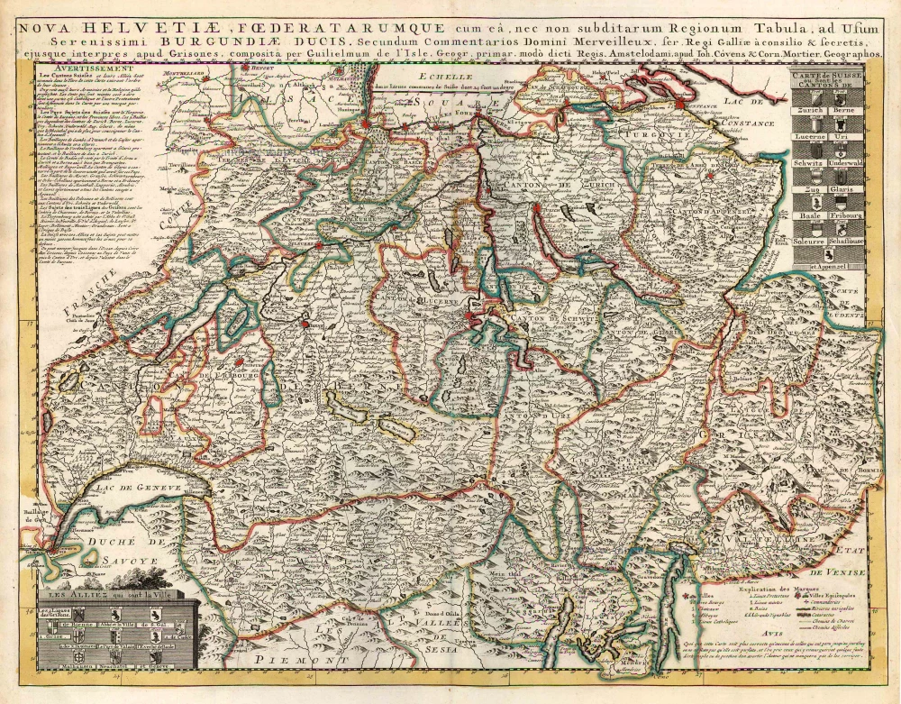
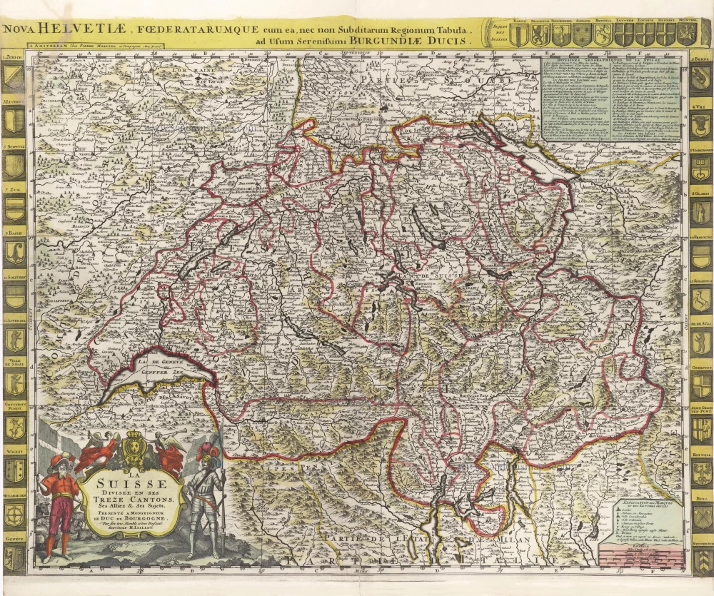
Nova Helvetiae, Foederatarumque cum ea, nec non Subditarum Regionum Tabula ... 1730
Switzerland by Guillaume Delisle, published by Covens & Mortier.
[Item number: 25699]
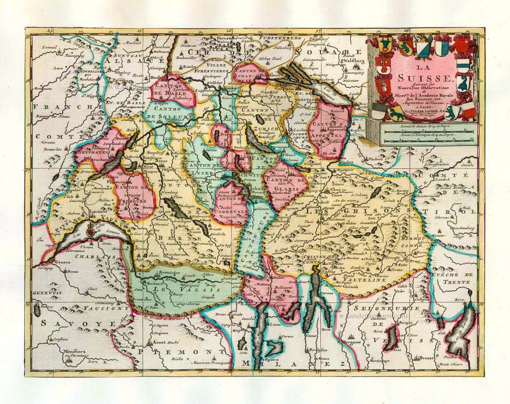
La Suisse. 1713
Switzerland, by Pieter Van der Aa.
[Item number: 26174]
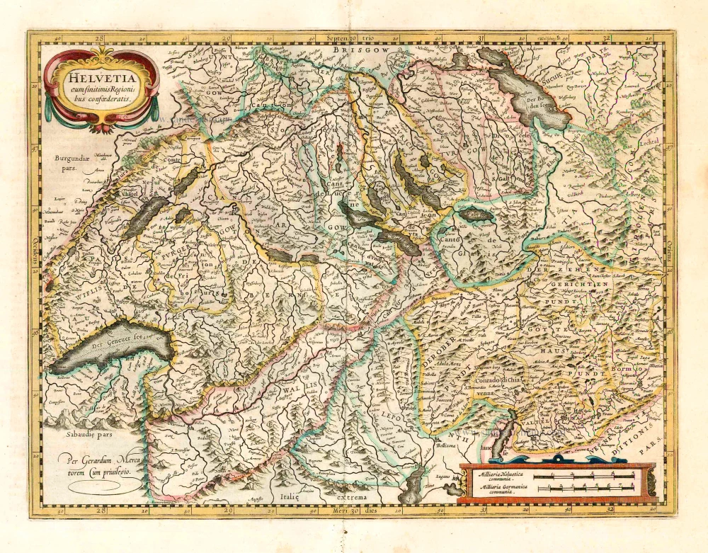
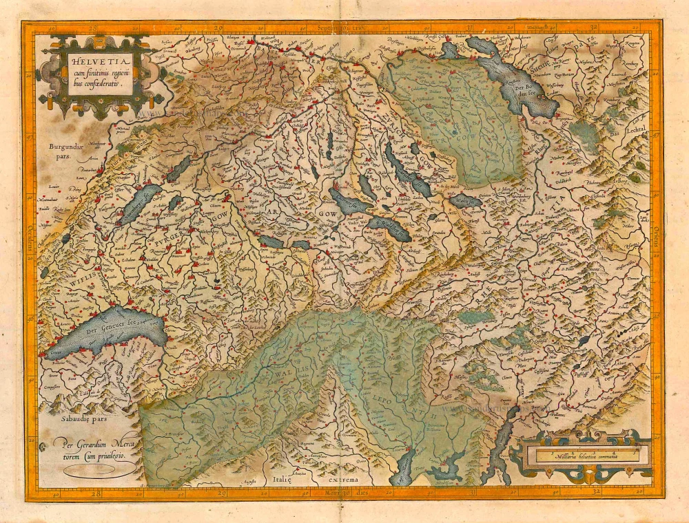
Helvetia cum finitimis regionibus confoederatis. 1641
Switzerland, by Henricus Hondius
[Item number: 26292]
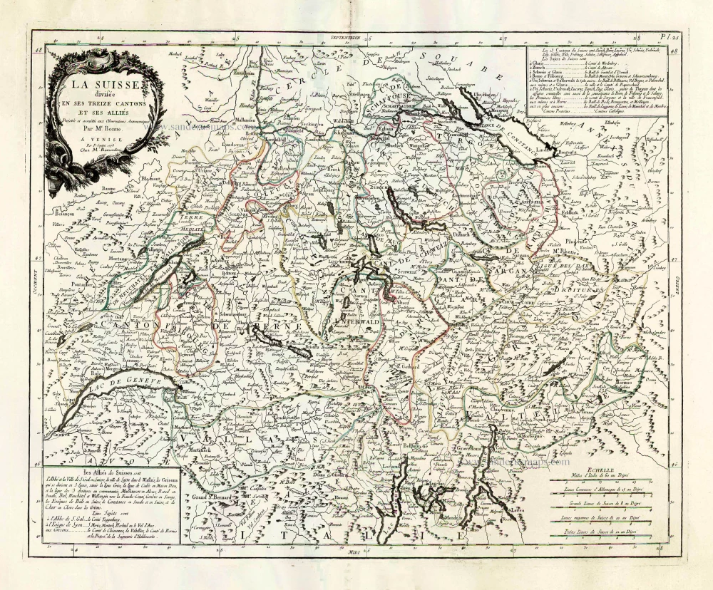
La Suisse Divisee en ses Treize Cantons et ses Allies. 1776-79
Switzerland, by Francesco Santini.
[Item number: 26957]
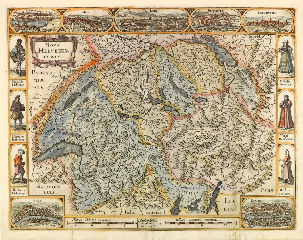
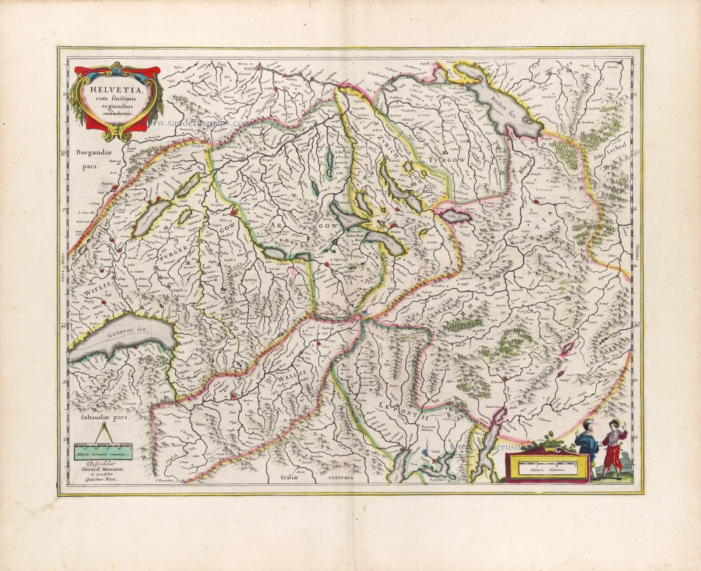
Helvetia cum finitimis regionibus confoederatis. 1623
Switzerland, by Gerard Mercator.
[Item number: 27884]
Nova Helvetiae Tabula. c. 1634
Switzerland, by Jodocus Hondius.
[Item number: 28003]
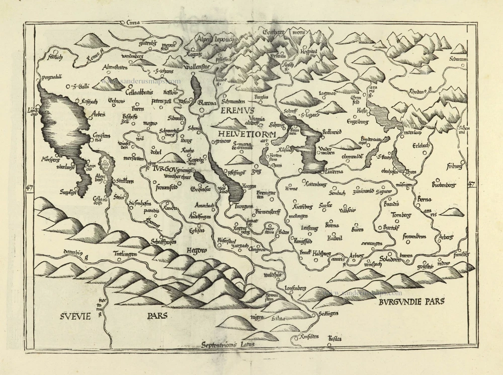
Ta . Here . Helve. [From verso] 1525
Switzerland by Lorenz Fries.
[Item number: 28199]
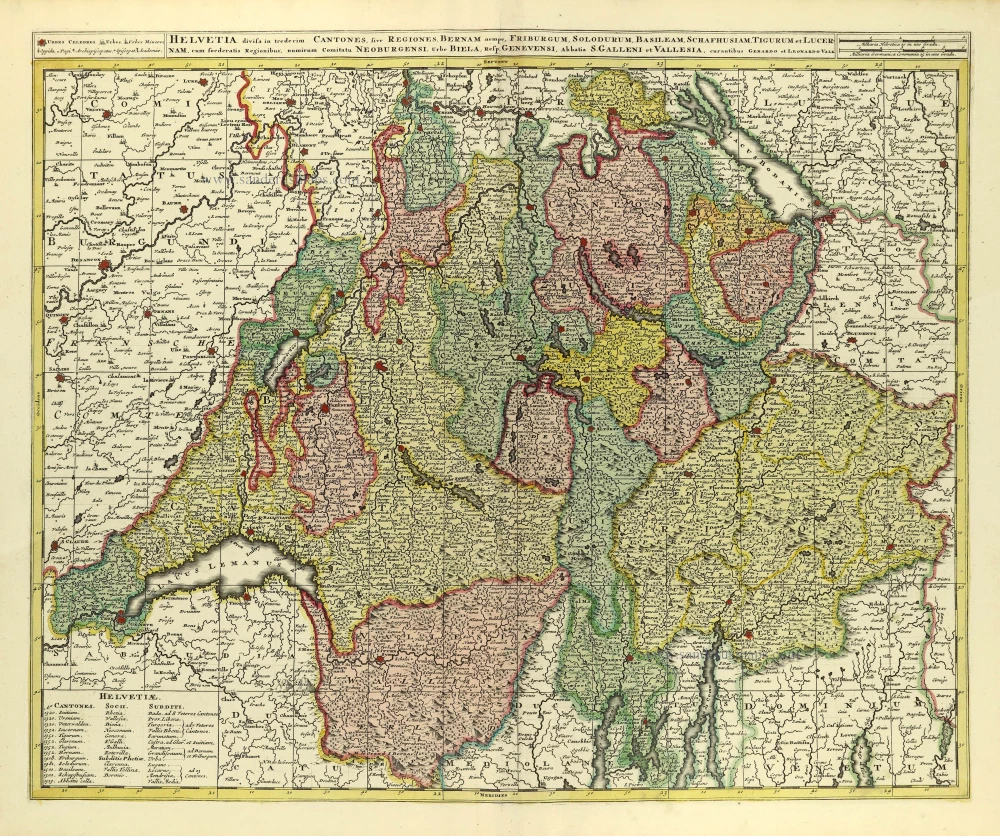
Helvetia Divisa in Tredicem Cantones sive Regiones, Bernam nempe Fruburgum, Solodurum, Basileam, Schafhusiam; Tigurum et Lucernam, cum foederatis Regionibus, numirum Comitatu Neoburgensi, urbe Biela, Resp. Genevensi Abbatia S. Galleni et Vallesia. c. 1702
Switzerland by Gerard & Leonard Valck.
[Item number: 28270]
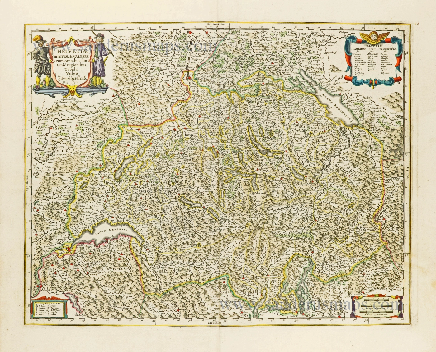
Helvetiae Rhetiae & Valesiae cum omnibus finitimis regionibus Tabula Vulgo Schweitzerland. c. 1678
Switzerland by Johannes Janssonius.
[Item number: 28538]
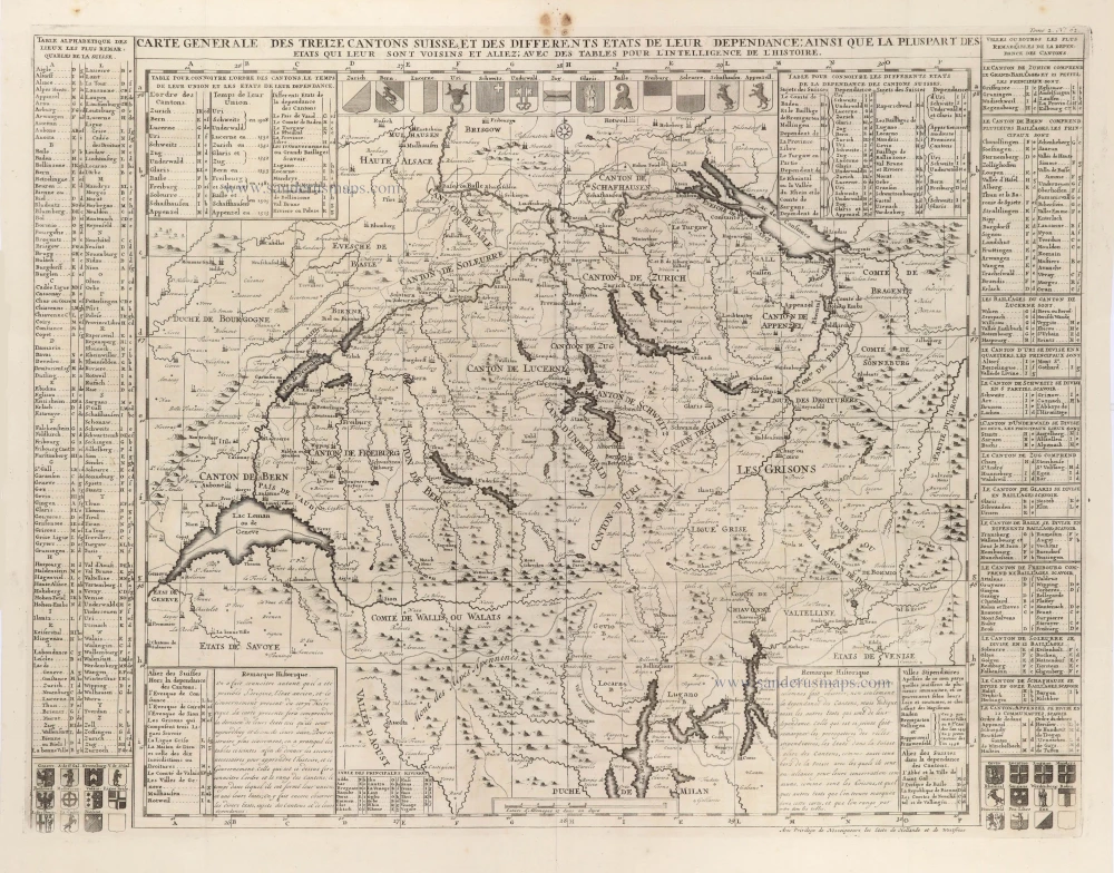
Carte Générale des treize Cantons Suisse, et des différents Etats de leur Dépendance; ainsi que la pluspart des Etats qui leur sont voisins et aliez; avec des tables pour l'intelligence de l'Histoire. 1708
Switzerlandx, by Zacharias Châtelain.
[Item number: 29444]
La Suisse divisée en ses Treze Cantons, Ses Alliez & Ses Sujets, c. 1709
Switzerland by Hubert Jaillot, published by Pierre Mortier.
[Item number: 29566]
Helvetia cum finitimis Regionibus confoederatis. 1643
Switzerland by Willem Blaeu.
[Item number: 29928]