
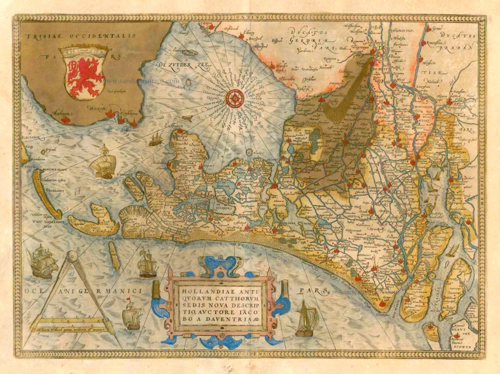
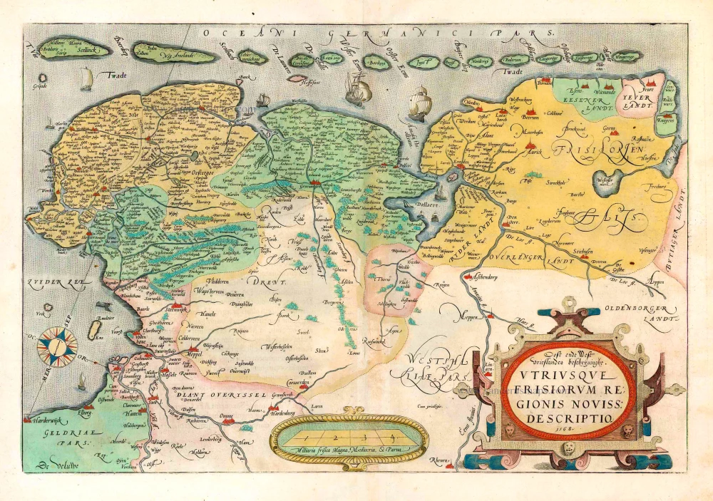
West Friesland, by Abraham Ortelius 1579


Abraham Ortelius (1527-1598)
The maker of the 'first atlas', the Theatrum Orbis Terrarum (1570), was born on 4 April 1527 into an old Antwerp family. He learned Latin and studied Greek and mathematics.
Abraham and his sisters Anne and Elizabeth took up map colouring. He was admitted to the Guild of St. Luke as an "illuminator of maps." Besides colouring maps, Ortelius was a dealer in antiques, coins, maps, and books, with the book and map trade gradually becoming his primary occupation.
Business went well because his means permitted him to start an extensive collection of medals, coins, antiques, and a library of many volumes. In addition, he travelled a lot and visited Italy and France, made contacts everywhere with scholars and editors, and maintained extensive correspondence with them.
In 1564 he published his first map, a large and ambitious world wall map. The inspiration for this map may well have been Gastaldi's large world map. In 1565 he published a map of Egypt and a map of the Holy Land, a large map of Asia followed.
In 1568 the production of individual maps for his atlas Theatrum Orbis Terrarum was already in full swing. He completed the atlas in 1569, and in May of 1570, the Theatrum was available for sale. It was one of the most expensive books ever published.
This first edition contained seventy maps on fifty-three sheets. Franciscus Hogenberg engraved the maps.
Later editions included Additamenta (additions), resulting in Ortelius' historical atlas, the Parergon, mostly bound together with the atlas. The Parergon can be called a truly original work of Ortelius, who drew the maps based on his research.
The importance of the Theatrum Orbis Terrarum for geographical knowledge in the last quarter of the sixteenth century is difficult to overemphasize. Nothing was like it until Mercator's atlas appeared twenty-five years later. Demand for the Theatrum was remarkable. Some 24 editions appeared during Ortelius's lifetime and another ten after his death in 1598. Editions were published in Dutch, German, French, Spanish, English, and Italian. The number of map sheets grew from 53 in 1570 to 167 in 1612 in the last edition.
In 1577, engraver Philip Galle and poet-translator Pieter Heyns published the first pocket-sized edition of the Theatrum, the Epitome. The work was trendy. Over thirty editions of this Epitome were published in different languages.
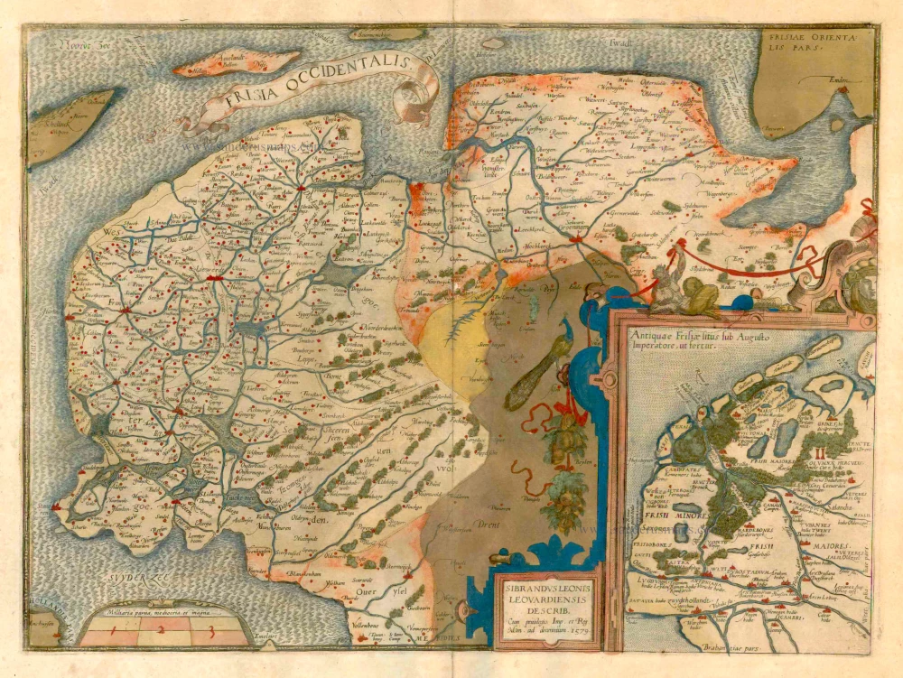
Frisia Occidentalis.
Item Number: 22673 Authenticity Guarantee
Category: Antique maps > Europe > The Netherlands
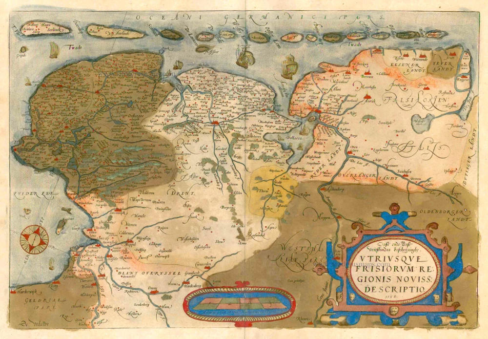
Old, antique map of Friesland, by Abraham Ortelius. (Peacock map)
Title: Frisia Occidentalis.
Cartographer: Sibrandus Leo.
Date of the first edition: 1579.
Date of this map: 1579.
Copper engraving, printed on paper.
Size (not including margins): 366 x 498mm (14.41 x 19.61 inches).
Verso: Latin text.
Condition: Original coloured, verdigris (= green colour) turned brown.
Condition Rating: B+.
From: Theatrum Orbis Terrarum. Antwerp, Chr. Plantin, 1579. (Van der Krogt 3, 31:021A (First printing of two)) First Plantin edition.
Abraham Ortelius (1527-1598)
The maker of the 'first atlas', the Theatrum Orbis Terrarum (1570), was born on 4 April 1527 into an old Antwerp family. He learned Latin and studied Greek and mathematics.
Abraham and his sisters Anne and Elizabeth took up map colouring. He was admitted to the Guild of St. Luke as an "illuminator of maps." Besides colouring maps, Ortelius was a dealer in antiques, coins, maps, and books, with the book and map trade gradually becoming his primary occupation.
Business went well because his means permitted him to start an extensive collection of medals, coins, antiques, and a library of many volumes. In addition, he travelled a lot and visited Italy and France, made contacts everywhere with scholars and editors, and maintained extensive correspondence with them.
In 1564 he published his first map, a large and ambitious world wall map. The inspiration for this map may well have been Gastaldi's large world map. In 1565 he published a map of Egypt and a map of the Holy Land, a large map of Asia followed.
In 1568 the production of individual maps for his atlas Theatrum Orbis Terrarum was already in full swing. He completed the atlas in 1569, and in May of 1570, the Theatrum was available for sale. It was one of the most expensive books ever published.
This first edition contained seventy maps on fifty-three sheets. Franciscus Hogenberg engraved the maps.
Later editions included Additamenta (additions), resulting in Ortelius' historical atlas, the Parergon, mostly bound together with the atlas. The Parergon can be called a truly original work of Ortelius, who drew the maps based on his research.
The importance of the Theatrum Orbis Terrarum for geographical knowledge in the last quarter of the sixteenth century is difficult to overemphasize. Nothing was like it until Mercator's atlas appeared twenty-five years later. Demand for the Theatrum was remarkable. Some 24 editions appeared during Ortelius's lifetime and another ten after his death in 1598. Editions were published in Dutch, German, French, Spanish, English, and Italian. The number of map sheets grew from 53 in 1570 to 167 in 1612 in the last edition.
In 1577, engraver Philip Galle and poet-translator Pieter Heyns published the first pocket-sized edition of the Theatrum, the Epitome. The work was trendy. Over thirty editions of this Epitome were published in different languages.
Related items
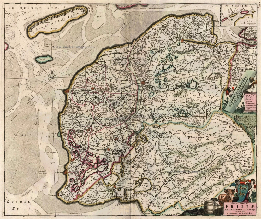
Tabula Comitatus Frisiae. Auctore B: Schotano à Sterringa. c. 1680
Friesland, by Frederik De Wit.
[Item number: 2635]
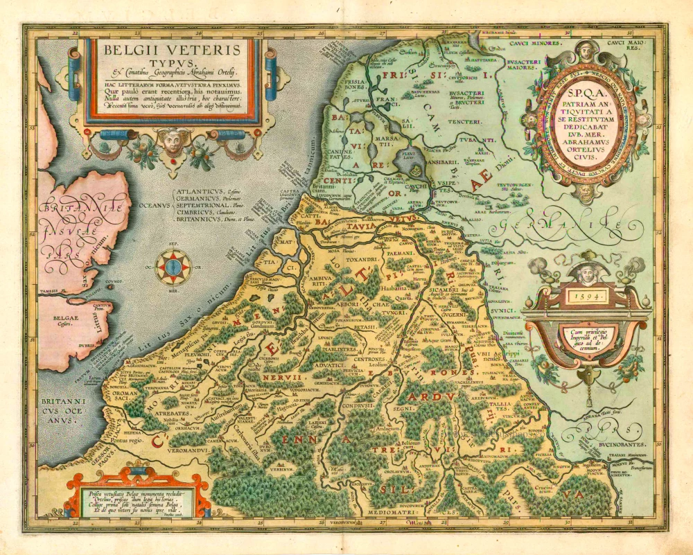
Belgii Veteris Typus. 1601
The ancient Low Countries, by Abraham Ortelius.
[Item number: 12355]
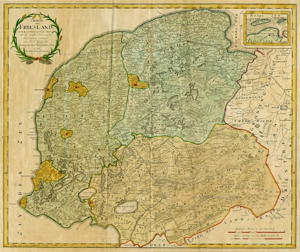
Charte von Friesland 1759-1784
Friesland by Homann Heirs.
[Item number: 13868]
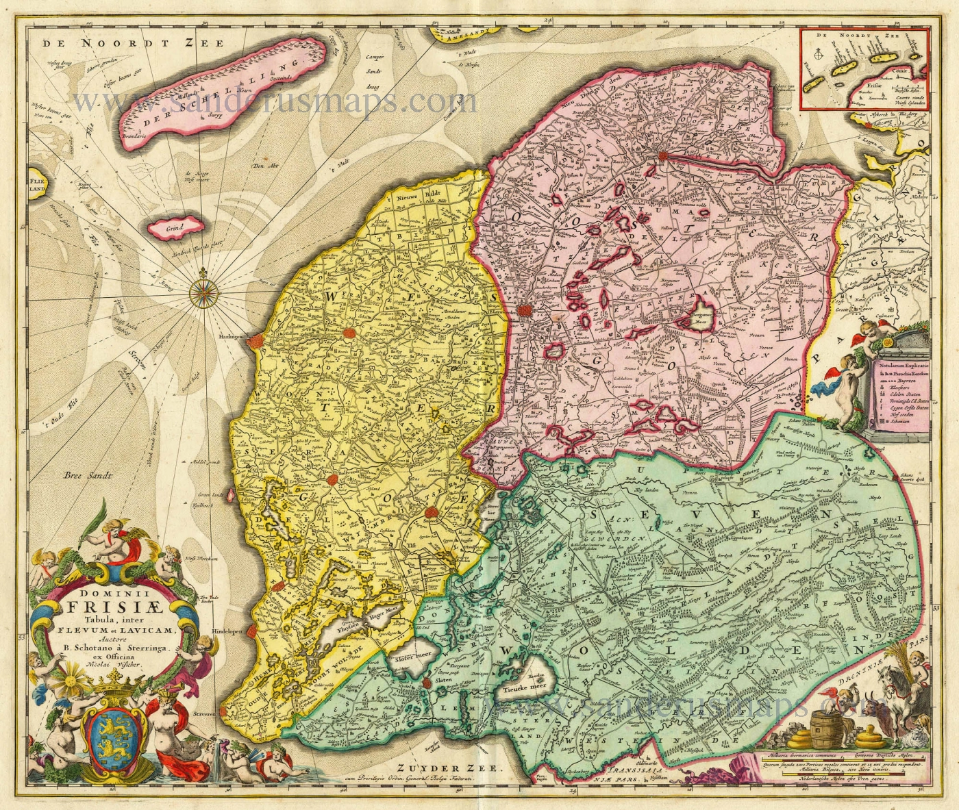
Dominii Frisiae Tabula, inter Flevum et Lavicam. c. 1678
Friesland by Nicolaas Visscher II.
[Item number: 18688]
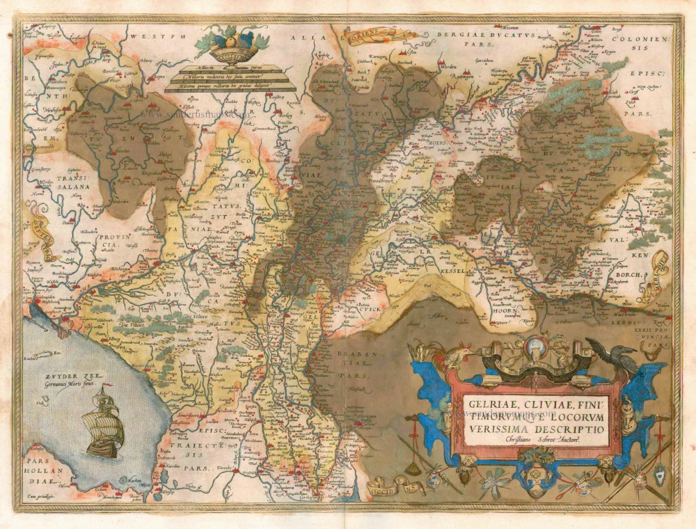
Gelriae, Cliviae, Finitimorumque Locorum Verissima Descriptio / Christiano Schrot Auctore 1579
Gelderland, by Ortelius A,
[Item number: 21729]
Hollandiae Antiquorum Catthorum Sedis Nova Descriptio. 1579
Holland by Ortelius A
[Item number: 22594]
Oost ende West Vrieslandts beschryvinghe, utriusque Frisiorum Regionis Noviss: Descriptio. 1605. 1579
Friesland by Abraham Ortelius.
[Item number: 22595]
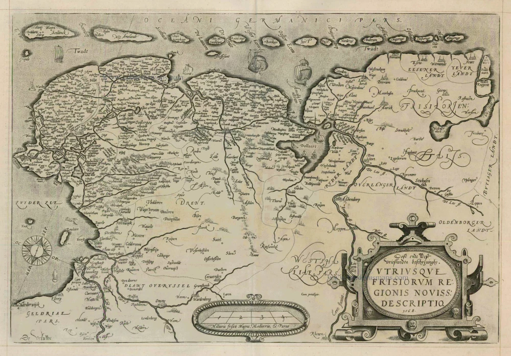
Oost ende West Vrieslandts beschryvinghe, utriusque ... 1598
Friesland, by A. Ortelius.
[Item number: 22914]
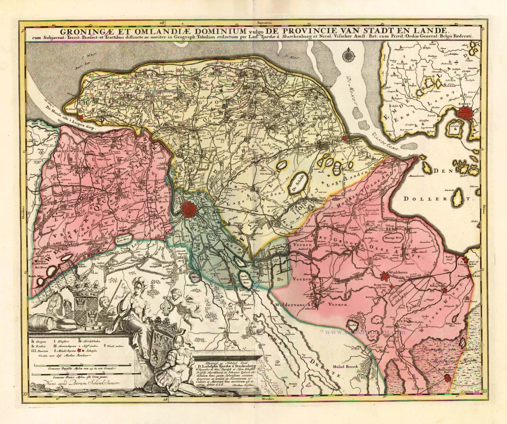
Groningae et Omlandiae Dominium vulgo de Provincie van Stadt en Lande. c. 1700
Groningen by N. Visscher II, published by Petrus Schenk.
[Item number: 25741]
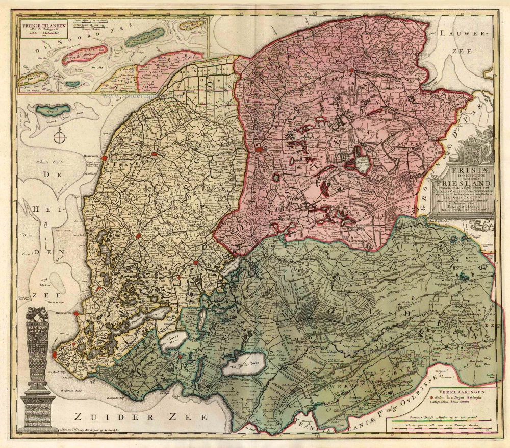
Frisiae Dominium vernacule Friesland, Ca. 1730
Friesland, by Ottens R. & I.
[Item number: 25746]
Oost ende West Vrieslandts beschryvinghe, utriusque Frisiorum Regionis Noviss: Descriptio. 1568. 1573
Friesland by Abraham Ortelius.
[Item number: 25855]
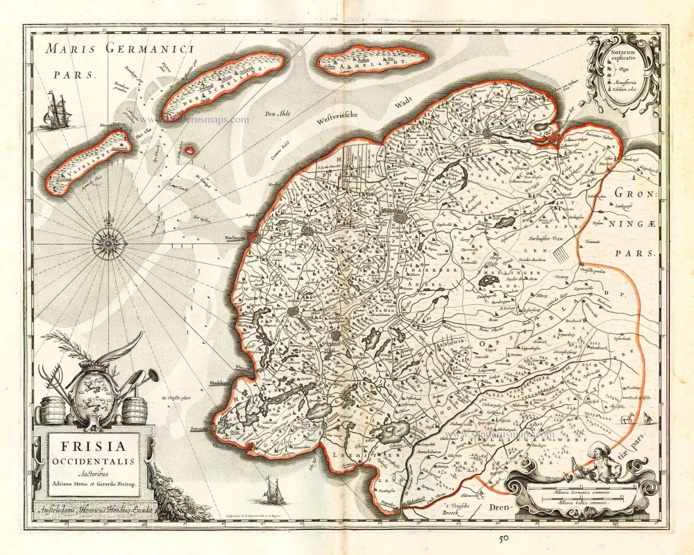
Frisia Occidentalis. 1629-30
West-Friesland, by Henricus Hondius.
[Item number: 26357]
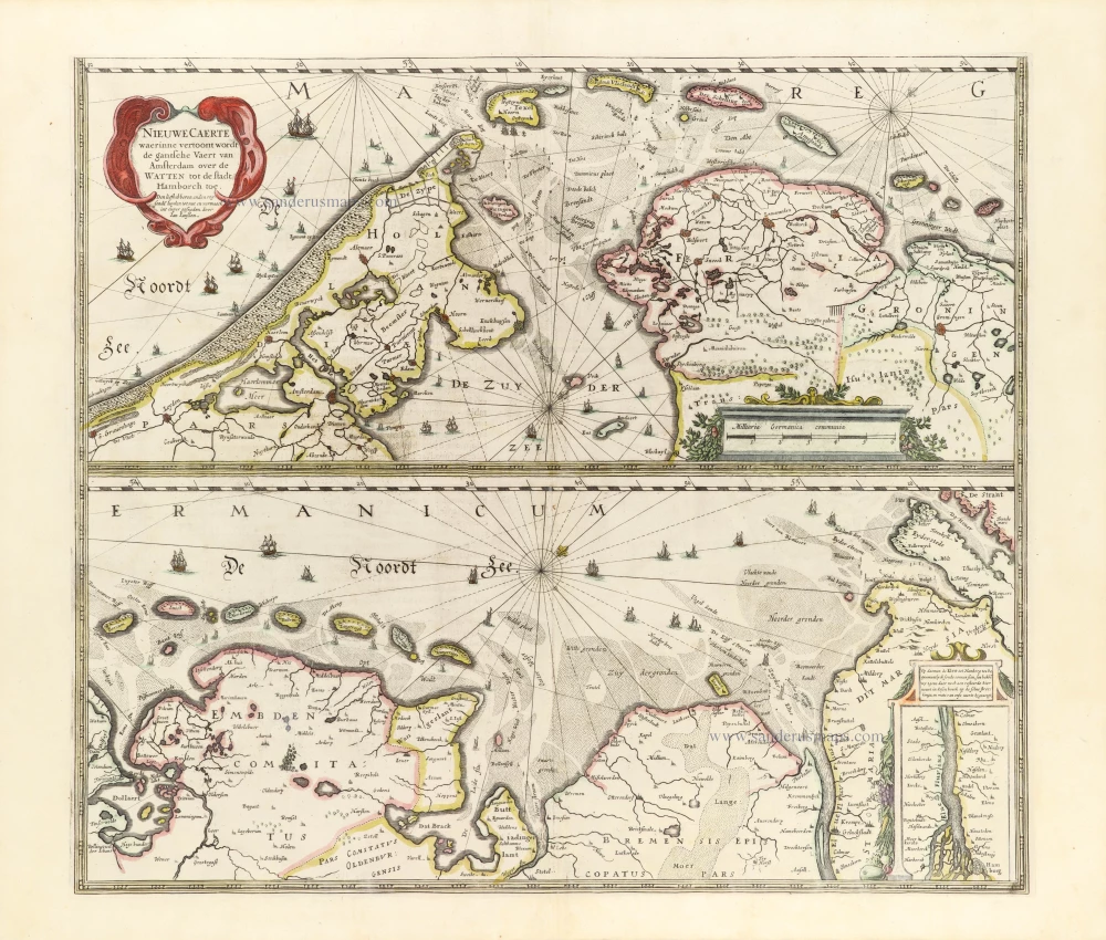
Nieuwe Caerte waerinne vertoont wordt de gantsche Vaert van Amsterdam over de Watten tot de stadt Hamborch toe. 1653
The Wadden Sea, by Henricus Hondius.
[Item number: 30375]
new