
Touraine, by Ortelius A. 1612
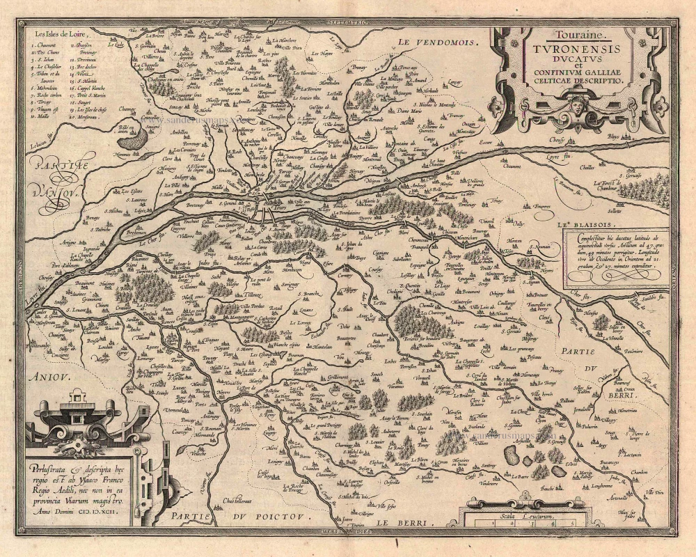
Touraine. - Turonensis Ducatus et Confinium Galliae Celticae Descriptio
Item Number: 22892 Authenticity Guarantee
Category: Antique maps > Europe > France
Antique map of Touraine by Ortelius A.
Title: Touraine. - Turonensis Ducatus et Confinium Galliae Celticae Descriptio.
Date of the first edition: 1598.
Date of this map: 1612.
Copper engraving, printed on paper.
Size (not including margins): 362 x 462mm (14.25 x 18.19 inches).
Verso: Italian text.
Condition: Uncoloured, excellent.
Condition Rating: A+.
From: Theatro del Mondo di Abrahamo Ortelio. Antwerpen, Plantin Press (J.&B. Moretus), 1612. (Van der Krogt 3, 1:652)
Related items
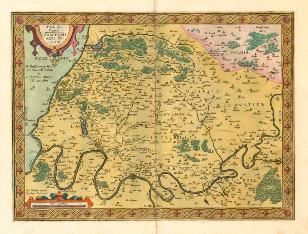
L'Isle de France. / Parisiensis Agri Descrip. 1601
Ile de France by Abraham Ortelius.
[Item number: 4055]
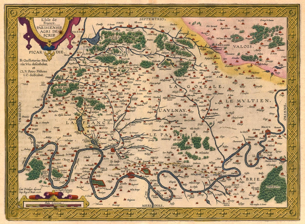
L'Isle de France. Parisiensis Agri Descrip. 1612.
Ile de France, by Ortelius A.
[Item number: 18788]
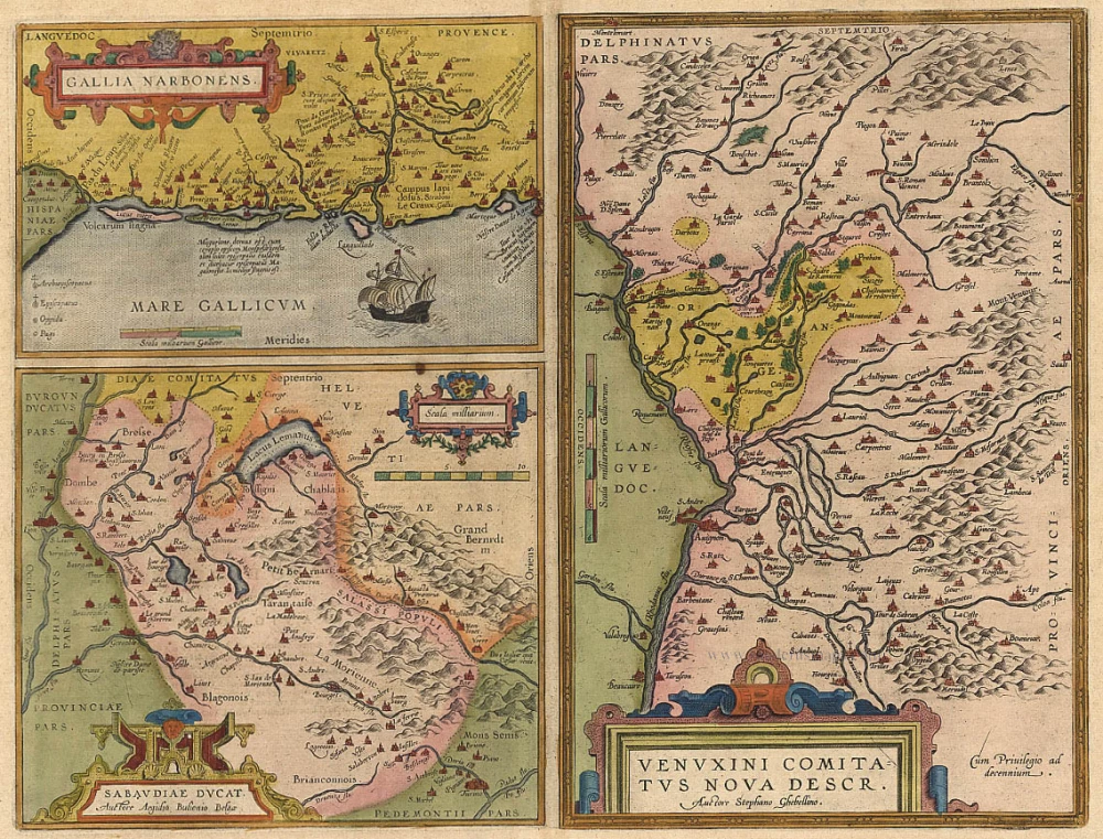
Gallia Narbonens [on sheet with] Sabaudiae Ducat. [and] Venuxini Comitatus Nova Descr. 1612.
Languedoc, Savoie, Venaissin, by Ortelius A.
[Item number: 19362]

Burgundiae Inferioris, que Ducatus Nomine Censetur Des. 1584. 1612
Bourgogne (Duché), by Ortelius A.
[Item number: 20535]
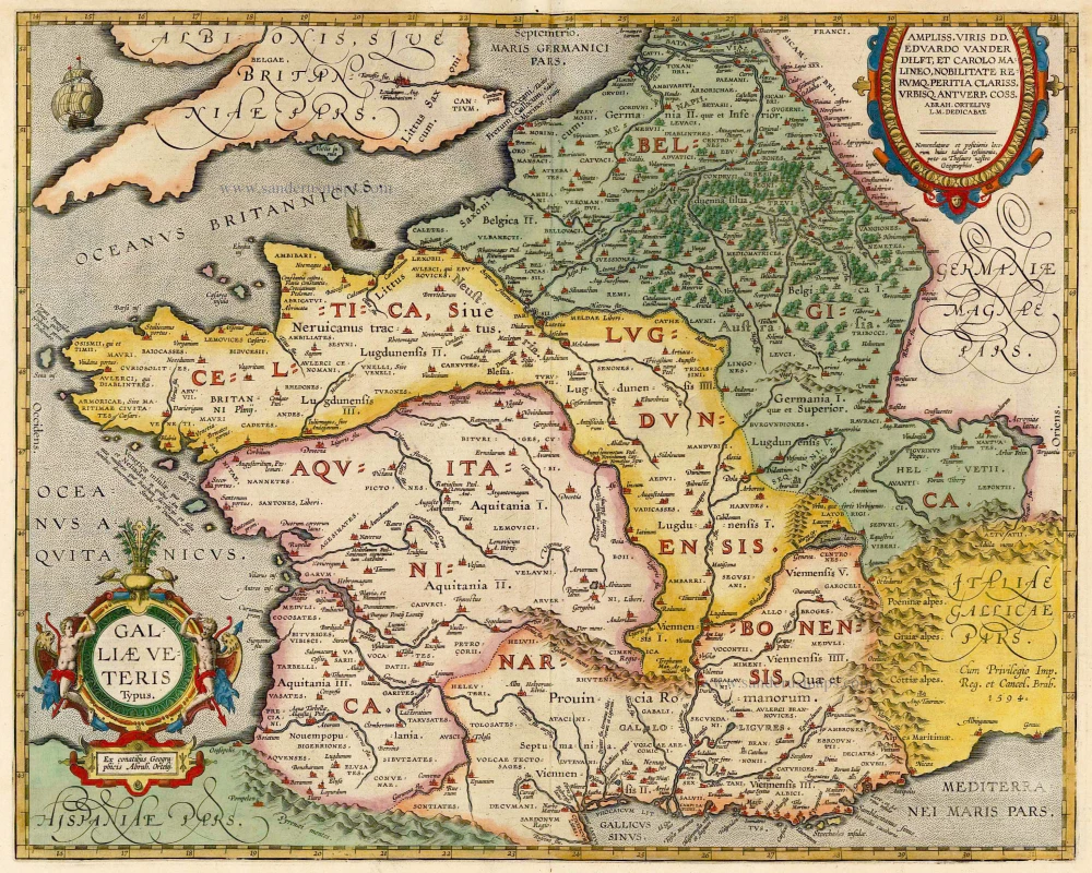
Galliae Veteris. 1601
France, by Ortelius A.
[Item number: 21253]
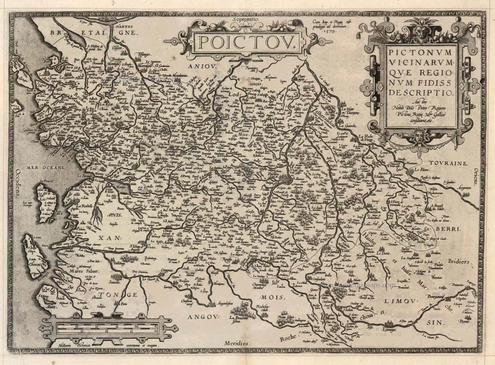
Poictou - Pictonum Vicinarum que Regionum Fidiss Descriptio 1598
Poitiers, by Ortelius A.
[Item number: 23104]