
SWITZERLAND by Abraham Ortelius 1579


Abraham Ortelius (1527-1598)
The maker of the 'first atlas', the Theatrum Orbis Terrarum (1570), was born on 4 April 1527 into an old Antwerp family. He learned Latin and studied Greek and mathematics.
Abraham and his sisters Anne and Elizabeth took up map colouring. He was admitted to the Guild of St. Luke as an "illuminator of maps." Besides colouring maps, Ortelius was a dealer in antiques, coins, maps, and books, with the book and map trade gradually becoming his primary occupation.
Business went well because his means permitted him to start an extensive collection of medals, coins, antiques, and a library of many volumes. In addition, he travelled a lot and visited Italy and France, made contacts everywhere with scholars and editors, and maintained extensive correspondence with them.
In 1564 he published his first map, a large and ambitious world wall map. The inspiration for this map may well have been Gastaldi's large world map. In 1565 he published a map of Egypt and a map of the Holy Land, a large map of Asia followed.
In 1568 the production of individual maps for his atlas Theatrum Orbis Terrarum was already in full swing. He completed the atlas in 1569, and in May of 1570, the Theatrum was available for sale. It was one of the most expensive books ever published.
This first edition contained seventy maps on fifty-three sheets. Franciscus Hogenberg engraved the maps.
Later editions included Additamenta (additions), resulting in Ortelius' historical atlas, the Parergon, mostly bound together with the atlas. The Parergon can be called a truly original work of Ortelius, who drew the maps based on his research.
The importance of the Theatrum Orbis Terrarum for geographical knowledge in the last quarter of the sixteenth century is difficult to overemphasize. Nothing was like it until Mercator's atlas appeared twenty-five years later. Demand for the Theatrum was remarkable. Some 24 editions appeared during Ortelius's lifetime and another ten after his death in 1598. Editions were published in Dutch, German, French, Spanish, English, and Italian. The number of map sheets grew from 53 in 1570 to 167 in 1612 in the last edition.
In 1577, engraver Philip Galle and poet-translator Pieter Heyns published the first pocket-sized edition of the Theatrum, the Epitome. The work was trendy. Over thirty editions of this Epitome were published in different languages.
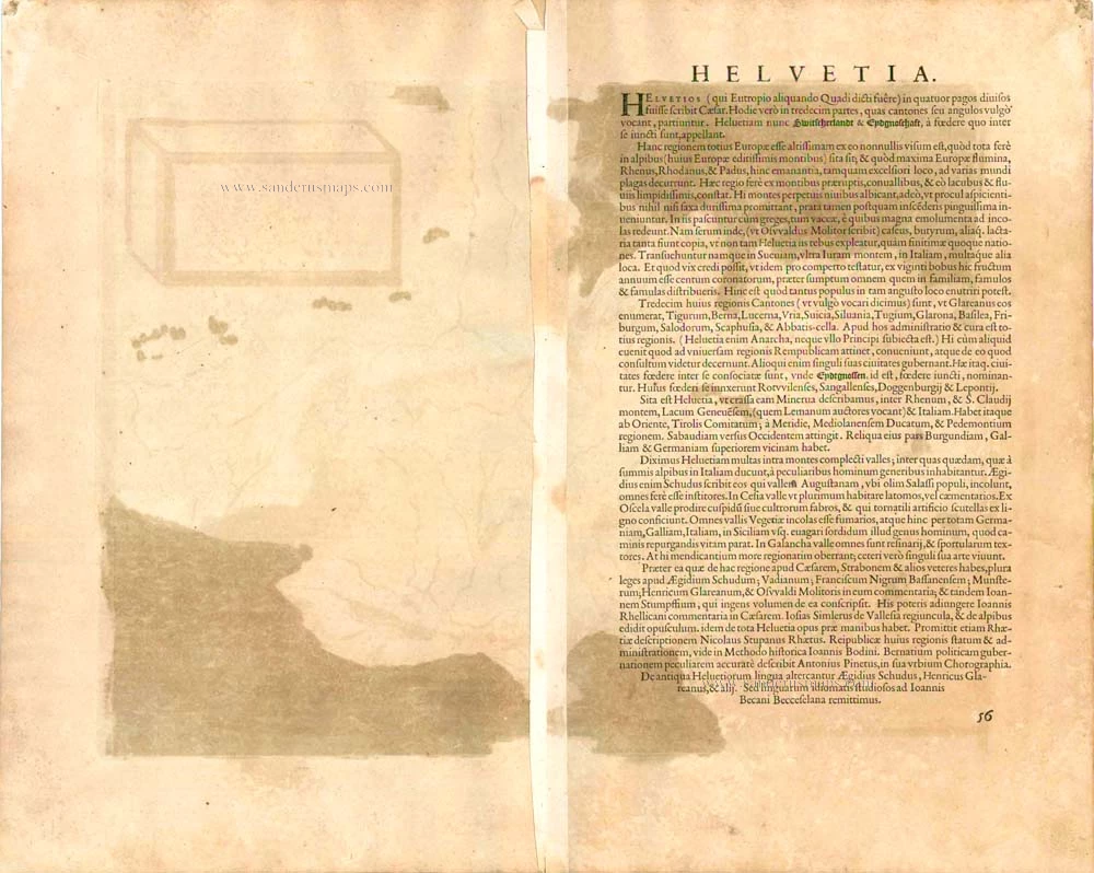
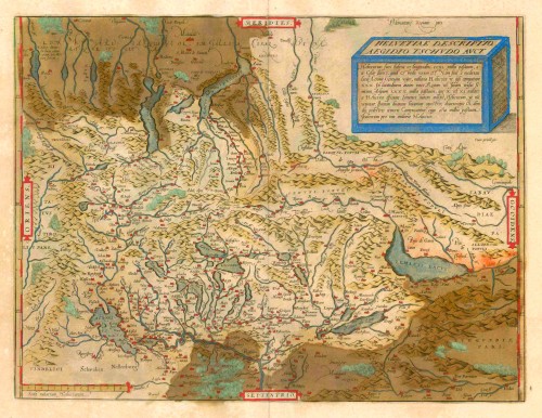
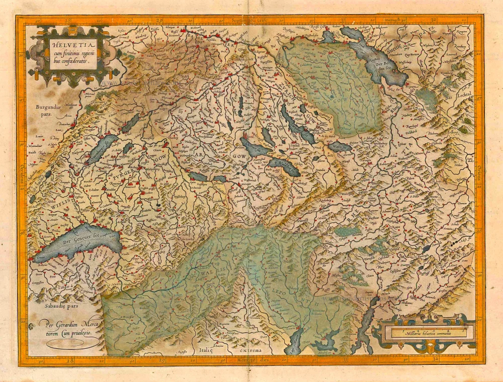
Helvetiae Descriptio Aegidio Tschudo Auct.
Item Number: 23164 Authenticity Guarantee
Category: Antique maps > Europe > Switzerland
Old, antique map of SWITZERLAND by Abraham Ortelius.
Title: Helvetiae Descriptio Aegidio Tschudo Auct.
Oriented to the south.
Cartographer: Aegidius Tschudi.
Date of the first edition: 1570.
Date of this map: 1579.
Copper engraving, printed on paper.
Size (not including margins): 345 x 445mm (13.58 x 17.52 inches).
Verso: Latin text.
Condition: Original coloured, green colour turned brown.
Condition Rating: A.
From: Theatrum Orbis Terrarum. Antwerp, Chr. Plantin, 1579. (Van der Krogt 3, 31:021A (First printing of two)) First Plantin edition.
Abraham Ortelius (1527-1598)
The maker of the 'first atlas', the Theatrum Orbis Terrarum (1570), was born on 4 April 1527 into an old Antwerp family. He learned Latin and studied Greek and mathematics.
Abraham and his sisters Anne and Elizabeth took up map colouring. He was admitted to the Guild of St. Luke as an "illuminator of maps." Besides colouring maps, Ortelius was a dealer in antiques, coins, maps, and books, with the book and map trade gradually becoming his primary occupation.
Business went well because his means permitted him to start an extensive collection of medals, coins, antiques, and a library of many volumes. In addition, he travelled a lot and visited Italy and France, made contacts everywhere with scholars and editors, and maintained extensive correspondence with them.
In 1564 he published his first map, a large and ambitious world wall map. The inspiration for this map may well have been Gastaldi's large world map. In 1565 he published a map of Egypt and a map of the Holy Land, a large map of Asia followed.
In 1568 the production of individual maps for his atlas Theatrum Orbis Terrarum was already in full swing. He completed the atlas in 1569, and in May of 1570, the Theatrum was available for sale. It was one of the most expensive books ever published.
This first edition contained seventy maps on fifty-three sheets. Franciscus Hogenberg engraved the maps.
Later editions included Additamenta (additions), resulting in Ortelius' historical atlas, the Parergon, mostly bound together with the atlas. The Parergon can be called a truly original work of Ortelius, who drew the maps based on his research.
The importance of the Theatrum Orbis Terrarum for geographical knowledge in the last quarter of the sixteenth century is difficult to overemphasize. Nothing was like it until Mercator's atlas appeared twenty-five years later. Demand for the Theatrum was remarkable. Some 24 editions appeared during Ortelius's lifetime and another ten after his death in 1598. Editions were published in Dutch, German, French, Spanish, English, and Italian. The number of map sheets grew from 53 in 1570 to 167 in 1612 in the last edition.
In 1577, engraver Philip Galle and poet-translator Pieter Heyns published the first pocket-sized edition of the Theatrum, the Epitome. The work was trendy. Over thirty editions of this Epitome were published in different languages.
Related items
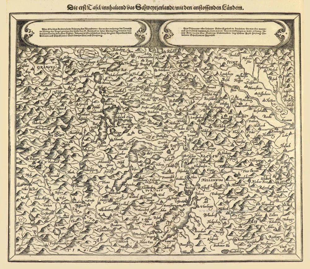
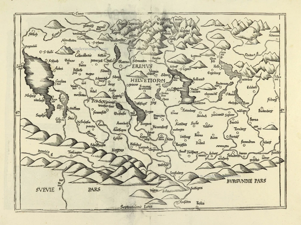
Die erst Tafel innhaltend das Schweytzerlandt mit den anstossenden Ländern. 1588
Switzerland by Sebastian Münster.
[Item number: 14631]
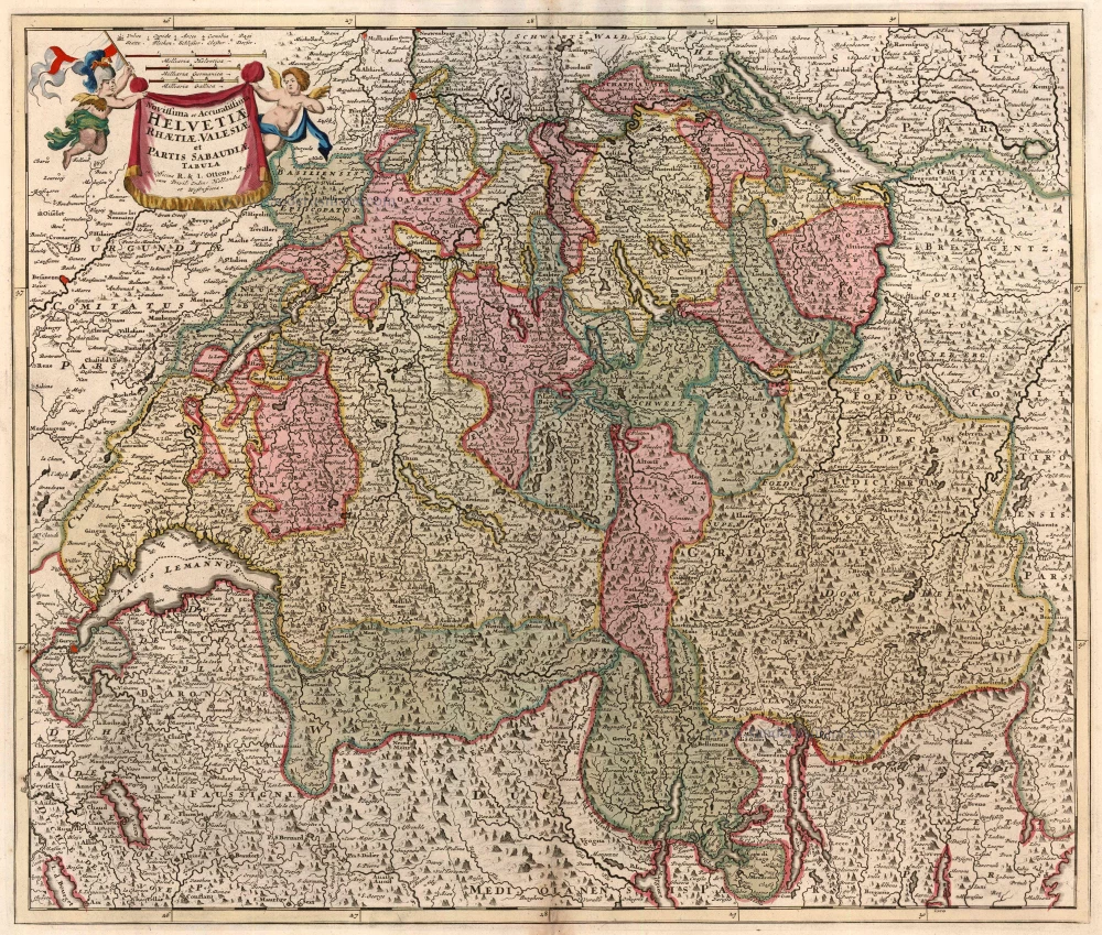
Novissima et Acuratissima Helvetiae, Rhaetiae, Valesiae et Partis Sabaudiae Tabula 1756
Antique map of Switzerland by Ottens R. & J.
[Item number: 23506]
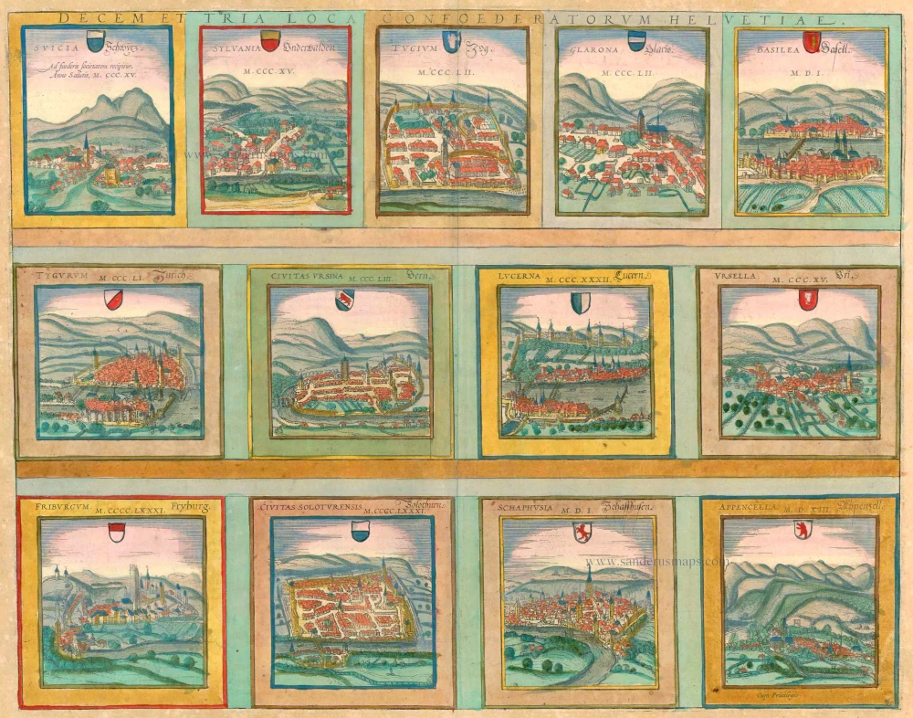
Decem et Tria Loca Confoederatorum Helvetiae. 1572-1624
13 bird's-eye views of Swiss cities by Braun and Hogenberg: Schwyz, Unterwalden, Zug, Glarus, Basel, Zurich, Bern, Lucerne, Uri, Fribourg, Solothurn, Schaffhausen and Appenzell.
[Item number: 23230]
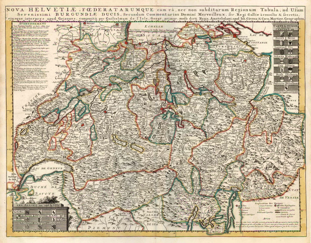
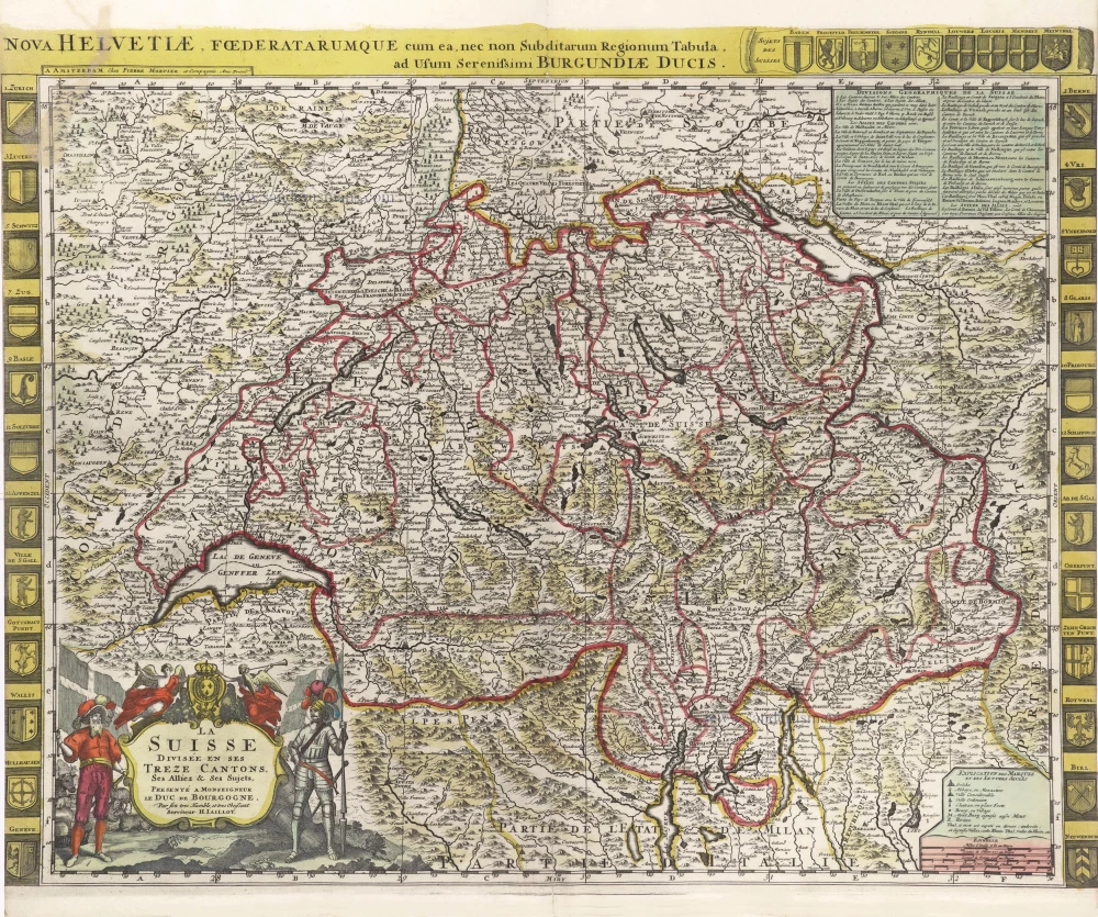
Nova Helvetiae, Foederatarumque cum ea, nec non Subditarum Regionum Tabula ... 1730
Switzerland by Guillaume Delisle, published by Covens & Mortier.
[Item number: 25699]
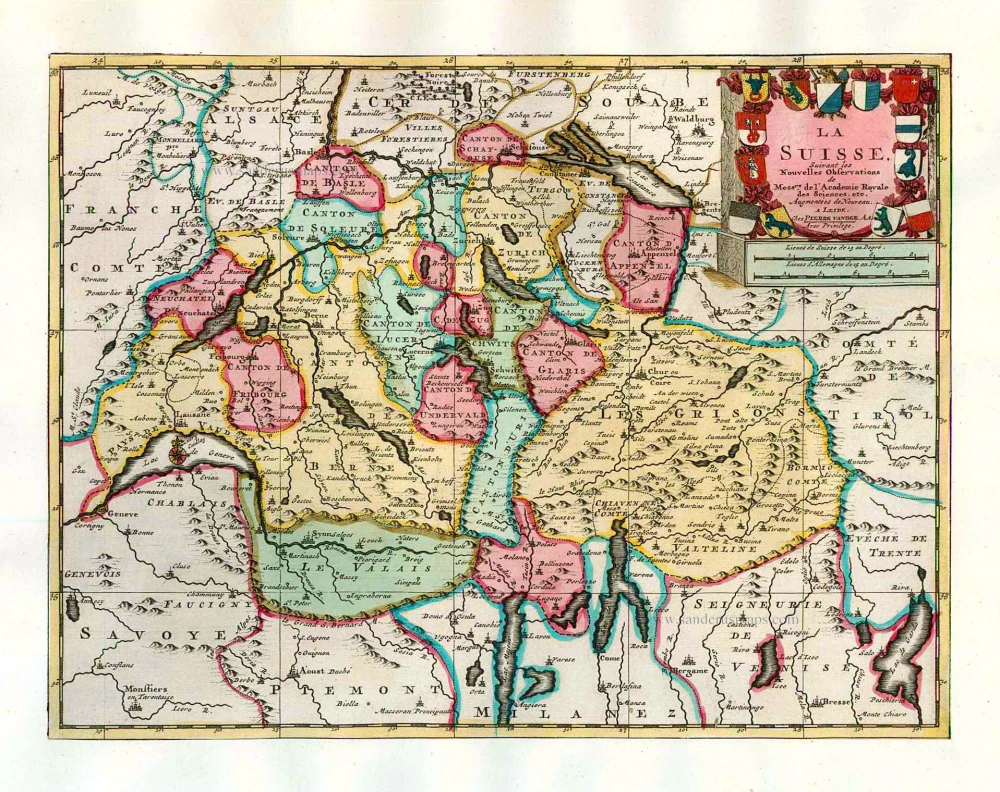
La Suisse. 1713
Switzerland, by Pieter Van der Aa.
[Item number: 26174]
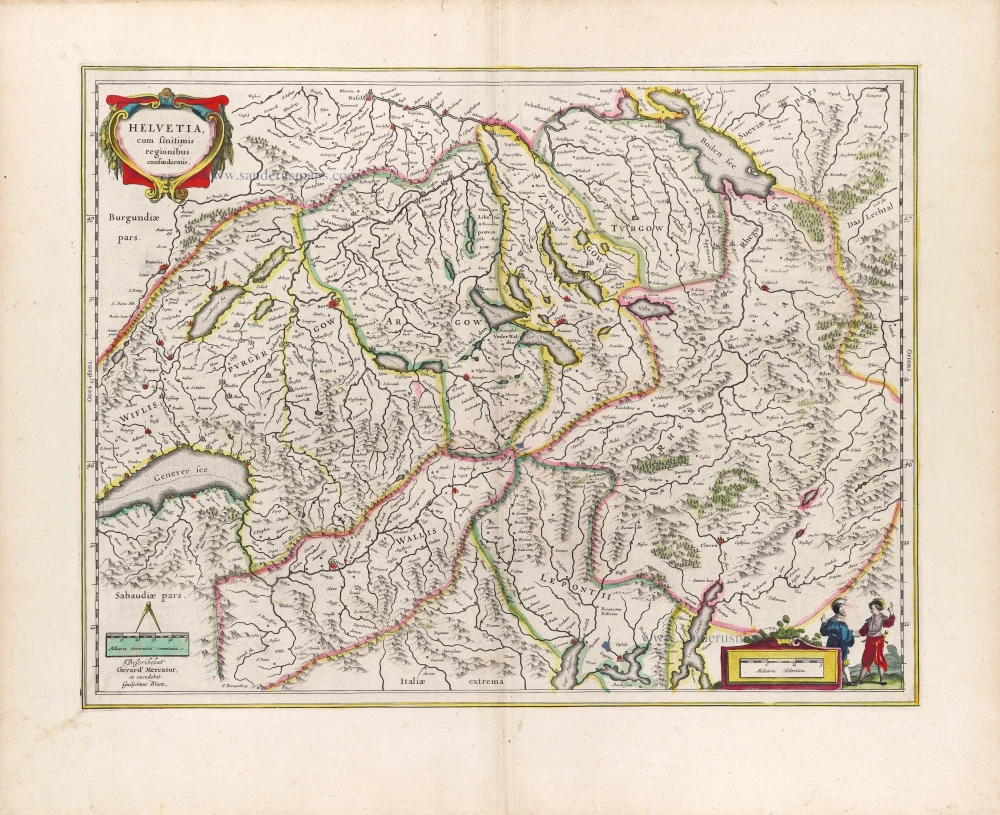
Helvetia cum finitimis regionibus confoederatis. 1641
Switzerland, by Henricus Hondius
[Item number: 26292]
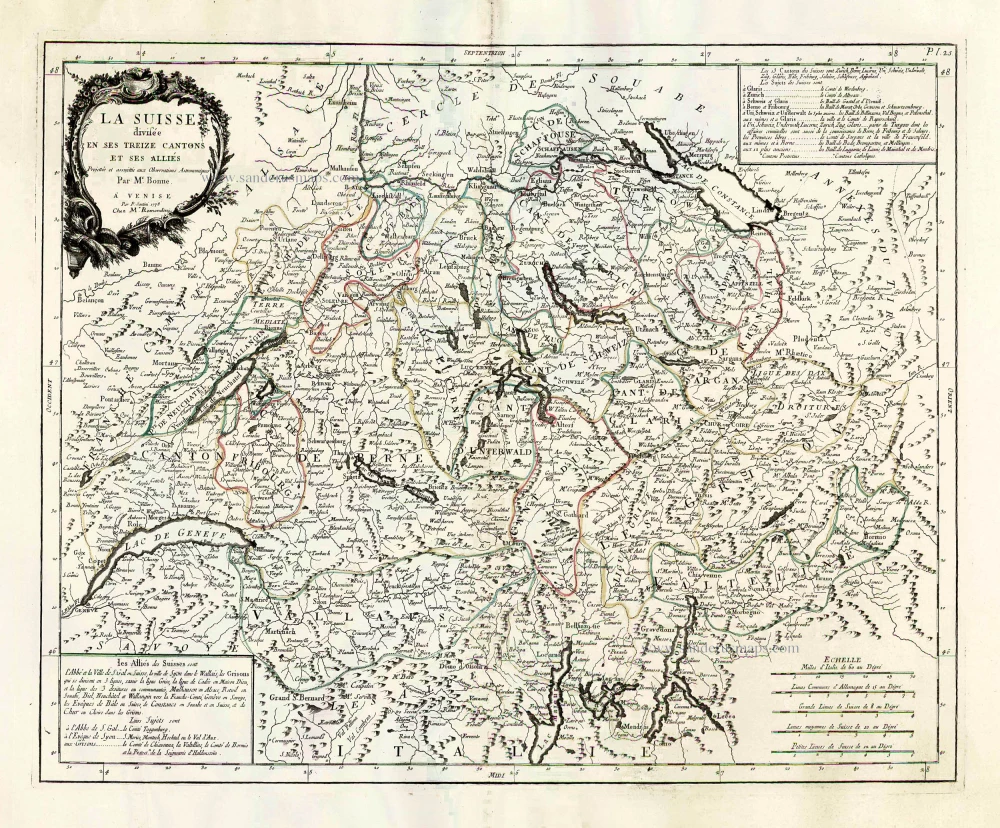
La Suisse Divisee en ses Treize Cantons et ses Allies. 1776-79
Switzerland, by Francesco Santini.
[Item number: 26957]
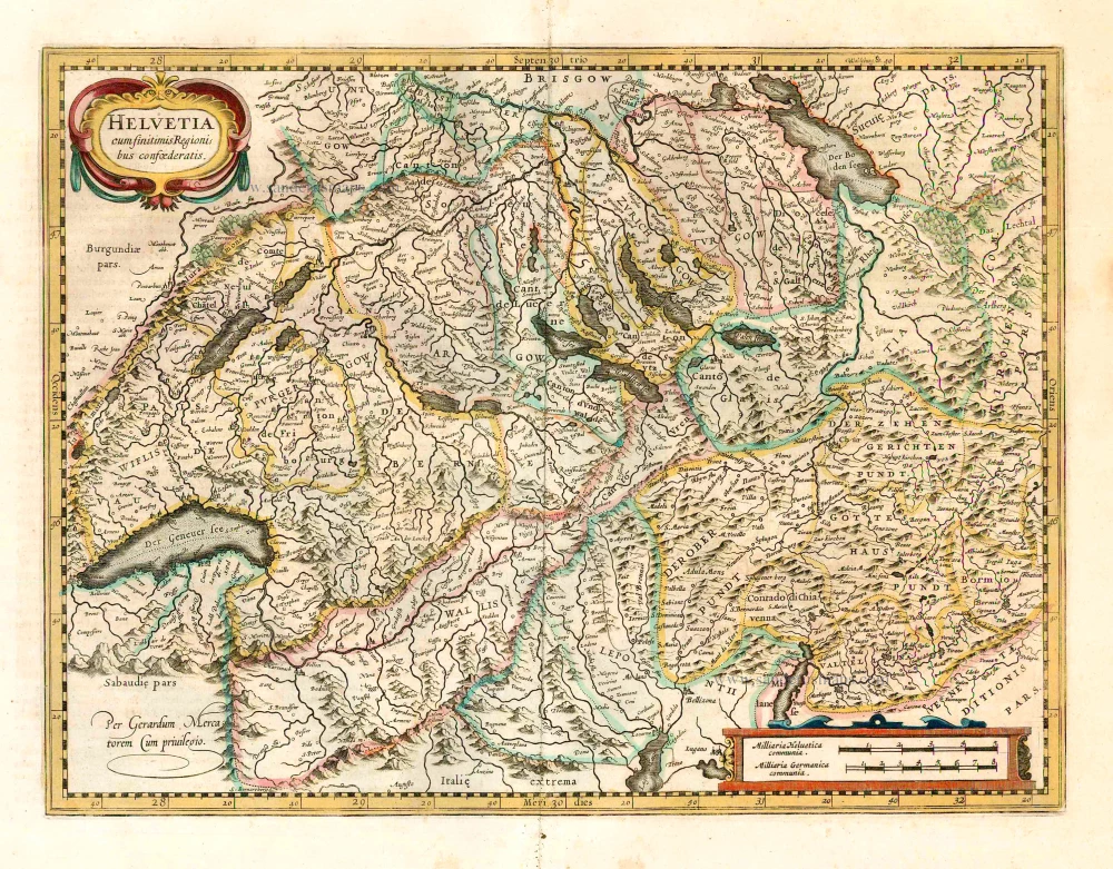
Helvetia cum finitimis regionibus confoederatis. 1623
Switzerland, by Gerard Mercator.
[Item number: 27884]
Nova Helvetiae Tabula. c. 1634
Switzerland, by Jodocus Hondius.
[Item number: 28003]
Ta . Here . Helve. [From verso] 1525
Switzerland by Lorenz Fries.
[Item number: 28199]
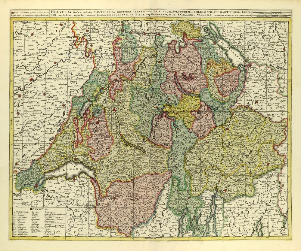
Helvetia Divisa in Tredicem Cantones sive Regiones, Bernam nempe Fruburgum, Solodurum, Basileam, Schafhusiam; Tigurum et Lucernam, cum foederatis Regionibus, numirum Comitatu Neoburgensi, urbe Biela, Resp. Genevensi Abbatia S. Galleni et Vallesia. c. 1702
Switzerland by Gerard & Leonard Valck.
[Item number: 28270]
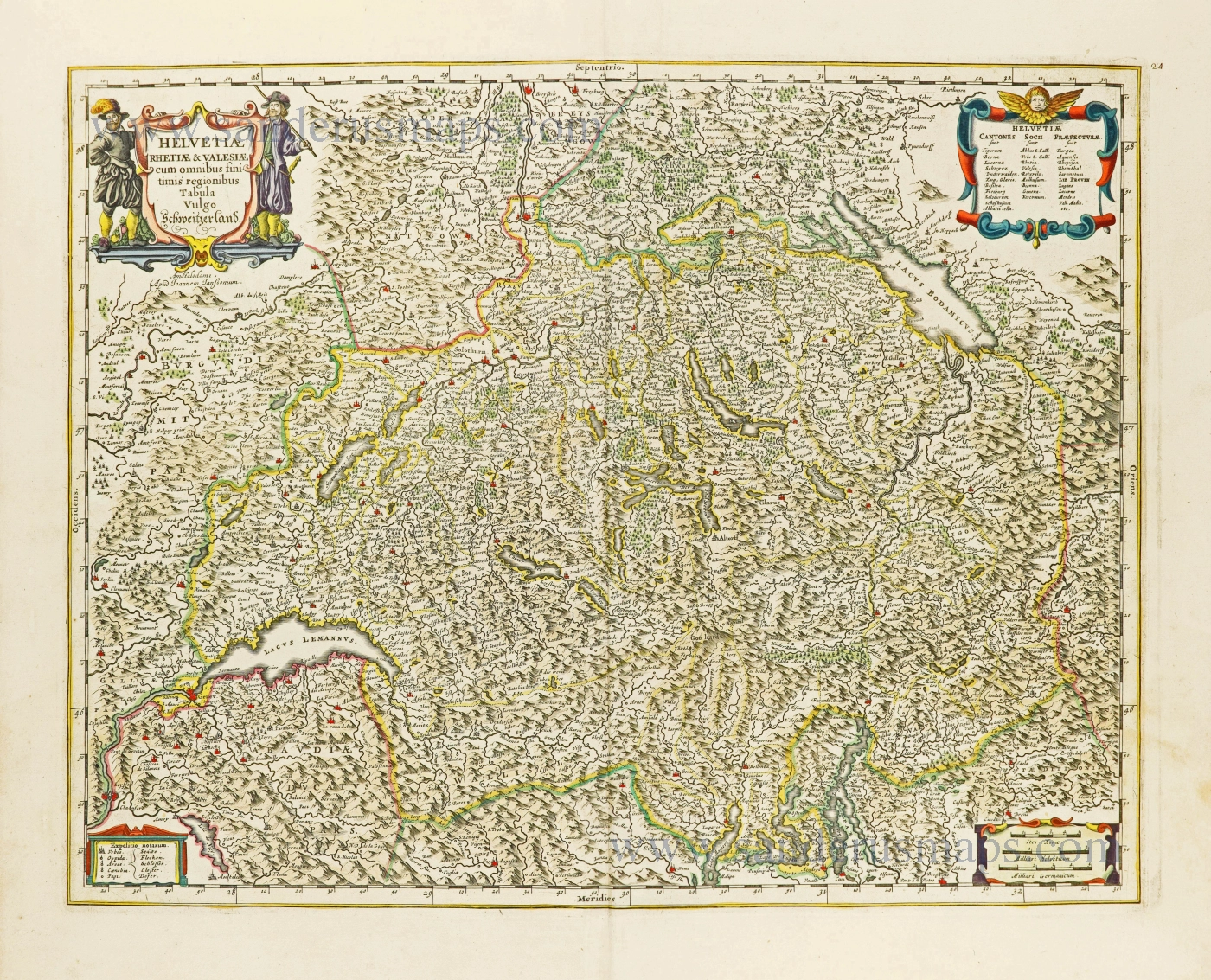
Helvetiae Rhetiae & Valesiae cum omnibus finitimis regionibus Tabula Vulgo Schweitzerland. c. 1678
Switzerland by Johannes Janssonius.
[Item number: 28538]
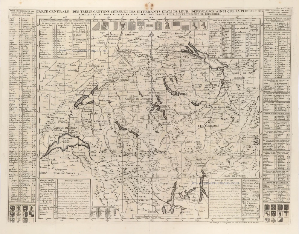
Carte Générale des treize Cantons Suisse, et des différents Etats de leur Dépendance; ainsi que la pluspart des Etats qui leur sont voisins et aliez; avec des tables pour l'intelligence de l'Histoire. 1708
Switzerlandx, by Zacharias Châtelain.
[Item number: 29444]
La Suisse divisée en ses Treze Cantons, Ses Alliez & Ses Sujets, c. 1709
Switzerland by Hubert Jaillot, published by Pierre Mortier.
[Item number: 29566]
Helvetia cum finitimis Regionibus confoederatis. 1643
Switzerland by Willem Blaeu.
[Item number: 29928]