
Egypt and the Middle East by Jaillot - Covens & Mortier. 1710
Covens & Mortier. A Map Publishing House in Amsterdam. 1721-1866.
For almost two centuries, the most significant and crucial Dutch publishing house in commercial cartography was the Amsterdam firm of Covens & Mortier. Concerning quantity, it was the biggest contemporary map-trading house worldwide. They distributed innumerable maps, atlases, globes, and books.
Pieter (Pierre) Mortier (Leiden, 1661 – Amsterdam, 1711)
Nothing is known about the youth of Pieter Mortier. He studied in Paris from 1681 to approximately 1685. He must have come into contact with French 'libraires' and learned the bookselling trade there. In 1685, he returned to Amsterdam and opened a small bookshop. He joined the Book, Art Sellers' and Printers' Guild in the same year.
Pieter sold books in Dutch and foreign languages, but he also published books on his own, usually in French. His business flourished so much that in 1688, he was forced to rent another house on the Vijgendam.
Pieter Mortier's first privilege for maps was granted by the States of Holland and West Friesland on September 15 1690. It refers to the maps of Sanson that he 'is printing and correcting with great pains and care'.
Pieter began the large-scale publication of maps and atlases. By the beginning of the 18th century, Pieter had become so wealthy that he could purchase three houses in Amsterdam: the Beurssluis, on the Vijgendam, and the Heremietensteeg. He rebuilt the house on the Vijgendam into a large, prestigious house that would serve for over a century as a shop, business, and residential structure for Covens & Mortier's publishing house.
He died on February 13, 1711, after a brief illness. The company continued under Pieter's widow's management, Amelia' s-Gravesande.
After she died in 1719, her son, Cornelis, took over the management for a few years.
On November 20, 1721, a company was founded by Cornelis Mortier and Johannes Covens I. The latter was married the same year to Cornelis's sister. From that year on, the name of :
Covens & Mortier.
Their firm would see a massive expansion in the next 140 years. In 1732, the heirs sold the property to their brother Cornelis and his partner Covens. Their main competitors were Reinier & Josua Ottens and Gerard Valck & Petrus Schenck. After the death of Johannes Covens I (1774), his son Johannes Covens II (1722-1794) entered the business. In 1778, Johannes added a new company name :
J. Covens & Son.
Johannes Covens II was succeeded by his son Cornelis Covens (1764-1825), who, in turn, brought Peter Mortier IV, the great-grandson of Petrus Mortier I, into the business. The name was from 1794 to 1866:
Mortier, Covens & Son.
The last Covens in the series was Cornelis Johannes Covens (1806-1880).
Covens & Mortier had a large stock of atlases and maps, including Delisle, Jaillot, Johannes Janssonius, Sanson, and Claes Jansz. Visscher, Nicolaas Visscher, and Frederik de Wit. For decades, an impressive number of atlases came from the press.
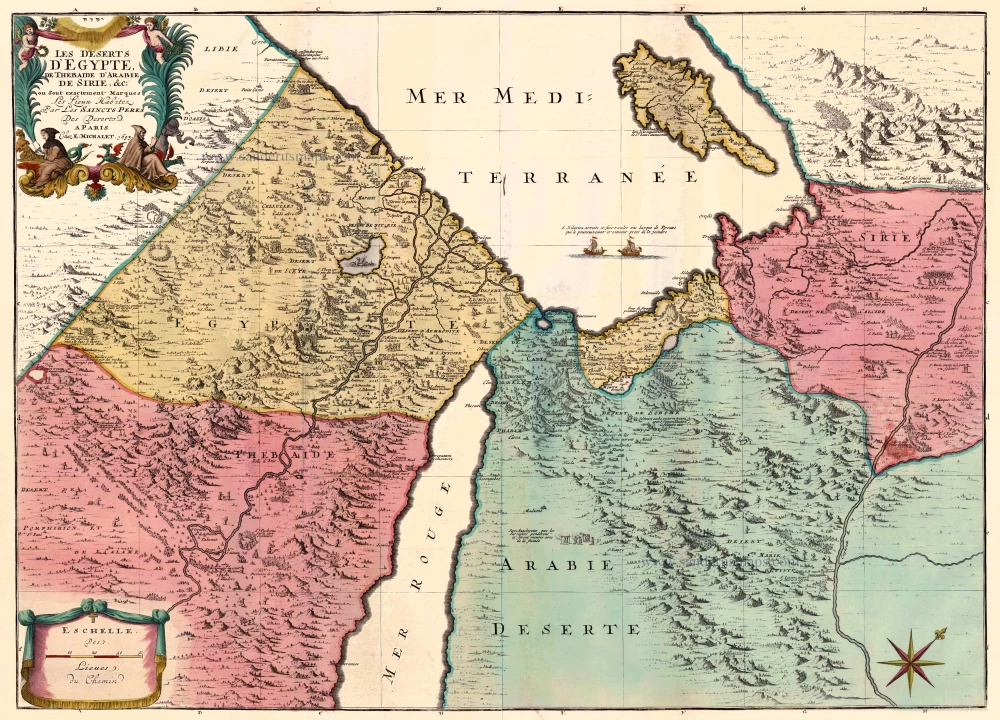
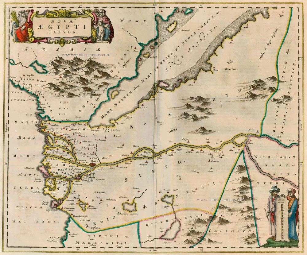
Les Deserts d'Egypte, de Thebaide d'Arabie, de Sirie, &c., ou sont Exactement Marques les Lieux Habitez par les Saincts Peres des Deserts
Item Number: 23617 Authenticity Guarantee
Category: Antique maps > Asia > Middle East
Antique map of Egypt and the Middle East by Jaillot - Covens & Mortier.
Title: Les Deserts d'Egypte, de Thebaide d'Arabie, de Sirie, &c., ou sont Exactement Marques les Lieux Habitez par les Saincts Peres des Deserts
Cartographer: E. Michalet.
Date: 1710.
Copper engraving, printed on paper.
Size (not including margins): 570 x 780mm (22.44 x 30.71 inches).
Verso: Blank.
Condition: Old body colour, on heavy paper, excellent.
Condition Rating: A.
From: Jaillot A.H. Atlas Nouveau, contenant toutes les parties du monde, ... Amsterdam, Covens & Mortier, 1710.
Covens & Mortier. A Map Publishing House in Amsterdam. 1721-1866.
For almost two centuries, the most significant and crucial Dutch publishing house in commercial cartography was the Amsterdam firm of Covens & Mortier. Concerning quantity, it was the biggest contemporary map-trading house worldwide. They distributed innumerable maps, atlases, globes, and books.
Pieter (Pierre) Mortier (Leiden, 1661 – Amsterdam, 1711)
Nothing is known about the youth of Pieter Mortier. He studied in Paris from 1681 to approximately 1685. He must have come into contact with French 'libraires' and learned the bookselling trade there. In 1685, he returned to Amsterdam and opened a small bookshop. He joined the Book, Art Sellers' and Printers' Guild in the same year.
Pieter sold books in Dutch and foreign languages, but he also published books on his own, usually in French. His business flourished so much that in 1688, he was forced to rent another house on the Vijgendam.
Pieter Mortier's first privilege for maps was granted by the States of Holland and West Friesland on September 15 1690. It refers to the maps of Sanson that he 'is printing and correcting with great pains and care'.
Pieter began the large-scale publication of maps and atlases. By the beginning of the 18th century, Pieter had become so wealthy that he could purchase three houses in Amsterdam: the Beurssluis, on the Vijgendam, and the Heremietensteeg. He rebuilt the house on the Vijgendam into a large, prestigious house that would serve for over a century as a shop, business, and residential structure for Covens & Mortier's publishing house.
He died on February 13, 1711, after a brief illness. The company continued under Pieter's widow's management, Amelia' s-Gravesande.
After she died in 1719, her son, Cornelis, took over the management for a few years.
On November 20, 1721, a company was founded by Cornelis Mortier and Johannes Covens I. The latter was married the same year to Cornelis's sister. From that year on, the name of :
Covens & Mortier.
Their firm would see a massive expansion in the next 140 years. In 1732, the heirs sold the property to their brother Cornelis and his partner Covens. Their main competitors were Reinier & Josua Ottens and Gerard Valck & Petrus Schenck. After the death of Johannes Covens I (1774), his son Johannes Covens II (1722-1794) entered the business. In 1778, Johannes added a new company name :
J. Covens & Son.
Johannes Covens II was succeeded by his son Cornelis Covens (1764-1825), who, in turn, brought Peter Mortier IV, the great-grandson of Petrus Mortier I, into the business. The name was from 1794 to 1866:
Mortier, Covens & Son.
The last Covens in the series was Cornelis Johannes Covens (1806-1880).
Covens & Mortier had a large stock of atlases and maps, including Delisle, Jaillot, Johannes Janssonius, Sanson, and Claes Jansz. Visscher, Nicolaas Visscher, and Frederik de Wit. For decades, an impressive number of atlases came from the press.
Related items
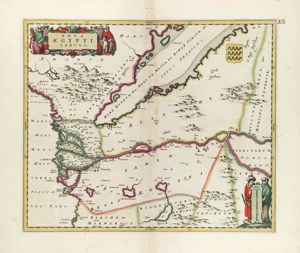
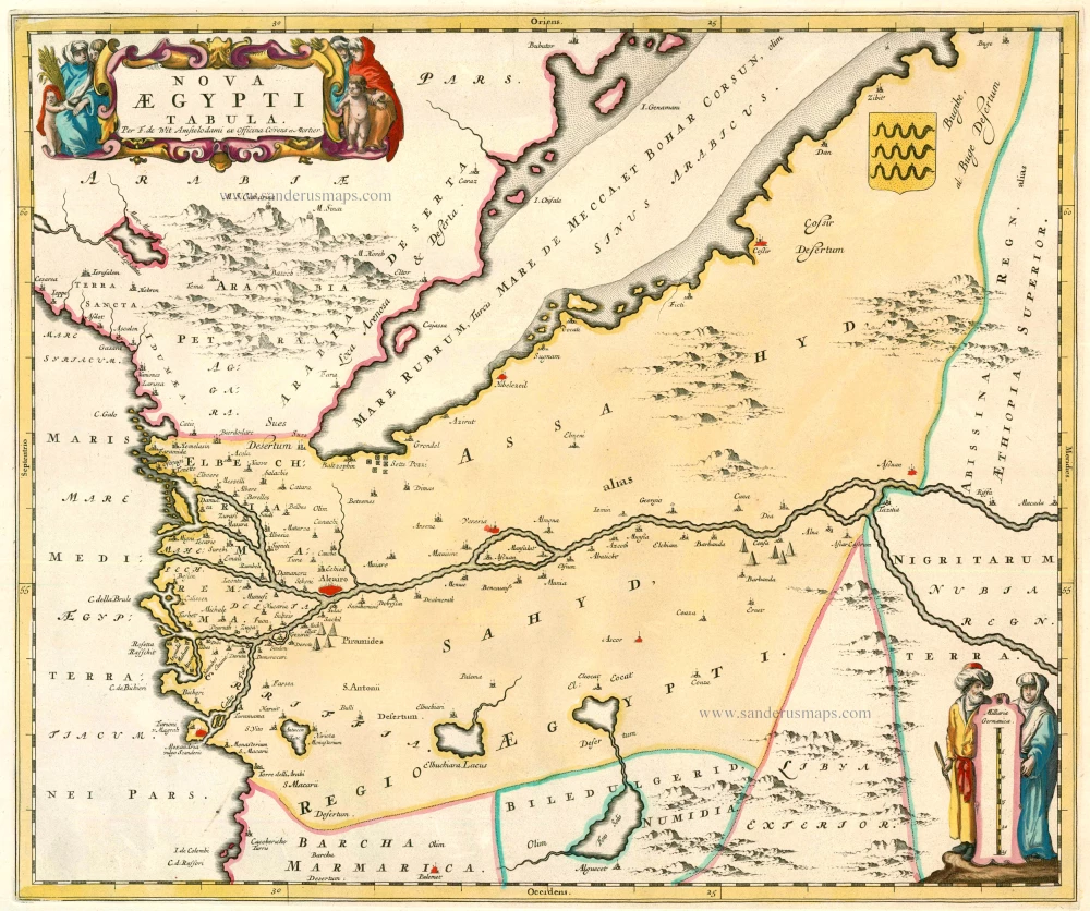
Nova Aegypti Tabula. c. 1680
Egypt, by Joan Blaeu, published by Frederick de Wit.
[Item number: 10610]
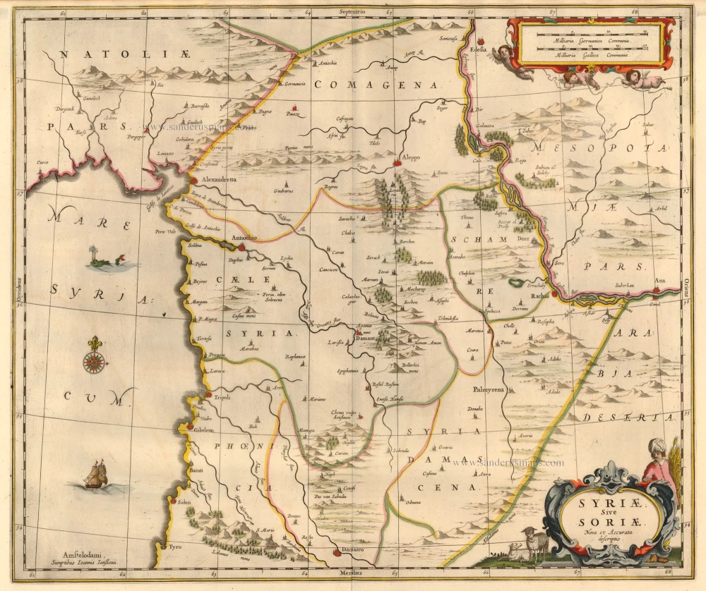
Syriae Sive Soriae. Nova et Accurata descriptio. c. 1658
Syria, by Janssonius J.
[Item number: 19520]
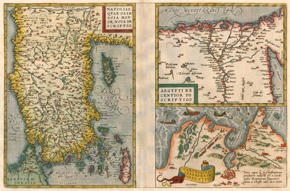
Natoliae quae olim Asia Minor [on sheet with] Argypti Recentioe Descriptio [and] Carthaginis Celeberrimi Sinus Typus 1612
Turkey - Egypt - Cartago by Ortelius A.
[Item number: 22800]
Nova Aegypti Tabula 1662
Egypt, by Joan Blaeu.
[Item number: 22818]
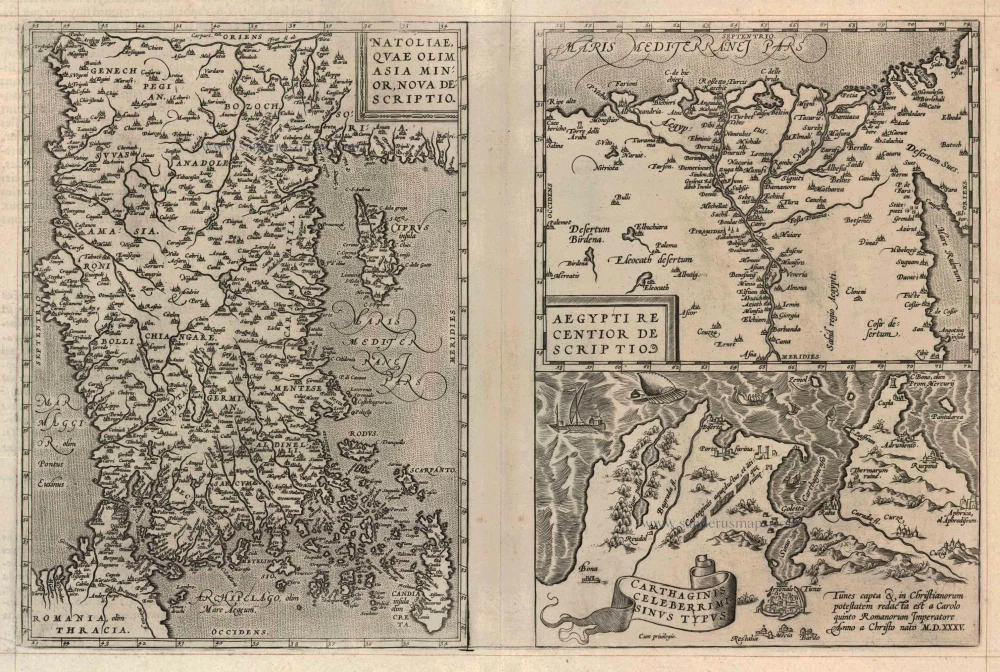
Natoliae quae olim Asia Minor [on sheet with] Argypti Recentioe Descriptio [and] Carthaginis Celeberrimi Sinus Typus 1598
Turkey - Egypt - Cartago, by A. Ortelius.
[Item number: 22865]
Nova Aegypti Tabula 1721-41
Egypt, by F. De Wit after Blaeu.
[Item number: 23616]
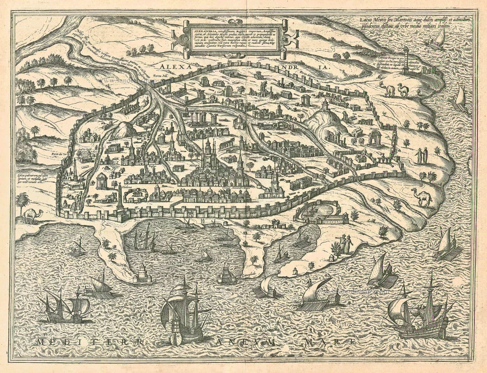
Alexandria, Vetustissimum Aegypti Emporium, Amplissima Civitas .Penon de Veles. 1597
Egypt - Alexandria by Georg Braun & Frans Hogenberg
[Item number: 24010]
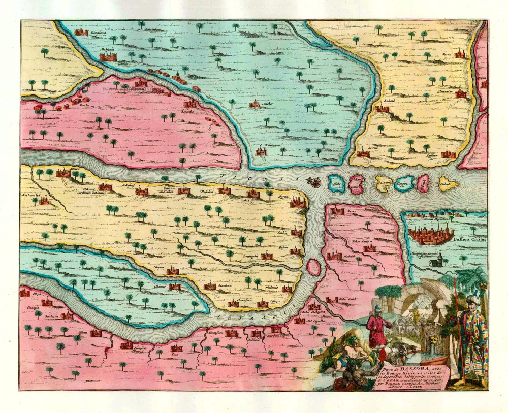
Pays de Bassora, avec les Bourgs, Rivieres et Iles de sa dependence, habité par les Chrétiens de S. Jean. 1713
Basra (Iraq), by Pieter van der Aa.
[Item number: 26109]
Tabula .IIII. Asiae. 1525
Middle East, by Lorenz Fries.
[Item number: 27995]
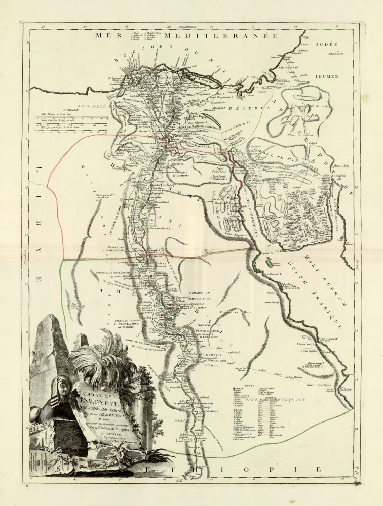
Carte de L'Egypte Ancienne et Moderne. 1776-79
Egypt, by Francesco Santini.
[Item number: 28099]
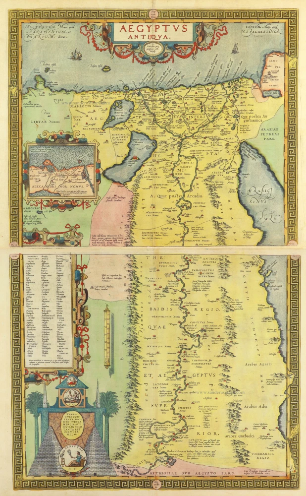
Aegyptus Antiqua. 1584
Egypt (Ancient) by Ortelius A.
[Item number: 29238]
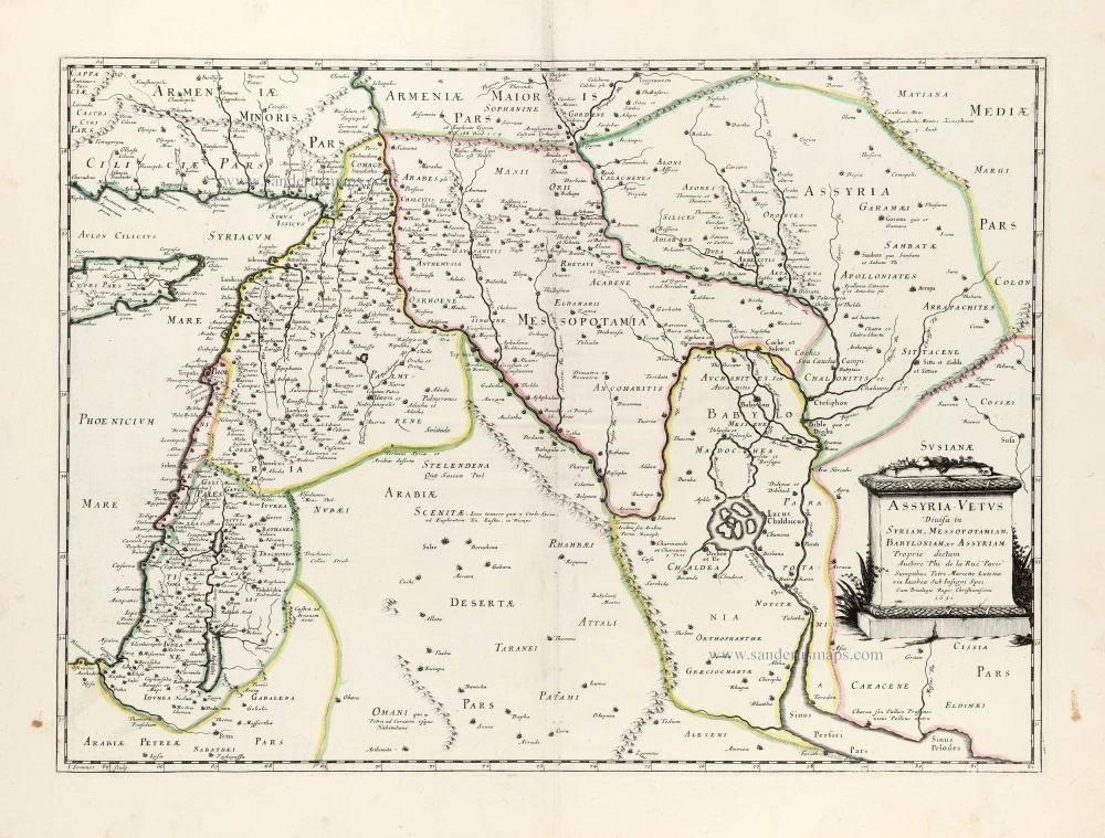
Assyria Vetus Divisa in Syriam, Messopotamiam, Babtloniam, et Assyriam. 1665
Historical map of the Middle East by Philippe De la Rue published for Pierre Mariette by Nicolas Sanson.
[Item number: 30015]
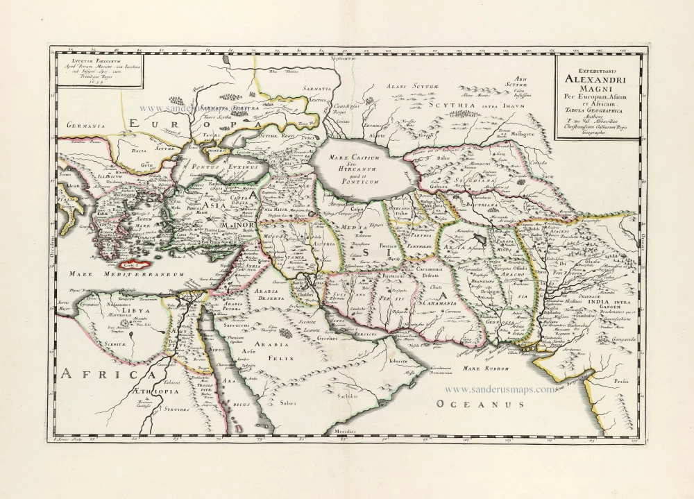
Expeditionis Alexandri Magni Per Europam, Asiam et Africam. Tabula Geograpica. 1655
Alexander's Expeditions by Pierre Duval.
[Item number: 30016]
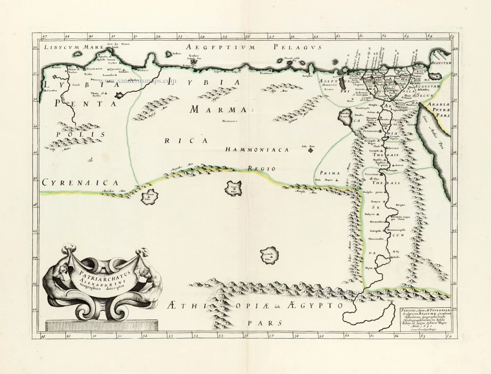
Patriarchatus Alexandrini Geographica descriptio. 1640
Egypt - Libya J.B. Tavernier.
[Item number: 30047]