
Denmark, by Covens & Mortier. 1721-41
The item displayed on this page has been sold. However, we have a similar map in stock:
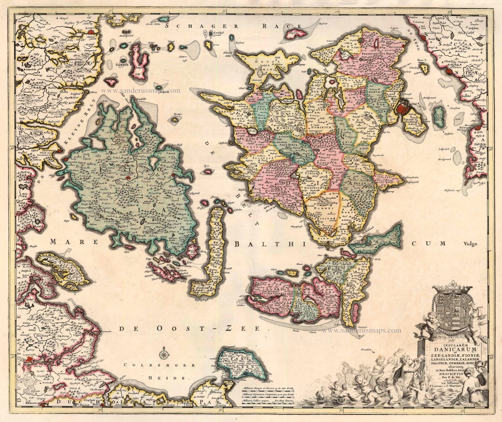
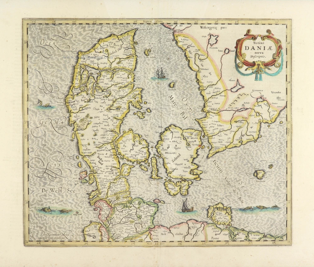
Danish Islands by de Wit F. c. 1682-86
Insularum Danicarum ut Zee-Landiae, Fioniae, ...
[Item number: 24504]

Frederick de Wit (1630-1706)
The engraver and map-seller, Frederick de Wit, was born in Gouda (Netherlands) in 1630 as a son of Hendrick Fredericksz de Wit. Through his marriage with Maria van der Waag of Amsterdam in 1661, he obtained citizenship of the city where he had been working since 1648 and where he became one of the most famous engravers of maps of the second half of the 17th century. Although De Wit was a Catholic, which meant that he was not favoured at the time by the city council, he was awarded the honour of being listed as one of the "excellent citizens" on the roll of the city council in the years 1694-1704. However, his name was not written in the Guild of St. Luke book before 1664. At that time, he lived on the Kalverstraat "in de Witte Pascaert", where he stayed until his death in 1706. His earliest dates on maps engraved are 1659 (Regni Daniae) and 1660 (World map).
Frederick de Wit published several world atlases, a sea atlas, and an atlas of the Netherlands.
The dating of the maps is difficult. However, as a privilege was granted in 1689, the annotation 'cum privilegio' marks an edition after 1688.
Around 1700, Frederick de Wit entered the market with a town atlas. He produced two volumes with a total of 260 plans and views. Most were printed from plates used for Janssonius and Blaeu town atlases.
After he died in 1706, his widow continued the shop until 1709. The plates and stock of De Wit's atlas were sold to Covens & Mortier in 1710, who sold the atlas for an extended period.
Covens & Mortier. A Map Publishing House in Amsterdam. 1721-1866.
For almost two centuries, the most significant and crucial Dutch publishing house in commercial cartography was the Amsterdam firm of Covens & Mortier. Concerning quantity, it was the biggest contemporary map-trading house worldwide. They distributed innumerable maps, atlases, globes, and books.
Pieter (Pierre) Mortier (Leiden, 1661 – Amsterdam, 1711)
Nothing is known about the youth of Pieter Mortier. He studied in Paris from 1681 to approximately 1685. He must have come into contact with French 'libraires' and learned the bookselling trade there. In 1685, he returned to Amsterdam and opened a small bookshop. He joined the Book, Art Sellers' and Printers' Guild in the same year.
Pieter sold books in Dutch and foreign languages, but he also published books on his own, usually in French. His business flourished so much that in 1688, he was forced to rent another house on the Vijgendam.
Pieter Mortier's first privilege for maps was granted by the States of Holland and West Friesland on September 15 1690. It refers to the maps of Sanson that he 'is printing and correcting with great pains and care'.
Pieter began the large-scale publication of maps and atlases. By the beginning of the 18th century, Pieter had become so wealthy that he could purchase three houses in Amsterdam: the Beurssluis, on the Vijgendam, and the Heremietensteeg. He rebuilt the house on the Vijgendam into a large, prestigious house that would serve for over a century as a shop, business, and residential structure for Covens & Mortier's publishing house.
He died on February 13, 1711, after a brief illness. The company continued under Pieter's widow's management, Amelia' s-Gravesande.
After she died in 1719, her son, Cornelis, took over the management for a few years.
On November 20, 1721, a company was founded by Cornelis Mortier and Johannes Covens I. The latter was married the same year to Cornelis's sister. From that year on, the name of :
Covens & Mortier.
Their firm would see a massive expansion in the next 140 years. In 1732, the heirs sold the property to their brother Cornelis and his partner Covens. Their main competitors were Reinier & Josua Ottens and Gerard Valck & Petrus Schenck. After the death of Johannes Covens I (1774), his son Johannes Covens II (1722-1794) entered the business. In 1778, Johannes added a new company name :
J. Covens & Son.
Johannes Covens II was succeeded by his son Cornelis Covens (1764-1825), who, in turn, brought Peter Mortier IV, the great-grandson of Petrus Mortier I, into the business. The name was from 1794 to 1866:
Mortier, Covens & Son.
The last Covens in the series was Cornelis Johannes Covens (1806-1880).
Covens & Mortier had a large stock of atlases and maps, including Delisle, Jaillot, Johannes Janssonius, Sanson, and Claes Jansz. Visscher, Nicolaas Visscher, and Frederik de Wit. For decades, an impressive number of atlases came from the press.
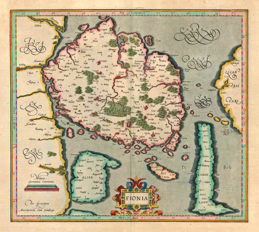
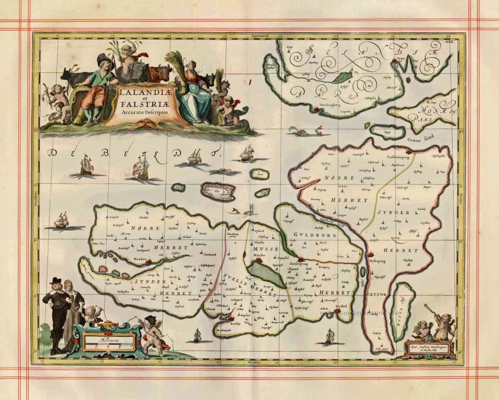
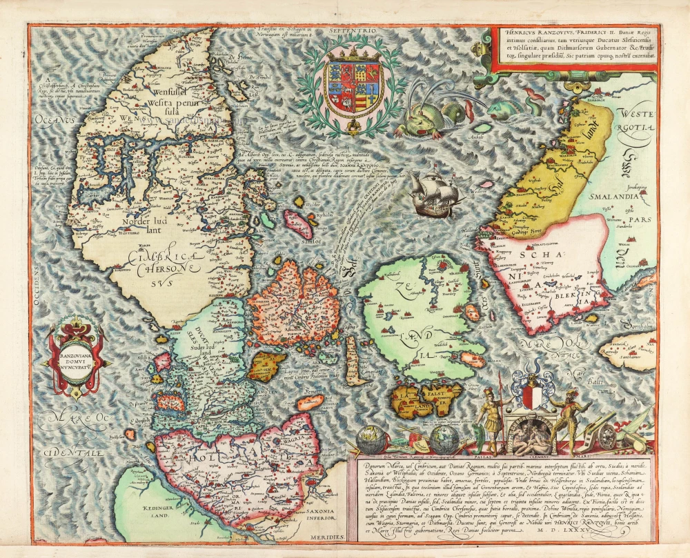
Insularum Danicarum ut Zee-Landiae, Fioniae, Langelandiae, Lalandiae, Falstriae, Fembriae, Mona aliarumq in Mari Balthico Sitar Descriptio
Item Number: 23740 Authenticity Guarantee
Category: Antique maps > Europe > Northern Europe
Denmark, by Frederick de Wit, published by Covens & Mortier.
Title: Insularum Danicarum ut Zee-Landiae, Fioniae, Langelandiae, Lalandiae, Falstriae, Fembriae, Mona aliarumq in Mari Balthico Sitar Descriptio
Cartographer: F. de Wit.
Date of the first edition: c. 1682-86.
Date of this map: 1721-41.
Copper engraving, printed on paper.
Image size: 490 x 580mm (19.29 x 22.83 inches).
Sheet size: 565 x 650mm (22.24 x 25.59 inches).
Verso: Blank.
Condition: Old body colour, on heavy paper, no centrefold (from a plano bound atlas), excellent.
Condition Rating: A+.
From: Composite Atlas. Amsterdam, Covens & Mortier, 1721-41.
Frederick de Wit (1630-1706)
The engraver and map-seller, Frederick de Wit, was born in Gouda (Netherlands) in 1630 as a son of Hendrick Fredericksz de Wit. Through his marriage with Maria van der Waag of Amsterdam in 1661, he obtained citizenship of the city where he had been working since 1648 and where he became one of the most famous engravers of maps of the second half of the 17th century. Although De Wit was a Catholic, which meant that he was not favoured at the time by the city council, he was awarded the honour of being listed as one of the "excellent citizens" on the roll of the city council in the years 1694-1704. However, his name was not written in the Guild of St. Luke book before 1664. At that time, he lived on the Kalverstraat "in de Witte Pascaert", where he stayed until his death in 1706. His earliest dates on maps engraved are 1659 (Regni Daniae) and 1660 (World map).
Frederick de Wit published several world atlases, a sea atlas, and an atlas of the Netherlands.
The dating of the maps is difficult. However, as a privilege was granted in 1689, the annotation 'cum privilegio' marks an edition after 1688.
Around 1700, Frederick de Wit entered the market with a town atlas. He produced two volumes with a total of 260 plans and views. Most were printed from plates used for Janssonius and Blaeu town atlases.
After he died in 1706, his widow continued the shop until 1709. The plates and stock of De Wit's atlas were sold to Covens & Mortier in 1710, who sold the atlas for an extended period.
Covens & Mortier. A Map Publishing House in Amsterdam. 1721-1866.
For almost two centuries, the most significant and crucial Dutch publishing house in commercial cartography was the Amsterdam firm of Covens & Mortier. Concerning quantity, it was the biggest contemporary map-trading house worldwide. They distributed innumerable maps, atlases, globes, and books.
Pieter (Pierre) Mortier (Leiden, 1661 – Amsterdam, 1711)
Nothing is known about the youth of Pieter Mortier. He studied in Paris from 1681 to approximately 1685. He must have come into contact with French 'libraires' and learned the bookselling trade there. In 1685, he returned to Amsterdam and opened a small bookshop. He joined the Book, Art Sellers' and Printers' Guild in the same year.
Pieter sold books in Dutch and foreign languages, but he also published books on his own, usually in French. His business flourished so much that in 1688, he was forced to rent another house on the Vijgendam.
Pieter Mortier's first privilege for maps was granted by the States of Holland and West Friesland on September 15 1690. It refers to the maps of Sanson that he 'is printing and correcting with great pains and care'.
Pieter began the large-scale publication of maps and atlases. By the beginning of the 18th century, Pieter had become so wealthy that he could purchase three houses in Amsterdam: the Beurssluis, on the Vijgendam, and the Heremietensteeg. He rebuilt the house on the Vijgendam into a large, prestigious house that would serve for over a century as a shop, business, and residential structure for Covens & Mortier's publishing house.
He died on February 13, 1711, after a brief illness. The company continued under Pieter's widow's management, Amelia' s-Gravesande.
After she died in 1719, her son, Cornelis, took over the management for a few years.
On November 20, 1721, a company was founded by Cornelis Mortier and Johannes Covens I. The latter was married the same year to Cornelis's sister. From that year on, the name of :
Covens & Mortier.
Their firm would see a massive expansion in the next 140 years. In 1732, the heirs sold the property to their brother Cornelis and his partner Covens. Their main competitors were Reinier & Josua Ottens and Gerard Valck & Petrus Schenck. After the death of Johannes Covens I (1774), his son Johannes Covens II (1722-1794) entered the business. In 1778, Johannes added a new company name :
J. Covens & Son.
Johannes Covens II was succeeded by his son Cornelis Covens (1764-1825), who, in turn, brought Peter Mortier IV, the great-grandson of Petrus Mortier I, into the business. The name was from 1794 to 1866:
Mortier, Covens & Son.
The last Covens in the series was Cornelis Johannes Covens (1806-1880).
Covens & Mortier had a large stock of atlases and maps, including Delisle, Jaillot, Johannes Janssonius, Sanson, and Claes Jansz. Visscher, Nicolaas Visscher, and Frederik de Wit. For decades, an impressive number of atlases came from the press.
Related items
Totius Iutiae Generalis Accurata delineatio. 1680
Denmark - Jylland, by J. Janssonius, published by Moses Pitt and J. Janssonius-Waesberge.
[Item number: 1337]
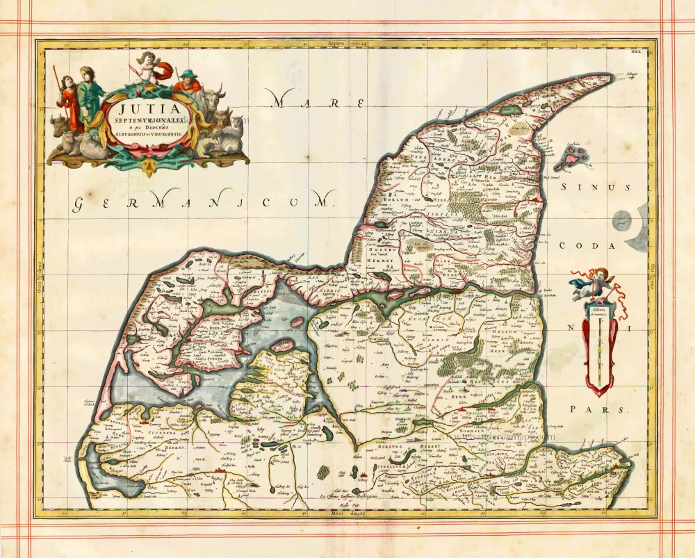
Iutia Septentrionalis, in qua Dioeceses Alburgensis et Viburgensis 1680
Denmark - Jylland (North) by J. Janssonius, published by Moses Pitt and J. Janssonius-Waesberge.
[Item number: 1353]
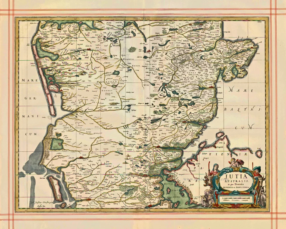
Jutia Australis, in qua Dioecesis Ripensis et Arhusiensis. 1680
Jutia Australis, in qua Dioecesis Ripensis et Arhusiensis. - Janssonius J. - Pitt Moses, 1680.
[Item number: 1373]
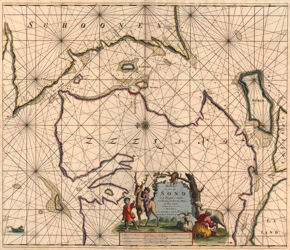
Pascaart om Door de Sond en de Droogen te Seylen Strekkende van Kol tot Meun 1697-1709
Denmark - Sjaelland, by J. Van Keulen Johannes.
[Item number: 4495]

Paskaert van t' Schager-Rak 1697-1709
Denmark - Skagerrak and Kattegat, by Van Keulen Johannes.
[Item number: 5394]
Fionia 1623
Denmark - Fyn, by Gerard Mercator.
[Item number: 12559]

Nouvelle Carte Géographique du Royaume de Dannemarck avec une Table des Villes les plus remarquables. 1714
Denmark, by Zacharias Châtelain.
[Item number: 21341]
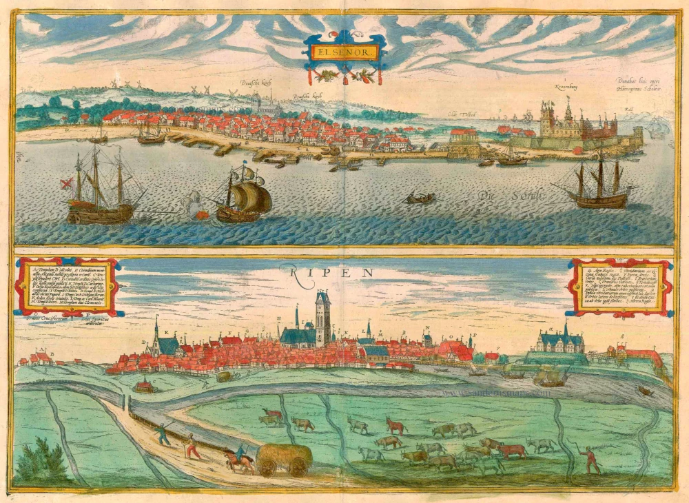
Elsenor [on sheet with] Ripen 1596-1640
Helsingør (Sjaelland) & Ribe (Jutland), by Georg Braun and Frans Hogenberg.
[Item number: 23375]
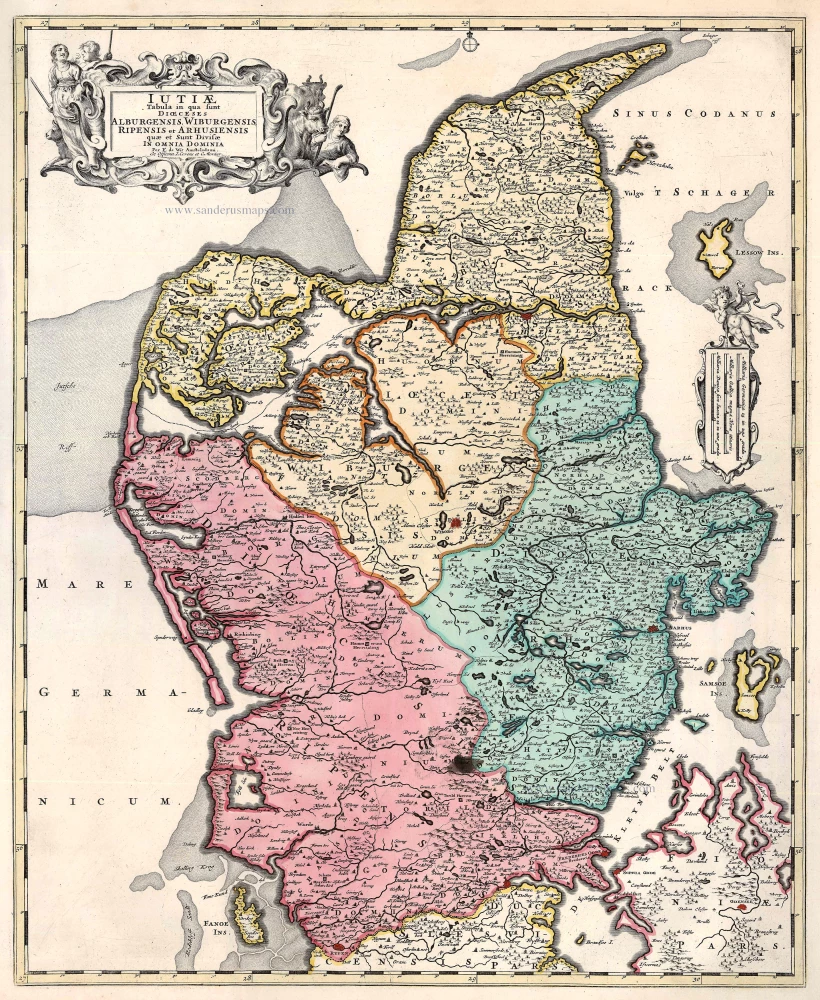
Iutiae Tabula in qua sunt Dioecesis Alburgensis, Wiburgensis, Ripensis et Arhusiensis quae et sunt divisae in Omnia Dominia. 1721-41
Denmark - Jutland, by Covens & Mortier.
[Item number: 23738]
Lalandiae et Falstriae Accurata Descriptio. 1680
Denmark - Laaland and Falster by J. Janssonius, published by Moses Pitt and J. Janssonius-Waesberge.
[Item number: 25066]

Regni Daniae, Novißima at Accuratißima Tabula. c. 1678
Denmark by Nicolaes Visscher I.
[Item number: 28521]
Totius Daniae nova descriptio. 1639-42
Denmark by Henricus Hondius.
[Item number: 28699]
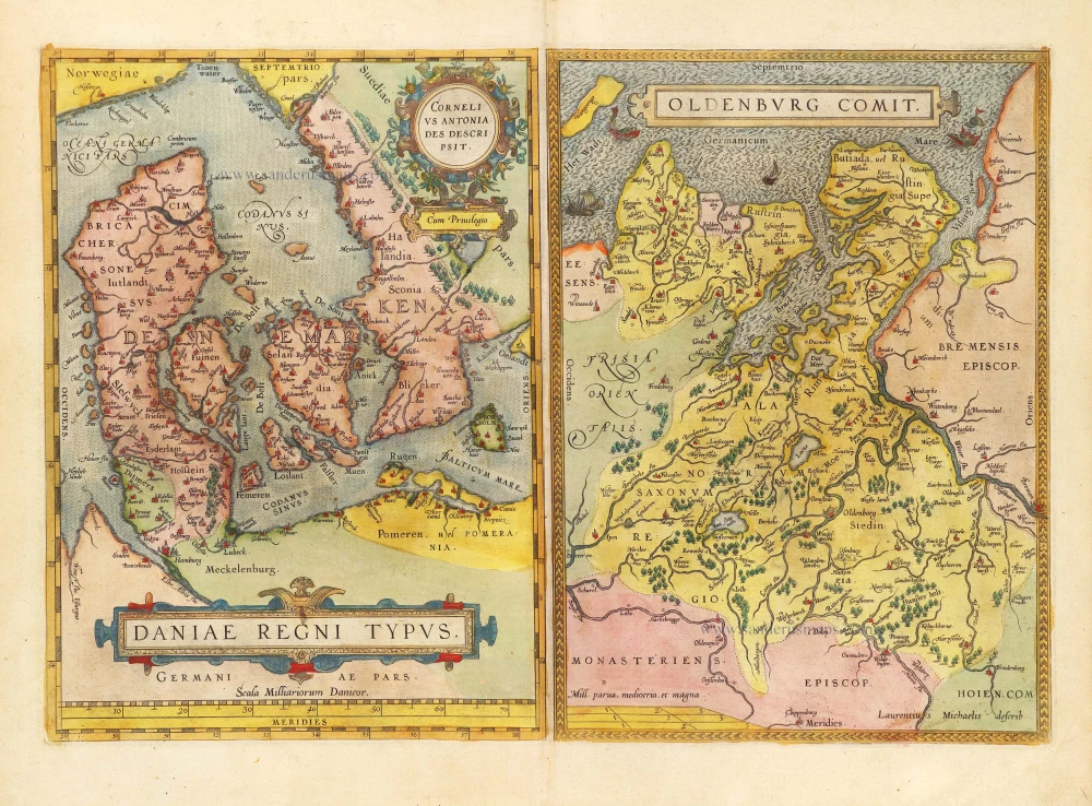
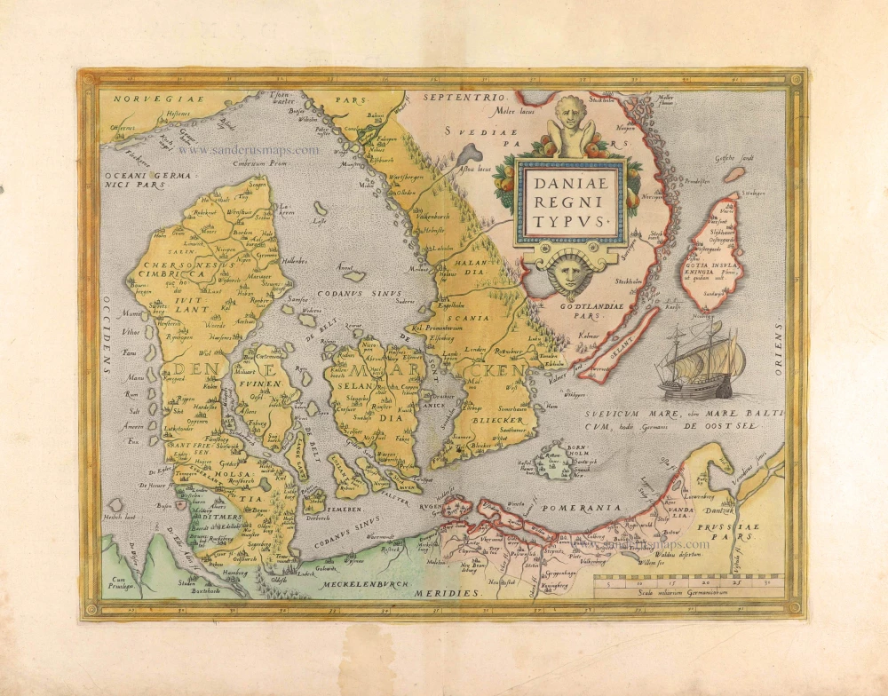
Daniae Regni Typus Cornelius Antoniades Descripsit; [On sheet with:] Oldenburg Comit. 1584
Denmark and Jutland by Abraham Ortelius.
[Item number: 29133]

Nouvelle Carte Géographique du Royaume de Dannemarck avec une Table des Villes les plus remarquables. 1714
Denmark by Zacharias Châtelain.
[Item number: 29430]
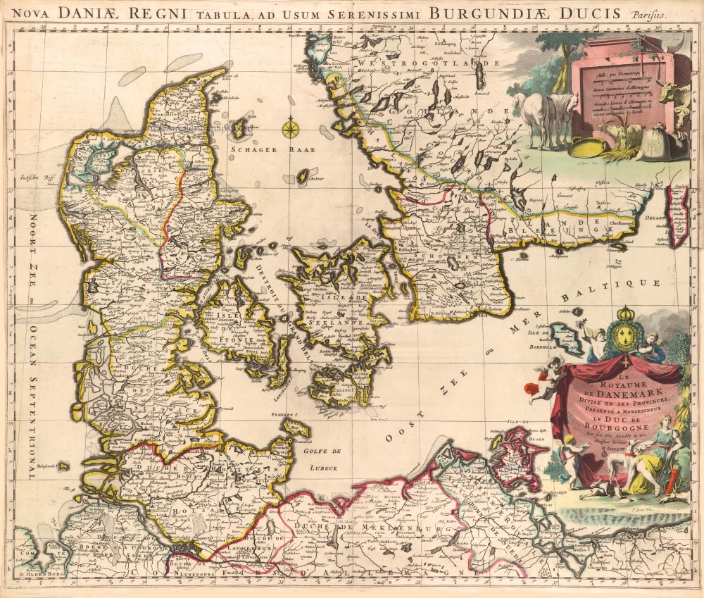
Le Royaume de Danemark, Divisé en ses Provinces. c. 1709
Denmark by Hubert Jaillot.
[Item number: 29589]
Daniae Regni Typus. 1574
Denmark by Abraham Ortelius.
[Item number: 29601]
First edition, first state of this famous map of Denmark by Marcus Jordan, published by Braun & Hogenberg.
Danorum Marca, vel Cimbricum, aut Daniae Regnum ... 1588
Denmark, by Georg Braun & Frans Hogenberg.
[Item number: 30175]