
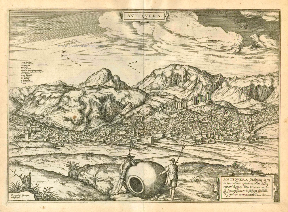
Antiquera, by Georg Braun and Frans Hogenberg. 1597
Braun G. & Hogenberg F. and the Civitates Orbis Terrarum.
The Civitates Orbis Terrarum, or the "Braun & Hogenberg", is a six-volume town atlas and the most excellent book of town views and plans ever published: 363 engravings, sometimes beautifully coloured. It was one of the best-selling works in the last quarter of the 16th century. Georg Braun wrote the text accompanying the plans and views on the verso. Many plates were engraved after the original drawings of a professional artist, a professional artist, Joris Hoefnagel (1542-1600). The first volume was published in Latin in 1572, and the sixth in 1617. Frans Hogenberg created the tables for volumes I through IV, and Simon van den Neuwel made those for volumes V and VI. Other contributors were cartographers Daniel Freese and Heinrich Rantzau. Works by Jacob van Deventer, Sebastian Münster, and Johannes Stumpf were also used. Translations appeared in German and French.
Following the original publication of Volume 1 of the Civitates in 1572, seven further editions of 1575, 1577, 1582, 1588, 1593, 1599 and 1612 can be identified. Vol.2, first issued in 1575, was followed by further editions in 1597 and 1612. The subsequent volumes appeared in 1581, 1588, 1593, 1599 and 1606. The German translation of the first volume appeared from 1574 on, and the French edition from 1575 on.
Several printers were involved: Theodor Graminaeus, Heinrich von Aich, Gottfried von Kempen, Johannis Sinniger, Bertram Buchholtz and Peter von Brachel, who all worked in Cologne.
Georg Braun (1541-1622)
Georg Braun was born in Cologne in 1541. After his studies in Cologne, he entered the Jesuit Order as a novice. 1561, he obtained his bachelor's degree, and in 1562, he received his Magister Artium. Although he left the Jesuit Order, he studied theology, gaining a licentiate in theology.
Frans Hogenberg (1535-1590)
Frans Hogenberg was a Flemish and German painter, engraver, and mapmaker. He was born in Mechelen as the son of Nicolaas Hogenberg.
By the end of the 1560s, Frans Hogenberg was employed upon Abraham Ortelius's Theatrum Orbis Terrarum, published in 1570; he is named an engraver of numerous maps. In 1568, he was banned from Antwerp by the Duke of Alva and travelled to London, where he stayed a few years before emigrating to Cologne. He immediately embarked on his two most important works, the Civitates, published in 1572 and the Geschichtsblätter, which appeared in several series from 1569 until about 1587.
Thanks to large-scale projects like the Geschichtsblätter and the Civitates, Hogenberg's social circumstances improved with each passing year. He died as a wealthy man in Cologne in 1590.
Antequera
Item Number: 23958 Authenticity Guarantee
Category: Antique maps > Europe > Spain and Portugal
Old, antique map - bird's-eye view of Antiquera by Braun and Hogenberg, after G. Hoefnagel.
TRANSLATION OF CARTOUCHE TEXT: Antequera, Spanish town in the Kingdom of Granada, once royal city of the Moors; noteworthy because of its very pleasant position, its abundance of salt, its stone quarries and potteries.
COMMENTARY BY BRAUN: "Antequera is a well-known and splendid city in the Kingdom of Granada. [...] On the mountain it has a magnificent and well-fortified castle, called the Alcazaba, in which the kings of Granada took up their quarters while the Moors were still in control of the country. [...] Many nobles have their comfortable apartments close to the castle, while the surrounding countryside is inhabited by peasants. These are very wealthy, partly due to the fertility of the soil, and partly because of the salt that they extract and collect. For there are many salt springs in the surrounding mountains."
The engraving shows Antequera in front of the towering peaks of the Sierra de los Torcales. In the foreground the depiction of two peasants with a huge earthenware jug symbolizes the flourishing of agriculture, crafts and trade. In AD 711 Antequera was conquered by the Moors and renamed Medina Antaquira. In the 13th century they built an extensive defence system in the town, in order to be able to resist the attacks of the Christian kings during the Reconquista. Among other things, the castle of Alcazaba was built on a hill overlooking the city. Not until 1410 did an army, under the leadership of Ferdinand I of Aragon, succeed in capturing the town. After this, due to its central position in Andalusia, Antequera became an important commercial centre, in which agriculture and crafts flourished. (Taschen)
Date of the first edition: 1575
Date of this map: 1597
Copper engraving
Size: 35.5 x 50cm (13.8 x 19.4 inches)
Verso text: Latin
Condition: Uncoloured, excellent.
Condition Rating: A
References: Van der Krogt 4, 178; Taschen, Braun and Hogenberg, p.144.
From: Civitates Orbis Terrarum, ... Part 2: De Praecipuis, Totius Universi Urbibus, Liber Secundus. Köln, Bertram Buchholz, 1597. (Van der Krogt 4, 41:1.2)
Braun G. & Hogenberg F. and the Civitates Orbis Terrarum.
The Civitates Orbis Terrarum, or the "Braun & Hogenberg", is a six-volume town atlas and the most excellent book of town views and plans ever published: 363 engravings, sometimes beautifully coloured. It was one of the best-selling works in the last quarter of the 16th century. Georg Braun wrote the text accompanying the plans and views on the verso. Many plates were engraved after the original drawings of a professional artist, a professional artist, Joris Hoefnagel (1542-1600). The first volume was published in Latin in 1572, and the sixth in 1617. Frans Hogenberg created the tables for volumes I through IV, and Simon van den Neuwel made those for volumes V and VI. Other contributors were cartographers Daniel Freese and Heinrich Rantzau. Works by Jacob van Deventer, Sebastian Münster, and Johannes Stumpf were also used. Translations appeared in German and French.
Following the original publication of Volume 1 of the Civitates in 1572, seven further editions of 1575, 1577, 1582, 1588, 1593, 1599 and 1612 can be identified. Vol.2, first issued in 1575, was followed by further editions in 1597 and 1612. The subsequent volumes appeared in 1581, 1588, 1593, 1599 and 1606. The German translation of the first volume appeared from 1574 on, and the French edition from 1575 on.
Several printers were involved: Theodor Graminaeus, Heinrich von Aich, Gottfried von Kempen, Johannis Sinniger, Bertram Buchholtz and Peter von Brachel, who all worked in Cologne.
Georg Braun (1541-1622)
Georg Braun was born in Cologne in 1541. After his studies in Cologne, he entered the Jesuit Order as a novice. 1561, he obtained his bachelor's degree, and in 1562, he received his Magister Artium. Although he left the Jesuit Order, he studied theology, gaining a licentiate in theology.
Frans Hogenberg (1535-1590)
Frans Hogenberg was a Flemish and German painter, engraver, and mapmaker. He was born in Mechelen as the son of Nicolaas Hogenberg.
By the end of the 1560s, Frans Hogenberg was employed upon Abraham Ortelius's Theatrum Orbis Terrarum, published in 1570; he is named an engraver of numerous maps. In 1568, he was banned from Antwerp by the Duke of Alva and travelled to London, where he stayed a few years before emigrating to Cologne. He immediately embarked on his two most important works, the Civitates, published in 1572 and the Geschichtsblätter, which appeared in several series from 1569 until about 1587.
Thanks to large-scale projects like the Geschichtsblätter and the Civitates, Hogenberg's social circumstances improved with each passing year. He died as a wealthy man in Cologne in 1590.
Related items
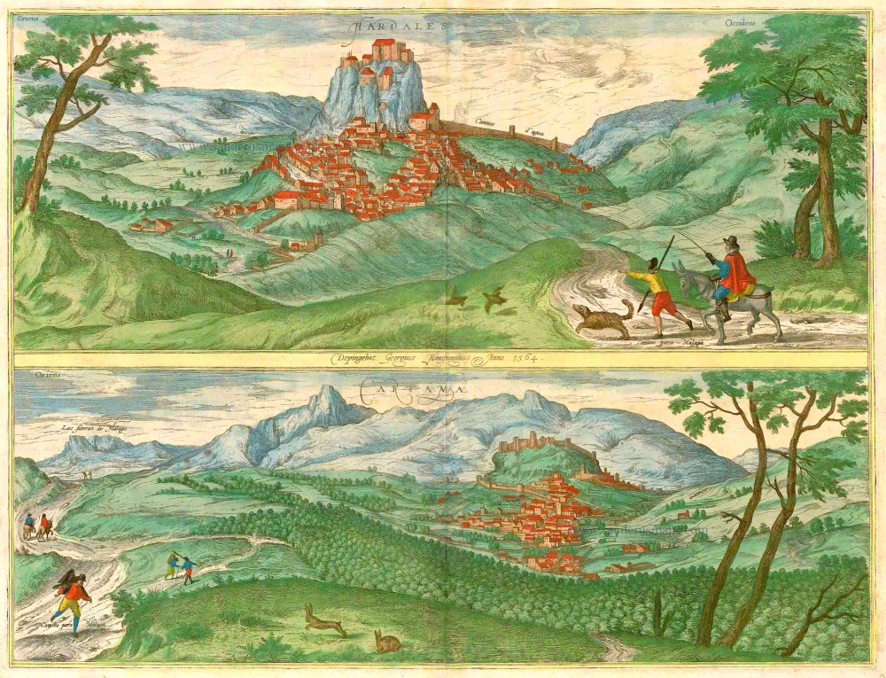
Hardales [on sheet with] Cartama. 1596
Ardales & Cartama by Georg Braun & Frans Hogenberg.
[Item number: 229]
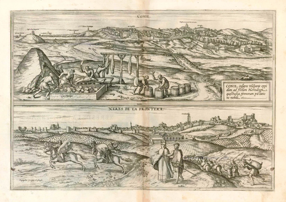
Conil [on sheet with] Xeres de la Frontera 1576
Conil de la Frontera and Jerez de la Frontera, by Georg Braun and Frans Hogenberg, after Georg Hoefnagel.
[Item number: 4133]
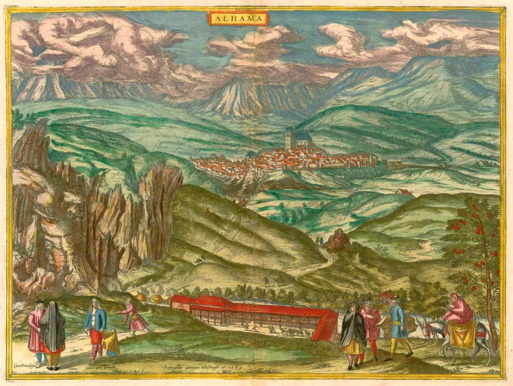
Alhama 1593
Alhama de Granada by Georg Braun & Frans Hogenberg
[Item number: 14714]
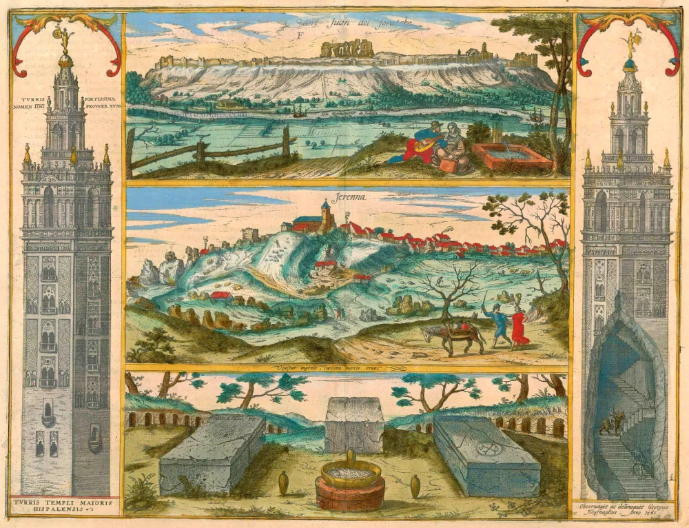
Sant Juan del Foratche [on sheet with] Jerenna ... 1596-1640
Sevilla - Gerena, by Braun & Hogenberg.
[Item number: 16487]
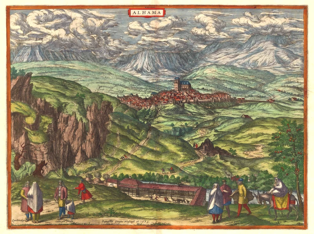
Alhama. 1575-1612
Alhama de Granada by Braun & Hogenberg
[Item number: 17930]
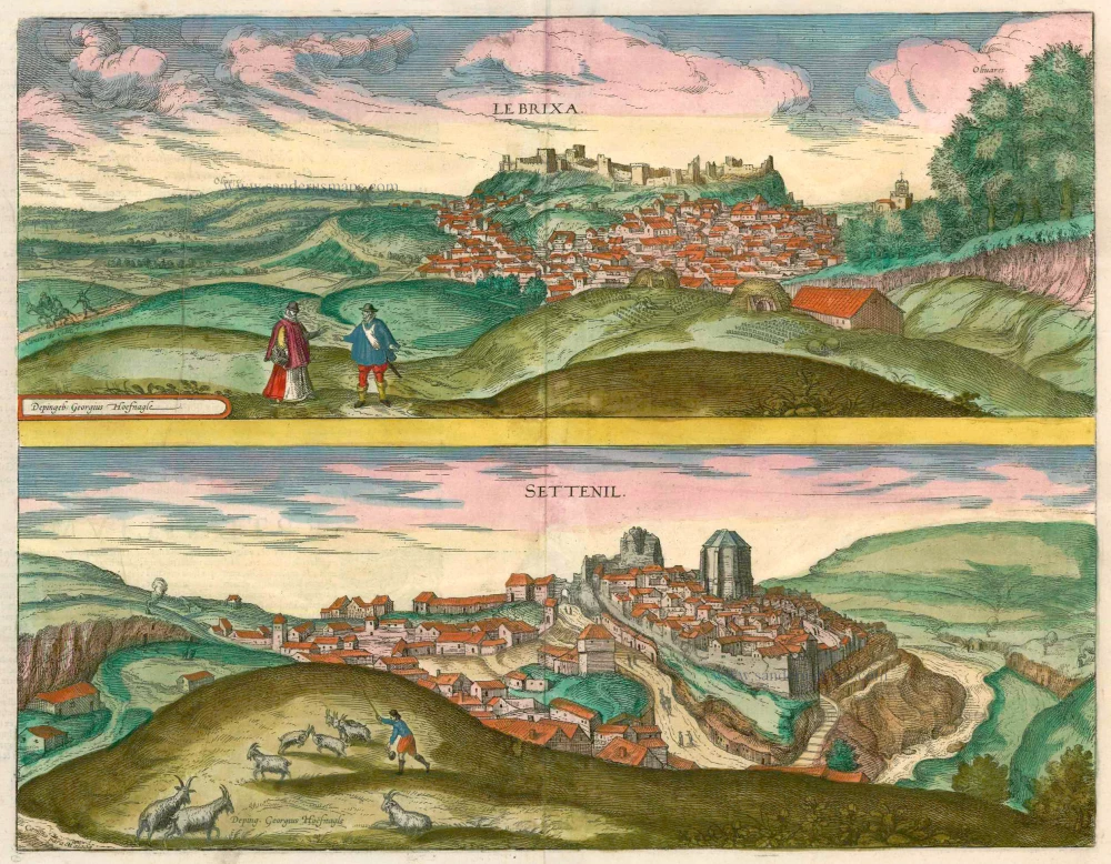
Le Brixa [on sheet with] Settenil. 1599
Lebrija & Settenil de las Bodegas by Braun & Hogenberg.
[Item number: 22188]

Loxa. 1597
Loja, by Georg Braun and Frans Hogenberg, after G. Hoefnagel.
[Item number: 23253]
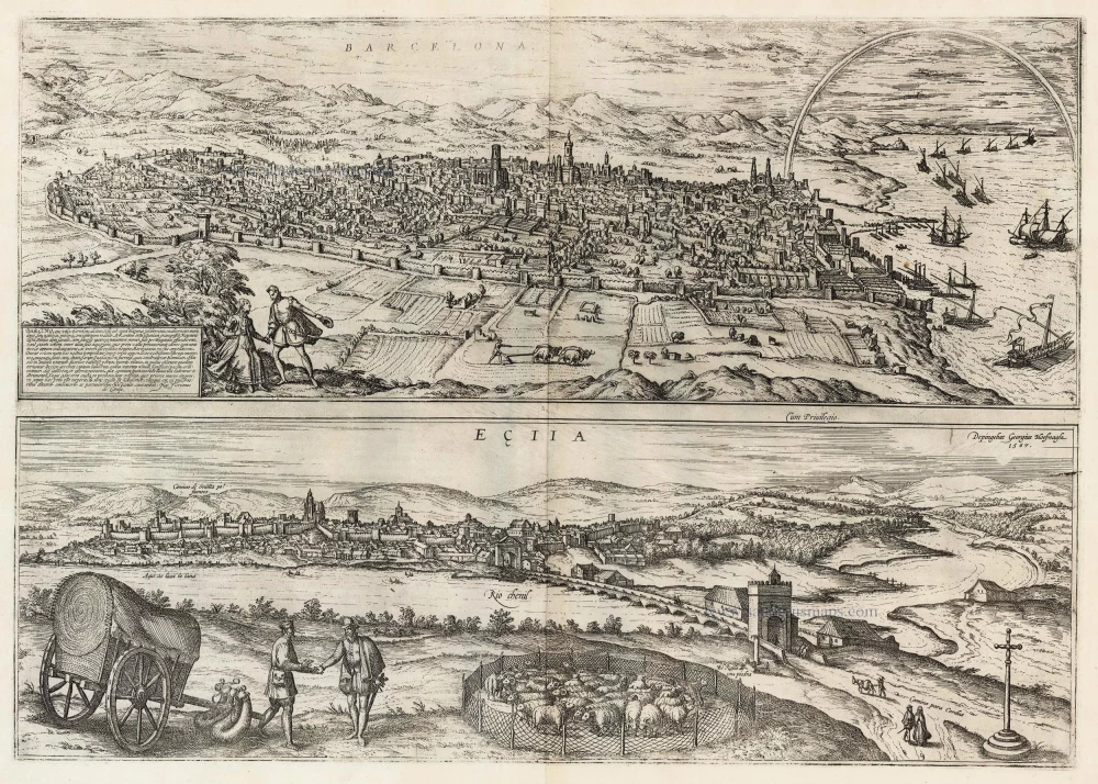
Barcelona, Barcino, que vulgo Barcelona Dicitur [on sheet with] Ecija 1599
Barcelona and Ecija, by Georg Braun and Frans Hogenberg.
[Item number: 23901]
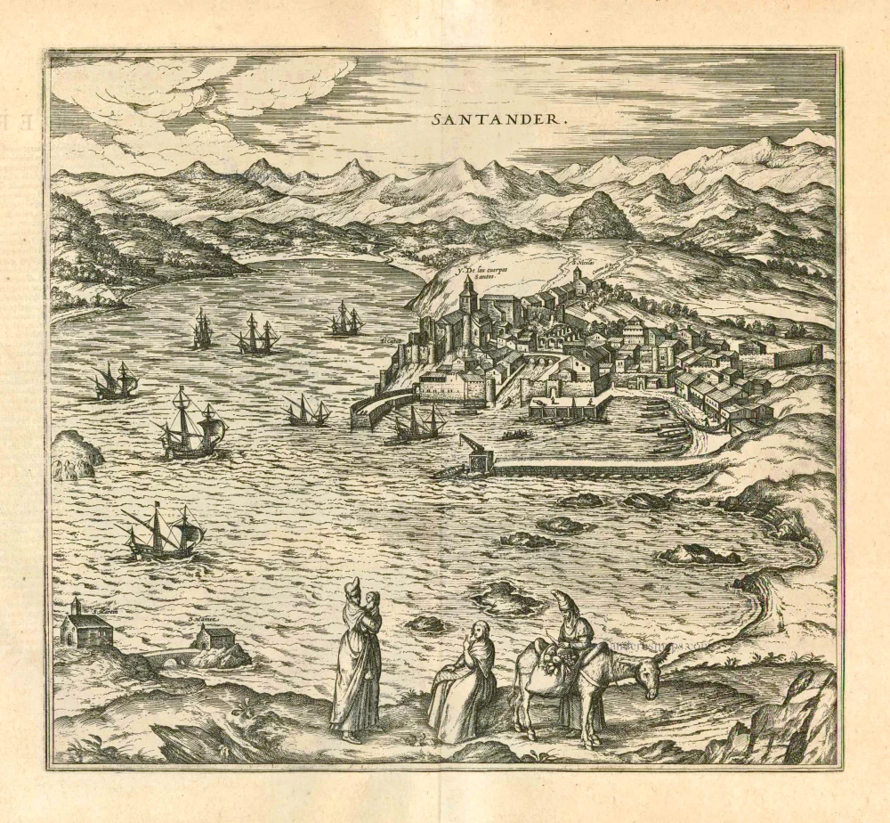
Santander 1597
Santander, by Georg Braun and Frans Hogenberg.
[Item number: 23963]
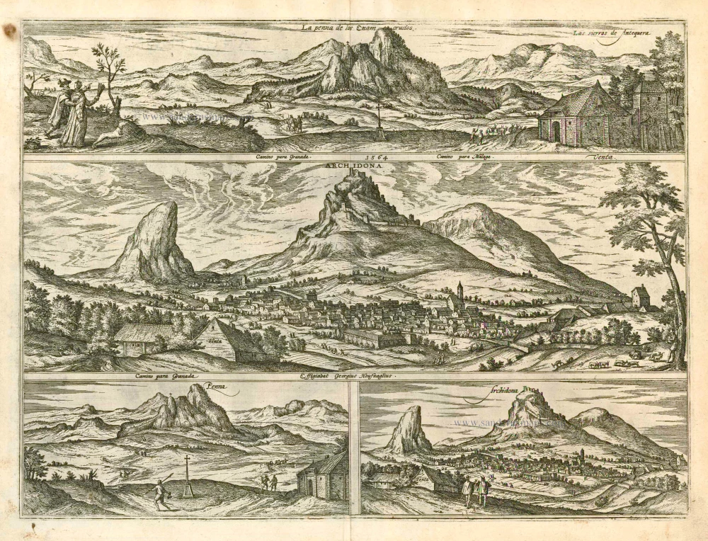
La Penna de los Enamorados - Archidona 1596
The mountain La Peña de los Enamorados and the village Archidona, by Georg Braun and Frans Hogenberg.
[Item number: 24140]