
Frankenberg, by Georg Braun and Frans Hogenberg. 1599
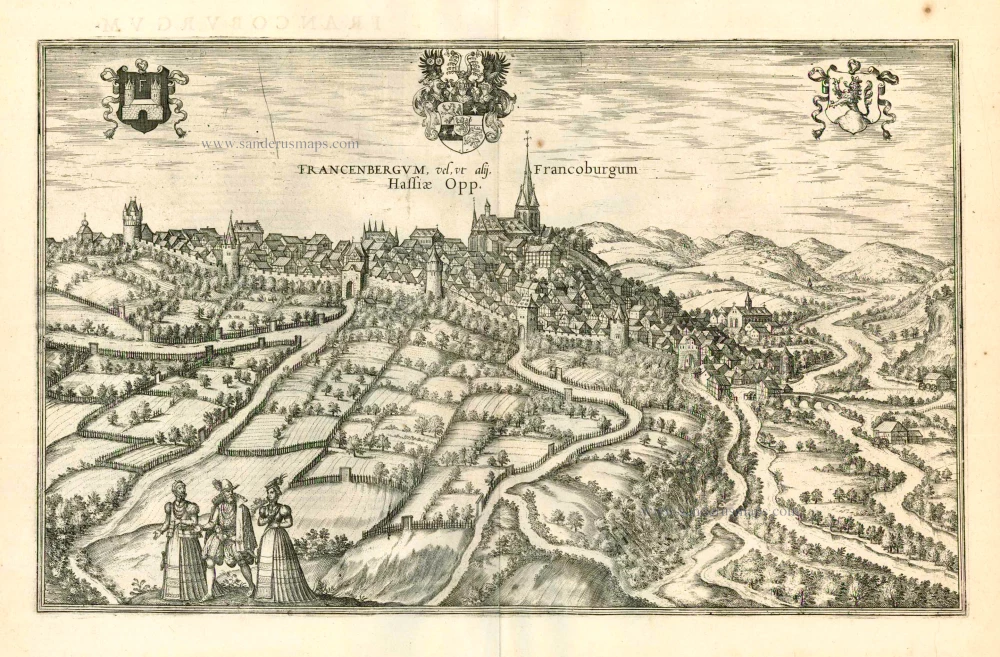
CAPTION: Frankenberg or, according to others, Francoburgum, a town in Hesse.
COMMENTARY BY BRAUN: "Charlemagne vested the town of Frankenberg with many freedoms and privileges, which it still enjoys to this day, and on account of its valiant and victorious soldiers awarded a signet, upon which there formerly appeared a golden castle with a tower, together with the letter F and a golden crown."
Frankenberg, seen here from the northeast, lies on a hill above the River Eder. The hillside is covered with fields neatly separated by bushes and fences. Soaring above the town is the massive Liebfrauenkirche, modelled on St Elizabeth's church in Marburg. The New Town was founded in 1335 at the foot of the hill (right) and merged with the Old Town as late as 1556. Conrad of Thuringia founded Frankenberg in 1233/34 to prevent the archbishops of Mainz from expanding their sphere of influence in the region. The town quickly developed into a bustling centre of trade and commerce. (Taschen)
Braun G. & Hogenberg F. and the Civitates Orbis Terrarum.
The Civitates Orbis Terrarum, or the "Braun & Hogenberg", is a six-volume town atlas and the most excellent book of town views and plans ever published: 363 engravings, sometimes beautifully coloured. It was one of the best-selling works in the last quarter of the 16th century. Georg Braun wrote the text accompanying the plans and views on the verso. Many plates were engraved after the original drawings of a professional artist, a professional artist, Joris Hoefnagel (1542-1600). The first volume was published in Latin in 1572, and the sixth in 1617. Frans Hogenberg created the tables for volumes I through IV, and Simon van den Neuwel made those for volumes V and VI. Other contributors were cartographers Daniel Freese and Heinrich Rantzau. Works by Jacob van Deventer, Sebastian Münster, and Johannes Stumpf were also used. Translations appeared in German and French.
Following the original publication of Volume 1 of the Civitates in 1572, seven further editions of 1575, 1577, 1582, 1588, 1593, 1599 and 1612 can be identified. Vol.2, first issued in 1575, was followed by further editions in 1597 and 1612. The subsequent volumes appeared in 1581, 1588, 1593, 1599 and 1606. The German translation of the first volume appeared from 1574 on, and the French edition from 1575 on.
Several printers were involved: Theodor Graminaeus, Heinrich von Aich, Gottfried von Kempen, Johannis Sinniger, Bertram Buchholtz and Peter von Brachel, who all worked in Cologne.
Georg Braun (1541-1622)
Georg Braun was born in Cologne in 1541. After his studies in Cologne, he entered the Jesuit Order as a novice. 1561, he obtained his bachelor's degree, and in 1562, he received his Magister Artium. Although he left the Jesuit Order, he studied theology, gaining a licentiate in theology.
Frans Hogenberg (1535-1590)
Frans Hogenberg was a Flemish and German painter, engraver, and mapmaker. He was born in Mechelen as the son of Nicolaas Hogenberg.
By the end of the 1560s, Frans Hogenberg was employed upon Abraham Ortelius's Theatrum Orbis Terrarum, published in 1570; he is named an engraver of numerous maps. In 1568, he was banned from Antwerp by the Duke of Alva and travelled to London, where he stayed a few years before emigrating to Cologne. He immediately embarked on his two most important works, the Civitates, published in 1572 and the Geschichtsblätter, which appeared in several series from 1569 until about 1587.
Thanks to large-scale projects like the Geschichtsblätter and the Civitates, Hogenberg's social circumstances improved with each passing year. He died as a wealthy man in Cologne in 1590.
Francenbergum, vel ut alij Francoburgum Hassiae Opp.
Item Number: 24053 Authenticity Guarantee
Category: Antique maps > Europe > Germany - Cities
Old, antique view of Frankenberg, by Georg Braun and Frans Hogenberg.
Title: Francenbergum, vel ut alij Francoburgum Hassiae Opp.
Date of the first edition: 1581.
Date of this map: 1599.
Copper engraving, printed on paper.
Size (not including margins): 310 x 485mm (12.2 x 19.09 inches).
Verso: Latin text.
Condition: Uncoloured, excellent.
Condition Rating: A+.
From: Civitates Orbis Terrarum. Liber tertius. Köln, Bertram Buchholtz, 1599. (Koeman, B&H3)
CAPTION: Frankenberg or, according to others, Francoburgum, a town in Hesse.
COMMENTARY BY BRAUN: "Charlemagne vested the town of Frankenberg with many freedoms and privileges, which it still enjoys to this day, and on account of its valiant and victorious soldiers awarded a signet, upon which there formerly appeared a golden castle with a tower, together with the letter F and a golden crown."
Frankenberg, seen here from the northeast, lies on a hill above the River Eder. The hillside is covered with fields neatly separated by bushes and fences. Soaring above the town is the massive Liebfrauenkirche, modelled on St Elizabeth's church in Marburg. The New Town was founded in 1335 at the foot of the hill (right) and merged with the Old Town as late as 1556. Conrad of Thuringia founded Frankenberg in 1233/34 to prevent the archbishops of Mainz from expanding their sphere of influence in the region. The town quickly developed into a bustling centre of trade and commerce. (Taschen)
Braun G. & Hogenberg F. and the Civitates Orbis Terrarum.
The Civitates Orbis Terrarum, or the "Braun & Hogenberg", is a six-volume town atlas and the most excellent book of town views and plans ever published: 363 engravings, sometimes beautifully coloured. It was one of the best-selling works in the last quarter of the 16th century. Georg Braun wrote the text accompanying the plans and views on the verso. Many plates were engraved after the original drawings of a professional artist, a professional artist, Joris Hoefnagel (1542-1600). The first volume was published in Latin in 1572, and the sixth in 1617. Frans Hogenberg created the tables for volumes I through IV, and Simon van den Neuwel made those for volumes V and VI. Other contributors were cartographers Daniel Freese and Heinrich Rantzau. Works by Jacob van Deventer, Sebastian Münster, and Johannes Stumpf were also used. Translations appeared in German and French.
Following the original publication of Volume 1 of the Civitates in 1572, seven further editions of 1575, 1577, 1582, 1588, 1593, 1599 and 1612 can be identified. Vol.2, first issued in 1575, was followed by further editions in 1597 and 1612. The subsequent volumes appeared in 1581, 1588, 1593, 1599 and 1606. The German translation of the first volume appeared from 1574 on, and the French edition from 1575 on.
Several printers were involved: Theodor Graminaeus, Heinrich von Aich, Gottfried von Kempen, Johannis Sinniger, Bertram Buchholtz and Peter von Brachel, who all worked in Cologne.
Georg Braun (1541-1622)
Georg Braun was born in Cologne in 1541. After his studies in Cologne, he entered the Jesuit Order as a novice. 1561, he obtained his bachelor's degree, and in 1562, he received his Magister Artium. Although he left the Jesuit Order, he studied theology, gaining a licentiate in theology.
Frans Hogenberg (1535-1590)
Frans Hogenberg was a Flemish and German painter, engraver, and mapmaker. He was born in Mechelen as the son of Nicolaas Hogenberg.
By the end of the 1560s, Frans Hogenberg was employed upon Abraham Ortelius's Theatrum Orbis Terrarum, published in 1570; he is named an engraver of numerous maps. In 1568, he was banned from Antwerp by the Duke of Alva and travelled to London, where he stayed a few years before emigrating to Cologne. He immediately embarked on his two most important works, the Civitates, published in 1572 and the Geschichtsblätter, which appeared in several series from 1569 until about 1587.
Thanks to large-scale projects like the Geschichtsblätter and the Civitates, Hogenberg's social circumstances improved with each passing year. He died as a wealthy man in Cologne in 1590.
Related items

Magdeburgum ... Metropolitica Saxoniae Urbs 1582
Magdeburg, by Georg Braun and Frans Hogenberg.
[Item number: 4119]
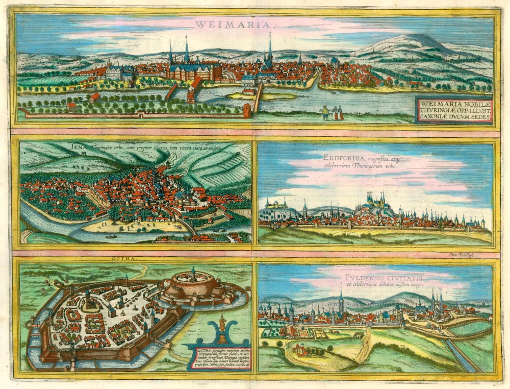
Weimaria [on sheet with] Iena [and] Erdfordia [and] Gotha [and] Fuldensis Civitatis. 1574
Weimar, Jena, Erfurt, Gotha, and Fulda, by Georg Braun and Frans Hogenberg.
[Item number: 22323]
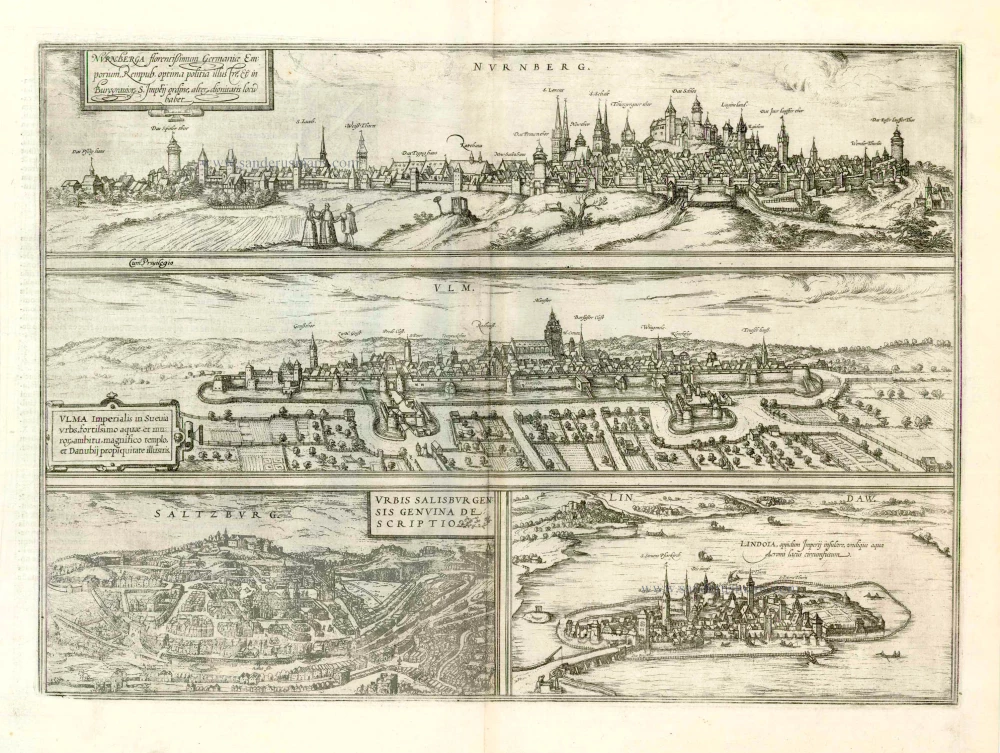
Nurnberga Florentissimum Germaniae Emporium, ... [on sheet with] Ulma Imperialis in Suevia [and] Saltzburg Urbis Salisburgensis Genvina Descriptio [and] Lindaw - Lindoia, Oppidum Imperij insulare, ... 1599
Nürnberg, Ulm, Salzburg, and Lindau, by Georg Braun and Frans Hogenberg.
[Item number: 23926]
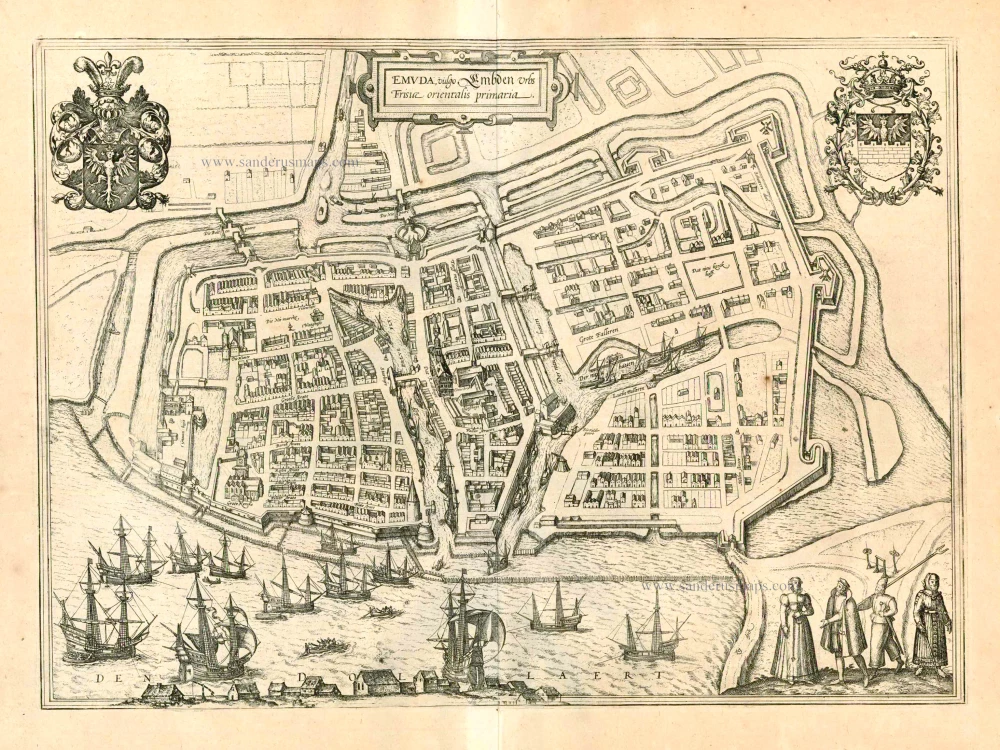
Emuda vulgo Embden Urbs Frisiae orientalis primaria. 1597
Emden, by Georg Braun and Frans Hogenberg.
[Item number: 23986]
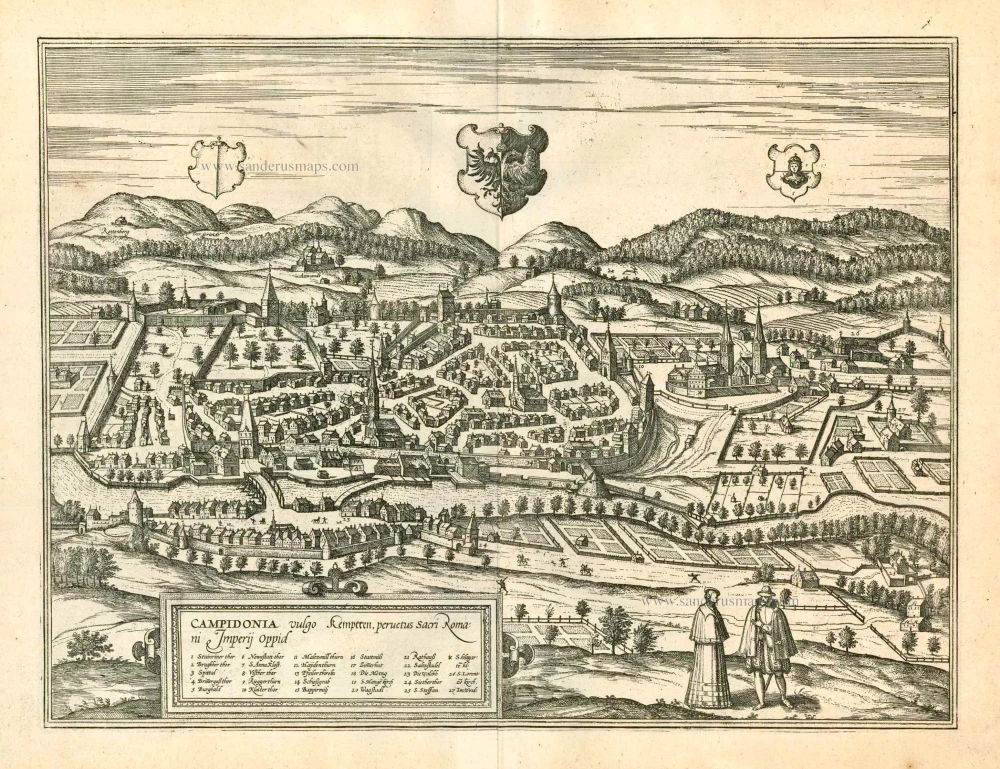
Campidonia vulgo Kemptten, Peruetus Sacri Romani Imperij Oppid. 1597
Kempten in Allgäu, by Georg Braun and Frans Hogenberg.
[Item number: 23992]
Francenbergum, vel ut alij Francoburgum Hassiae Opp. 1599
Frankenberg, by Georg Braun and Frans Hogenberg.
[Item number: 24053]
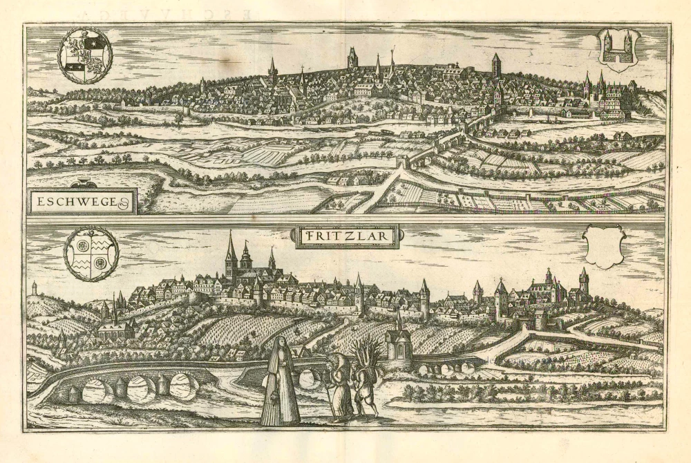
Eschwege [on sheet with] Fritzlar 1599
Eschwege and Fritzlar, by Georg Braun and Frans Hogenberg.
[Item number: 24054]
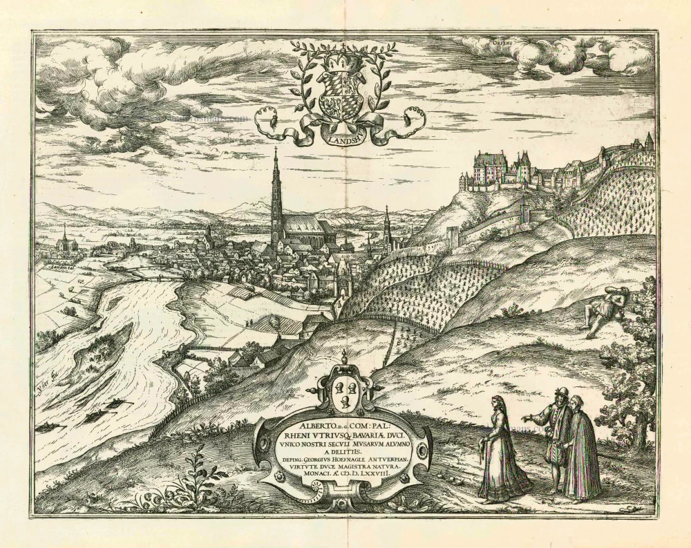
Landshut 1599
Landshut, by Georg Braun and Frans Hogenberg.
[Item number: 24060]
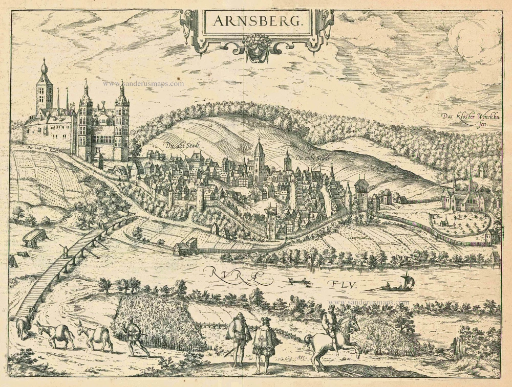
Arnsberg. 1599
Arnsberg by Braun and Hogenberg.
[Item number: 24096]
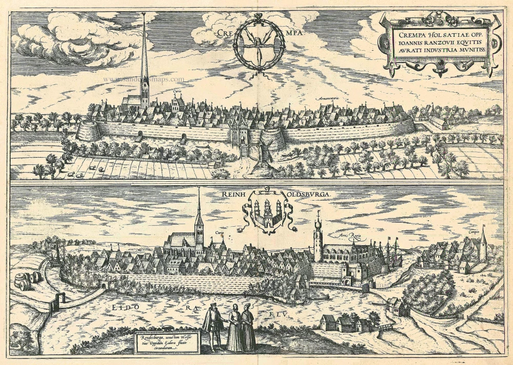
Crempa Holsatiae Opp. ... [on sheet with] Reinholdsburga - Rendesburga .. 1588-97
Krempe and Rendsburg, by Georg Braun and Frans Hogenberg.
[Item number: 24109]
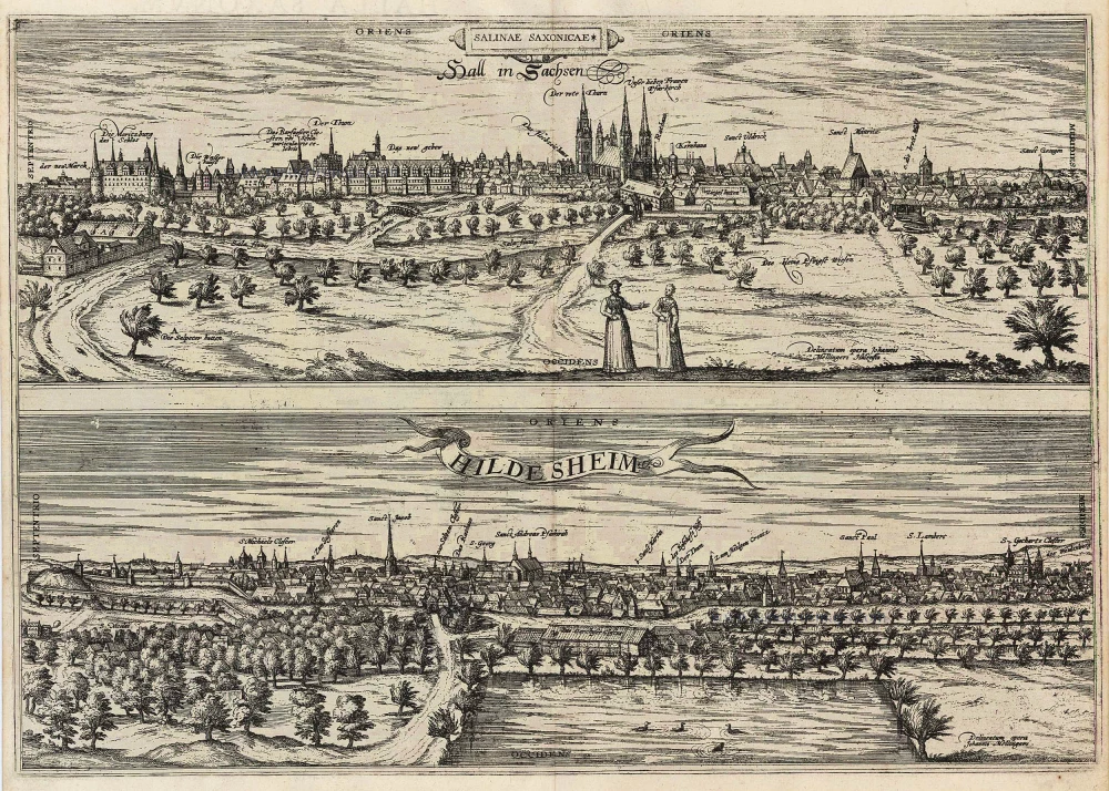
Salinae Saxoniae. Hall in Sachsen [on sheet with:] Hildesheim 1596
Halle and Hildesheim, by Georg Braun and Frans Hogenberg.
[Item number: 24180]
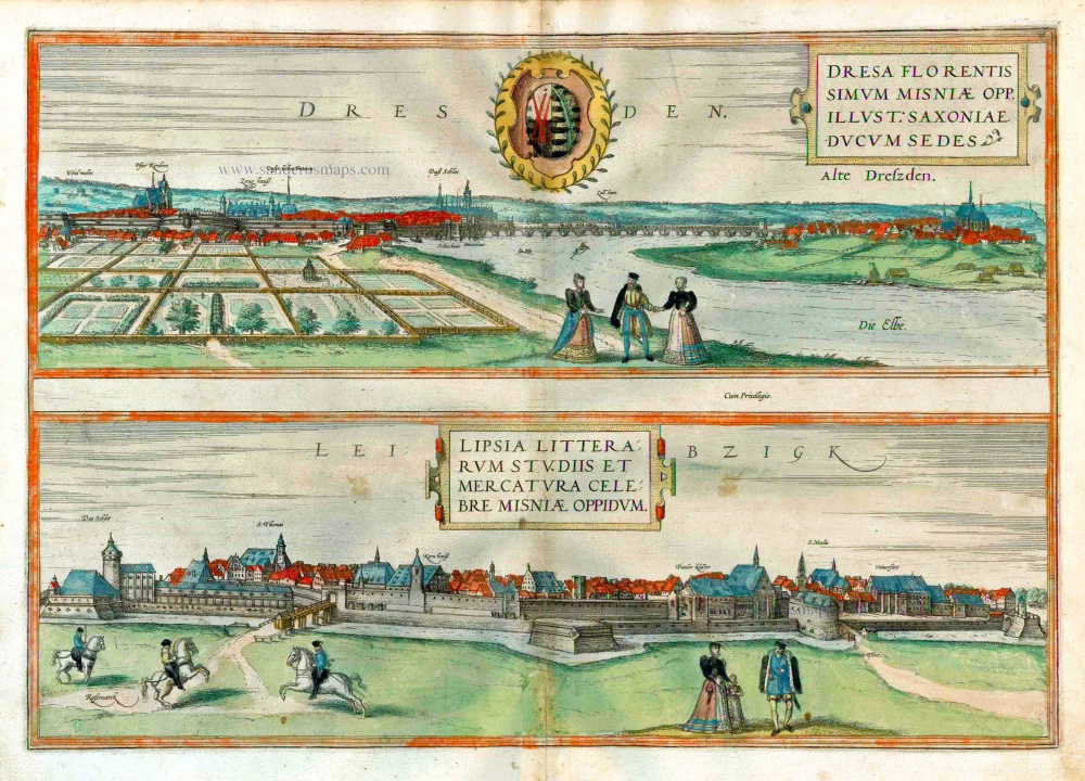
Dresden - Dresa Florentissimum Misniae Opp. Illust: Saxoniae Ducum Sedes [on sheet with] Leibzigk - Lipsia Litterarum Studiis et Mercatura Celebre Misniae Oppidum. 1582
Dresden and Leipzig, by Georg Braun and Frans Hogenberg.
[Item number: 25502]