
Terracina by Braun and Hogenberg. 1599
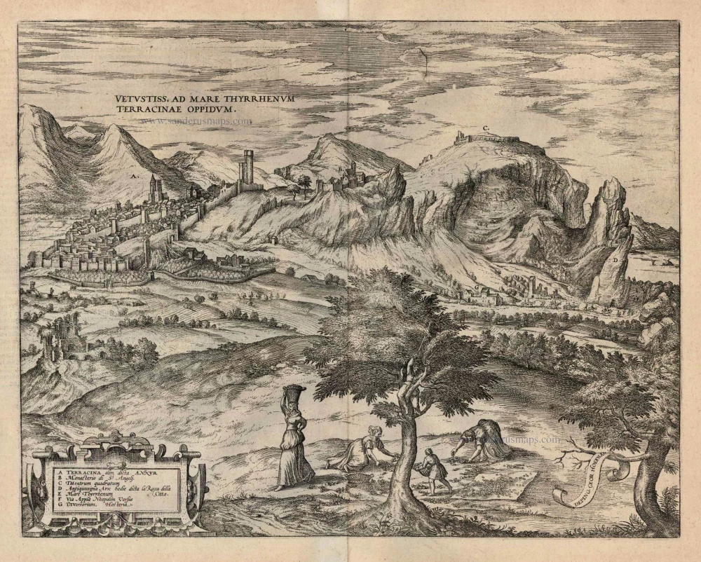
TRANSLATION OF CAPTION: The ancient town of Terracina on the Tyrrhenian Sea.
COMMENTARY BY BRAUN (on verso): "Terracina is an ancient city in Latium that was surrounded by the sea in earlier times. It stood originally on a hill surrounded by valleys filled with seawater. But since these valleys have been filled with earth, the hill is now on the mainland, and the city stretches to the coast. The Via Appia that leads from Rome to Brindisi passes by Terracina but is currently flooded by marsh water."
This is a view from the northwest of the city of Terracina, which is situated on a steep hillside. The cathedral of San Cesareo (A) can be seen inside the city wall and, on the right, on a hill outside the walls, the monastery of Sant'Angelo (B). On the top of Mount Sant'Angelo is an ancient building known as the Theatrum quadratum (C). This is the temple of Jupiter Anxur, dating from the 1st century BC. In antiquity, Terracina was called Anxur and was a prosperous city, especially after the Via Appia (F) was built nearby in 312 BC. It battled malaria until the draining of the Pontine Marshes at the beginning of the 20th century. In this plate, Hoefnagel has documented the time of the almond harvest, which is shown in the foreground. (Taschen)
Braun G. & Hogenberg F. and the Civitates Orbis Terrarum.
The Civitates Orbis Terrarum, or the "Braun & Hogenberg", is a six-volume town atlas and the most excellent book of town views and plans ever published: 363 engravings, sometimes beautifully coloured. It was one of the best-selling works in the last quarter of the 16th century. Georg Braun wrote the text accompanying the plans and views on the verso. Many plates were engraved after the original drawings of a professional artist, a professional artist, Joris Hoefnagel (1542-1600). The first volume was published in Latin in 1572, and the sixth in 1617. Frans Hogenberg created the tables for volumes I through IV, and Simon van den Neuwel made those for volumes V and VI. Other contributors were cartographers Daniel Freese and Heinrich Rantzau. Works by Jacob van Deventer, Sebastian Münster, and Johannes Stumpf were also used. Translations appeared in German and French.
Following the original publication of Volume 1 of the Civitates in 1572, seven further editions of 1575, 1577, 1582, 1588, 1593, 1599 and 1612 can be identified. Vol.2, first issued in 1575, was followed by further editions in 1597 and 1612. The subsequent volumes appeared in 1581, 1588, 1593, 1599 and 1606. The German translation of the first volume appeared from 1574 on, and the French edition from 1575 on.
Several printers were involved: Theodor Graminaeus, Heinrich von Aich, Gottfried von Kempen, Johannis Sinniger, Bertram Buchholtz and Peter von Brachel, who all worked in Cologne.
Georg Braun (1541-1622)
Georg Braun was born in Cologne in 1541. After his studies in Cologne, he entered the Jesuit Order as a novice. 1561, he obtained his bachelor's degree, and in 1562, he received his Magister Artium. Although he left the Jesuit Order, he studied theology, gaining a licentiate in theology.
Frans Hogenberg (1535-1590)
Frans Hogenberg was a Flemish and German painter, engraver, and mapmaker. He was born in Mechelen as the son of Nicolaas Hogenberg.
By the end of the 1560s, Frans Hogenberg was employed upon Abraham Ortelius's Theatrum Orbis Terrarum, published in 1570; he is named an engraver of numerous maps. In 1568, he was banned from Antwerp by the Duke of Alva and travelled to London, where he stayed a few years before emigrating to Cologne. He immediately embarked on his two most important works, the Civitates, published in 1572 and the Geschichtsblätter, which appeared in several series from 1569 until about 1587.
Thanks to large-scale projects like the Geschichtsblätter and the Civitates, Hogenberg's social circumstances improved with each passing year. He died as a wealthy man in Cologne in 1590.
Vetustiss. Ad Mare Thyrrhenum Terracinae Oppidum.
Item Number: 24069 Authenticity Guarantee
Category: Antique maps > Europe > Italy - Cities
Old, antique bird’s-eye view plan of Terracina by Braun and Hogenberg after G. Hoefnagel.
With a key to locations.
Title: Vetustiss. Ad Mare Thyrrhenum Terracinae Oppidum.
Date of the first edition: 1581.
Date of this map: 1599.
Copper engraving, printed on paper.
Size (not including margins): 330 x 425mm (12.99 x 16.73 inches).
Verso: Latin text.
Condition: Uncoloured, excellent.
Condition Rating: A+.
From: Civitates Orbis Terrarum. Liber tertius. Köln, Bertram Buchholtz, 1599. (Koeman, B&H3)
TRANSLATION OF CAPTION: The ancient town of Terracina on the Tyrrhenian Sea.
COMMENTARY BY BRAUN (on verso): "Terracina is an ancient city in Latium that was surrounded by the sea in earlier times. It stood originally on a hill surrounded by valleys filled with seawater. But since these valleys have been filled with earth, the hill is now on the mainland, and the city stretches to the coast. The Via Appia that leads from Rome to Brindisi passes by Terracina but is currently flooded by marsh water."
This is a view from the northwest of the city of Terracina, which is situated on a steep hillside. The cathedral of San Cesareo (A) can be seen inside the city wall and, on the right, on a hill outside the walls, the monastery of Sant'Angelo (B). On the top of Mount Sant'Angelo is an ancient building known as the Theatrum quadratum (C). This is the temple of Jupiter Anxur, dating from the 1st century BC. In antiquity, Terracina was called Anxur and was a prosperous city, especially after the Via Appia (F) was built nearby in 312 BC. It battled malaria until the draining of the Pontine Marshes at the beginning of the 20th century. In this plate, Hoefnagel has documented the time of the almond harvest, which is shown in the foreground. (Taschen)
Braun G. & Hogenberg F. and the Civitates Orbis Terrarum.
The Civitates Orbis Terrarum, or the "Braun & Hogenberg", is a six-volume town atlas and the most excellent book of town views and plans ever published: 363 engravings, sometimes beautifully coloured. It was one of the best-selling works in the last quarter of the 16th century. Georg Braun wrote the text accompanying the plans and views on the verso. Many plates were engraved after the original drawings of a professional artist, a professional artist, Joris Hoefnagel (1542-1600). The first volume was published in Latin in 1572, and the sixth in 1617. Frans Hogenberg created the tables for volumes I through IV, and Simon van den Neuwel made those for volumes V and VI. Other contributors were cartographers Daniel Freese and Heinrich Rantzau. Works by Jacob van Deventer, Sebastian Münster, and Johannes Stumpf were also used. Translations appeared in German and French.
Following the original publication of Volume 1 of the Civitates in 1572, seven further editions of 1575, 1577, 1582, 1588, 1593, 1599 and 1612 can be identified. Vol.2, first issued in 1575, was followed by further editions in 1597 and 1612. The subsequent volumes appeared in 1581, 1588, 1593, 1599 and 1606. The German translation of the first volume appeared from 1574 on, and the French edition from 1575 on.
Several printers were involved: Theodor Graminaeus, Heinrich von Aich, Gottfried von Kempen, Johannis Sinniger, Bertram Buchholtz and Peter von Brachel, who all worked in Cologne.
Georg Braun (1541-1622)
Georg Braun was born in Cologne in 1541. After his studies in Cologne, he entered the Jesuit Order as a novice. 1561, he obtained his bachelor's degree, and in 1562, he received his Magister Artium. Although he left the Jesuit Order, he studied theology, gaining a licentiate in theology.
Frans Hogenberg (1535-1590)
Frans Hogenberg was a Flemish and German painter, engraver, and mapmaker. He was born in Mechelen as the son of Nicolaas Hogenberg.
By the end of the 1560s, Frans Hogenberg was employed upon Abraham Ortelius's Theatrum Orbis Terrarum, published in 1570; he is named an engraver of numerous maps. In 1568, he was banned from Antwerp by the Duke of Alva and travelled to London, where he stayed a few years before emigrating to Cologne. He immediately embarked on his two most important works, the Civitates, published in 1572 and the Geschichtsblätter, which appeared in several series from 1569 until about 1587.
Thanks to large-scale projects like the Geschichtsblätter and the Civitates, Hogenberg's social circumstances improved with each passing year. He died as a wealthy man in Cologne in 1590.
Related items
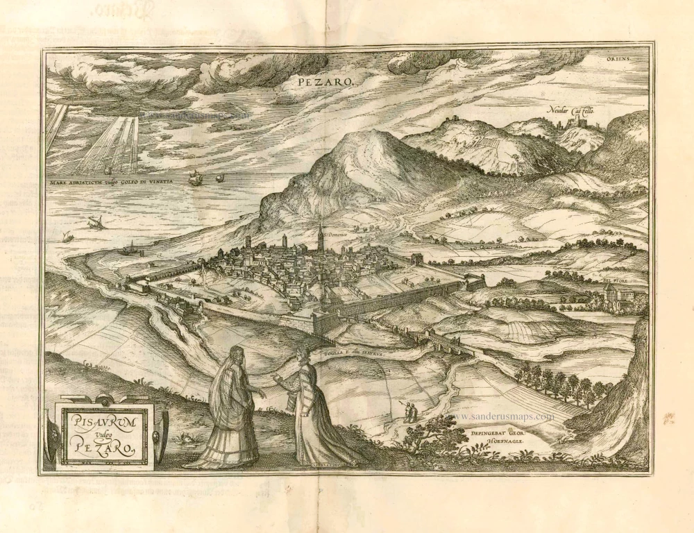
Pisaurum Vulgo Pezaro. 1582
Pesaro by Braun & Hogenberg.
[Item number: 14164]
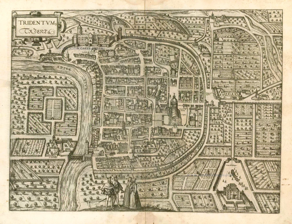
Tridentum. Trient. 1582
Trente (Trento) by Georg Braun & Frans Hogenberg
[Item number: 14165]
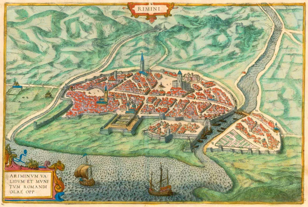
Rimini - Ariminum validum et munitum romandi olae opp. 1612
Rimini, by Braun & Hogenberg.
[Item number: 16426]
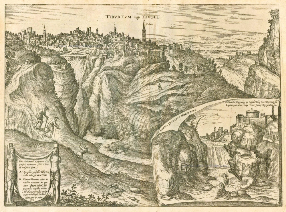
Tiburtum vulgo Tivoli. 1588
Tivoli by Braun and Hogenberg.
[Item number: 20609]
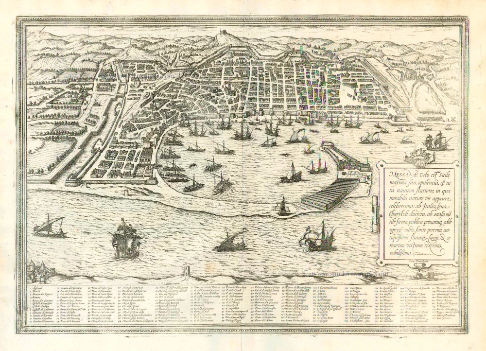
Messana, Urbs est Sicilie maxima, situ, opulentia, & tuta navium statione, ... 1612
Messina in Sicily, by Georg Braun and Frans Hogenberg.
[Item number: 22348]
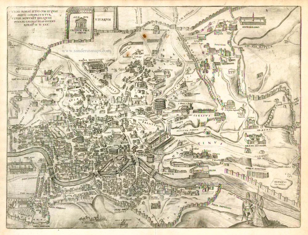
Urbis Romae Situs cum ils quae adhuc Conspiciuntur Veter. Monumet Reliquiis Pyrrho Ligorio Neap. Invent. Romae M.D.LXX 1623
Ancient Rome by Braun and Hogenberg.
[Item number: 22409]
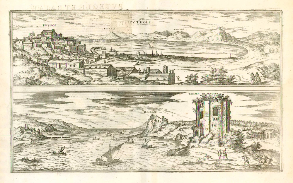
Puteoli - Baiae 1623
Pozzuoli and Baia, by Georg Braun and Frans Hogenberg.
[Item number: 22411]
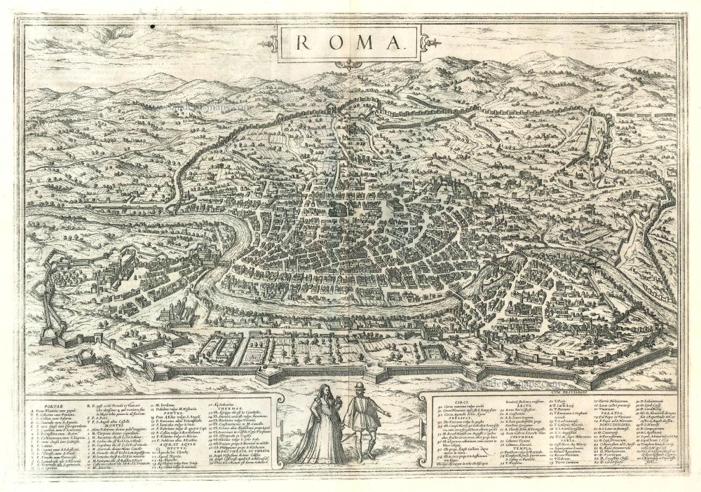
Roma. 1599
Rome by Braun and Hogenberg.
[Item number: 23941]

Magnifica Illa Civitas Verona [on sheet with] Colonia Augusta Verona Nova Galieniana Verona, Celeberrima, Amplissimaque Cenomanorum Urbs, Ptolemaeo 1599
Verona, by Braun and Hogenberg.
[Item number: 24064]
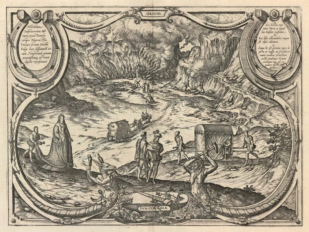
Mirabilium Sulphureorum Motium Apud Puteolos campos. 1599
The Phlegraean Fields (Campi Flegrei), by Braun and Hogenberg.
[Item number: 24073]
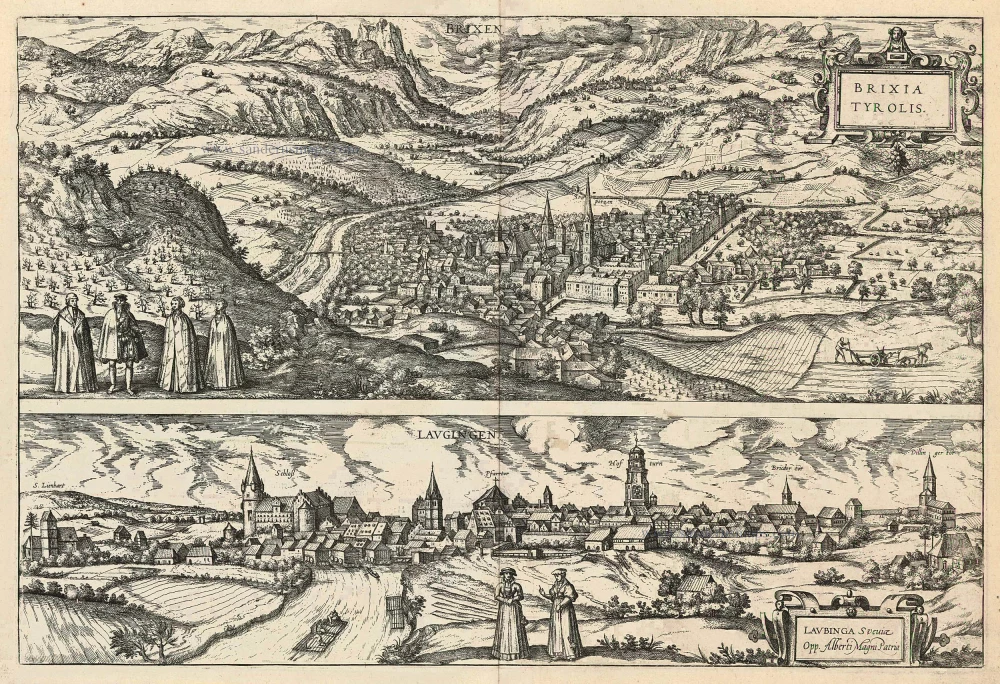
Brixen - Brixia Tyrolis [on sheet with] Laugingen - Laubinga Sueviae Opp. Alberti Magni Patria. 1599
Bressanone (Brixen) in South Tyrol Italy and Lauingen in Schwaben Germany, by Georg Braun and Frans Hogenberg.
[Item number: 24119]
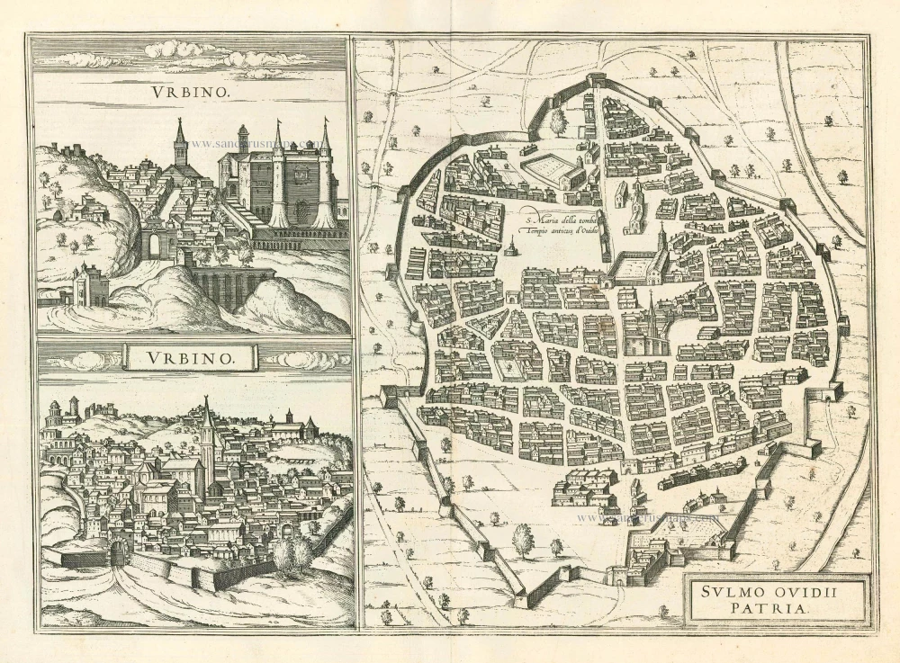
Urbino - Sulmo Ovidii Patria 1599
Urbino and Sulmona, by Braun and Hogenberg.
[Item number: 24126]
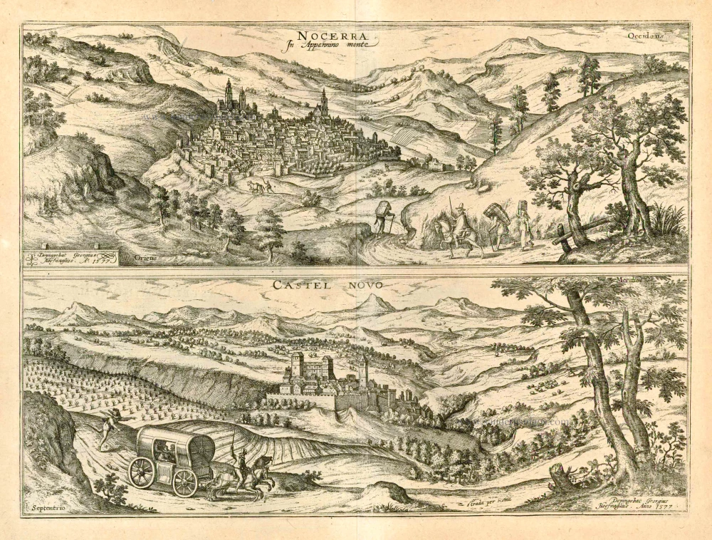
Nocerra In Appennino monte [on sheet with] Castel Novo 1596
Nocerra Umbra and Castelnuovo di Porto, by Georg Braun and Frans Hogenberg.
[Item number: 24196]
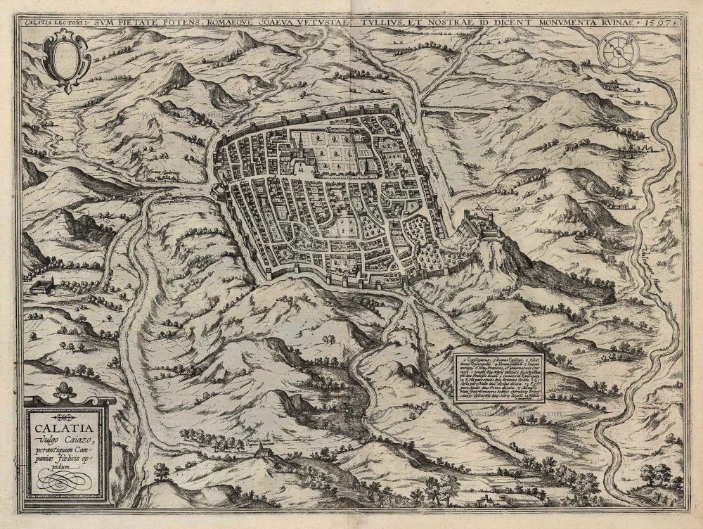
Calatia vulgo Caiazo, perantiquum Campaniae foelicis oppidum. 1596
Caiazzo by Braun and Hogenberg.
[Item number: 24198]