
Dortmund and Lippstadt, by Georg Braun and Frans Hogenberg. 1599
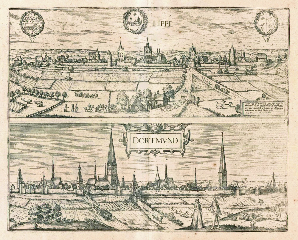
LIPPSTADT
TRANSLATION OF CARTOUCHE TEXT: Although the town of Lippe is subject to the Counts of Lippe, nevertheless, half of it was once ceded to the Counts of Mark so that now they have equal rights of ownership with the Counts of Lippe; the town makes its living from agriculture and draws lucrative benefits from the River Lippe.
The engraving shows Lippstadt from the north, which lies on the River Lippe. The bustling trade routes are a prominent feature. The town was built in the second half of the 12th century at the same time as the Romanesque church of St Nicholas and was fortified from the start. On the right is the Augustinian convent of St Mary, identifiable by the thin spire of its collegiate church. Around 1198 St Mary's quarter was added in the north and included the parish church of St Mary, the city's landmark today. Lippstadt was granted a municipal charter in 1220 and was one of the founding members of the Hanseatic League. Unfortunately, Braun does not describe his atlas of this city in North Rhine-Westphalia, known as Lippstadt since the 17th century.
DORTMUND
COMMENTARY BY BRAUN (on verso): "This country of the Holy Roman Empire, with the city of Dortmund in the middle of it, is one of those territories that are under the direct authority of the Roman Emperor as their liege lord. In the old days, the Swabian peoples called it Trutmannen/Tromannia, later Tremonia; in the common vernacular, it is called Dortmund."
In this view of Dortmund from the north, the churches are larger than life-size; among them, the church of St Reinold stands out in particular. The city is first mentioned in the 9th century AD. Like Soest, it lay on the Hellweg, a major road from west to east. Dortmund was granted a municipal charter in 1202 and played a model role as the principal Westphalian Hanseatic city. Besides being a centre of long-distance trade, the town developed a cloth industry, and coal was mined from the beginning of the 14th century. (Taschen)
Braun G. & Hogenberg F. and the Civitates Orbis Terrarum.
The Civitates Orbis Terrarum, or the "Braun & Hogenberg", is a six-volume town atlas and the most excellent book of town views and plans ever published: 363 engravings, sometimes beautifully coloured. It was one of the best-selling works in the last quarter of the 16th century. Georg Braun wrote the text accompanying the plans and views on the verso. Many plates were engraved after the original drawings of a professional artist, a professional artist, Joris Hoefnagel (1542-1600). The first volume was published in Latin in 1572, and the sixth in 1617. Frans Hogenberg created the tables for volumes I through IV, and Simon van den Neuwel made those for volumes V and VI. Other contributors were cartographers Daniel Freese and Heinrich Rantzau. Works by Jacob van Deventer, Sebastian Münster, and Johannes Stumpf were also used. Translations appeared in German and French.
Following the original publication of Volume 1 of the Civitates in 1572, seven further editions of 1575, 1577, 1582, 1588, 1593, 1599 and 1612 can be identified. Vol.2, first issued in 1575, was followed by further editions in 1597 and 1612. The subsequent volumes appeared in 1581, 1588, 1593, 1599 and 1606. The German translation of the first volume appeared from 1574 on, and the French edition from 1575 on.
Several printers were involved: Theodor Graminaeus, Heinrich von Aich, Gottfried von Kempen, Johannis Sinniger, Bertram Buchholtz and Peter von Brachel, who all worked in Cologne.
Georg Braun (1541-1622)
Georg Braun was born in Cologne in 1541. After his studies in Cologne, he entered the Jesuit Order as a novice. 1561, he obtained his bachelor's degree, and in 1562, he received his Magister Artium. Although he left the Jesuit Order, he studied theology, gaining a licentiate in theology.
Frans Hogenberg (1535-1590)
Frans Hogenberg was a Flemish and German painter, engraver, and mapmaker. He was born in Mechelen as the son of Nicolaas Hogenberg.
By the end of the 1560s, Frans Hogenberg was employed upon Abraham Ortelius's Theatrum Orbis Terrarum, published in 1570; he is named an engraver of numerous maps. In 1568, he was banned from Antwerp by the Duke of Alva and travelled to London, where he stayed a few years before emigrating to Cologne. He immediately embarked on his two most important works, the Civitates, published in 1572 and the Geschichtsblätter, which appeared in several series from 1569 until about 1587.
Thanks to large-scale projects like the Geschichtsblätter and the Civitates, Hogenberg's social circumstances improved with each passing year. He died as a wealthy man in Cologne in 1590.
Lippe [on sheet with] Dortmund.
Item Number: 24094 Authenticity Guarantee
Category: Antique maps > Europe > Germany - Cities
Two bird's-eye views by Braun and Hogenberg on one sheet: Dortmund and Lippstadt.
Title: Lippe [on sheet with] Dortmund.
Date of the first edition: 1588.
Date of this map: 1599.
Copper engraving, printed on paper.
Size (not including margins): 305 x 485mm (12.01 x 19.09 inches).
Verso: Latin text.
Condition: Uncoloured, excellent.
Condition Rating: A+.
From: Liber quartus Urbium Praecipuarum totius Mundi. Cologne, Bertram Buchholtz, 1599. (Van der Krogt 4, 41:1.4(1599))
LIPPSTADT
TRANSLATION OF CARTOUCHE TEXT: Although the town of Lippe is subject to the Counts of Lippe, nevertheless, half of it was once ceded to the Counts of Mark so that now they have equal rights of ownership with the Counts of Lippe; the town makes its living from agriculture and draws lucrative benefits from the River Lippe.
The engraving shows Lippstadt from the north, which lies on the River Lippe. The bustling trade routes are a prominent feature. The town was built in the second half of the 12th century at the same time as the Romanesque church of St Nicholas and was fortified from the start. On the right is the Augustinian convent of St Mary, identifiable by the thin spire of its collegiate church. Around 1198 St Mary's quarter was added in the north and included the parish church of St Mary, the city's landmark today. Lippstadt was granted a municipal charter in 1220 and was one of the founding members of the Hanseatic League. Unfortunately, Braun does not describe his atlas of this city in North Rhine-Westphalia, known as Lippstadt since the 17th century.
DORTMUND
COMMENTARY BY BRAUN (on verso): "This country of the Holy Roman Empire, with the city of Dortmund in the middle of it, is one of those territories that are under the direct authority of the Roman Emperor as their liege lord. In the old days, the Swabian peoples called it Trutmannen/Tromannia, later Tremonia; in the common vernacular, it is called Dortmund."
In this view of Dortmund from the north, the churches are larger than life-size; among them, the church of St Reinold stands out in particular. The city is first mentioned in the 9th century AD. Like Soest, it lay on the Hellweg, a major road from west to east. Dortmund was granted a municipal charter in 1202 and played a model role as the principal Westphalian Hanseatic city. Besides being a centre of long-distance trade, the town developed a cloth industry, and coal was mined from the beginning of the 14th century. (Taschen)
Braun G. & Hogenberg F. and the Civitates Orbis Terrarum.
The Civitates Orbis Terrarum, or the "Braun & Hogenberg", is a six-volume town atlas and the most excellent book of town views and plans ever published: 363 engravings, sometimes beautifully coloured. It was one of the best-selling works in the last quarter of the 16th century. Georg Braun wrote the text accompanying the plans and views on the verso. Many plates were engraved after the original drawings of a professional artist, a professional artist, Joris Hoefnagel (1542-1600). The first volume was published in Latin in 1572, and the sixth in 1617. Frans Hogenberg created the tables for volumes I through IV, and Simon van den Neuwel made those for volumes V and VI. Other contributors were cartographers Daniel Freese and Heinrich Rantzau. Works by Jacob van Deventer, Sebastian Münster, and Johannes Stumpf were also used. Translations appeared in German and French.
Following the original publication of Volume 1 of the Civitates in 1572, seven further editions of 1575, 1577, 1582, 1588, 1593, 1599 and 1612 can be identified. Vol.2, first issued in 1575, was followed by further editions in 1597 and 1612. The subsequent volumes appeared in 1581, 1588, 1593, 1599 and 1606. The German translation of the first volume appeared from 1574 on, and the French edition from 1575 on.
Several printers were involved: Theodor Graminaeus, Heinrich von Aich, Gottfried von Kempen, Johannis Sinniger, Bertram Buchholtz and Peter von Brachel, who all worked in Cologne.
Georg Braun (1541-1622)
Georg Braun was born in Cologne in 1541. After his studies in Cologne, he entered the Jesuit Order as a novice. 1561, he obtained his bachelor's degree, and in 1562, he received his Magister Artium. Although he left the Jesuit Order, he studied theology, gaining a licentiate in theology.
Frans Hogenberg (1535-1590)
Frans Hogenberg was a Flemish and German painter, engraver, and mapmaker. He was born in Mechelen as the son of Nicolaas Hogenberg.
By the end of the 1560s, Frans Hogenberg was employed upon Abraham Ortelius's Theatrum Orbis Terrarum, published in 1570; he is named an engraver of numerous maps. In 1568, he was banned from Antwerp by the Duke of Alva and travelled to London, where he stayed a few years before emigrating to Cologne. He immediately embarked on his two most important works, the Civitates, published in 1572 and the Geschichtsblätter, which appeared in several series from 1569 until about 1587.
Thanks to large-scale projects like the Geschichtsblätter and the Civitates, Hogenberg's social circumstances improved with each passing year. He died as a wealthy man in Cologne in 1590.
Related items

Magdeburgum ... Metropolitica Saxoniae Urbs 1582
Magdeburg, by Georg Braun and Frans Hogenberg.
[Item number: 4119]

Bardum Pomeraniae. 1596
Barth, by Georg Braun and Frans Hogenberg.
[Item number: 23386]
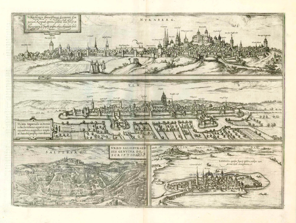
Nurnberga Florentissimum Germaniae Emporium, ... [on sheet with] Ulma Imperialis in Suevia [and] Saltzburg Urbis Salisburgensis Genvina Descriptio [and] Lindaw - Lindoia, Oppidum Imperij insulare, ... 1599
Nürnberg, Ulm, Salzburg, and Lindau, by Georg Braun and Frans Hogenberg.
[Item number: 23926]
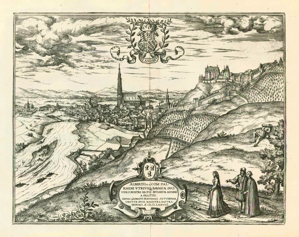
Landshut 1599
Landshut, by Georg Braun and Frans Hogenberg.
[Item number: 24060]