
Nysa and Legnica (Poland), by Georg Braun and Frans Hogenberg. c. 1625
Braun G. & Hogenberg F. and the Civitates Orbis Terrarum.
The Civitates Orbis Terrarum, or the "Braun & Hogenberg", is a six-volume town atlas and the most excellent book of town views and plans ever published: 363 engravings, sometimes beautifully coloured. It was one of the best-selling works in the last quarter of the 16th century. Georg Braun wrote the text accompanying the plans and views on the verso. Many plates were engraved after the original drawings of a professional artist, a professional artist, Joris Hoefnagel (1542-1600). The first volume was published in Latin in 1572, and the sixth in 1617. Frans Hogenberg created the tables for volumes I through IV, and Simon van den Neuwel made those for volumes V and VI. Other contributors were cartographers Daniel Freese and Heinrich Rantzau. Works by Jacob van Deventer, Sebastian Münster, and Johannes Stumpf were also used. Translations appeared in German and French.
Following the original publication of Volume 1 of the Civitates in 1572, seven further editions of 1575, 1577, 1582, 1588, 1593, 1599 and 1612 can be identified. Vol.2, first issued in 1575, was followed by further editions in 1597 and 1612. The subsequent volumes appeared in 1581, 1588, 1593, 1599 and 1606. The German translation of the first volume appeared from 1574 on, and the French edition from 1575 on.
Several printers were involved: Theodor Graminaeus, Heinrich von Aich, Gottfried von Kempen, Johannis Sinniger, Bertram Buchholtz and Peter von Brachel, who all worked in Cologne.
Georg Braun (1541-1622)
Georg Braun was born in Cologne in 1541. After his studies in Cologne, he entered the Jesuit Order as a novice. 1561, he obtained his bachelor's degree, and in 1562, he received his Magister Artium. Although he left the Jesuit Order, he studied theology, gaining a licentiate in theology.
Frans Hogenberg (1535-1590)
Frans Hogenberg was a Flemish and German painter, engraver, and mapmaker. He was born in Mechelen as the son of Nicolaas Hogenberg.
By the end of the 1560s, Frans Hogenberg was employed upon Abraham Ortelius's Theatrum Orbis Terrarum, published in 1570; he is named an engraver of numerous maps. In 1568, he was banned from Antwerp by the Duke of Alva and travelled to London, where he stayed a few years before emigrating to Cologne. He immediately embarked on his two most important works, the Civitates, published in 1572 and the Geschichtsblätter, which appeared in several series from 1569 until about 1587.
Thanks to large-scale projects like the Geschichtsblätter and the Civitates, Hogenberg's social circumstances improved with each passing year. He died as a wealthy man in Cologne in 1590.
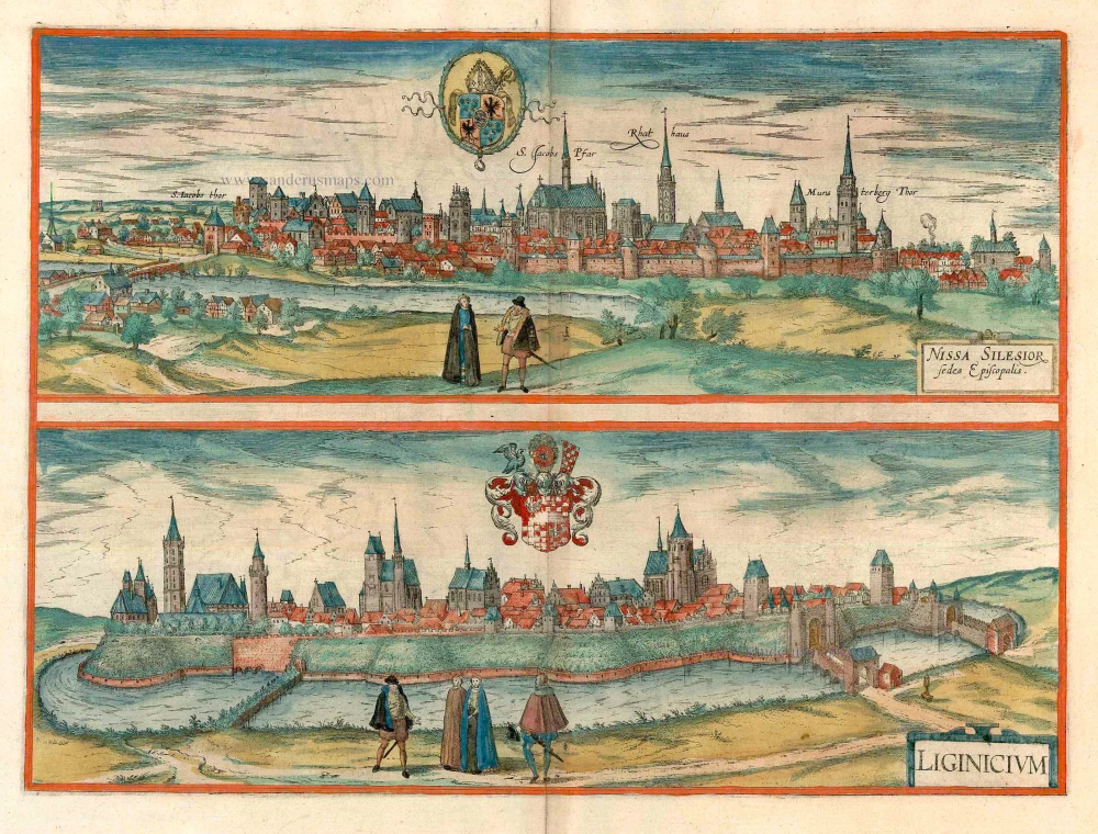
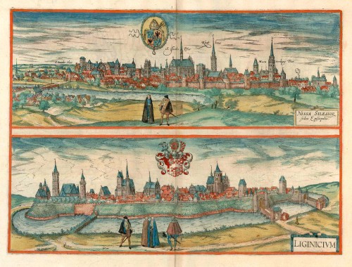
Nissa Silesior Sedes Episcopalis [on sheet with] Liginicium
Item Number: 24584 Authenticity Guarantee
Category: Antique maps > Europe > Eastern Europe
Antique map with two bird's-eye views by Braun and Hogenberg: Nysa and Legnica (Poland)
NYSA
CARTOUCHE: Nysa, episcopal see in Silesia.
COMMENTARY BY BRAUN (on verso): "This is also a fine city in Silesia. Its name is taken from the River Nysa on which it lies. It is quit large, handsome and well built, in a very cheerful and fertile situation. It has the right of entrepôt for goods that pass the city on the Neisse. This river rises in the Bohemian mountains and flows past Görlitz to join the Oder at Crossen."
This is a view of Nysa (German Neisse) from the northwest. In the middle of the city is the Gothic cathedral of St James, dating from the 14th/15th centuries with its separate bell tower. To the right of this is the town hall tower, and on the far right the Münsterberg gate tower, which is a part of the city wall, built in 1350. In the left foreground, in front of the Neisse bridge, the Capuchin monastery can be identified. Nysa, one of the oldest cities in Silesia, lies in a strategically favourable position on the Nysa Klodzka. In the 12th century the city was the seat of the Piast duke. After 1198 Nysa passed into the possession of the bishops of Wroclaw, whose residence can be seen on the left in the northeastern part of the town.
LEGNICA
COMMENTARY BY BRAUN (on verso): "On the origins of this city, like almost all other cities in Silesia, we have little information. This is due to a certain extent to the fact that the annals, together with other archives and written documents, have been destroyed, partly by enemy attack and partly by fire."
This is a view from the northwest of the city of Legnica (German Liegnitz), which is protected by bastions and a moat. The nobles depicted in the foreground illustrate the city's importance. On the left is the castle with its octagonal St Peter's tower and the round St Hedwig's tower, to the right of this is the church of Our Lady and on the far right the Gothic cathedral of SS Peter and Paul. In the 12th century the city was the seat of the Dukes of Lower Silesia and from 1248 to 1675 it was the residence of the Duchy of Legnica. In 1526 the first Protestant university in Europe was founded here. This important trade and industrial city passed to Prussia in 1742 and to Poland in 1945. (Taschen)
Date of the first edition: 1617
Date of this map: c. 1625
Copper engraving
Size: 33 x 45.5cm (12.9 x 17.6 inches)
Verso text: French
Condition: Contemporary coloured, excellent.
Condition Rating: A
References: Taschen, Braun and Hogenberg, p.455.
From: Théatre des Principales Villes de tout l'Univers Vol. VI. c. 1625. (Van der Krogt 4, 41:3.6)
Braun G. & Hogenberg F. and the Civitates Orbis Terrarum.
The Civitates Orbis Terrarum, or the "Braun & Hogenberg", is a six-volume town atlas and the most excellent book of town views and plans ever published: 363 engravings, sometimes beautifully coloured. It was one of the best-selling works in the last quarter of the 16th century. Georg Braun wrote the text accompanying the plans and views on the verso. Many plates were engraved after the original drawings of a professional artist, a professional artist, Joris Hoefnagel (1542-1600). The first volume was published in Latin in 1572, and the sixth in 1617. Frans Hogenberg created the tables for volumes I through IV, and Simon van den Neuwel made those for volumes V and VI. Other contributors were cartographers Daniel Freese and Heinrich Rantzau. Works by Jacob van Deventer, Sebastian Münster, and Johannes Stumpf were also used. Translations appeared in German and French.
Following the original publication of Volume 1 of the Civitates in 1572, seven further editions of 1575, 1577, 1582, 1588, 1593, 1599 and 1612 can be identified. Vol.2, first issued in 1575, was followed by further editions in 1597 and 1612. The subsequent volumes appeared in 1581, 1588, 1593, 1599 and 1606. The German translation of the first volume appeared from 1574 on, and the French edition from 1575 on.
Several printers were involved: Theodor Graminaeus, Heinrich von Aich, Gottfried von Kempen, Johannis Sinniger, Bertram Buchholtz and Peter von Brachel, who all worked in Cologne.
Georg Braun (1541-1622)
Georg Braun was born in Cologne in 1541. After his studies in Cologne, he entered the Jesuit Order as a novice. 1561, he obtained his bachelor's degree, and in 1562, he received his Magister Artium. Although he left the Jesuit Order, he studied theology, gaining a licentiate in theology.
Frans Hogenberg (1535-1590)
Frans Hogenberg was a Flemish and German painter, engraver, and mapmaker. He was born in Mechelen as the son of Nicolaas Hogenberg.
By the end of the 1560s, Frans Hogenberg was employed upon Abraham Ortelius's Theatrum Orbis Terrarum, published in 1570; he is named an engraver of numerous maps. In 1568, he was banned from Antwerp by the Duke of Alva and travelled to London, where he stayed a few years before emigrating to Cologne. He immediately embarked on his two most important works, the Civitates, published in 1572 and the Geschichtsblätter, which appeared in several series from 1569 until about 1587.
Thanks to large-scale projects like the Geschichtsblätter and the Civitates, Hogenberg's social circumstances improved with each passing year. He died as a wealthy man in Cologne in 1590.
Related items
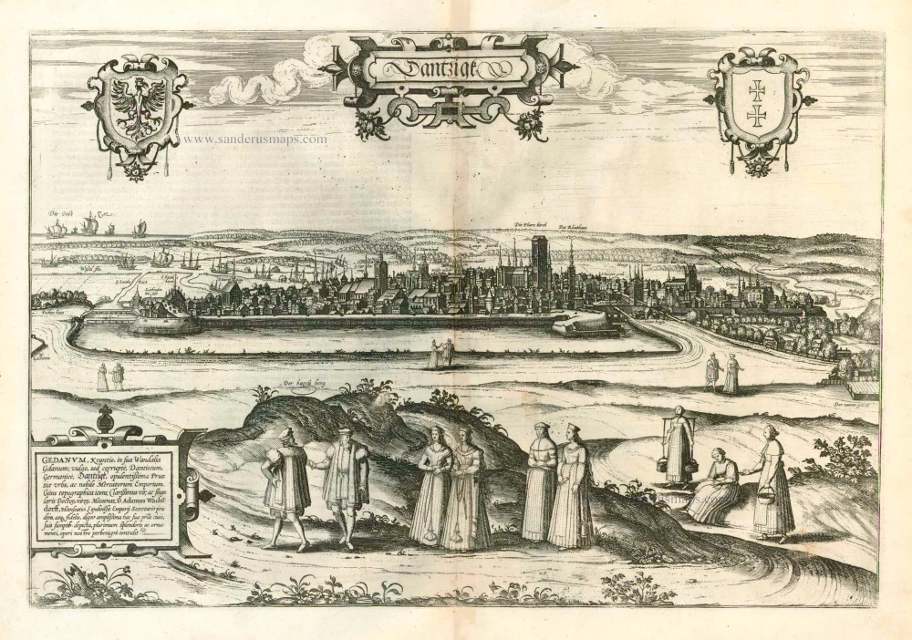
Dantzigk - Gedanum, Krantio, in sua Wandalia Gdanum; . . . 1576
Gdansk, by Georg Braun and Frans Hogenberg.
[Item number: 4056]
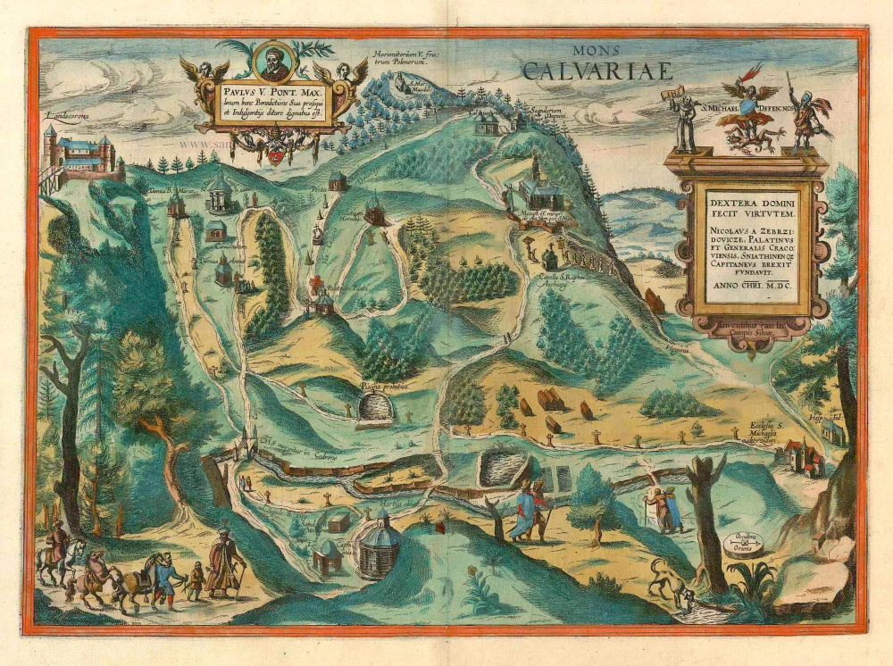
Mons Calvariae. c. 1625
Kalwarya Zebrzydowska (Poland) by Georg Braun & Frans Hogenberg.
[Item number: 10510]
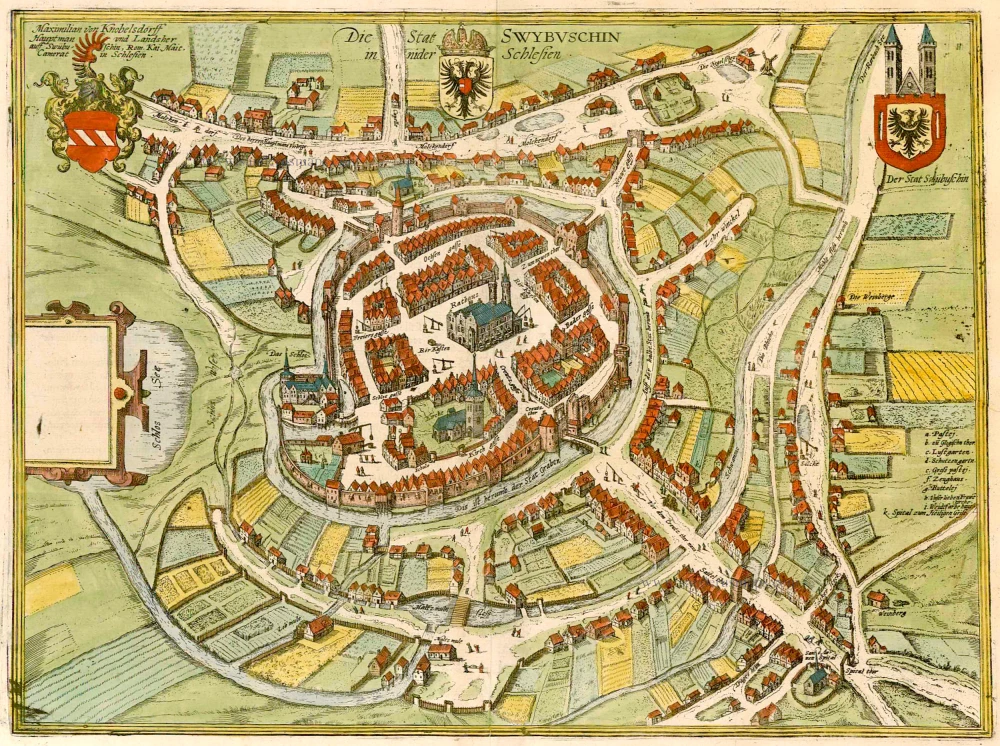
Die Stat Swybuschin in Nider Schlesien. 1596
Poland - Swiebodzin, by Braun & Hogenberg.
[Item number: 22102]
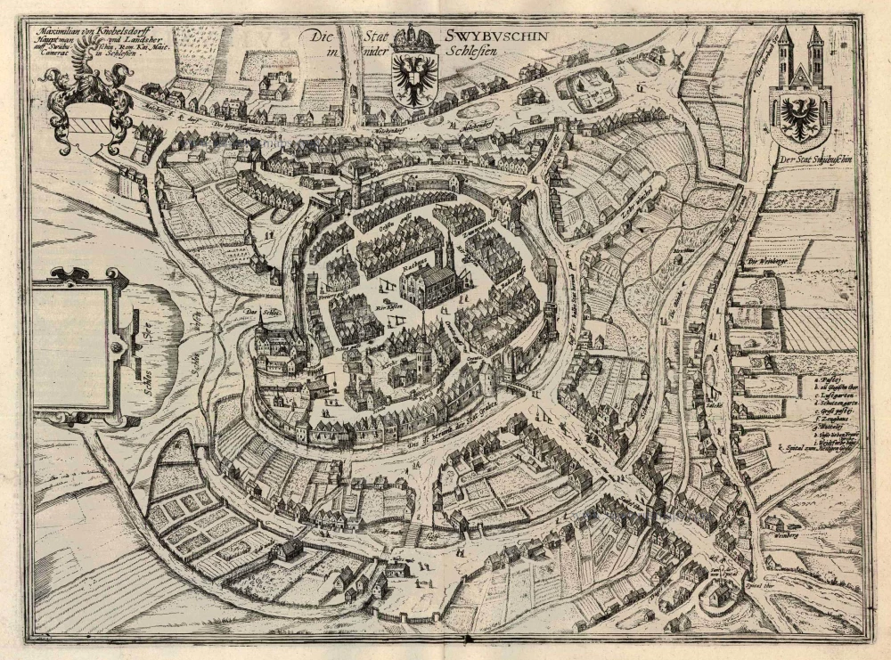
Die Stat Swybuschin in Nider Schlesien 1596
Swiebodzin, by Georg Braun and Frans Hogenberg.
[Item number: 24182]
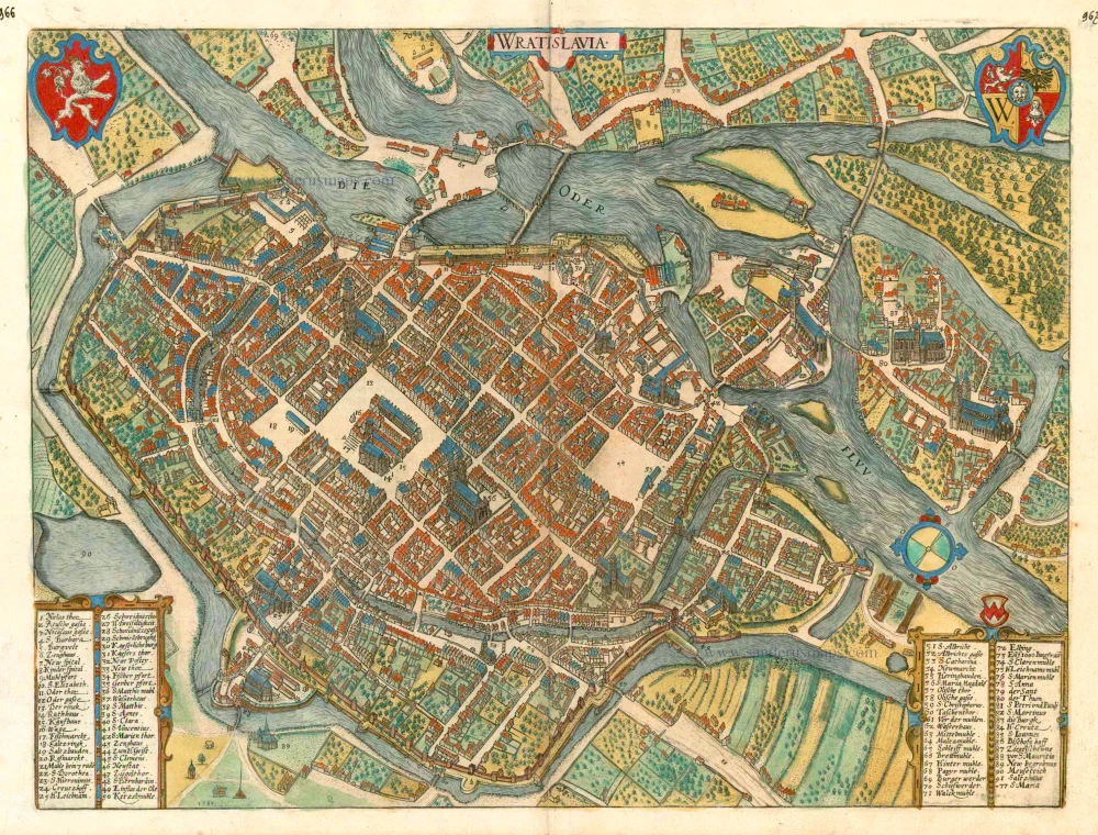
Wratislavia. c. 1593
Wroclaw (Breslau), by Georg Braun and Frans Hogenberg.
[Item number: 24572]
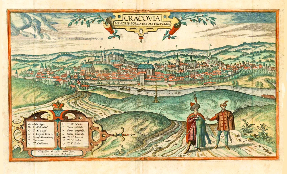
Cracovia Minoris Poloniae Metropolis. 1617-18
Krakow, by Georg Braun and Frans Hogenberg. after G. Hoefnagel and E. vander Rye.
[Item number: 25150]
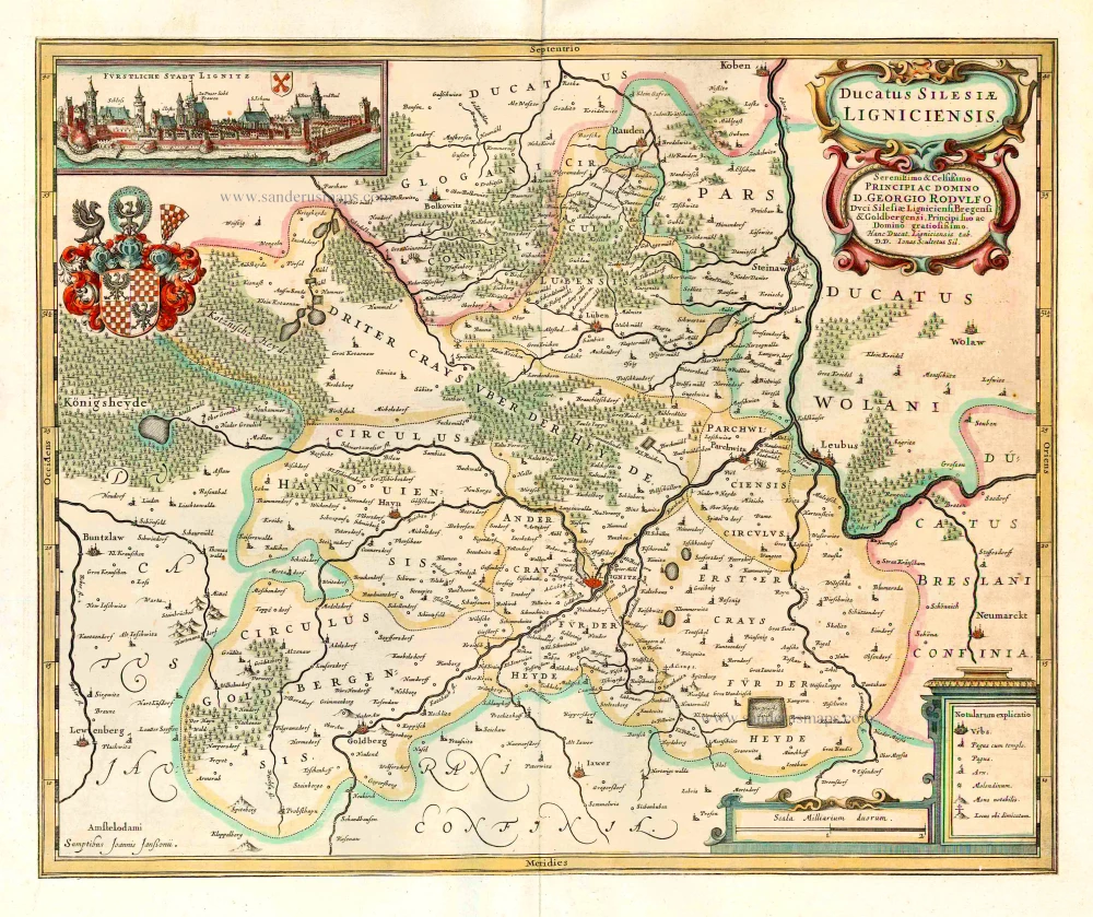
Ducatus Silesiae Ligniciensis. 1641
Legnica (Poland), by J. Janssonius.
[Item number: 26279]
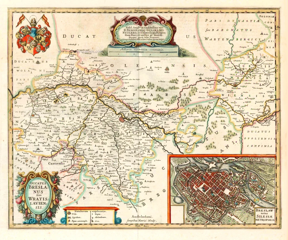
Ducatus Breslanus sive Wratislaviensis. 1641
Wroclaw (Breslau), by Henricus Hondius.
[Item number: 26280]
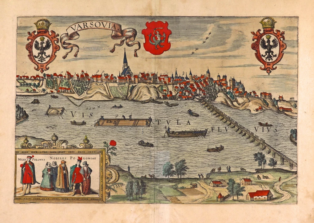
Varsovia. 1618
Warsaw (Warszawa), by Georg Braun & Frans Hogenberg.
[Item number: 27942]

Alten Stettin 1588
Szczecin in Poland, by Georg Braun and Frans Hogenberg.
[Item number: 29161]
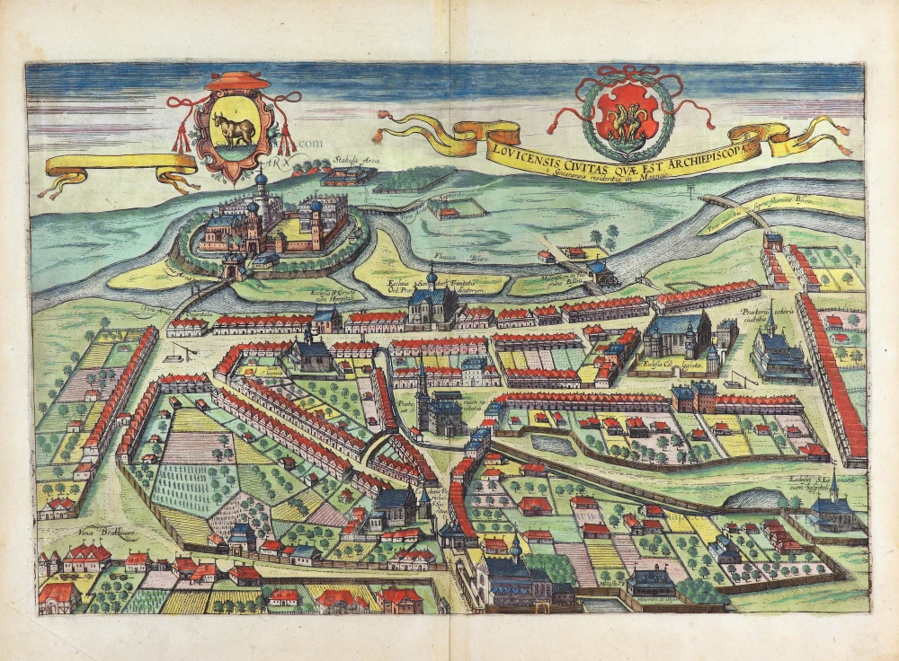
Lovicensis Civitas quae est Archiepiscopa. 1617-18
Lowicz by Georg Braun & Frans Hogenberg
[Item number: 29282]