
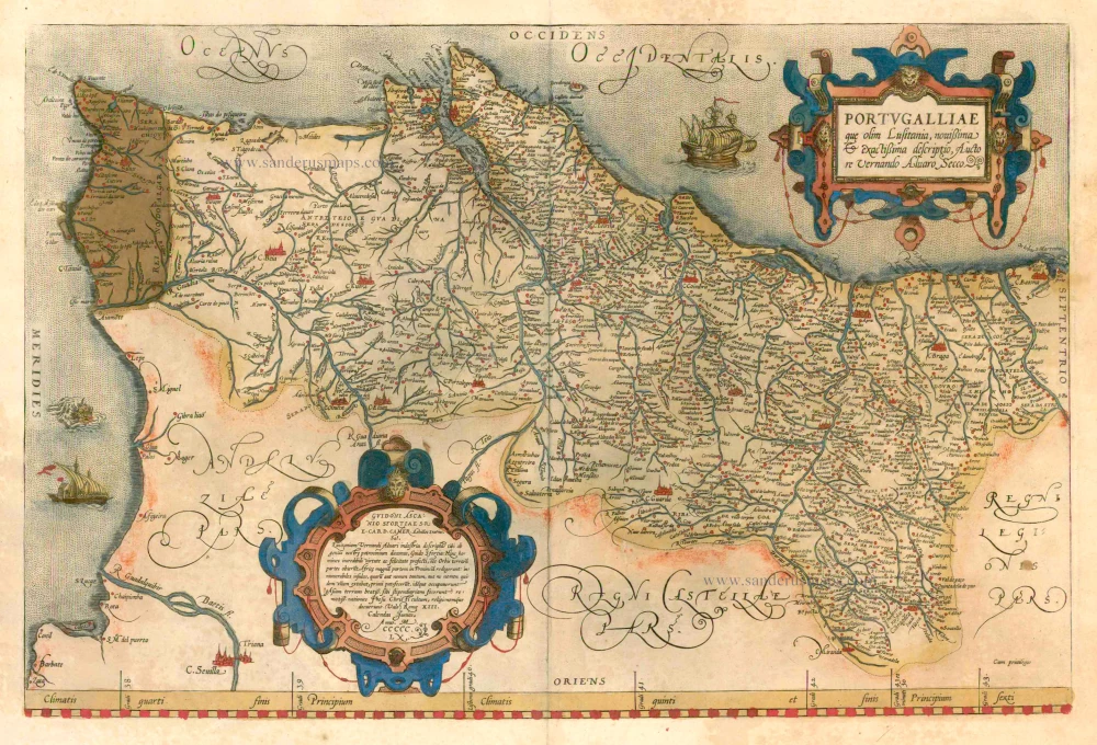
Portugal by Jodocus Hondius. 1607
The Hondius Family
Jodocus Hondius the Elder (1563-1612)
Joost d’Hondt was born at Wakken (Flanders) in 1563. Two years later, his family settled in Ghent, where young Joost displayed an excellent gift for drawing and calligraphy. Through study and lessons, he developed his talents and became an engraver with a good reputation.
Due to the circumstances of the war, he moved to London in 1584, where he settled down as an engraver, instrument-maker, and map-maker. In 1587, he married Coletta van den Keere, sister of the well-known engraver Pieter van den Keere (Petrus Kaerius); some years earlier, his sister, Jacomina, had married Pieter van den Berghe (Petrus Montanus). Joost, who had Latinized his name to Jodocus Hondius, closely co-operated with his two brothers-in-law.
The political situation in the Northern Netherlands in 1593 was such that Jodocus seemed justified in establishing himself in Amsterdam, where many Antwerp printers, publishers, and engravers had gone. In this new centre of cartography, Jodocus Hondius set up his business “In de Wackere Hondt” (in the vigilant dog), this name being an allusion to his birthplace and name. He engraved many maps and published atlases and many other works, such as his continuation of Gerard Mercator’s Atlas.
He suddenly passed away in February 1612. The publishing firm of Jodocus Hondius was continued by his widow, later on, by his two sons, Jodocus Jr. and Henricus, and by his son-in-law, J. Janssonius.
Jodocus Hondius II (1594-1629) & Henricus Hondius (1597-1651)
After the father’s death, the widow and her seven children continued publishing the atlases under the name of Jodocus Hondius till 1620. The firm was reinforced by the very welcome help of Joannes Janssonius (1588-1664), who married 24-year-old Elisabeth Hondius in 1612. After 1619, Mercator’s Atlas was published under the name of Henricus Hondius.
One of the most dramatic events in the early history of commercial cartography in Amsterdam was the sale of Jodocus Hondius Jr.’s copper plates to Willem Jansz. Blaeu in 1629, the year of his death. At least 34 plates, from which Jodocus II had printed single-sheet maps for his benefit, passed into the hands of his great competitor. Immediately after that, his brother, Henricus, and Joannes Janssonius ordered the engraving of identical plates.
Henricus devoted all his energy to publishing the Atlas for an extended period. He saw its growth up to and including the fourth part in 1646; after that, his name no longer figures on the title pages. After 1638, the title of the Atlas was changed to Atlas Novus; Joannes Janssonius mainly carried it on.
The competition with the Blaeu's dates from 1630. In 1630, Willem Janszoon (=Blaeu) first attacked with his Atlantis Appendix. In 1635, Blaeu completed his Theatrum Orbis Terrarum in two volumes with French, Latin, Dutch, and German texts, prompting Henricus Hondius to speed up the enlargement of his Atlas.
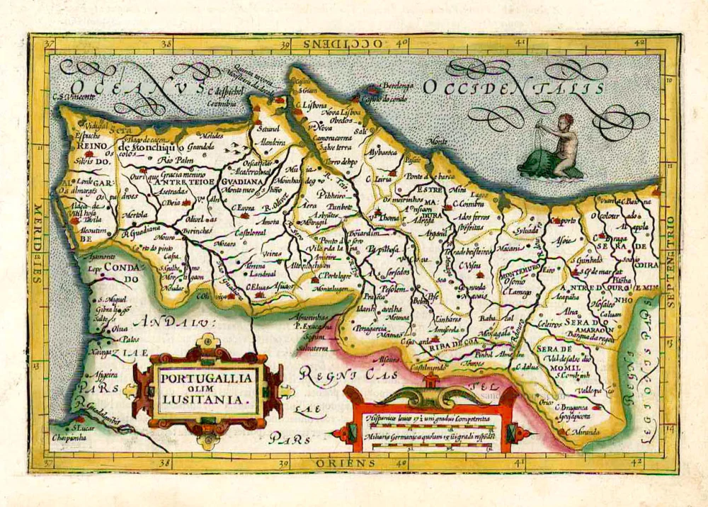
Portugallia olim Lusitania.
Item Number: 24627 Authenticity Guarantee
Category: Antique maps > Europe > Spain and Portugal
Old, antique map of Portugal, by Jodocus Hondius.
Title: Portugallia olim Lusitania.
Oriented to the west.
Date of the first edition: 1607.
Date of this map: 1607.
Copper engraving, printed on paper.
Map size: 135 x 205mm (5.31 x 8.07 inches).
Sheet size: 170 x 225mm (6.69 x 8.86 inches).
Verso: Latin text.
Condition: Contemporary coloured. Handwritten number in upper right corner.
Condition Rating: A+.
References: Van der Krogt 3, 6300:351
From: Atlas Minor Gerardi Mercatoris Amsterdam, J. Hondius, 1607. (Van der Krogt 3, 351:01)
The Hondius Family
Jodocus Hondius the Elder (1563-1612)
Joost d’Hondt was born at Wakken (Flanders) in 1563. Two years later, his family settled in Ghent, where young Joost displayed an excellent gift for drawing and calligraphy. Through study and lessons, he developed his talents and became an engraver with a good reputation.
Due to the circumstances of the war, he moved to London in 1584, where he settled down as an engraver, instrument-maker, and map-maker. In 1587, he married Coletta van den Keere, sister of the well-known engraver Pieter van den Keere (Petrus Kaerius); some years earlier, his sister, Jacomina, had married Pieter van den Berghe (Petrus Montanus). Joost, who had Latinized his name to Jodocus Hondius, closely co-operated with his two brothers-in-law.
The political situation in the Northern Netherlands in 1593 was such that Jodocus seemed justified in establishing himself in Amsterdam, where many Antwerp printers, publishers, and engravers had gone. In this new centre of cartography, Jodocus Hondius set up his business “In de Wackere Hondt” (in the vigilant dog), this name being an allusion to his birthplace and name. He engraved many maps and published atlases and many other works, such as his continuation of Gerard Mercator’s Atlas.
He suddenly passed away in February 1612. The publishing firm of Jodocus Hondius was continued by his widow, later on, by his two sons, Jodocus Jr. and Henricus, and by his son-in-law, J. Janssonius.
Jodocus Hondius II (1594-1629) & Henricus Hondius (1597-1651)
After the father’s death, the widow and her seven children continued publishing the atlases under the name of Jodocus Hondius till 1620. The firm was reinforced by the very welcome help of Joannes Janssonius (1588-1664), who married 24-year-old Elisabeth Hondius in 1612. After 1619, Mercator’s Atlas was published under the name of Henricus Hondius.
One of the most dramatic events in the early history of commercial cartography in Amsterdam was the sale of Jodocus Hondius Jr.’s copper plates to Willem Jansz. Blaeu in 1629, the year of his death. At least 34 plates, from which Jodocus II had printed single-sheet maps for his benefit, passed into the hands of his great competitor. Immediately after that, his brother, Henricus, and Joannes Janssonius ordered the engraving of identical plates.
Henricus devoted all his energy to publishing the Atlas for an extended period. He saw its growth up to and including the fourth part in 1646; after that, his name no longer figures on the title pages. After 1638, the title of the Atlas was changed to Atlas Novus; Joannes Janssonius mainly carried it on.
The competition with the Blaeu's dates from 1630. In 1630, Willem Janszoon (=Blaeu) first attacked with his Atlantis Appendix. In 1635, Blaeu completed his Theatrum Orbis Terrarum in two volumes with French, Latin, Dutch, and German texts, prompting Henricus Hondius to speed up the enlargement of his Atlas.
Related items
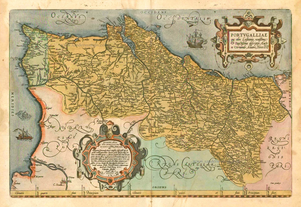
Portugalliae que olim Lusitania, novissima & exactissima descriptio, ... 1601
Portugal by A. Ortelius.
[Item number: 5729]
Very rare!
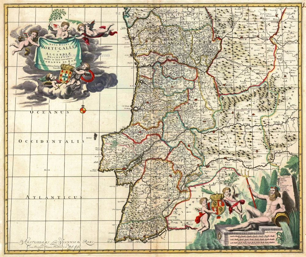
Nova Regni Portugalliae et Algarbiae Descriptio ... c. 1690
Portugal by J. de Ram, published by F. De Wit.
[Item number: 13745]
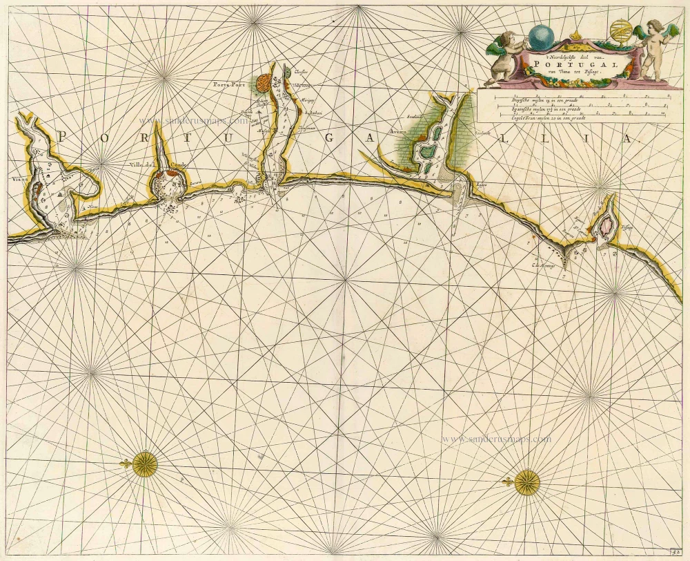
't Noordelyckste deel van Portugal van Viana tot Pissage. 1686
Sea chart of Portugal by Doncker H.
[Item number: 15379]
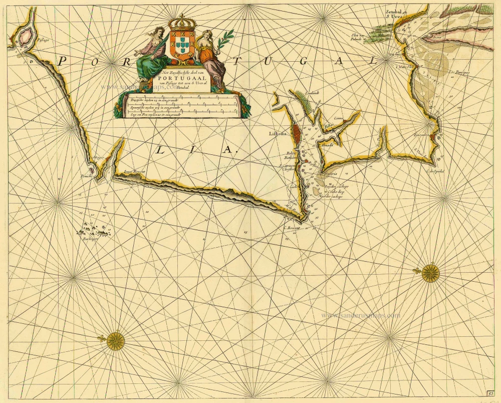
Het Zuydlyckste deel van Portugaal van Pissage tot aen S. Uves al: Setubal. 1686
Sea chart of Portugal by Doncker H.
[Item number: 16192]
Portugalliae que olim Lusitania, novissima & exactissima descriptio, ... 1579
Portugal by A. Ortelius.
[Item number: 20873]
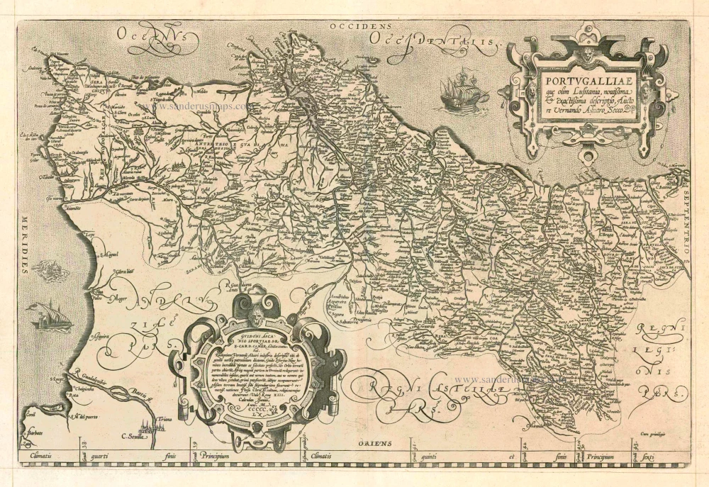
Portugalliae que olim Lusitania, novissima & exactissima descriptio, ... 1598
Portugal, by Abraham Ortelius.
[Item number: 22917]
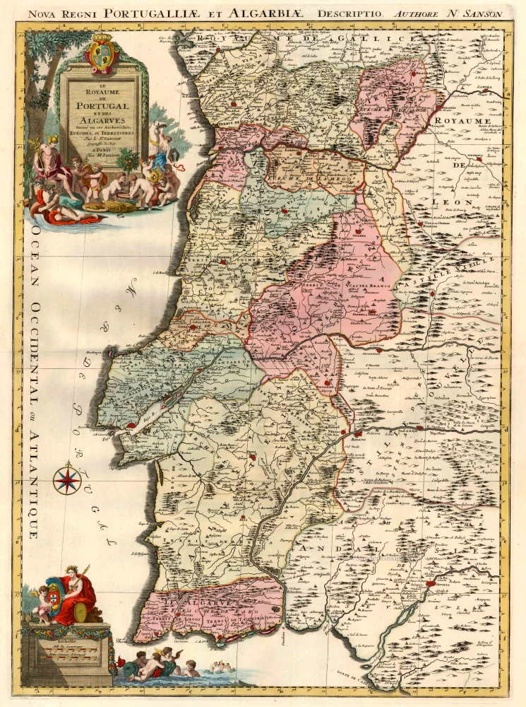
Le Royaume de Portugal et des Algarves ... 1710
Portugal, by Sanson - Covens & Mortier.
[Item number: 23699]
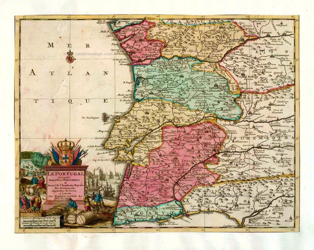
Le Portugal. 1713
Portugal, by Pieter van der Aa.
[Item number: 26086]
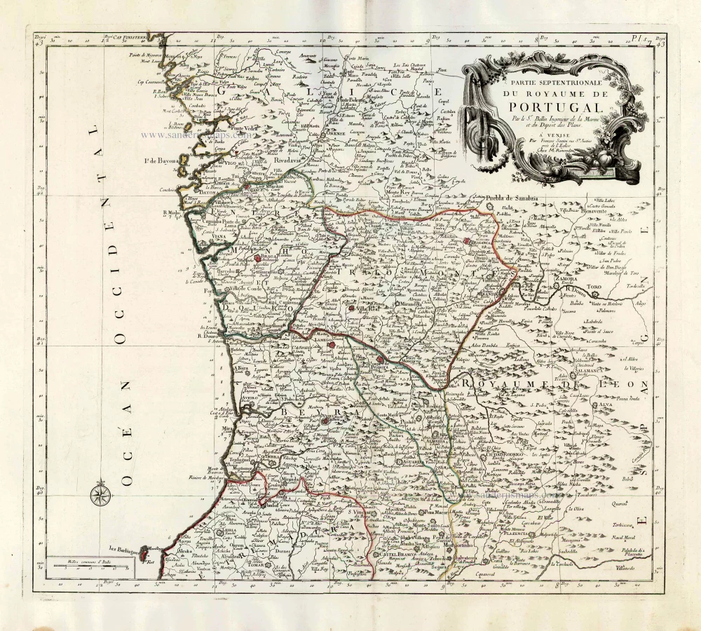
Partie Septentrionale du Royaume de Portugal. 1776-79
Northern Portugal, by Francesco Santini.
[Item number: 26951]
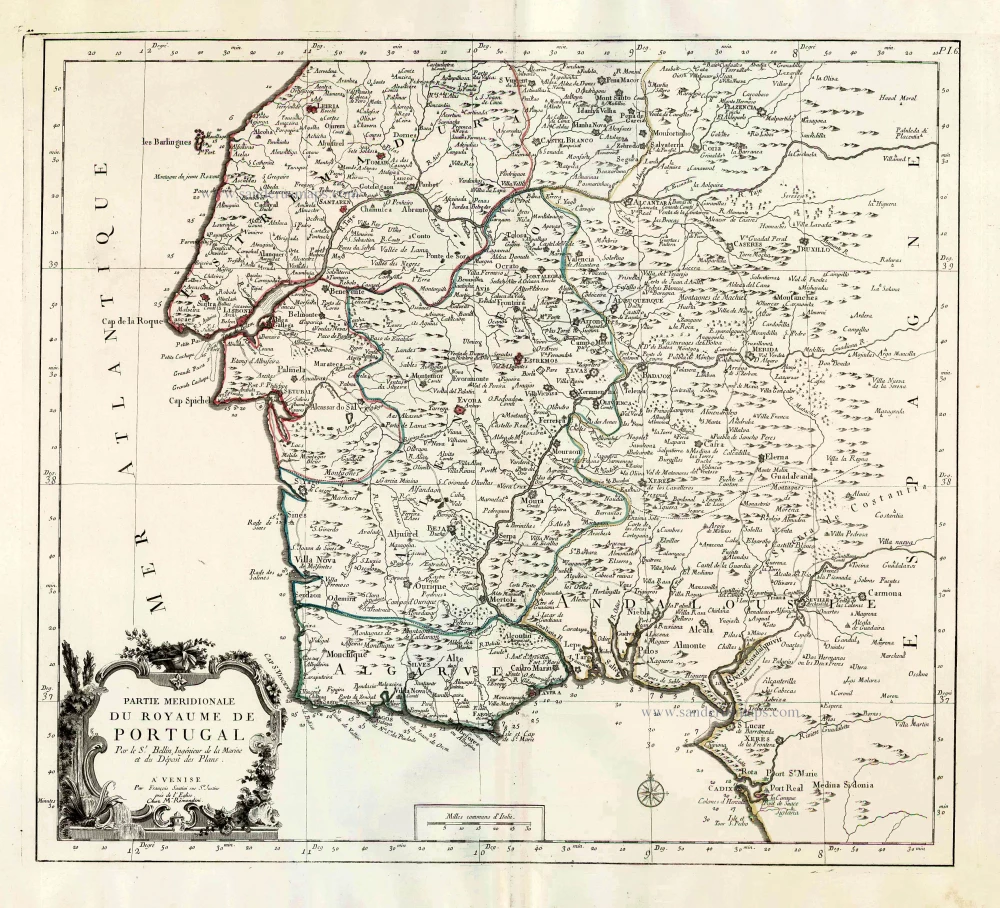
Partie Méridional du Royaume de Portugal. 1776-79
Southern Portugal, by Francesco Santini.
[Item number: 26952]
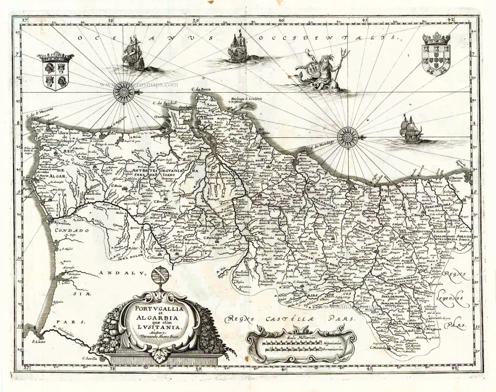
Portugallia et Algarbia quae olim Lusitania. 1638
Portugal by Matthäus Merian
[Item number: 27797]

Novissima Regnorum Portugalliae et Algarbiae Descriptio. after 1721
Portugal by F. de Wit, published by Covens & Mortier.
[Item number: 28234]
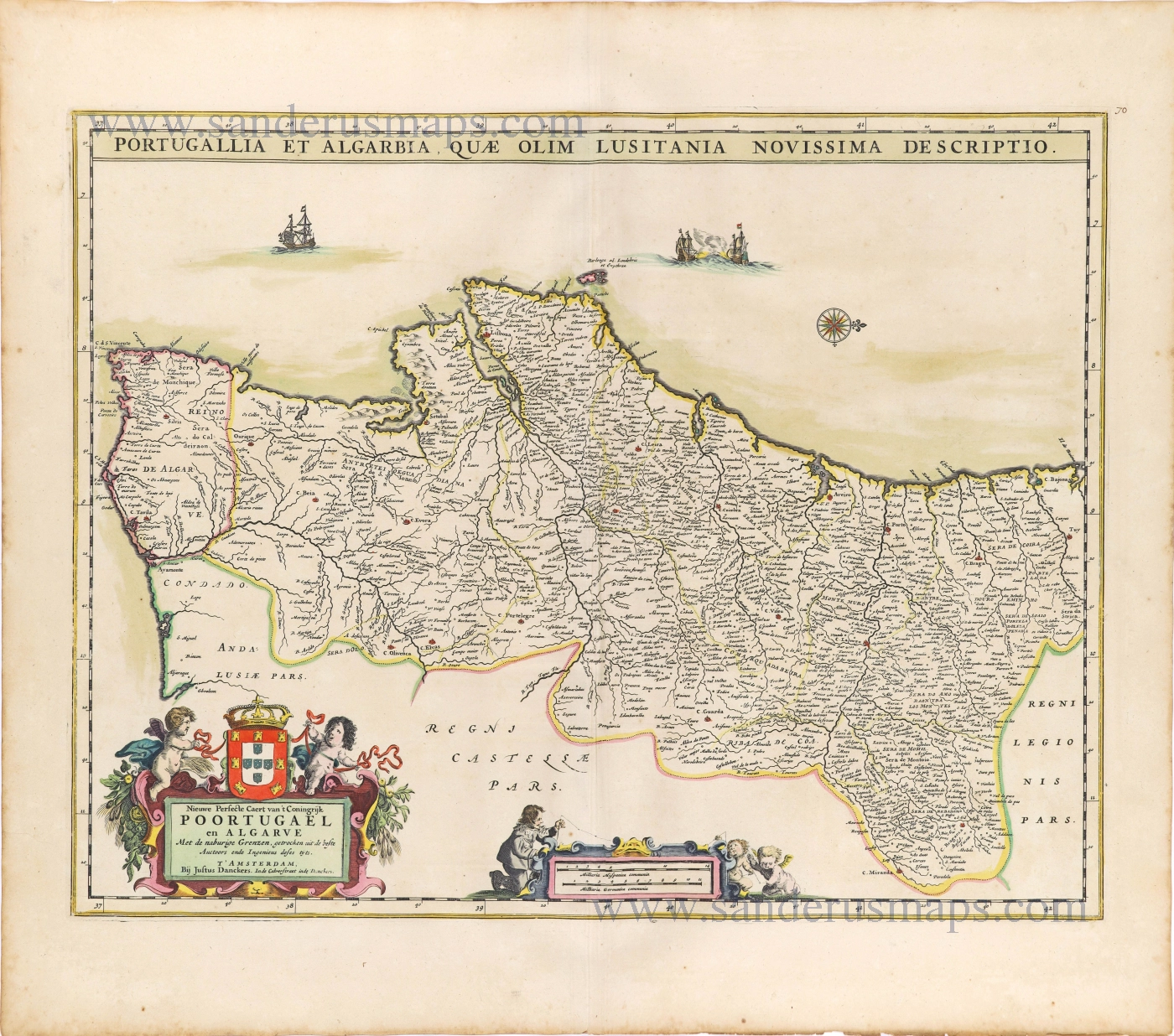
Nieuwe Perfecte Caert van 't Coningrijk Poortugael en Algarve. 1656-80
Portugal by Justus Danckerts.
[Item number: 28603]
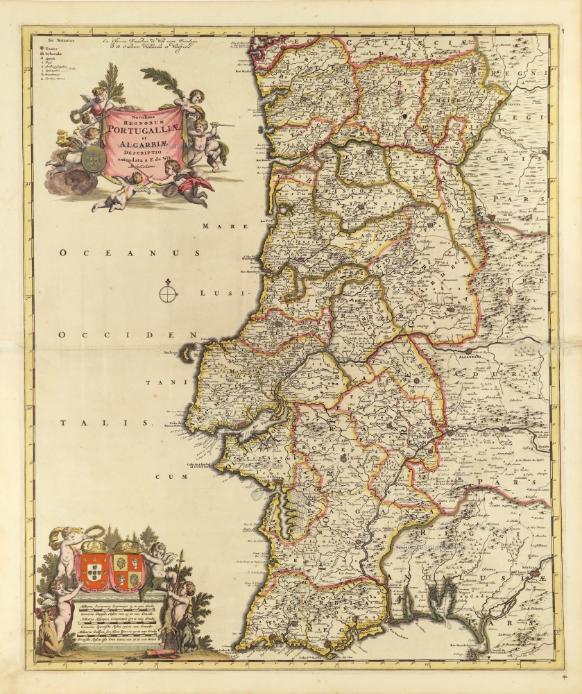
Novissima Regnorum Portugalliae et Algarbiae Descriptio. c. 1690
Portugal by Frederick de Wit.
[Item number: 28748]
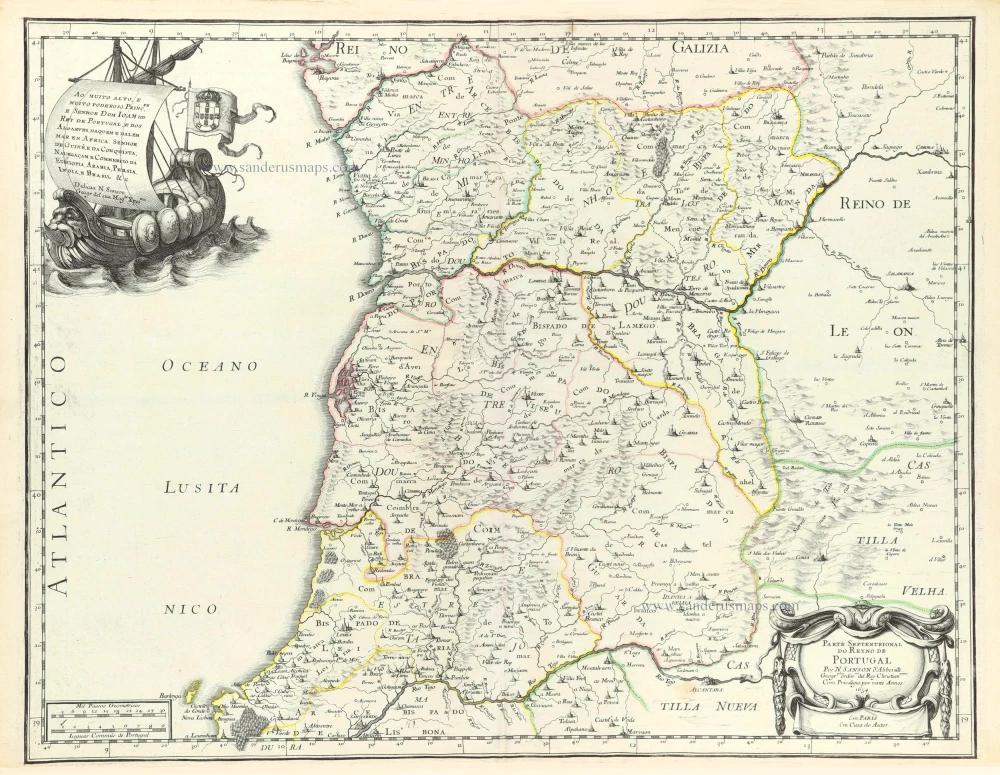
Parte Septentrional do Reyno de Portugal. 1658
Northern Portugal by Nicolas Sanson.
[Item number: 29663]
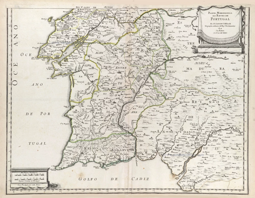
Parte Septentrional do Reyno de Portugal. 1658
Southern Portugal by Nicolas Sanson.
[Item number: 29664]