
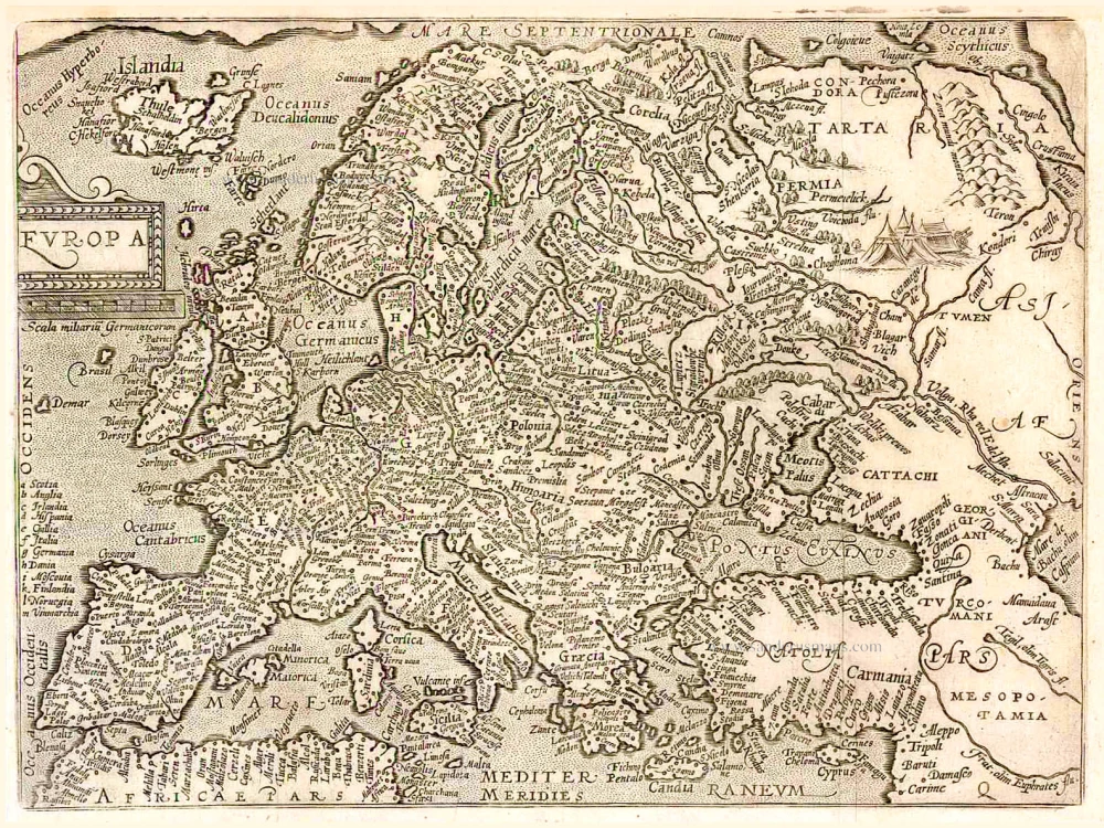
Europe by A. Ortelius 1612

Abraham Ortelius (1527-1598)
The maker of the 'first atlas', the Theatrum Orbis Terrarum (1570), was born on 4 April 1527 into an old Antwerp family. He learned Latin and studied Greek and mathematics.
Abraham and his sisters Anne and Elizabeth took up map colouring. He was admitted to the Guild of St. Luke as an "illuminator of maps." Besides colouring maps, Ortelius was a dealer in antiques, coins, maps, and books, with the book and map trade gradually becoming his primary occupation.
Business went well because his means permitted him to start an extensive collection of medals, coins, antiques, and a library of many volumes. In addition, he travelled a lot and visited Italy and France, made contacts everywhere with scholars and editors, and maintained extensive correspondence with them.
In 1564 he published his first map, a large and ambitious world wall map. The inspiration for this map may well have been Gastaldi's large world map. In 1565 he published a map of Egypt and a map of the Holy Land, a large map of Asia followed.
In 1568 the production of individual maps for his atlas Theatrum Orbis Terrarum was already in full swing. He completed the atlas in 1569, and in May of 1570, the Theatrum was available for sale. It was one of the most expensive books ever published.
This first edition contained seventy maps on fifty-three sheets. Franciscus Hogenberg engraved the maps.
Later editions included Additamenta (additions), resulting in Ortelius' historical atlas, the Parergon, mostly bound together with the atlas. The Parergon can be called a truly original work of Ortelius, who drew the maps based on his research.
The importance of the Theatrum Orbis Terrarum for geographical knowledge in the last quarter of the sixteenth century is difficult to overemphasize. Nothing was like it until Mercator's atlas appeared twenty-five years later. Demand for the Theatrum was remarkable. Some 24 editions appeared during Ortelius's lifetime and another ten after his death in 1598. Editions were published in Dutch, German, French, Spanish, English, and Italian. The number of map sheets grew from 53 in 1570 to 167 in 1612 in the last edition.
In 1577, engraver Philip Galle and poet-translator Pieter Heyns published the first pocket-sized edition of the Theatrum, the Epitome. The work was trendy. Over thirty editions of this Epitome were published in different languages.
Europae
Item Number: 25052 Authenticity Guarantee
Category: Antique maps > Europe > Europe Continent
Europe by Abraham Ortelius.
Title: Europae.
Cartographer: Gerard Mercator.
Date of the first edition: 1584.
Date of this map: 1612.
Copper engraving, printed on paper.
Size (not including margins): 345 x 465mm (13.58 x 18.31 inches).
Verso: Latin text.
Condition: Uncoloured, excellent.
Condition Rating: A.
From: Theatrum Orbis Terrarum Abrahami Ortelii Antverp. Antwerpen, Plantin Press (J. & B. Moretus), 1612. (Van der Krogt 3, 1:055).
Abraham Ortelius (1527-1598)
The maker of the 'first atlas', the Theatrum Orbis Terrarum (1570), was born on 4 April 1527 into an old Antwerp family. He learned Latin and studied Greek and mathematics.
Abraham and his sisters Anne and Elizabeth took up map colouring. He was admitted to the Guild of St. Luke as an "illuminator of maps." Besides colouring maps, Ortelius was a dealer in antiques, coins, maps, and books, with the book and map trade gradually becoming his primary occupation.
Business went well because his means permitted him to start an extensive collection of medals, coins, antiques, and a library of many volumes. In addition, he travelled a lot and visited Italy and France, made contacts everywhere with scholars and editors, and maintained extensive correspondence with them.
In 1564 he published his first map, a large and ambitious world wall map. The inspiration for this map may well have been Gastaldi's large world map. In 1565 he published a map of Egypt and a map of the Holy Land, a large map of Asia followed.
In 1568 the production of individual maps for his atlas Theatrum Orbis Terrarum was already in full swing. He completed the atlas in 1569, and in May of 1570, the Theatrum was available for sale. It was one of the most expensive books ever published.
This first edition contained seventy maps on fifty-three sheets. Franciscus Hogenberg engraved the maps.
Later editions included Additamenta (additions), resulting in Ortelius' historical atlas, the Parergon, mostly bound together with the atlas. The Parergon can be called a truly original work of Ortelius, who drew the maps based on his research.
The importance of the Theatrum Orbis Terrarum for geographical knowledge in the last quarter of the sixteenth century is difficult to overemphasize. Nothing was like it until Mercator's atlas appeared twenty-five years later. Demand for the Theatrum was remarkable. Some 24 editions appeared during Ortelius's lifetime and another ten after his death in 1598. Editions were published in Dutch, German, French, Spanish, English, and Italian. The number of map sheets grew from 53 in 1570 to 167 in 1612 in the last edition.
In 1577, engraver Philip Galle and poet-translator Pieter Heyns published the first pocket-sized edition of the Theatrum, the Epitome. The work was trendy. Over thirty editions of this Epitome were published in different languages.
Related items

Imperii Caroli Magni et Vicinarum Regionum Descriptio ... 1635
Empire of Charlemagne, by Blaeu W.& J.
[Item number: 9393]

Schlavoniae, Croatiae, Carniae, Istriae, Bosniae, finitimarumque Regionum Nova Descriptio, ... 1598
Western Balkans, by A. Ortelius.
[Item number: 22920]

Europa Pars Tenet haec Mundi Reliquas Celeberrima Partes c. 1730.
Europe by G.& L. Valk.
[Item number: 24536]
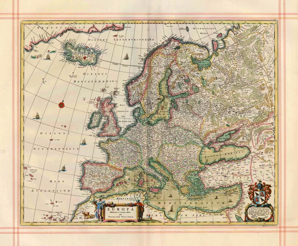
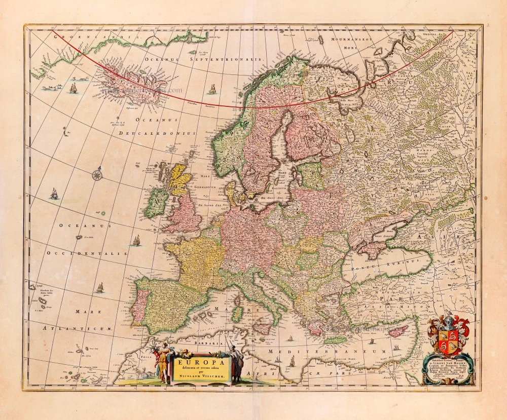
Europa delineata et recens edita. 1680
Europe by N. Visscher.
[Item number: 25056]
Europa. 1600
Europe, by Matthias Quad.
[Item number: 26666]
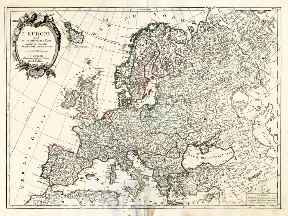
L'Europe Divisee en ses Principaux Etats. 1776-79
Europe, by Francesco Santini.
[Item number: 26947]
Big spectacular map
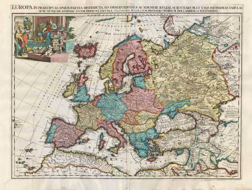
L'Europe selon les Nouvelles Observations de Messrs de l'Academie des Sciences, etc. Before 1713
Europe, by François Halma.
[Item number: 27850]
Big spectacular map.
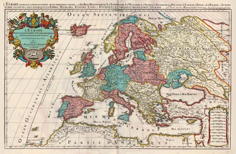
L'Europe Divisée Suivant l'Estendue de ses Principaux Estats subdivisés en leurs principales Provinces. c. 1705
Europe, by H. Jaillot, published by P. Mortier.
[Item number: 27854]
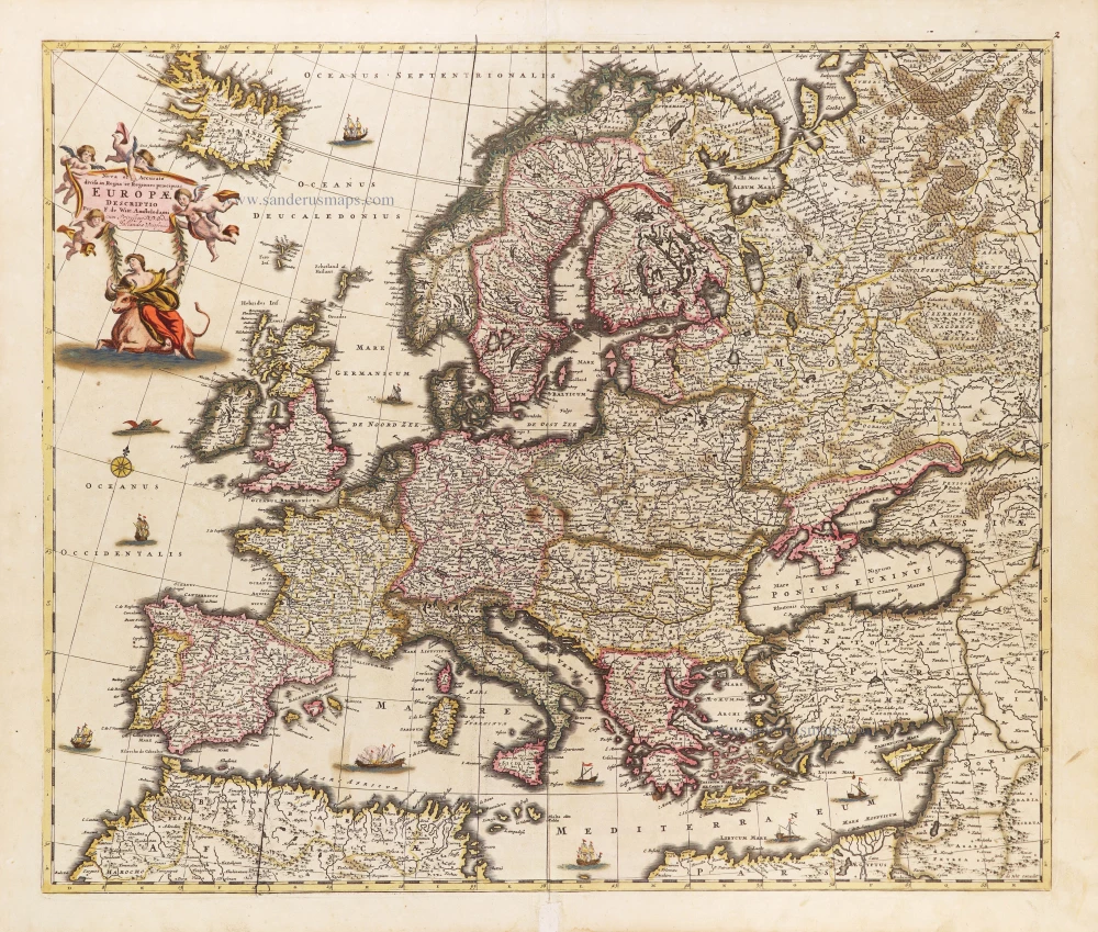
Europa delineata et recens edita. 1683-1696
Europe by Nicolaas Visscher II.
[Item number: 28712]
Nova et Accurate Divisa in Regna et Regiones Praecipuas Europae Descriptio. c. 1691-96
Europe, by Frederick de Wit;
[Item number: 29233]
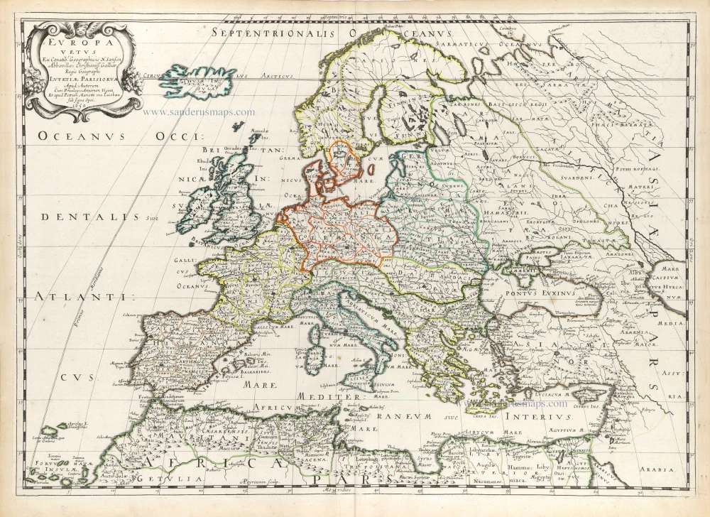
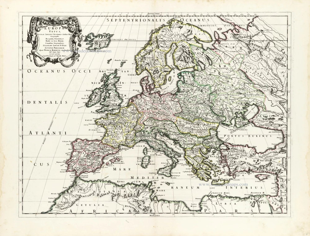
Europa Vetus. 1652
Ancient Europe by Nicolas Sanson.
[Item number: 29689]
Europa Vetus. 1667-69
Ancient Europe by Nicolas & Guillaume Sanson.
[Item number: 30000]
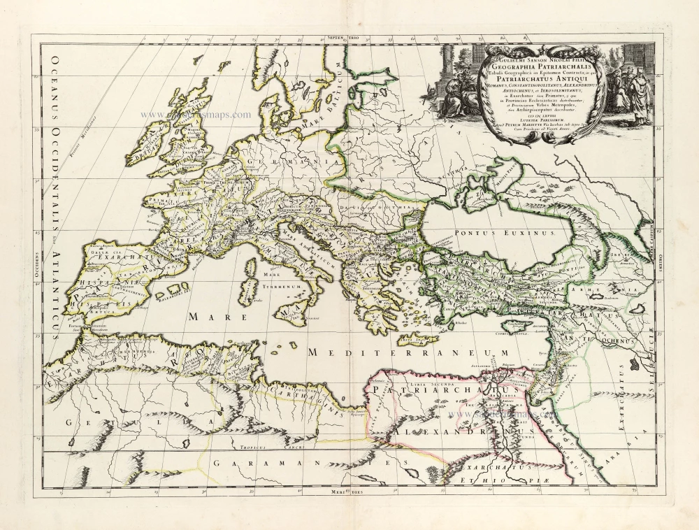
Geographia Patriarchalis Tabula Geographica in Epitomen Contracta; in quo Patriarchatus Antiqui Romanus, Constantinopolitanus, Alexandrinus Antiochenus, et Ierosolymitanus; ... 1669
Europe & Mediterranean Sea by Nicolas & Guillaume Sanson.
[Item number: 30049]
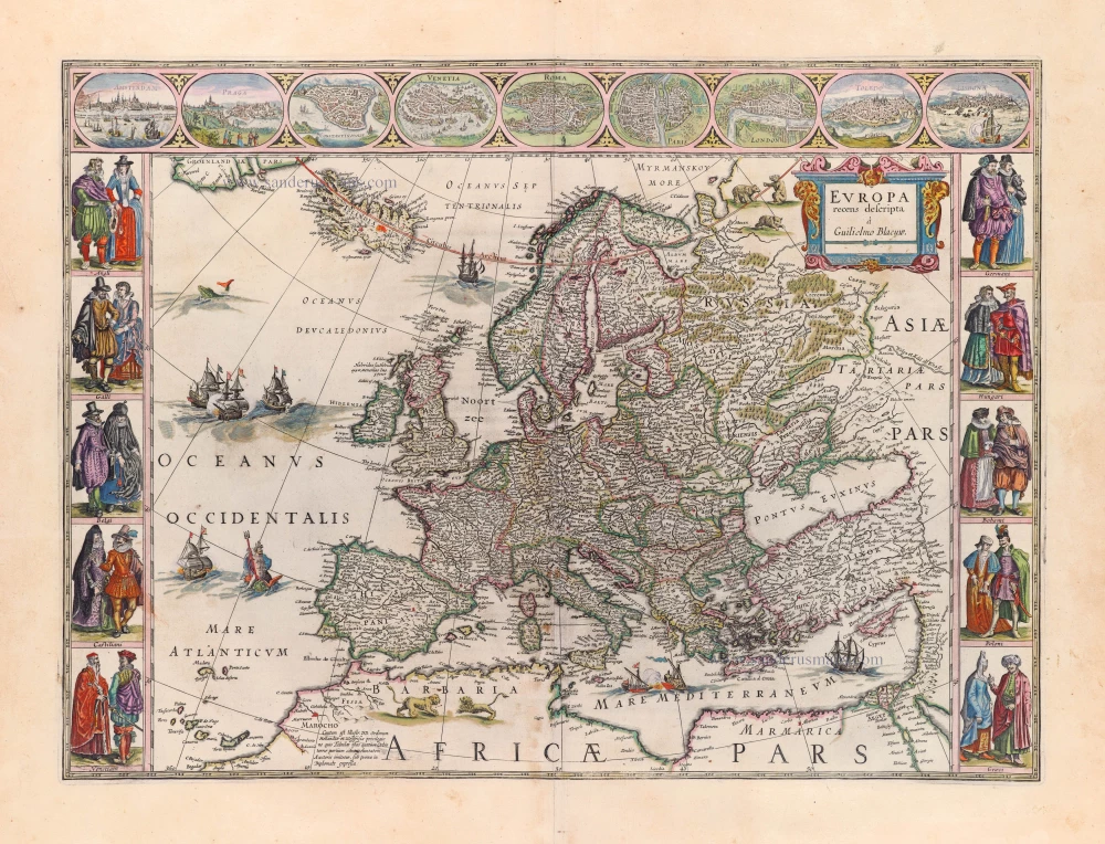
Europa Recens Descripta. 1659
Europe by Willem & Joan Blaeu.
[Item number: 30206]
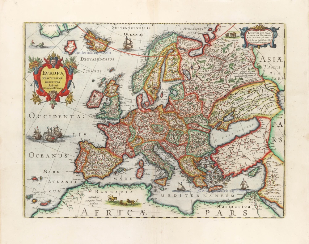
Europa Exactissime Descripta. 1666
Europe by Henricus Hondius, published by Johannes Janssonius.
[Item number: 30305]
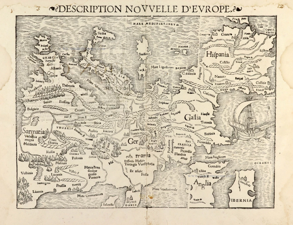
Description Nouvelle d'Europe. 1568
Europe by Sebastian Münster
[Item number: 30523]
new