
America, by Nicolas de Fer. 1698
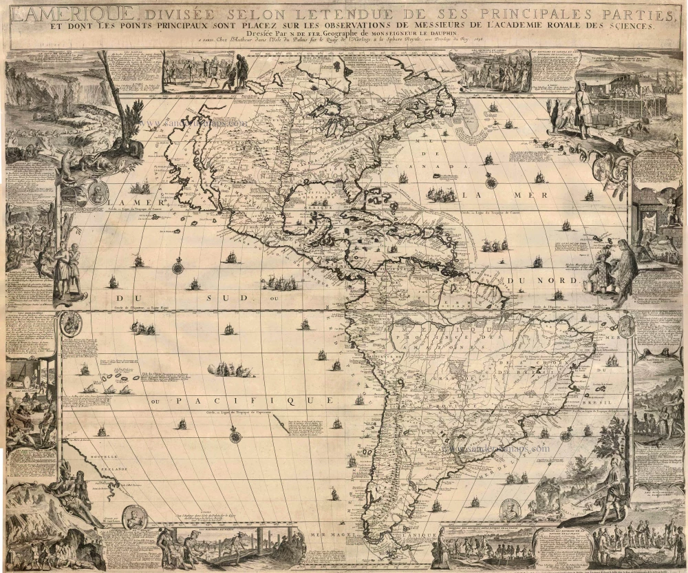
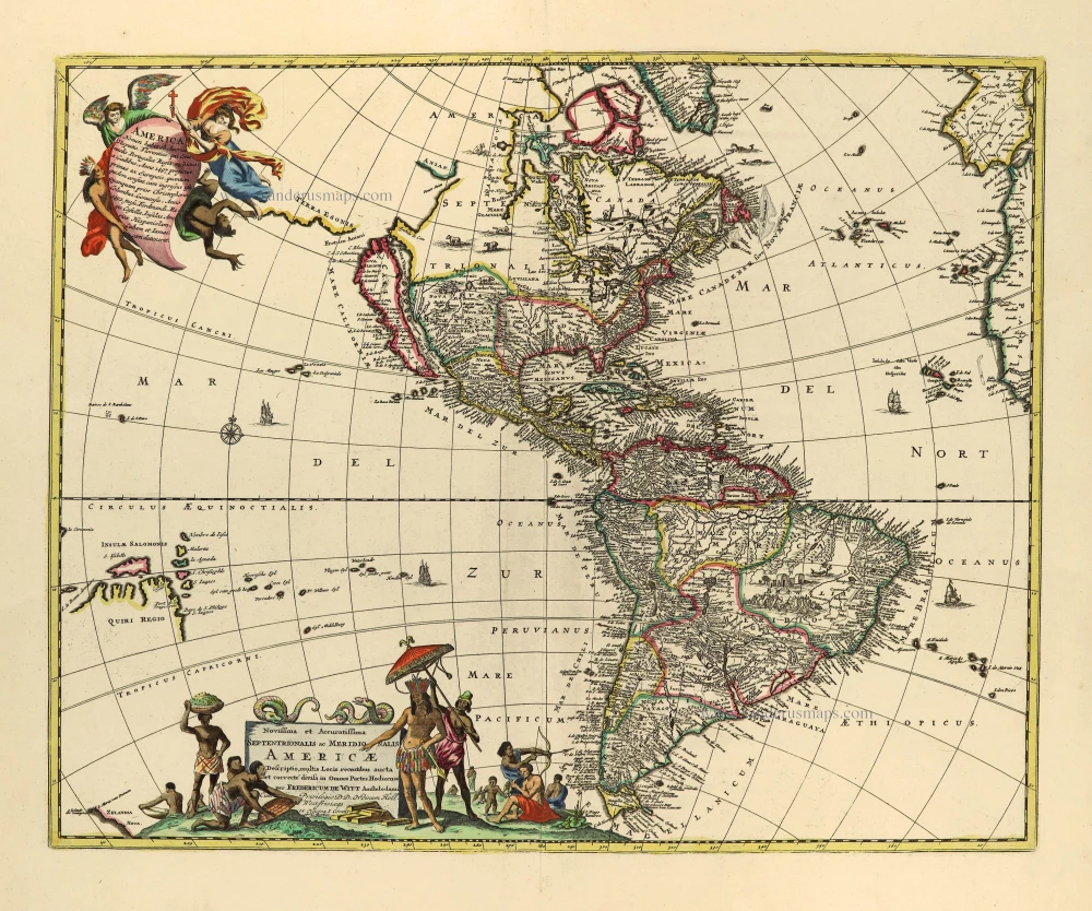
Only a few copies are known of this first state of Nicolas de Fer's wall map of America. Burden: "The classic wall map of America published by Nicolas de Fer (1646-1720) in 1698 is most noted for introducing to the world of cartography its beaver scene. De Fer had worked quietly in the field of maps for a while. He was first apprenticed to Nicolas Spirinx, the engraver, at the age of twelve. His first known published work was of the Languedoc Canal in 1669. From 1690 he began publishing his own books such as Les Forces de l'Europe, and the Petit et Nouveau Atlas in 1697. His first wall map, in 1694, was naturally of the world, and this was followed by a set of four continents. His wall map of America was first published in 1698 and is very rare. The later states are more usually located. Cartographically the map draws upon independent sources, namely the Academie Royale des Sciences. Their archives at the time were being filled with regular accounts and maps of New France in particular. Many of these maps were drawn at the hand of Jean Baptiste-Louis Franquelin of Montreal, who collected first hand much of the data. On the map Hudson Bay is perfectly aligned with the Great Lakes to its south, a position many cartographers failed to achieve. Similarly, the southern reaches of the Great Lakes are better aligned with the east coast. As Hudson Bay and the east coast were controlled by the English, relating these regions to each other accurately was made all the more difficult. More detail of the river and lake network to the west of Hudson Bay is displayed; much of this can be found on Franquelin's manuscript of 1681. The Mississippi River is displayed in much the same manner as other contemporary maps, with its mouth placed too far to the west. Arguably the first more accurately defined Missouri River, named Outantes R. is found, although the Ohio River is placed far to the south. Some of the more general outlines bear a similarity to Vincenzo Maria Coronelli's two sheet map AMERICA SETTENTRIONALE published in 1688. But many of Coronelli's sources were also French. California is still depicted as an island, on the cusp of it being restored as a peninsula by mainstream cartographers. The map is in four sheets and is the work of Hendrick van Loon and Nicolas Guérard. We may presume that van Loon engraved the map and Guérard designed and engraved the wonderful cartouches and inset scenes surrounding the whole. Each sheet bears a further imprint dated 1698. In its first state the lower left sheet bears the imprint only. The dedication to the Dauphin, Louis XIV's son and the ornamental cartouche are engraved for the second state. Some examples [as our copy] are noted with a separate title banner dated 1698 attached across the top of the map. This was clearly intended to accompany it as there is no title within the four sheets themselves. Many examples bear text panels on the remaining three sides, these have been noted bearing the dates of 1703, 1707, 1713 and 1717. Traditionally wall maps to date bore decorative scenes in panels that were to be attached to the sides of the map. Here de Fer places them within the main body of the work. There are two main scenes in the upper corners. Top left is one of the most noted scenes in American cartographic history, the beaver scene. Guérard draws upon the Louis Hennepin engraving of Niagara Falls, the first published view of them, which appeared in his Nouvelle Decouverte in the previous year, 1697. Here Guérard embellishes the scene with native beavers industriously building a dam. As Ed Dahl points out in his study of the scene many liberties are taken. Several are standing clutching branches over their shoulders; some are walking on their hind legs carrying mud in their tails! A key nearby identifies 'woodsmen', 'carpenters', 'porters' and even a 'commander or architect'! He identifies the source of some of these aspects as being Nicolas Denys' Histoire Naturelle, 1672. The presence of the beaver symbolised the nature of what it was that drove the explorers: a plentiful supply of them. The pelt of the beaver was highly prized for hats in fashionable Europe. It might seem surprising to us that a mere fashion accessory could drive the economy of a region do vast! The top right of the map bore a scene illustrating the typical cod-finishing factory along the Newfoundland coast. The fisheries of the Grand Banks were the other economic mainstay of the region. Both this scene and the beaver scene were to be found in later maps, Herman Moll's being the most notable. His A New and Exact Map of the Dominions of the King of Great Britain on ye Continent of North America, 1715, would incorporate the beaver scene, and the North America, 1719, would include the codfish one. Further images were of Canadian savages, ancient Mexico, people of New Mexico, the Buccaneers or Filibusters, people of La Plata, Peru, Chile, Brazilians, Virginia and Illinois. These are framed by six medallions of Ferdinand Magellan, Artha Balipa, Christophe Colombe, François Pissar., Mote-Zuma Roy de Mexique and Americq Vespuse. Burden identified seven states of the map itself, the text panels varying. The title banner can be found undated, or with the dates 1698, 1705 or 1717. Throughout, the cartography does not appear to alter. A second state is created by the addition of a decorative cartouche to frame the imprint on the lower left sheet and include also a dedication to the Dauphin, Louis XIV's son. A third state is formed by the erasure of the date on all four sheets, the date 1705 is replaced on all but the lower right. The fourth bears the imprint of Jacques-François Bénard, de Fer's son-in-law, on the lower right sheet. The fifth state was most likely instigated by the death of Louis' grandson, the Duke of Burgundy, his wife and eldest son of, it is believed, scarlet fever. The dedicatory cartouche and accompanying imprint were removed leaving it blank. Following the death of de Fer in 1720 the business was continued by his sons-in-law Guillaume Danet and Jacques-François Bénard. A sixth state incorporated a new title and imprint in its place. It also bears a date change to 1738 in the upper left sheet, and a curious 1695 upper right. It appears the previous 1705 was poorly altered to 1695. A final state appeared the following year with the addition below the title lower left of the date 1739. There is one very similar map that was issued by Paolo Petrini in Naples, also in four sheets, shortly after 1700."
Nicolas de Fer (1646-1720)
Nicolas de Fer was one of the greatest map producers of the 17th century. At the age of twelve, he had been apprenticed to the etcher Louis Spirinx in Paris. He quickly turned to the actual making of geography maps and edited very current and "useful" documents: border maps, towns fortified by Vauban, voyages of discovery, etc.
His father, Antoine de Fer, a modest print merchant, died in June 1673. His widow, Geneviève Hourlier, continued to operate the fund during the years following the death of her husband.
The career of Nicolas de Fer did not begin until 1687, when his mother gave up her business in maps. After several difficult years, he achieved high prosperity and notoriety. He was appointed as a geographer of the Grand Dauphin and published his first atlases, the Côtes de France and the Introduction à la fortification.
When the Grand Dauphin died in 1711, he became "Géographe des rois de France et d'Espagne" (Geographer of the kings of France and Spain). After the disappearance of Louis XIV, we found him, in 1720, with the sole title of "Géographe ordinaire de Sa Majesté Catholique".
At the time that he received this official support, N. de Fer continued to publish atlases which, both by their number and by the importance of their content, significantly contributed to the success of his publishing career. He published numerous successful atlases and other works. Dutch publishers copied several of these atlases. In 1695 Pieter Mortier published the Atlas Royal, and Carel Allard published the Théatre de la Guerre du Pais Bas Catholique in the following years. He also published 26 large wall maps.
The sign of De Fer's shop was the "Sphère Royale", an emblem to which he was very attached because we find the image of this armillary sphere on many of his publications.
L'Amerique, divisée selon Letendue de ses Principales parties, et dont les points principaux sont placez sur les observations de messieurs de l'Academie Royale des Sciences.
Item Number: 25173 Authenticity Guarantee
Category: Antique maps > America > The Americas
First state of the original "Beaver Map", by Nicolas de Fer.
Title: L'Amerique, divisée selon Letendue de ses Principales parties, et dont les points principaux sont placez sur les observations de messieurs de l'Academie Royale des Sciences.
Date of the first edition: 1698.
Date of this map: 1698.
Copper engraving, printed on paper.
Size (not including margins): 980 x 1180mm (38.58 x 46.46 inches).
Verso: Blank.
Condition: Linnen-backed, two small repairs: left upper corner, 2x1cm and in the centre of the Pacific, 2x4cm.
Condition Rating: A.
From: Separate publication.
Only a few copies are known of this first state of Nicolas de Fer's wall map of America. Burden: "The classic wall map of America published by Nicolas de Fer (1646-1720) in 1698 is most noted for introducing to the world of cartography its beaver scene. De Fer had worked quietly in the field of maps for a while. He was first apprenticed to Nicolas Spirinx, the engraver, at the age of twelve. His first known published work was of the Languedoc Canal in 1669. From 1690 he began publishing his own books such as Les Forces de l'Europe, and the Petit et Nouveau Atlas in 1697. His first wall map, in 1694, was naturally of the world, and this was followed by a set of four continents. His wall map of America was first published in 1698 and is very rare. The later states are more usually located. Cartographically the map draws upon independent sources, namely the Academie Royale des Sciences. Their archives at the time were being filled with regular accounts and maps of New France in particular. Many of these maps were drawn at the hand of Jean Baptiste-Louis Franquelin of Montreal, who collected first hand much of the data. On the map Hudson Bay is perfectly aligned with the Great Lakes to its south, a position many cartographers failed to achieve. Similarly, the southern reaches of the Great Lakes are better aligned with the east coast. As Hudson Bay and the east coast were controlled by the English, relating these regions to each other accurately was made all the more difficult. More detail of the river and lake network to the west of Hudson Bay is displayed; much of this can be found on Franquelin's manuscript of 1681. The Mississippi River is displayed in much the same manner as other contemporary maps, with its mouth placed too far to the west. Arguably the first more accurately defined Missouri River, named Outantes R. is found, although the Ohio River is placed far to the south. Some of the more general outlines bear a similarity to Vincenzo Maria Coronelli's two sheet map AMERICA SETTENTRIONALE published in 1688. But many of Coronelli's sources were also French. California is still depicted as an island, on the cusp of it being restored as a peninsula by mainstream cartographers. The map is in four sheets and is the work of Hendrick van Loon and Nicolas Guérard. We may presume that van Loon engraved the map and Guérard designed and engraved the wonderful cartouches and inset scenes surrounding the whole. Each sheet bears a further imprint dated 1698. In its first state the lower left sheet bears the imprint only. The dedication to the Dauphin, Louis XIV's son and the ornamental cartouche are engraved for the second state. Some examples [as our copy] are noted with a separate title banner dated 1698 attached across the top of the map. This was clearly intended to accompany it as there is no title within the four sheets themselves. Many examples bear text panels on the remaining three sides, these have been noted bearing the dates of 1703, 1707, 1713 and 1717. Traditionally wall maps to date bore decorative scenes in panels that were to be attached to the sides of the map. Here de Fer places them within the main body of the work. There are two main scenes in the upper corners. Top left is one of the most noted scenes in American cartographic history, the beaver scene. Guérard draws upon the Louis Hennepin engraving of Niagara Falls, the first published view of them, which appeared in his Nouvelle Decouverte in the previous year, 1697. Here Guérard embellishes the scene with native beavers industriously building a dam. As Ed Dahl points out in his study of the scene many liberties are taken. Several are standing clutching branches over their shoulders; some are walking on their hind legs carrying mud in their tails! A key nearby identifies 'woodsmen', 'carpenters', 'porters' and even a 'commander or architect'! He identifies the source of some of these aspects as being Nicolas Denys' Histoire Naturelle, 1672. The presence of the beaver symbolised the nature of what it was that drove the explorers: a plentiful supply of them. The pelt of the beaver was highly prized for hats in fashionable Europe. It might seem surprising to us that a mere fashion accessory could drive the economy of a region do vast! The top right of the map bore a scene illustrating the typical cod-finishing factory along the Newfoundland coast. The fisheries of the Grand Banks were the other economic mainstay of the region. Both this scene and the beaver scene were to be found in later maps, Herman Moll's being the most notable. His A New and Exact Map of the Dominions of the King of Great Britain on ye Continent of North America, 1715, would incorporate the beaver scene, and the North America, 1719, would include the codfish one. Further images were of Canadian savages, ancient Mexico, people of New Mexico, the Buccaneers or Filibusters, people of La Plata, Peru, Chile, Brazilians, Virginia and Illinois. These are framed by six medallions of Ferdinand Magellan, Artha Balipa, Christophe Colombe, François Pissar., Mote-Zuma Roy de Mexique and Americq Vespuse. Burden identified seven states of the map itself, the text panels varying. The title banner can be found undated, or with the dates 1698, 1705 or 1717. Throughout, the cartography does not appear to alter. A second state is created by the addition of a decorative cartouche to frame the imprint on the lower left sheet and include also a dedication to the Dauphin, Louis XIV's son. A third state is formed by the erasure of the date on all four sheets, the date 1705 is replaced on all but the lower right. The fourth bears the imprint of Jacques-François Bénard, de Fer's son-in-law, on the lower right sheet. The fifth state was most likely instigated by the death of Louis' grandson, the Duke of Burgundy, his wife and eldest son of, it is believed, scarlet fever. The dedicatory cartouche and accompanying imprint were removed leaving it blank. Following the death of de Fer in 1720 the business was continued by his sons-in-law Guillaume Danet and Jacques-François Bénard. A sixth state incorporated a new title and imprint in its place. It also bears a date change to 1738 in the upper left sheet, and a curious 1695 upper right. It appears the previous 1705 was poorly altered to 1695. A final state appeared the following year with the addition below the title lower left of the date 1739. There is one very similar map that was issued by Paolo Petrini in Naples, also in four sheets, shortly after 1700."
Nicolas de Fer (1646-1720)
Nicolas de Fer was one of the greatest map producers of the 17th century. At the age of twelve, he had been apprenticed to the etcher Louis Spirinx in Paris. He quickly turned to the actual making of geography maps and edited very current and "useful" documents: border maps, towns fortified by Vauban, voyages of discovery, etc.
His father, Antoine de Fer, a modest print merchant, died in June 1673. His widow, Geneviève Hourlier, continued to operate the fund during the years following the death of her husband.
The career of Nicolas de Fer did not begin until 1687, when his mother gave up her business in maps. After several difficult years, he achieved high prosperity and notoriety. He was appointed as a geographer of the Grand Dauphin and published his first atlases, the Côtes de France and the Introduction à la fortification.
When the Grand Dauphin died in 1711, he became "Géographe des rois de France et d'Espagne" (Geographer of the kings of France and Spain). After the disappearance of Louis XIV, we found him, in 1720, with the sole title of "Géographe ordinaire de Sa Majesté Catholique".
At the time that he received this official support, N. de Fer continued to publish atlases which, both by their number and by the importance of their content, significantly contributed to the success of his publishing career. He published numerous successful atlases and other works. Dutch publishers copied several of these atlases. In 1695 Pieter Mortier published the Atlas Royal, and Carel Allard published the Théatre de la Guerre du Pais Bas Catholique in the following years. He also published 26 large wall maps.
The sign of De Fer's shop was the "Sphère Royale", an emblem to which he was very attached because we find the image of this armillary sphere on many of his publications.
Related items
Americae nova Tabula. 1647-49
America, by Willem Blaeu.
[Item number: 6717]
Carte de l'Ocean Pacifique au Nord de l'Equateur, et des Cotes qui le Bornent des Deux Cotes: D'Apres les Dernieres Decouvertes Faites par les Espagnols, les Russes et les Anglois, jusqu'en 1780. 1780
The Northern Pacific Ocean, by T.C. Lotter.
[Item number: 11984]
California as an island
La Division de l'Ocean du Nouveau Monde 1648
America, by Briet Ph.
[Item number: 17771]

America. 1597
AMERICA by Giovanni Magini
[Item number: 22492]
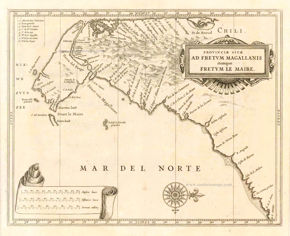
Provinciae Sitae ad Fretum Magallanis itemque Fretum le Maire. 1630
Magellan Straits & Tierra Del Fuego, by Johannes de Laet.
[Item number: 25391]
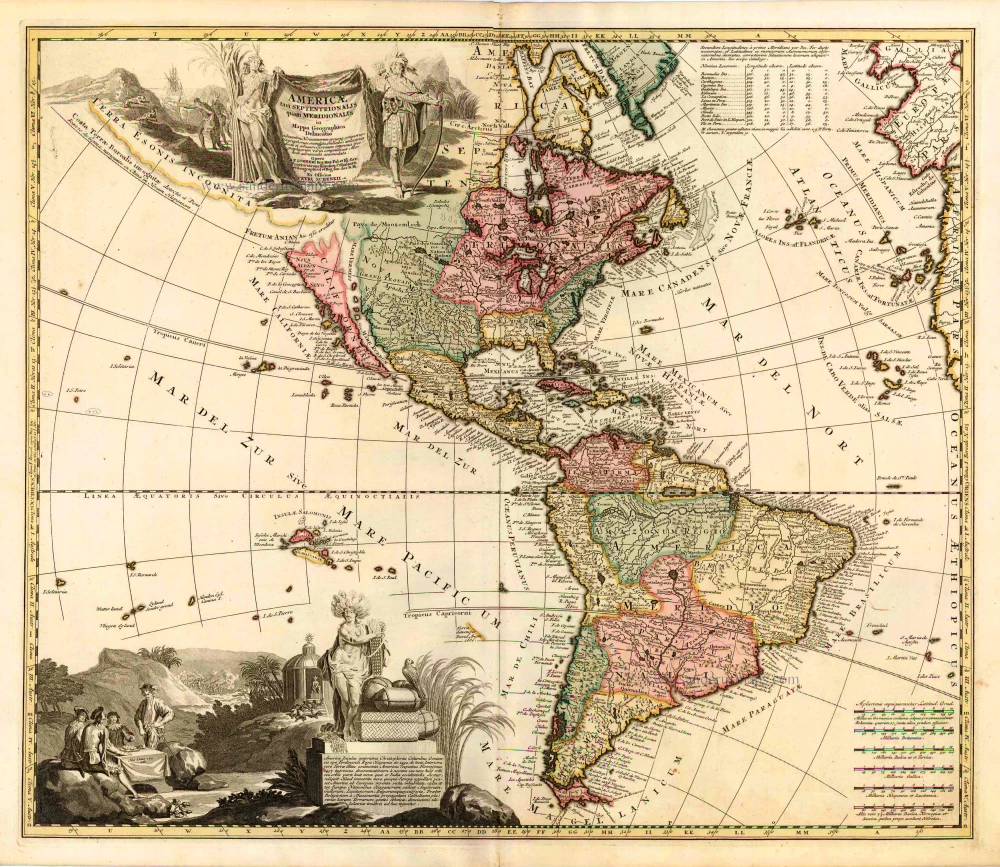
Americae tam Septentrionalis quam Meridionalis in Mappa Geographica Delineatio. c. 1700
America by A.F. Zürner, published by Petrus Schenk.
[Item number: 25715]
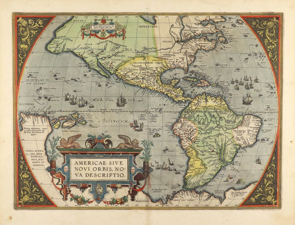
Americae Sive Novi Orbis, Nova Descriptio. 1603
America by Abraham Ortelius.
[Item number: 27538]
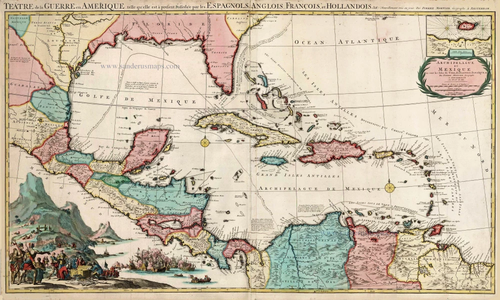
Big and spectacular map in excellent condition
Teatre de la Guerre en Amerique, telle qu'elle est a Present Possedee par les Espagnols, Anglois, Francois, et Hollandois &c. c. 1705
Central America by Pieter Mortier (Pierre).
[Item number: 27766]
Novissima et Accuratissima Septentrionalis ac Meridionalis Americae. c. 1715
America by Frederick de Wit, published by Covens & Mortier.
[Item number: 28295]
California as an island
Atlantis Insula. 1692
The Americas by Guillaume Sanson.
[Item number: 28376]
America. 1598
America, by Giovanni Lorenzo d'Anania, published by Girolamo Ruscelli.
[Item number: 28432]
America. 1613
America by Jodocus Hondius.
[Item number: 28530]
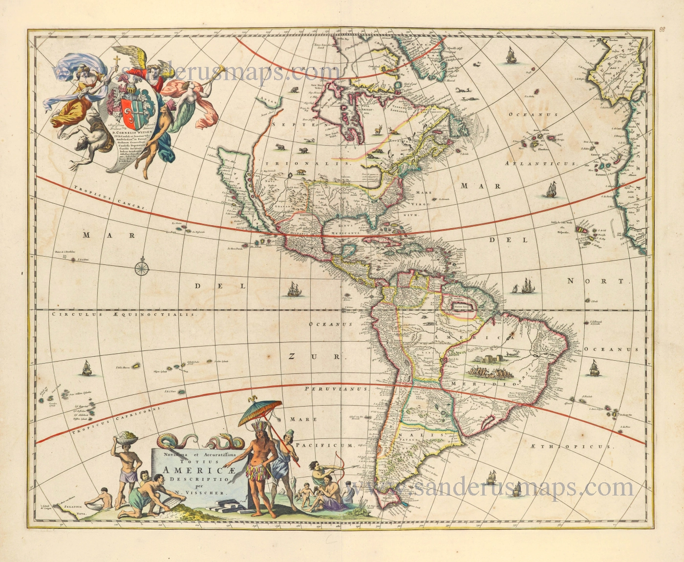
Novissima et Accuratissima Totius Americae Descriptio. 1656-77
America by Nicolaes Visscher I.
[Item number: 28554]
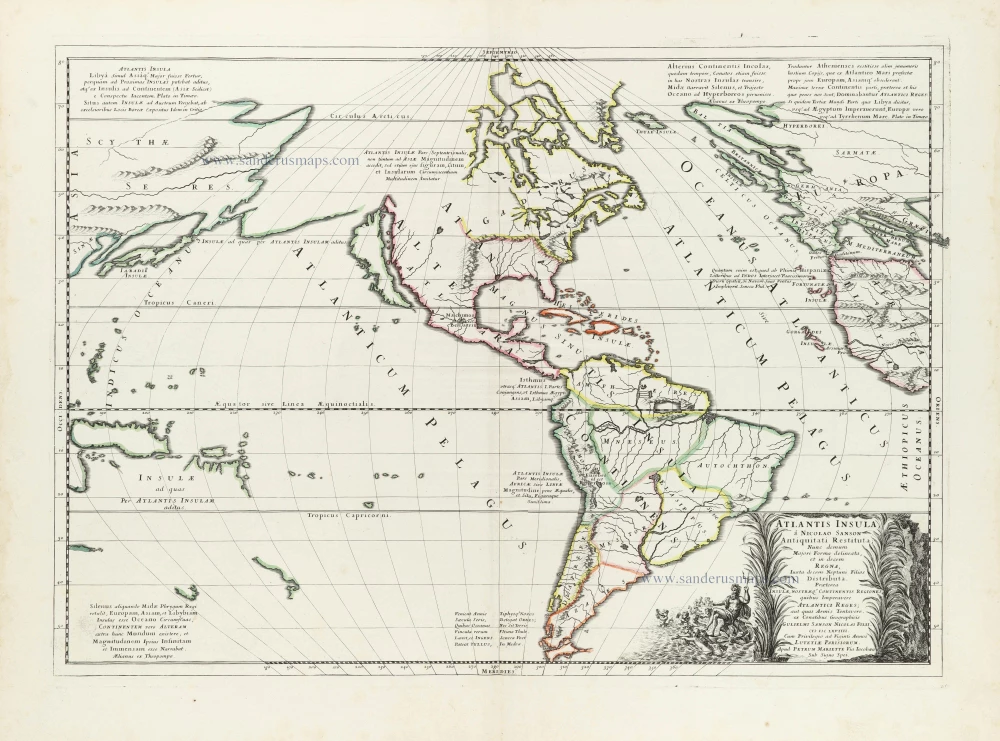
First state
Atlantis Insula. 1667-69
The Americas and the Pacific and Atlantic Ocean by Guillaume Sanson.
[Item number: 29999]