
Eastern part of the Mediterranean Sea, by Heinrich Bünting. 1581
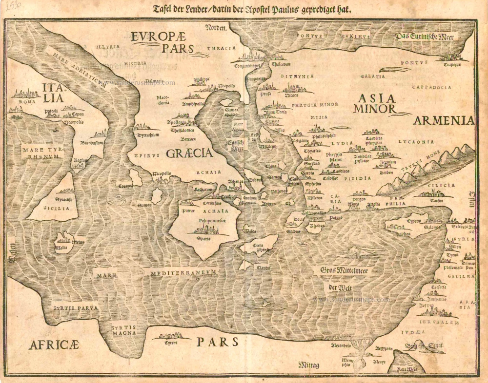
Heinrich Bünting (Hannover, 1545-1606)
Heinrich Bünting was a protestant pastor and theologian. He was also a brewer in Hannover, and he was concerned with history and wrote a Braunschweigische Chronica in 1584. His main work was the popular Itinerarium Sacrae Scripturae, which after the first edition in Magdeburg in 1581 had many editions in German, Latin, Dutch, Swedish, Danish, Czech and English.
The book gave an overview of biblical geography based on the travel descriptions of various notable people from the Old and New Testaments. It contained ten woodcut maps, including three figurative maps: the world depicted as a cloverleaf with Jerusalem in the centre, Europe in the shape of a crowned woman, and Asia as the winged horse Pegasus.
Tafel der Lender darin der Apostel Paulus geprediget hat.
Item Number: 2530 Authenticity Guarantee
Category: Antique maps > Mediterranean Sea
Old, antique map of the Eastern part of the Mediterranean Sea, by Bünting H.
Title: Tafel der Lender darin der Apostel Paulus geprediget hat.
Date: 1581.
Woodcut, printed on paper.
Size (not including margins): 290 x 380mm (11.42 x 14.96 inches).
Verso: German text.
Condition: Age-toned.
Condition Rating: A.
From: Itinerarium Sacrae Scriptura . . . Magdeburg, 1581- ....
Heinrich Bünting (Hannover, 1545-1606)
Heinrich Bünting was a protestant pastor and theologian. He was also a brewer in Hannover, and he was concerned with history and wrote a Braunschweigische Chronica in 1584. His main work was the popular Itinerarium Sacrae Scripturae, which after the first edition in Magdeburg in 1581 had many editions in German, Latin, Dutch, Swedish, Danish, Czech and English.
The book gave an overview of biblical geography based on the travel descriptions of various notable people from the Old and New Testaments. It contained ten woodcut maps, including three figurative maps: the world depicted as a cloverleaf with Jerusalem in the centre, Europe in the shape of a crowned woman, and Asia as the winged horse Pegasus.
Related items
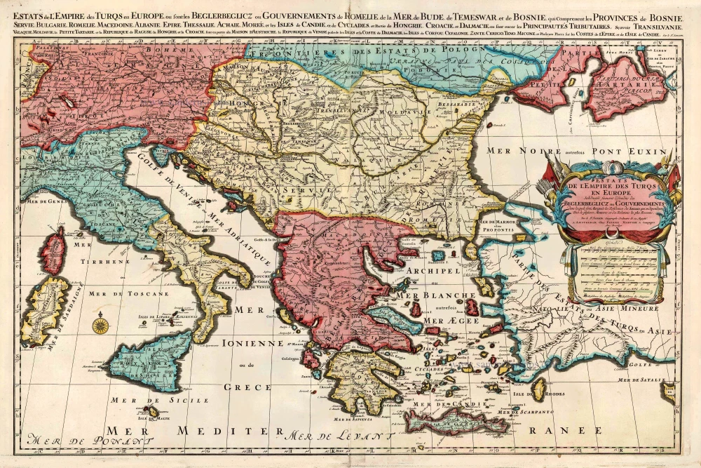
Estats de l'Empire des Turqs en Europe. c. 1705
European Ottoman Empire, by Pieter Mortier.
[Item number: 27770]
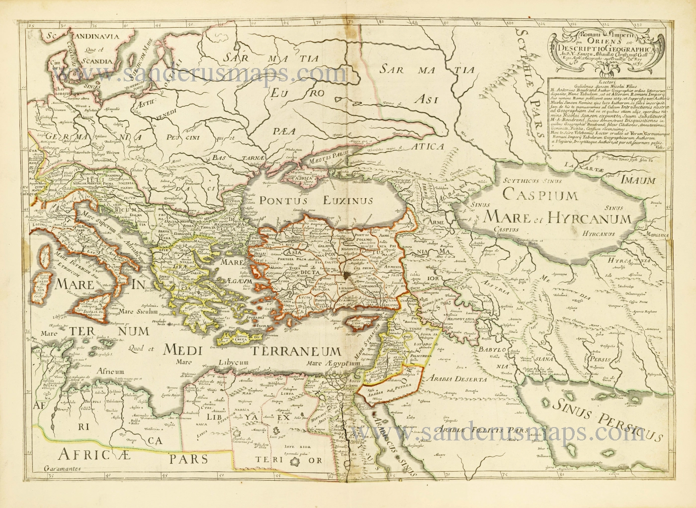
Romani Imperii qua Oriens est Descriptio Geographica. 1700-1710
Eastern Roman Empire by Nicolas Sanson.
[Item number: 28527]
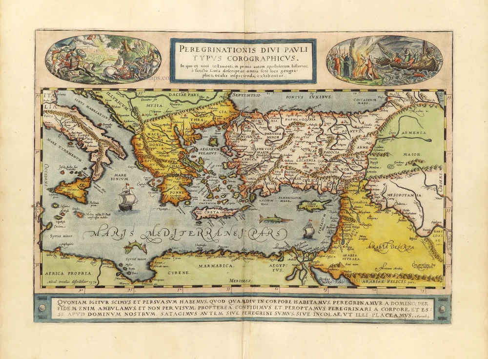
Parergon map
Peregrinationis Divi Pauli Typus Chorographicus. 1598
Paulus's Travels by Abraham Ortelius.
[Item number: 28920]
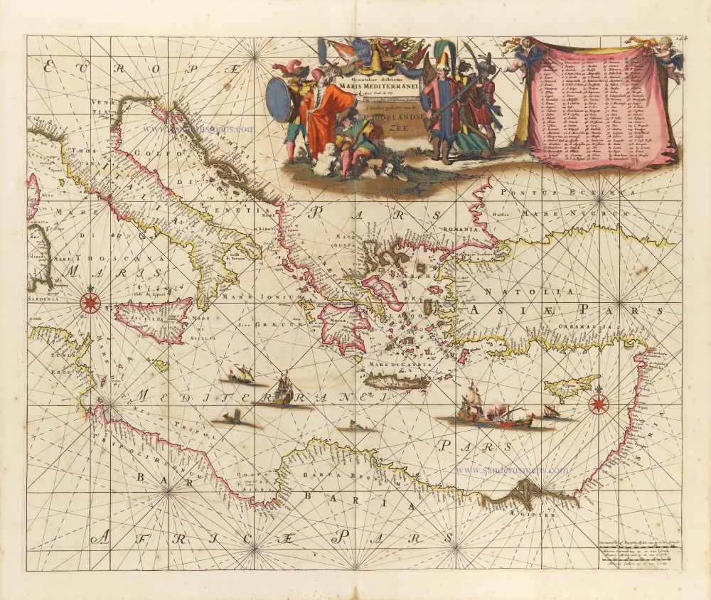
Orientalior districtus Maris Mediterranei. = t' Ooster gedeelte van de Middelandse Zee. c. 1689-90
Western Mediterranean Sea, by Frederick de Wit.
[Item number: 29247]
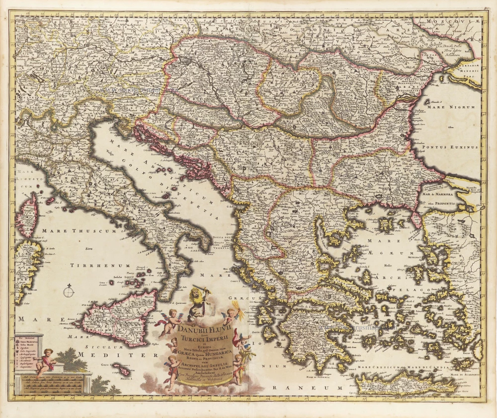
Danubii Fluvii Sive Turcici Imperii in Europa. c. 1705
Danube and European Ottoman Empire, by Frederick de Wit.
[Item number: 29279]
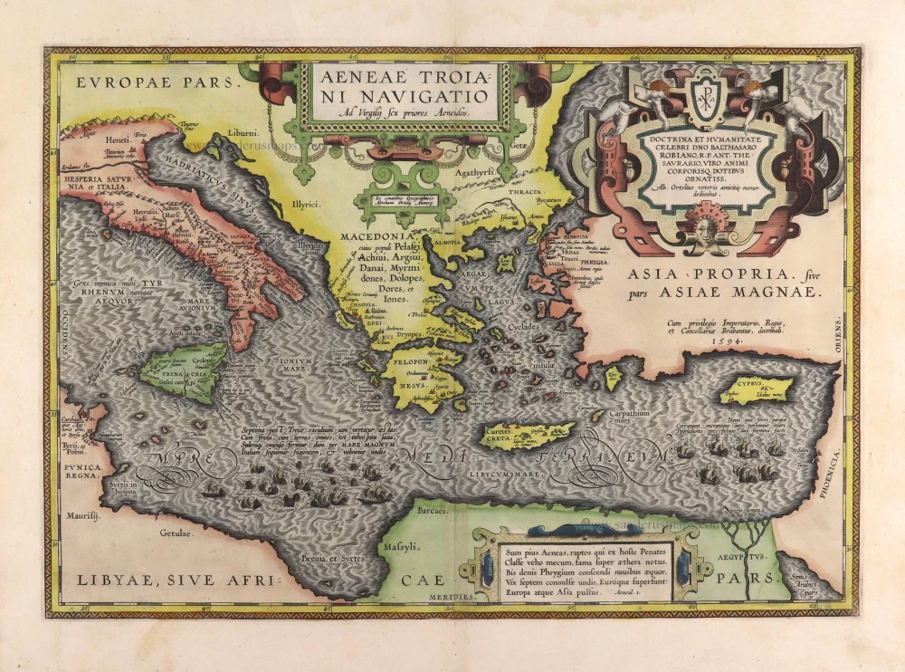
Aeneae Troiani Navigatio Ad Vergilij sex priores Aeneidos. 1595
Aenea's travels by Abraham Ortelius.
[Item number: 29470]
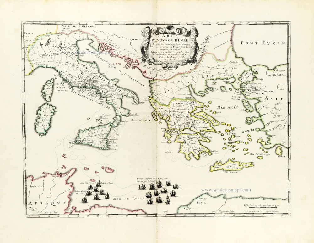
*** Rare first edition ***
Carte du voyage d'Enée Et de tous les Lieux qui sont nommez dans les Oeuvres de Virgile, pour bien entendre cet Auteur. 1655
Aeneas's Travels by Pierre Duval.
[Item number: 30037]
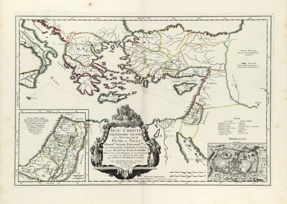
Iesu Christi salvatoris nostri apostolorum Petri, et Pauli mansiones, itinera, peregrinationes &c. per Galilaeam, Samariam, Iudaeam, et per Aegyptum, Asiam, Europam. 1665
Eastern Mediterranean by Nicolas Sanson.
[Item number: 30044]
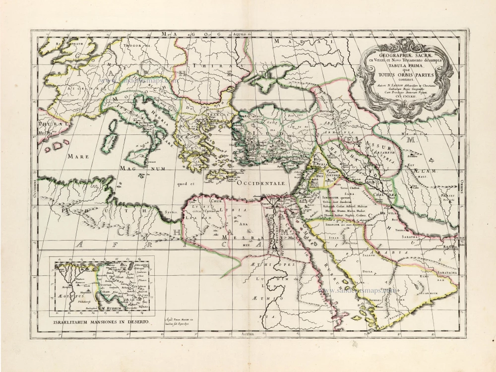
Geographiae Sacrae ex Veteri et Novo Testamento desumptae Tabula Prima, quae Totius Orbis Partet continet. 1665
Eastern Mediterranean by Nicolas Sanson, published by Pierre Mariette.
[Item number: 30075]
Parergon map
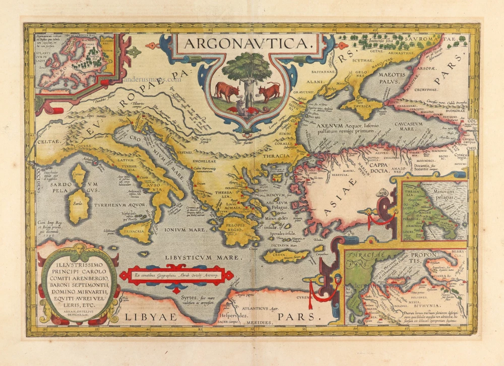
Argonautica. 1603
The roaming of Jason and his Argonauts in the Mediterranean Sea, by Abraham Ortelius.
[Item number: 30179]
Superb old colouring, heightened with gold.
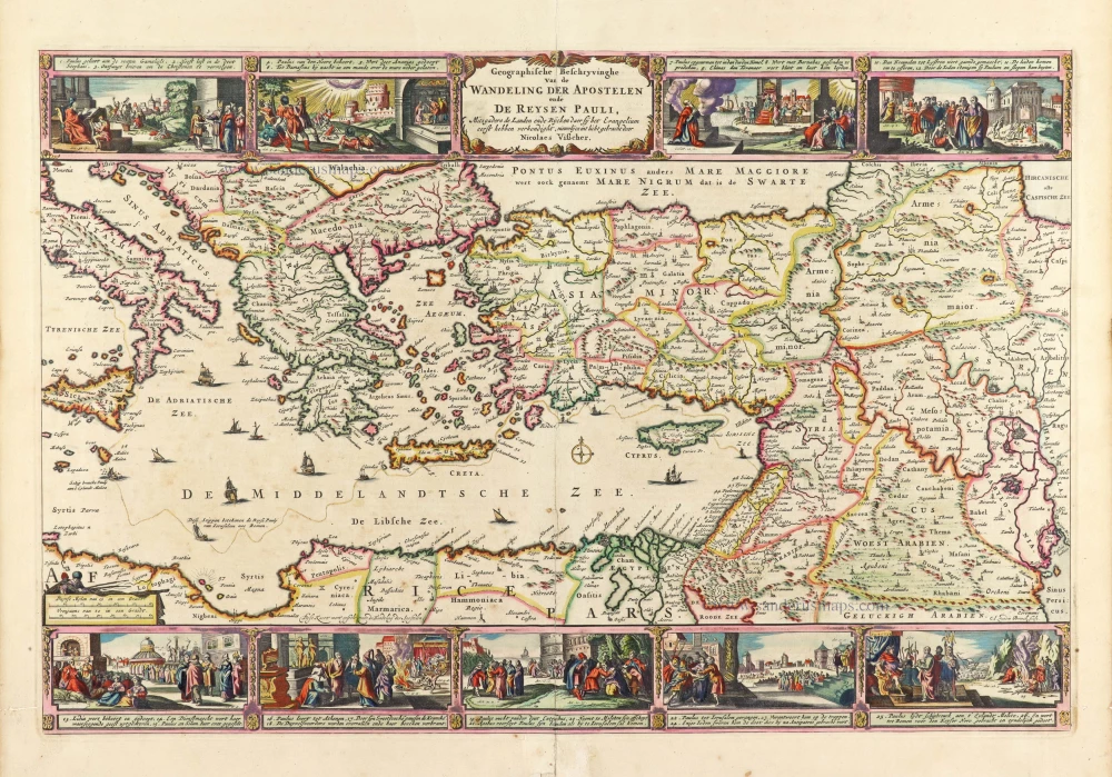
Geografische Beschryvinghe van de Wandeling der Apostelen ende De Reysen Pauli, Mitsgaders de Landen ende Rijcken daer sij het Evangelium eerst hebben verkondight. ... 1663
Eastern Mediterranean Sea, by Nicolaes Visscher I.
[Item number: 30537]
new