
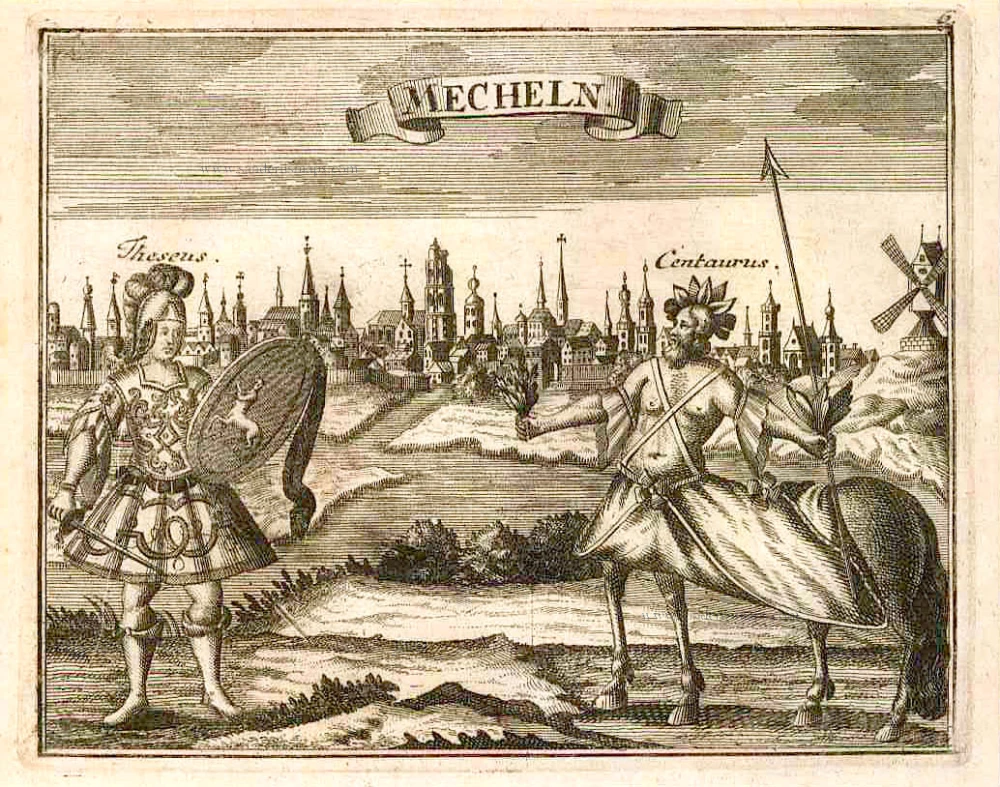
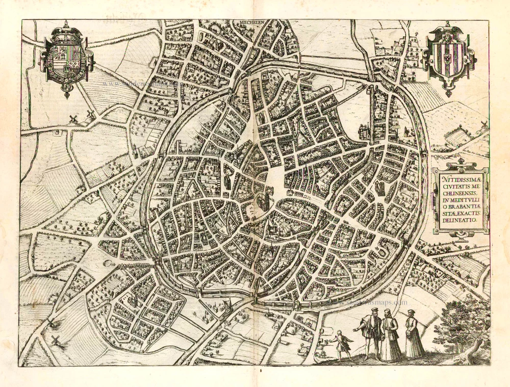
Mechelen by Visscher N. - Schut P.H. 1656
The Visscher Family
For nearly a century, the members of the Visscher family were essential art dealers and map publishers in Amsterdam.
Claes Jansz. Visscher, or N.J. Piscator (1587-1652)
Claes Jansz. Vischer bought a house in Amsterdam, 'de gulden Bors', on the crucial Kalverstraat and changed the name into "In de Visscher"; under this title, the shop was to flourish for many years.
He was famous for his engravings and etchings of Dutch landscapes and 'historical scenes', such as sieges, battles, etc. These 'historical scenes' were considered contemporary illustrated news items, especially e.g. that of 'the Eighty Years' War'.
For the publication of his first atlas, he bought copperplates of the atlas Germania Inferior by Pieter van den Keere (1623).
In 1649, he published an atlas entitled Tabularum Geographicarum Contractarum, containing the same maps as Langenes' Caert Thresoor, for which Visscher had only new title pages engraved.
Claes Jansz. Visscher died in 1652. His wife, Neeltjen Florisdr., had already died in 1640. They had seven children, four of whom were still alive at Claes Jansz.'s death. One was Nicolaes Visscher I, who was to continue his father's business.
Nicolaes Visscher I (1618-1679)
Nicolaes Visscher I partnered with his father, continued the business, and stayed on the Kalverstraat 'in de Visscher' till his death.
In about 1657, the first edition of his Atlas Contractus Orbis Terrarum appeared.
Between 1664 and 1677, several editions of his Atlas Contractus appeared without a printed index, for these atlases had no fixed contents but were composed according to the buyer's financial leaping pole.
In May 1664, Nicolaes Visscher was admitted as a member of the Booksellers' Guild of his town. In July 1677, he was granted a patent of the States of Holland and West-Friesland for printing and publishing maps and atlases for 15 years.
After this, he again published an Atlas Contractus with a printed index. At about the same time, he also brought out an Atlas Minor.
Nicolaes Visscher II (1649-1702)
Nicolaes Visscher II inherited the 'shop' from his father. To obtain a new privilege, he applied to the States of Holland and West-Friesland in 1682 for a patent for printing and publishing maps. This patent was granted to him the same year. He moved the firm to the Dam, but it kept the same signboard: "In de Visscher".
Around 1683, he published his first Atlas Minor with a printed index of 91 maps. In 1684, an atlas Germania Inferior appeared. Till 1697, he published another number of atlases. He used his grandfather's (Claes Jansz.) maps less often now and relied more and more on his own.
The wars waged at this time initiated the compilation of maps of the countries where the armies operated. Many war maps were included in the various editions of his Atlas Minor.
After Nicolaes's death, his wife, Elizabeth Verseyl, published all the war maps as an atlas under the title De Stoel des Oorlogs in de Wereld (The seat of war in the world).
The widow of Nicolaes Visscher II (?-1726)
His widow continued the business energetically, and by her hand, under the name of her deceased husband, numerous atlases appeared, e.g., several editions of the Atlas Minor, an Atlas Maior and De Stoel des Oorlogs. The shop enjoyed a high reputation due to the assortment's incredible variety. Not only 'Visscher' maps but also maps of other publishers were obtainable. With the death of Elizabeth Verseyl in 1726, the last descendant died of a great map- and atlas-publishing firm in Amsterdam.
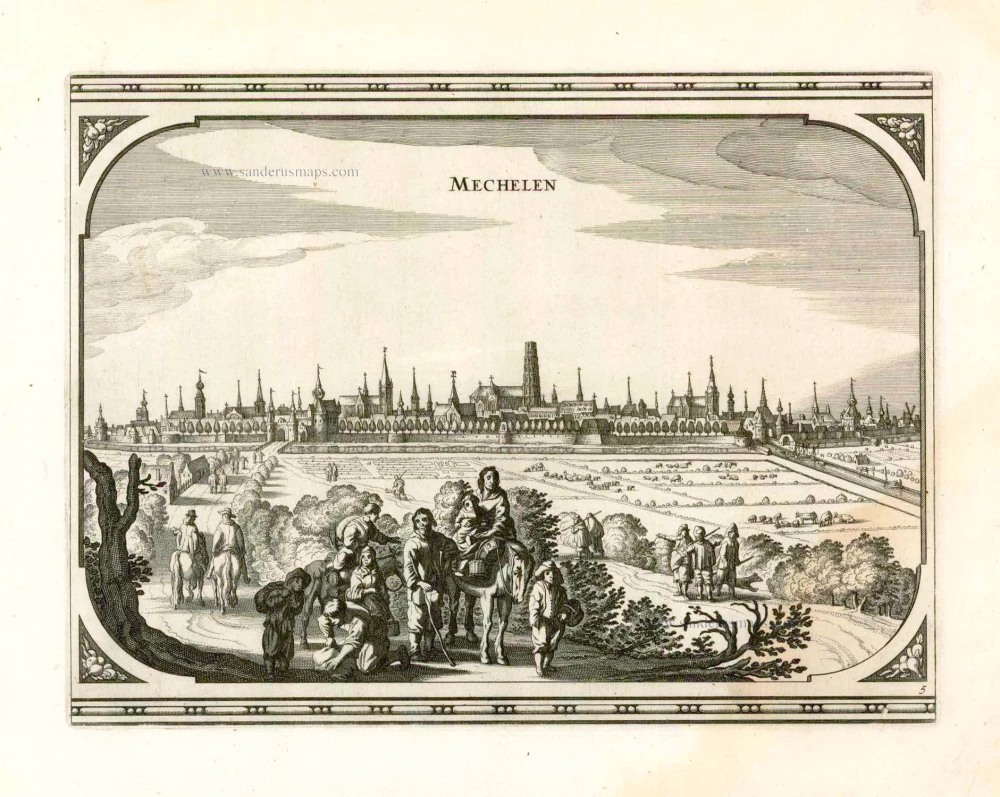
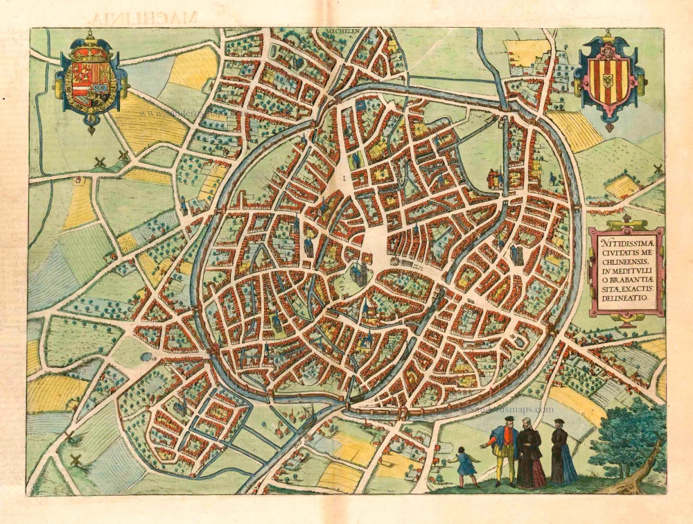
Mechelen.
Item Number: 25372 Authenticity Guarantee
Category: Antique maps > Europe > Belgium - Cities
Old antique map - panoramic view of Mechelen by N. Visscher & P.H. Schut
Date of the first edition: 1656
Date of this map: 1656
Copper engraving
Size (not including margins): 21 x 27.5cm (8.2 x 10.7 inches)
Verso: Blank
Condition: Nice sharp impression, excellent.
Condition Rating: A+
References: Van der Krogt 4, 2668.
From: Pieter Hendricksz. Schut, Theatrum praecipuarum urbium ducatus Brabantiae necnon comitatum Flandriae et Zelandiae. Amsterdam, N. Visscher, 1656. (Van der Krogt 4, 451:11)
The Visscher Family
For nearly a century, the members of the Visscher family were essential art dealers and map publishers in Amsterdam.
Claes Jansz. Visscher, or N.J. Piscator (1587-1652)
Claes Jansz. Vischer bought a house in Amsterdam, 'de gulden Bors', on the crucial Kalverstraat and changed the name into "In de Visscher"; under this title, the shop was to flourish for many years.
He was famous for his engravings and etchings of Dutch landscapes and 'historical scenes', such as sieges, battles, etc. These 'historical scenes' were considered contemporary illustrated news items, especially e.g. that of 'the Eighty Years' War'.
For the publication of his first atlas, he bought copperplates of the atlas Germania Inferior by Pieter van den Keere (1623).
In 1649, he published an atlas entitled Tabularum Geographicarum Contractarum, containing the same maps as Langenes' Caert Thresoor, for which Visscher had only new title pages engraved.
Claes Jansz. Visscher died in 1652. His wife, Neeltjen Florisdr., had already died in 1640. They had seven children, four of whom were still alive at Claes Jansz.'s death. One was Nicolaes Visscher I, who was to continue his father's business.
Nicolaes Visscher I (1618-1679)
Nicolaes Visscher I partnered with his father, continued the business, and stayed on the Kalverstraat 'in de Visscher' till his death.
In about 1657, the first edition of his Atlas Contractus Orbis Terrarum appeared.
Between 1664 and 1677, several editions of his Atlas Contractus appeared without a printed index, for these atlases had no fixed contents but were composed according to the buyer's financial leaping pole.
In May 1664, Nicolaes Visscher was admitted as a member of the Booksellers' Guild of his town. In July 1677, he was granted a patent of the States of Holland and West-Friesland for printing and publishing maps and atlases for 15 years.
After this, he again published an Atlas Contractus with a printed index. At about the same time, he also brought out an Atlas Minor.
Nicolaes Visscher II (1649-1702)
Nicolaes Visscher II inherited the 'shop' from his father. To obtain a new privilege, he applied to the States of Holland and West-Friesland in 1682 for a patent for printing and publishing maps. This patent was granted to him the same year. He moved the firm to the Dam, but it kept the same signboard: "In de Visscher".
Around 1683, he published his first Atlas Minor with a printed index of 91 maps. In 1684, an atlas Germania Inferior appeared. Till 1697, he published another number of atlases. He used his grandfather's (Claes Jansz.) maps less often now and relied more and more on his own.
The wars waged at this time initiated the compilation of maps of the countries where the armies operated. Many war maps were included in the various editions of his Atlas Minor.
After Nicolaes's death, his wife, Elizabeth Verseyl, published all the war maps as an atlas under the title De Stoel des Oorlogs in de Wereld (The seat of war in the world).
The widow of Nicolaes Visscher II (?-1726)
His widow continued the business energetically, and by her hand, under the name of her deceased husband, numerous atlases appeared, e.g., several editions of the Atlas Minor, an Atlas Maior and De Stoel des Oorlogs. The shop enjoyed a high reputation due to the assortment's incredible variety. Not only 'Visscher' maps but also maps of other publishers were obtainable. With the death of Elizabeth Verseyl in 1726, the last descendant died of a great map- and atlas-publishing firm in Amsterdam.
Related items

Mechelen. 1659
Mechelen, door Matthäus Merian & Martin Zeiller.
[Item number: 407]
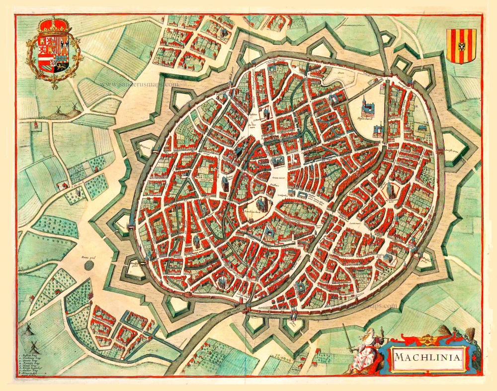
Machlinia. 1652
Mechelen, by Joan Blaeu.
[Item number: 3780]
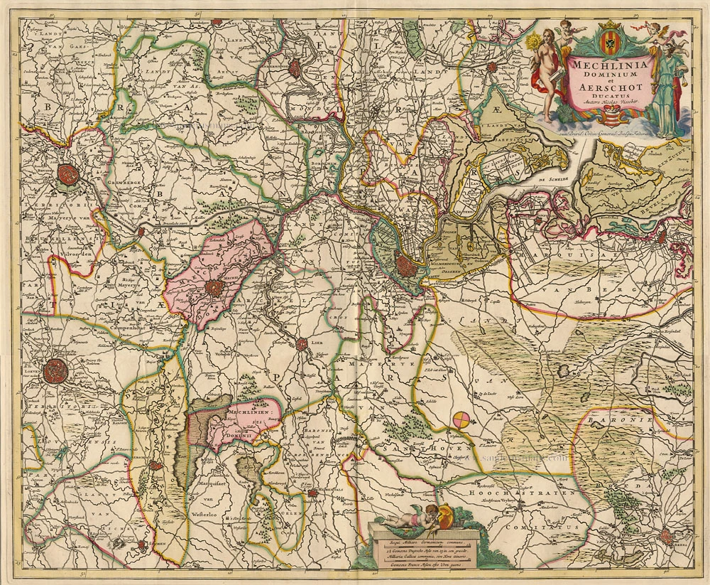
Mechlinia Dominium et Aerschot Ducatus 1680-1710
Antique map of Mechelen - Aarschot by Visscher N.
[Item number: 5938]
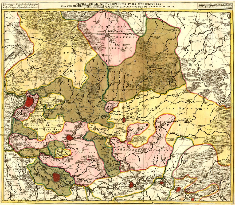
Tetrarchiae Antverpiensis Pars Meridionalis 1683-1696
Antwerpen - Mechelen by Visscher N. II.
[Item number: 14777]
Mechelen - Nitidissimae Civitatis Mechlineensis in meditullio Brabantiae sitae, exactis: delineatio 1581-88
Mechelen, by Braun & Hogenberg.
[Item number: 18002]
Machelen - Nitidissimae Civitatis Mechlineensis, ... 1572-1624
Mechelen, by Georg Braun and Frans Hogenberg.
[Item number: 17854]
MECHELEN 1659
MECHELEN by Merian C.
[Item number: 18394]
Mechlinia Dominium, et Aerschot Ducatus. 1635
Mechelen - Aarschot, by Blaeu W. & J.
[Item number: 20308]
Mecheln 1726
Mechelen by D. Fassmann
[Item number: 5948]
Marchionatus Sacri Imperiit Dominii Mechelini Tabula 1721-41
Mechelen - Antwerpen, by Covens & Mortier.
[Item number: 23690]
Mechlinia. 1617
Mechelen, by Petrus Kaerius (Pieter Van den Keere)
[Item number: 15408]
Tshertogenbosch - Buscumducis oppidum ludo Literario, ... [on sheet with] Loeven - Lovanium Perantiqua Brabantiae urbs ... [and] Machelen - Nitidissimae Civitatis Mechlin ... 1599
's Hertogenbosch, Leuven (Louvain), and Mechelen, by Georg Braun and Frans Hogenberg.
[Item number: 23224]

Tshertogenbosch - Buscumducis oppidum ludo Literario, ... [on sheet with] Loeven - Lovanium Perantiqua Brabantiae urbs ... [and] Machelen - Nitidissimae Civitatis Mechlin ... 1582
's Hertogenbosch, Leuven (Louvain) and Mechelen, by Georg Braun and Frans Hogenberg.
[Item number: 16669]

Machelen - Nitidissimae Civitatis Mechlineensis, in meditulio Brabantiae Sitae, exaxtissima delineatio. 1575
Mechelen, by Georg Braun and Frans Hogenberg.
[Item number: 2484]
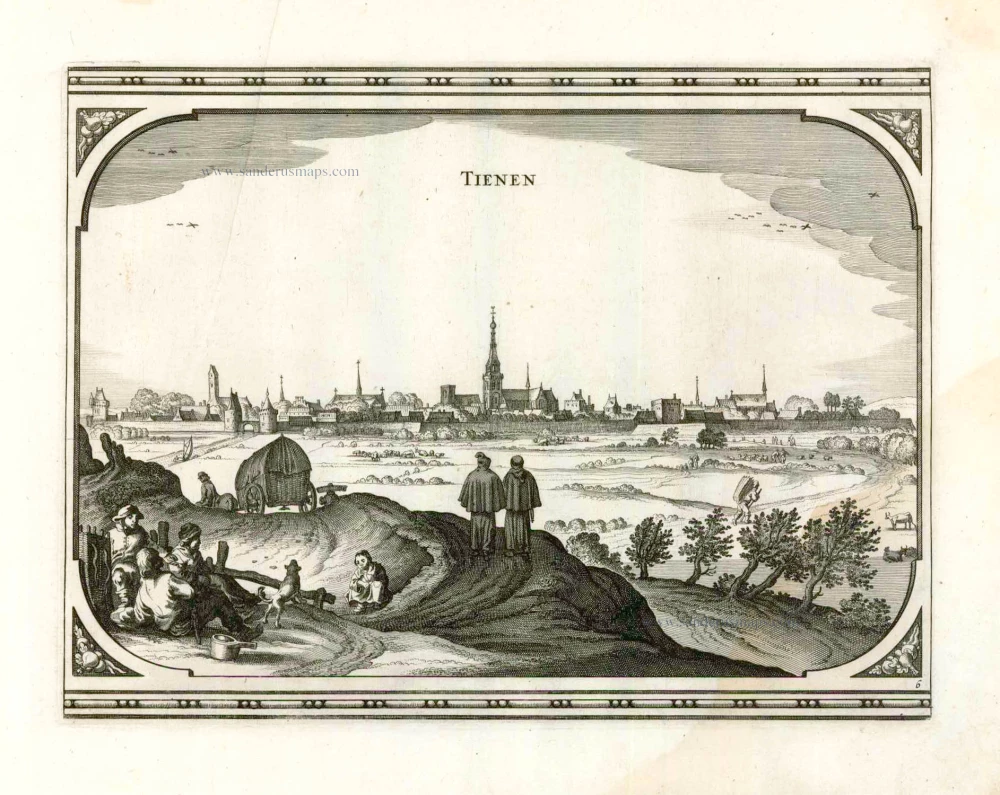
Tienen. 1656
Tienen, by Visscher N. - Schut P.H.
[Item number: 25373]
Mechelen - Nitidissimae Civitatis Mechlineensis in meditullio Brabantiae sitae, exactis: delineatio. 1582
Mechelen, by Georg Braun & Frans Hogenberg.
[Item number: 14483]
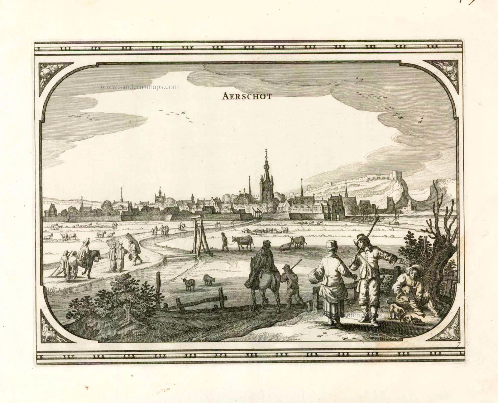
Aerschot. 1656
Aarschot, by Visscher N. - Schut P.H.
[Item number: 25375]
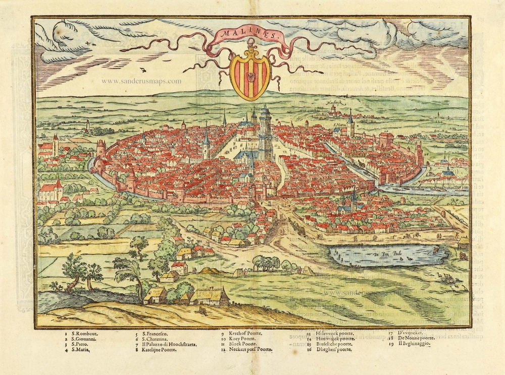
Malines. 1567
Mechelen by Lodovico Guicciardini.
[Item number: 29158]