
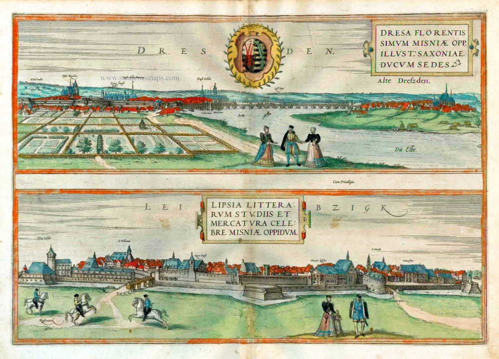
Dresden and Leipzig, by Georg Braun and Frans Hogenberg. 1582
Braun G. & Hogenberg F. and the Civitates Orbis Terrarum.
The Civitates Orbis Terrarum, or the "Braun & Hogenberg", is a six-volume town atlas and the most excellent book of town views and plans ever published: 363 engravings, sometimes beautifully coloured. It was one of the best-selling works in the last quarter of the 16th century. Georg Braun wrote the text accompanying the plans and views on the verso. Many plates were engraved after the original drawings of a professional artist, a professional artist, Joris Hoefnagel (1542-1600). The first volume was published in Latin in 1572, and the sixth in 1617. Frans Hogenberg created the tables for volumes I through IV, and Simon van den Neuwel made those for volumes V and VI. Other contributors were cartographers Daniel Freese and Heinrich Rantzau. Works by Jacob van Deventer, Sebastian Münster, and Johannes Stumpf were also used. Translations appeared in German and French.
Following the original publication of Volume 1 of the Civitates in 1572, seven further editions of 1575, 1577, 1582, 1588, 1593, 1599 and 1612 can be identified. Vol.2, first issued in 1575, was followed by further editions in 1597 and 1612. The subsequent volumes appeared in 1581, 1588, 1593, 1599 and 1606. The German translation of the first volume appeared from 1574 on, and the French edition from 1575 on.
Several printers were involved: Theodor Graminaeus, Heinrich von Aich, Gottfried von Kempen, Johannis Sinniger, Bertram Buchholtz and Peter von Brachel, who all worked in Cologne.
Georg Braun (1541-1622)
Georg Braun was born in Cologne in 1541. After his studies in Cologne, he entered the Jesuit Order as a novice. 1561, he obtained his bachelor's degree, and in 1562, he received his Magister Artium. Although he left the Jesuit Order, he studied theology, gaining a licentiate in theology.
Frans Hogenberg (1535-1590)
Frans Hogenberg was a Flemish and German painter, engraver, and mapmaker. He was born in Mechelen as the son of Nicolaas Hogenberg.
By the end of the 1560s, Frans Hogenberg was employed upon Abraham Ortelius's Theatrum Orbis Terrarum, published in 1570; he is named an engraver of numerous maps. In 1568, he was banned from Antwerp by the Duke of Alva and travelled to London, where he stayed a few years before emigrating to Cologne. He immediately embarked on his two most important works, the Civitates, published in 1572 and the Geschichtsblätter, which appeared in several series from 1569 until about 1587.
Thanks to large-scale projects like the Geschichtsblätter and the Civitates, Hogenberg's social circumstances improved with each passing year. He died as a wealthy man in Cologne in 1590.
Dresden - Dresa Florentissimum Misniae Opp. Illust: Saxoniae Ducum Sedes [on sheet with] Leibzigk - Lipsia Litterarum Studiis et Mercatura Celebre Misniae Oppidum.
Item Number: 25502 Authenticity Guarantee
Category: Antique maps > Europe > Germany - Cities
Old, antique map with two bird's-eye views by Braun and Hogenberg: Dresden and Leipzig.
Zwei antike Gesamtansichten von Braun und Hogenberg: Dresden und Leipzig.
DRESDEN
TRANSLATION OF CARTOUCHE TEXT: Dresden, the flourishing Meissen town and illustrious residence of the Dukes of Saxony.
COMMENTARY BY BRAUN: "The Elbe, which is not dissimilar to the Rhine and which flows past Dresden, is crossed by a large stone bridge, which is most admirable in view of its length and its distinctive stonework. On this side lies the wellknown town of Dresden; since this place is beneficial to the health in view of its good air, His Most Serene Highness, the Duke and Elector of Saxony, [...] moved his permanent seat and residence here. The town of Dresden was consequently embellished with an exceptionally beautiful palace [...] built of square stones hewn with a straight edge with remarkabkle skill."
In the first half of the 16th century Dresden - here seen at a distance from the direction of Pirna - still appears relatively modest in size. Clearly indicated by the caption on the left is the Protestant parish church (Pfar Kirchen) in which the Reformation was officially introduced in Dresden in 1539 by Henry the Pious. Further right is the arsenal (Zeughauss), an important Renaissance building, which was converted into the Albertinum in the 19th century. Further right again is the town's oldest church of Unser Lieben Frauen (today the Frauenkirche), with a miracle-working icon that drew pilgrims from early on. The palace was being transformed into a Renaissance palace under Moritz of Saxony. Not until the 18th century would the "Florence on the Elbe", as Dresden is known, assume the architectural face for which it is so famous today, with the Zwinger, Frauenkirche, Hofkirche and Semper Opera House.
LEIPZIG
CARTOUCHE: Leipzig, famous town of the sciences and trade in the land of Meissen.
COMMENTARY BY BRAUN: "Leipzig is not a very big town, but it surpasses many another city, both German and princely. For there are many merchants here who hold a fair in the town three times a year [...]. This town possesses many large stone houses, all panelled in wood inside and decorated with paintings outside. A council of learned men meets in Leipzig in order to pass judgement on the disputes that are brought before them [...]. It also possesses a splendid university, which was transferred from Prague to here in 1408. For when the Germans refused to accept the new teachings of Hus that were spread in Prague, over 2,000 students and their teachers left in a single day and went to Leipzig and resumed their studies there."
This plate shows the city around 1570 from a very low position, with three horsemen in the left foreground as a reference to the horse market. After receiving market privileges in the year 1165, Leipzig developed into a leading trade-fair centre, achieving fame across Europe after having been awarded imperial trade-fair rights in 1497. (Taschen)
Date of the first edition: 1572
Date of this map: 1582
Copper engraving
Size (not including margins): 34 x 48cm (13.3 x 18.7 inches)
Verso text: Latin
Condition: Original coloured, some discolouring at lower centrefold, a few small stains.
Condition Rating: B+
References: Van der Krogt 4, #1142, State 2 (with privilege); Fauser, #3236, 7440; Taschen, Braun and Hogenberg, p.86.
From: Civitates Orbis Terrarum, Liber Primus. Köln, Gottfried von Kempen, 1582. (Van der Krogt 4, 41:1.1(1582))
Braun G. & Hogenberg F. and the Civitates Orbis Terrarum.
The Civitates Orbis Terrarum, or the "Braun & Hogenberg", is a six-volume town atlas and the most excellent book of town views and plans ever published: 363 engravings, sometimes beautifully coloured. It was one of the best-selling works in the last quarter of the 16th century. Georg Braun wrote the text accompanying the plans and views on the verso. Many plates were engraved after the original drawings of a professional artist, a professional artist, Joris Hoefnagel (1542-1600). The first volume was published in Latin in 1572, and the sixth in 1617. Frans Hogenberg created the tables for volumes I through IV, and Simon van den Neuwel made those for volumes V and VI. Other contributors were cartographers Daniel Freese and Heinrich Rantzau. Works by Jacob van Deventer, Sebastian Münster, and Johannes Stumpf were also used. Translations appeared in German and French.
Following the original publication of Volume 1 of the Civitates in 1572, seven further editions of 1575, 1577, 1582, 1588, 1593, 1599 and 1612 can be identified. Vol.2, first issued in 1575, was followed by further editions in 1597 and 1612. The subsequent volumes appeared in 1581, 1588, 1593, 1599 and 1606. The German translation of the first volume appeared from 1574 on, and the French edition from 1575 on.
Several printers were involved: Theodor Graminaeus, Heinrich von Aich, Gottfried von Kempen, Johannis Sinniger, Bertram Buchholtz and Peter von Brachel, who all worked in Cologne.
Georg Braun (1541-1622)
Georg Braun was born in Cologne in 1541. After his studies in Cologne, he entered the Jesuit Order as a novice. 1561, he obtained his bachelor's degree, and in 1562, he received his Magister Artium. Although he left the Jesuit Order, he studied theology, gaining a licentiate in theology.
Frans Hogenberg (1535-1590)
Frans Hogenberg was a Flemish and German painter, engraver, and mapmaker. He was born in Mechelen as the son of Nicolaas Hogenberg.
By the end of the 1560s, Frans Hogenberg was employed upon Abraham Ortelius's Theatrum Orbis Terrarum, published in 1570; he is named an engraver of numerous maps. In 1568, he was banned from Antwerp by the Duke of Alva and travelled to London, where he stayed a few years before emigrating to Cologne. He immediately embarked on his two most important works, the Civitates, published in 1572 and the Geschichtsblätter, which appeared in several series from 1569 until about 1587.
Thanks to large-scale projects like the Geschichtsblätter and the Civitates, Hogenberg's social circumstances improved with each passing year. He died as a wealthy man in Cologne in 1590.
Related items

Dresden - Dresa Florentissimum Misniae Opp. Illust: Saxoniae Ducum Sedes [on sheet with] Leibzigk - Lipsia Litterarum Studiis et Mercatura Celebre Misniae Oppidum 1612
Dresden and Leipzig, by Georg Braun and Frans Hogenberg.
[Item number: 22326]
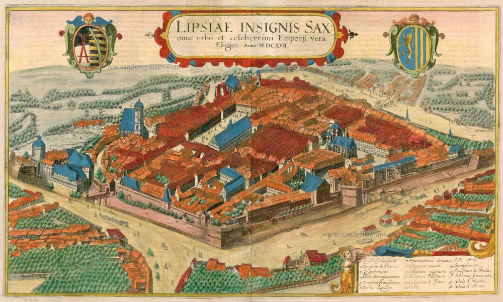
Lipsiae Insignis Saxoniae Urbis et Celeberrimi Emporij Vera Effigies. 1617
Leipzig, by Braun and Hogenberg.
[Item number: 22137]
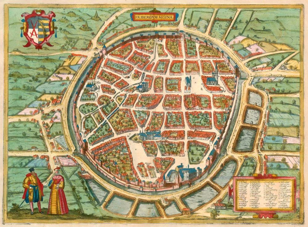
Fribergum Misinae 1575-1612
Freiberg (Saxony), by Georg Braun and Frans Hogenberg.
[Item number: 23279]
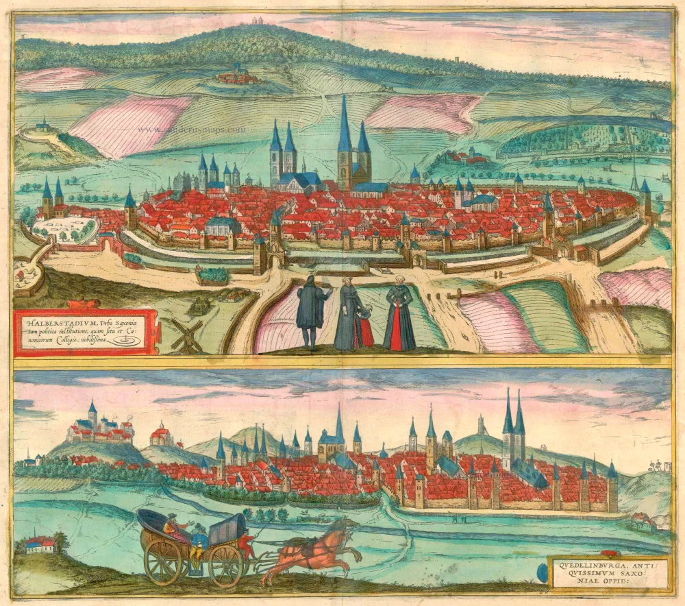
Halberstadium, Urbs Saxoniae [on sheet with] Quedelinburga, Antiquissimum Saxoniae Oppid. 1581-88
Halberstadt and Quedlinburg, by Georg Braun and Frans Hogenberg.
[Item number: 23323]

Bardum Pomeraniae. 1596
Barth, by Georg Braun and Frans Hogenberg.
[Item number: 23386]
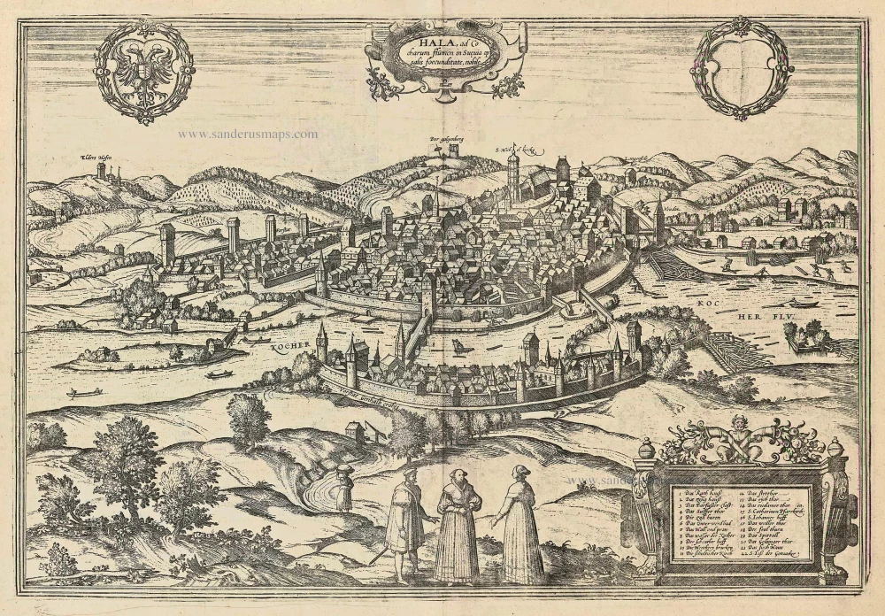
Hala, ad Cocharum Flumen in Suevia Op. 1597
Schwäbisch Hall by Braun and Hogenberg.
[Item number: 23991]
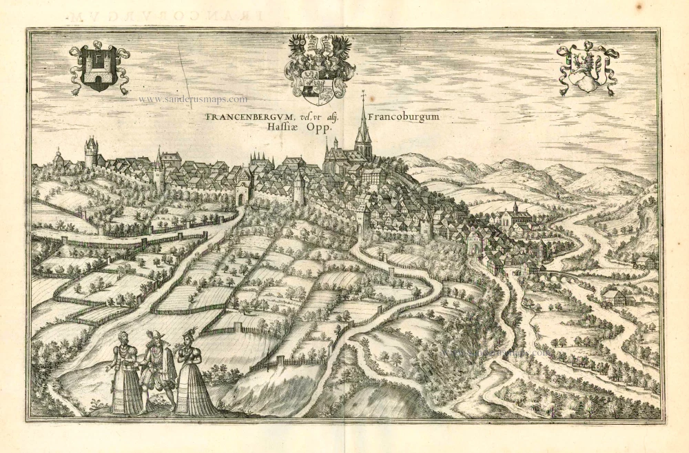
Francenbergum, vel ut alij Francoburgum Hassiae Opp. 1599
Frankenberg, by Georg Braun and Frans Hogenberg.
[Item number: 24053]

Fribergum Misinae 1597
Freiberg (Saxony) by Braun and Hogenberg
[Item number: 23993]
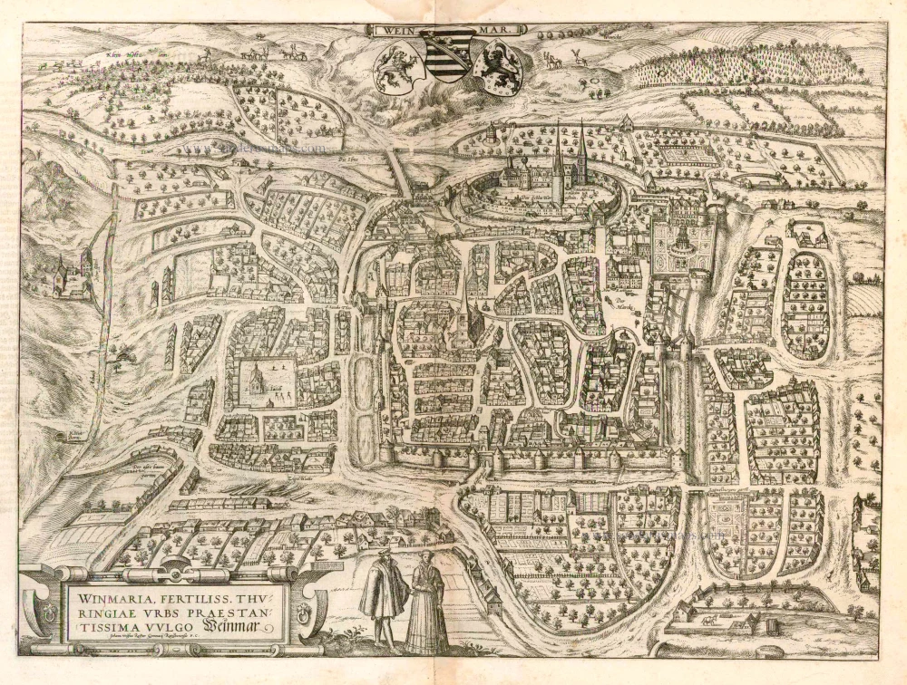
Weinmar - Winmaria, Fertiliss. Thuringiae Urbs Praestantissima vulgo Weinmar 1582
Weimar, by Georg Braun and Frans Hogenberg.
[Item number: 25085]
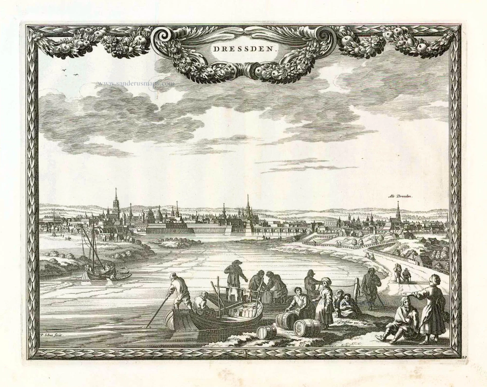
Dressden. 1658/60
Dresden, by Nicolaes Visscher & Pieter Hendricksz. Schut.
[Item number: 26648]

Unrecorded variant of Schut's view of Dresden, by Carel Allard
Dressden. 1673
View of Dresden by Carel Allard.
[Item number: 30570]
new