
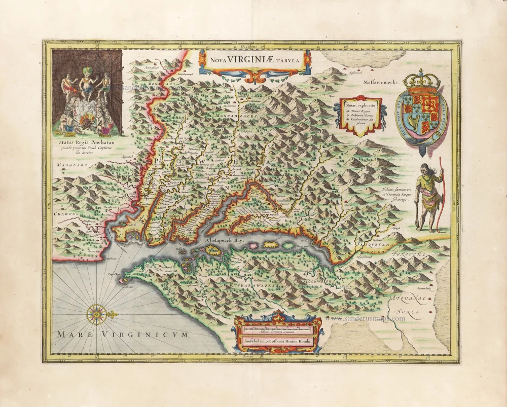
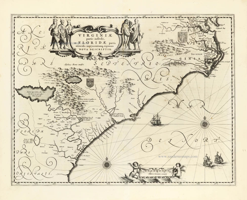
Virginia, by A. Montanus. 1671
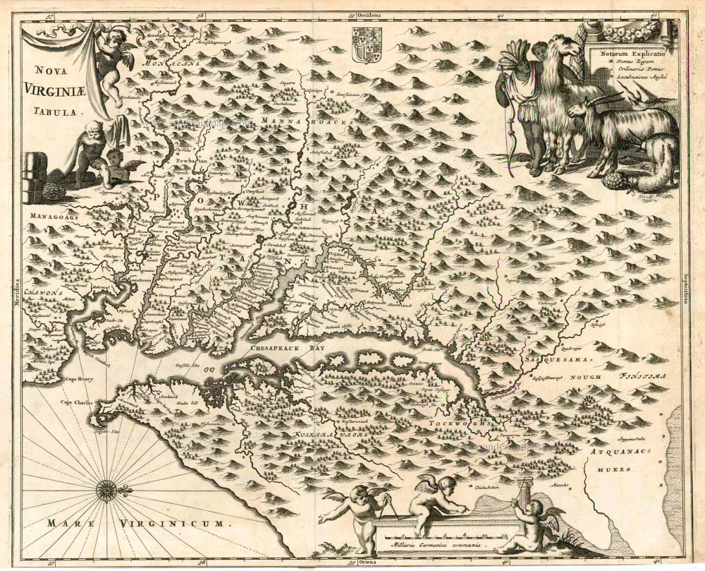
To depict the region of the Chesapeake Bay Arnoldus Montanus utilised the most dominant map of the region, that of John Smith, first published in 1612. It emulates more closely the version by Jodocus Hondius, 1618, later utilised by Blaeu. This is one of the more attractive derivatives. (Burden)
Nova Virginiae Tabula.
Item Number: 25613 Authenticity Guarantee
Category: Antique maps > America > North America
Old, antique map of Virginia by Montanus A., oriented to the West
Date of the first edition: 1671
Date of this map: 1671
Copper engraving
Size: 29 x 35.5cm (11.3 x 13.8 inches)
Verso: Blank
Condition: Bottom margin trimmed to neatline.
Condition Rating: A
References: Burden, 412, State 1.
From: Montanus A. Die Unbekante Neue Welt, oder Beschreibung des Welt-teils Amerika. Amsterdam, 1673.
To depict the region of the Chesapeake Bay Arnoldus Montanus utilised the most dominant map of the region, that of John Smith first published in 1612. It emulates more closely the version by Jodocus Hondius, 1618, later utilised by Blaeu. This is one of the more attractive derivatives. (Burden)
To depict the region of the Chesapeake Bay Arnoldus Montanus utilised the most dominant map of the region, that of John Smith, first published in 1612. It emulates more closely the version by Jodocus Hondius, 1618, later utilised by Blaeu. This is one of the more attractive derivatives. (Burden)
Related items
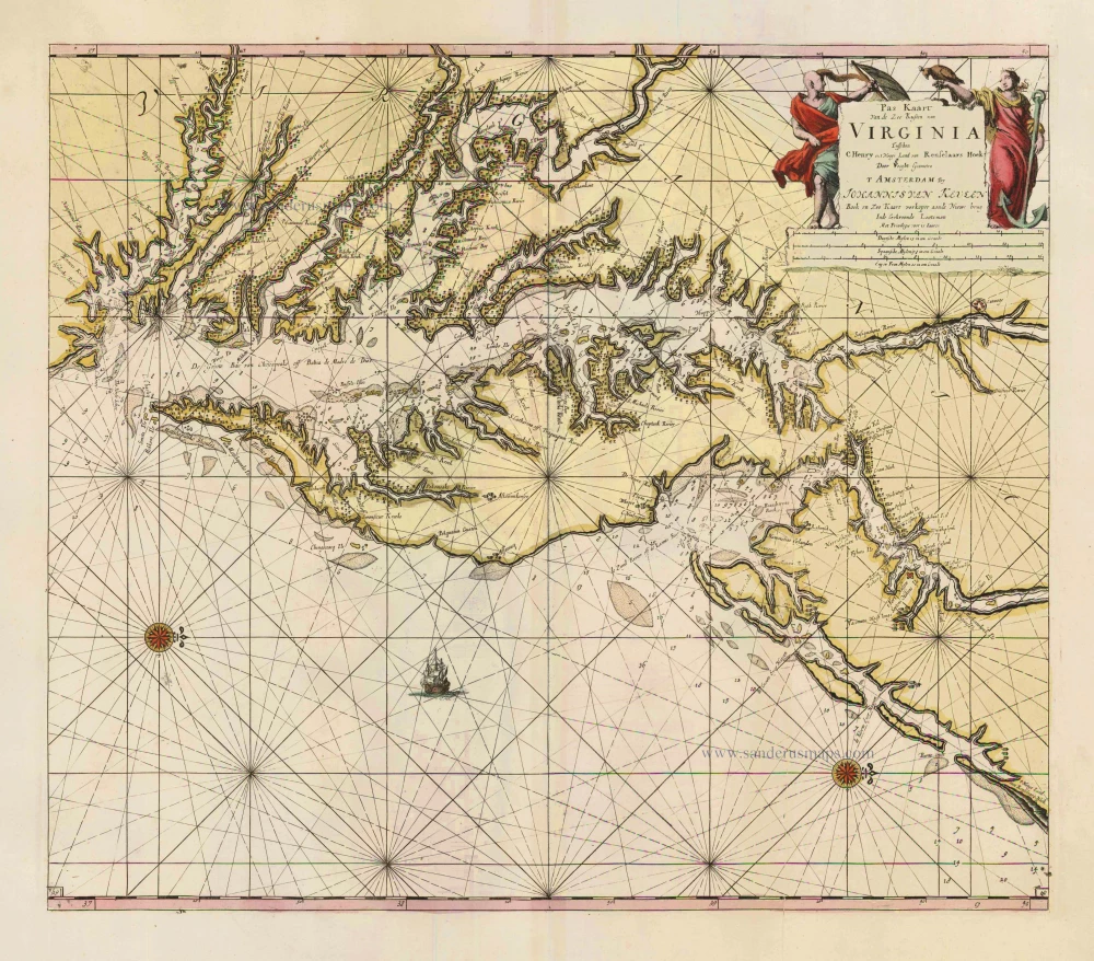
Pas Kaart van de Zee Kusten van Virginia tusschen C. Henry en t Hooge Land van Renselaars Hoek. 1702
Virginia by Johannes van Keulen
[Item number: 1332]
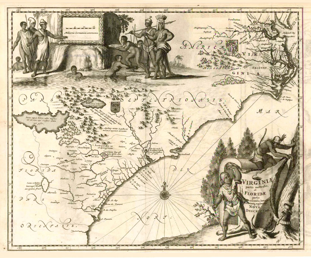
Virginiae partis australis et Floridae. 1671
Carolina, by A. Montanus.
[Item number: 5211]
Virginiae Partis Australis, Et Floridae Partis Orientalis ... 1649-55
Virginia by Willem Blaeu.
[Item number: 15427]
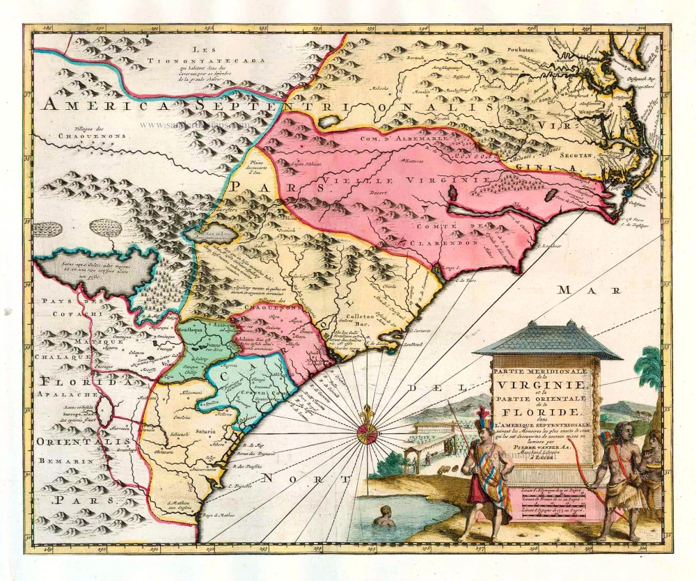
Partie Meridionale de la Virginie, et la Partie Orientale de la Floride dans l'Amerique Septentrionale. 1713
Carolina by Pieter van der Aa.
[Item number: 26137]
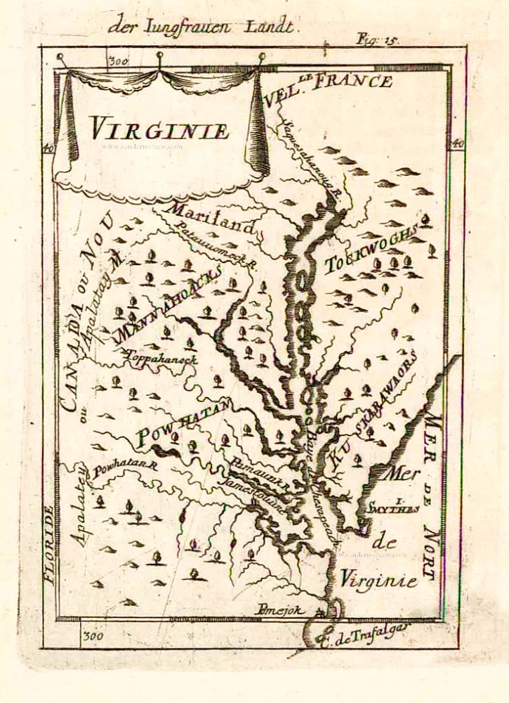
Virginie. 1685
Virginia and Maryland, by A.M. Mallet.
[Item number: 26602]
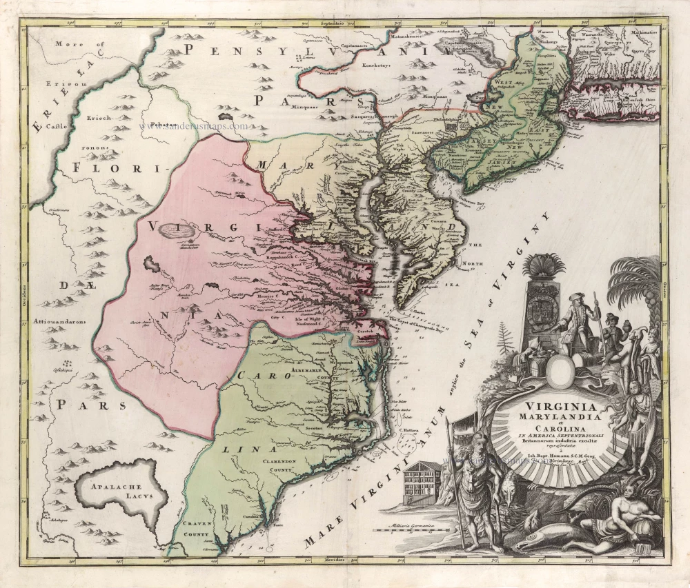
Virginia Marylandia et Carolina in America Septentrionali Britannorum Industria Excultae Repraesentatae c. 1730-37
Virginia - Carolina - Maryland by Homann J.B.
[Item number: 29486]
Nova Virginiae Tabula. 1666
Virginia by Henricus Hondius.
[Item number: 29956]
Luxury colouring
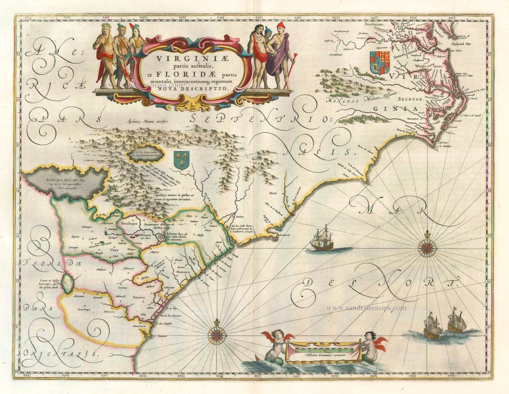
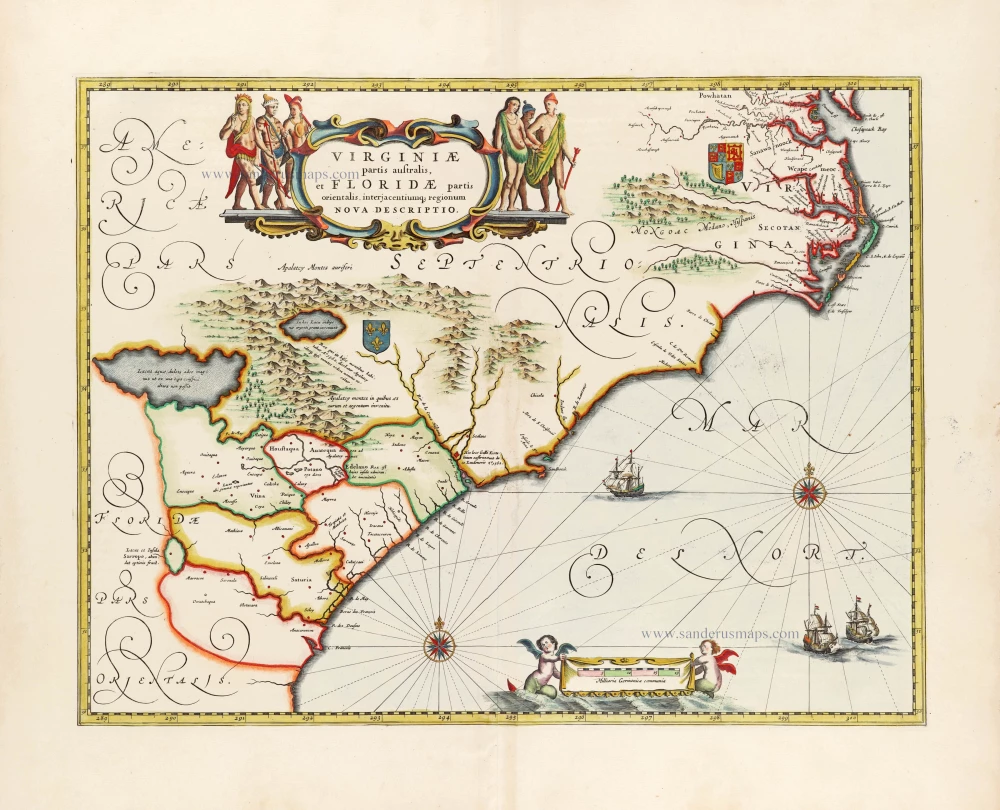
Virginiae partis australis et Floridae partis orientalis, interjacentiumq; regionum Nova Descriptio. 1666
Carolina by Johannes Janssonius
[Item number: 30020]
Virginiae Partis Australis, Et Floridae Partis Orientalis, interjacentiumq regionum Nova Descriptio. 1641
Virginia by Johannes Janssonius.
[Item number: 30319]