
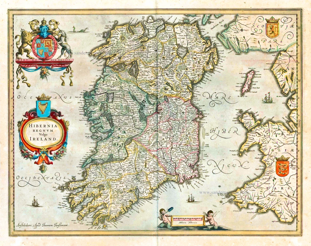
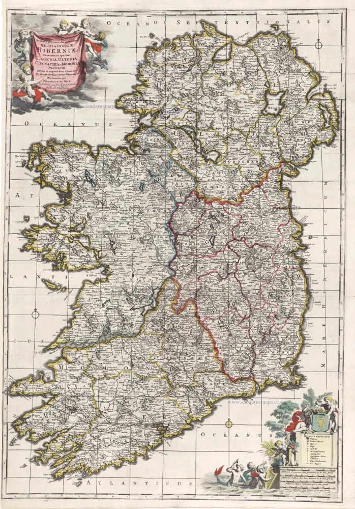
Ireland by Nicolas Visscher II, published by Petrus Schenk. c. 1710
The Visscher Family
For nearly a century, the members of the Visscher family were essential art dealers and map publishers in Amsterdam.
Claes Jansz. Visscher, or N.J. Piscator (1587-1652)
Claes Jansz. Vischer bought a house in Amsterdam, 'de gulden Bors', on the crucial Kalverstraat and changed the name into "In de Visscher"; under this title, the shop was to flourish for many years.
He was famous for his engravings and etchings of Dutch landscapes and 'historical scenes', such as sieges, battles, etc. These 'historical scenes' were considered contemporary illustrated news items, especially e.g. that of 'the Eighty Years' War'.
For the publication of his first atlas, he bought copperplates of the atlas Germania Inferior by Pieter van den Keere (1623).
In 1649, he published an atlas entitled Tabularum Geographicarum Contractarum, containing the same maps as Langenes' Caert Thresoor, for which Visscher had only new title pages engraved.
Claes Jansz. Visscher died in 1652. His wife, Neeltjen Florisdr., had already died in 1640. They had seven children, four of whom were still alive at Claes Jansz.'s death. One was Nicolaes Visscher I, who was to continue his father's business.
Nicolaes Visscher I (1618-1679)
Nicolaes Visscher I partnered with his father, continued the business, and stayed on the Kalverstraat 'in de Visscher' till his death.
In about 1657, the first edition of his Atlas Contractus Orbis Terrarum appeared.
Between 1664 and 1677, several editions of his Atlas Contractus appeared without a printed index, for these atlases had no fixed contents but were composed according to the buyer's financial leaping pole.
In May 1664, Nicolaes Visscher was admitted as a member of the Booksellers' Guild of his town. In July 1677, he was granted a patent of the States of Holland and West-Friesland for printing and publishing maps and atlases for 15 years.
After this, he again published an Atlas Contractus with a printed index. At about the same time, he also brought out an Atlas Minor.
Nicolaes Visscher II (1649-1702)
Nicolaes Visscher II inherited the 'shop' from his father. To obtain a new privilege, he applied to the States of Holland and West-Friesland in 1682 for a patent for printing and publishing maps. This patent was granted to him the same year. He moved the firm to the Dam, but it kept the same signboard: "In de Visscher".
Around 1683, he published his first Atlas Minor with a printed index of 91 maps. In 1684, an atlas Germania Inferior appeared. Till 1697, he published another number of atlases. He used his grandfather's (Claes Jansz.) maps less often now and relied more and more on his own.
The wars waged at this time initiated the compilation of maps of the countries where the armies operated. Many war maps were included in the various editions of his Atlas Minor.
After Nicolaes's death, his wife, Elizabeth Verseyl, published all the war maps as an atlas under the title De Stoel des Oorlogs in de Wereld (The seat of war in the world).
The widow of Nicolaes Visscher II (?-1726)
His widow continued the business energetically, and by her hand, under the name of her deceased husband, numerous atlases appeared, e.g., several editions of the Atlas Minor, an Atlas Maior and De Stoel des Oorlogs. The shop enjoyed a high reputation due to the assortment's incredible variety. Not only 'Visscher' maps but also maps of other publishers were obtainable. With the death of Elizabeth Verseyl in 1726, the last descendant died of a great map- and atlas-publishing firm in Amsterdam.
The Schenk Family
Petrus Schenk (1660-1718), the founder of one of the best-known publishing firms of Amsterdam in the 18th century, was born in Elberfeld, Germany, in 1660. He went to Amsterdam where he became a pupil of the engraver Gerard Valck. On 19 Nov. 1686, a privilegio was granted to Petrus Schenk and Gerard Valk for the manufacturing and selling of their prints. Schenk’s contribution to cartography dates from c. 1695. In 1706 he moved to the Vijgendam in Amsterdam, ‘in Sanson’s Atlas’. After he died in 1718 his son, Leonardus Schenk, continued the art and print shop. The second son, Petrus II, settled in another famous house: ‘in Visscher’s Atlas’ where he continued the association with Gerard and Leonarus Valck.
The Schenk family produced general geographical atlases and special atlases. Apart from seventy original maps, several hundred are known with the name of Schenk, which were printed from plates obtained from Janssonius and Visscher. Schenk and Valck acquired all the plates of the Janssonius Heir’s Novus Atlas, Celestial atlas included. Many of Janssonius’ plates were reworked and amended.
The republishing of the maps from Janssonius’ Novus Atlas since c. 1680 was followed by the engraving of new maps, copied from Sanson’s better and more modern maps. Petrus Schenk published these maps in his Atlas Contractus sive mapparum geographicarum Sansoniarum auctarum et correctum Nova Congeries, also called Atlas Minor. After 1719, Petrus Schenk II continued the Atlas Contractus.
Petrus Schenk, the elder, enjoyed great fame as a print-seller and artist among art-and print-dealers in the whole of Europe. The great activity in map publishing, displayed by Petrus Schenk, the elder, was continued by his son and grandson. But the number of original atlas-maps is small. Like his father, who bought the copperplates of Janssonius’ atlas, Petrus Schenk II bought many of the plates formerly owned by Nicolaas Visscher.
Apart from the globes, maps and atlases, Petrus Schenk II published many books. He was older men of the booksellers guild in 1733.
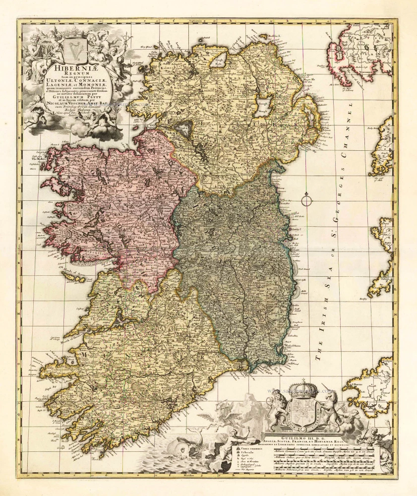
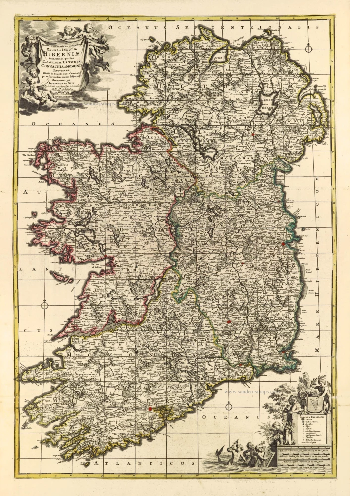
Hiberniae Regnum tam in Praecipuas Ultoniae, Connaciae, Lageniae, et Momoniae
Item Number: 25670 Authenticity Guarantee
Category: Antique maps > Europe > British Isles
Old, antique map of Ireland, by Nicolas Visscher II, published by Petrus Schenk.
Title: Hiberniae Regnum tam in Praecipuas Ultoniae, Connaciae, Lageniae, et Momoniae
quam in minores earumdem Provincias, et Ditiones subjacentes peraccurate divisum ac noviter delineatum per Guilielmum Petty et in lucem editum per Nicolaum Visscher Amst: Bat:
cum Privileg: Ordin: General: Belgii Foederati.
Nunc apud Pet: Schenk Iunior.
Cartographer: N. Visscher II.
Date: c. 1710.
Copper engraving, printed on paper.
Image size: 555 x 475mm (21.85 x 18.7 inches).
Sheet size: 635 x 530mm (25 x 20.87 inches).
Verso: Blank.
Condition: Original coloured, excellent.
Condition Rating: A+.
From: Atlas Contractus sive Mapparum Geographicarum Sansoniarum auctarum et correctarum Nova Congeries. Amsterdam, Petrus Schenk, c. 1700. (Koeman, Sche 1)
The Visscher Family
For nearly a century, the members of the Visscher family were essential art dealers and map publishers in Amsterdam.
Claes Jansz. Visscher, or N.J. Piscator (1587-1652)
Claes Jansz. Vischer bought a house in Amsterdam, 'de gulden Bors', on the crucial Kalverstraat and changed the name into "In de Visscher"; under this title, the shop was to flourish for many years.
He was famous for his engravings and etchings of Dutch landscapes and 'historical scenes', such as sieges, battles, etc. These 'historical scenes' were considered contemporary illustrated news items, especially e.g. that of 'the Eighty Years' War'.
For the publication of his first atlas, he bought copperplates of the atlas Germania Inferior by Pieter van den Keere (1623).
In 1649, he published an atlas entitled Tabularum Geographicarum Contractarum, containing the same maps as Langenes' Caert Thresoor, for which Visscher had only new title pages engraved.
Claes Jansz. Visscher died in 1652. His wife, Neeltjen Florisdr., had already died in 1640. They had seven children, four of whom were still alive at Claes Jansz.'s death. One was Nicolaes Visscher I, who was to continue his father's business.
Nicolaes Visscher I (1618-1679)
Nicolaes Visscher I partnered with his father, continued the business, and stayed on the Kalverstraat 'in de Visscher' till his death.
In about 1657, the first edition of his Atlas Contractus Orbis Terrarum appeared.
Between 1664 and 1677, several editions of his Atlas Contractus appeared without a printed index, for these atlases had no fixed contents but were composed according to the buyer's financial leaping pole.
In May 1664, Nicolaes Visscher was admitted as a member of the Booksellers' Guild of his town. In July 1677, he was granted a patent of the States of Holland and West-Friesland for printing and publishing maps and atlases for 15 years.
After this, he again published an Atlas Contractus with a printed index. At about the same time, he also brought out an Atlas Minor.
Nicolaes Visscher II (1649-1702)
Nicolaes Visscher II inherited the 'shop' from his father. To obtain a new privilege, he applied to the States of Holland and West-Friesland in 1682 for a patent for printing and publishing maps. This patent was granted to him the same year. He moved the firm to the Dam, but it kept the same signboard: "In de Visscher".
Around 1683, he published his first Atlas Minor with a printed index of 91 maps. In 1684, an atlas Germania Inferior appeared. Till 1697, he published another number of atlases. He used his grandfather's (Claes Jansz.) maps less often now and relied more and more on his own.
The wars waged at this time initiated the compilation of maps of the countries where the armies operated. Many war maps were included in the various editions of his Atlas Minor.
After Nicolaes's death, his wife, Elizabeth Verseyl, published all the war maps as an atlas under the title De Stoel des Oorlogs in de Wereld (The seat of war in the world).
The widow of Nicolaes Visscher II (?-1726)
His widow continued the business energetically, and by her hand, under the name of her deceased husband, numerous atlases appeared, e.g., several editions of the Atlas Minor, an Atlas Maior and De Stoel des Oorlogs. The shop enjoyed a high reputation due to the assortment's incredible variety. Not only 'Visscher' maps but also maps of other publishers were obtainable. With the death of Elizabeth Verseyl in 1726, the last descendant died of a great map- and atlas-publishing firm in Amsterdam.
The Schenk Family
Petrus Schenk (1660-1718), the founder of one of the best-known publishing firms of Amsterdam in the 18th century, was born in Elberfeld, Germany, in 1660. He went to Amsterdam where he became a pupil of the engraver Gerard Valck. On 19 Nov. 1686, a privilegio was granted to Petrus Schenk and Gerard Valk for the manufacturing and selling of their prints. Schenk’s contribution to cartography dates from c. 1695. In 1706 he moved to the Vijgendam in Amsterdam, ‘in Sanson’s Atlas’. After he died in 1718 his son, Leonardus Schenk, continued the art and print shop. The second son, Petrus II, settled in another famous house: ‘in Visscher’s Atlas’ where he continued the association with Gerard and Leonarus Valck.
The Schenk family produced general geographical atlases and special atlases. Apart from seventy original maps, several hundred are known with the name of Schenk, which were printed from plates obtained from Janssonius and Visscher. Schenk and Valck acquired all the plates of the Janssonius Heir’s Novus Atlas, Celestial atlas included. Many of Janssonius’ plates were reworked and amended.
The republishing of the maps from Janssonius’ Novus Atlas since c. 1680 was followed by the engraving of new maps, copied from Sanson’s better and more modern maps. Petrus Schenk published these maps in his Atlas Contractus sive mapparum geographicarum Sansoniarum auctarum et correctum Nova Congeries, also called Atlas Minor. After 1719, Petrus Schenk II continued the Atlas Contractus.
Petrus Schenk, the elder, enjoyed great fame as a print-seller and artist among art-and print-dealers in the whole of Europe. The great activity in map publishing, displayed by Petrus Schenk, the elder, was continued by his son and grandson. But the number of original atlas-maps is small. Like his father, who bought the copperplates of Janssonius’ atlas, Petrus Schenk II bought many of the plates formerly owned by Nicolaas Visscher.
Apart from the globes, maps and atlases, Petrus Schenk II published many books. He was older men of the booksellers guild in 1733.
Related items
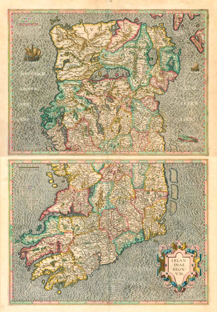
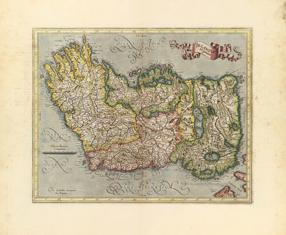
Irlandiae Regnum . 1623
Ireland (North + South) (2 maps), by G. Mercator.
[Item number: 2684]
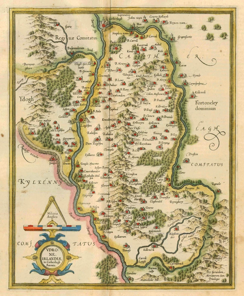
Udrone Irlandiae in Catherlagh Baronia. 1628
Ireland - Carlow by Mercator G. - Hondius J.
[Item number: 6474]
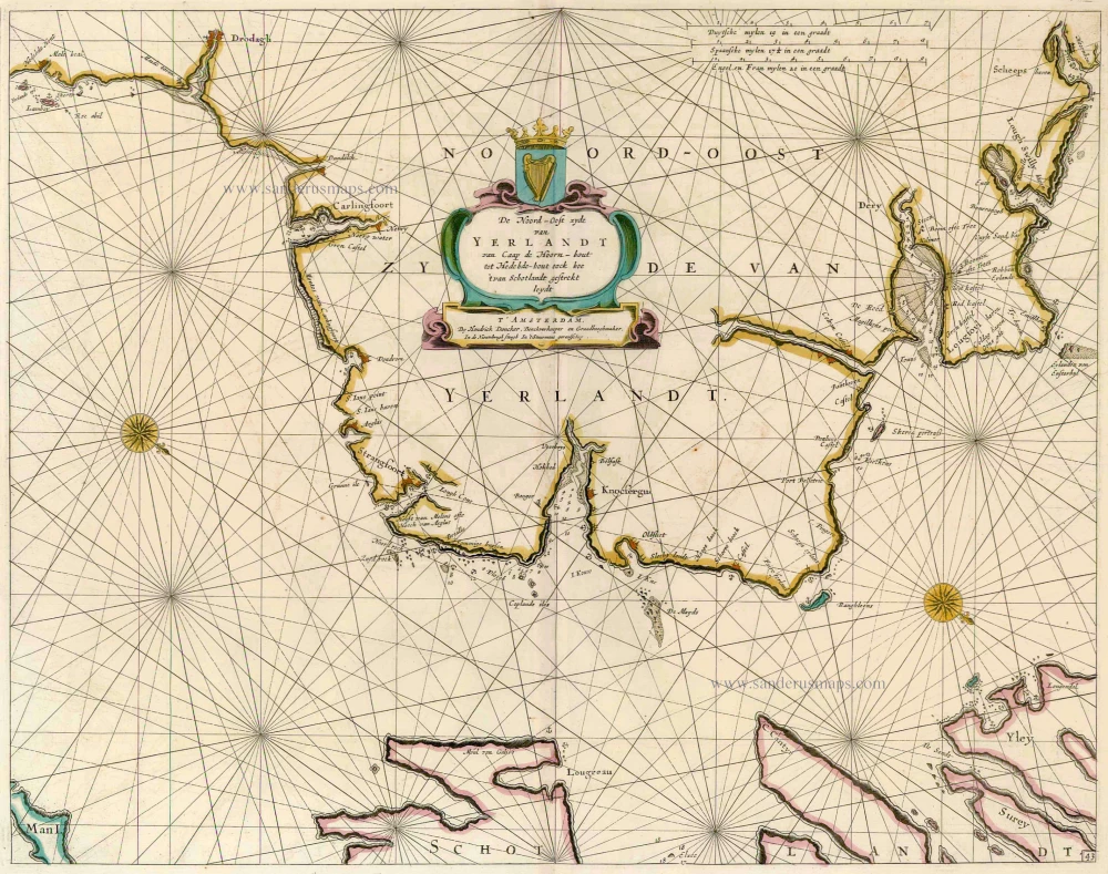
De Noord-Oost zyde van Yerlandt van Caap de Hoorn-hout tot Hedehde-hout oock hoe 't van Schotlandt gestrekt leydt 1686
Ireland, by Doncker H.
[Item number: 13644]
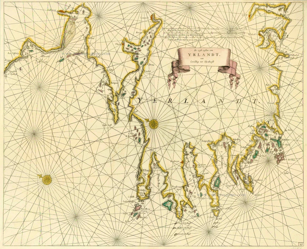
De West Custen van Yrlandt van Corckbeg tot Slynhooft 1686
Ireland (Southwest), by Doncker H.
[Item number: 13767]
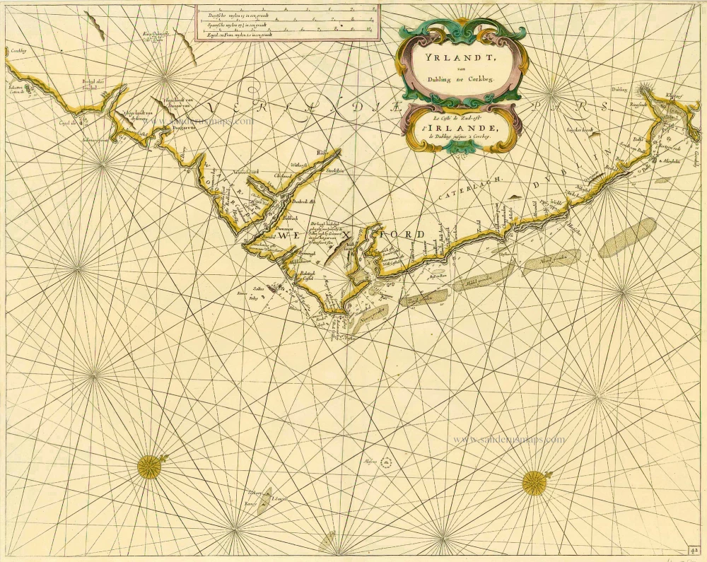
Yrlandt, van Dubling tot Corkbeg - Lz Coste de Zud-est d'Irlande, de Dubling jusques à Corcbeg. 1686
Sea chart of the southeast coast of Ireland, by Doncker H.
[Item number: 14587]

Noord-west zyde van Yrlandt van C. de Hoorn to Slynhooft. 1686
Ireland (Northwest), by Doncker H.
[Item number: 14899]
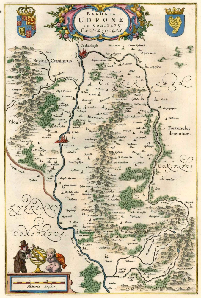
Baronia Udrone in Comitatu Catherloughae. 1654-1662
Ireland - Idrone by Joan Blaeu.
[Item number: 23155]
Hibernia Regnum Vulgo Ireland. 1641
Ireland by Joannes Janssonius
[Item number: 26258]
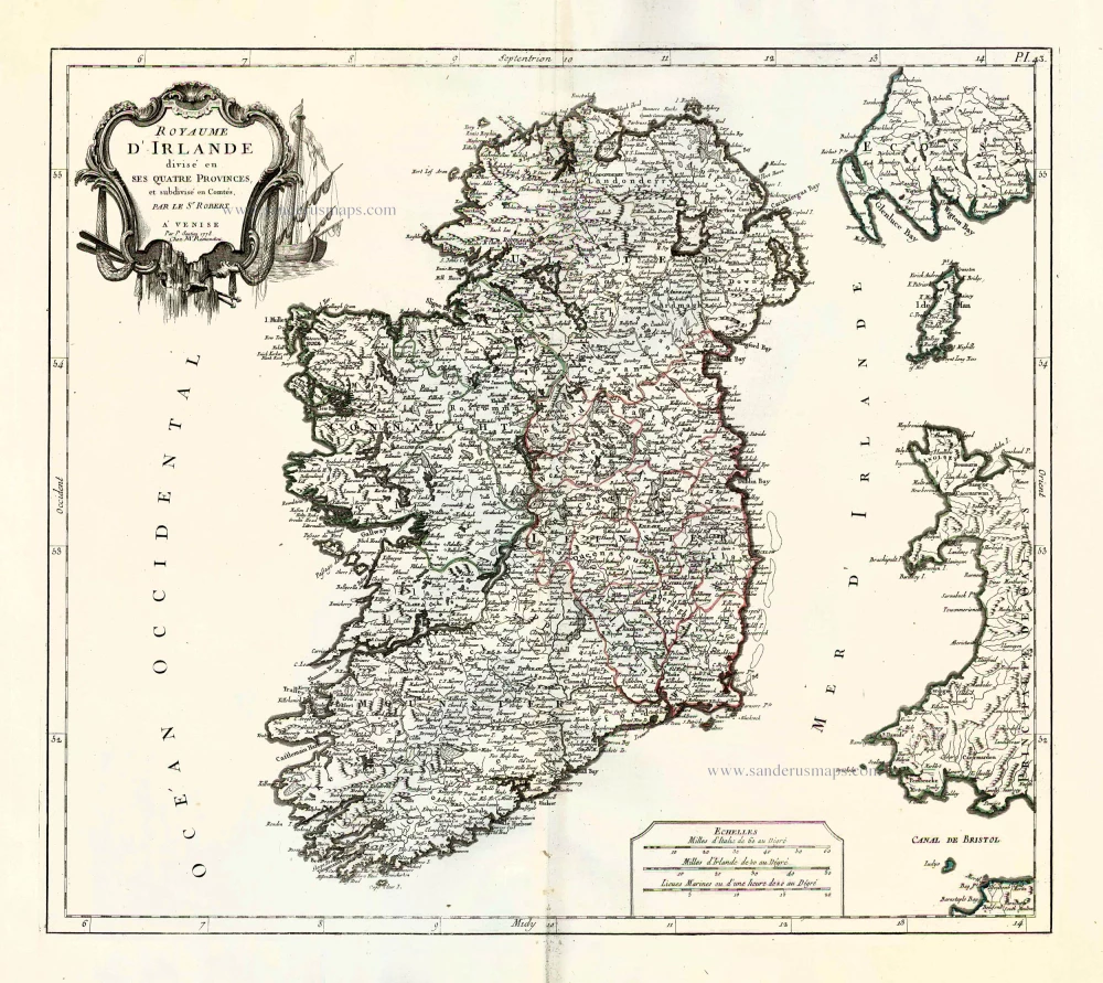
Royaume d'Irlande divisé en ses quatre provences, et subdivisé en Comtés. 1776-79
Ireland by Francesco & Paolo Santini
[Item number: 26962]
Novissima ac Prae Caeteris Aliis Accuratissima Regni et Insulae Hiberniae Delineatio, in qua sunt Lagenia, Ultonia, Connachia, et Momonia Provinciae. c. 1715
Ireland by Frederik de Wit, published by Covens & Mortier.
[Item number: 28241]
Irlandiae Regnum. 1628
Ireland, by Gerard Mercator.
[Item number: 28936]
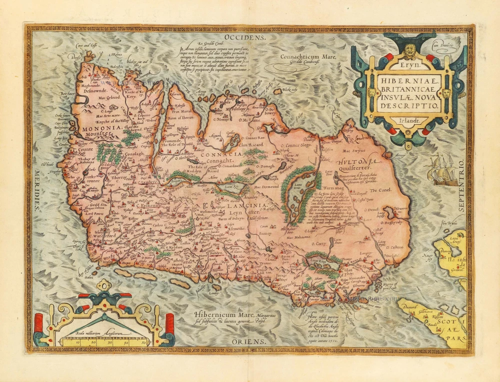
Eryn. Hiberniae, Britannicae Insulae, Nova Descriptio. Irlandt. 1584
Ireland by Abraham Ortelius.
[Item number: 29131]
Novissima ac Prae Caeteris Aliis Accuratissima Regni et Insulae Hiberniae Delineatio, in qua sunt Lagenia, Ultonia, Connachia, et Momonia Provinciae. c. 1691-97
Ireland by Frederik de Wit.
[Item number: 29565]
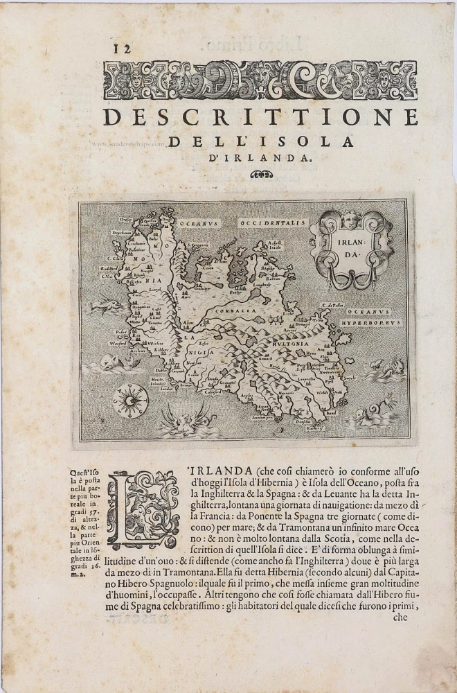
Irlanda. - [Above map :] Descrittione dell'Isola d'Irlanda 1590
Ireland, by Thomaso Porcacchi.
[Item number: 29734]
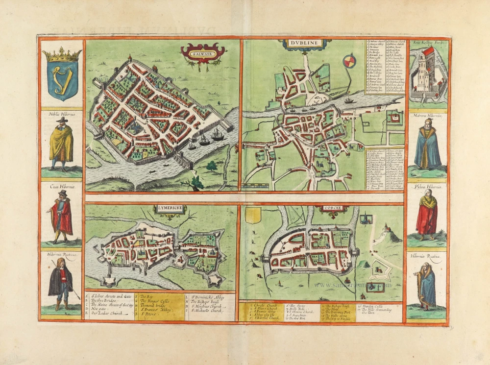
Galwaye [on sheet with] Dubline [and] Lymericke [and] Corcke. 1635
Dublin, Galway, Limerick & Cork by Georg Braun & Frans Hogenberg.
[Item number: 30541]
new