
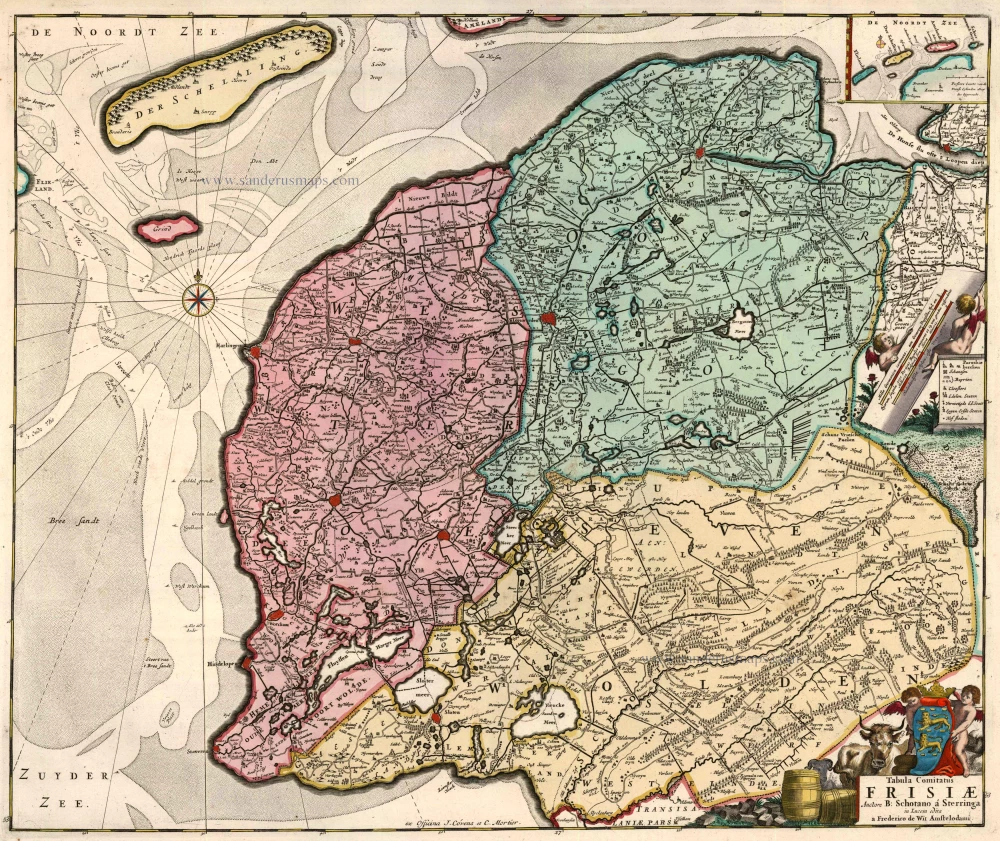
Friesland, by Ottens R. & I. Ca. 1730


Abraham Allard originally published this map in the early 18th century. In 1718 François Halma (1653-1722), a bookseller from Utrecht republished this map under his name (state 3). Around 1733 a new version of this map was issued (state 4), which was included in the atlases of Ottens.
The Ottens Family
Joachim Ottens (1663-1719), was a copper-engraver and the founder of the print- and mapsellers’ firm in Amsterdam. In 1710 he became a member of the art- and printsellers guild. After he died in 1719, his widow and the sons continued the business under the name “In de Wereldcaert” (In the world map). On the whole, the Ottens’s financial position was rather weak, and the stock was not very large.
In a notary contract dated 20 October 1726, the partnership between the two brothers, Reinier and Josua, was stipulated. Despite separate shops, the brothers’ partnership continued until the death of Renier in 1750.
After Joshua died in 1765, his widow continued the firm, together with her son, Renier II, until c. 1780.
The firm flourished mainly between 1719 and c. 1750. In that period, they advertised at various times the publication of new maps.
Ottens’s greatest fame comes from the voluminous atlases assembled to order. A small number of these so-called ‘Atlas factice’, splendid copies with gorgeous illumination, have survived. These collector’s copies are known to exist in 2, 6, 8, 11, and even 15 volumes. Ottens also published atlases in one volume, with a varying number of maps, pocket atlases, collections of military plans, and Renard’s atlas de la navigation.
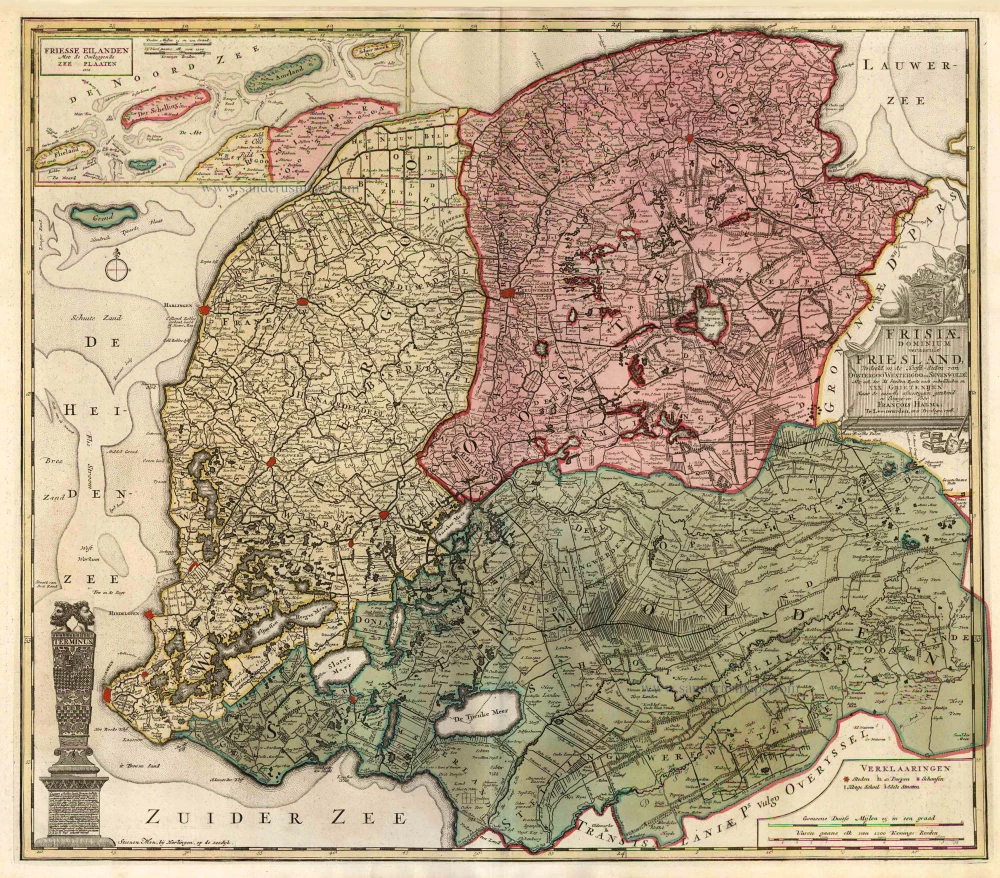
Frisiae Dominium vernacule Friesland,
Item Number: 25746 Authenticity Guarantee
Category: Antique maps > Europe > The Netherlands
Old antique map of Friesland by François Halma, published by Ottens R. & I.
Title: Frisiae Dominium vernacule Friesland,
Verdeeld in de Hoofd-deelen van Oostergoo Westergoo en Sevenwolde Als ook der XI Steden Zynde noch onderscheiden in XXX Grietenijen. ... door François Halma, Te Leeuwarden, met privilege 1718.
Steenen man, bij Harlingen, op de zeedijk.
Cartographer: François Halma.
Date: Ca. 1730.
Copper engraving, printed on paper.
Size (not including margins): 515 x 585mm (20.28 x 23.03 inches).
Verso: Blank.
Condition: Original coloured, excellent.
Condition Rating: A+.
From: Atlas sive Geographia compendiosa in qua Orbis Terrarum pacis attamen novissimis Tabulis Ostenditur. - Atlas Nouveau, contenant toutes les partis du monde ... R. & I. Ottens, c. 1745. (Composite Atlas).
Abraham Allard originally published this map in the early 18th century. In 1718 François Halma (1653-1722), a bookseller from Utrecht republished this map under his name (state 3). Around 1733 a new version of this map was issued (state 4), which was included in the atlases of Ottens.
The Ottens Family
Joachim Ottens (1663-1719), was a copper-engraver and the founder of the print- and mapsellers’ firm in Amsterdam. In 1710 he became a member of the art- and printsellers guild. After he died in 1719, his widow and the sons continued the business under the name “In de Wereldcaert” (In the world map). On the whole, the Ottens’s financial position was rather weak, and the stock was not very large.
In a notary contract dated 20 October 1726, the partnership between the two brothers, Reinier and Josua, was stipulated. Despite separate shops, the brothers’ partnership continued until the death of Renier in 1750.
After Joshua died in 1765, his widow continued the firm, together with her son, Renier II, until c. 1780.
The firm flourished mainly between 1719 and c. 1750. In that period, they advertised at various times the publication of new maps.
Ottens’s greatest fame comes from the voluminous atlases assembled to order. A small number of these so-called ‘Atlas factice’, splendid copies with gorgeous illumination, have survived. These collector’s copies are known to exist in 2, 6, 8, 11, and even 15 volumes. Ottens also published atlases in one volume, with a varying number of maps, pocket atlases, collections of military plans, and Renard’s atlas de la navigation.
Related items
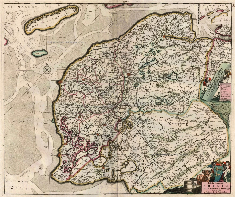
Tabula Comitatus Frisiae. Auctore B: Schotano à Sterringa. c. 1680
Friesland, by Frederik De Wit.
[Item number: 2635]
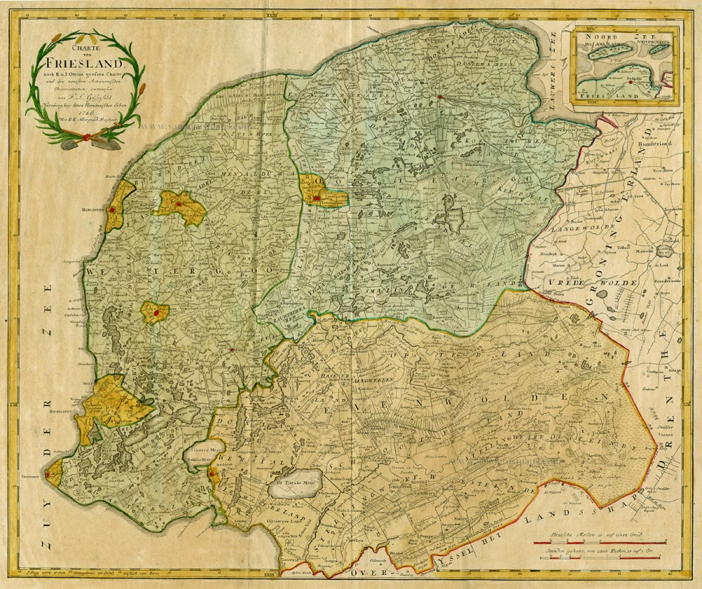
Charte von Friesland 1759-1784
Friesland by Homann Heirs.
[Item number: 13868]
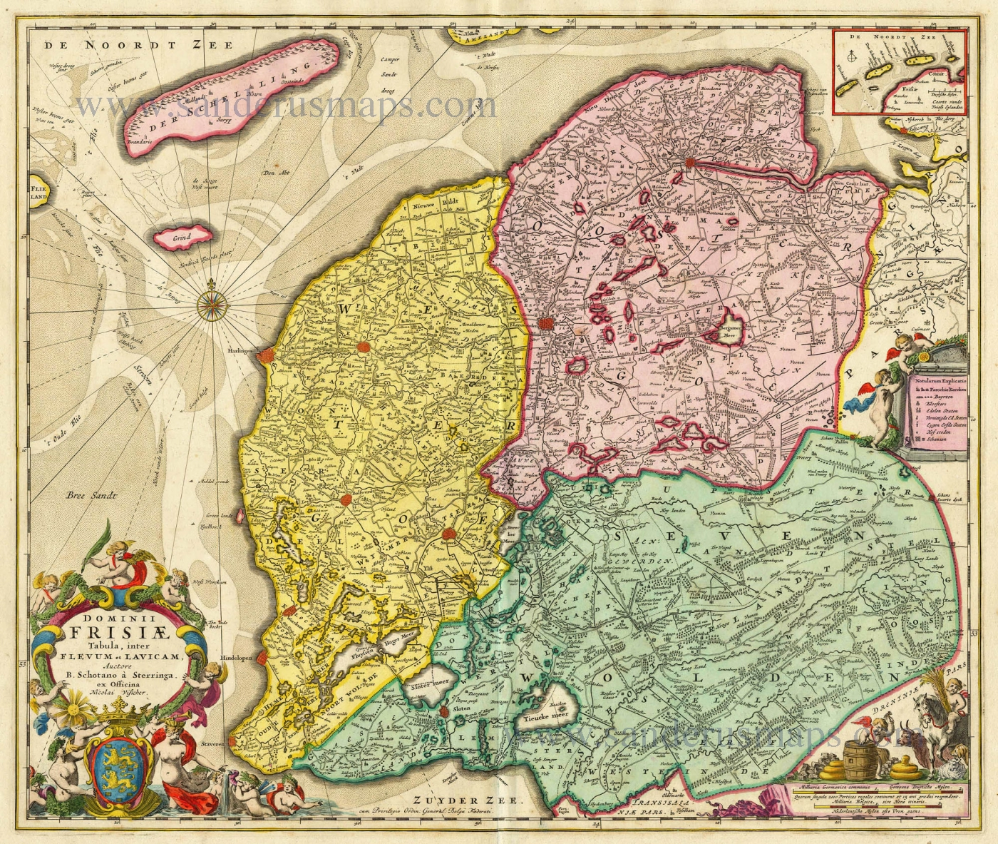
Dominii Frisiae Tabula, inter Flevum et Lavicam. c. 1678
Friesland by Nicolaas Visscher II.
[Item number: 18688]
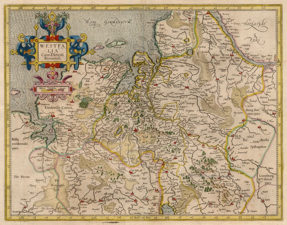
Westfalia Cum Dioecesi Bremensi 1595
Ost-Friesland, Oldenburg, and Bremen by Gerard Mercator.
[Item number: 19091]
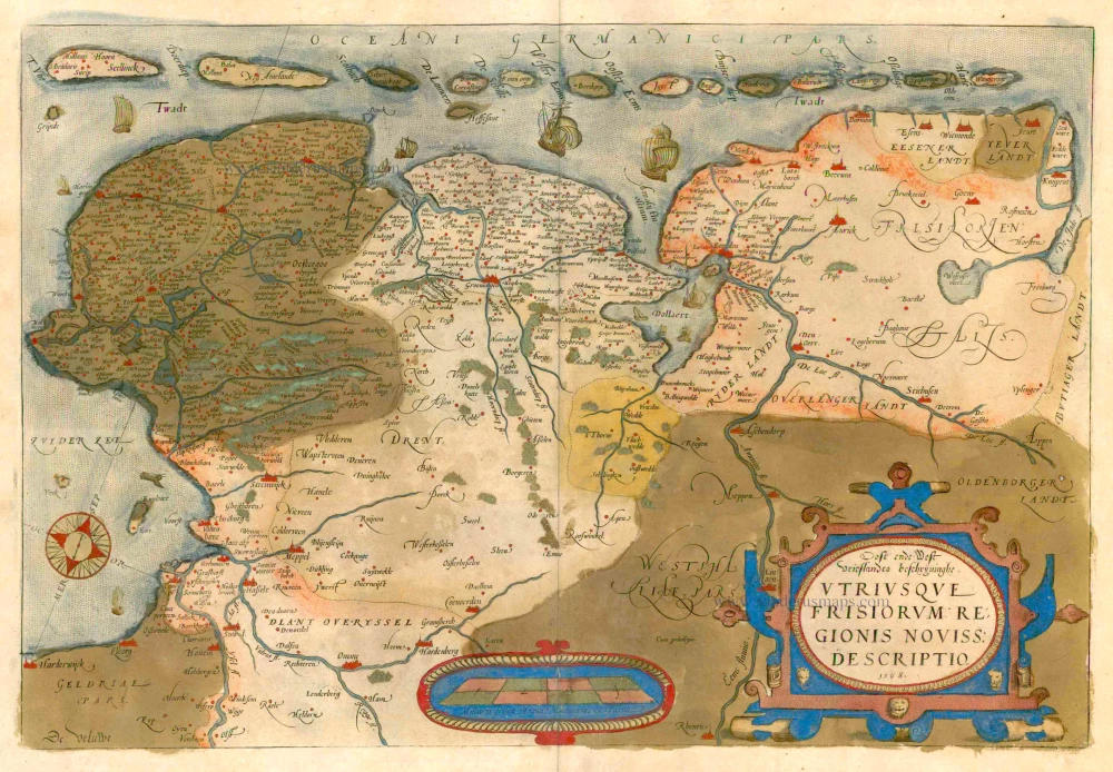
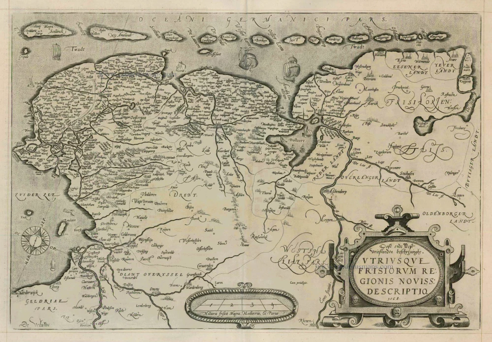
Oost ende West Vrieslandts beschryvinghe, utriusque Frisiorum Regionis Noviss: Descriptio. 1605. 1579
Friesland by Abraham Ortelius.
[Item number: 22595]
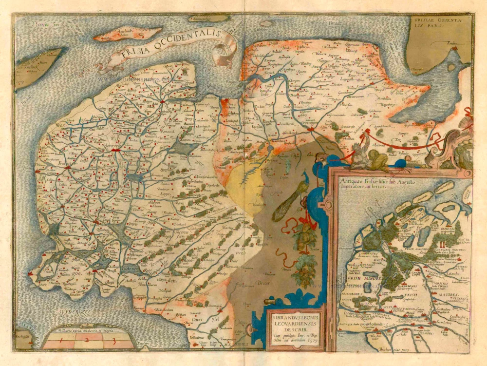
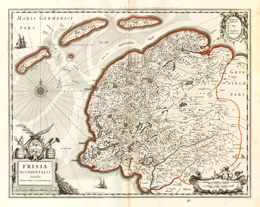
Frisia Occidentalis. 1579
West Friesland, by Abraham Ortelius
[Item number: 22673]
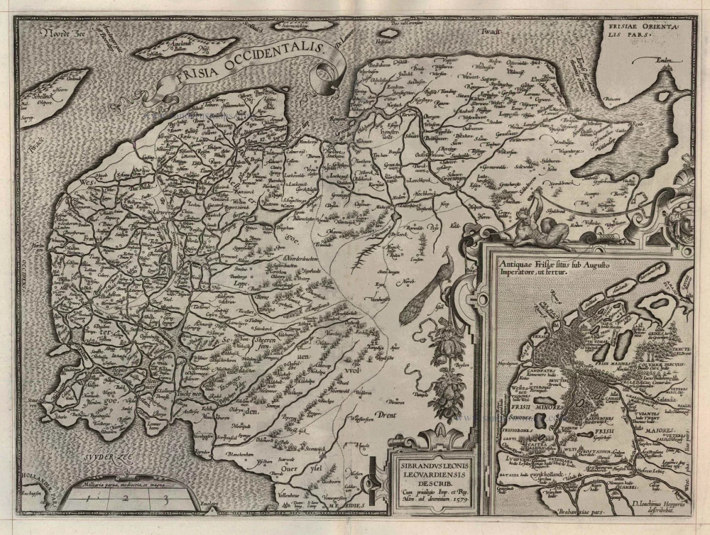
Frisia Occidentalis 1598
West Friesland, by Abraham Ortelius.
[Item number: 22913]
Oost ende West Vrieslandts beschryvinghe, utriusque ... 1598
Friesland, by A. Ortelius.
[Item number: 22914]
Tabula Comitatus Frisiae. Auctore B: Schotano à Sterringa. c. 1715
Friesland by Frederik de Wit.
[Item number: 23665]
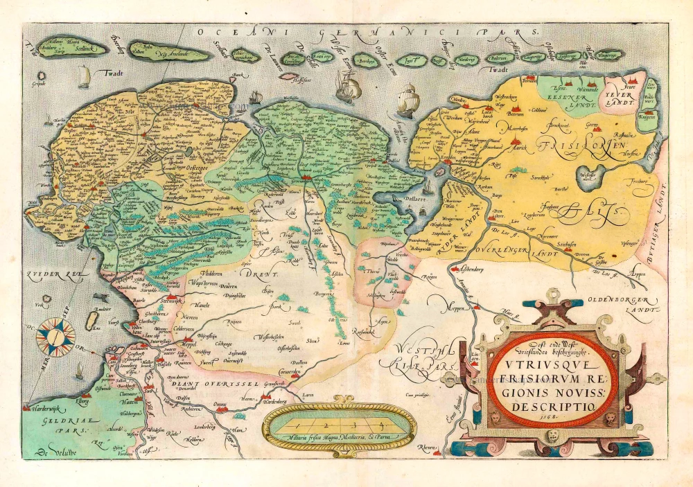
Oost ende West Vrieslandts beschryvinghe, utriusque Frisiorum Regionis Noviss: Descriptio. 1568. 1573
Friesland by Abraham Ortelius.
[Item number: 25855]
Frisia Occidentalis. 1629-30
West-Friesland, by Henricus Hondius.
[Item number: 26357]
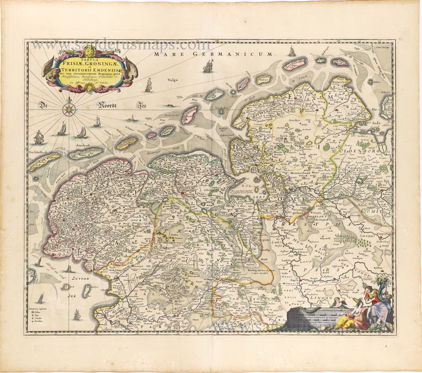
Tabula Frisiae, Groningae, er Territorii Emdensis nec non circumjacentium Regionum, puta Transisalaniae, Benthemiae, Westphaliae et Oldenburgi. 1656-80
Friesland & Groningen by Nicolaes Visscher I.
[Item number: 28601]
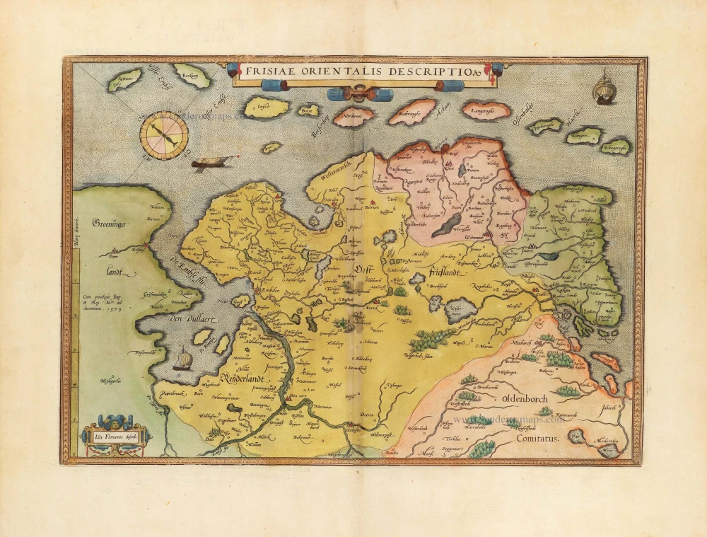
Frisiae Orientalis Descriptio. 1584
East Friesland by Ortelius Abraham
[Item number: 29132]
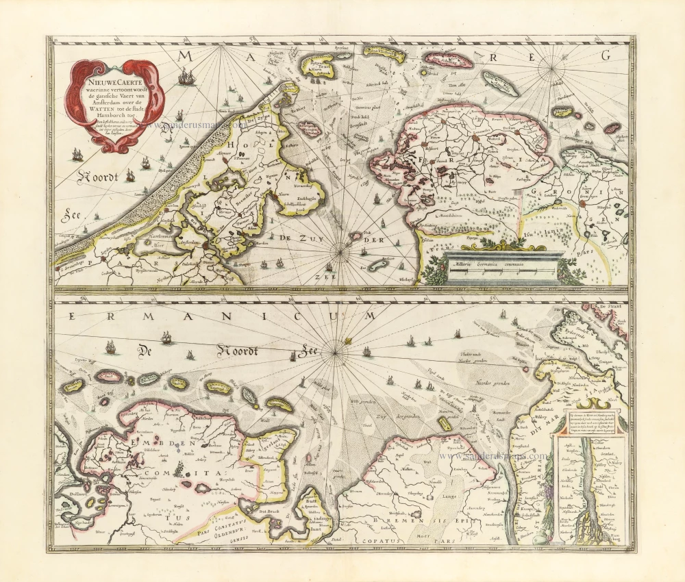
Nieuwe Caerte waerinne vertoont wordt de gantsche Vaert van Amsterdam over de Watten tot de stadt Hamborch toe. 1653
The Wadden Sea, by Henricus Hondius.
[Item number: 30375]
new