
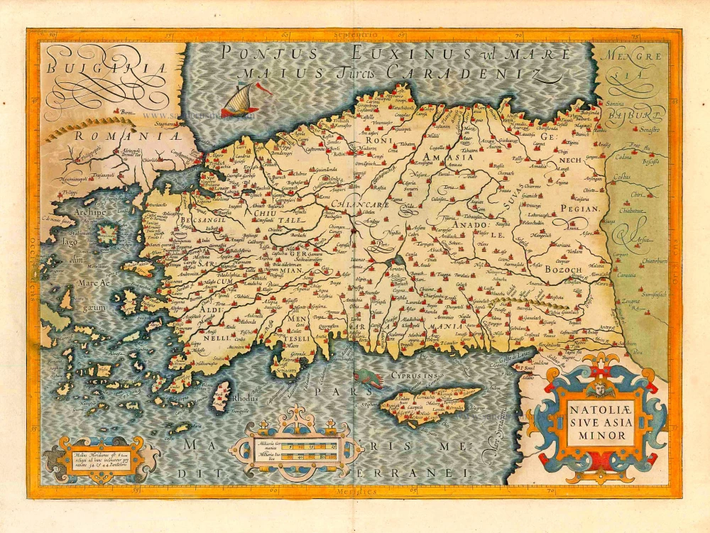
Turkey - Cyprus by N. Visscher II - P. Schenk. c. 1740


The Visscher Family
For nearly a century, the members of the Visscher family were essential art dealers and map publishers in Amsterdam.
Claes Jansz. Visscher, or N.J. Piscator (1587-1652)
Claes Jansz. Vischer bought a house in Amsterdam, 'de gulden Bors', on the crucial Kalverstraat and changed the name into "In de Visscher"; under this title, the shop was to flourish for many years.
He was famous for his engravings and etchings of Dutch landscapes and 'historical scenes', such as sieges, battles, etc. These 'historical scenes' were considered contemporary illustrated news items, especially e.g. that of 'the Eighty Years' War'.
For the publication of his first atlas, he bought copperplates of the atlas Germania Inferior by Pieter van den Keere (1623).
In 1649, he published an atlas entitled Tabularum Geographicarum Contractarum, containing the same maps as Langenes' Caert Thresoor, for which Visscher had only new title pages engraved.
Claes Jansz. Visscher died in 1652. His wife, Neeltjen Florisdr., had already died in 1640. They had seven children, four of whom were still alive at Claes Jansz.'s death. One was Nicolaes Visscher I, who was to continue his father's business.
Nicolaes Visscher I (1618-1679)
Nicolaes Visscher I partnered with his father, continued the business, and stayed on the Kalverstraat 'in de Visscher' till his death.
In about 1657, the first edition of his Atlas Contractus Orbis Terrarum appeared.
Between 1664 and 1677, several editions of his Atlas Contractus appeared without a printed index, for these atlases had no fixed contents but were composed according to the buyer's financial leaping pole.
In May 1664, Nicolaes Visscher was admitted as a member of the Booksellers' Guild of his town. In July 1677, he was granted a patent of the States of Holland and West-Friesland for printing and publishing maps and atlases for 15 years.
After this, he again published an Atlas Contractus with a printed index. At about the same time, he also brought out an Atlas Minor.
Nicolaes Visscher II (1649-1702)
Nicolaes Visscher II inherited the 'shop' from his father. To obtain a new privilege, he applied to the States of Holland and West-Friesland in 1682 for a patent for printing and publishing maps. This patent was granted to him the same year. He moved the firm to the Dam, but it kept the same signboard: "In de Visscher".
Around 1683, he published his first Atlas Minor with a printed index of 91 maps. In 1684, an atlas Germania Inferior appeared. Till 1697, he published another number of atlases. He used his grandfather's (Claes Jansz.) maps less often now and relied more and more on his own.
The wars waged at this time initiated the compilation of maps of the countries where the armies operated. Many war maps were included in the various editions of his Atlas Minor.
After Nicolaes's death, his wife, Elizabeth Verseyl, published all the war maps as an atlas under the title De Stoel des Oorlogs in de Wereld (The seat of war in the world).
The widow of Nicolaes Visscher II (?-1726)
His widow continued the business energetically, and by her hand, under the name of her deceased husband, numerous atlases appeared, e.g., several editions of the Atlas Minor, an Atlas Maior and De Stoel des Oorlogs. The shop enjoyed a high reputation due to the assortment's incredible variety. Not only 'Visscher' maps but also maps of other publishers were obtainable. With the death of Elizabeth Verseyl in 1726, the last descendant died of a great map- and atlas-publishing firm in Amsterdam.
The Schenk Family
Petrus Schenk (1660-1718), the founder of one of the best-known publishing firms of Amsterdam in the 18th century, was born in Elberfeld, Germany, in 1660. He went to Amsterdam where he became a pupil of the engraver Gerard Valck. On 19 Nov. 1686, a privilegio was granted to Petrus Schenk and Gerard Valk for the manufacturing and selling of their prints. Schenk’s contribution to cartography dates from c. 1695. In 1706 he moved to the Vijgendam in Amsterdam, ‘in Sanson’s Atlas’. After he died in 1718 his son, Leonardus Schenk, continued the art and print shop. The second son, Petrus II, settled in another famous house: ‘in Visscher’s Atlas’ where he continued the association with Gerard and Leonarus Valck.
The Schenk family produced general geographical atlases and special atlases. Apart from seventy original maps, several hundred are known with the name of Schenk, which were printed from plates obtained from Janssonius and Visscher. Schenk and Valck acquired all the plates of the Janssonius Heir’s Novus Atlas, Celestial atlas included. Many of Janssonius’ plates were reworked and amended.
The republishing of the maps from Janssonius’ Novus Atlas since c. 1680 was followed by the engraving of new maps, copied from Sanson’s better and more modern maps. Petrus Schenk published these maps in his Atlas Contractus sive mapparum geographicarum Sansoniarum auctarum et correctum Nova Congeries, also called Atlas Minor. After 1719, Petrus Schenk II continued the Atlas Contractus.
Petrus Schenk, the elder, enjoyed great fame as a print-seller and artist among art-and print-dealers in the whole of Europe. The great activity in map publishing, displayed by Petrus Schenk, the elder, was continued by his son and grandson. But the number of original atlas-maps is small. Like his father, who bought the copperplates of Janssonius’ atlas, Petrus Schenk II bought many of the plates formerly owned by Nicolaas Visscher.
Apart from the globes, maps and atlases, Petrus Schenk II published many books. He was older men of the booksellers guild in 1733.
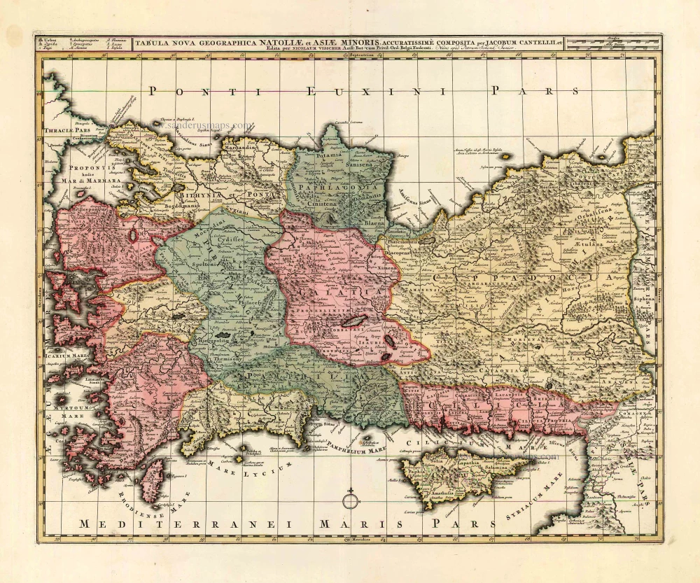
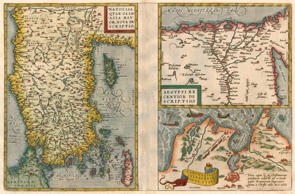
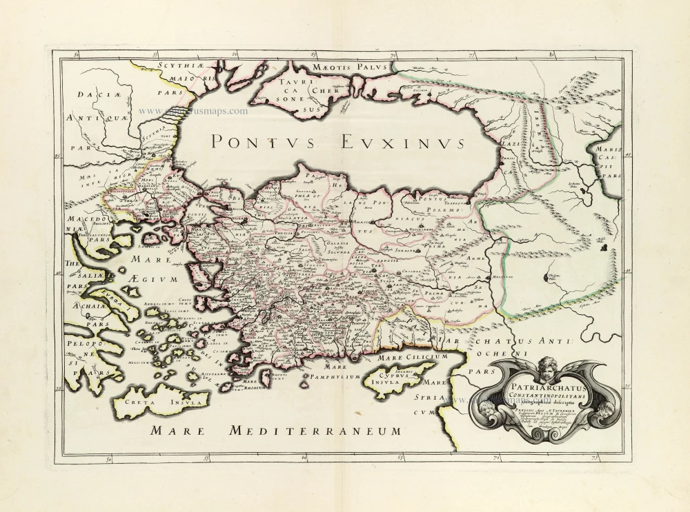
Tabula Nova Geographica Natoliae et Asiae Minoris.
Item Number: 25841 Authenticity Guarantee
Category: Antique maps > Asia > Turkey - Cyprus
Old, antique map of Turkey - Cyprus by N. Visscher II - P. Schenk.
Copper engraving, printed on paper.
Size (not including margins): 44.5 x 54.5cm (17.4 x 21.3 inches)
Verso: Blank
Condition: Original coloured, excellent.
Condition Rating: A+
References: Zacharakis, 3274/2697.
From: Atlas sive Geographia compendiosa in qua Orbis Terrarum pacis attamen novissimis Tabulis Ostenditur. - Atlas Nouveau, contenant toutes les partis du monde ... R. & I. Ottens, c. 1740. (Composite Atlas).
The Visscher Family
For nearly a century, the members of the Visscher family were essential art dealers and map publishers in Amsterdam.
Claes Jansz. Visscher, or N.J. Piscator (1587-1652)
Claes Jansz. Vischer bought a house in Amsterdam, 'de gulden Bors', on the crucial Kalverstraat and changed the name into "In de Visscher"; under this title, the shop was to flourish for many years.
He was famous for his engravings and etchings of Dutch landscapes and 'historical scenes', such as sieges, battles, etc. These 'historical scenes' were considered contemporary illustrated news items, especially e.g. that of 'the Eighty Years' War'.
For the publication of his first atlas, he bought copperplates of the atlas Germania Inferior by Pieter van den Keere (1623).
In 1649, he published an atlas entitled Tabularum Geographicarum Contractarum, containing the same maps as Langenes' Caert Thresoor, for which Visscher had only new title pages engraved.
Claes Jansz. Visscher died in 1652. His wife, Neeltjen Florisdr., had already died in 1640. They had seven children, four of whom were still alive at Claes Jansz.'s death. One was Nicolaes Visscher I, who was to continue his father's business.
Nicolaes Visscher I (1618-1679)
Nicolaes Visscher I partnered with his father, continued the business, and stayed on the Kalverstraat 'in de Visscher' till his death.
In about 1657, the first edition of his Atlas Contractus Orbis Terrarum appeared.
Between 1664 and 1677, several editions of his Atlas Contractus appeared without a printed index, for these atlases had no fixed contents but were composed according to the buyer's financial leaping pole.
In May 1664, Nicolaes Visscher was admitted as a member of the Booksellers' Guild of his town. In July 1677, he was granted a patent of the States of Holland and West-Friesland for printing and publishing maps and atlases for 15 years.
After this, he again published an Atlas Contractus with a printed index. At about the same time, he also brought out an Atlas Minor.
Nicolaes Visscher II (1649-1702)
Nicolaes Visscher II inherited the 'shop' from his father. To obtain a new privilege, he applied to the States of Holland and West-Friesland in 1682 for a patent for printing and publishing maps. This patent was granted to him the same year. He moved the firm to the Dam, but it kept the same signboard: "In de Visscher".
Around 1683, he published his first Atlas Minor with a printed index of 91 maps. In 1684, an atlas Germania Inferior appeared. Till 1697, he published another number of atlases. He used his grandfather's (Claes Jansz.) maps less often now and relied more and more on his own.
The wars waged at this time initiated the compilation of maps of the countries where the armies operated. Many war maps were included in the various editions of his Atlas Minor.
After Nicolaes's death, his wife, Elizabeth Verseyl, published all the war maps as an atlas under the title De Stoel des Oorlogs in de Wereld (The seat of war in the world).
The widow of Nicolaes Visscher II (?-1726)
His widow continued the business energetically, and by her hand, under the name of her deceased husband, numerous atlases appeared, e.g., several editions of the Atlas Minor, an Atlas Maior and De Stoel des Oorlogs. The shop enjoyed a high reputation due to the assortment's incredible variety. Not only 'Visscher' maps but also maps of other publishers were obtainable. With the death of Elizabeth Verseyl in 1726, the last descendant died of a great map- and atlas-publishing firm in Amsterdam.
The Schenk Family
Petrus Schenk (1660-1718), the founder of one of the best-known publishing firms of Amsterdam in the 18th century, was born in Elberfeld, Germany, in 1660. He went to Amsterdam where he became a pupil of the engraver Gerard Valck. On 19 Nov. 1686, a privilegio was granted to Petrus Schenk and Gerard Valk for the manufacturing and selling of their prints. Schenk’s contribution to cartography dates from c. 1695. In 1706 he moved to the Vijgendam in Amsterdam, ‘in Sanson’s Atlas’. After he died in 1718 his son, Leonardus Schenk, continued the art and print shop. The second son, Petrus II, settled in another famous house: ‘in Visscher’s Atlas’ where he continued the association with Gerard and Leonarus Valck.
The Schenk family produced general geographical atlases and special atlases. Apart from seventy original maps, several hundred are known with the name of Schenk, which were printed from plates obtained from Janssonius and Visscher. Schenk and Valck acquired all the plates of the Janssonius Heir’s Novus Atlas, Celestial atlas included. Many of Janssonius’ plates were reworked and amended.
The republishing of the maps from Janssonius’ Novus Atlas since c. 1680 was followed by the engraving of new maps, copied from Sanson’s better and more modern maps. Petrus Schenk published these maps in his Atlas Contractus sive mapparum geographicarum Sansoniarum auctarum et correctum Nova Congeries, also called Atlas Minor. After 1719, Petrus Schenk II continued the Atlas Contractus.
Petrus Schenk, the elder, enjoyed great fame as a print-seller and artist among art-and print-dealers in the whole of Europe. The great activity in map publishing, displayed by Petrus Schenk, the elder, was continued by his son and grandson. But the number of original atlas-maps is small. Like his father, who bought the copperplates of Janssonius’ atlas, Petrus Schenk II bought many of the plates formerly owned by Nicolaas Visscher.
Apart from the globes, maps and atlases, Petrus Schenk II published many books. He was older men of the booksellers guild in 1733.
Related items
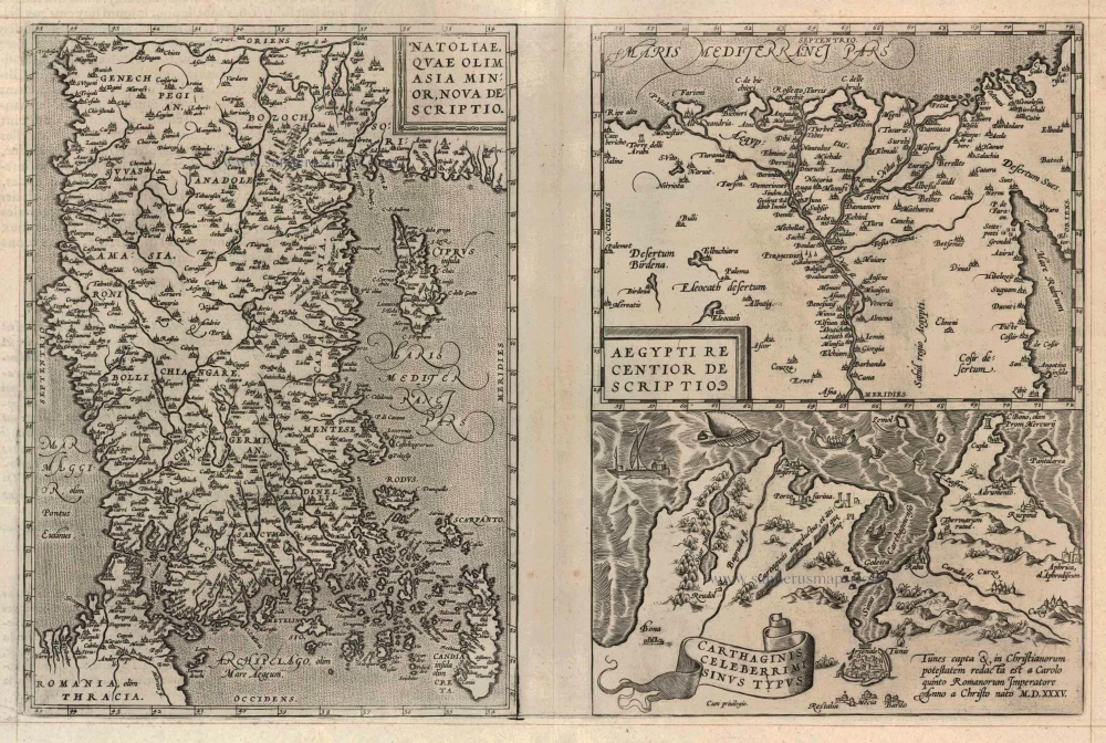
Natoliae quae olim Asia Minor [on sheet with] Argypti Recentioe Descriptio [and] Carthaginis Celeberrimi Sinus Typus 1598
Turkey - Egypt - Cartago, by A. Ortelius.
[Item number: 22865]
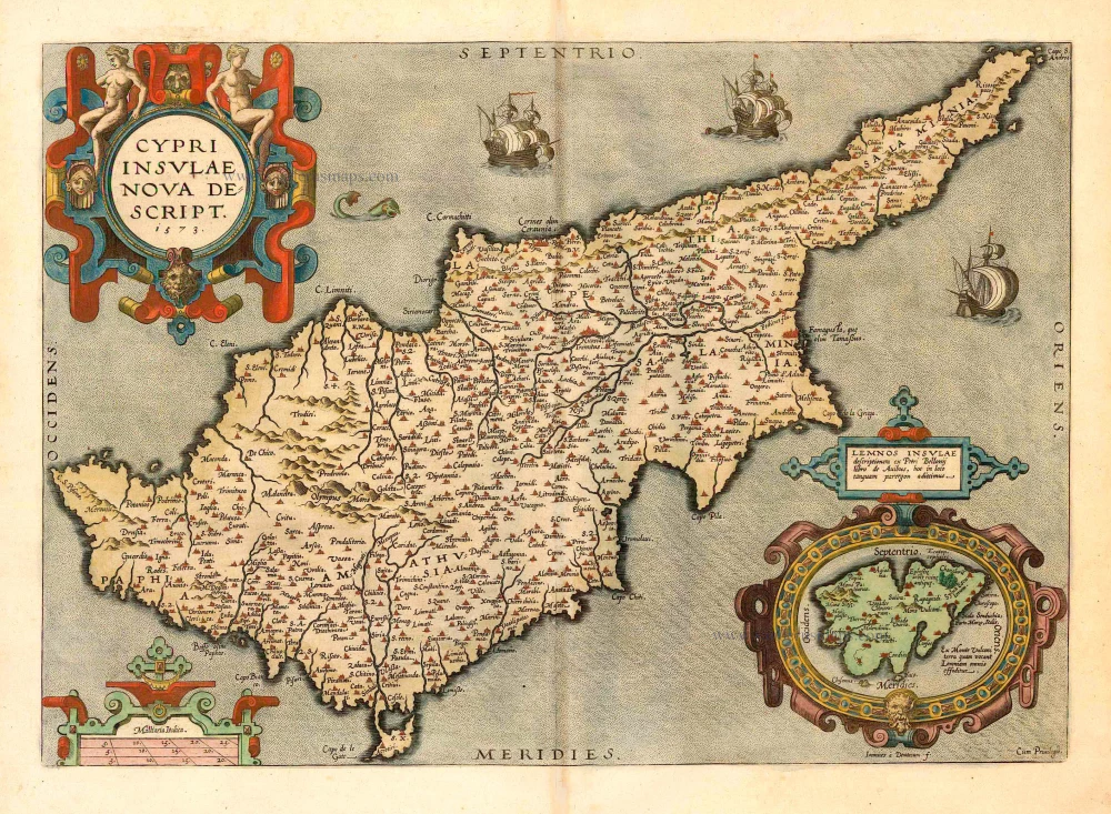
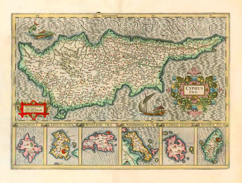
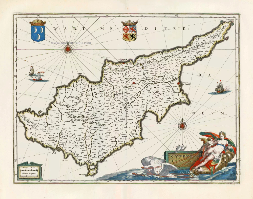
Cypri Insulae Nova Descript. 1573 1592
Cyprus, by Ortelius A.
[Item number: 22955]
Natoliae quae olim Asia Minor [on sheet with] Argypti Recentioe Descriptio [and] Carthaginis Celeberrimi Sinus Typus 1612
Turkey - Egypt - Cartago by Ortelius A.
[Item number: 22800]
Cyprus Ins: 1633
Cyprus, by Jodocus Hondius.
[Item number: 24436]

Cyprus Insula - Candia, olim Creta. 1572
Cyprus - Crete, by A. Ortelius.
[Item number: 16585]
Cyprus Insula. 1552
Cyprus, by S. Münster.
[Item number: 25723]

Cyprus Ins: 1641
Cyprus, by Henricus Hondius.
[Item number: 26436]
Cyprus. 1602
Cyprus, by Barent Langenes, published by P. Bertius.
[Item number: 26542]
Cyprus Insula. 1640-43
Cyprus, by W. & J. Blaeu.
[Item number: 26641]
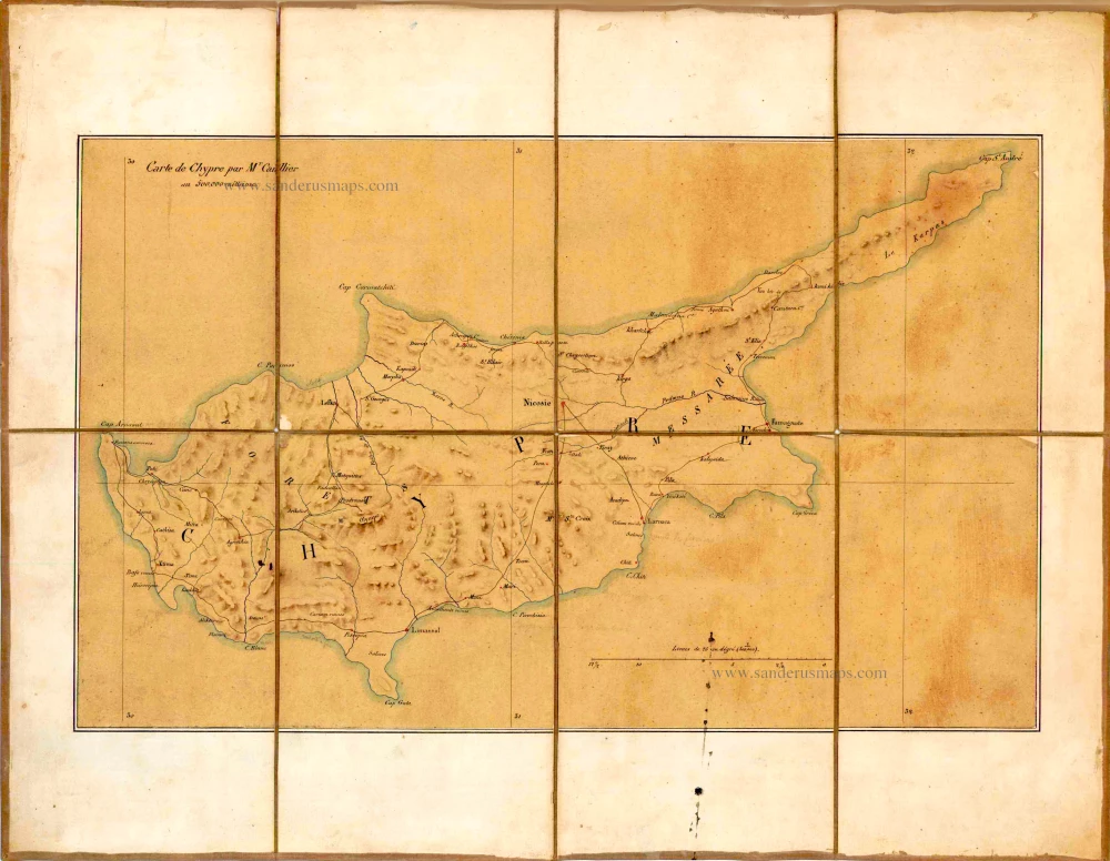
Carte de Chypre par Mr Caillier. c. 1850
Manuscript map of Cyprus, by Caillier.
[Item number: 26720]

Turquie d'Europe. 1776-79
The Ottoman Empire, by Francesco Santini.
[Item number: 26972]
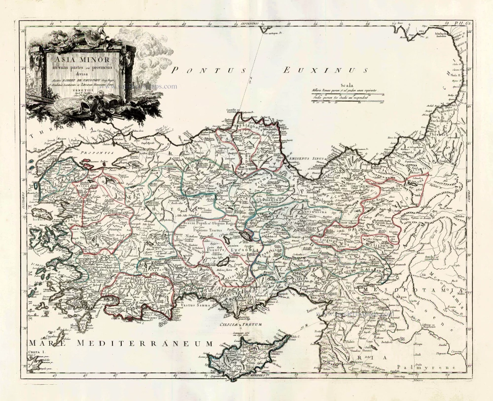
Asia Minor in suas partes seu provincias divisa. 1776-79
Turkey and Cyprus, by Paolo Santini.
[Item number: 27014]
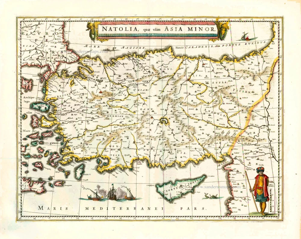
Natolia quae olim Asia Minor. 1640
Turkey and Cyprus, by Willem Blaeu.
[Item number: 27148]
Natoliae sive Asia Minor. 1623
Turkey with Natoliae sive Asia Minor, by Jodocus Hondius.
[Item number: 27824]
Tabula nova Asiae minoris. 1525
Turkey, by Lorenz Fries.
[Item number: 27954]
Asia Minor. 1665
Turkey - Cyprus by Philippe de la Rue.
[Item number: 28470]
Asia Minor In Epitomen contracta, Magnas Regiones seu Provincias Representans In Quibus Populi, Primariae Urbes Locaque Praecipua Notantur. 1700-1710
Turkey & Cyprus by Pierre Moullart-Sanson.
[Item number: 28532]
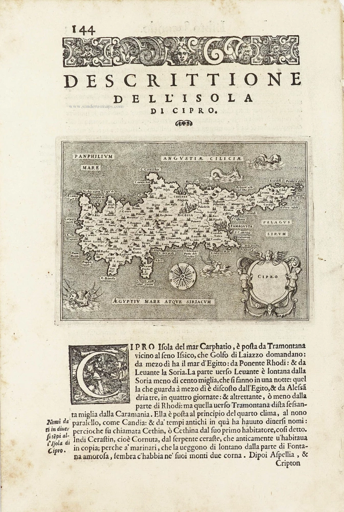
Cipro. - [Above map :] Descrittione dell'Isola di Cipro. 1590
Cyprus by Thomasso Porcacchi.
[Item number: 29827]
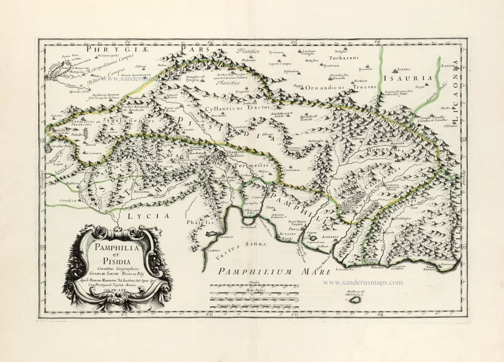
Pamphilia et Pisidia. 1670
Pamphylia & Pisidia (Anatolia - Turkey) by Pierre Mariette.
[Item number: 30022]
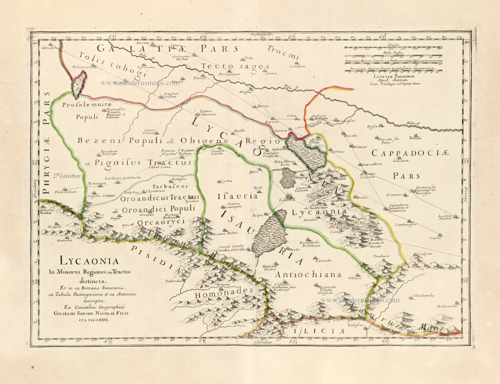
Lycaonia In Minores Regiones seu Tractus distincta; Et in ea Romana Itineraria, ex Tabula Peutingeriana et ex Antonino descripta. 1676
Lycaonia (Central Turkey) by Guillaume Sanson.
[Item number: 30023]
*** Scarce first edition ***
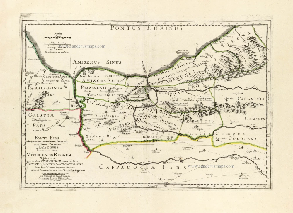
Ponti Pars, Ad Halym, Iridem Thermodontemq[ue]; Fluvios Sita; quam Heroicis Temporibus Amazones Romanorum Aetate Mithridatis Regnum Nobilitarunt: quae tandem Provincia Romanorum facta Pontus Galaticus mox Hellenopontus dicta et in Minores Regiones distincta; et in ea Romana Itineraria ex Tabula Peutingeriana, et ex Antonino descripta. 1676
Ancient Northern Turkey by Guillaume Sanson.
[Item number: 30024]
*** Rare first edition ***
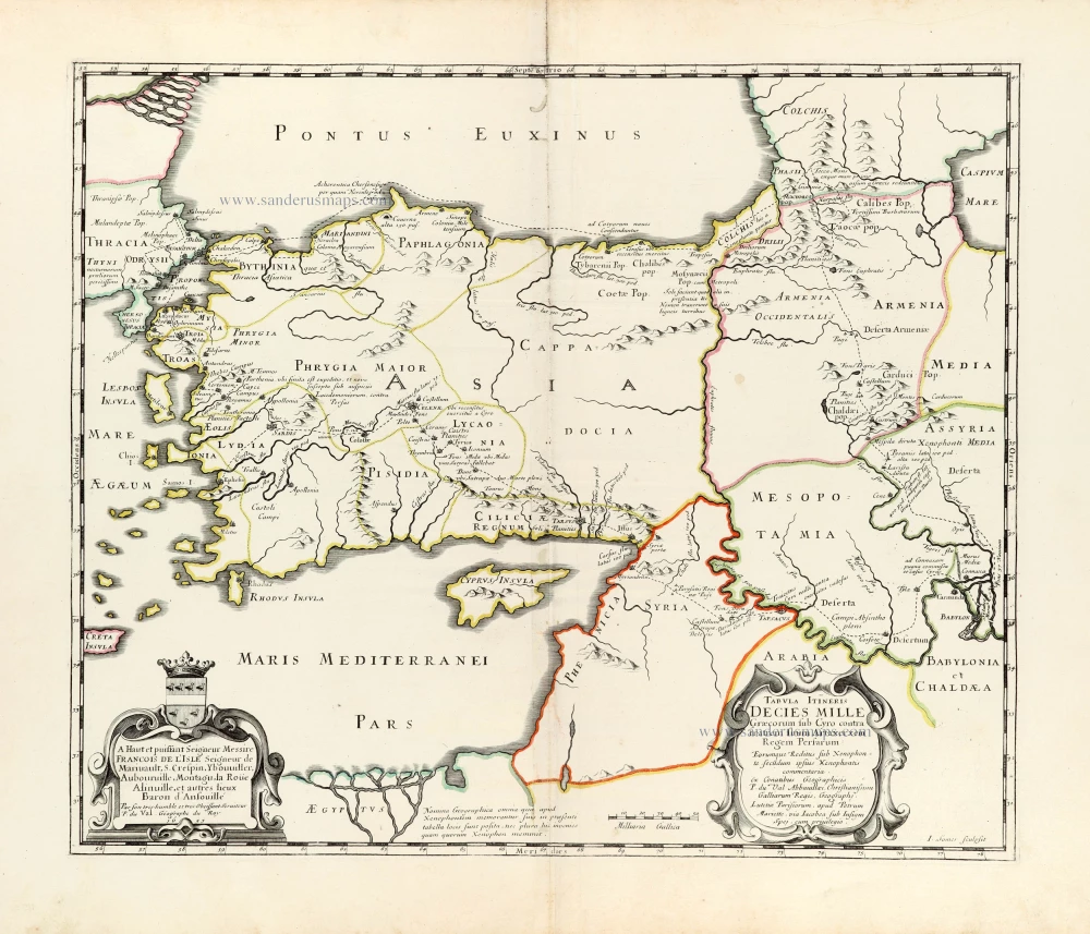
Tabula Itineris Decies Mille Graecorum sub Cyro contra fratrem suum Artaxerxem Regem Persarum. 1653
Asia Minor through to Armenia and Babylon by Pierre Duval.
[Item number: 30038]
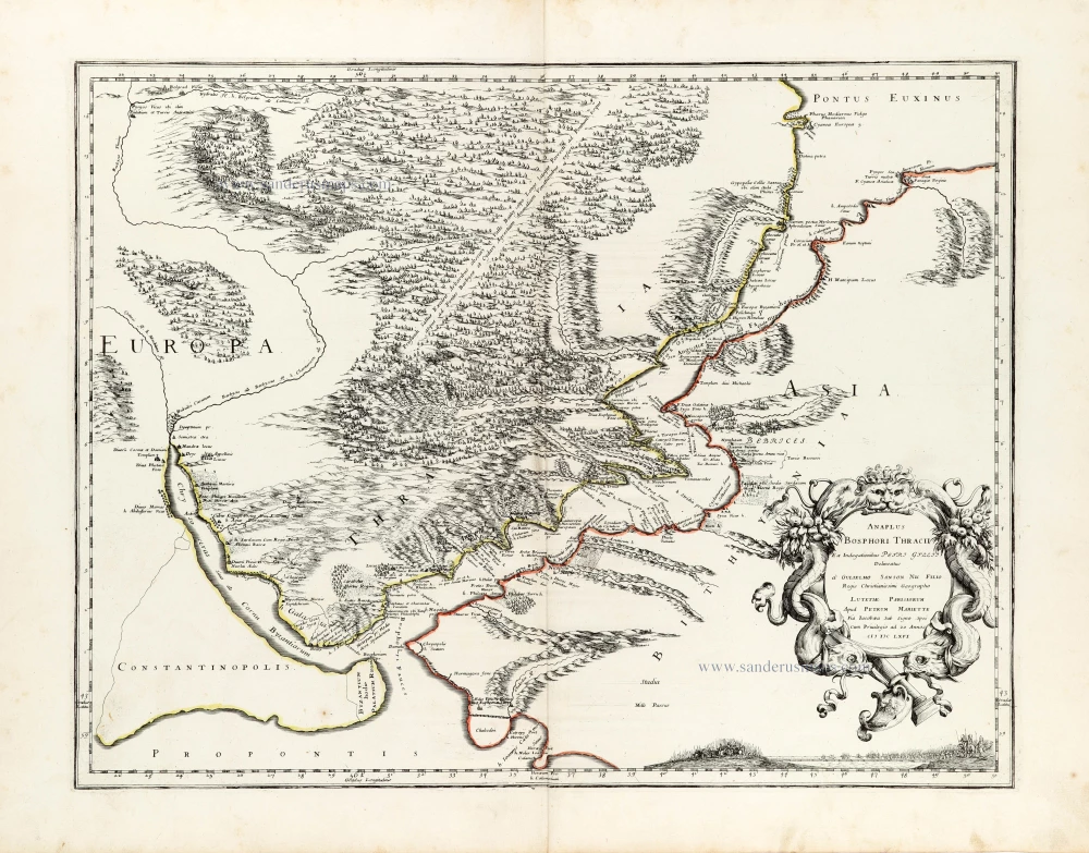
Anaplus Bosphori Thracii. 1665
Bosporus by Guillaume Sanson.
[Item number: 30040]
Rare.
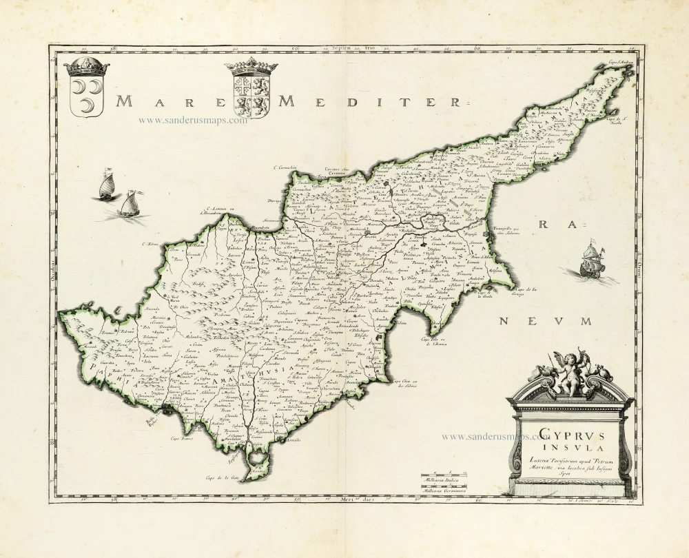
Cyprus Insula. ca. 1658-1663
Cyprus by Nicolas Sanson, published by Pierre Mariette.
[Item number: 30045]
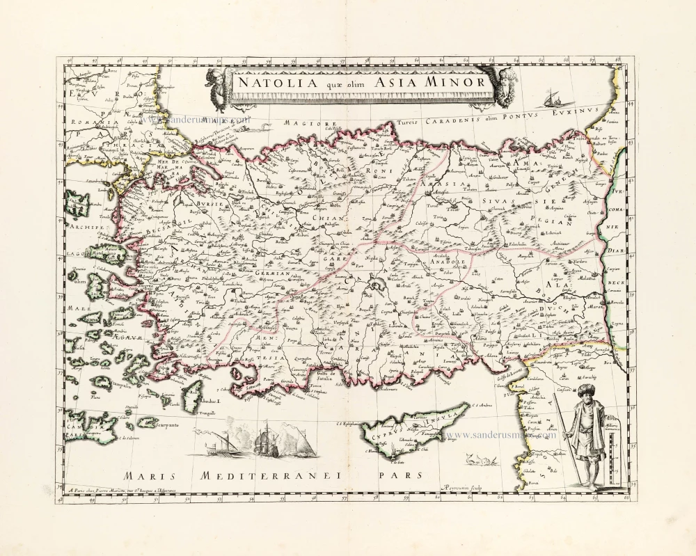
Natolia quae olim Asia Minor. ca. 1658-1663
Turkey by Nicolas Sanson, published by Pierre Mariette.
[Item number: 30046]
Patriarchatus Constantinopolitani Geographica descriptio. ca. 1640
Turkey & Black Sea by J.B. Tavernier.
[Item number: 30048]