Antique maps catalogue
- All recent additions
-
Antique maps
- World and Polar
-
Europe
- Europe Continent
- Belgium
- Belgium - Cities
- The Low Countries
- The Netherlands
- The Netherlands - Cities
- Luxembourg
- France
- France - Cities
- Germany
- Germany - Cities
- Austria
- Italy
- Italy - Cities
- Spain and Portugal
- Greece & Greek Islands
- Switzerland
- British Isles
- British Isles - Cities
- Northern Europe
- Central Europe
- Eastern Europe
- Southeastern Europe
- America
- Asia
- Africa
- Mediterranean Sea
- Australia
- Oceans
- Celestial Maps
- Curiosities
- Books
- Medieval manuscripts
- Prints
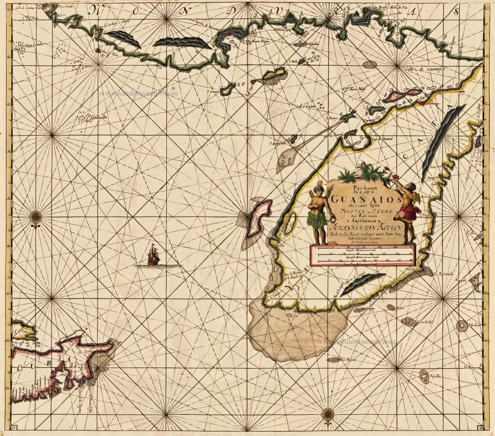
The Caribbean Sea, by Johannes Van Keulen. 1697-1709
Pas-Kaart van de Golff de Guanaios. Met 't Canaal tusschen ...
[Item number: 13037]
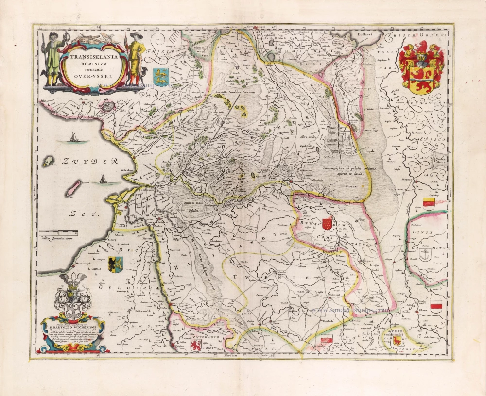
Overijssel, by Willem Blaeu. 1643
Transiselania Dominium vernacule Over-Yssel.
[Item number: 29949]

Cordoba, by Georg Braun and Frans Hogenberg. c. 1625
Corduba.
[Item number: 16385]
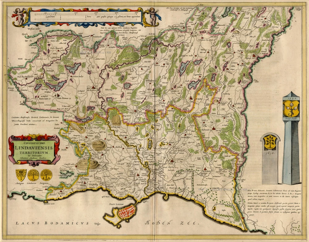
Lindau, by Blaeu Willem. 1659-72
Civitatis Imp. Lindaviensis Territorium.
[Item number: 9566]
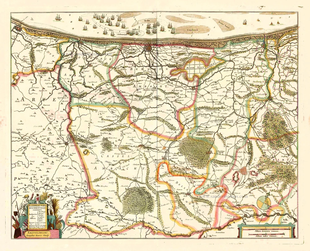
Western Flanders (West Vlaanderen), by Henricus Hondius. 1641
Flandriae Pars Occidentalis continens ...
[Item number: 26319]
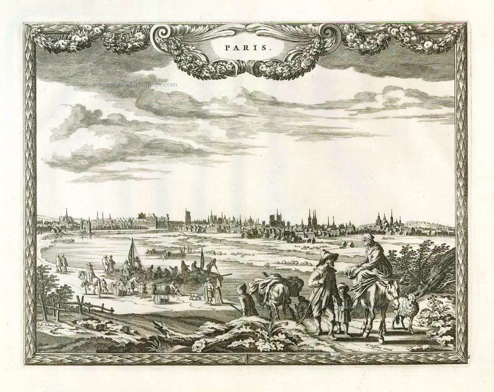
Paris, by P.H. Schut, published by N. Visscher. 1658/60
Paris.
[Item number: 26631]
Recent additions
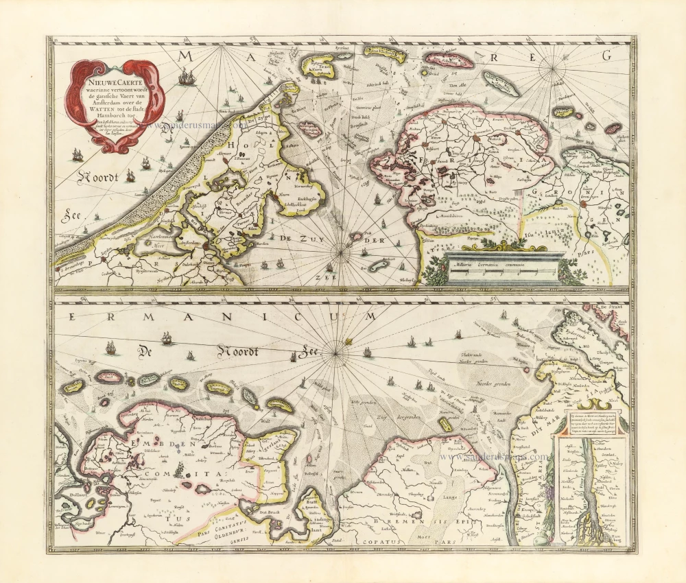
The Wadden Sea, by Henricus Hondius. 1653
Nieuwe Caerte waerinne vertoont wordt de gantsche Vaert van ...
[Item number: 30375]
new
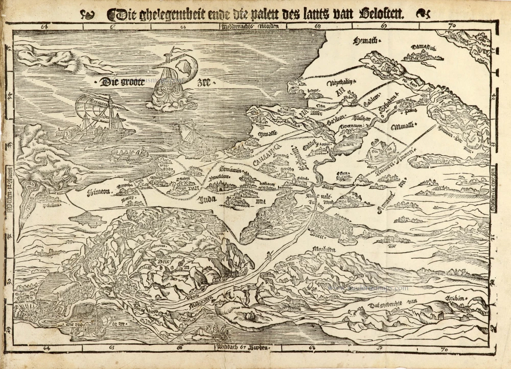
Holy Land map from the very rare van Liesveldt Bible
Holy Land by van Jacob van Liesveldt. 1532-1560
Die ghelegentheit ende die palen des lants van Beloften.
[Item number: 30549]
new
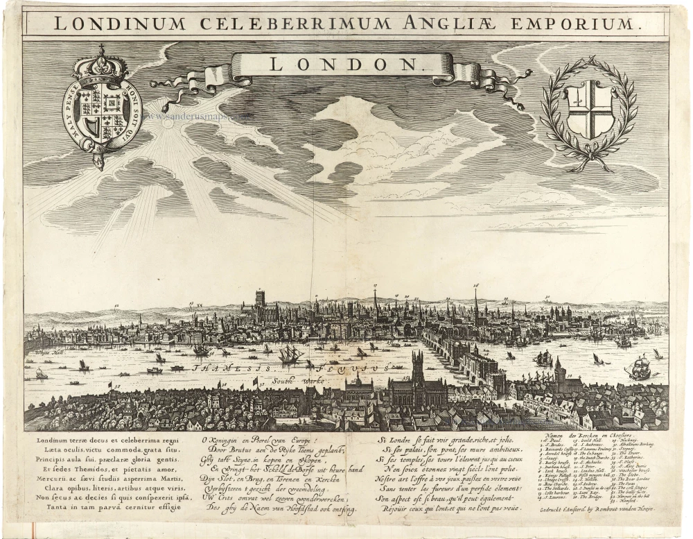
Extremely Rare panoramic view of London
Panoramic view of the City of London, by Rombout vanden Hoeye. c. 1638
Londinum Celeberrimum Angliae Emporium. - LONDON.
[Item number: 30543]
new
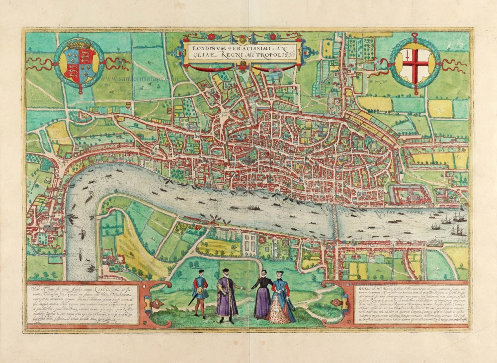
London by Georg Braun & Frans Hogenberg 1593
Londinum Feracissimi Angliae Regni Metropolis.
[Item number: 30542]
new
Welcome to Sanderus Antiquariaat
Antiquariaat Sanderus, named after the famous Flemish historian, Antonius Sanderus, is specialised in antiquarian books, medieval manuscripts, antique maps and prints from the 15th to the 18th centuries.
The company is a member of the Antiquarian Booksellers’ Association (ABA), the “The Belgian Royal Chamber of Antiques and Art Dealers” and the International Association of Antique Map Dealers (IAMA).