
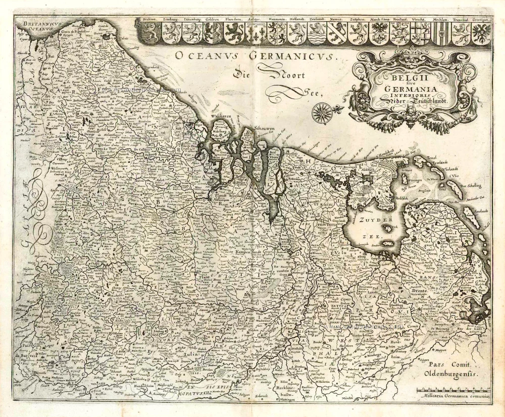
The 17 Provinces, by Ludovico Guicciardini. 1609

Lodovico Guicciardini (1521-1589)
Lodovico Guicciardini, an Italian writer and merchant from Florence, arrived in Antwerp in 1541 and lived there until he died in 1589.
His best-known work, the Descrittione di tutti I Paesi Bassi was published in 1567 by the Antwerp publisher Willem Silvius. It was an influential account of the history and the arts of the Low Countries, accompanied by city maps by various leading engravers. It was a great success right from the start, and many editions, translations, extracts and adaptations have been released to this day. Although he experienced relative prosperity during certain periods of his life, he ended his life in poverty.
In the first edition of the three original Italian publications of the Descrittione , Guicciardini describes the happy and prosperous Netherlands before the uprising against Spain. Only in the third Italian edition of 1588, published by Plantijn in Antwerp, does he show how the state of the country has gradually changed as a result of the war. This was the last edition published in Antwerp. In 1589 both Plantin and Guicciardini died. It would take until 1609 before a new edition was published in the northern Netherlands.
As new editions appeared, the number of illustrations increased, and several prints were replaced by new ones. The first four editions were mainly provided with woodcuts, the majority of which concerned the Southern Netherlands. In the later editions, only copper plates were used for an increasing number of engravings of cities and regions of the entire Netherlands. The work appeared in folio, oblong and duodecimo editions.
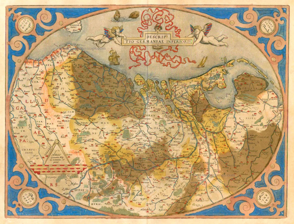
Belgiae Inferioris descriptio emendata cum circu(m)jacentium regionum confinijs.
Item Number: 25913 Authenticity Guarantee
Category: Antique maps > Europe > The Low Countries
Old, antique map of the 17 Provinces by L. Guicciardini.
Date of the first edition: 1609
Date of this map: 1609
Copper engraving, printed on paper.
Size (not including margins): 32.5 x 3.5cm (12.7 x 1.2 inches)
Verso: Blank
Condition: Excellent.
Condition Rating: A+
References: Guicc. Ill., Nederlanden-6; Van der Heijden (Netherlands), #70.
From: Description de touts les Pays-Bas, autrement appelez la germanie inferieure, ou Basse Allemagne. Amsterdam, 1609.
Lodovico Guicciardini (1521-1589)
Lodovico Guicciardini, an Italian writer and merchant from Florence, arrived in Antwerp in 1541 and lived there until he died in 1589.
His best-known work, the Descrittione di tutti I Paesi Bassi was published in 1567 by the Antwerp publisher Willem Silvius. It was an influential account of the history and the arts of the Low Countries, accompanied by city maps by various leading engravers. It was a great success right from the start, and many editions, translations, extracts and adaptations have been released to this day. Although he experienced relative prosperity during certain periods of his life, he ended his life in poverty.
In the first edition of the three original Italian publications of the Descrittione , Guicciardini describes the happy and prosperous Netherlands before the uprising against Spain. Only in the third Italian edition of 1588, published by Plantijn in Antwerp, does he show how the state of the country has gradually changed as a result of the war. This was the last edition published in Antwerp. In 1589 both Plantin and Guicciardini died. It would take until 1609 before a new edition was published in the northern Netherlands.
As new editions appeared, the number of illustrations increased, and several prints were replaced by new ones. The first four editions were mainly provided with woodcuts, the majority of which concerned the Southern Netherlands. In the later editions, only copper plates were used for an increasing number of engravings of cities and regions of the entire Netherlands. The work appeared in folio, oblong and duodecimo editions.
Related items
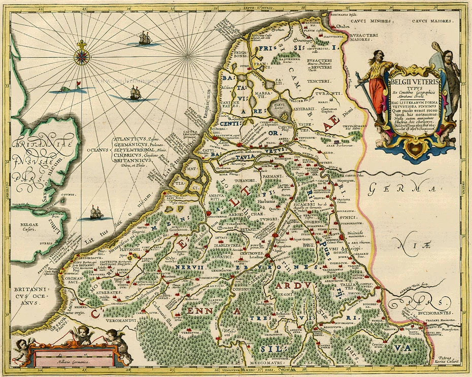
Belgii Veteris Typus. 1658
Ancient Netherlands by Janssonius J.
[Item number: 83]
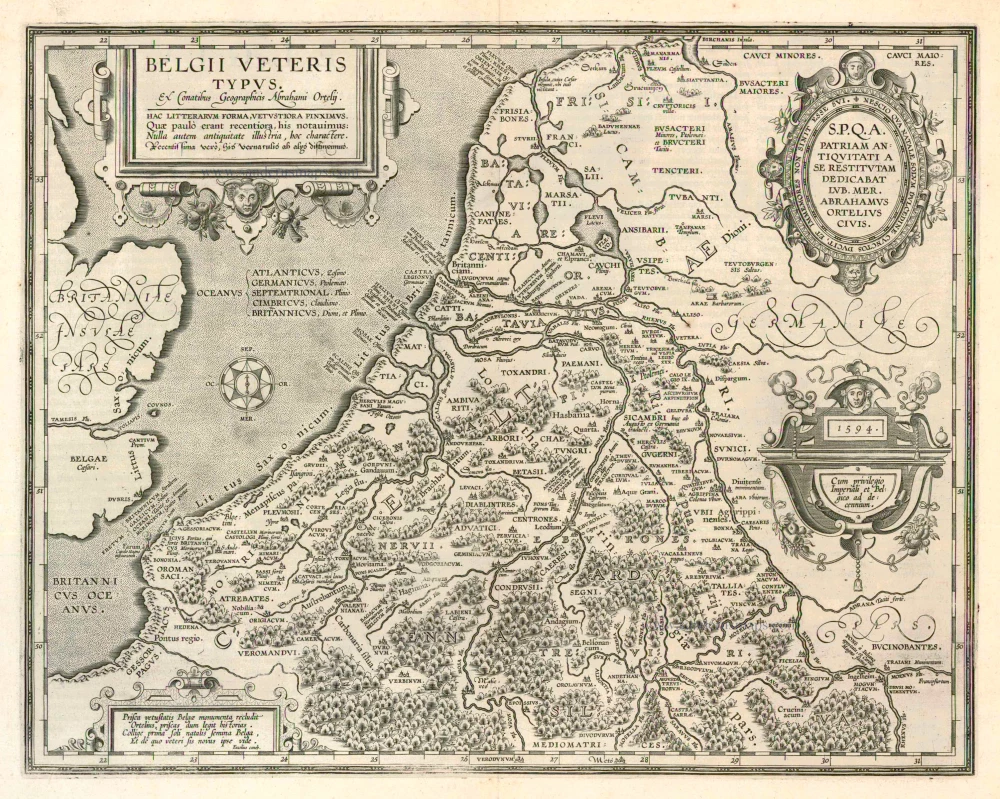
Belgii Veteris Typus. 1624
Ancient Netherlands by Abraham Ortelius.
[Item number: 2025]
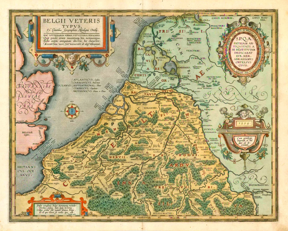
Belgii Veteris Typus. 1601
The ancient Low Countries, by Abraham Ortelius.
[Item number: 12355]
Descriptio Germaniae Inferioris. 1579
XVII Provinces by Abraham Ortelius.
[Item number: 21663]
Belgii sive Germania Inferioris - Nider Teutschlandt. 1638
The 17 Provinces, by Matthäus Merian.
[Item number: 26030]
belgii sive germaniae inferioris accuratissima tabula. auctore henrico hondio 1631. amstelodami, sumptibus henrici hondio 1631. 1641
The 17 Provinces, by Henricus Hondius.
[Item number: 26301]
Germania Inferior. Gallia Belgica Dicta, continens Hispaniarum Regis Provincias Septentrionales. 1593
XVII Provinces, by Gerard de Jode.
[Item number: 27943]
Belgium sive Inferior Germania. 1630
XVII Provinces, by A. Goos - J. Janssonius.
[Item number: 27988]
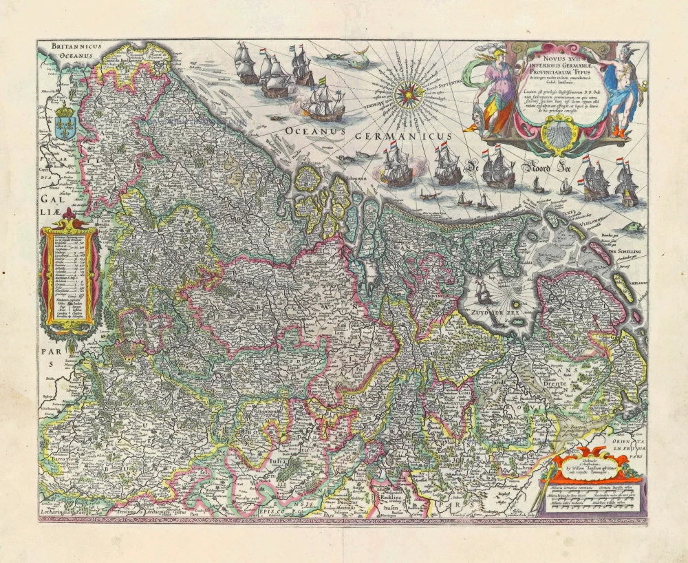
Novus XVII Inferioris Germaniae Provinciarum Typus. 1631
17 Provinces, by Willem Blaeu.
[Item number: 28019]
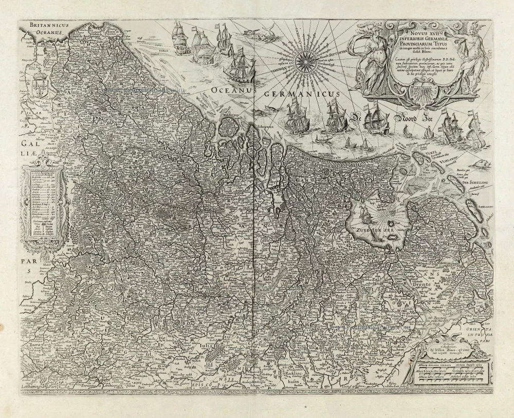
Novus XVII Inferioris Germaniae Provinciarum Typus. 1664-65
17 Provinces, by Willem Blaeu.
[Item number: 28110]
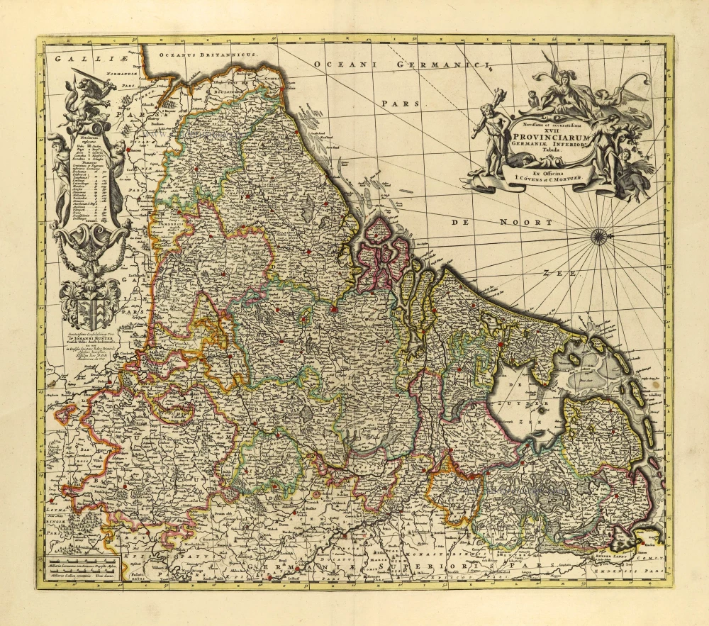
Novissima et accuratissima XVII provinciarum Germaniae Inferioris Tabula. c. 1715
17 Provinces, by Frederik de Wit, published by Covens & Mortier.
[Item number: 28284]
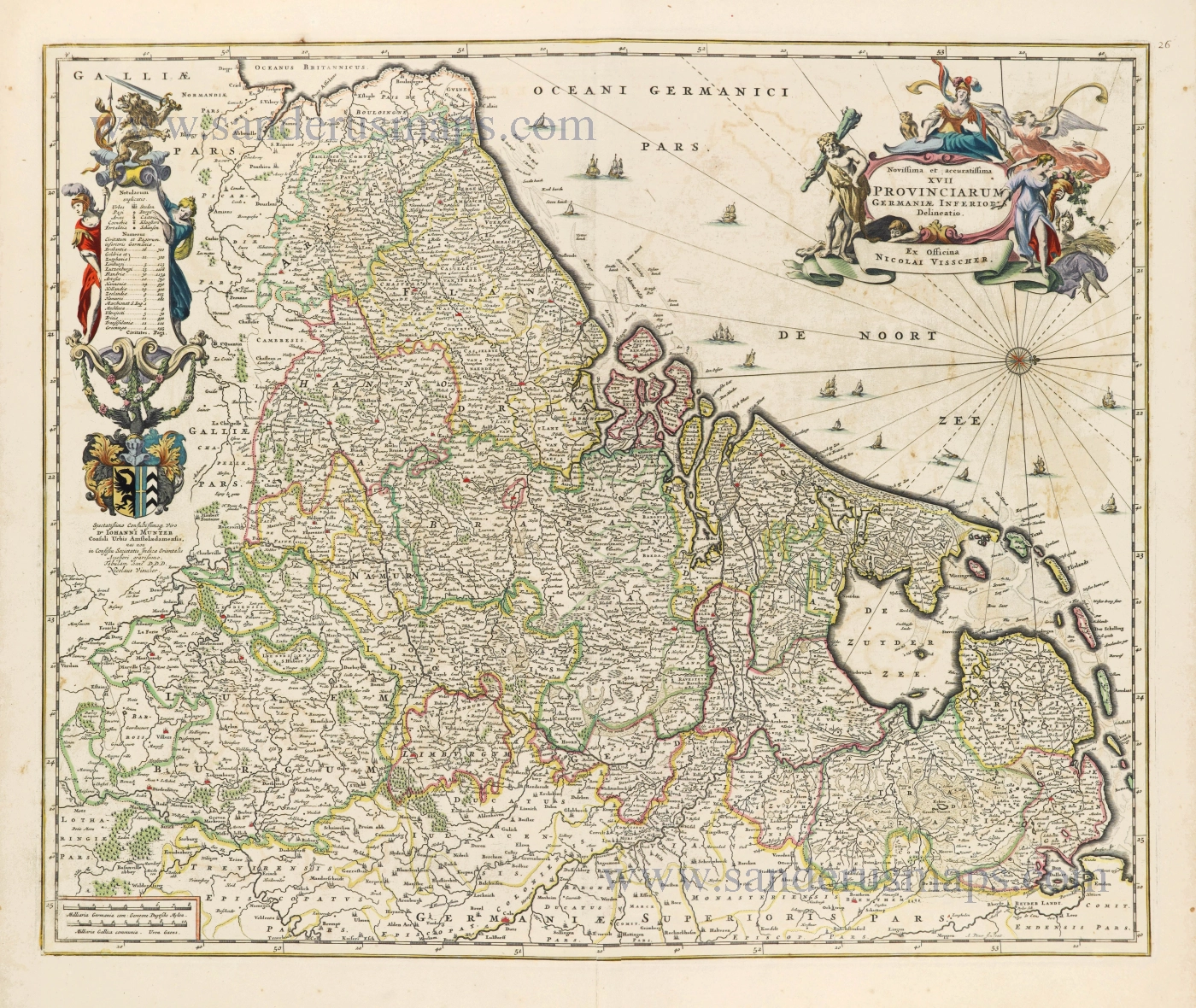
Novissima et accuratissima XVII Provinciarum Germaniae Inferioris Delineatio. c. 1656
Seventeen Provinces by Nicolaes Visscher I.
[Item number: 28539]

Descriptio Germaniae Inferioris. 1603
XVII Provinces by Abraham Ortelius.
[Item number: 28899]

Belgium seu Germania Inferior. 1594
The 17 Provinces, by Giovanni Magini.
[Item number: 28914]
In luxury colouring
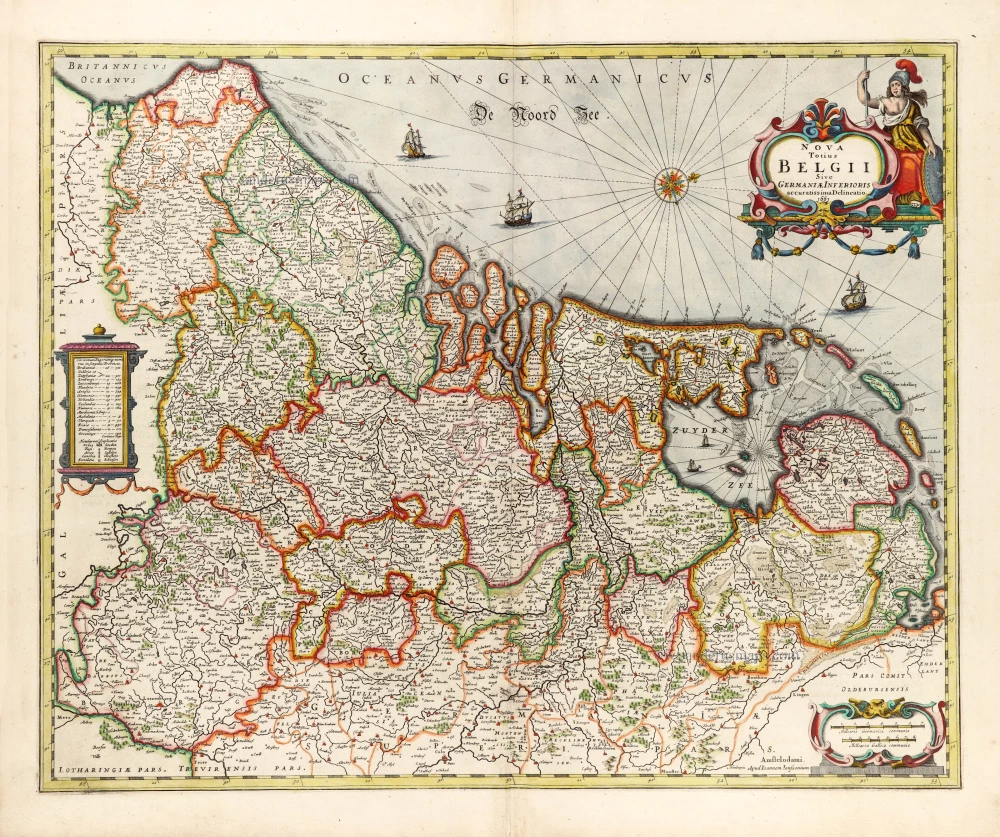
Nova Totius Belgii Sive Germaniae Inferioris. 1666
XVII Provinces (Low Countries) by Joannes Janssonius.
[Item number: 30079]
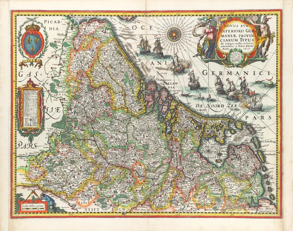
Novus XVII Inferioris Germaniae Provinciarum Typus. 1617
17 Provinces by Petrus Kaerius (Pieter Van den Keere).
[Item number: 30258]