
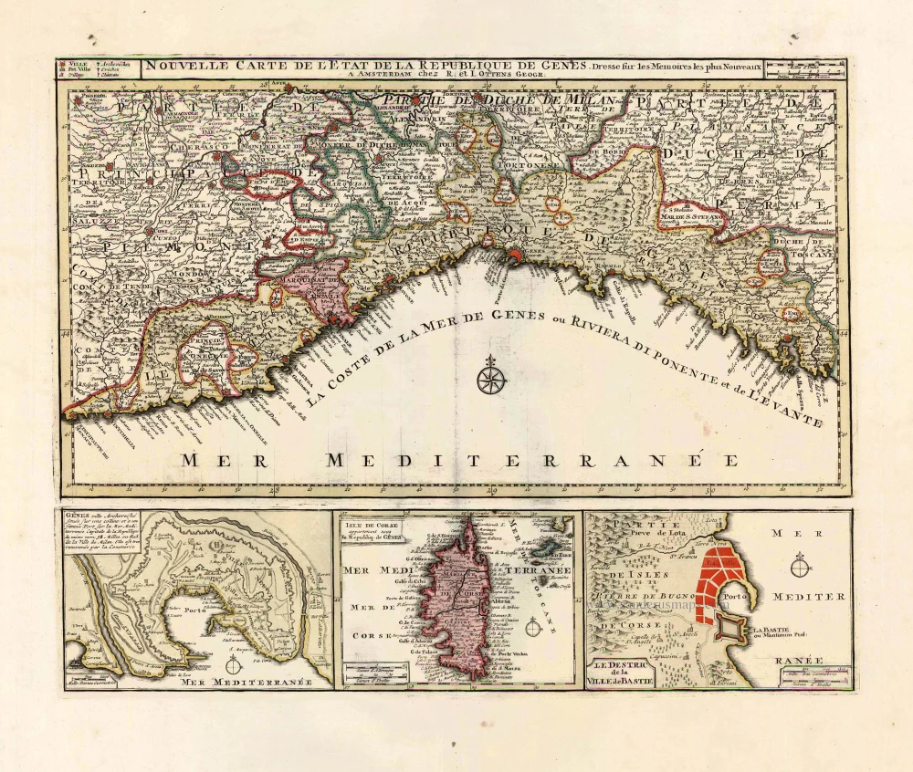
Liguria - Corsica, by Ottens R. & I. 1730-45
The Ottens Family
Joachim Ottens (1663-1719), was a copper-engraver and the founder of the print- and mapsellers’ firm in Amsterdam. In 1710 he became a member of the art- and printsellers guild. After he died in 1719, his widow and the sons continued the business under the name “In de Wereldcaert” (In the world map). On the whole, the Ottens’s financial position was rather weak, and the stock was not very large.
In a notary contract dated 20 October 1726, the partnership between the two brothers, Reinier and Josua, was stipulated. Despite separate shops, the brothers’ partnership continued until the death of Renier in 1750.
After Joshua died in 1765, his widow continued the firm, together with her son, Renier II, until c. 1780.
The firm flourished mainly between 1719 and c. 1750. In that period, they advertised at various times the publication of new maps.
Ottens’s greatest fame comes from the voluminous atlases assembled to order. A small number of these so-called ‘Atlas factice’, splendid copies with gorgeous illumination, have survived. These collector’s copies are known to exist in 2, 6, 8, 11, and even 15 volumes. Ottens also published atlases in one volume, with a varying number of maps, pocket atlases, collections of military plans, and Renard’s atlas de la navigation.
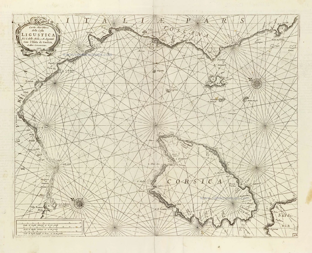
Nouvelle Carte de l'Etat et de la Republique de Genes.
Item Number: 25917 Authenticity Guarantee
Category: Antique maps > Europe > Italy
Old, antique map of Liguria by Ottens R. & I.
With three insets: Vicinity of Genoa, Corsica and a plan of Bastia. (Insets printed from a separate plate.)
Copper engraving, printed on paper.
Size (not including margins): 36.5 x 46cm (14.2 x 17.9 inches)
Verso: Blank
Condition: Original coloured, excellent.
Condition Rating: A+
References: Cervoni (Corsica), #49.
From: Atlas sive Geographia compendiosa in qua Orbis Terrarum pacis attamen novissimis Tabulis Ostenditur. - Atlas Nouveau, contenant toutes les partis du monde ... R. & I. Ottens, c. 1745. (Composite Atlas).
The Ottens Family
Joachim Ottens (1663-1719), was a copper-engraver and the founder of the print- and mapsellers’ firm in Amsterdam. In 1710 he became a member of the art- and printsellers guild. After he died in 1719, his widow and the sons continued the business under the name “In de Wereldcaert” (In the world map). On the whole, the Ottens’s financial position was rather weak, and the stock was not very large.
In a notary contract dated 20 October 1726, the partnership between the two brothers, Reinier and Josua, was stipulated. Despite separate shops, the brothers’ partnership continued until the death of Renier in 1750.
After Joshua died in 1765, his widow continued the firm, together with her son, Renier II, until c. 1780.
The firm flourished mainly between 1719 and c. 1750. In that period, they advertised at various times the publication of new maps.
Ottens’s greatest fame comes from the voluminous atlases assembled to order. A small number of these so-called ‘Atlas factice’, splendid copies with gorgeous illumination, have survived. These collector’s copies are known to exist in 2, 6, 8, 11, and even 15 volumes. Ottens also published atlases in one volume, with a varying number of maps, pocket atlases, collections of military plans, and Renard’s atlas de la navigation.
Related items
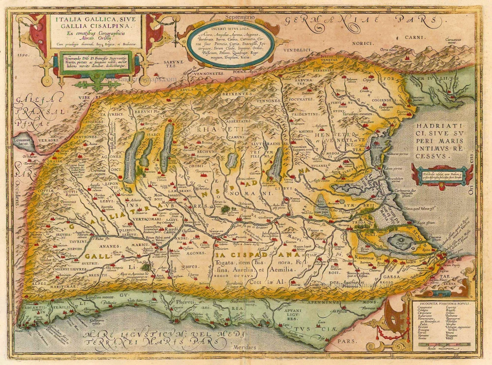
Italia Gallica sive Gallia Cisalpina. 1624
Northern Italy, by Abraham Ortelius.
[Item number: 21122]
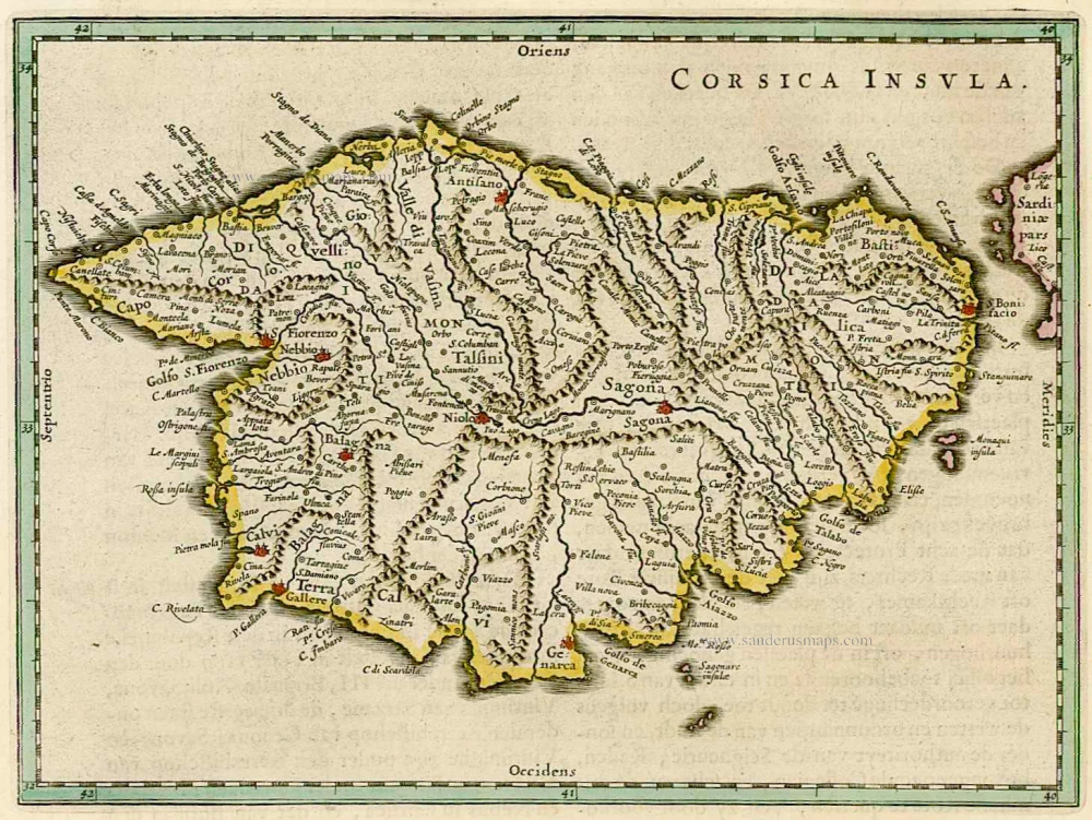
Corsica Insula 1664-65
Corse, by W. & J. Blaeu.
[Item number: 22050]
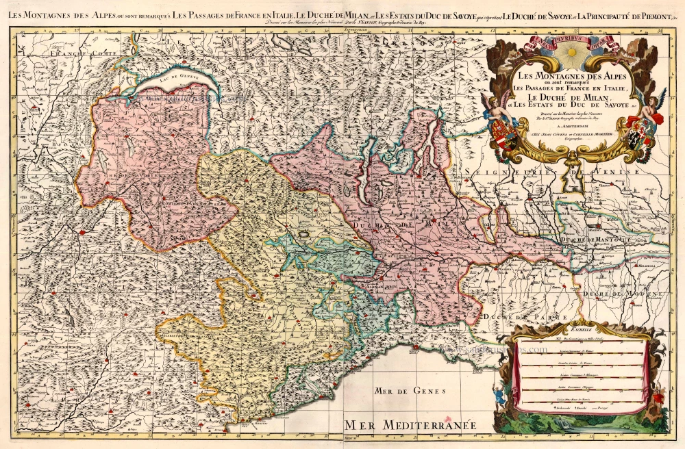
Les Montagnes des Alpes ou sont Remarques les Passages de France en Italie. Le Duche de Milan, et les Estats du Duc de Savoye &c. 1721-41
Northern Italy, by Covens & Mortier.
[Item number: 23547]
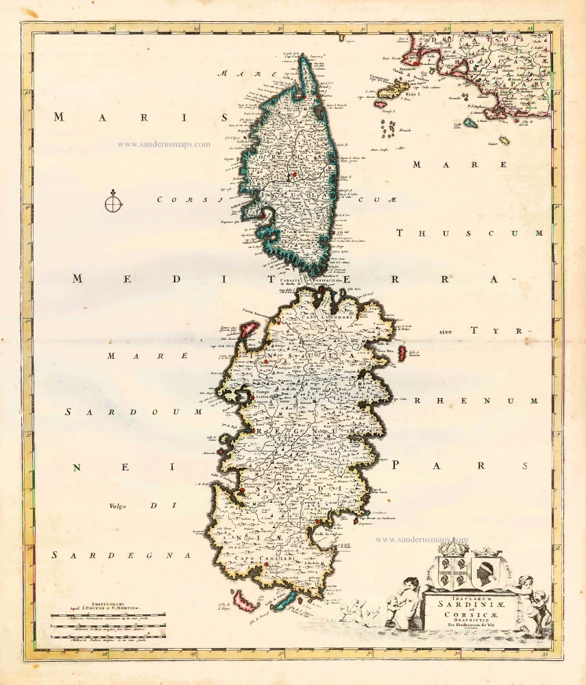
Insularum Sardiniae et Corsicae Descriptio. c. 1680
Corsica & Sardinia, by F. De Wit.
[Item number: 25914]
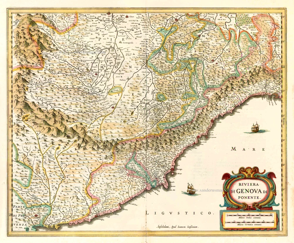
Riviera di Genova di Ponente. 1641
Liguria (West), by Johannes Janssonius.
[Item number: 26385]
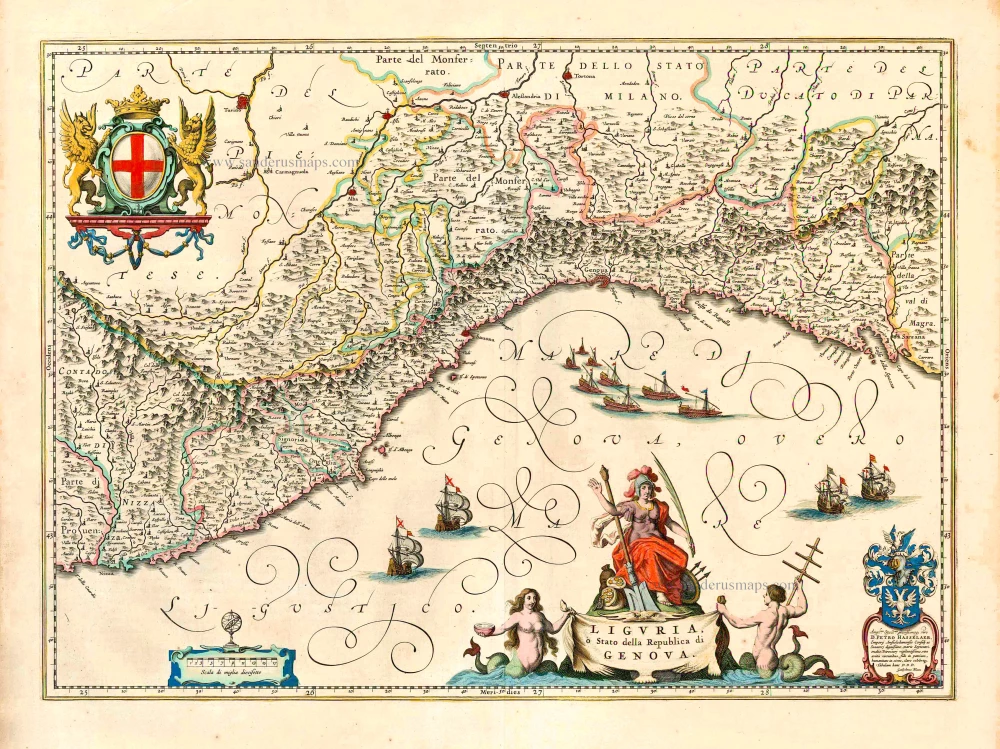
Liguria, o Stato della Republica di Genova. 1640
Liguria, by Willem & Joan Blaeu
[Item number: 27208]
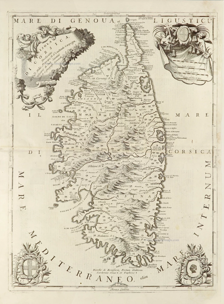
Isola di Corsica, 1696
Corsica by Vincenzo Coronelli.
[Item number: 28720]
Carta Marittima della Costa Ligustica ... con l'Isola di Corsica, et altre Circonvicine. 1696
Ligurian Coast, including Corsica, by Vincenzo Coronelli.
[Item number: 29134]
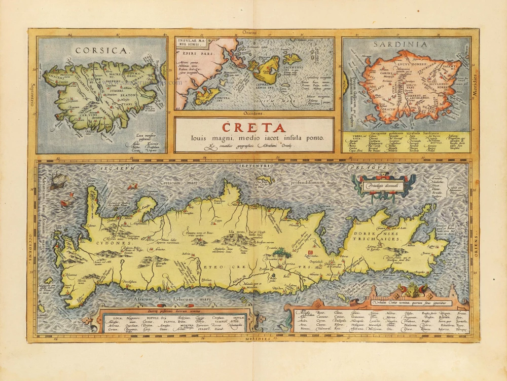
Creta Iovis magni, medio iacet insula ponto. [On sheet with:] Corsica [and:] Insulae Maris Ionii [and:] Sardinia. 1584
Corsica, Crete (Creta), Sardinia, by Abraham Ortelius.
[Item number: 29148]
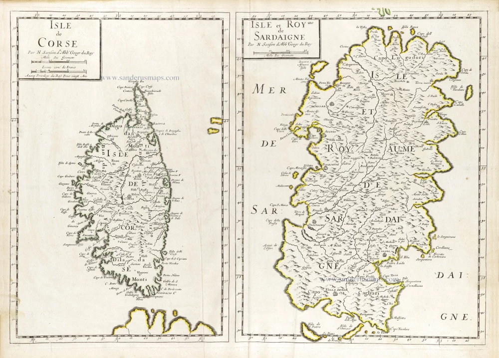
Isle de Corse. - Isle et Roy[au]me de Sardaigne. 1652
Corsica & Sardinia (Sardegna) by Nicolas Sanson.
[Item number: 29674]
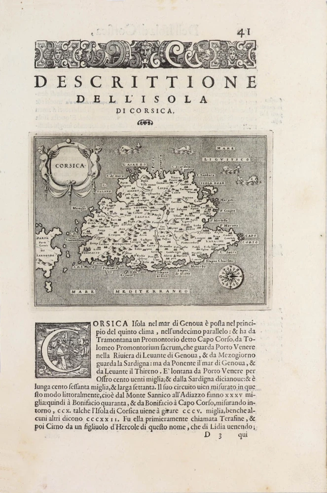
Corsica - [Above map :] Descrittione dell'Isola di Corsica. 1590
Corsica, by Thomaso Porcacchi.
[Item number: 29761]
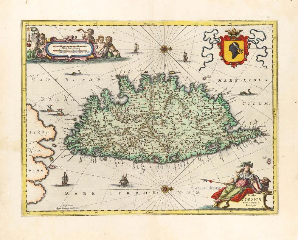
Insulae Corsicae Nova & accurata Descriptio. 1666
Corse (Corsica) by Johannes Janssonius.
[Item number: 29793]