
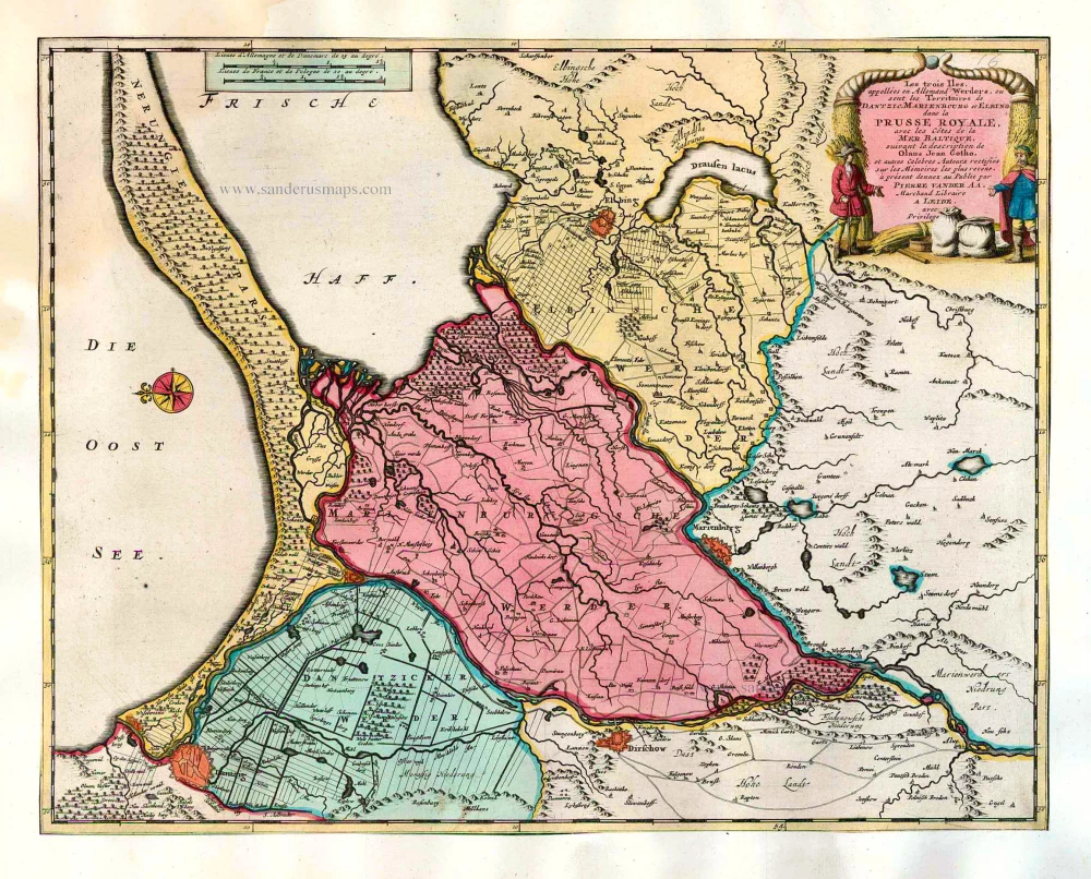
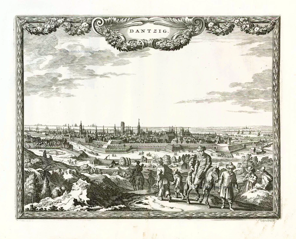
Gdansk, Marlbork and Elblag, by Pieter van der Aa. 1713
Pieter van der Aa (Leiden, 1659-1733)
Pieter van der Aa was already in 1682 owner of a bookshop and auction house. During his life, he has published an enormous amount of printed material.
After 1700, van der Aa increasingly specialised in books on geography and travel.
He published composite atlases, a series of geographical descriptions of European countries, and some very spectacular works. Between 1706 and 1708 he published the Naauweurige versameling der gedenkwaardigste zee- en land-reysen, in 28 volumes.
Many of Van der Aa’s publications are richly illustrated with maps and plates. He took over many copperplates and prints from other publishers such as Carel Allard and Frederik De Wit. The composite atlases that appeared from his workshop contain a curious mixture of his own material, copies of maps from other publishers, and reprints made from old copper plates, now with his own imprint.
The Galérie agréable du monde, was completed in 1729, and comprised 66 parts, bound in 27 volumes. Van der Aa presented it as a good investment; after publication, the antiquarian value of the work would double, the more so since it was printed in a limited edition of only one hundred copies.
Les trois Iles, appellées en Allemand Werders, ou sont les Territoires de Dantzic, Marienbourg et Elbing dans la Prusse Royale, avec les Côtes de la Mer Baltique, suivant la description de Olaus Jean Gotho, ...
Item Number: 26041 Authenticity Guarantee
Category: Antique maps > Europe > Eastern Europe
Old, antique map of Poland showing the area east of Gdansk, by P. Van der Aa.
Oriented to the East
Date of the first edition: 1713
Date of this map: 1713
Copper engraving, printed on paper.
Size (not including margins): 28.5 x 36cm (11.1 x 14 inches)
Verso: Blank
Condition: Original body colour, trimmed to neatline and mounted on heavy paper at an early time, light waterstain in upper left corner.
Condition Rating: A
References: Van der Krogt A, 44:20; Dutch Maps of Russia and Poland, 21:016; Niewodniczanski, K102/4; Koeman Aa7 (21).
From: Nouvel Atlas, très exact et fort commode pour toutes sortes de personnes, Contenant Les Principales cartes géographiques. Leiden, P. Van der Aa, n.d. (1713) (Koeman, Aa7 & Aa8).
Van der Aa maps are rarely found in original colouring.
Pieter van der Aa (Leiden, 1659-1733)
Pieter van der Aa was already in 1682 owner of a bookshop and auction house. During his life, he has published an enormous amount of printed material.
After 1700, van der Aa increasingly specialised in books on geography and travel.
He published composite atlases, a series of geographical descriptions of European countries, and some very spectacular works. Between 1706 and 1708 he published the Naauweurige versameling der gedenkwaardigste zee- en land-reysen, in 28 volumes.
Many of Van der Aa’s publications are richly illustrated with maps and plates. He took over many copperplates and prints from other publishers such as Carel Allard and Frederik De Wit. The composite atlases that appeared from his workshop contain a curious mixture of his own material, copies of maps from other publishers, and reprints made from old copper plates, now with his own imprint.
The Galérie agréable du monde, was completed in 1729, and comprised 66 parts, bound in 27 volumes. Van der Aa presented it as a good investment; after publication, the antiquarian value of the work would double, the more so since it was printed in a limited edition of only one hundred copies.
Related items
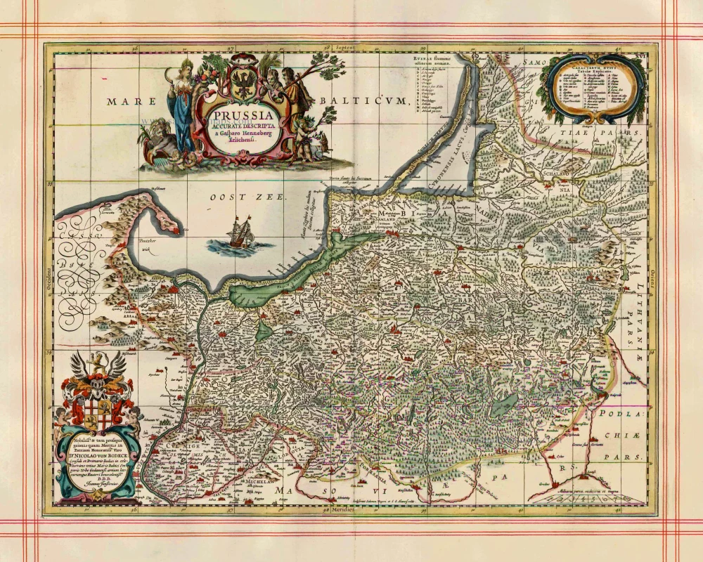
Prussia Accurate Descripta. 1680
Poland - Prussia by J. Janssonius, published by Moses Pitt & J. Janssonius-Waesberge.
[Item number: 999]
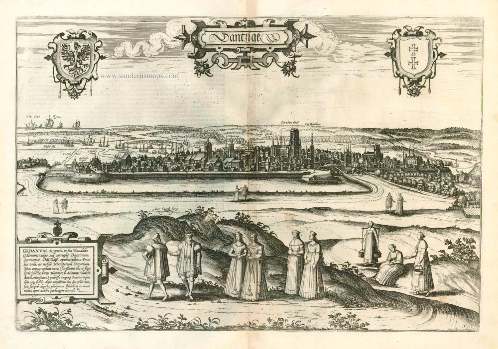
Dantzigk - Gedanum, Krantio, in sua Wandalia Gdanum; . . . 1576
Gdansk, by Georg Braun and Frans Hogenberg.
[Item number: 4056]

Poloniae Finitimarumque Locorum Descriptio Auctore Wenceslao Godreccio Polono. 1572
Poland, by Abraham Ortelius.
[Item number: 16790]
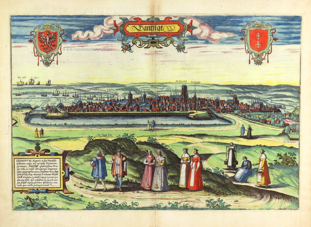
Dantzigk - Gedanum, Krantio, in sua Wandalia Gdanum; . . . 1575
Danzig (Gdansk), by Georg Braun & Frans Hogenberg.
[Item number: 21614]
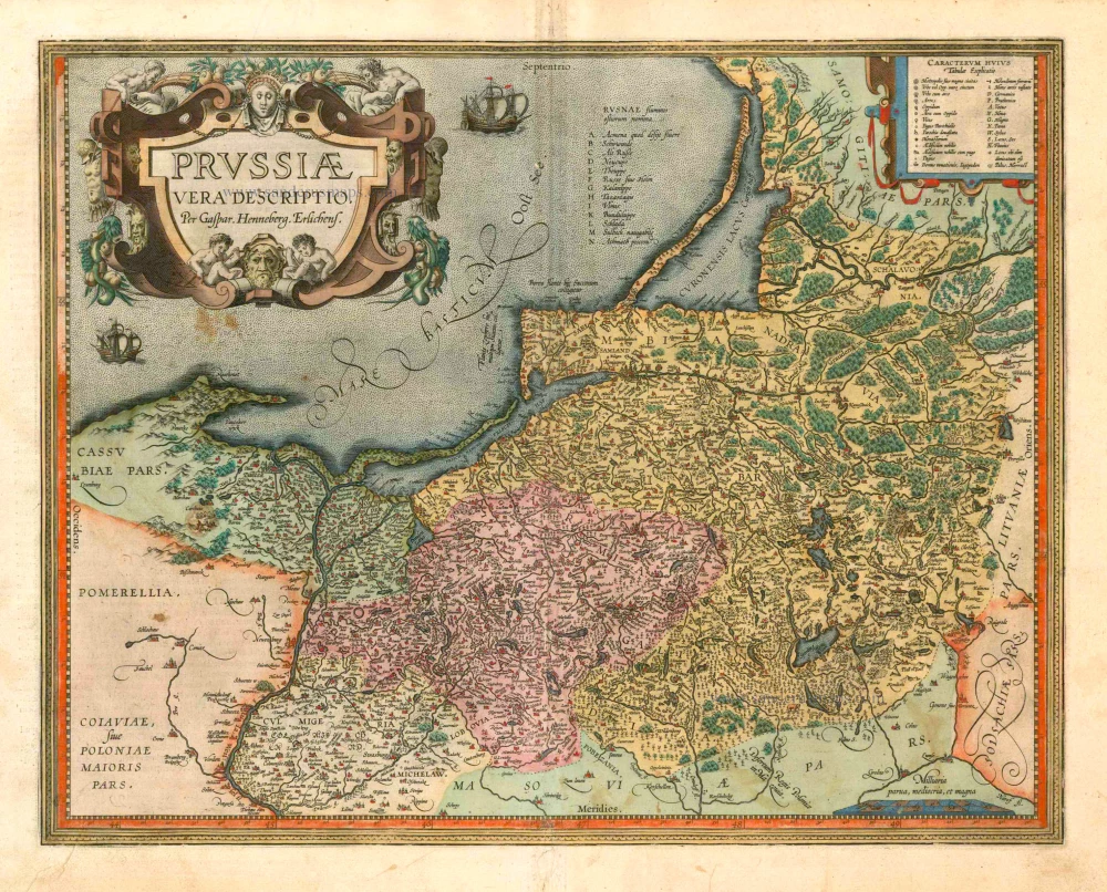
Prussiae Vera Descriptio. 1601
Prussia (Poland) by Abraham Ortelius.
[Item number: 25260]
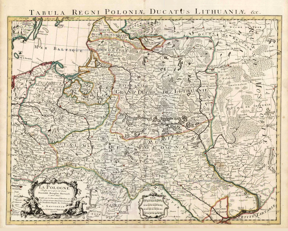
La Pologne Dressée sur ce qu'en ont donné Starovolsk, Beauplan, Hartnoch, et autres auteurs. [Latin title in upper margin:] Tabula Regni Poloniae, Ducatus Lithuaniae &c. 1730
Poland - Lithuania by Guillaume Delisle, published by Covens & Mortier.
[Item number: 25890]
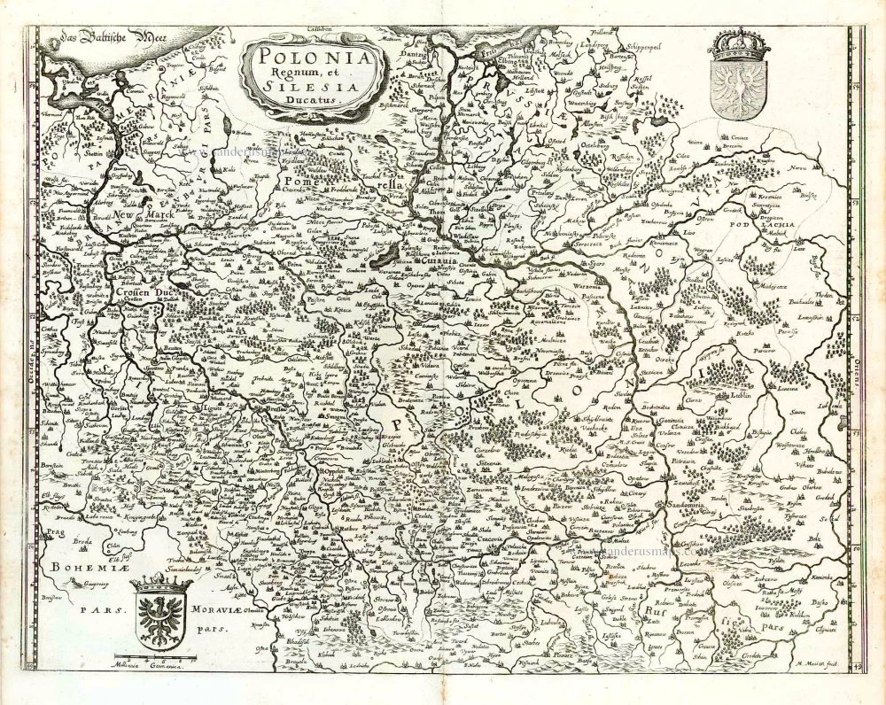
Polonia Regnum et Silesia Ducatus. 1638
Poland, by M. Merian.
[Item number: 25927]
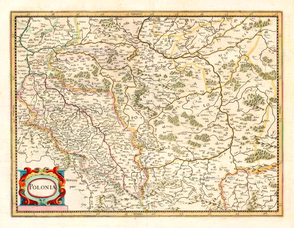
Polonia. 1641
Poland, by Henricus Hondius.
[Item number: 26267]
Dantzig. 1658/60
Gdansk (Danzig), by N. Visscher & P.H. Schut.
[Item number: 26639]
Unrecorded variant of Schut's view of Gdansk (Danzig), by Carel Allard
Dantzig 1673
View of Gdansk (Danzig) by Carel Allard.
[Item number: 30571]
new