
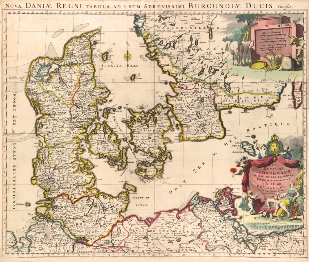
Denmark, by Pieter van der Aa 1713
Pieter van der Aa (Leiden, 1659-1733)
Pieter van der Aa was already in 1682 owner of a bookshop and auction house. During his life, he has published an enormous amount of printed material.
After 1700, van der Aa increasingly specialised in books on geography and travel.
He published composite atlases, a series of geographical descriptions of European countries, and some very spectacular works. Between 1706 and 1708 he published the Naauweurige versameling der gedenkwaardigste zee- en land-reysen, in 28 volumes.
Many of Van der Aa’s publications are richly illustrated with maps and plates. He took over many copperplates and prints from other publishers such as Carel Allard and Frederik De Wit. The composite atlases that appeared from his workshop contain a curious mixture of his own material, copies of maps from other publishers, and reprints made from old copper plates, now with his own imprint.
The Galérie agréable du monde, was completed in 1729, and comprised 66 parts, bound in 27 volumes. Van der Aa presented it as a good investment; after publication, the antiquarian value of the work would double, the more so since it was printed in a limited edition of only one hundred copies.
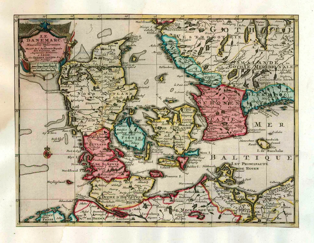
Le Danemarc, Suivant les Nouvelles Observations de Mess.rs de L'Academie Royale des Sciences, etc.
Item Number: 26044 Authenticity Guarantee
Category: Antique maps > Europe > Northern Europe
Old, antique map of Denmark by P. Van der Aa.
Date of the first edition: 1713
Date of this map: 1713
Copper engraving, printed on paper.
Size (not including margins): 22.5 x 29.5cm (8.7 x 11.5 inches)
Verso: Blank
Condition: Original body colour, trimmed to neatline and mounted on heavy paper at an early time.
Condition Rating: A
References: Van der Krogt A, 43:03; Koemand, Aa7 (12).
From: Nouvel Atlas, très exact et fort commode pour toutes sortes de personnes, Contenant Les Principales cartes géographiques. Leiden, P. Van der Aa, n.d. (1713) (Koeman, Aa7).
Van der Aa maps are rarely found in original colouring.
Pieter van der Aa (Leiden, 1659-1733)
Pieter van der Aa was already in 1682 owner of a bookshop and auction house. During his life, he has published an enormous amount of printed material.
After 1700, van der Aa increasingly specialised in books on geography and travel.
He published composite atlases, a series of geographical descriptions of European countries, and some very spectacular works. Between 1706 and 1708 he published the Naauweurige versameling der gedenkwaardigste zee- en land-reysen, in 28 volumes.
Many of Van der Aa’s publications are richly illustrated with maps and plates. He took over many copperplates and prints from other publishers such as Carel Allard and Frederik De Wit. The composite atlases that appeared from his workshop contain a curious mixture of his own material, copies of maps from other publishers, and reprints made from old copper plates, now with his own imprint.
The Galérie agréable du monde, was completed in 1729, and comprised 66 parts, bound in 27 volumes. Van der Aa presented it as a good investment; after publication, the antiquarian value of the work would double, the more so since it was printed in a limited edition of only one hundred copies.
Related items
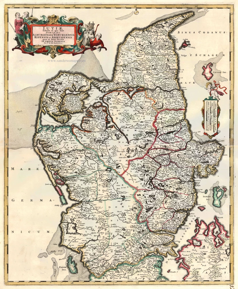
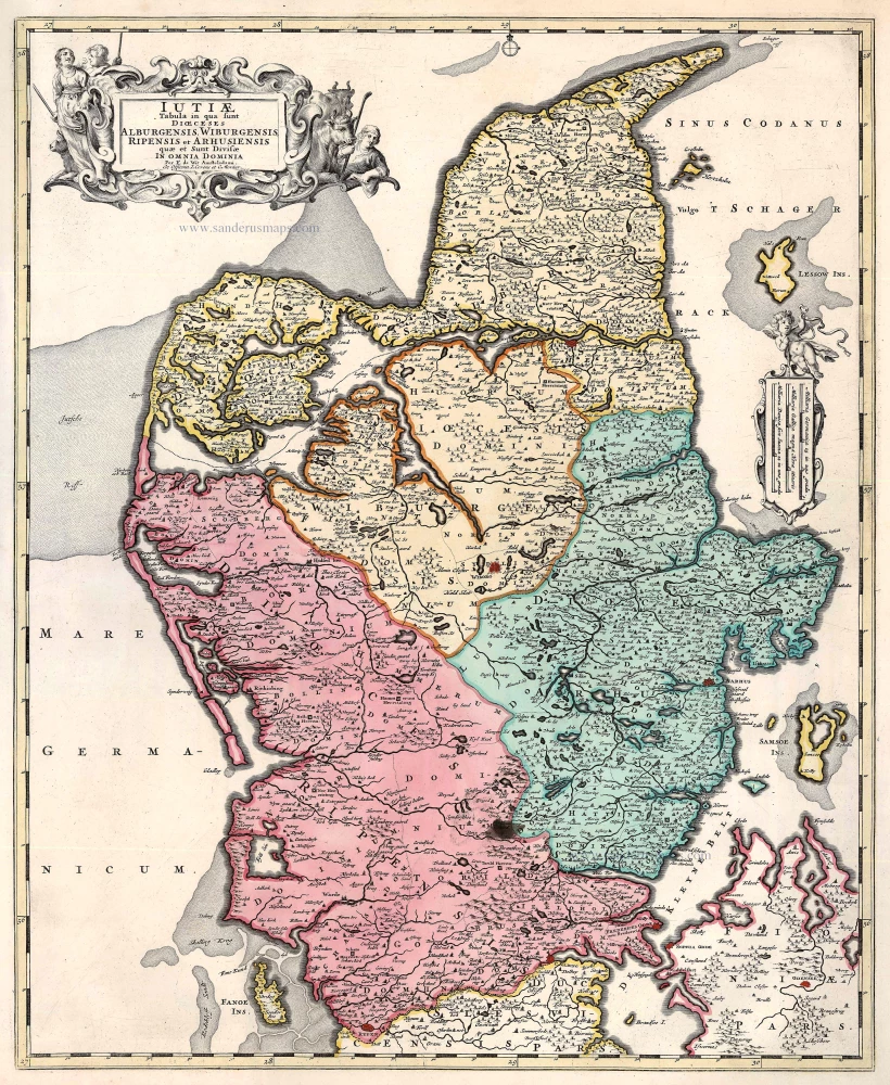
Iutiae Tabula in qua sunt Dioecesis Alburgensis, Wiburgensis, Ripensis et Arhusiensis quae et sunt divisae in Omnia Dominia. c. 1680
Denmark - Jutland, by F. De Wit.
[Item number: 2669]
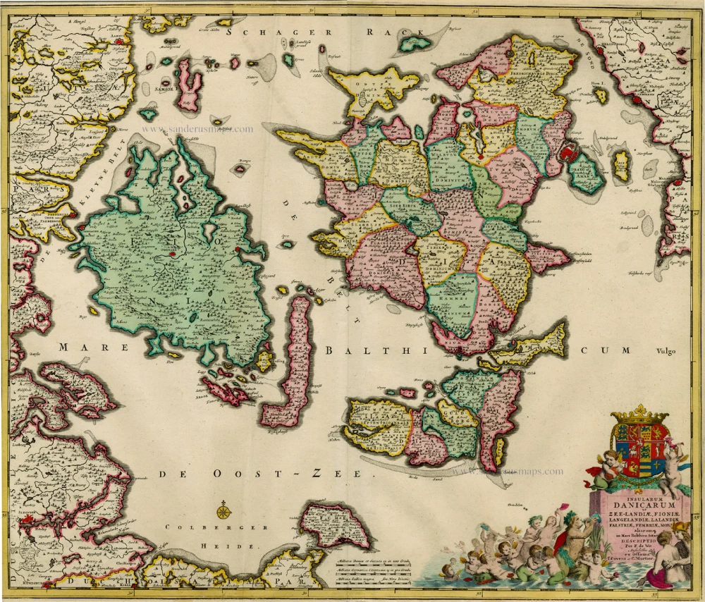
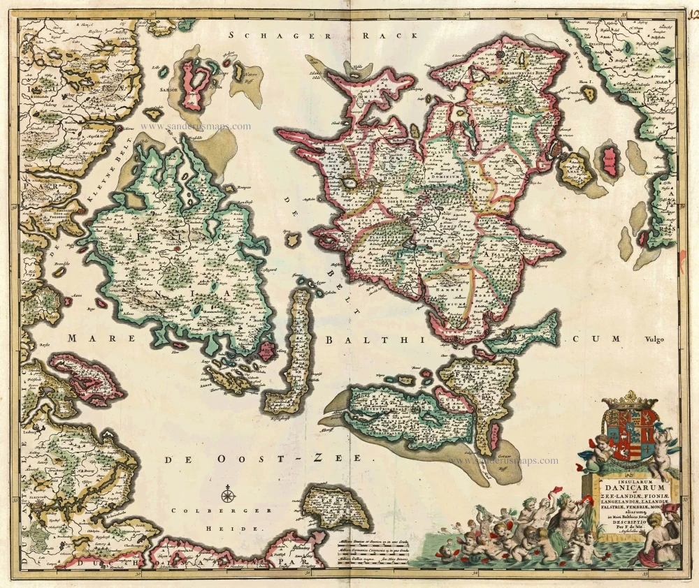
Insularum Danicarum ut Zee-landiae, Fioniae, Langelandiae, Lalandiae, Falstriae, Fembriae, Monae aliarumq. in Mari Balthico Sitar. 1721-41
Antique map of the Danish Islands by F. de Wit, published by Covens & Mortier.
[Item number: 8492]
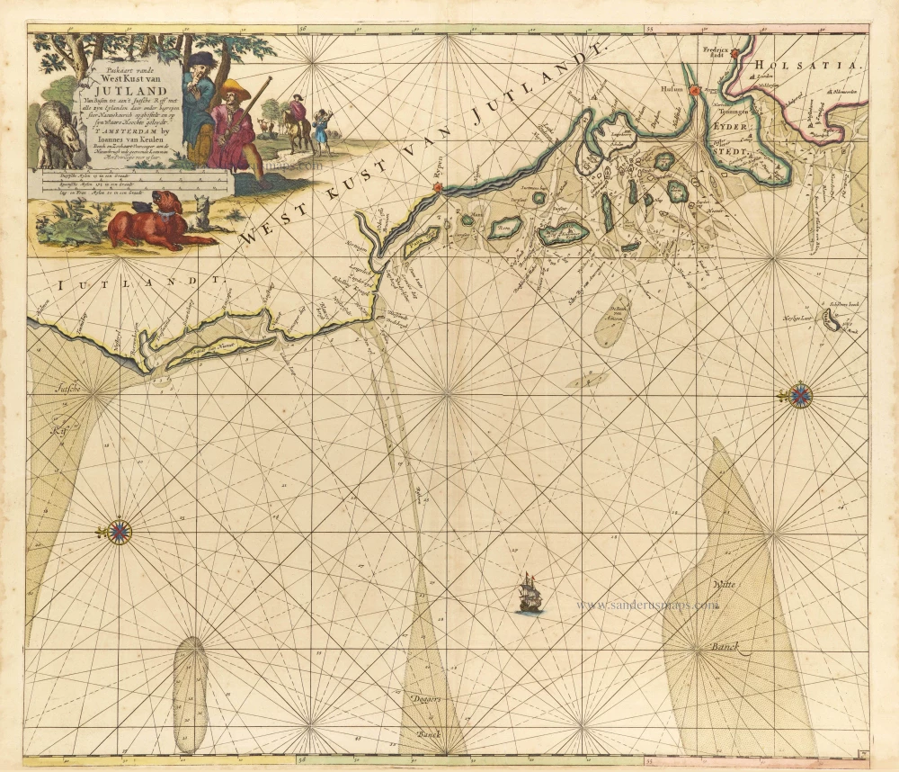
Paskaart vande West Kust van Jutland van Busem tot aen 't Jutsche Riff met Alle syn Eylanden daer onder Begrepen. 1697-1709
Sea chart of Denmark (Westcoast of Jutland), by J. Van Keulen.
[Item number: 13449]

Carte de l'Etat du Royaume de Dannemarck et diverses observations pour conduire à l'Intelligence de l'Histoire et du Gouvernement de ce Royaume. 1714
Denmark - Copenhagen, by Zacharias Châtelain.
[Item number: 21339]

Nouvelle Carte Géographique du Royaume de Dannemarck avec une Table des Villes les plus remarquables. 1714
Denmark, by Zacharias Châtelain.
[Item number: 21341]
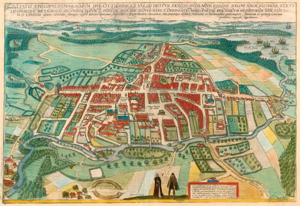
Civitates Episcopalis Othenarum sive Otthoniae, ut vulgo Dicitur, Fioniae ... 1596-1640
Odense, by Georg Braun and Frans Hogenberg.
[Item number: 23372]
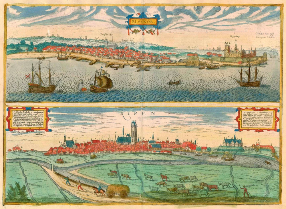
Elsenor [on sheet with] Ripen 1596-1640
Helsingør (Sjaelland) & Ribe (Jutland), by Georg Braun and Frans Hogenberg.
[Item number: 23375]
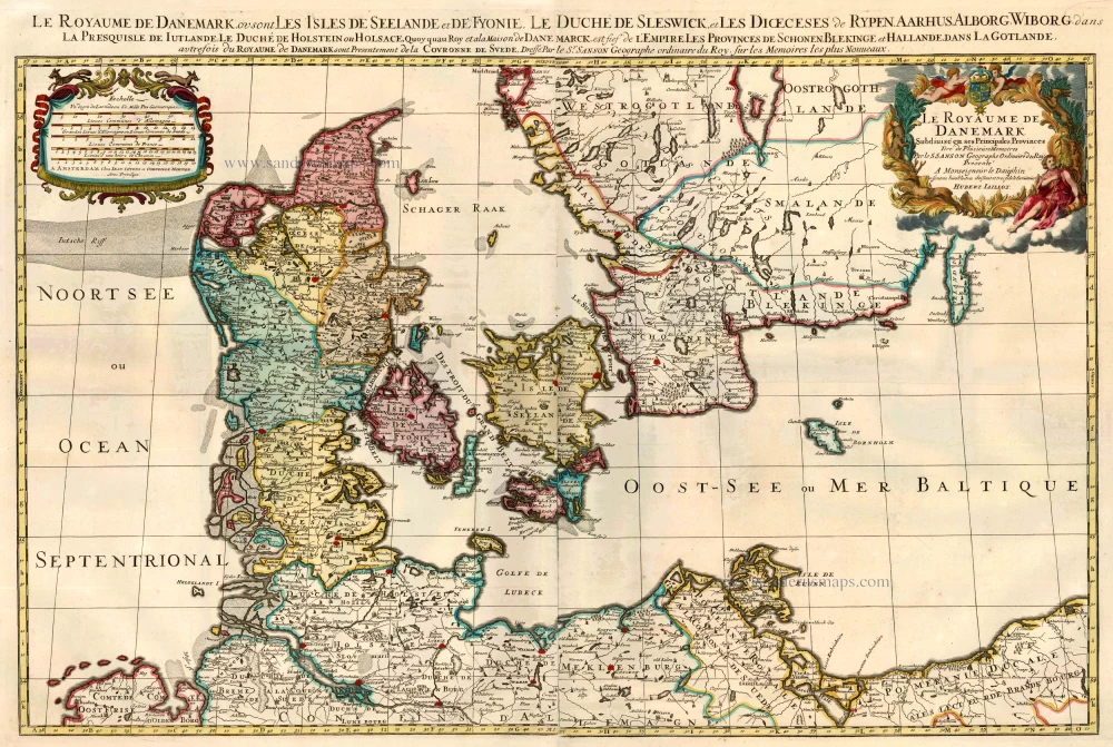
Le Royaume de Danemark Subdivisé en ses Principales Provinces. 1710
Denmark by Sanson - Covens & Mortier.
[Item number: 23736]
Iutiae Tabula in qua sunt Dioecesis Alburgensis, Wiburgensis, Ripensis et Arhusiensis quae et sunt divisae in Omnia Dominia. 1721-41
Denmark - Jutland, by Covens & Mortier.
[Item number: 23738]
Insularum Danicarum ut Zee-Landiae, Fioniae, Langelandiae, Lalandiae, Falstriae, Fembriae, Mona aliarumq in Mari Balthico Sitar Descriptio. c. 1682-86
Danish Islands by de Wit F.
[Item number: 24504]
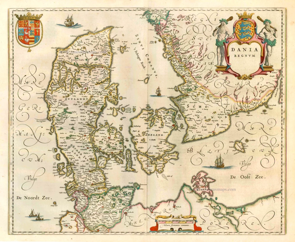
Dania Regnum. 1649-55
Denmark, by W. & J. Blaeu.
[Item number: 25266]
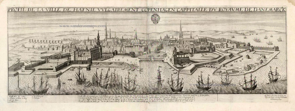
Profil de la Ville de Hafnie vulgairement Copenhagen Cappitalle du Royaume de Danemarck. 1648
Copenhagen, by J. Boisseau.
[Item number: 25597]
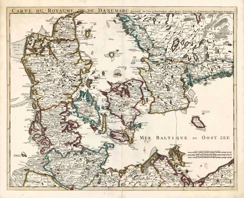
Carte du Royaume de Danemarc. 1730
Denmark by Guillaume Delisle, published by Covens & Mortier.
[Item number: 25900]
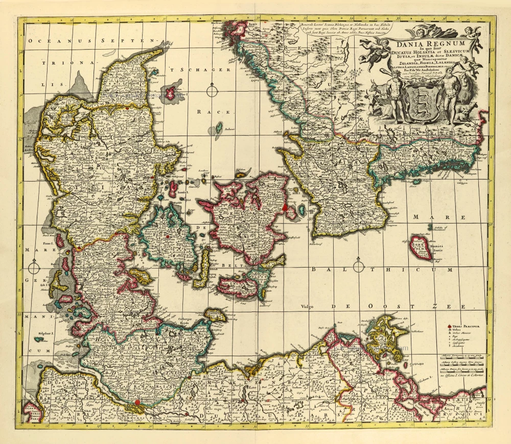
Dania Regnum In quo sunt Ducatus Holsatia et Slesvicum Iutia, et Insulae, dictae Danicae, quae Nuncupantur Zelandia, Fionia, Lalandia, Falstria, Langelandia Bornholmia etc. after 1721
Denmark by Frederik de Wit, published by Covens & Mortier.
[Item number: 28268]

Regni Daniae, Novißima at Accuratißima Tabula. c. 1678
Denmark by Nicolaes Visscher I.
[Item number: 28521]
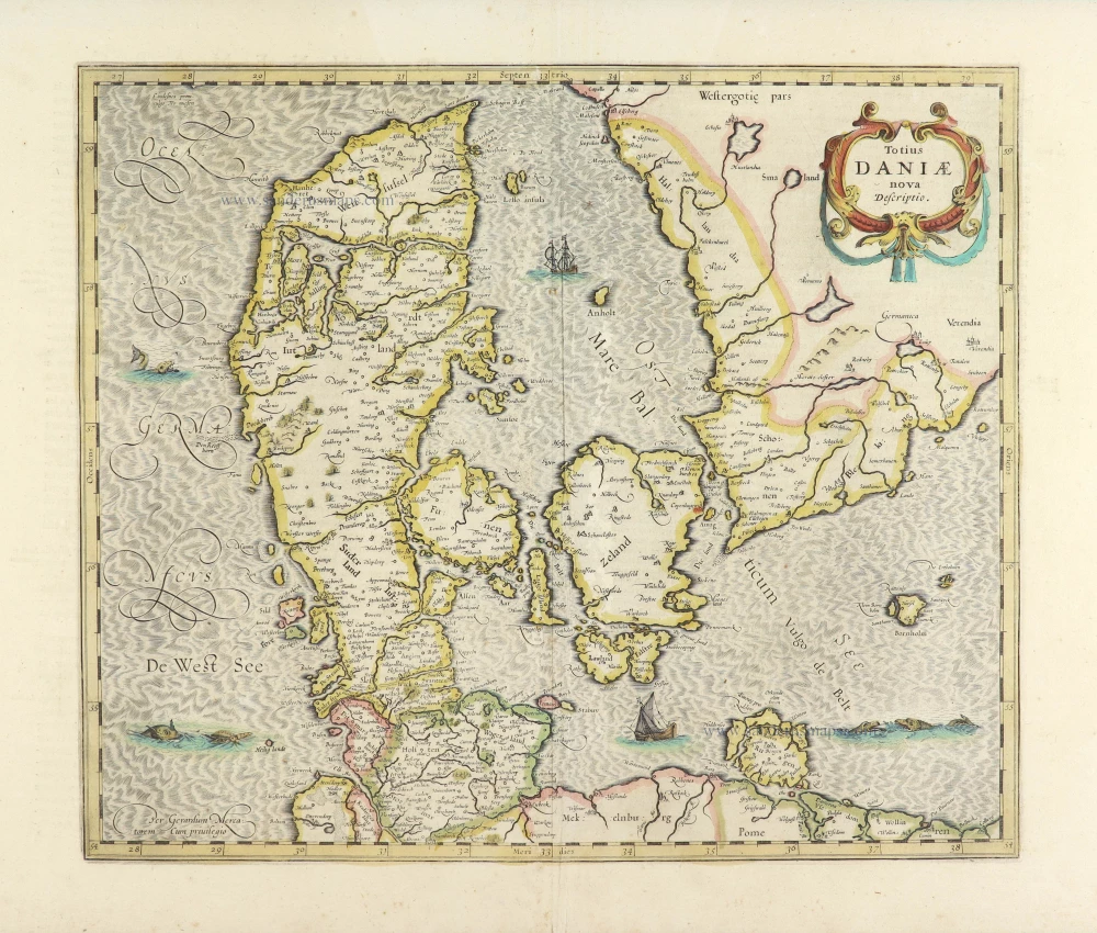
Totius Daniae nova descriptio. 1639-42
Denmark by Henricus Hondius.
[Item number: 28699]
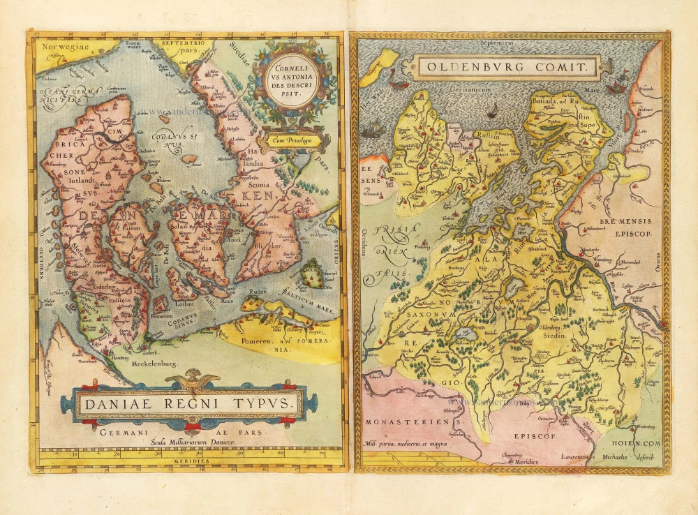
Daniae Regni Typus Cornelius Antoniades Descripsit; [On sheet with:] Oldenburg Comit. 1584
Denmark and Jutland by Abraham Ortelius.
[Item number: 29133]

Nouvelle Carte Géographique du Royaume de Dannemarck avec une Table des Villes les plus remarquables. 1714
Denmark by Zacharias Châtelain.
[Item number: 29430]
Le Royaume de Danemark, Divisé en ses Provinces. c. 1709
Denmark by Hubert Jaillot.
[Item number: 29589]
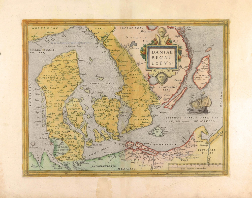
Daniae Regni Typus. 1574
Denmark by Abraham Ortelius.
[Item number: 29601]
First edition, first state of this famous map of Denmark by Marcus Jordan, published by Braun & Hogenberg.
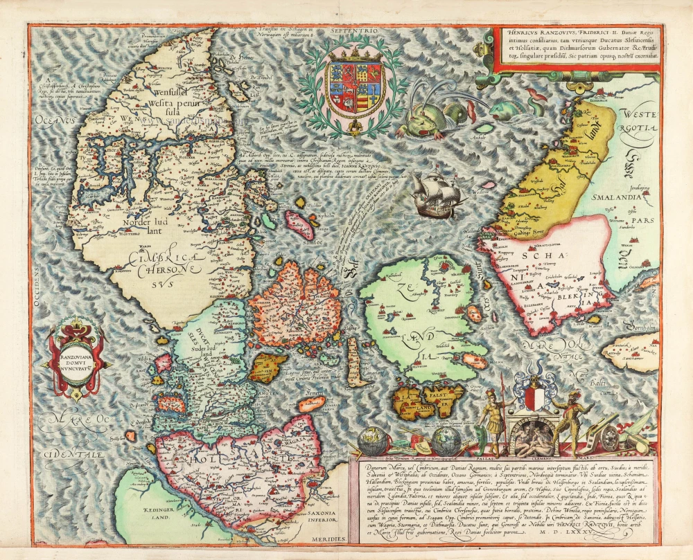
Danorum Marca, vel Cimbricum, aut Daniae Regnum ... 1588
Denmark, by Georg Braun & Frans Hogenberg.
[Item number: 30175]