
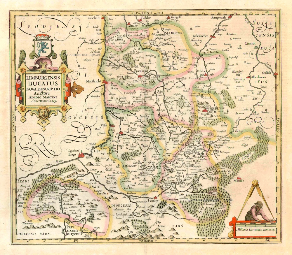
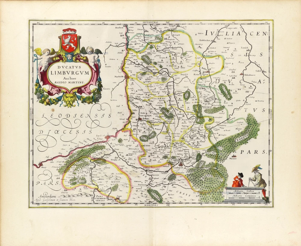
Limburg, by P. Van der Aa. 1713
Pieter van der Aa (Leiden, 1659-1733)
Pieter van der Aa was already in 1682 owner of a bookshop and auction house. During his life, he has published an enormous amount of printed material.
After 1700, van der Aa increasingly specialised in books on geography and travel.
He published composite atlases, a series of geographical descriptions of European countries, and some very spectacular works. Between 1706 and 1708 he published the Naauweurige versameling der gedenkwaardigste zee- en land-reysen, in 28 volumes.
Many of Van der Aa’s publications are richly illustrated with maps and plates. He took over many copperplates and prints from other publishers such as Carel Allard and Frederik De Wit. The composite atlases that appeared from his workshop contain a curious mixture of his own material, copies of maps from other publishers, and reprints made from old copper plates, now with his own imprint.
The Galérie agréable du monde, was completed in 1729, and comprised 66 parts, bound in 27 volumes. Van der Aa presented it as a good investment; after publication, the antiquarian value of the work would double, the more so since it was printed in a limited edition of only one hundred copies.
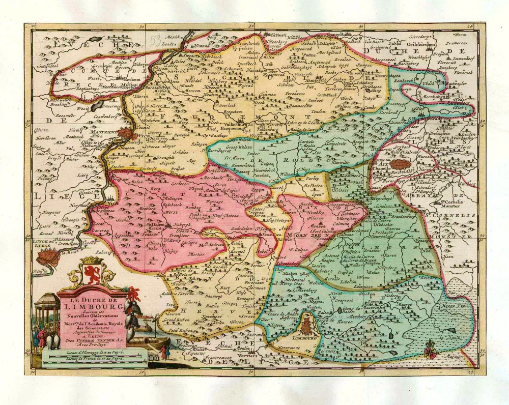
Le Duché de Limbourg.
Item Number: 26052 Authenticity Guarantee
Category: Antique maps > Europe > Belgium
Old, antique map of Limburg, by P. Van der Aa.
Oude kaart van Limburg, door P. Van der Aa.
Date of the first edition: 1713
Date of this map: 1713
Copper engraving, printed on paper.
Size (not including margins): 23 x 29.5cm (8.9 x 11.4 inches)
Verso: Blank
Condition: Original body colour, trimmed to neatline and mounted on heavy paper at an early time.
Condition Rating: A
References: Van der Krogt A, 15:26; Koeman, Aa7 (63).
From: Nouvel Atlas, très exact et fort commode pour toutes sortes de personnes, Contenant Les Principales cartes géographiques. Leiden, P. Van der Aa, n.d. (1713) (Koeman, Aa7).
Van der Aa maps are rarely found in original colouring.
Pieter van der Aa (Leiden, 1659-1733)
Pieter van der Aa was already in 1682 owner of a bookshop and auction house. During his life, he has published an enormous amount of printed material.
After 1700, van der Aa increasingly specialised in books on geography and travel.
He published composite atlases, a series of geographical descriptions of European countries, and some very spectacular works. Between 1706 and 1708 he published the Naauweurige versameling der gedenkwaardigste zee- en land-reysen, in 28 volumes.
Many of Van der Aa’s publications are richly illustrated with maps and plates. He took over many copperplates and prints from other publishers such as Carel Allard and Frederik De Wit. The composite atlases that appeared from his workshop contain a curious mixture of his own material, copies of maps from other publishers, and reprints made from old copper plates, now with his own imprint.
The Galérie agréable du monde, was completed in 1729, and comprised 66 parts, bound in 27 volumes. Van der Aa presented it as a good investment; after publication, the antiquarian value of the work would double, the more so since it was printed in a limited edition of only one hundred copies.
Related items
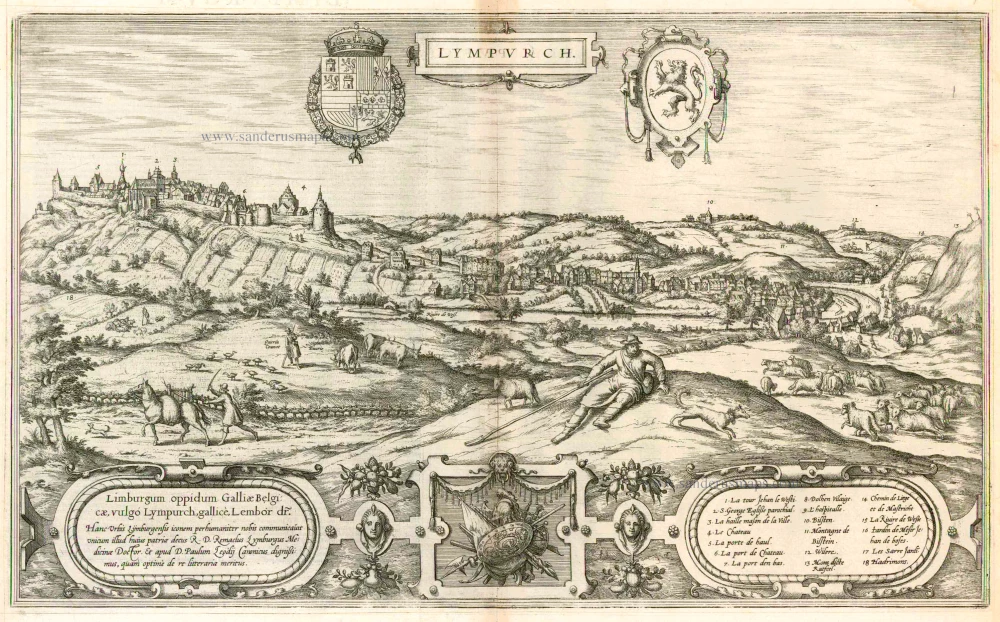
Lympurch. - Limburgum oppidum Galliae Belgicae, vulgo Lympurch, gallice, Lembor dr. ... 1575
Limbourg, by Georg Braun and Frans Hogenberg.
[Item number: 7535]
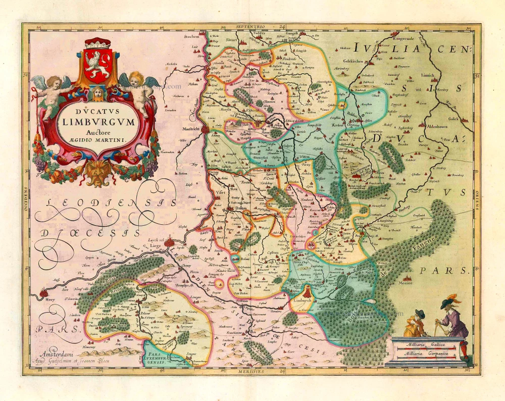
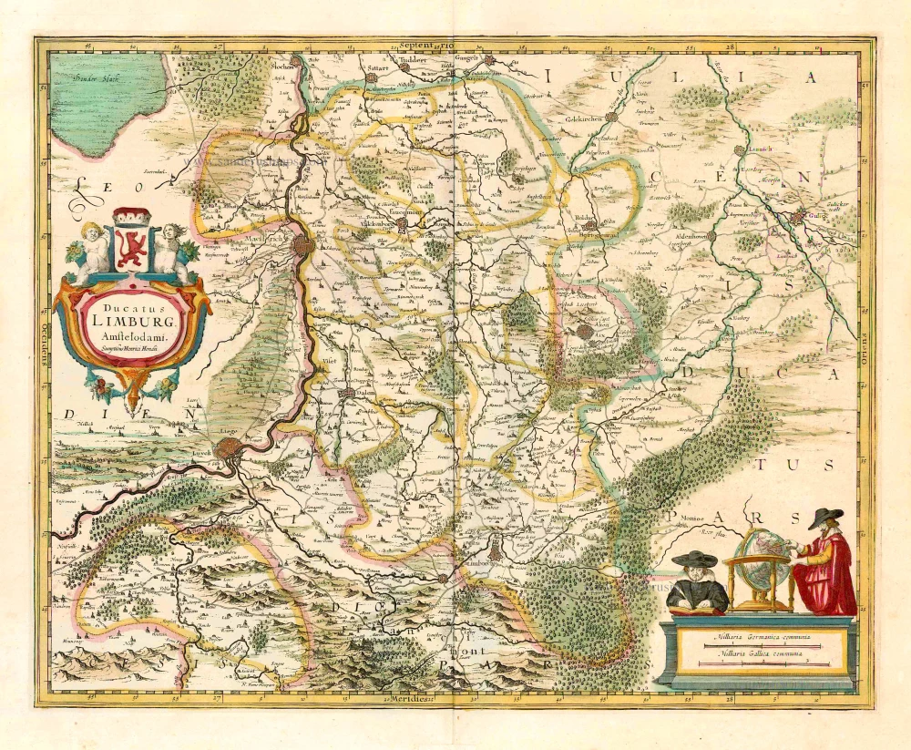
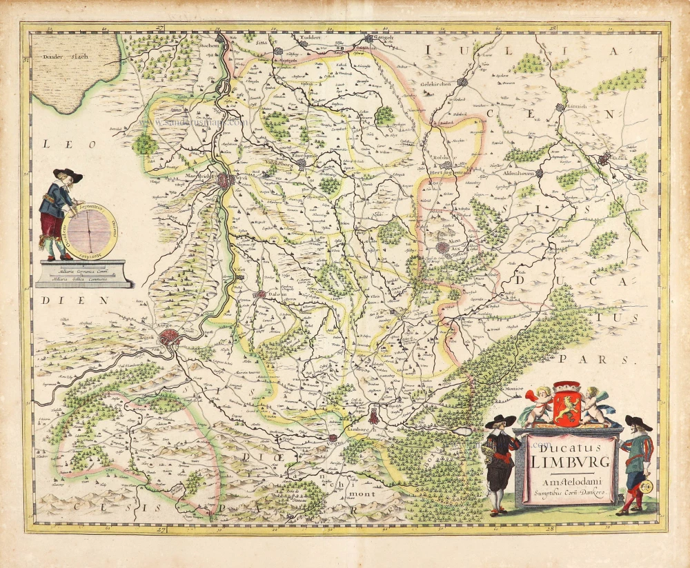
Ducatus Limburgum. 1659-72
Limburg, by Willem and Joan Blaeu.
[Item number: 8841]
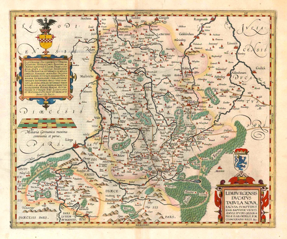
Scarce map by Vrients
Limburgensis Ducatus Tabula Nova. 1612
Limburg, by Ortelius A.
[Item number: 22979]
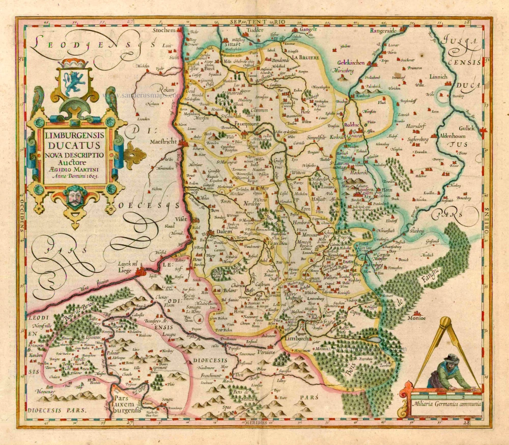
Limburgensis Ducatus. 1623
Limburg, by Henricus Hondius.
[Item number: 24917]

Limburg. 1652
Limbourg, by Joan Blaeu.
[Item number: 25299]
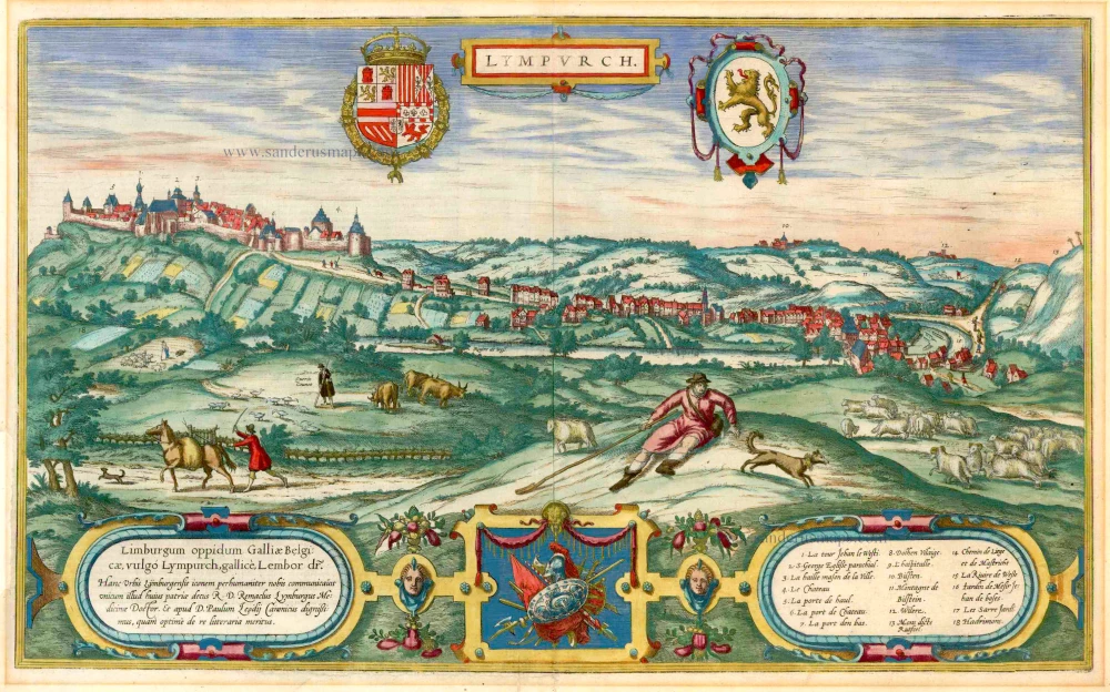
Lympurch. - Limburgum oppidum Galliae Belgicae, vulgo Lympurch, gallice, Lembor dr. ... 1575
Limbourg, by Braun & Hogenberg.
[Item number: 25346]

Limburgi Ducatus Et Comitatus Valckenburgi. 1683-1696
Limburg, by Nicolaas Visscher I.
[Item number: 26216]
Ducatus Limburg. 1641
Limburg, by Henricus Hondius.
[Item number: 26308]
Limburgensis Ducatus. 1619
Limburg, by Henricus Hondius.
[Item number: 26774]
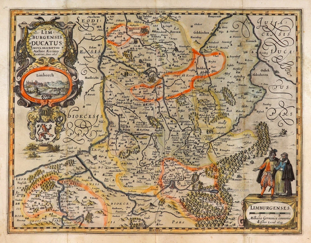
Limburgensis Ducatus Nova Descriptio. 1634
Limburg, by C.J. Visscher.
[Item number: 27969]
Ducatus Limburg. c. 1636
Limburg by Cornelis Danckerts.
[Item number: 28772]
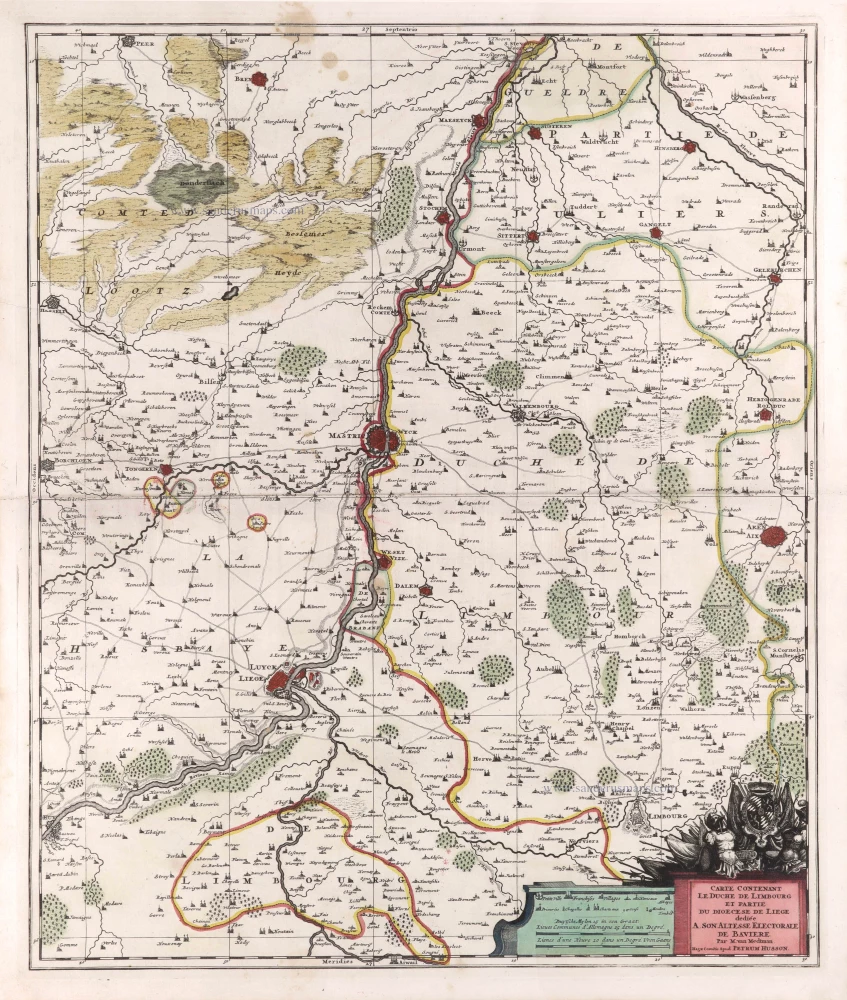
Carte contenant le Duché de Limbourg et partie du Diocèse de Liège. c. 1709
Limburg - Liège by Pierre Husson.
[Item number: 29590]
Ducatus Limburgum. 1643
Limburg by W. & J. Blaeu.
[Item number: 29931]
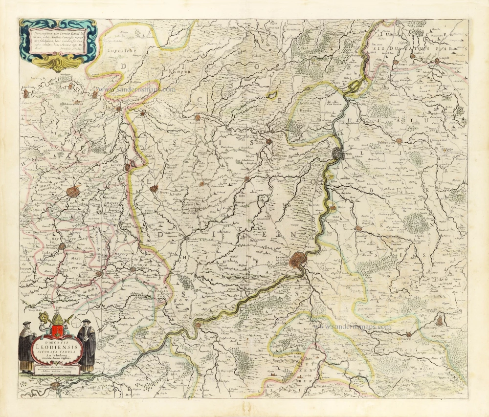
Dioecesis Leodiensis Accurata Tabula. 1653
Diocese of Liège by Johannes Janssonius.
[Item number: 30372]