
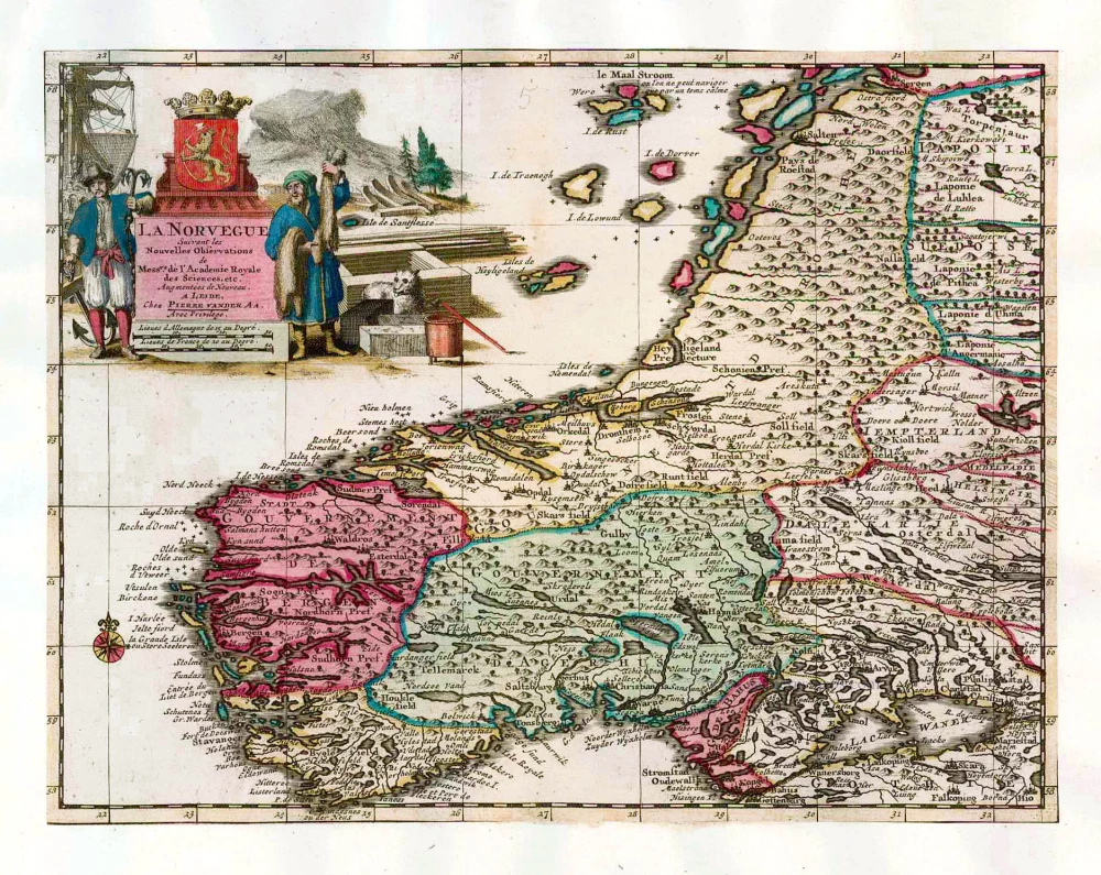
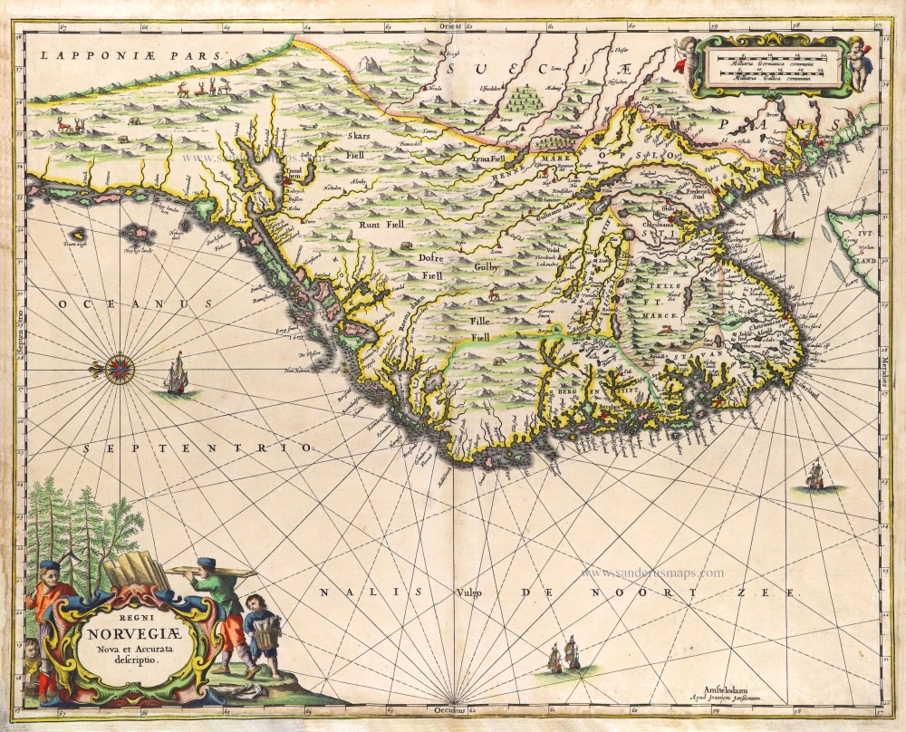
Southern Norway, by Pieter van der Aa. 1713
Pieter van der Aa (Leiden, 1659-1733)
Pieter van der Aa was already in 1682 owner of a bookshop and auction house. During his life, he has published an enormous amount of printed material.
After 1700, van der Aa increasingly specialised in books on geography and travel.
He published composite atlases, a series of geographical descriptions of European countries, and some very spectacular works. Between 1706 and 1708 he published the Naauweurige versameling der gedenkwaardigste zee- en land-reysen, in 28 volumes.
Many of Van der Aa’s publications are richly illustrated with maps and plates. He took over many copperplates and prints from other publishers such as Carel Allard and Frederik De Wit. The composite atlases that appeared from his workshop contain a curious mixture of his own material, copies of maps from other publishers, and reprints made from old copper plates, now with his own imprint.
The Galérie agréable du monde, was completed in 1729, and comprised 66 parts, bound in 27 volumes. Van der Aa presented it as a good investment; after publication, the antiquarian value of the work would double, the more so since it was printed in a limited edition of only one hundred copies.
La Norvegue.
Item Number: 26061 Authenticity Guarantee
Category: Antique maps > Europe > Northern Europe
Southern Norway, by Pieter van der Aa.
Title: La Norvegue.
Date of the first edition: 1713.
Date of this map: 1713.
Copper engraving, printed on paper.
Image size: 225 x 293mm (8.86 x 11.54 inches).
Sheet size: 340 x 450mm (13.39 x 17.72 inches).
Verso: Blank.
Condition: Original coloured, trimmed to neatline and mounted on heavy paper at an early time.
Condition Rating: A.
From: Nouvel Atlas, très exact et fort commode pour toutes sortes de personnes, Contenant Les Principales cartes géographiques. Leiden, P. Van der Aa, n.d. (1713) (Koeman, Aa7).
Pieter van der Aa (Leiden, 1659-1733)
Pieter van der Aa was already in 1682 owner of a bookshop and auction house. During his life, he has published an enormous amount of printed material.
After 1700, van der Aa increasingly specialised in books on geography and travel.
He published composite atlases, a series of geographical descriptions of European countries, and some very spectacular works. Between 1706 and 1708 he published the Naauweurige versameling der gedenkwaardigste zee- en land-reysen, in 28 volumes.
Many of Van der Aa’s publications are richly illustrated with maps and plates. He took over many copperplates and prints from other publishers such as Carel Allard and Frederik De Wit. The composite atlases that appeared from his workshop contain a curious mixture of his own material, copies of maps from other publishers, and reprints made from old copper plates, now with his own imprint.
The Galérie agréable du monde, was completed in 1729, and comprised 66 parts, bound in 27 volumes. Van der Aa presented it as a good investment; after publication, the antiquarian value of the work would double, the more so since it was printed in a limited edition of only one hundred copies.
Related items
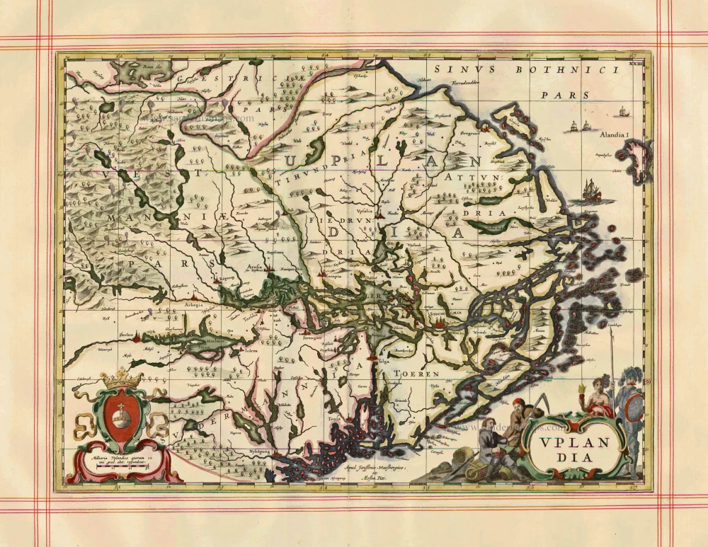
Uplandia 1680
Uppland by J. Janssonius, published by Moses Pitt and J. Janssonius-Waesberge.
[Item number: 1246]
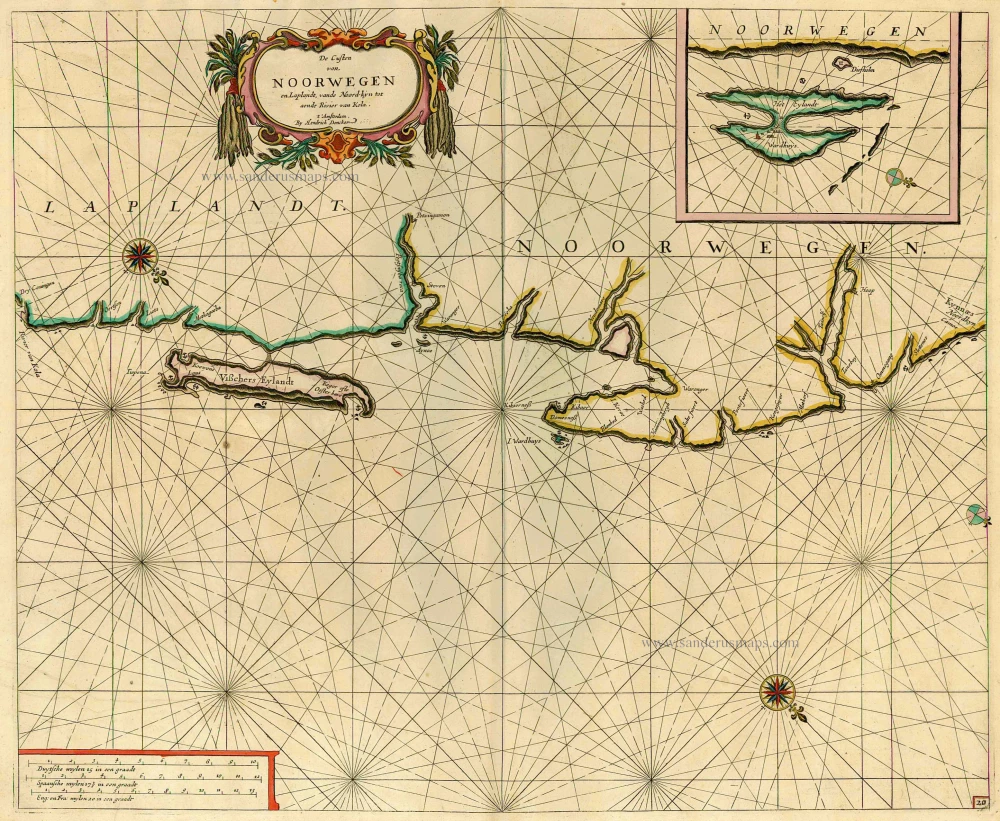
De Custen van Noorwegen en Laplandt, vande Noord-kyn tot aende Rivier van Kola. 1686
Sea chart of the coast of Norway, by Doncker H.
[Item number: 12920]
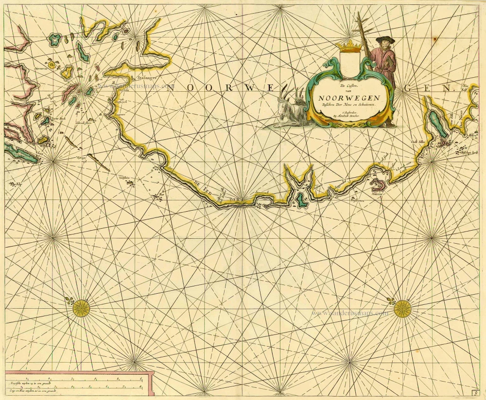
De Custen van Noorwegen tusschen Der Neus en Schuitenes. 1686
Sea chart of Norway, by Doncker H.
[Item number: 15775]
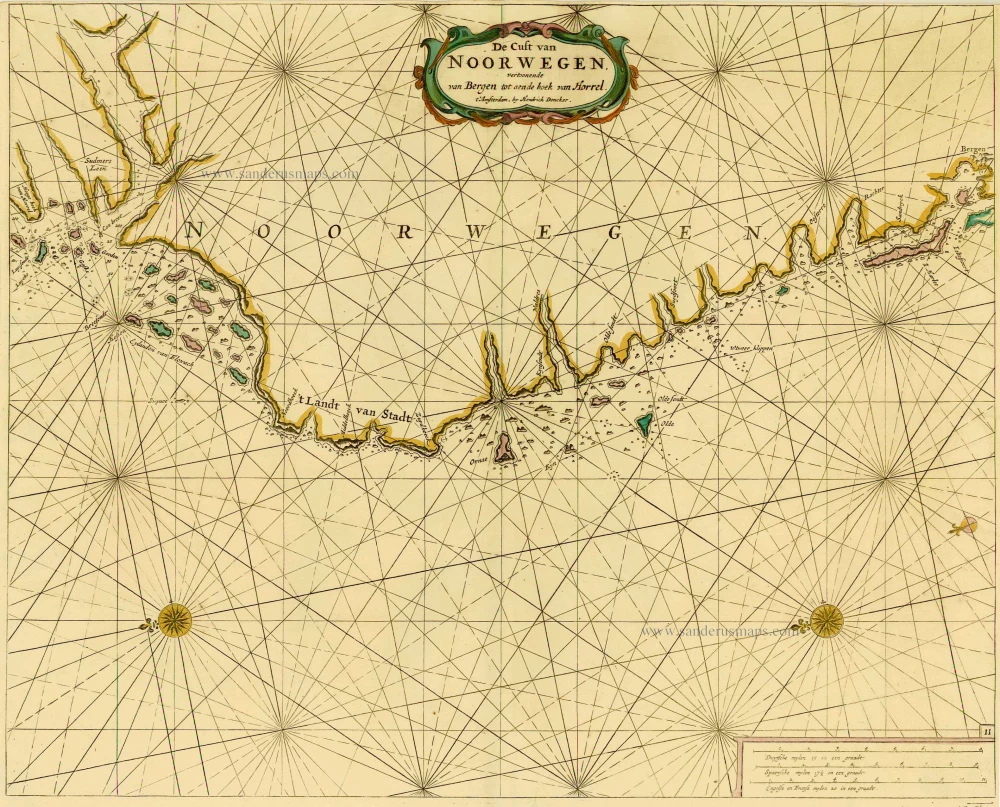
De Cust van Noorwegen vertoonende van Bergen tot aen de hoek van Horrel. 1686
Norway, by Doncker H.
[Item number: 17064]
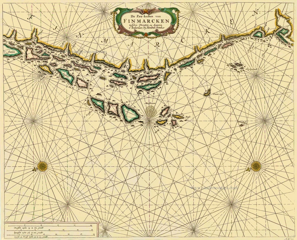
De Zee-kusten van Finmarcken tusschen Dronten en Sanien. 1686
Sea chart of Norway - Finnmark, by Doncker H.
[Item number: 17630]

Caarte van Finmargken van 't Eylandt Sanien tot Noordkyn. 1686
Sea chart of Norway - Finnmark, by Doncker H.
[Item number: 17900]
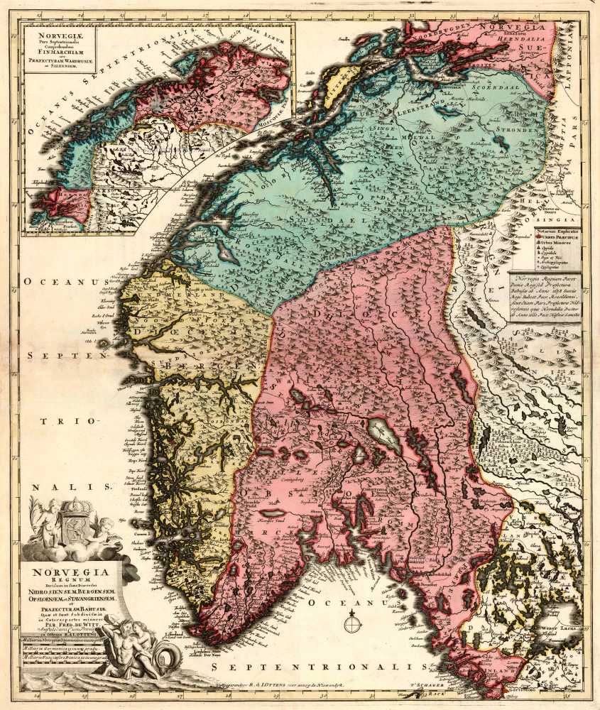
Norvegia Regnum Divisum in suos Dioeceses Nidrosiensem, Bergensem, Opsloensem, et Stavangriensem et Praefecturam Bahusiae ... 1756
Norway by F. de Wit - R. & J. Ottens.
[Item number: 23499]
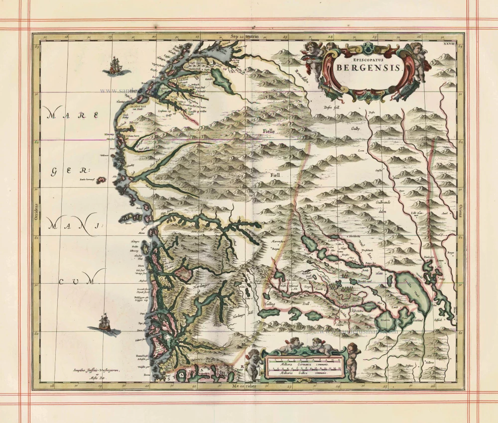
Episcopatus Bergensis 1680
Norway - Bergen, by J. Janssonius, published by Moses Pitt and J. Janssonius-Waesberge.
[Item number: 25068]
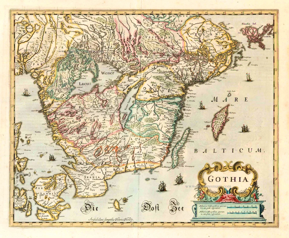
Gothia. 1641
Götaland, by Henricus Hondius.
[Item number: 26260]
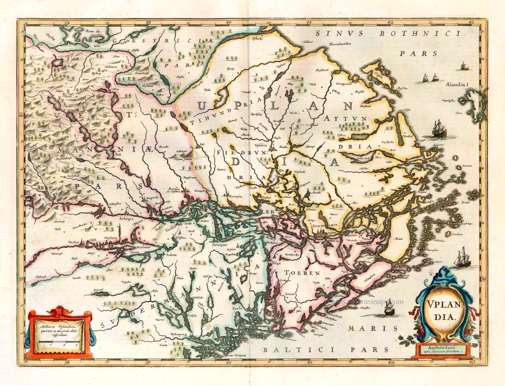
Uplandia. 1641
Uppland, by Henricus Hondius.
[Item number: 26261]
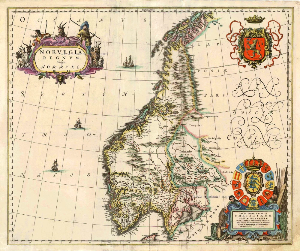
Norvegia Regnum, Vulgo Nor-Ryke. 1667
Norway, by J. Blaeu.
[Item number: 26585]
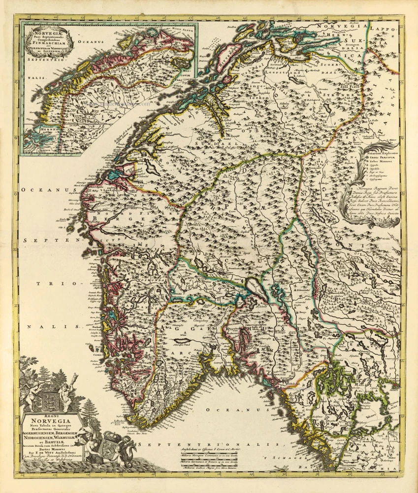
Regni Norvegia Nova Tabula in Quinque Praefecturas Generalis Aggerhusiensem, Bergensem, Nidrosiensem, Warhusiae, et Bahusiae. c. 1715
Norway by Frederik de Wit, published by Covens & Mortier.
[Item number: 28266]
Regni Norvegiae. 1666
Norway by Joannes Janssonius.
[Item number: 29724]
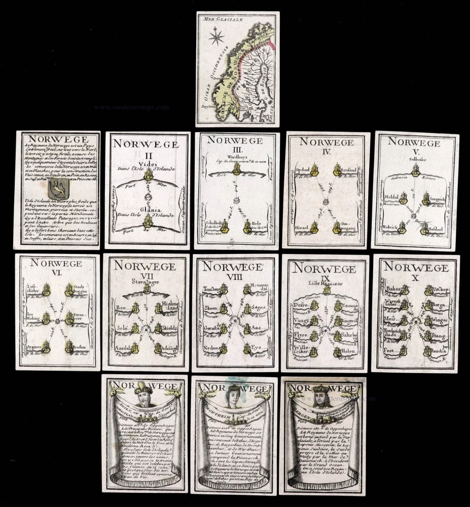
Extremely rare complete series.
Norwege. c. 1763
Norway, 14 playing cards, a complete series forming the Norway set, designed by Nicolas Jean Baptiste de Poilly, printed by Jean-Baptiste Mitoire.
[Item number: 30104]

Dioecesis Stavangriensis, & partes aliquot vicinae, opera L. Scavenii, S.S. 1659
Norway - Stavanger, by Willem & Joan Blaeu.
[Item number: 30208]
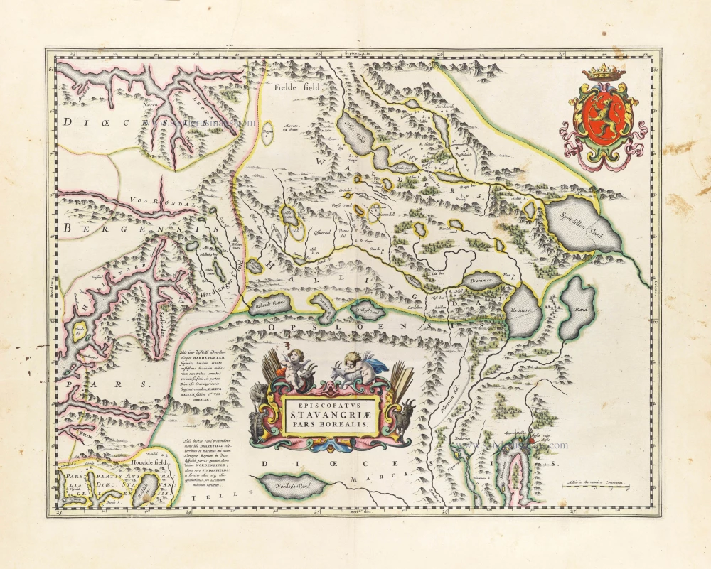
Episcopatus Stavangriae Pars Borealis. 1659
Northern Stavanger (Norway) by Joan Blaeu.
[Item number: 30209]