
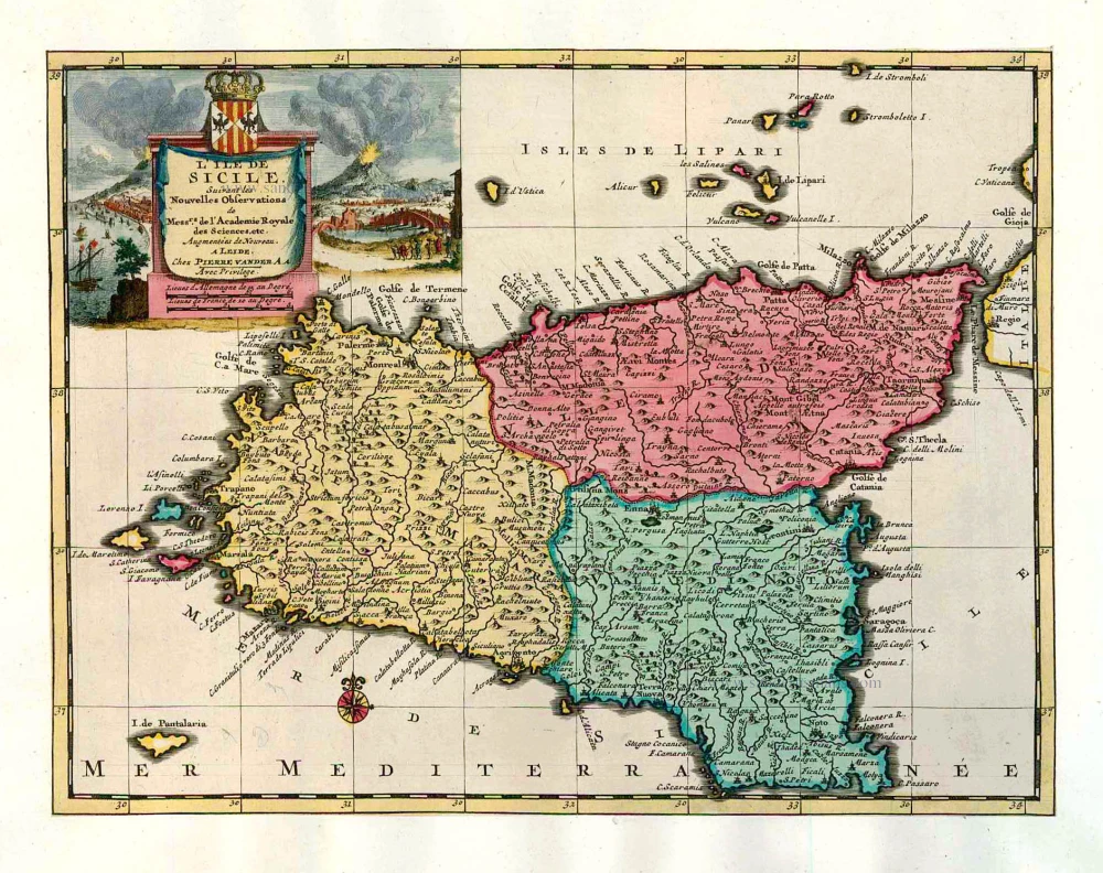
Sicily, by Pieter Van der Aa. 1713
Pieter van der Aa (Leiden, 1659-1733)
Pieter van der Aa was already in 1682 owner of a bookshop and auction house. During his life, he has published an enormous amount of printed material.
After 1700, van der Aa increasingly specialised in books on geography and travel.
He published composite atlases, a series of geographical descriptions of European countries, and some very spectacular works. Between 1706 and 1708 he published the Naauweurige versameling der gedenkwaardigste zee- en land-reysen, in 28 volumes.
Many of Van der Aa’s publications are richly illustrated with maps and plates. He took over many copperplates and prints from other publishers such as Carel Allard and Frederik De Wit. The composite atlases that appeared from his workshop contain a curious mixture of his own material, copies of maps from other publishers, and reprints made from old copper plates, now with his own imprint.
The Galérie agréable du monde, was completed in 1729, and comprised 66 parts, bound in 27 volumes. Van der Aa presented it as a good investment; after publication, the antiquarian value of the work would double, the more so since it was printed in a limited edition of only one hundred copies.
L'Ile de Sicile.
Currently not available
Item Number: 26077 Authenticity Guarantee
Category: Antique maps > Europe > Italy
Old, antique map of Sicily by P. Van der Aa.
Mappa antica della Sicilia, di P. Van der Aa.
Date of the first edition: 1713
Date of this map: 1713
Copper engraving, printed on paper.
Size (not including margins): 22 x 29cm (8.6 x 11.3 inches)
Verso: Blank
Condition: Original coloured, trimmed to platemark and mounted on heavy paper at an early time.
Condition Rating: A
References: Van der Krogt 4, 38:04; Not in Dufour-La Gumina.
From: Nouvel Atlas, très exact et fort commode pour toutes sortes de personnes, Contenant Les Principales cartes géographiques. Leiden, P. Van der Aa, n.d. (1713) (Koeman, Aa7).
Van der Aa maps are rarely found in original colouring.
Pieter van der Aa (Leiden, 1659-1733)
Pieter van der Aa was already in 1682 owner of a bookshop and auction house. During his life, he has published an enormous amount of printed material.
After 1700, van der Aa increasingly specialised in books on geography and travel.
He published composite atlases, a series of geographical descriptions of European countries, and some very spectacular works. Between 1706 and 1708 he published the Naauweurige versameling der gedenkwaardigste zee- en land-reysen, in 28 volumes.
Many of Van der Aa’s publications are richly illustrated with maps and plates. He took over many copperplates and prints from other publishers such as Carel Allard and Frederik De Wit. The composite atlases that appeared from his workshop contain a curious mixture of his own material, copies of maps from other publishers, and reprints made from old copper plates, now with his own imprint.
The Galérie agréable du monde, was completed in 1729, and comprised 66 parts, bound in 27 volumes. Van der Aa presented it as a good investment; after publication, the antiquarian value of the work would double, the more so since it was printed in a limited edition of only one hundred copies.
Related items
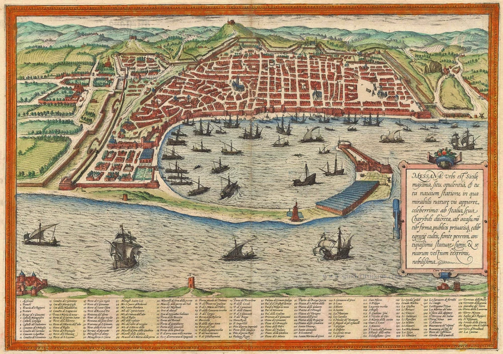
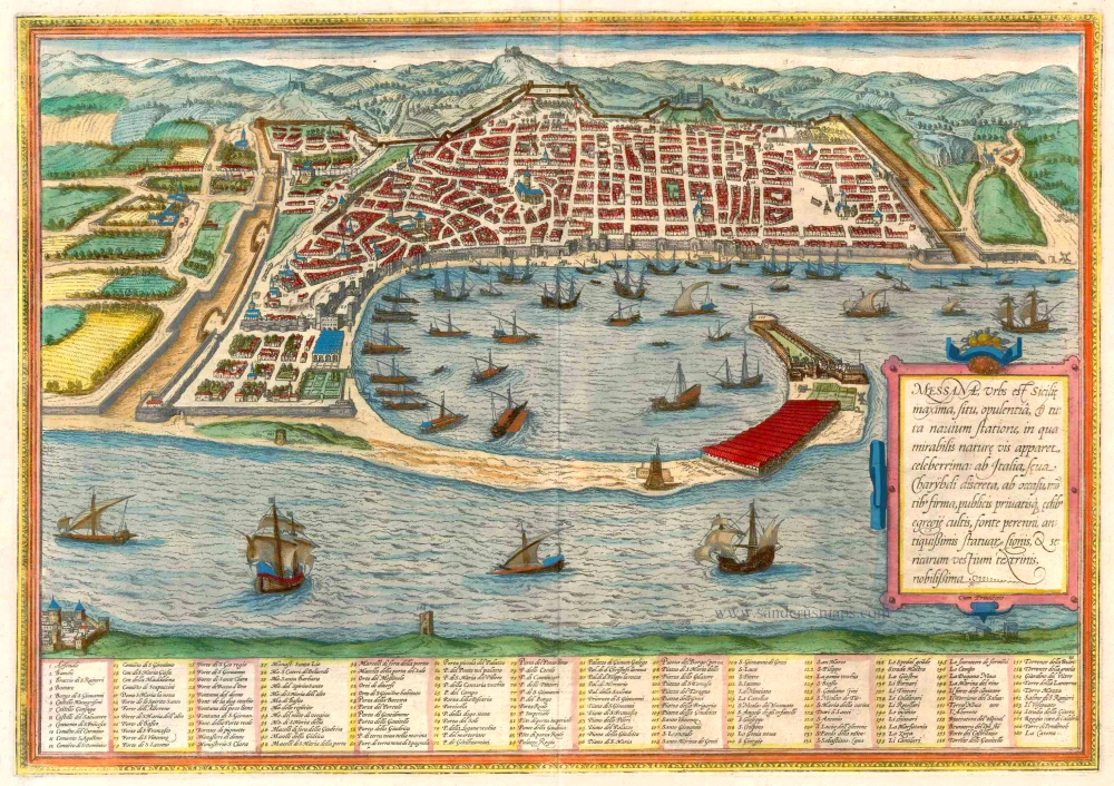
Messana, Urbs est Sicilie maxima, situ, opulentia, & tuta navium statione, ... 1574
Messina by Braun & Hogenberg
[Item number: 5497]
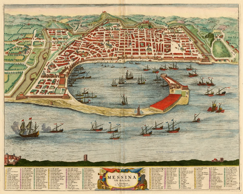
Messina Ville de la Sicile. 1704
Sicily - Messina, by Blaeu - Mortier.
[Item number: 18139]
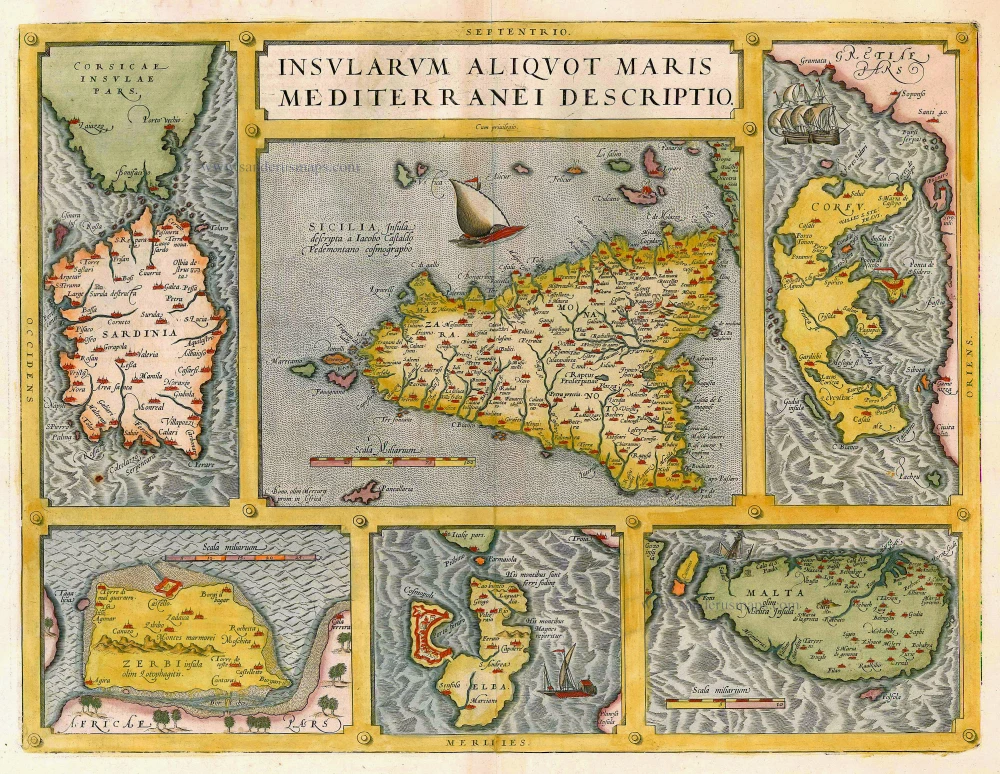
Insularum Aliquot Maris Mediterranei Descriptio. 1612
Sicily, Sardinia, Corfu, Djerba, Elba, Malta by Abraham Ortelius
[Item number: 20929]
Messana, Urbs est Sicilie maxima, situ, opulentia, & tuta navium statione, ... 1572-1624
Sicily - Messina, by Braun & Hogenberg
[Item number: 21463]
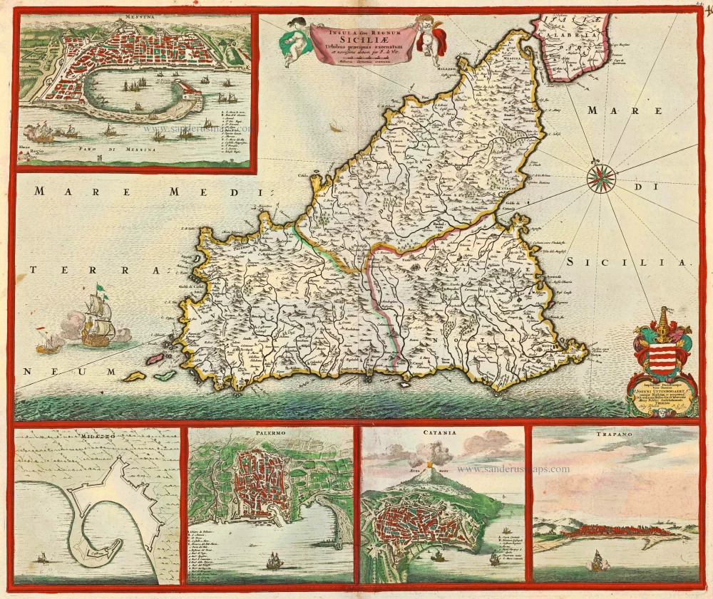
Insula sive Regnum Siciliae Urbibus praecipuis exornatum c. 1682
Sicily by Frederick de Wit.
[Item number: 24517]
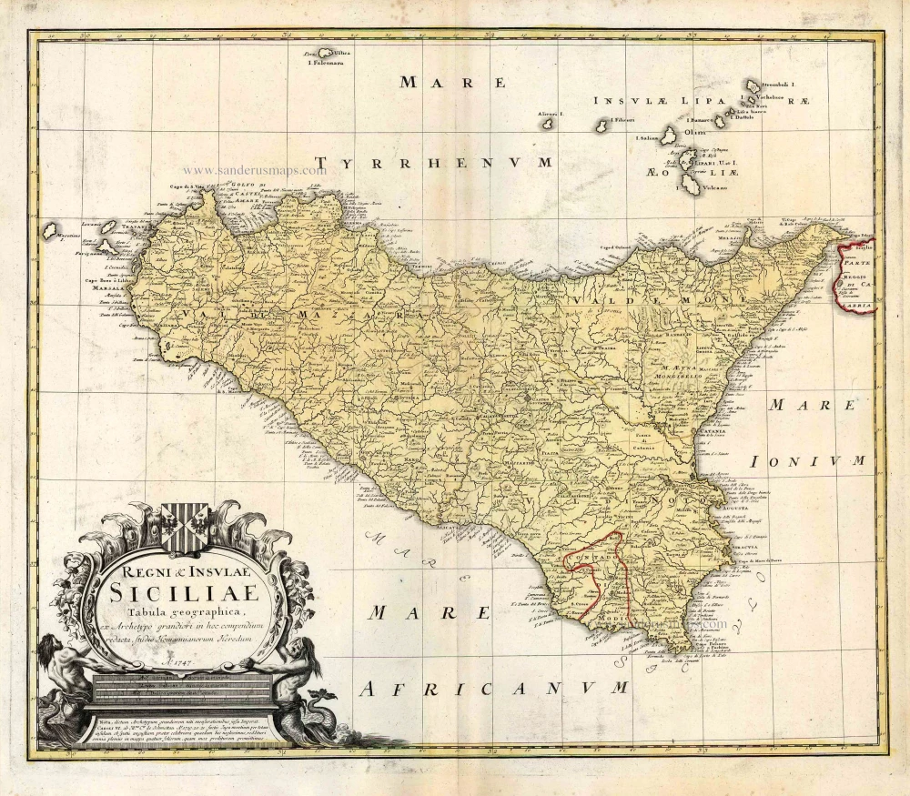
Regni & Insulae Siciliae Tabula Geographica ... c. 1720-65
Sicily, by Homann Heirs.
[Item number: 25478]
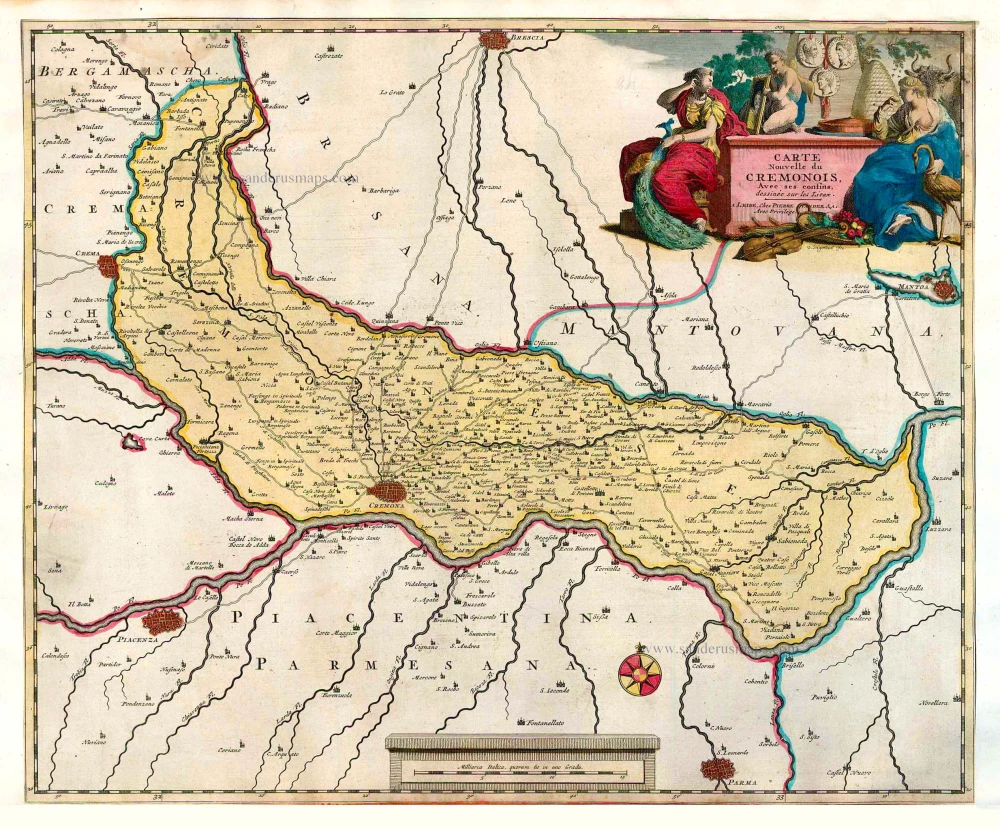
Carte Nouvelle du Cremonois, Avec ses confins. 1713
Cremona by Pieter Van der Aa
[Item number: 26082]
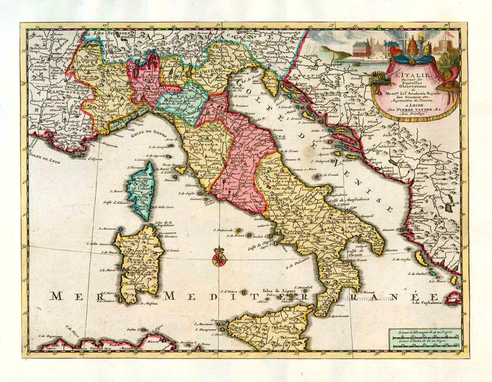
L'Italie. 1713
Italy, by Pieter Van der Aa.
[Item number: 26083]

Siciliae Veteris Typus. 1641
Ancient Sicily, by Johannes Janssonius.
[Item number: 26426]
Siciliae Regnum. 1641
Sicily, by Henricus Hondius.
[Item number: 26427]
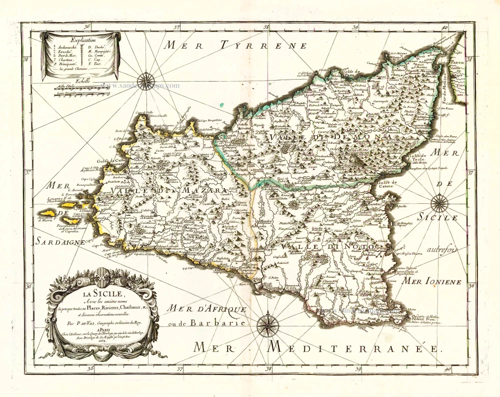
La Sicile, Avec les anciens noms de presque toutes ses Places, Rivieres, Chasteaux, &c. 1679
Sicily, by P. Duval.
[Item number: 26485]
Sicilia. 1602
Sicily (Sicilia), by Langenes, published by P. Bertius.
[Item number: 26539]
Very rare!
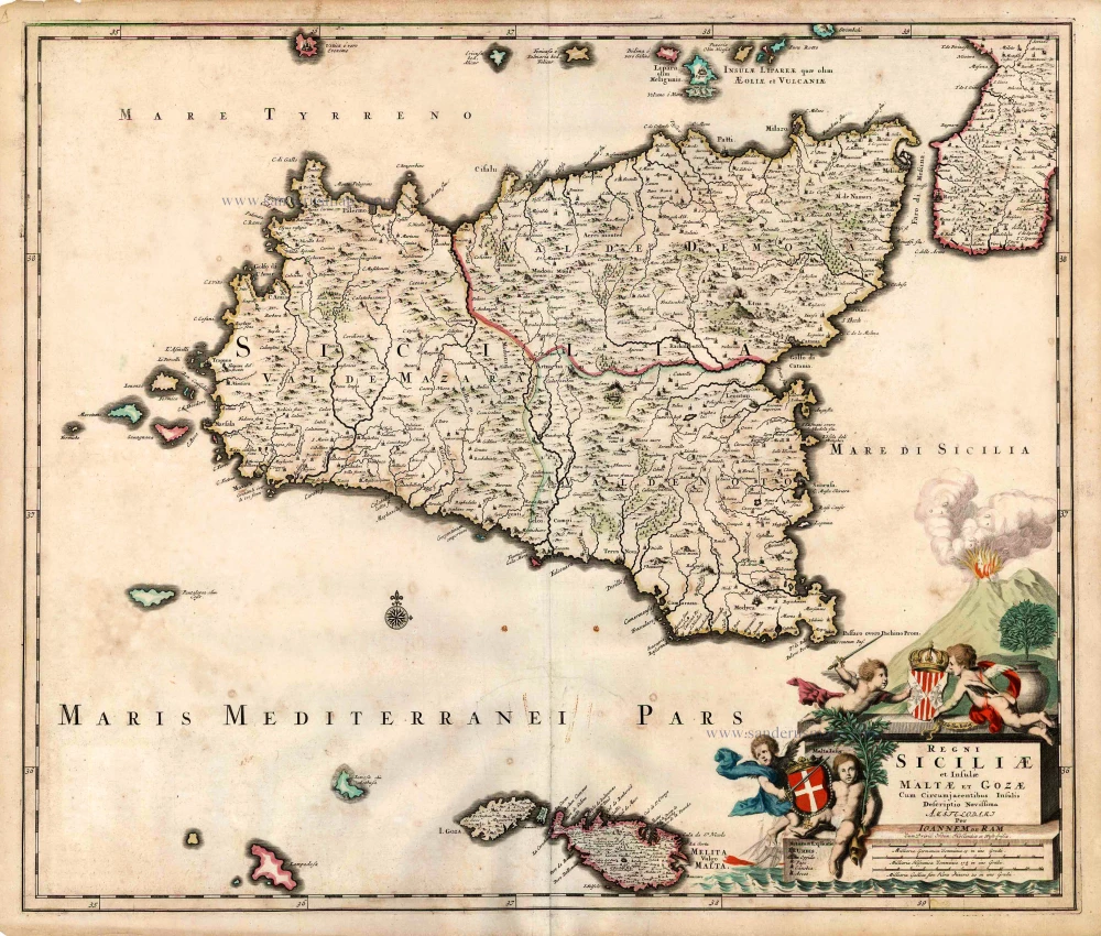
Regni Siciliae et Insulae Maltae et Gozae Cum Circumjacentibus Insulis. c. 1690
Sicily by Johannes De Ram.
[Item number: 26726]
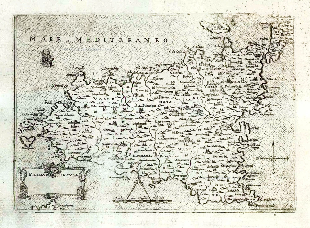
Sicilia Insula. After 1575
Sicily (Sicilia) by Giovanni Francesco Camocio
[Item number: 27566]
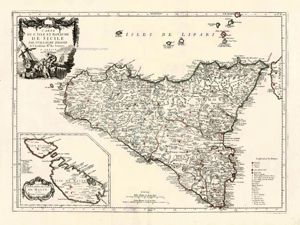
Carte de L'Isle et Royaume de Sicile. 1776-79
Sicily & Malta, by Paolo Santini.
[Item number: 27732]

Tabula . VII . Euro. 1525
Sardinia & Sicily by Lorenz Fries.
[Item number: 28385]

Sicilia Regnum. 1650
Sicily (Sicilia), by Willem & Joan Blaeu.
[Item number: 28774]
Parergon map
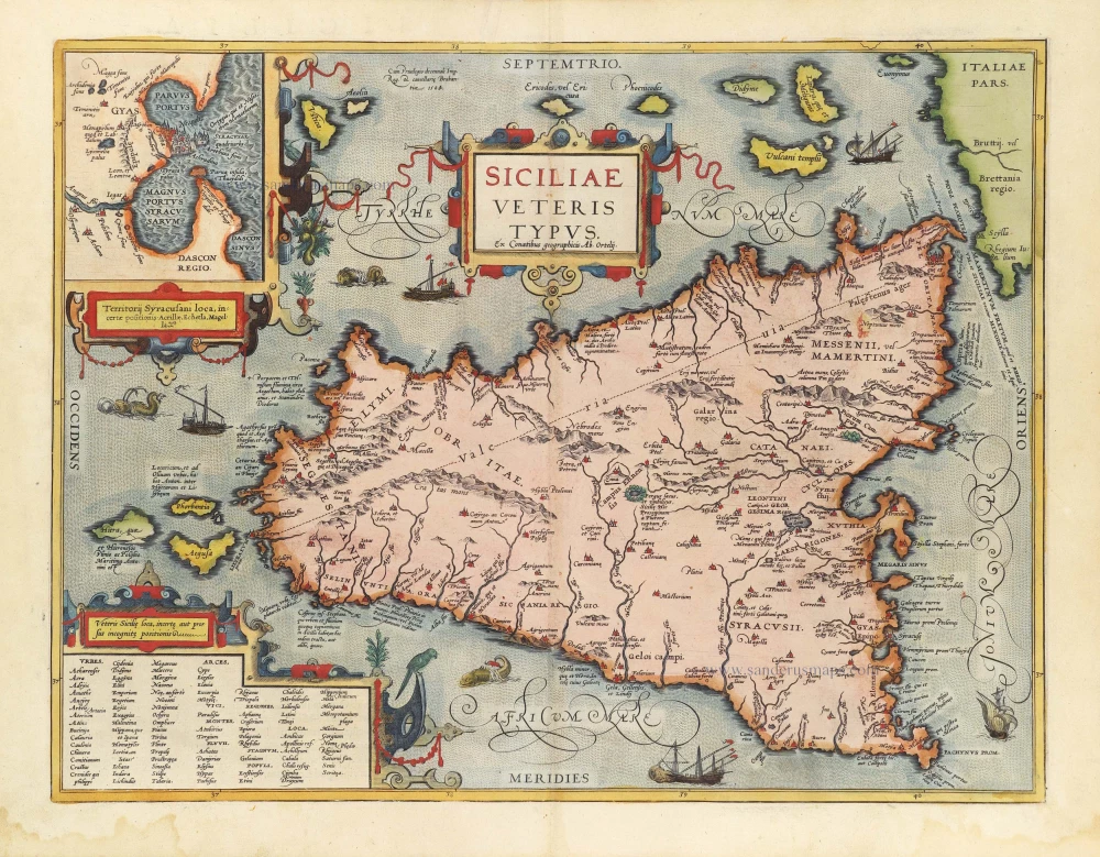
Siciliae Veteris Typus. 1584
Ancient Sicily, by Abraham Ortelius.
[Item number: 29146]
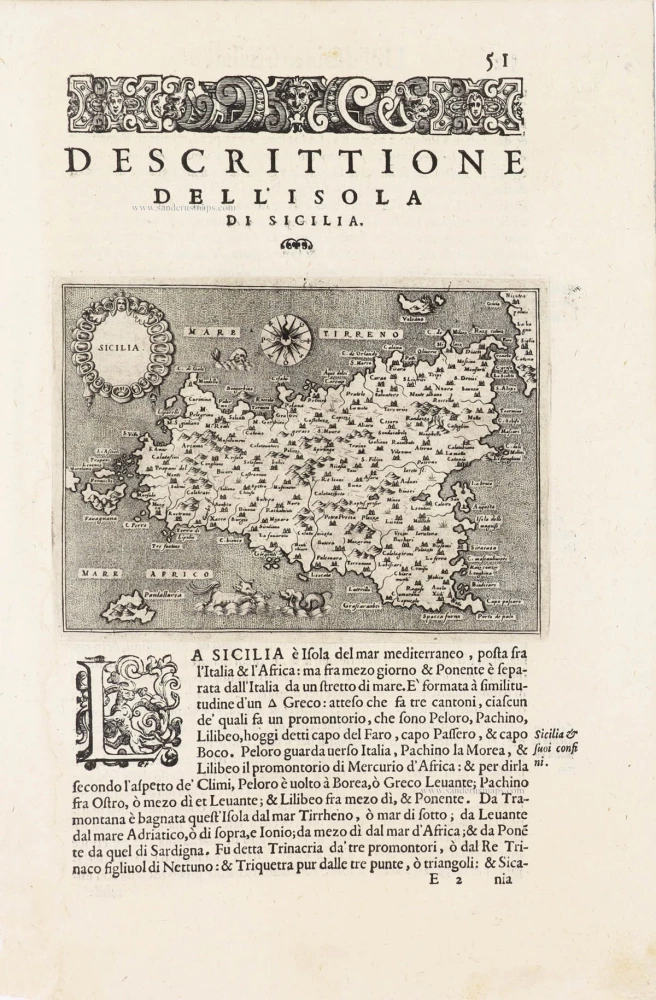
Sicilia - [Above map :] Descrittione dell'Isola di Sicilia. 1590
Sicily (Sicilia) by Thomaso Porcacchi.
[Item number: 29766]
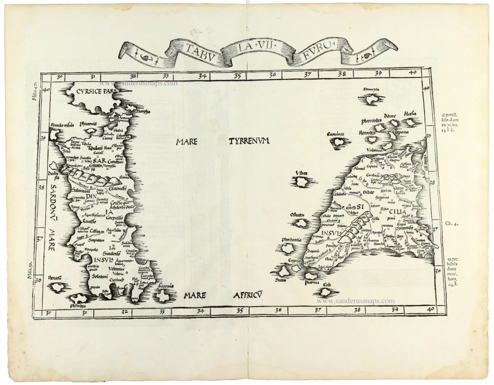
Tabula . VII . Euro. 1525
Sardinia & Sicily by Lorenz Fries.
[Item number: 30534]