
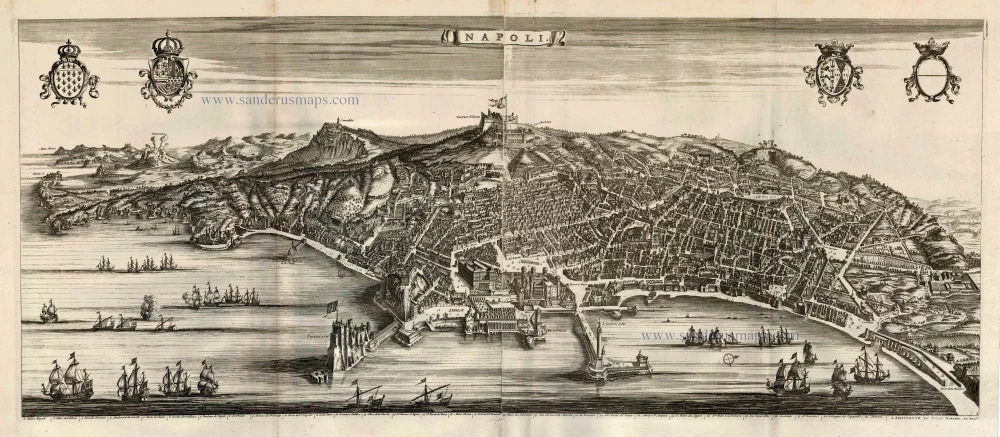
Naples, by P. Van der Aa., 1713
Pieter van der Aa (Leiden, 1659-1733)
Pieter van der Aa was already in 1682 owner of a bookshop and auction house. During his life, he has published an enormous amount of printed material.
After 1700, van der Aa increasingly specialised in books on geography and travel.
He published composite atlases, a series of geographical descriptions of European countries, and some very spectacular works. Between 1706 and 1708 he published the Naauweurige versameling der gedenkwaardigste zee- en land-reysen, in 28 volumes.
Many of Van der Aa’s publications are richly illustrated with maps and plates. He took over many copperplates and prints from other publishers such as Carel Allard and Frederik De Wit. The composite atlases that appeared from his workshop contain a curious mixture of his own material, copies of maps from other publishers, and reprints made from old copper plates, now with his own imprint.
The Galérie agréable du monde, was completed in 1729, and comprised 66 parts, bound in 27 volumes. Van der Aa presented it as a good investment; after publication, the antiquarian value of the work would double, the more so since it was printed in a limited edition of only one hundred copies.
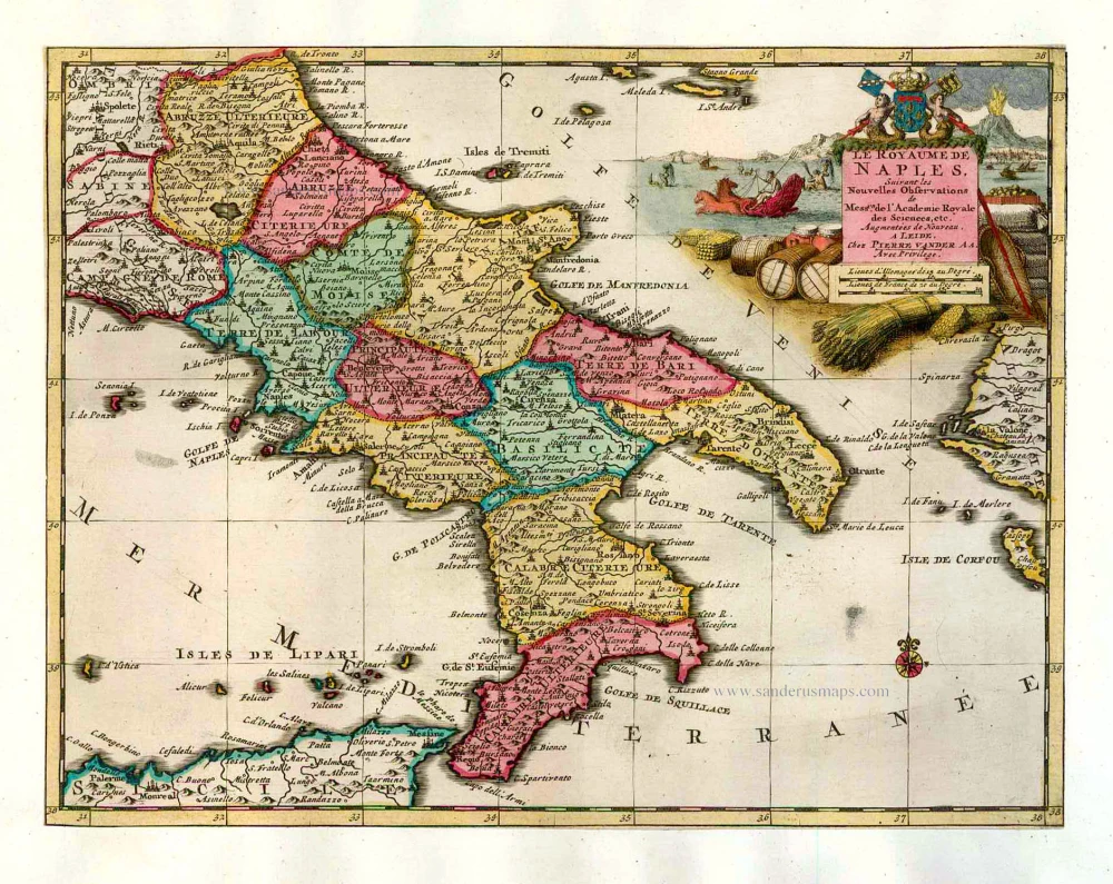
Le Royaume de Naples.
Item Number: 26078 Authenticity Guarantee
Category: Antique maps > Europe > Italy
Old, antique map of Naples, by P. Van der Aa.
Mappa antica del regno di Napoli, di P. Van der Aa.
Date of the first edition: 1713
Date of this map: 1713
Copper engraving, printed on paper.
Size (not including margins): 22.5 x 29cm (8.8 x 11.3 inches)
Verso: Blank
Condition: Original coloured, trimmed to neatline and mounted on heavy paper at an early time.
Condition Rating: A
References: Van der Krogt 4, 37:05
From: Nouvel Atlas, très exact et fort commode pour toutes sortes de personnes, Contenant Les Principales cartes géographiques. Leiden, P. Van der Aa, n.d. (1713) (Koeman, Aa7).
Van der Aa maps are rarely found in original colouring.
Pieter van der Aa (Leiden, 1659-1733)
Pieter van der Aa was already in 1682 owner of a bookshop and auction house. During his life, he has published an enormous amount of printed material.
After 1700, van der Aa increasingly specialised in books on geography and travel.
He published composite atlases, a series of geographical descriptions of European countries, and some very spectacular works. Between 1706 and 1708 he published the Naauweurige versameling der gedenkwaardigste zee- en land-reysen, in 28 volumes.
Many of Van der Aa’s publications are richly illustrated with maps and plates. He took over many copperplates and prints from other publishers such as Carel Allard and Frederik De Wit. The composite atlases that appeared from his workshop contain a curious mixture of his own material, copies of maps from other publishers, and reprints made from old copper plates, now with his own imprint.
The Galérie agréable du monde, was completed in 1729, and comprised 66 parts, bound in 27 volumes. Van der Aa presented it as a good investment; after publication, the antiquarian value of the work would double, the more so since it was printed in a limited edition of only one hundred copies.
Related items
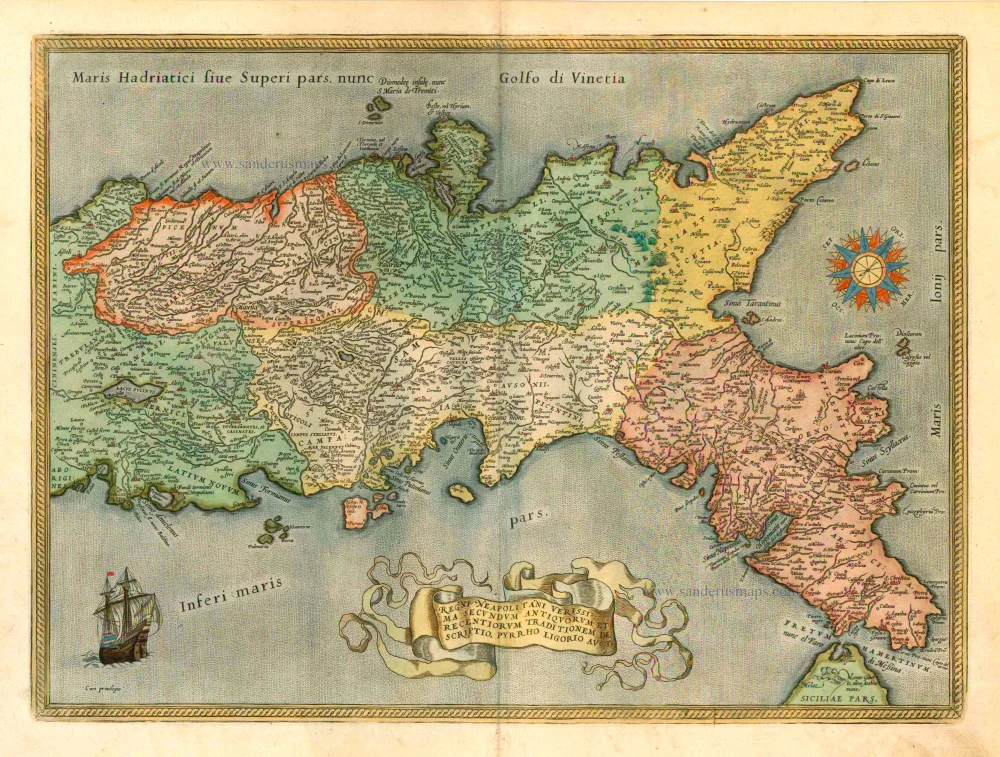
Regni Neapolitani Verissima Secundum Antiquorum et Recentiorum Traditionem Descriptio, Pyrrho Ligorio Auct. 1601
Napoli, by A. Ortelius.
[Item number: 8072]
Important map in excellent condition.
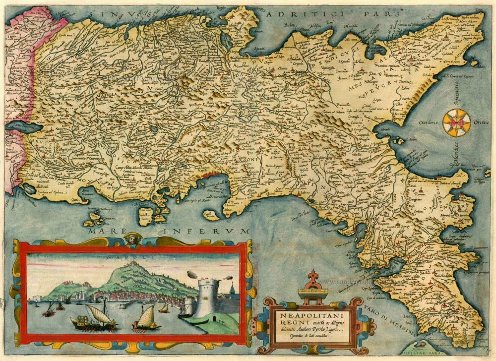
Neapolitani Regni exacta ac diligens delineatio Authore Pyrrho Ligorio 1593
Napoli by Gerard de Jode. (Kingdom)
[Item number: 13663]
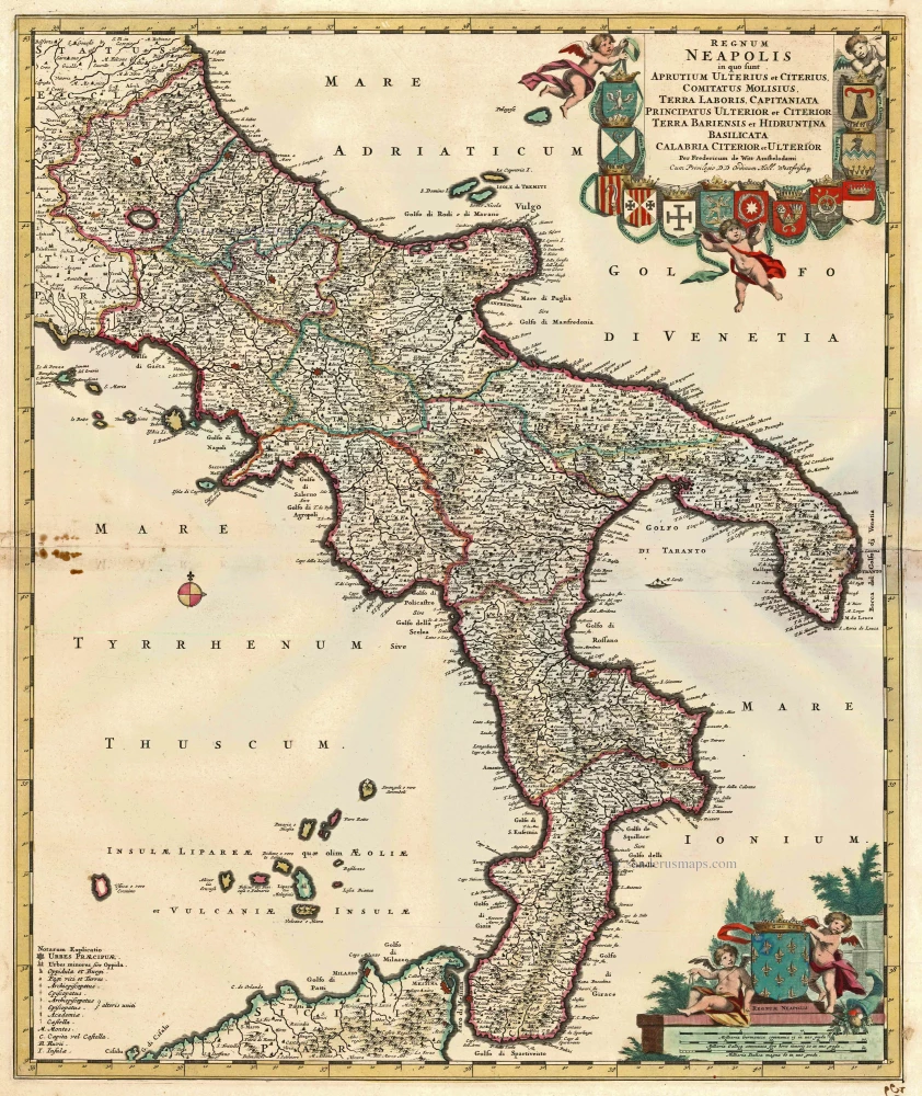
Regnum Neapolis in quo sunt Aprutium Ulterius et Citerius, Comitatus Molisius, Terra Laboris, Capitaniata Orincipatus Ulterior et Citerior Terra Bariensis et Hidruntina Basilicata Calabria Citerior et Ulterior. c. 1680
Napoli (Kingdom) by Frederik de Wit.
[Item number: 14832]
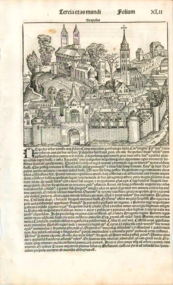
Neapolis. 1493
Naples (Napoli) by Schedel H.
[Item number: 24705]
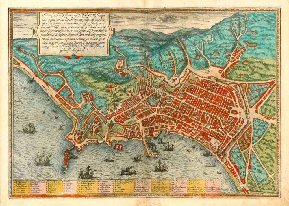
Haec est Nobilis, & Florens Illa Neapolis ... 1582
Napels (Napoli) by Georg Braun & Frans Hogenberg
[Item number: 25328]
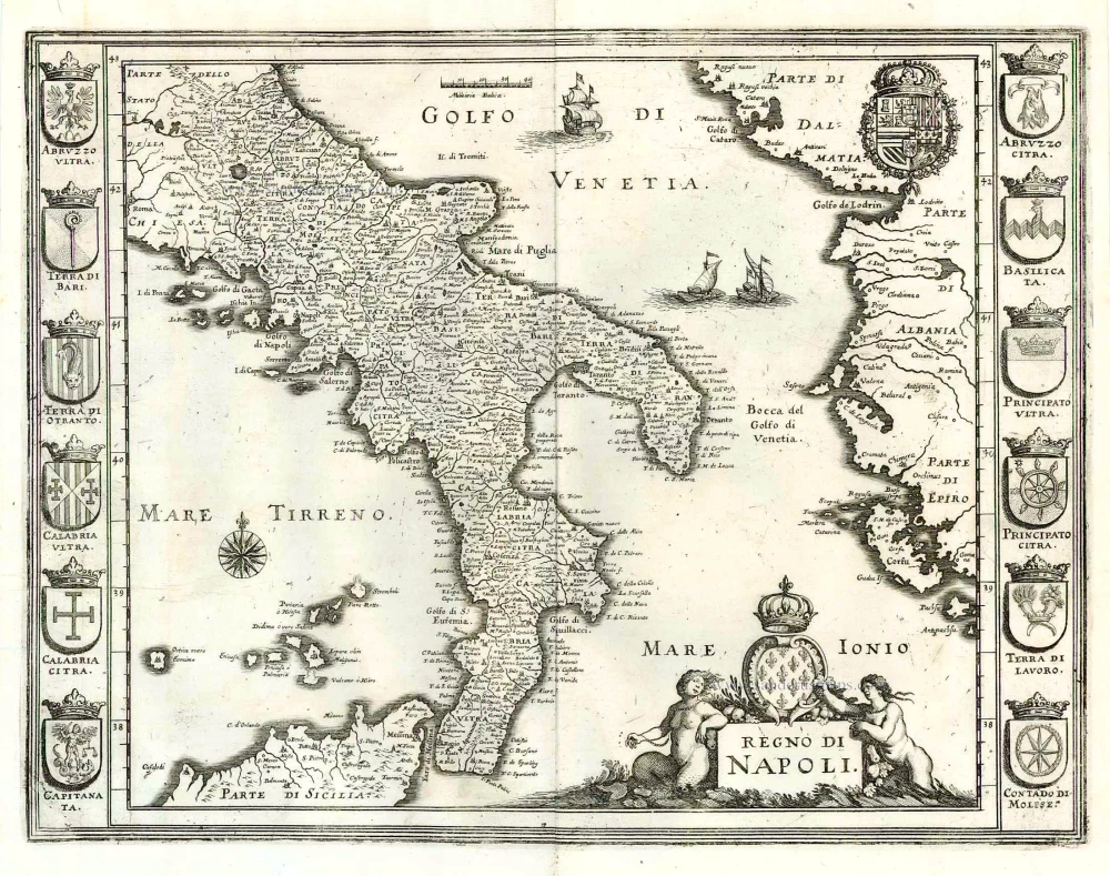
Regno di Napoli. 1638
Southern Italy, by M. Merian.
[Item number: 25925]
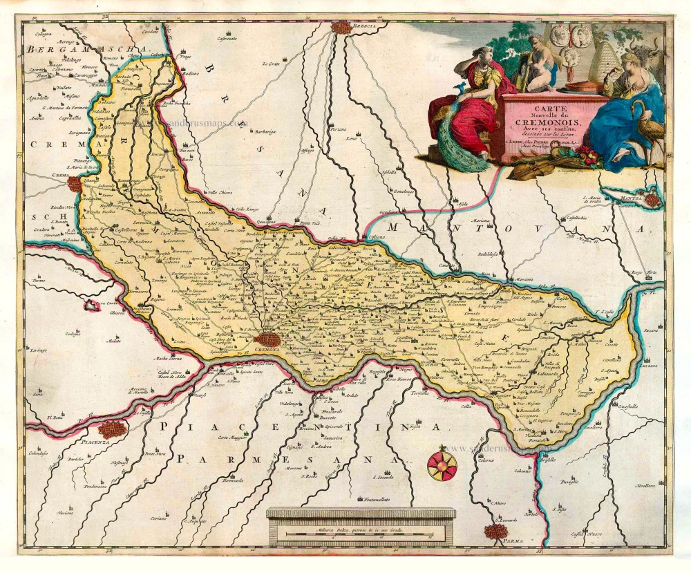
Carte Nouvelle du Cremonois, Avec ses confins. 1713
Cremona by Pieter Van der Aa
[Item number: 26082]
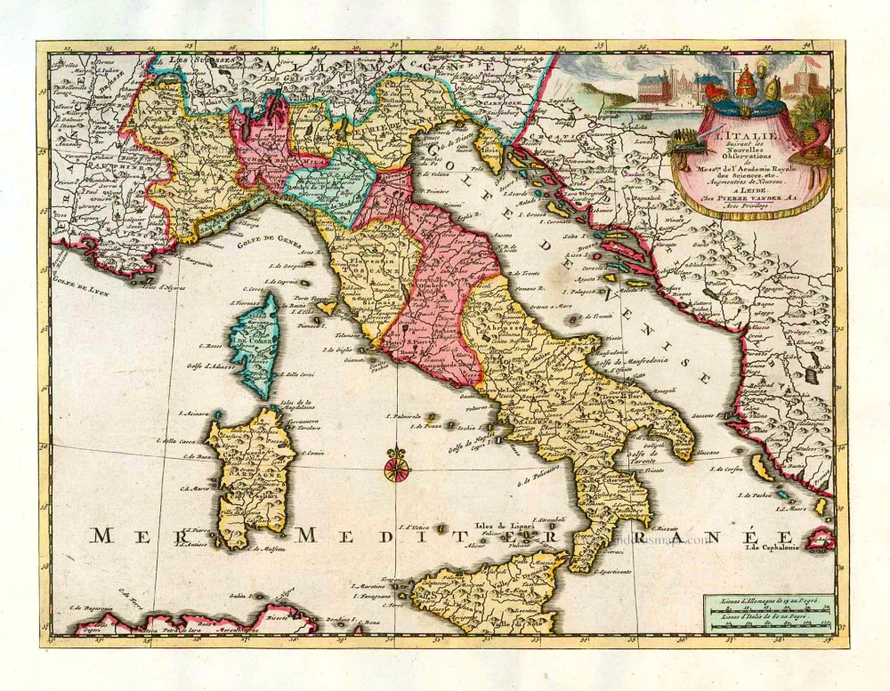
L'Italie. 1713
Italy, by Pieter Van der Aa.
[Item number: 26083]
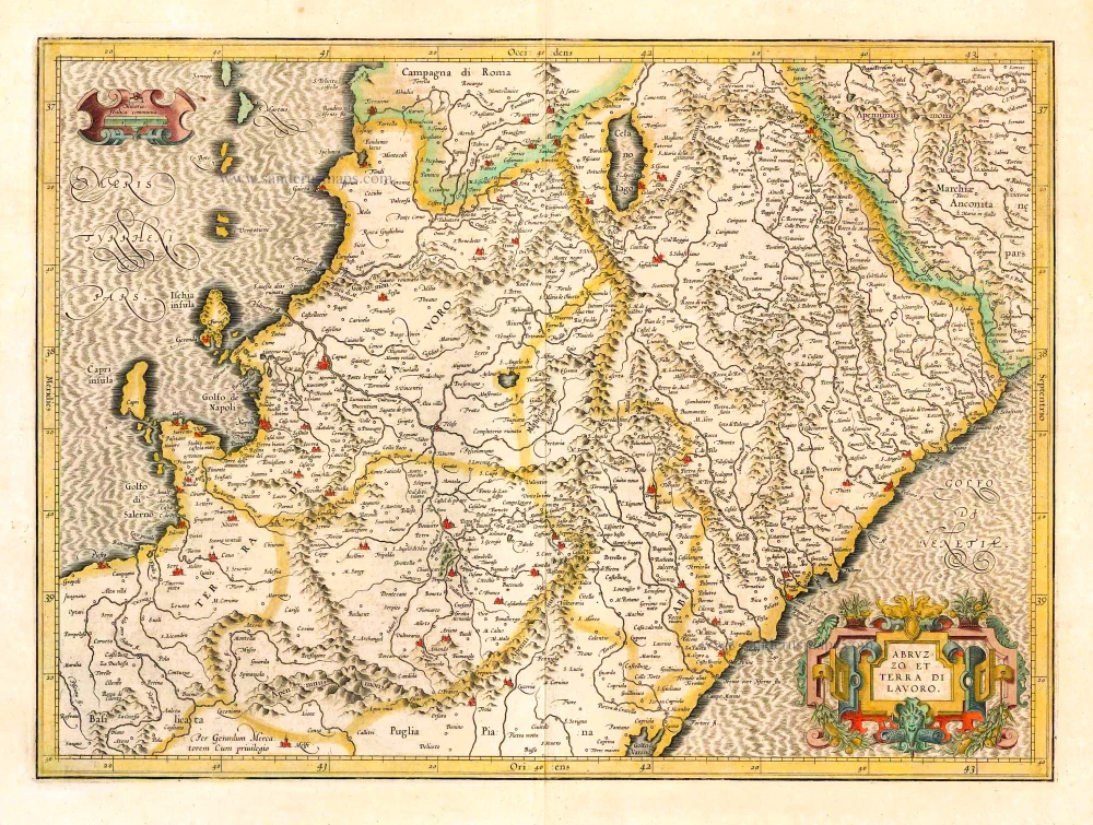
Abruzzo et Terra di Lavoro. 1619
Napoli (North) by Gerard Mercator.
[Item number: 26116]
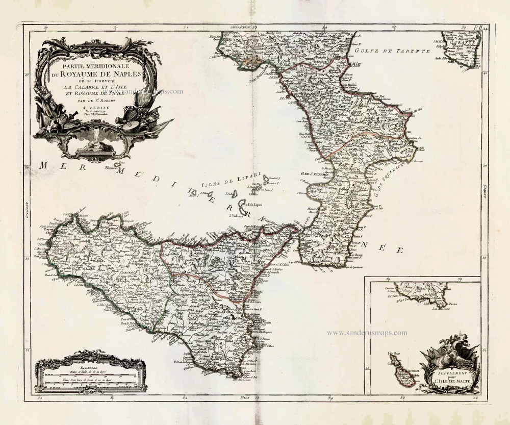
Partie Méridionale du Royaume de Naples ou se trouvent La Calabre et L'Isle et Royaume de Sicile. 1776-79
Kingdom of Naples (South), by Paolo Santini.
[Item number: 27730]
Big and spectacular view
Napoli. 1704
Napels (Napoli), by Pieter Mortier.
[Item number: 27910]
![Profile and map of Capri [on verso:] bird's-eye view plan of Naples (Napoli), by Vincenzo Coronelli.](https://sanderusmaps.com/assets/WEBP/m28887.webp)
Isola di Capri. / La Citta di Napoli. 1696
Profile and map of Capri [on verso:] bird's-eye view plan of Naples (Napoli), by Vincenzo Coronelli.
[Item number: 28887]