
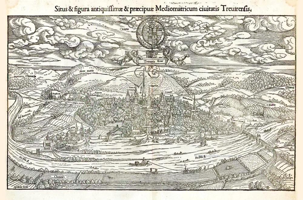
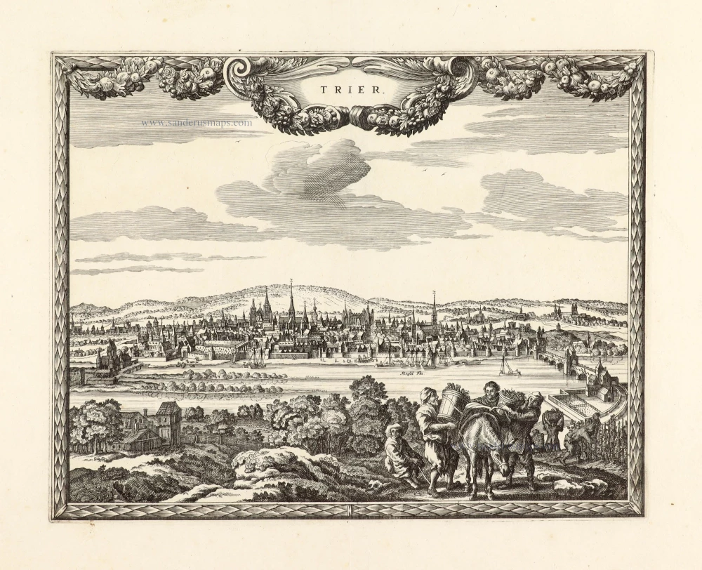
Trier, by S. Münster. 1552
Sebastian Münster (1488-1552)
Sebastian Münster, a German geographer, cartographer, Hebraist, and theologian, was born in Ingelheim, near Mainz In 1505, he went to Heidelberg to enter the Franciscan order. In 1507 he went to Louvain, where he studied mathematics, geography, and astronomy. In 1509 Münster became a student of Konrad Pelikan, who taught Hebrew and Greek as well as mathematics and cosmography. In 1518 he completed his studies at the University of Tübingen. He was the favorite of the famous mathematician and astronomer Johann Stöffler.
In 1524 Münster was appointed professor of Hebrew at Heidelberg University. In 1525 he published his first map as part of a broadside: The Instrument of the Suns combined a map, calendar, astrological almanac, sundial, and nocturnal on one attractive sheet, suitable for wall mounting.
In 1540 he published a Latin edition of Ptolemy's Geographia with illustrations. He based this edition on the Latin translation by Willibald Pirkheimer and produced new maps to supplement the Ptolemaic maps. The twenty-seven maps of the Ptolemaic canon are supplemented by twenty-one new maps. Further editions appeared in 1541 and 1542.
In 1544 he published the Cosmographia, a bulky book with 659 pages and some 520 woodcuts. Maps in this edition included three maps from the Ptolemaic canon and fourteen modern maps (from previous editions of the Geographia), as well as nine new maps. Later editions (1545, 1546, 1548) enlarged the Cosmographia. The 1550 edition contains cities, portraits, and costumes. These editions in both Latin and German constitute the full fruition of Münster's dream of a comprehensive geography.
The Cosmographia was one of the most successful works of the 16th century. It passed through 24 editions in 100 years, in different languages, including Latin, French, Italian, English, and even Czech. The last German edition was published in 1628.
He died at Basel of the plague in 1552.
As a cartographer, Münster deserves special recognition for formulating a plan for a comprehensive and uniform map of a country. As a geographer, his greatest achievement was the Cosmographia. (Karrow).
Situs & figura antiquissimae & praecipuae Mediomatricum civitatis Trevirensis.
Item Number: 26271 Authenticity Guarantee
Category: Antique maps > Europe > Germany - Cities
Old, antique bird's-eye view of Trier, by S. Münster.
Alter, antiker Vogelperspektive von Trier, von Braun & Hogenberg.
Date of the first edition: 1550
Date of this map: 1552
Woodcut, printed on paper.
Size (not including margins): 23 x 38cm (9 x 14.8 inches)
Verso text: Latin
Condition: Excellent.
Condition Rating: A+
References: Fauser, #14235
From: Cosmographiae Universalis Lib. VI. . . . Basle, H. Petri, 1552.
Sebastian Münster (1488-1552)
Sebastian Münster, a German geographer, cartographer, Hebraist, and theologian, was born in Ingelheim, near Mainz In 1505, he went to Heidelberg to enter the Franciscan order. In 1507 he went to Louvain, where he studied mathematics, geography, and astronomy. In 1509 Münster became a student of Konrad Pelikan, who taught Hebrew and Greek as well as mathematics and cosmography. In 1518 he completed his studies at the University of Tübingen. He was the favorite of the famous mathematician and astronomer Johann Stöffler.
In 1524 Münster was appointed professor of Hebrew at Heidelberg University. In 1525 he published his first map as part of a broadside: The Instrument of the Suns combined a map, calendar, astrological almanac, sundial, and nocturnal on one attractive sheet, suitable for wall mounting.
In 1540 he published a Latin edition of Ptolemy's Geographia with illustrations. He based this edition on the Latin translation by Willibald Pirkheimer and produced new maps to supplement the Ptolemaic maps. The twenty-seven maps of the Ptolemaic canon are supplemented by twenty-one new maps. Further editions appeared in 1541 and 1542.
In 1544 he published the Cosmographia, a bulky book with 659 pages and some 520 woodcuts. Maps in this edition included three maps from the Ptolemaic canon and fourteen modern maps (from previous editions of the Geographia), as well as nine new maps. Later editions (1545, 1546, 1548) enlarged the Cosmographia. The 1550 edition contains cities, portraits, and costumes. These editions in both Latin and German constitute the full fruition of Münster's dream of a comprehensive geography.
The Cosmographia was one of the most successful works of the 16th century. It passed through 24 editions in 100 years, in different languages, including Latin, French, Italian, English, and even Czech. The last German edition was published in 1628.
He died at Basel of the plague in 1552.
As a cartographer, Münster deserves special recognition for formulating a plan for a comprehensive and uniform map of a country. As a geographer, his greatest achievement was the Cosmographia. (Karrow).
Related items
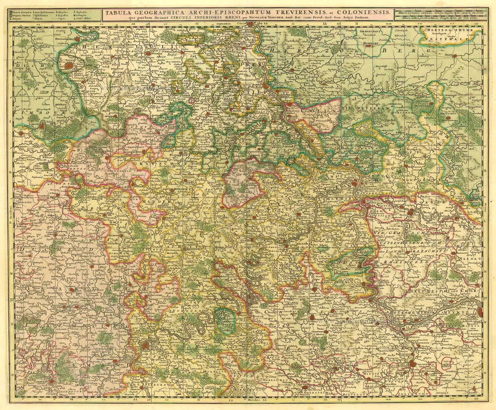
Tabula Geographica Archi-Episcopatum Treviriensis et Coloniensis 1683-1696
Köln - Trier by Visscher N. II
[Item number: 10651]
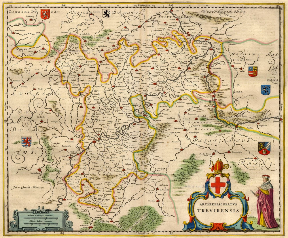
Archiepiscopatus Trevirensis 1668
Trier by Blaeu W. & J.
[Item number: 9654]
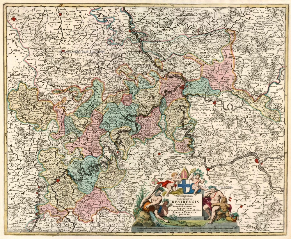
Archiepiscopatus et Electoratus Trevirensis Novissima Delineatio Exacte divisa in Omnes Suas Praefecturas in hac quaqz Tabula Accurate Describitur Eyfalia Tractus. 1721-41
Trier, by F. de Wit - Covens & Mortier.
[Item number: 23836]
Trier 1720
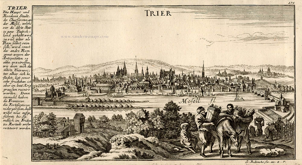
Trier, by Bodenehr G.
[Item number: 13433]
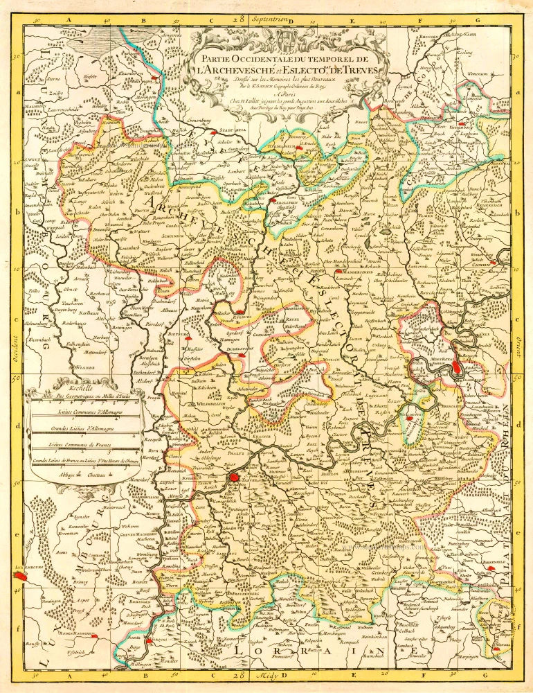
Partie Occidentale du Temporel de l'Archevesche et Eslectorat de Treves 1710
Trier by N. Sanson - H. Jaillot.
[Item number: 23834]

Trier & Lutzenburg 1623
Luxembourg and Trier, by Gerard Mercator.
[Item number: 24918]

Trier. 1658/60
Trier, by N. Visscher & P.H. Schut.
[Item number: 26642]
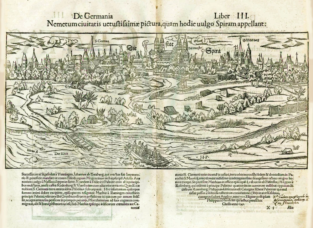
Die Stat Spira. - [Above:] Nemetum civitatis vetustissimae pictura, quam hodie vulgo Spiram appellant. 1552
Speyer, by Sebastian Münster.
[Item number: 26849]
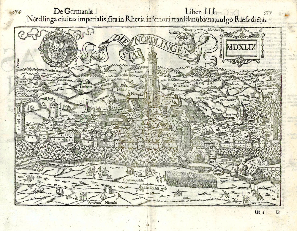
Die Stat Nördlingen. - MDXLIX - Nördlinga civitas imperialis sita in Rhaetia inferiori ... 1552
Nördlingen, by Sebastian Münster.
[Item number: 26862]
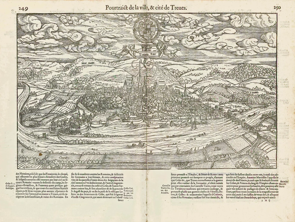
Treveris Trier [Au-dessus de la carte:] Pourtraict de la ville, & cité de Treves. 1575
Trier, by François de Belleforest.
[Item number: 27213]
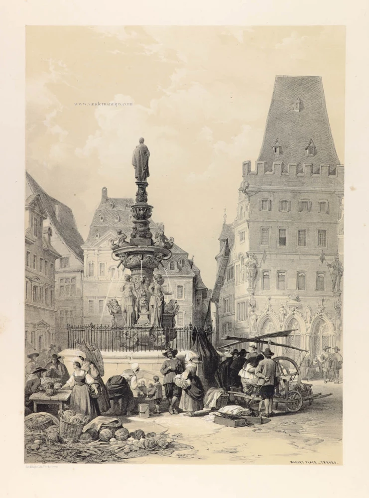
Market Place - Treves. 1842
View of the Market Place in Trier.
[Item number: 30294]
Unrecorded variant of Schut's view of Trier, by Carel Allard
Trier. 1673
View of Trier by Carel Allard.
[Item number: 30562]
new