
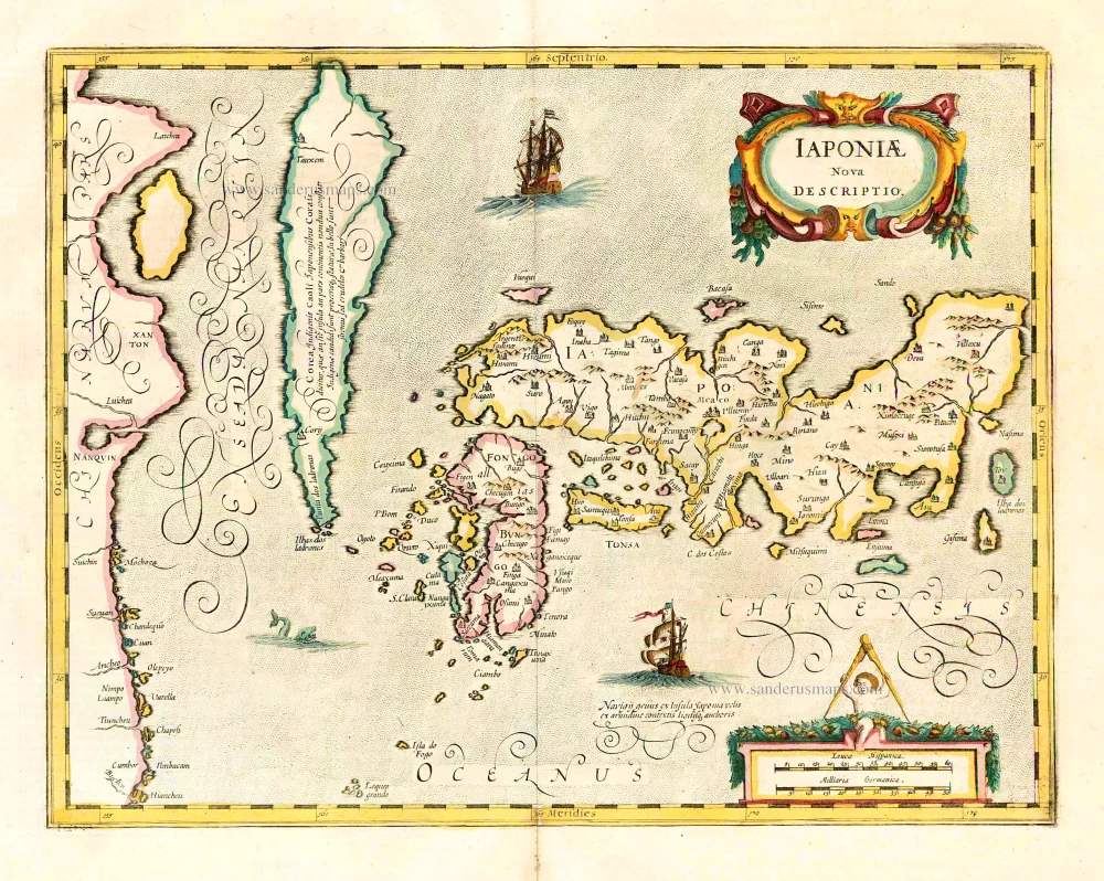
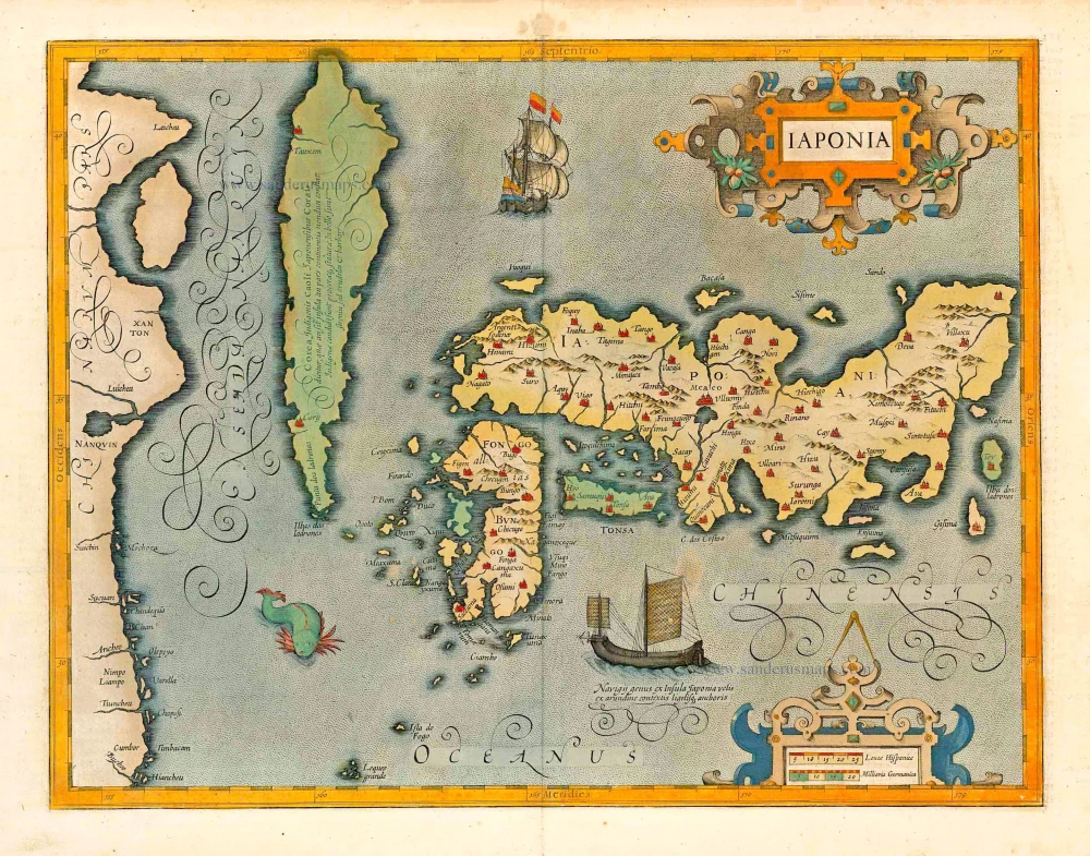
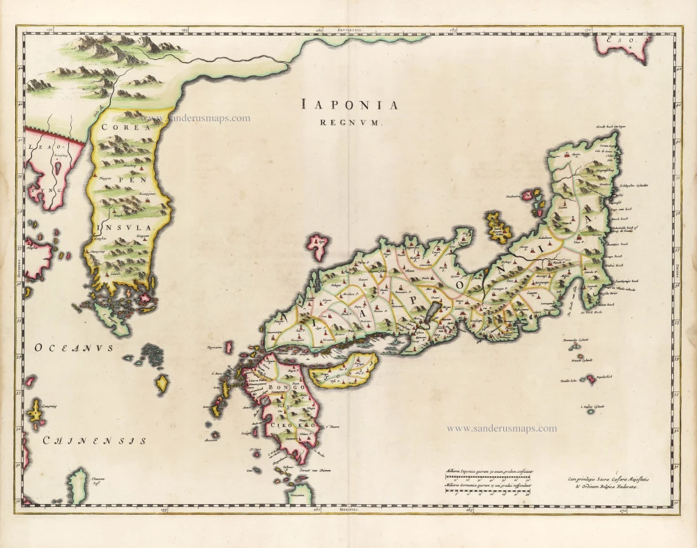
Japan & Korea by Johannes Janssonius 1641

Rare - differs from the earlier Hondius version by different cartouches, title and decorative elements.
The Janssonius Family
Joannes Janssonius (Arnhem, 1588-1664), son of the Arnhem publisher Jan Janssen, married Elisabeth Hondius, daughter of Jodocus Hondius, in Amsterdam in 1612. After his marriage, he settled down in this town as a bookseller and publisher of cartographic material. In 1618, he established himself in Amsterdam next door to Blaeu’s bookshop. He entered into serious competition with Willem Jansz. Blaeu when copying Blaeu’s Licht der Zeevaert after the expiration of the privilege in 1620. His activities concerned the publication of atlases, books, single maps, and an extensive book trade with branches in Frankfurt, Danzig, Stockholm, Copenhagen, Berlin, Koningsbergen, Geneva, and Lyon. In 1631, he began publishing atlases together with Henricus Hondius.
In the early 1640s, Henricus Hondius left the atlas publishing business to Janssonius. Competition with Joan Blaeu, Willem’s son and successor, in atlas production, prompted Janssonius to enlarge his Atlas Novus finally into a work of six volumes, into which a sea atlas and an atlas of the Old World were inserted. Other atlases published by Janssonius are Mercator’s Atlas Minor, Hornius’s historical atlas (1652), the townbooks in eight volumes (1657), Cellarius’s Atlas Coelestis and several sea atlases and pilot guides.
After the death of Joannes Janssonius, the shop and publishing firm were continued by the heirs under the direction of Johannes van Waesbergen (c. 1616-1681), son-in-law of Joannes Janssonius. Van Waesbergen added Janssonius's name to his own.
In 1676, Joannes Janssonius’s heirs sold by auction “all the remaining Atlases in Latin, French, High and Low German, as well as the Stedeboecken in Latin, in 8 volumes, bound and unbound, maps, plates belonging to the Atlas and Stedeboecken.” The copperplates from Janssonius’s atlases were afterwards sold to Schenk and Valck.
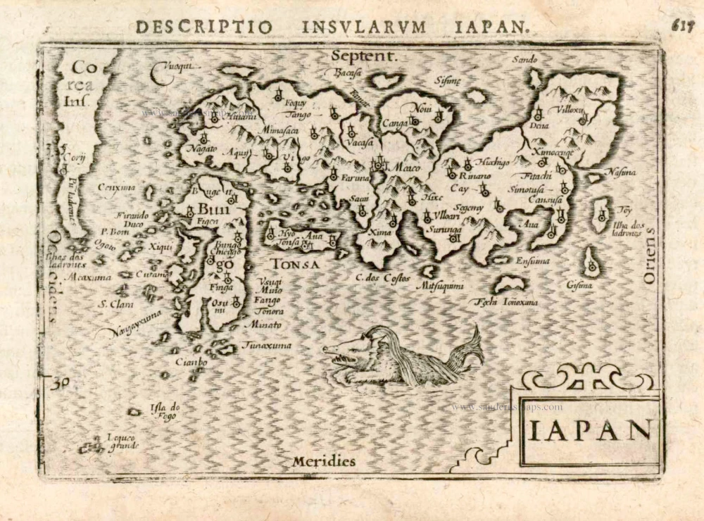
Iaponiae Nova Desciptio.
Item Number: 26441 Authenticity Guarantee
Category: Antique maps > Asia > Japan
Old, antique map of Japan, by J. Janssonius.
Rare - differs from the earlier Hondius version by different cartouches, title and decorative elements.
Date of the first edition: 1636
Date of this map: 1641
Copper engraving, printed on paper.
Size (not including margins): 34 x 44.5cm (13.3 x 17.4 inches)
Verso text: French
Condition: Original coloured, excellent.
Condition Rating: A+
References: Van der Krogt 1, 8450:1A.2; Walter L., OAG 18, cat. no. 23.
From: Nouveau Theatre du Monde ou Nouvel Atlas comprenant Les Tables et Descriptions de toutes les Regions de la Terre. Amsterdam, H. Hondius, 1641. (Van der Krogt 1, 412)
Rare - differs from the earlier Hondius version by different cartouches, title and decorative elements.
The Janssonius Family
Joannes Janssonius (Arnhem, 1588-1664), son of the Arnhem publisher Jan Janssen, married Elisabeth Hondius, daughter of Jodocus Hondius, in Amsterdam in 1612. After his marriage, he settled down in this town as a bookseller and publisher of cartographic material. In 1618, he established himself in Amsterdam next door to Blaeu’s bookshop. He entered into serious competition with Willem Jansz. Blaeu when copying Blaeu’s Licht der Zeevaert after the expiration of the privilege in 1620. His activities concerned the publication of atlases, books, single maps, and an extensive book trade with branches in Frankfurt, Danzig, Stockholm, Copenhagen, Berlin, Koningsbergen, Geneva, and Lyon. In 1631, he began publishing atlases together with Henricus Hondius.
In the early 1640s, Henricus Hondius left the atlas publishing business to Janssonius. Competition with Joan Blaeu, Willem’s son and successor, in atlas production, prompted Janssonius to enlarge his Atlas Novus finally into a work of six volumes, into which a sea atlas and an atlas of the Old World were inserted. Other atlases published by Janssonius are Mercator’s Atlas Minor, Hornius’s historical atlas (1652), the townbooks in eight volumes (1657), Cellarius’s Atlas Coelestis and several sea atlases and pilot guides.
After the death of Joannes Janssonius, the shop and publishing firm were continued by the heirs under the direction of Johannes van Waesbergen (c. 1616-1681), son-in-law of Joannes Janssonius. Van Waesbergen added Janssonius's name to his own.
In 1676, Joannes Janssonius’s heirs sold by auction “all the remaining Atlases in Latin, French, High and Low German, as well as the Stedeboecken in Latin, in 8 volumes, bound and unbound, maps, plates belonging to the Atlas and Stedeboecken.” The copperplates from Janssonius’s atlases were afterwards sold to Schenk and Valck.
Related items
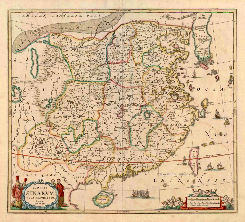
Imperii Sinarum Nova Descriptio. c. 1680.
China with Japan, Korea and Taiwan, by J. Janssonius.
[Item number: 2618]
Iapan. 1602
Japan by Langenes, published by Bertius P.
[Item number: 12487]
Scarce map in old colour
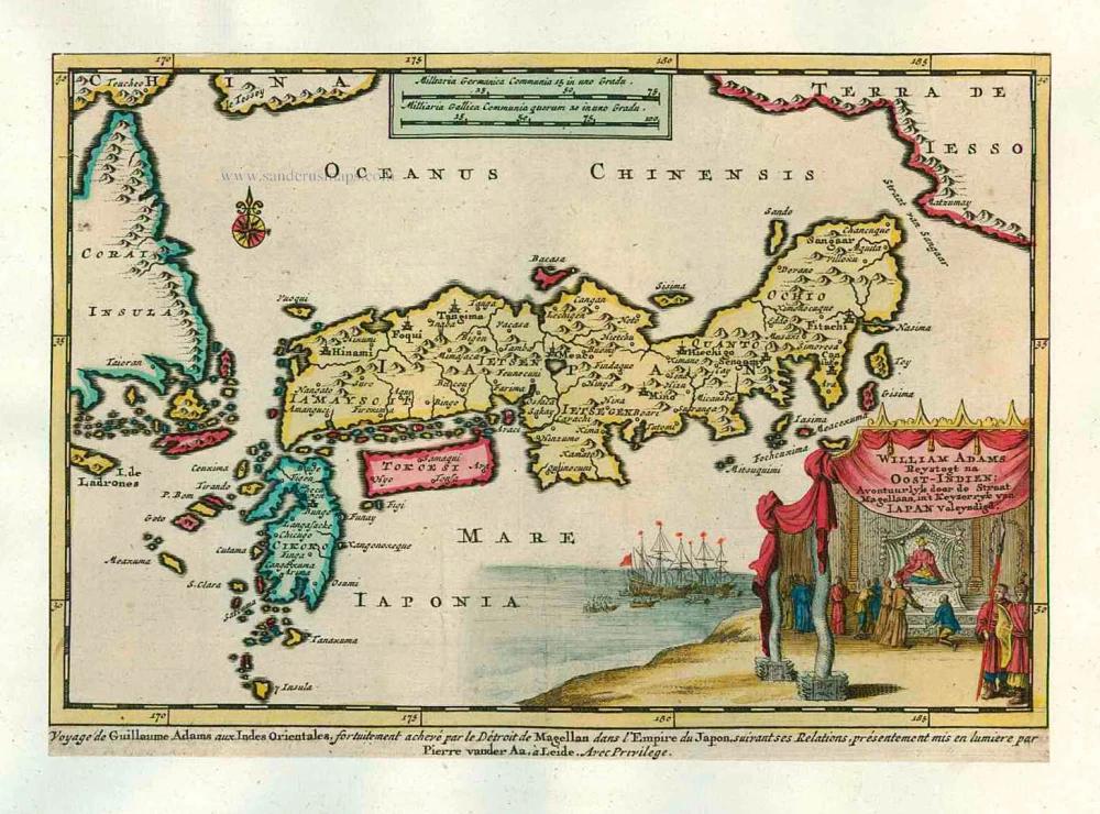
William Adams Reystogt na Oost-Indien; Avontuurlyk door de Straat Magellaan, in't Keyzerryk van Japan Voleyndigd. 1713
Japan by P. Van der Aa
[Item number: 26121]
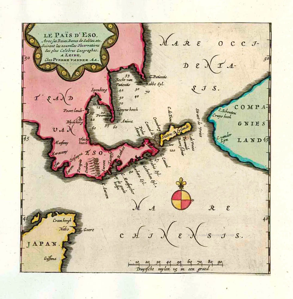
In rare old colour
Le Païs d'Eso, Avec ses Baies, Bancs de Sables, etc. 1713
Eso (Hokkaido), by Pieter van der Aa.
[Item number: 26122]
In rare old colour
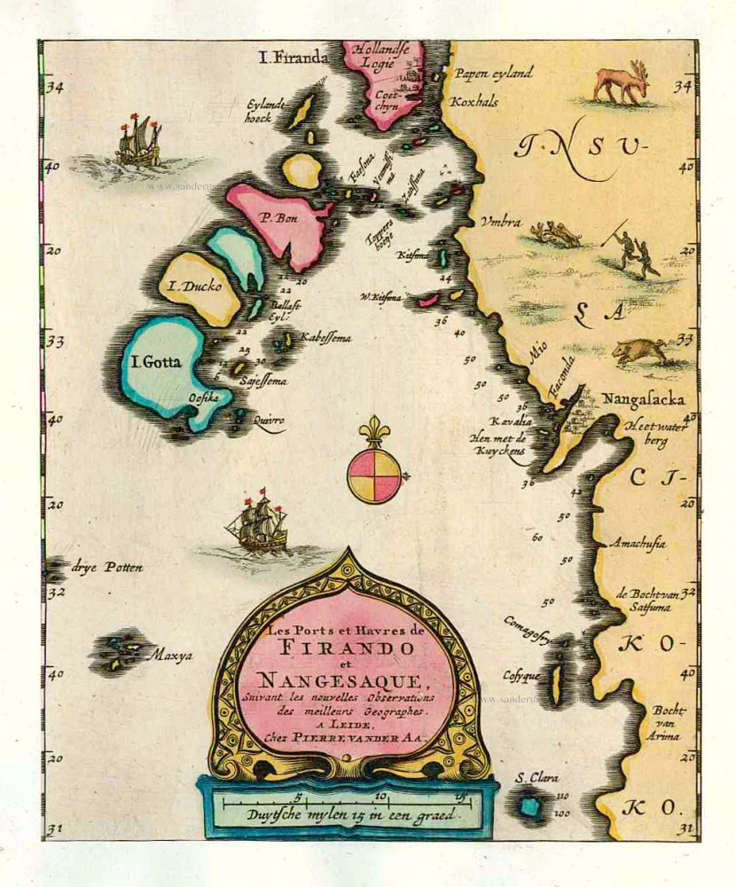
Les Ports et Havres de Firando et Nangesaque. 1713
Nagasaki and Hirado, by Pieter Van der Aa.
[Item number: 26123]
Rare first edition!
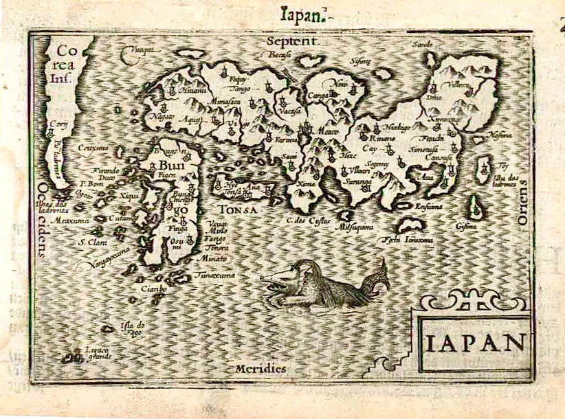
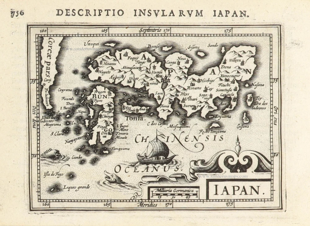
Iapan. 1598
Japan by Barent Langenes & Cornelis Claesz
[Item number: 26543]
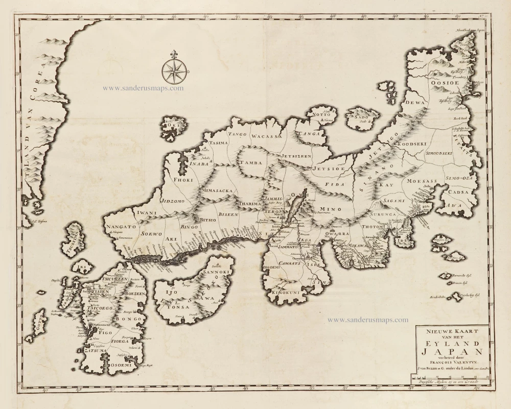
Nieuwe kaart van het Eyland Japan. 1724-26
Japan by François Valentyn (Valentijn).
[Item number: 26876]
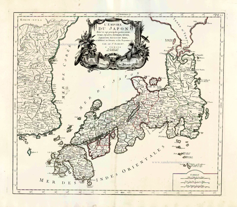
L'Empire du Japon Divisé en sept principales parties, savoir, Ochio, Quanto, Jetsegen, Jetsen, Jamaisoit, Xicoco et Ximo, et subdivisé en soixante et six Royaumes. 1776-79
Japan, by Francesco Santini.
[Item number: 26975]
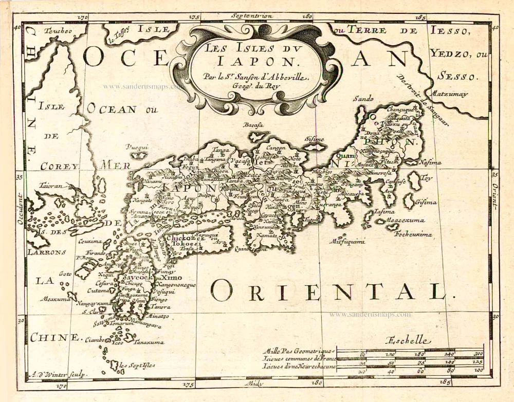
Les Isles du Iapon. 1683
Japan, by Nicolas Sanson.
[Item number: 27081]
Very nice old colour
Iaponia. 1623
Japan, Jodocus Hondius.
[Item number: 27819]
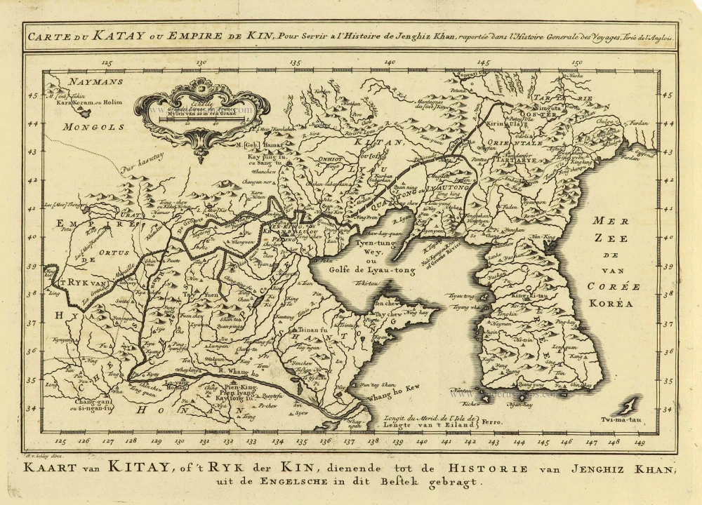
Carte du Katay, ou Empire de Kin. 1750
China - Korea by Jacques Nicolas Bellin.
[Item number: 28177]

The first accurate European map of Japan.
Iaponiae Insulae Descriptio. 1609
Japan by Abraham Ortelius.
[Item number: 28433]
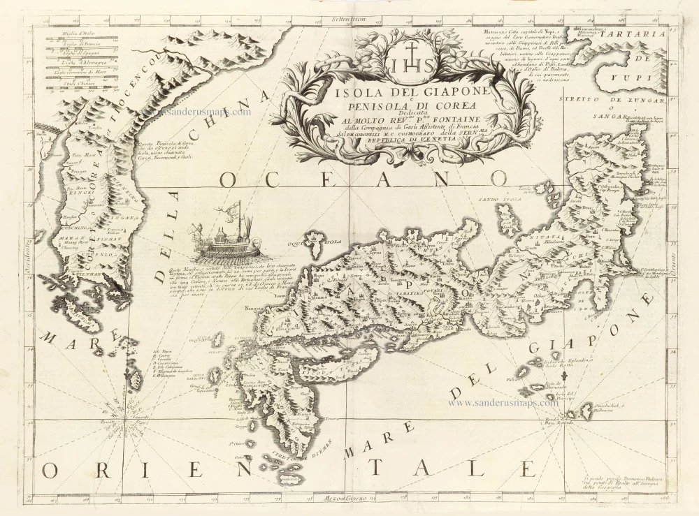
Isola del Giapone e Penisola di Corea. 1696
Japan - Korea by Vincenzo Coronelli.
[Item number: 28757]
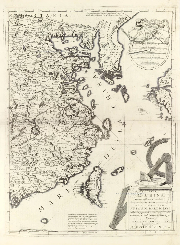
Parte Orientale della China, 1696
Eastern part of China with Korea and Formosa (Taiwan), by Vincenzo Coronelli.
[Item number: 28775]
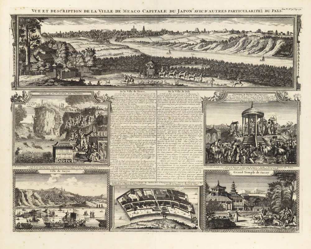
Vue et Description de la Ville de Meaco, Capitale du Japon avec d'autres Particularitez du Pays. 1719
Meaco (Kyoto - Japan), by Z. Châtelain.
[Item number: 29373]
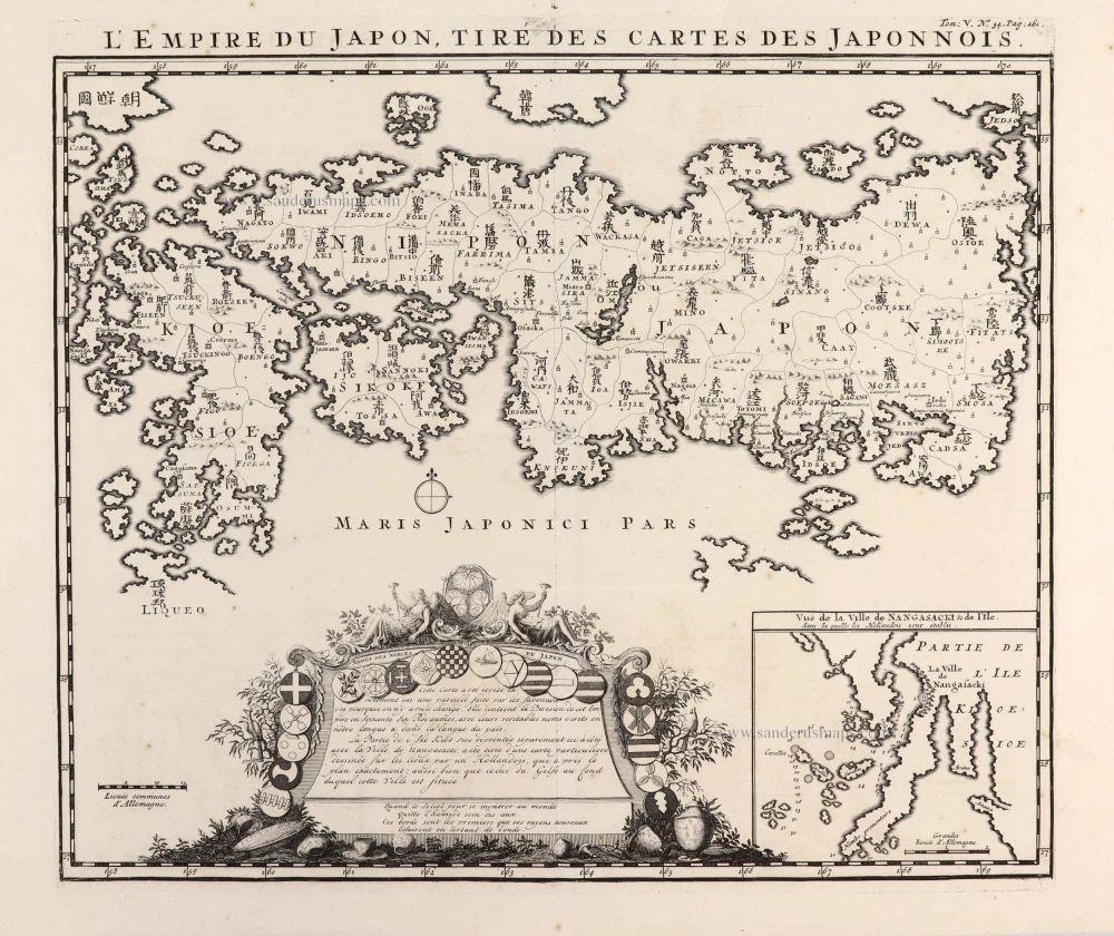
L'Empire du Japon, tiré des Cartes des Japonnois. 1719
Japan, by Z. Châtelain.
[Item number: 29379]
First map to show Korea as a peninsula. Excellent condition.
Iaponia Regnum. 1655-1659
Japan & Korea by Joan Blaeu.
[Item number: 29853]
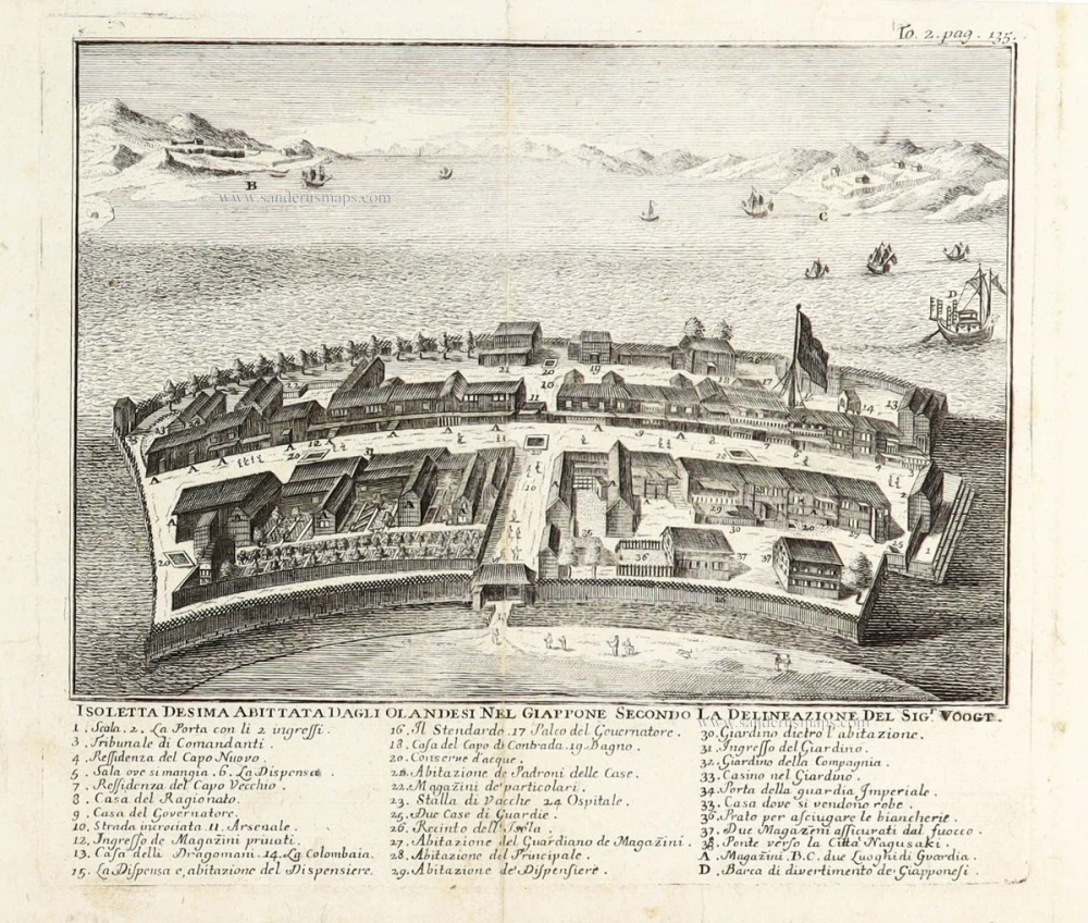
Isoletta Desima abittata dagli Olandeis nel Giappone secondo la delineazione del Sigr. Voogt. 1736
Deshima (Dejima - Japan) by Thomas Salmon after Gerrits Voogt.
[Item number: 29892]
Scarce
Iapan. 1616
Japan by Petrus Bertius, published by Jodocus Hondius jr.
[Item number: 30244]
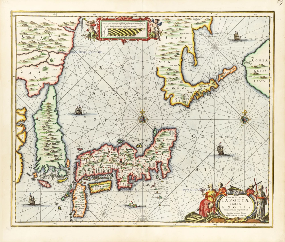
Nova et Accurata Iaponiae, Terrae Esonis, ac Insularum Adjacentium. 1666
Japan - Korea by Johannes Janssonius
[Item number: 30335]