
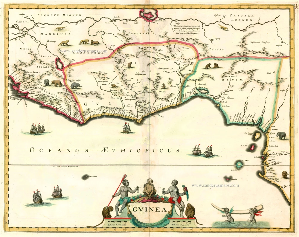
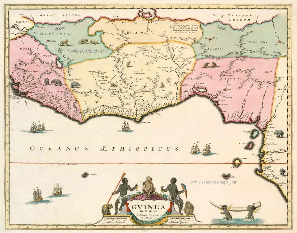
Guinea by F. De Wit. c. 1680
Frederick de Wit (1630-1706)
The engraver and map-seller, Frederick de Wit, was born in Gouda (Netherlands) in 1630 as a son of Hendrick Fredericksz de Wit. Through his marriage with Maria van der Waag of Amsterdam in 1661, he obtained citizenship of the city where he had been working since 1648 and where he became one of the most famous engravers of maps of the second half of the 17th century. Although De Wit was a Catholic, which meant that he was not favoured at the time by the city council, he was awarded the honour of being listed as one of the "excellent citizens" on the roll of the city council in the years 1694-1704. However, his name was not written in the Guild of St. Luke book before 1664. At that time, he lived on the Kalverstraat "in de Witte Pascaert", where he stayed until his death in 1706. His earliest dates on maps engraved are 1659 (Regni Daniae) and 1660 (World map).
Frederick de Wit published several world atlases, a sea atlas, and an atlas of the Netherlands.
The dating of the maps is difficult. However, as a privilege was granted in 1689, the annotation 'cum privilegio' marks an edition after 1688.
Around 1700, Frederick de Wit entered the market with a town atlas. He produced two volumes with a total of 260 plans and views. Most were printed from plates used for Janssonius and Blaeu town atlases.
After he died in 1706, his widow continued the shop until 1709. The plates and stock of De Wit's atlas were sold to Covens & Mortier in 1710, who sold the atlas for an extended period.
Guinea
Item Number: 2646 Authenticity Guarantee
Category: Antique maps > Africa
Old, antique map of Guinea, by Frederik De Wit.
Title: Guinea
Cartographer: F. De Wit.
Copper engraving, printed on paper.
Size (not including margins): 420 x 535mm (16.54 x 21.06 inches).
Verso: Blank.
Condition: Old coloured, excellent.
Condition Rating: .
From: Composite Atlas by F. De Wit, c. 1680.
Frederick de Wit (1630-1706)
The engraver and map-seller, Frederick de Wit, was born in Gouda (Netherlands) in 1630 as a son of Hendrick Fredericksz de Wit. Through his marriage with Maria van der Waag of Amsterdam in 1661, he obtained citizenship of the city where he had been working since 1648 and where he became one of the most famous engravers of maps of the second half of the 17th century. Although De Wit was a Catholic, which meant that he was not favoured at the time by the city council, he was awarded the honour of being listed as one of the "excellent citizens" on the roll of the city council in the years 1694-1704. However, his name was not written in the Guild of St. Luke book before 1664. At that time, he lived on the Kalverstraat "in de Witte Pascaert", where he stayed until his death in 1706. His earliest dates on maps engraved are 1659 (Regni Daniae) and 1660 (World map).
Frederick de Wit published several world atlases, a sea atlas, and an atlas of the Netherlands.
The dating of the maps is difficult. However, as a privilege was granted in 1689, the annotation 'cum privilegio' marks an edition after 1688.
Around 1700, Frederick de Wit entered the market with a town atlas. He produced two volumes with a total of 260 plans and views. Most were printed from plates used for Janssonius and Blaeu town atlases.
After he died in 1706, his widow continued the shop until 1709. The plates and stock of De Wit's atlas were sold to Covens & Mortier in 1710, who sold the atlas for an extended period.
Related items
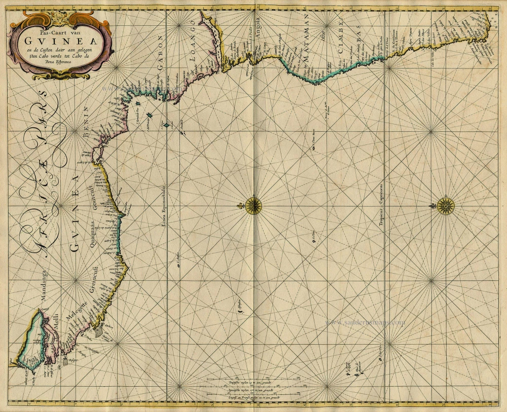
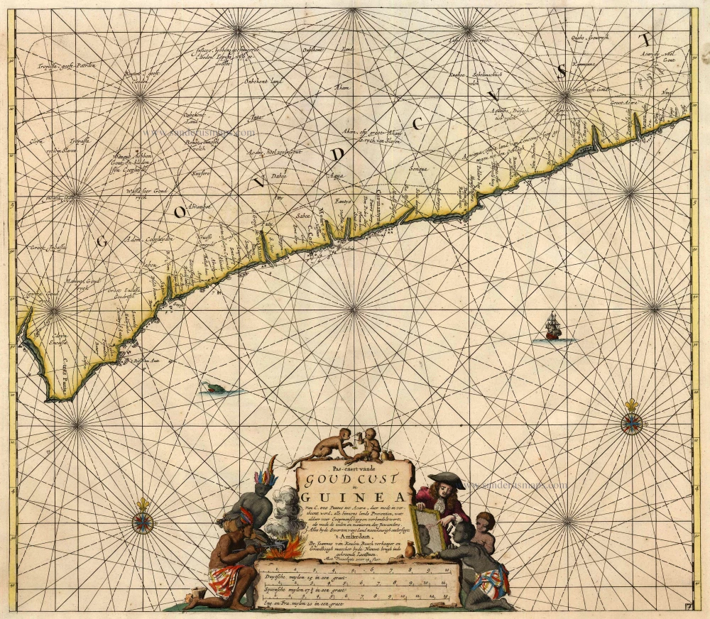
Pas-Caart van Guinea en de Custen daer aen Gelegen van Cabo Verde tot Cabo de Bona Esperanca 1667
Sea chart of Guinea, by Pieter Goos.
[Item number: 19060]
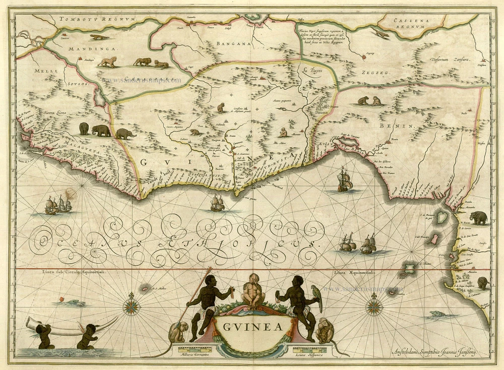
Guinea c. 1658
Guinea, by Janssonius J.
[Item number: 19543]
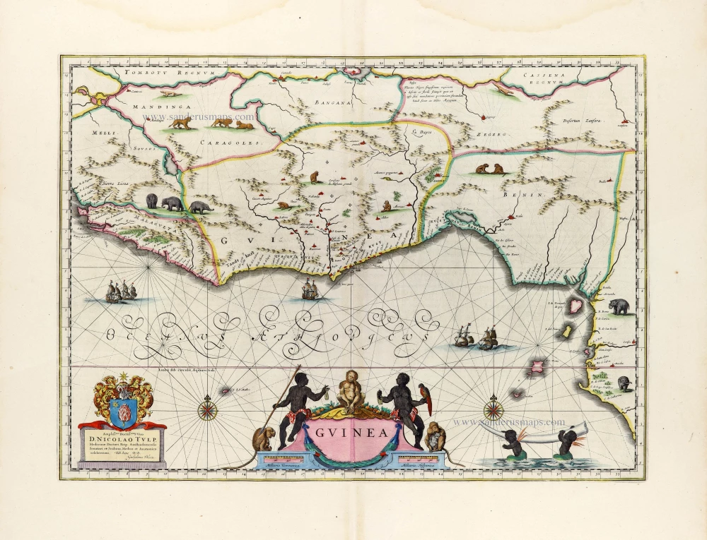
Guinea 1664
Guinea by Blaeu J.
[Item number: 12151]
Pas-Caert vande Goud Cust in Guinea van C. Tres Puntas tot Acara ... 1683
Sea chart of Guinea, by Van Keulen Johannes.
[Item number: 4059]

Pascaert vande Bocht van Benin, Tary Ardra en Rio de Lagos, van Acra tot C. Formosa 1683
The Gulf of Benin (West Africa), by Van Keulen Johannes.
[Item number: 9587]
Guinea 1721-41
Guinea, by F. De Wit after W. Blaeu.
[Item number: 23613]
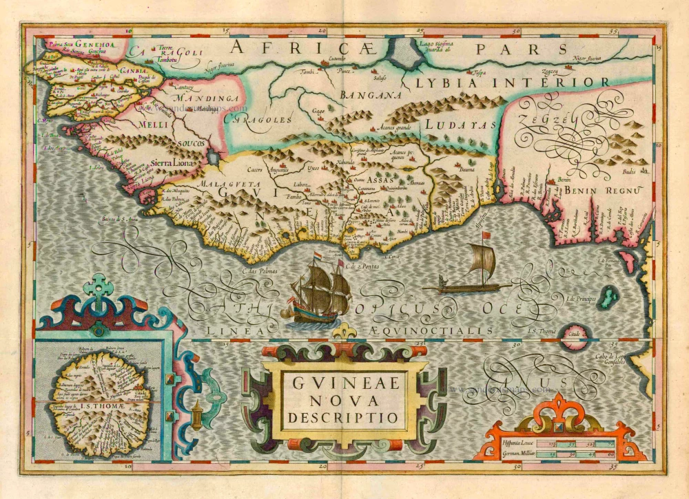
Guineae Nova Descriptio. 1623
Guinea, by Jodocus Hondius.
[Item number: 21985]

Pascaerte van Guinea, tusschen C. Verde, tot Cabo de bona Esperanca. 1661
Sea chart of Guinea, by J. Van Loon.
[Item number: 24328]
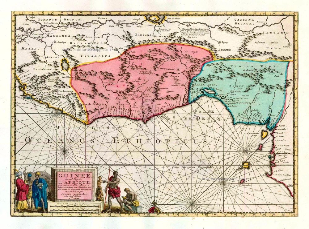
Guinée, Grand Pays de L'Afrique, avec toutes ses Côtes, Havres et Rivieres. 1713
Guinea, by Pieter van der Aa.
[Item number: 26156]
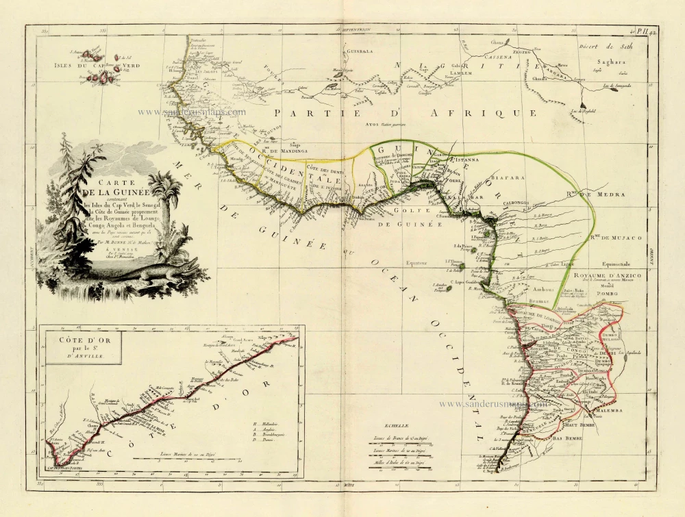
Carte de la Guinée contenant les Isles du Cap Verd, le Senegal, la Côte de Guinée proprement dite, les Royaumes de Loango, Congo, Angola et Benguela, avec les Pays voisins autant qu ils sont connus. 1776-79
West Africa, by Francesco Santini.
[Item number: 28100]
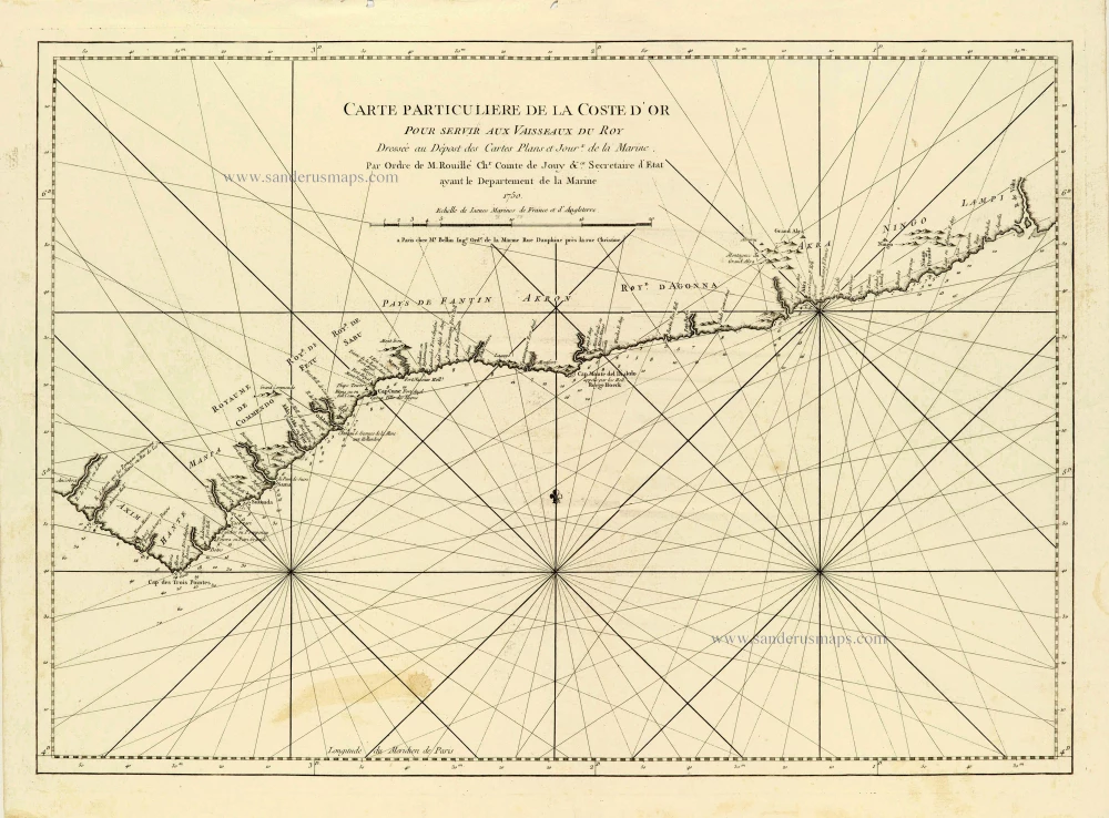
Carte Particulière de la Coste d'Or. 1756-1770
African Gold Coast (Guinea), by J.N. Bellin.
[Item number: 28125]
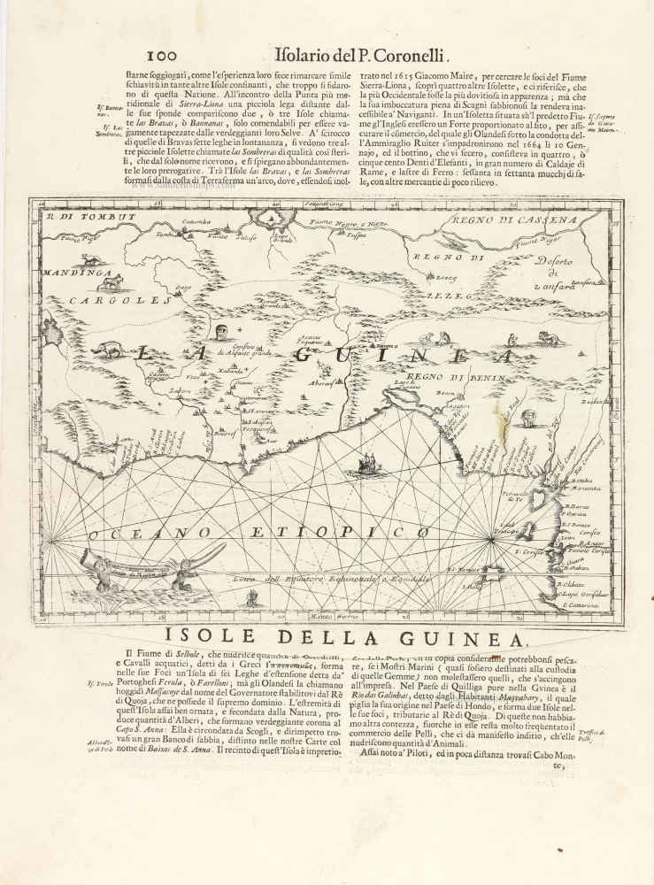
La Guinea. 1696
Guinea, by Vincenzo Coronelli.
[Item number: 29023]
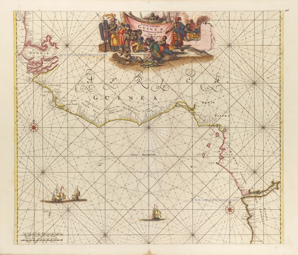
Tractus Littorales Guineae a Promontorio Verde usque ad Sinum Catenbelae. c. 1691-97
Tropical Atlantic Coast of Africa, by Frederick de Wit.
[Item number: 29258]