
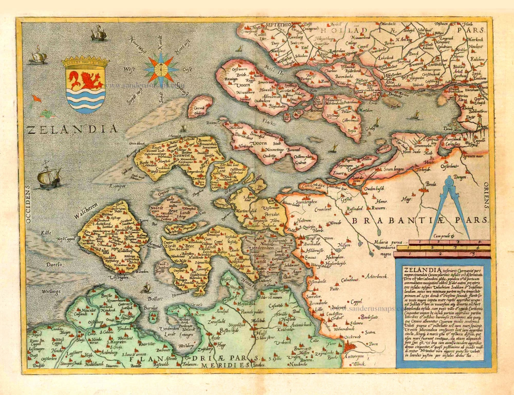
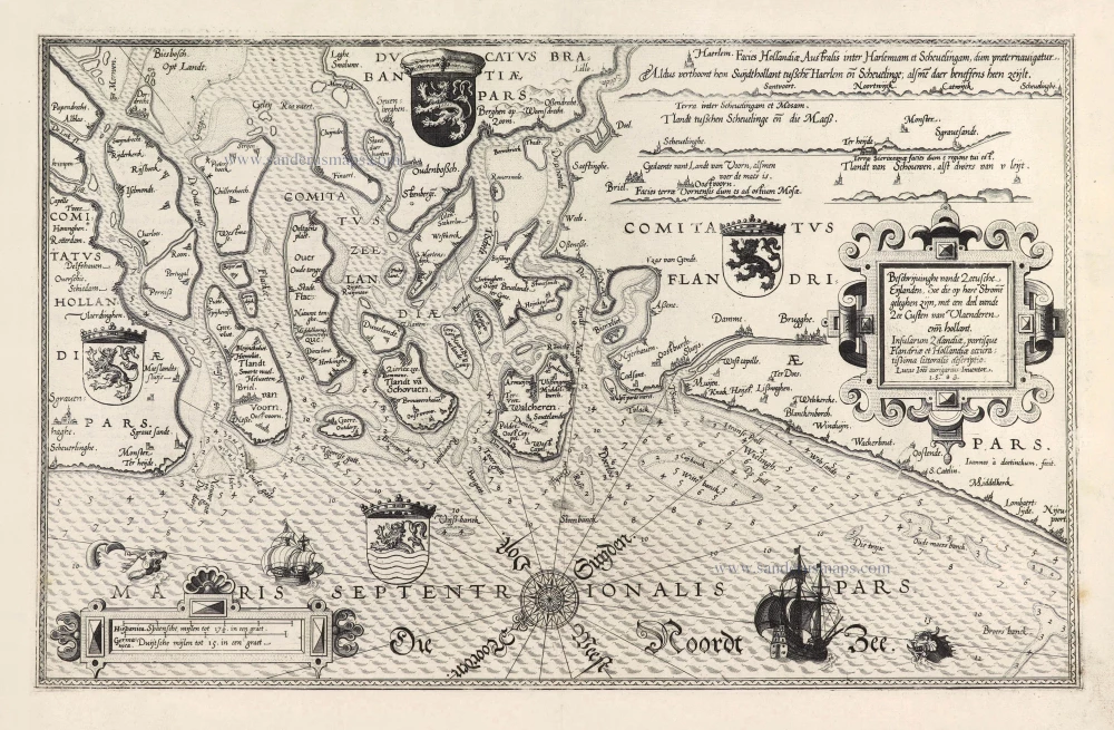
Zeeland, by Gerard de Jode. 1578


"In 1578, Gerard de Jode published his Speculum Orbis Terrarum, an atlas aimed at competing with the Theatrum of Ortelius. However, the latter had first been issued in 1570 and had already built a commanding market presence, so despite de Jode's long-standing reputation, the atlas did not sell very well. Only a dozen or so examples have survived. Undeterred, he made plans for another expanded edition, and upon his death in 1591, it was taken on by his son Cornelis. The Speculum Orbis Terrae of 1593 likewise did not sell well and was never reissued. Although more examples than the first edition have survived, it too is very scarce. Many of de Jode's maps are judged to be superior to those of Ortelius, both in detail and style."
Gerard and Cornelis de Jode
Gerard de Jode (Judaeus) (1508(?)-1591), a native of Nijmegen, began his career as a printer and engraver in Antwerp about 1550. He lived near the Bourse on the Catelijne Veste, or on "de Catte". He was in regular contact with Christoffel Plantin, to whom he sold many prints and maps. De Jode's business, which must have been a major one among Antwerp's many booksellers and printers, was represented at the Frankfurt fair, where de Jode bought maps that he later copied or re-sold. Most of the maps sold by De Jode have prototypes of Italian or German origin. Apart from his many separately published maps, Gerard de Jode is known for his atlas, Speculum Orbis Terrarum, published in 1578. Part of the engraving was done by himself, and part by brothers Jan and Lucas van Doetecum.
Gerard de Jode and Abraham Ortelius, who partly lived as map sellers, were competitors and only sometimes on good terms.
After the death of Gerard de Jode in 1591, the business was carried on by his widow, Pascale van Gelder and his son, Cornelis (1568-1600). More a publisher than an engraver, the latter reissued the Speculum in 1593, adding new maps and revising others.
Despite all its deficiencies, the Speculum must have had a good reputation. It is mentioned alongside Mercator's Atlas and Ortelius's Theatrum in Petrus Montanus's preface to the Germania Inferior of Pieter van den Keere.
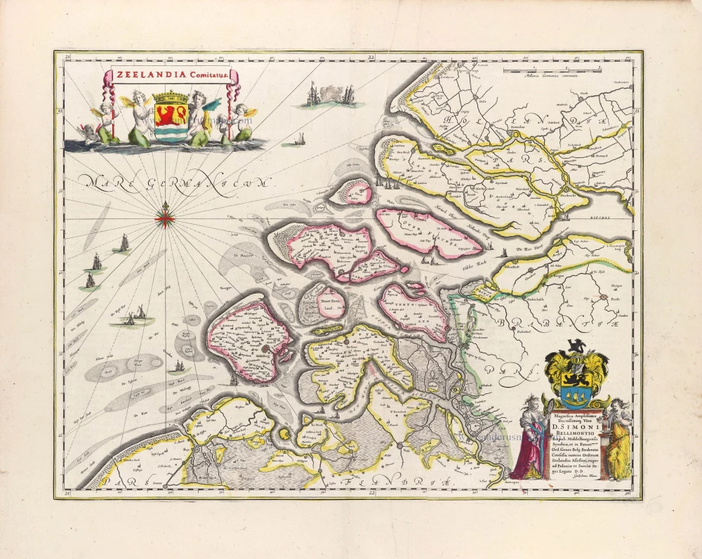
Zelandia.
Item Number: 26530 Authenticity Guarantee
Category: Antique maps > Europe > The Netherlands
Old antique map of Zeeland, by Gerard de Jode.
Title: Zelandia.
Cartographer: Zelandia..
Date of the first edition: 1578.
Date of this map: 1578.
RARE FIRST EDITION.
Copper engraving, printed on paper.
Size (not including margins): 360 x 480mm (14.17 x 18.9 inches).
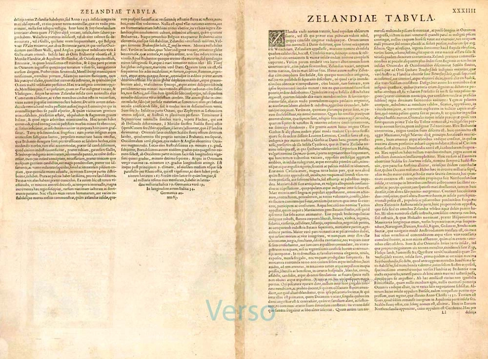
Verso: Latin text.
Condition: Original coloured, excellent.
Condition Rating: A+.
From: Speculum Orbis Terrae. Antwerp, G. De Jode, 1578. (Van der Krogt 3, 32:01)
"In 1578, Gerard de Jode published his Speculum Orbis Terrarum, an atlas aimed at competing with the Theatrum of Ortelius. However, the latter had first been issued in 1570 and had already built a commanding market presence, so despite de Jode's long-standing reputation, the atlas did not sell very well. Only a dozen or so examples have survived. Undeterred, he made plans for another expanded edition, and upon his death in 1591, it was taken on by his son Cornelis. The Speculum Orbis Terrae of 1593 likewise did not sell well and was never reissued. Although more examples than the first edition have survived, it too is very scarce. Many of de Jode's maps are judged to be superior to those of Ortelius, both in detail and style."
Gerard and Cornelis de Jode
Gerard de Jode (Judaeus) (1508(?)-1591), a native of Nijmegen, began his career as a printer and engraver in Antwerp about 1550. He lived near the Bourse on the Catelijne Veste, or on "de Catte". He was in regular contact with Christoffel Plantin, to whom he sold many prints and maps. De Jode's business, which must have been a major one among Antwerp's many booksellers and printers, was represented at the Frankfurt fair, where de Jode bought maps that he later copied or re-sold. Most of the maps sold by De Jode have prototypes of Italian or German origin. Apart from his many separately published maps, Gerard de Jode is known for his atlas, Speculum Orbis Terrarum, published in 1578. Part of the engraving was done by himself, and part by brothers Jan and Lucas van Doetecum.
Gerard de Jode and Abraham Ortelius, who partly lived as map sellers, were competitors and only sometimes on good terms.
After the death of Gerard de Jode in 1591, the business was carried on by his widow, Pascale van Gelder and his son, Cornelis (1568-1600). More a publisher than an engraver, the latter reissued the Speculum in 1593, adding new maps and revising others.
Despite all its deficiencies, the Speculum must have had a good reputation. It is mentioned alongside Mercator's Atlas and Ortelius's Theatrum in Petrus Montanus's preface to the Germania Inferior of Pieter van den Keere.
Related items
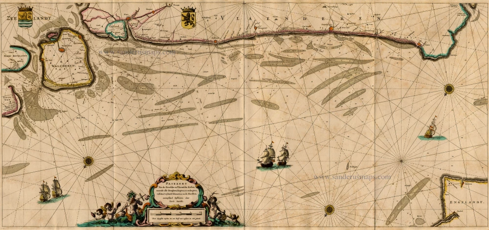
Paskaert van de Zeeusche en Vlaemsche Kusten, tonende Alle Drooghten, Diepten, en Ondiepten, tusschen t'Eylandt Schouwen en de Hoofden, Curieuselyck Beschreven door Dirck Davidsz 1667
Sea chart of Flanders (Vlaanderen) & Zeeland, by Pieter Goos.
[Item number: 19054]
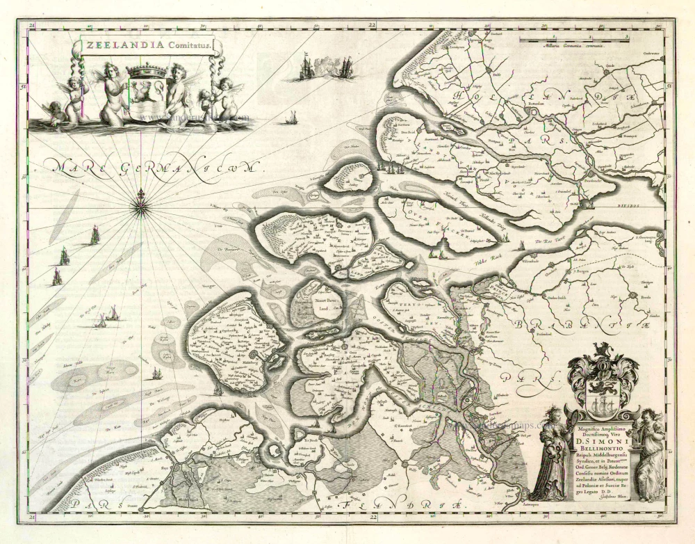
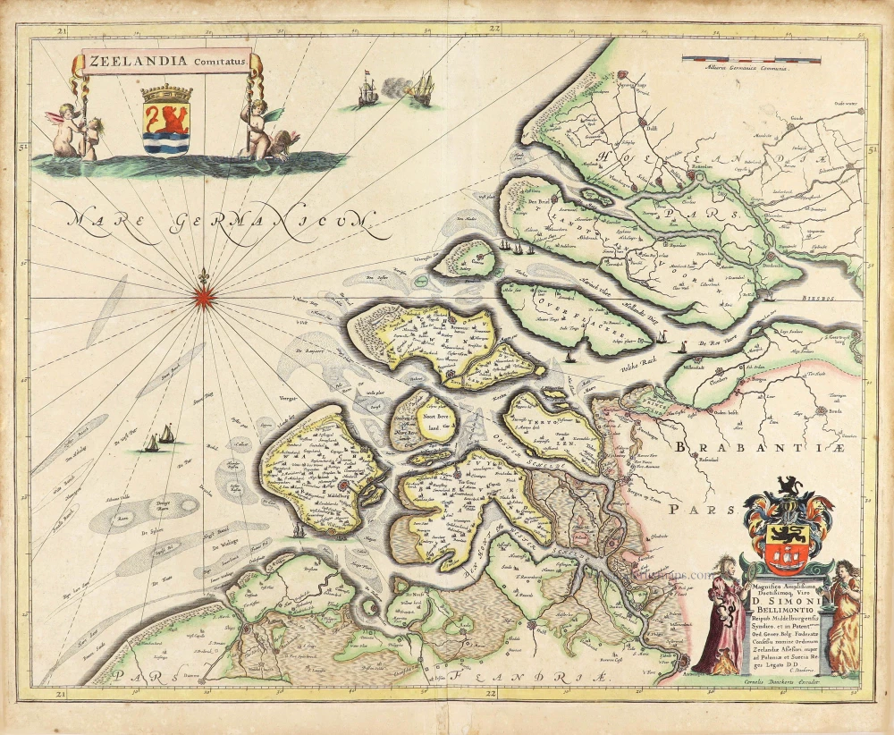
Zeelandia Comitatus 1635
Zeeland by Willem Blaeu.
[Item number: 3626]
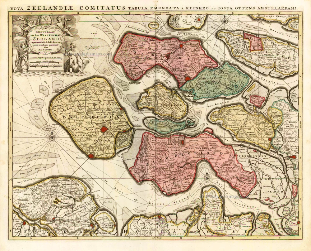
Nieuwe Kaart van het Graafschap Zeeland. 1730-45
Zeeland, by Ottens R. & I.
[Item number: 25736]
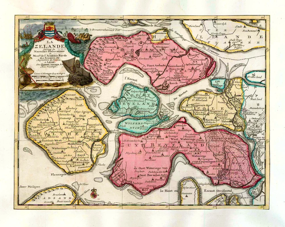
La Zelande. 1713
Zeeland, by Pieter Van der Aa.
[Item number: 26058]
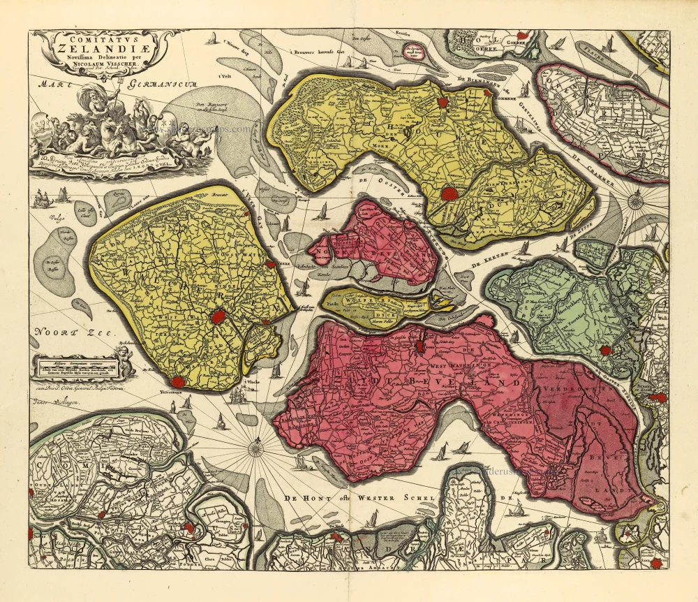
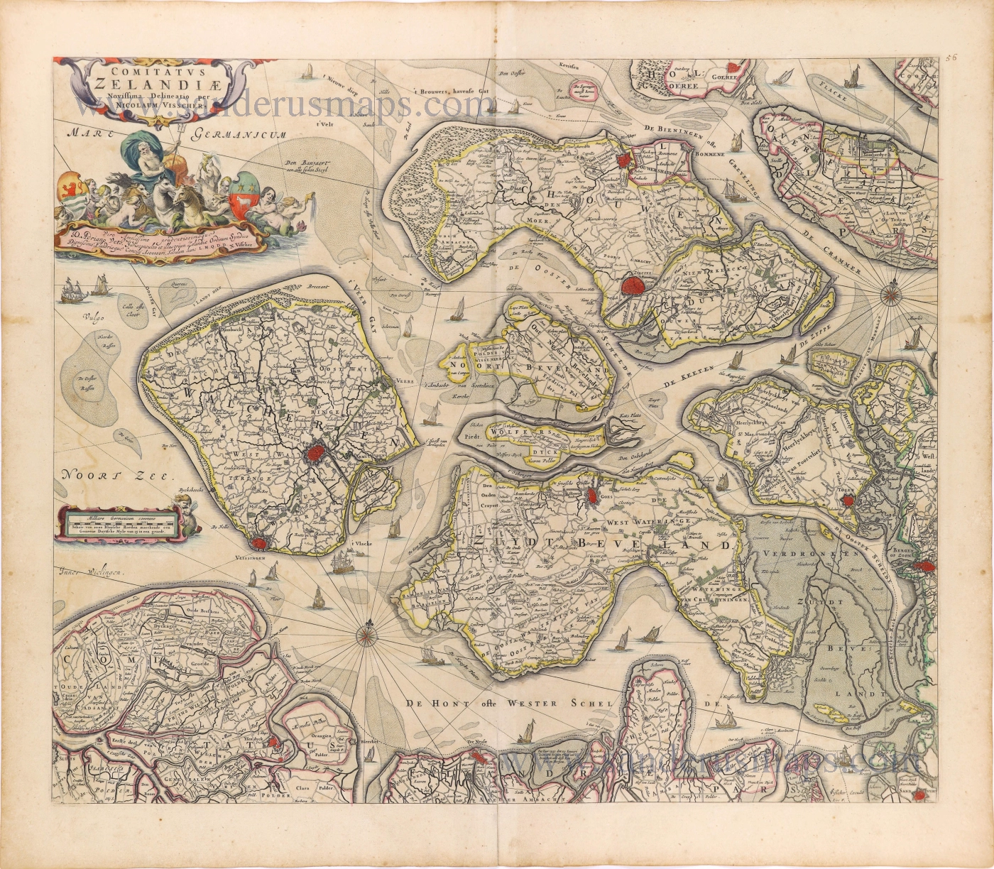
Comitatus Zelandiae. c. 1715
Zeeland by Nicolaas Visscher I, published by Petrus Schenk II.
[Item number: 28275]
Rare and important sea chart.
Beschrijvinghe vande Zeeusche Eijlanden Soe die op hare Strome geleghen zijn, met een deel vande Zee Custen van Vlaenderen enn Hollant. - Insularum Zelandiae, partisque Flandriae et Hollandiae accuratißima littoralis descriptio. 1586
Lucas Janszoon Waghenaer, Zeeland and Flanders.
[Item number: 28469]
Comitatus Zelandiae. 1658-80
Zeeland by Nicolaes Visscher I.
[Item number: 28602]
Zeelandia Comitatus. c. 1636
Zeeland by Cornelis Danckerts.
[Item number: 28771]
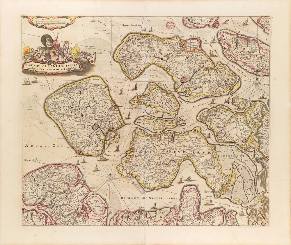
Comitatus Zelandiae Tabula. ca. 1705
Zeeland by Frederick de Wit.
[Item number: 29008]
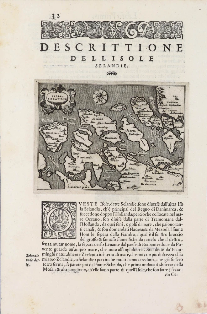
Isole Selandia - [Above map :] Descrittione dell'Isole Selandie. 1590
Zeeland, by Thomaso Porcacchi.
[Item number: 29759]
Zeelandia Comitatus. 1643
Zeeland, by W. Blaeu.
[Item number: 29937]