
Rare first edition!
Japan by Barent Langenes & Cornelis Claesz 1598
The Caert-Thresoor of 1598 set a new standard for minor atlases. Scholars like Petrus Bertius and Jacobus Viverius edited the text. The small maps are extremely well engraved, neat, clear, and elegantly composed. They served many purposes in other books published in Amsterdam. Their contents reflect the level of cartography in Amsterdam at the turn of the century, where up-to-date information on newly discovered regions was readily available. The Caert-Thresoor is a collection of maps to which the text was adapted and not the other way around, as with many geographical studies. The first edition was published in 1598 by Barent Langenes, a bookseller and publisher in Middelburg. Little is known about Langenes, except that he published some travel descriptions.
Barent Langenes ans his Caert-Thresoor
Barent Langenes, a Dutch bookseller and publisher of Middelburg (Zeeland), about whom little is known, was the first printer of the Caert-Thresoor (1598), a small-size atlas with an exciting history. This atlas had many editions in Dutch, Latin, French, and German, later brought out by Cornelis Claesz and Jodocus Hondius. Langenes was involved in the first two Dutch editions.
The Caert-Thresoor, is a collection of maps to which the text was adapted and not the reverse, as in the case with many geographical studies. The most exciting maps are those of the English and the Dutch in arctic waters, searching for the route to China (Northwest Passage). It records the departure of the third fleet of the Dutch in spring 1596, but not the return of survivors of this tragic voyage in August 1597. This atlas sets a new standard for minor atlases. Moreover, it was affordable to the citizens of the lowest income.
The text was rewritten, first by Petrus Bertius and reissued in 1600, secondly in 1609 by Jacobus Viverius. The edition with original basic text continued to be published until 1609, the year of Cornelis Claesz’s death.
Cornelis Claesz.
Printer and bookseller in Amsterdam, 1580-1609. He is famous for publishing maps, pilot guides, and atlases in the beginning period of the development of cartography in the northern Netherlands. He is noted for his co-operation with the cartographer Petrus Plancius and his editions of voyages. After 1590, the works of Lucas Jansz. He published Waghenaer, and in 1599, he acquired the publication rights of Barent Langenes’ Caert-thresoor.
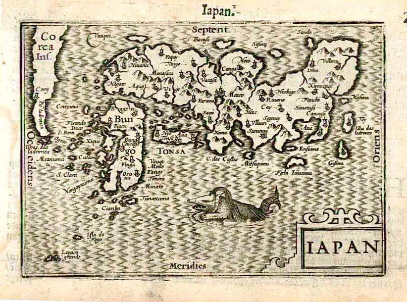
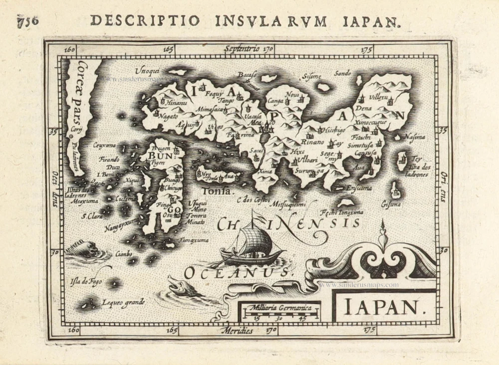
Iapan.
Item Number: 26543 Authenticity Guarantee
Category: Antique maps > Asia > Japan
Old, antique map of Japan by Barent Langenes & Cornelis Claesz.
Title: Iapan.
Oriented to the east.
Date of the first edition: 1598.
Date of this map: 1598.
Copper engraving, printed on paper.
Size (not including margins): 85 x 125mm (3.35 x 4.92 inches).
Verso: Dutch text.
Condition: Excellent.
Condition Rating: A+.
From: Barent Langenes. Caert-Tresoor, Inhoudende de tafelen des gansche Werelts Landen, met beschryvingen verlicht, tot lust vanden Leser, nu alles van nieus met groote costen ende arbeyt toegereet. Middelburg, Barent Langenes, 1598. (Van der Krogt 3, 341:01)
The Caert-Thresoor of 1598 set a new standard for minor atlases. Scholars like Petrus Bertius and Jacobus Viverius edited the text. The small maps are extremely well engraved, neat, clear, and elegantly composed. They served many purposes in other books published in Amsterdam. Their contents reflect the level of cartography in Amsterdam at the turn of the century, where up-to-date information on newly discovered regions was readily available. The Caert-Thresoor is a collection of maps to which the text was adapted and not the other way around, as with many geographical studies. The first edition was published in 1598 by Barent Langenes, a bookseller and publisher in Middelburg. Little is known about Langenes, except that he published some travel descriptions.
Barent Langenes ans his Caert-Thresoor
Barent Langenes, a Dutch bookseller and publisher of Middelburg (Zeeland), about whom little is known, was the first printer of the Caert-Thresoor (1598), a small-size atlas with an exciting history. This atlas had many editions in Dutch, Latin, French, and German, later brought out by Cornelis Claesz and Jodocus Hondius. Langenes was involved in the first two Dutch editions.
The Caert-Thresoor, is a collection of maps to which the text was adapted and not the reverse, as in the case with many geographical studies. The most exciting maps are those of the English and the Dutch in arctic waters, searching for the route to China (Northwest Passage). It records the departure of the third fleet of the Dutch in spring 1596, but not the return of survivors of this tragic voyage in August 1597. This atlas sets a new standard for minor atlases. Moreover, it was affordable to the citizens of the lowest income.
The text was rewritten, first by Petrus Bertius and reissued in 1600, secondly in 1609 by Jacobus Viverius. The edition with original basic text continued to be published until 1609, the year of Cornelis Claesz’s death.
Cornelis Claesz.
Printer and bookseller in Amsterdam, 1580-1609. He is famous for publishing maps, pilot guides, and atlases in the beginning period of the development of cartography in the northern Netherlands. He is noted for his co-operation with the cartographer Petrus Plancius and his editions of voyages. After 1590, the works of Lucas Jansz. He published Waghenaer, and in 1599, he acquired the publication rights of Barent Langenes’ Caert-thresoor.
Related items
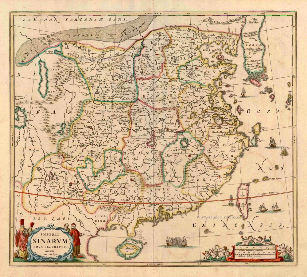
Imperii Sinarum Nova Descriptio. c. 1680.
China with Japan, Korea and Taiwan, by J. Janssonius.
[Item number: 2618]
Iapan. 1602
Japan by Langenes, published by Bertius P.
[Item number: 12487]
Scarce map in old colour
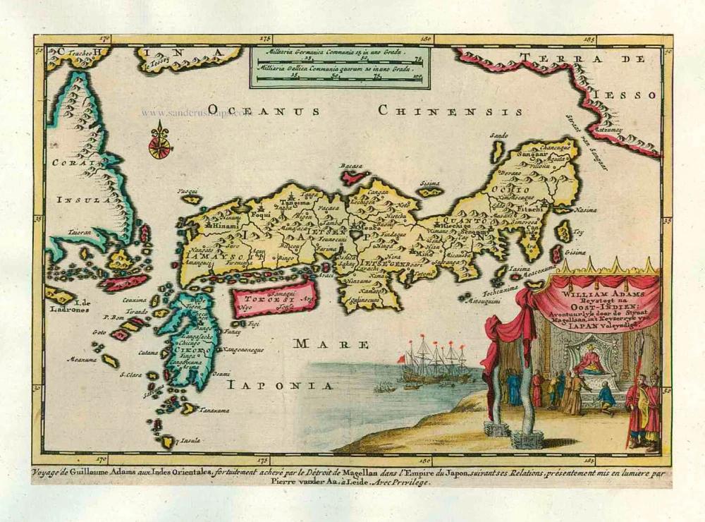
William Adams Reystogt na Oost-Indien; Avontuurlyk door de Straat Magellaan, in't Keyzerryk van Japan Voleyndigd. 1713
Japan by P. Van der Aa
[Item number: 26121]
In rare old colour
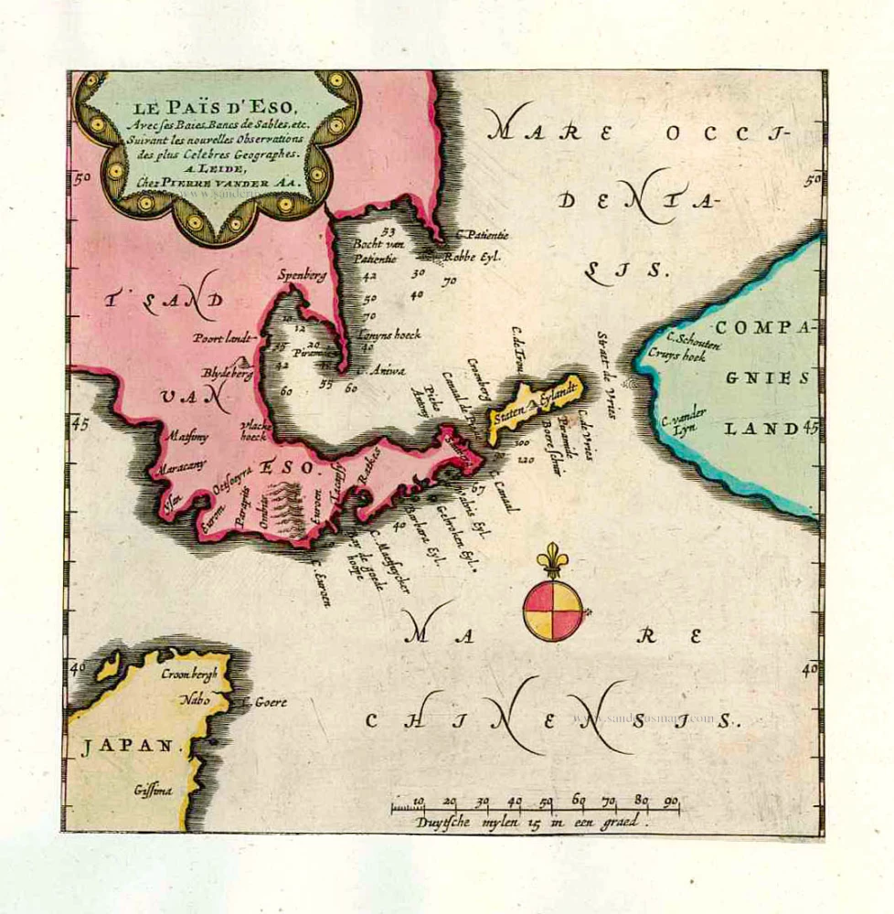
Le Païs d'Eso, Avec ses Baies, Bancs de Sables, etc. 1713
Eso (Hokkaido), by Pieter van der Aa.
[Item number: 26122]
In rare old colour
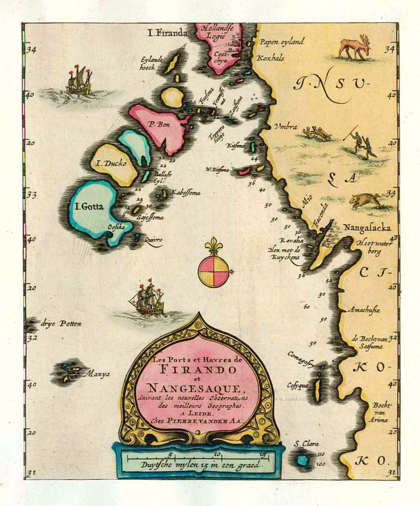
Les Ports et Havres de Firando et Nangesaque. 1713
Nagasaki and Hirado, by Pieter Van der Aa.
[Item number: 26123]
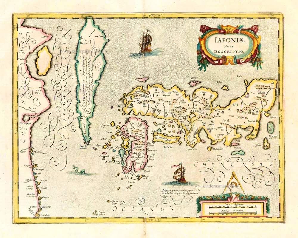
Iaponiae Nova Desciptio. 1641
Japan & Korea by Johannes Janssonius
[Item number: 26441]
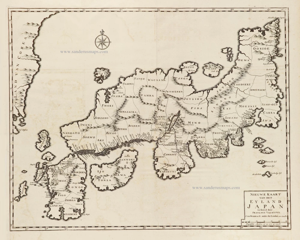
Nieuwe kaart van het Eyland Japan. 1724-26
Japan by François Valentyn (Valentijn).
[Item number: 26876]
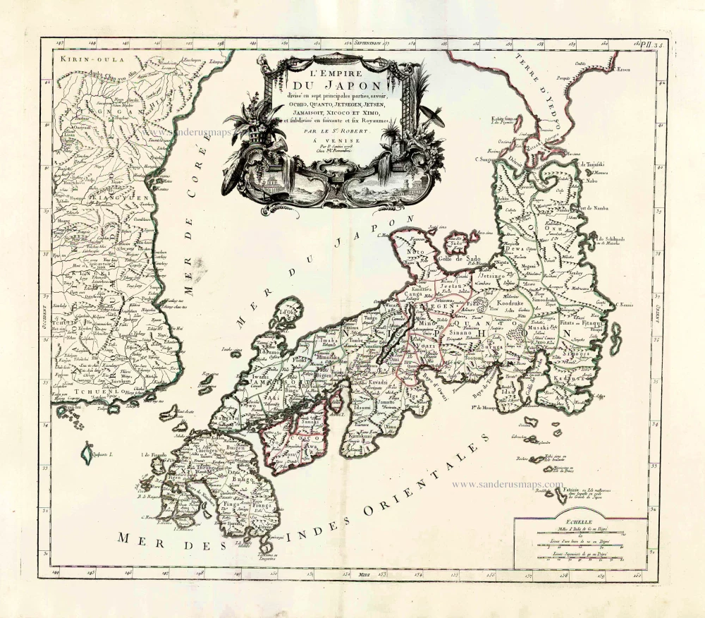
L'Empire du Japon Divisé en sept principales parties, savoir, Ochio, Quanto, Jetsegen, Jetsen, Jamaisoit, Xicoco et Ximo, et subdivisé en soixante et six Royaumes. 1776-79
Japan, by Francesco Santini.
[Item number: 26975]
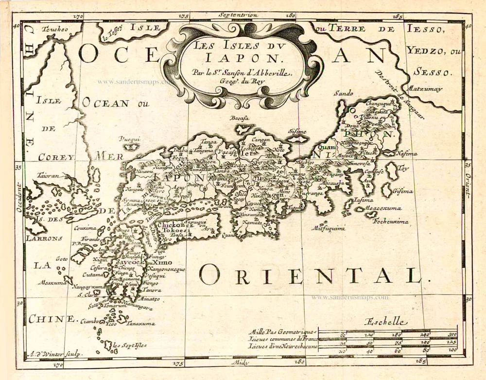
Les Isles du Iapon. 1683
Japan, by Nicolas Sanson.
[Item number: 27081]
Very nice old colour
Iaponia. 1623
Japan, Jodocus Hondius.
[Item number: 27819]

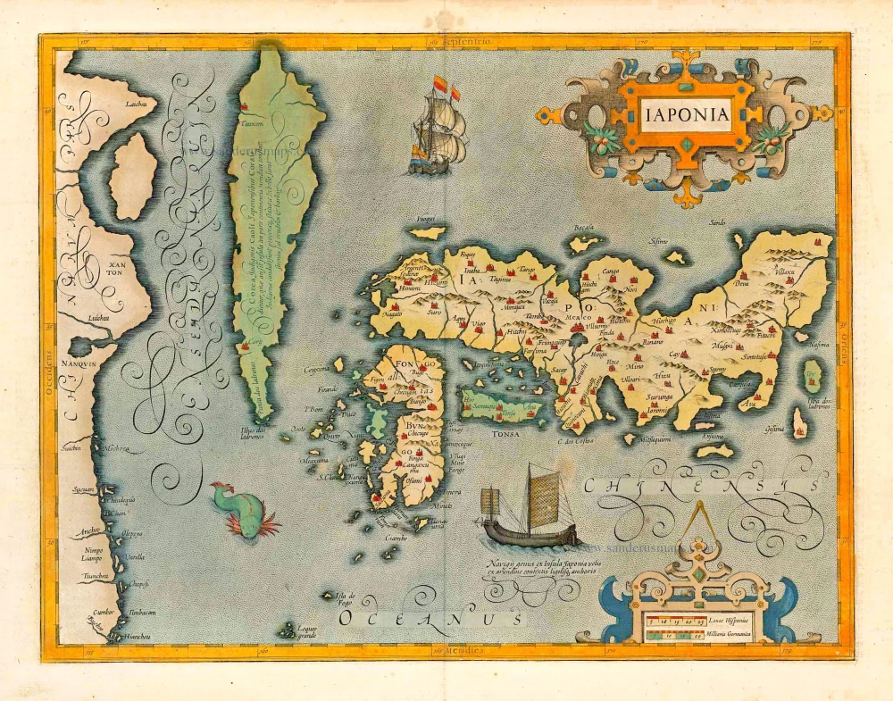
The first accurate European map of Japan.
Iaponiae Insulae Descriptio. 1609
Japan by Abraham Ortelius.
[Item number: 28433]
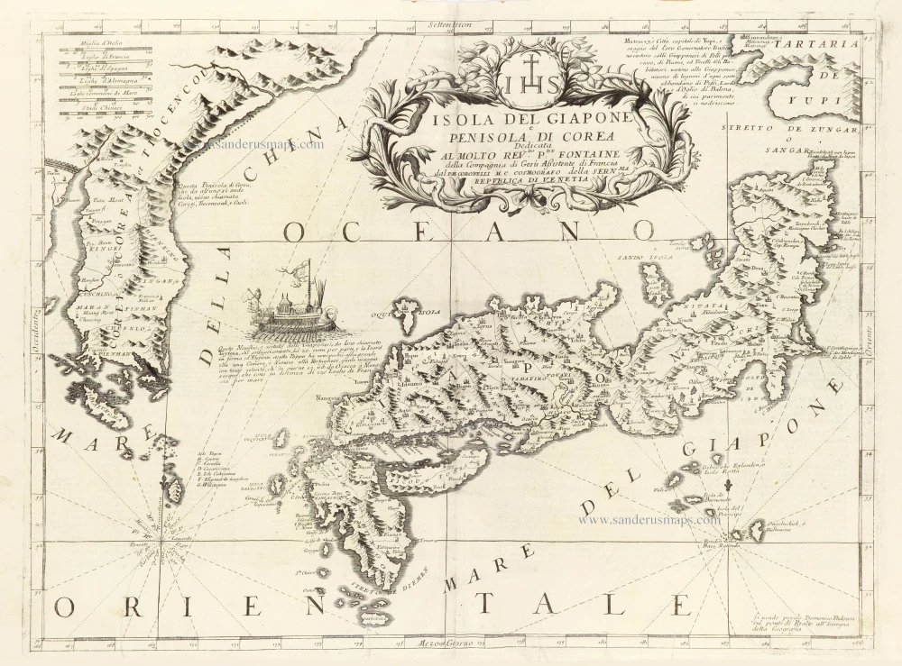
Isola del Giapone e Penisola di Corea. 1696
Japan - Korea by Vincenzo Coronelli.
[Item number: 28757]
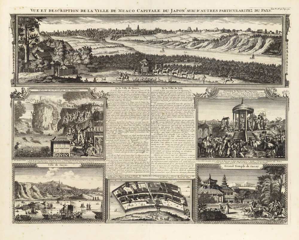
Vue et Description de la Ville de Meaco, Capitale du Japon avec d'autres Particularitez du Pays. 1719
Meaco (Kyoto - Japan), by Z. Châtelain.
[Item number: 29373]
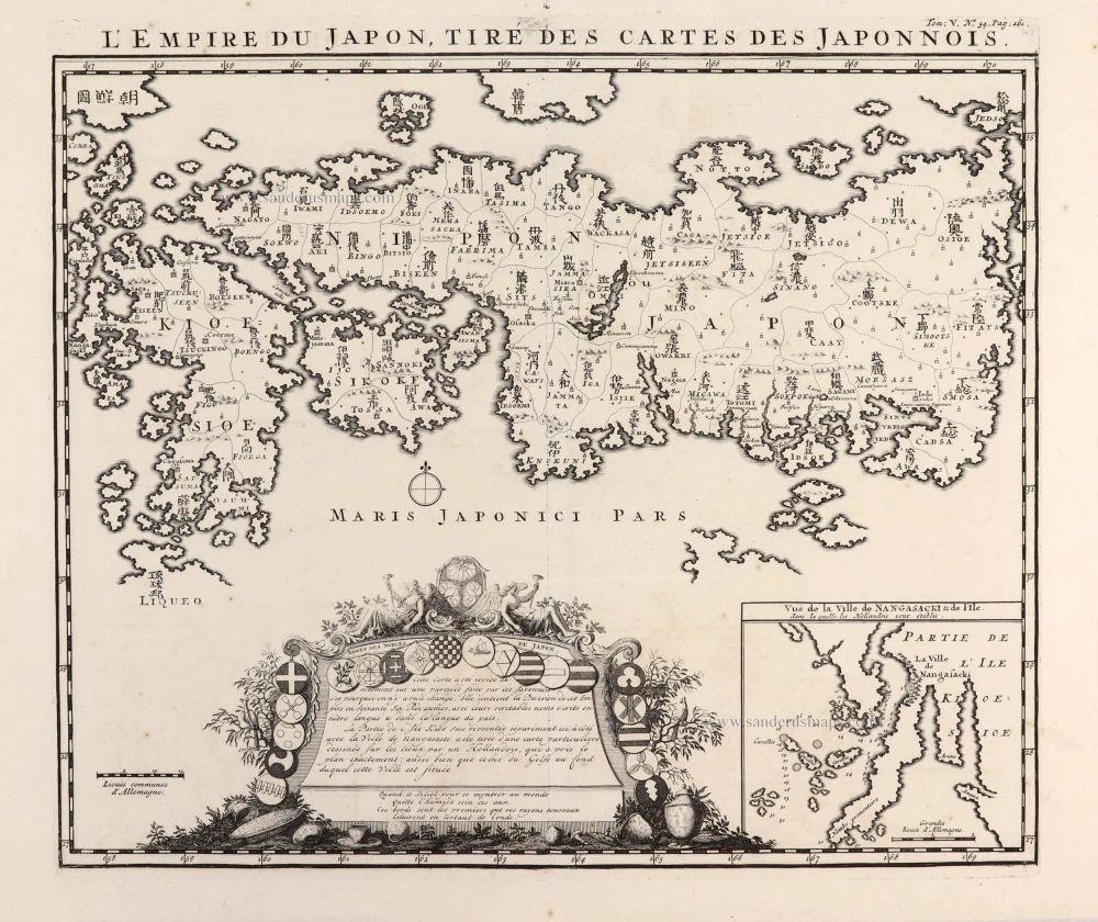
L'Empire du Japon, tiré des Cartes des Japonnois. 1719
Japan, by Z. Châtelain.
[Item number: 29379]
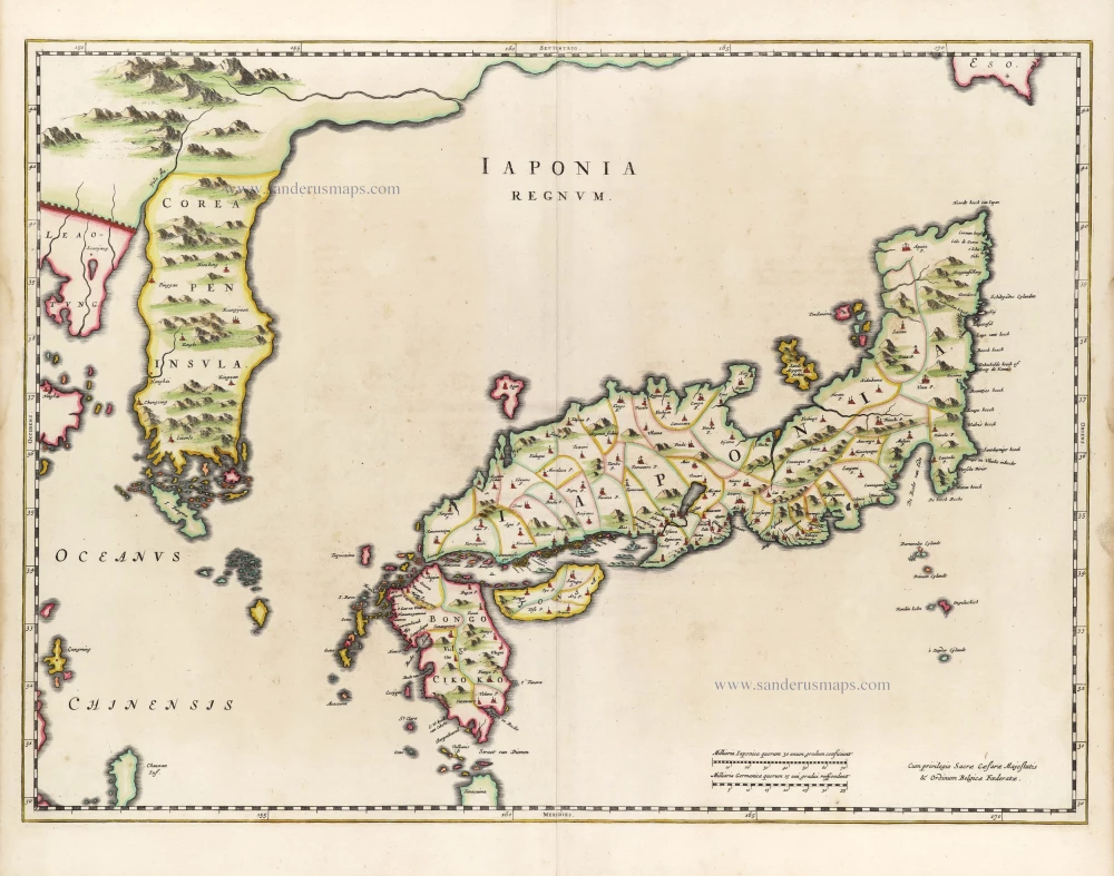
First map to show Korea as a peninsula. Excellent condition.
Iaponia Regnum. 1655-1659
Japan & Korea by Joan Blaeu.
[Item number: 29853]
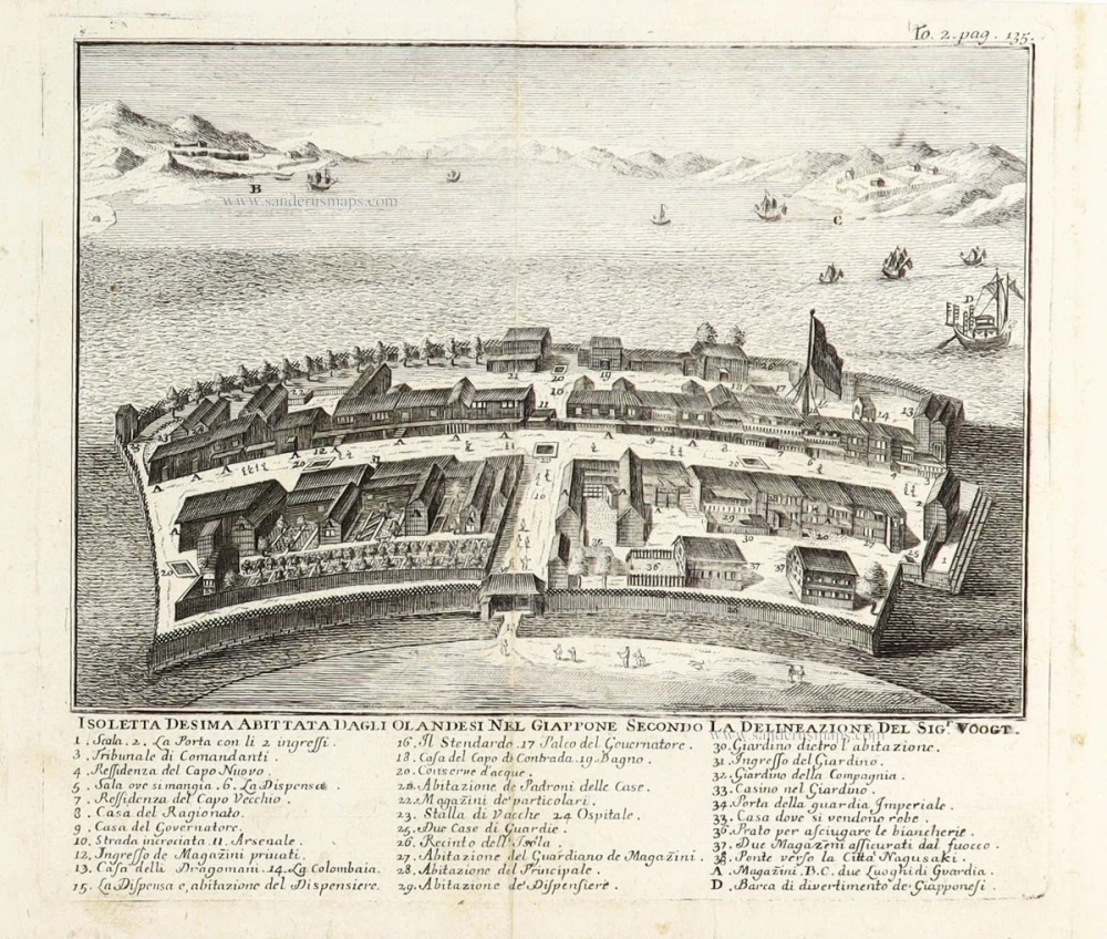
Isoletta Desima abittata dagli Olandeis nel Giappone secondo la delineazione del Sigr. Voogt. 1736
Deshima (Dejima - Japan) by Thomas Salmon after Gerrits Voogt.
[Item number: 29892]
Scarce
Iapan. 1616
Japan by Petrus Bertius, published by Jodocus Hondius jr.
[Item number: 30244]
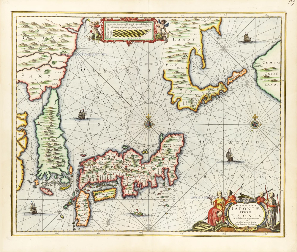
Nova et Accurata Iaponiae, Terrae Esonis, ac Insularum Adjacentium. 1666
Japan - Korea by Johannes Janssonius
[Item number: 30335]