
Europe by Barent Langenes & Cornelis Claesz 1598
Barent Langenes ans his Caert-Thresoor
Barent Langenes, a Dutch bookseller and publisher of Middelburg (Zeeland), about whom little is known, was the first printer of the Caert-Thresoor (1598), a small-size atlas with an exciting history. This atlas had many editions in Dutch, Latin, French, and German, later brought out by Cornelis Claesz and Jodocus Hondius. Langenes was involved in the first two Dutch editions.
The Caert-Thresoor, is a collection of maps to which the text was adapted and not the reverse, as in the case with many geographical studies. The most exciting maps are those of the English and the Dutch in arctic waters, searching for the route to China (Northwest Passage). It records the departure of the third fleet of the Dutch in spring 1596, but not the return of survivors of this tragic voyage in August 1597. This atlas sets a new standard for minor atlases. Moreover, it was affordable to the citizens of the lowest income.
The text was rewritten, first by Petrus Bertius and reissued in 1600, secondly in 1609 by Jacobus Viverius. The edition with original basic text continued to be published until 1609, the year of Cornelis Claesz’s death.
Cornelis Claesz.
Printer and bookseller in Amsterdam, 1580-1609. He is famous for publishing maps, pilot guides, and atlases in the beginning period of the development of cartography in the northern Netherlands. He is noted for his co-operation with the cartographer Petrus Plancius and his editions of voyages. After 1590, the works of Lucas Jansz. He published Waghenaer, and in 1599, he acquired the publication rights of Barent Langenes’ Caert-thresoor.
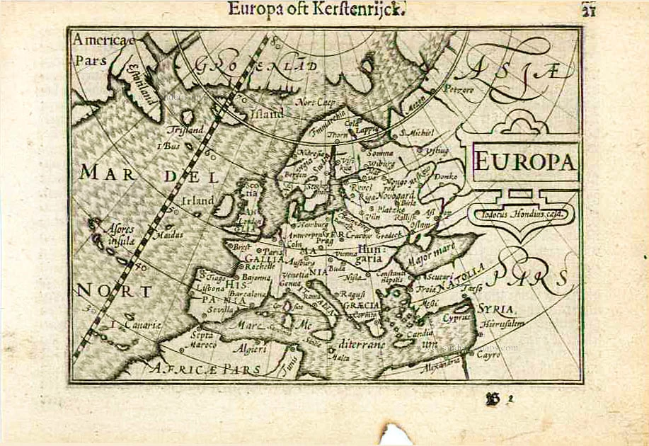
Europa [Title above:] Europa oft Kerstenrijck.
Item Number: 26674 Authenticity Guarantee
Category: Antique maps > Europe > Europe Continent
Old, antique map of Europe, by Barent Langenes.
Engraved by Jodocus Hondius.
Date of the first edition: 1598
Date of this map: 1598
Copper engraving, printed on paper.
Size (not including margins): 8.5 x 12.5cm (3.3 x 4.8 inches)
Verso text: Dutch
Condition: Excellent.
Condition Rating: A+
References: Van der Krogt 3, 0001:341A.1; Shirley (World), #211.
From: Old world map, by Cornelis Claesz and Barent Langenes.
Barent Langenes ans his Caert-Thresoor
Barent Langenes, a Dutch bookseller and publisher of Middelburg (Zeeland), about whom little is known, was the first printer of the Caert-Thresoor (1598), a small-size atlas with an exciting history. This atlas had many editions in Dutch, Latin, French, and German, later brought out by Cornelis Claesz and Jodocus Hondius. Langenes was involved in the first two Dutch editions.
The Caert-Thresoor, is a collection of maps to which the text was adapted and not the reverse, as in the case with many geographical studies. The most exciting maps are those of the English and the Dutch in arctic waters, searching for the route to China (Northwest Passage). It records the departure of the third fleet of the Dutch in spring 1596, but not the return of survivors of this tragic voyage in August 1597. This atlas sets a new standard for minor atlases. Moreover, it was affordable to the citizens of the lowest income.
The text was rewritten, first by Petrus Bertius and reissued in 1600, secondly in 1609 by Jacobus Viverius. The edition with original basic text continued to be published until 1609, the year of Cornelis Claesz’s death.
Cornelis Claesz.
Printer and bookseller in Amsterdam, 1580-1609. He is famous for publishing maps, pilot guides, and atlases in the beginning period of the development of cartography in the northern Netherlands. He is noted for his co-operation with the cartographer Petrus Plancius and his editions of voyages. After 1590, the works of Lucas Jansz. He published Waghenaer, and in 1599, he acquired the publication rights of Barent Langenes’ Caert-thresoor.
Related items

Imperii Caroli Magni et Vicinarum Regionum Descriptio ... 1635
Empire of Charlemagne, by Blaeu W.& J.
[Item number: 9393]
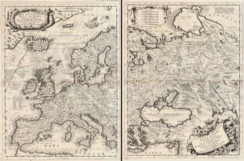
Parte Occidentale dell'Europa ... [in set with] Parte Orientale dell'Europa ... 1691
Europe, by V.M. Coronelli.
[Item number: 23186]

Europa Pars Tenet haec Mundi Reliquas Celeberrima Partes c. 1730.
Europe by G.& L. Valk.
[Item number: 24536]

Europae 1612
Europe by A. Ortelius
[Item number: 25052]
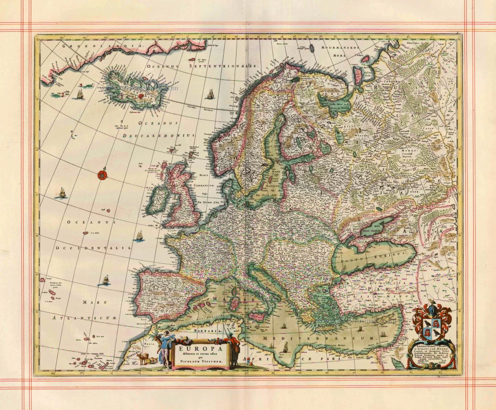
Europa delineata et recens edita. 1680
Europe by N. Visscher.
[Item number: 25056]
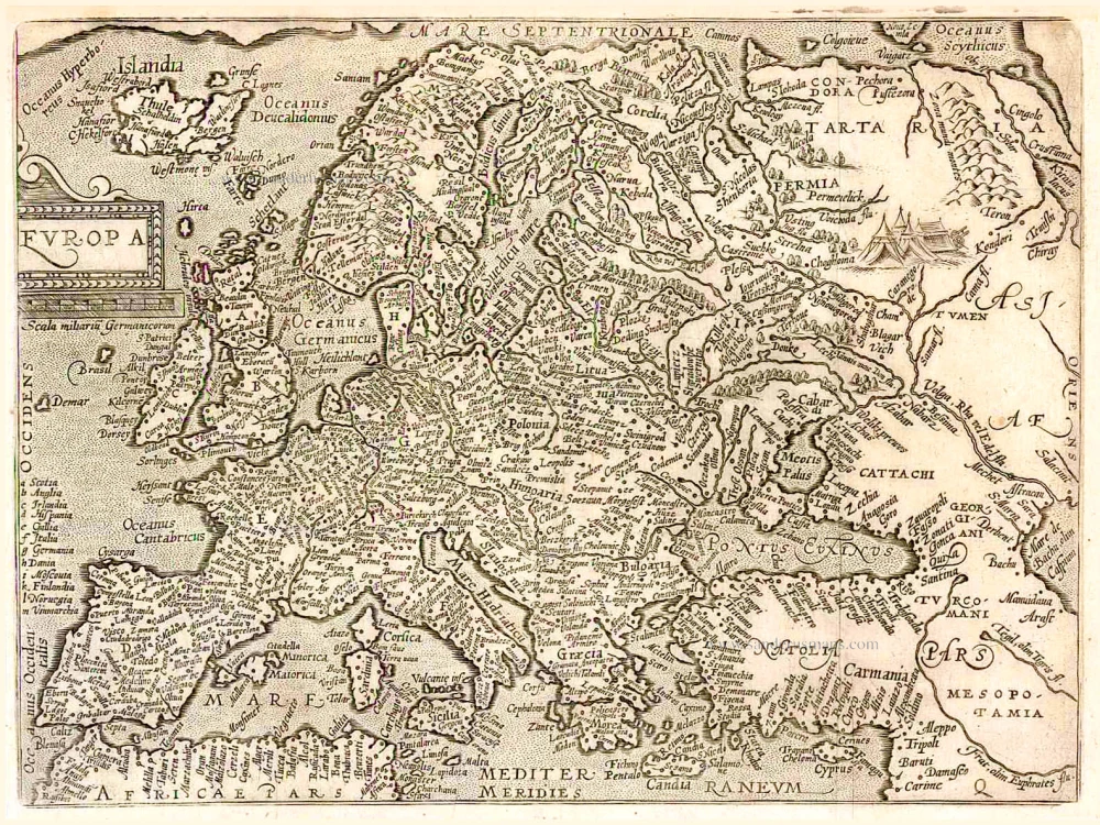
Europa. 1600
Europe, by Matthias Quad.
[Item number: 26666]
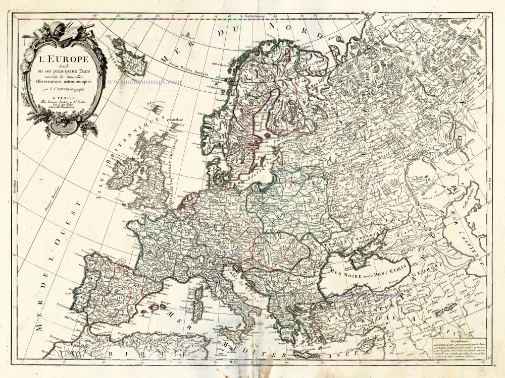
L'Europe Divisee en ses Principaux Etats. 1776-79
Europe, by Francesco Santini.
[Item number: 26947]
Big spectacular map
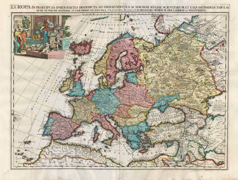
L'Europe selon les Nouvelles Observations de Messrs de l'Academie des Sciences, etc. Before 1713
Europe, by François Halma.
[Item number: 27850]