
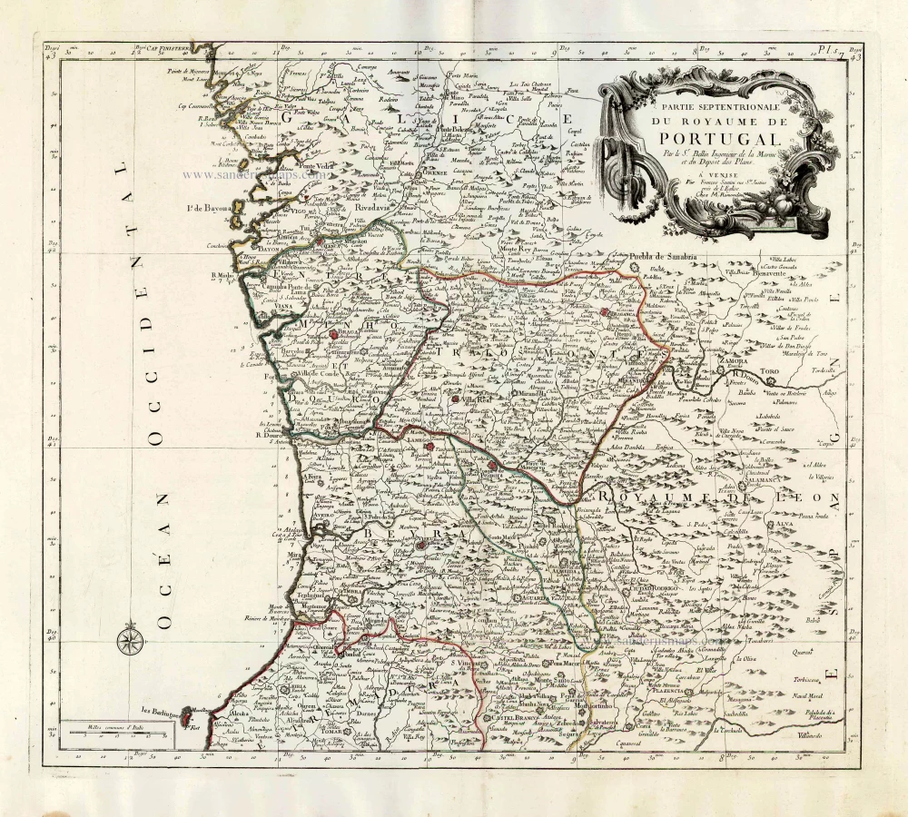
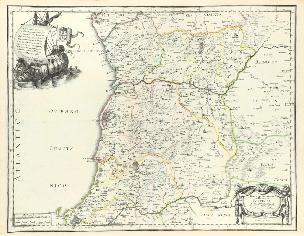
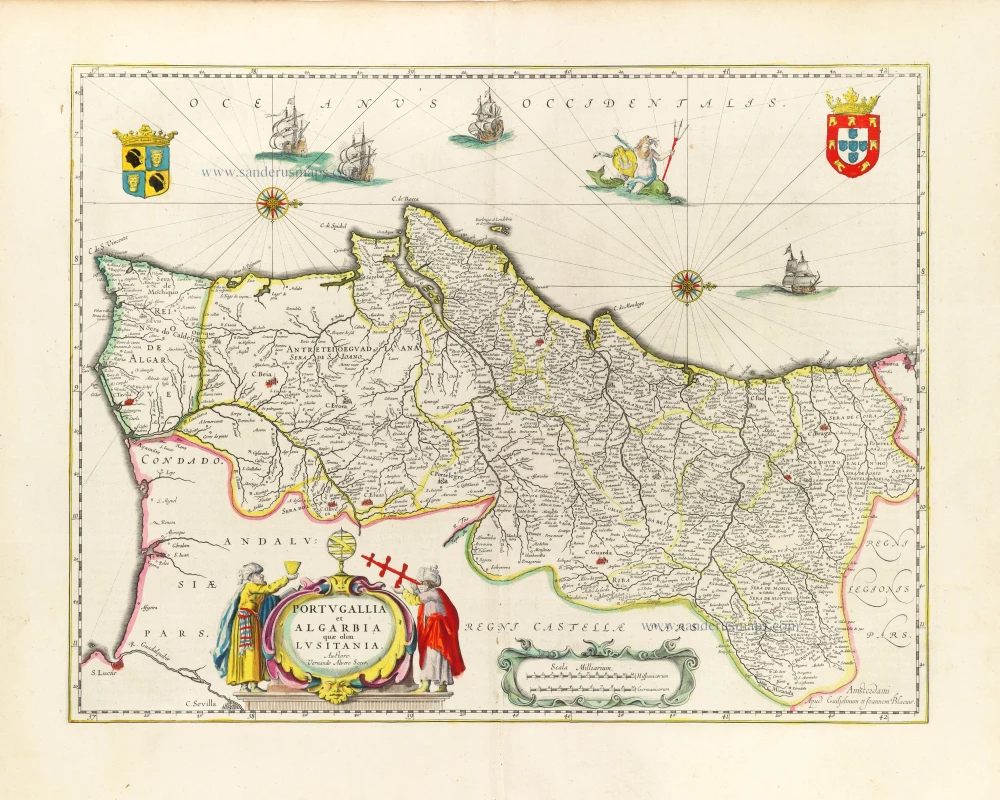
Northern Portugal, by Francesco Santini. 1776-79
Francesco and Paolo Santini (c.1729-1793)
Francesco Santini, a Venetian publisher, acquired the printing plates of Vaugondy’s Atlas Universel …, a commercial and cartographic success, with widespread influence on mapmakers throughout Europe. Together with his brother Paolo, he commissioned a new set of plates and reissued the atlas in 1776. The following year, Paolo Santini assigned all his publication rights to M. Remondini, who in 1777 reissued the same atlas but with his name.
Jacques-Nicolas Bellin (1703-1772)
Jacques-Nicolas Bellin, a French geographer, was among the most important mapmakers of the eighteenth century. In 1721, at the age of 18, he was appointed hydrographer of the Ministry of the Navy following the French hydrographic office's creation and the Dépot of charts and plans of the Navy. Appointed hydrographic engineer in August 1741. Member of the Academy of the Navy and the Royal Society of London.
Over the course of a 50-year career, he drew the maps of several major works of his time such as Histoire et description générale de la Nouvelle-France de Charlevoix (1744); Histoire générale des voyages de l'Abbé Prévost (published between 1746 and 1759) ); Neptune François (1753), Hydrographie Françoise (1756-1765), and Petit Atlas Français (1763) - reissued as Petit Atlas Maritime (1765). He is the most copied cartographer of the 18th century.
His maps of Canada and the French territories of North America are of considerable value. This is all the more remarkable since, an archetype of the cabinet cartographer, Bellin never came to America. For his cartography of the St. Lawrence River, he entrusted handwritten maps to navigators to correct and enrich. With each return of these maps, he was updating his knowledge. Two basic needs drive its cartography of North America: to secure navigation on the St. Lawrence River and to claim for France the lands explored by the French in the Great Lakes region and along the Mississippi River.
Jacques-Nicolas Bellin died on March 21, 1772, in Versailles. In the burial certificate, he is described as "the first engineer of the navy and the deposit of plans, royal censor of the academy of navy and the royal society of London".
Partie Septentrionale du Royaume de Portugal.
Item Number: 26951 Authenticity Guarantee
Category: Antique maps > Europe > Spain and Portugal
Old, antique map of Northern Portugal, by Francesco Santini
Cartographer: Jacques Nicolas Bellin
First state with the imprint of Remondini: with engraved page numbers in the top right corner: "P.I.5".
Date of the first edition: 1776
Date of this map: 1776
Copper engraving, printed on paper.
Size (not including margins): 48 x 54cm (18.7 x 21.1 inches)
Verso: Blank
Condition: Original coloured in outline, excellent.
Condition Rating: A+
From: Atlas Universel dressé sur les meilleures cartes modernes. Venice, Remondini, 1776.
Francesco and Paolo Santini (c.1729-1793)
Francesco Santini, a Venetian publisher, acquired the printing plates of Vaugondy’s Atlas Universel …, a commercial and cartographic success, with widespread influence on mapmakers throughout Europe. Together with his brother Paolo, he commissioned a new set of plates and reissued the atlas in 1776. The following year, Paolo Santini assigned all his publication rights to M. Remondini, who in 1777 reissued the same atlas but with his name.
Jacques-Nicolas Bellin (1703-1772)
Jacques-Nicolas Bellin, a French geographer, was among the most important mapmakers of the eighteenth century. In 1721, at the age of 18, he was appointed hydrographer of the Ministry of the Navy following the French hydrographic office's creation and the Dépot of charts and plans of the Navy. Appointed hydrographic engineer in August 1741. Member of the Academy of the Navy and the Royal Society of London.
Over the course of a 50-year career, he drew the maps of several major works of his time such as Histoire et description générale de la Nouvelle-France de Charlevoix (1744); Histoire générale des voyages de l'Abbé Prévost (published between 1746 and 1759) ); Neptune François (1753), Hydrographie Françoise (1756-1765), and Petit Atlas Français (1763) - reissued as Petit Atlas Maritime (1765). He is the most copied cartographer of the 18th century.
His maps of Canada and the French territories of North America are of considerable value. This is all the more remarkable since, an archetype of the cabinet cartographer, Bellin never came to America. For his cartography of the St. Lawrence River, he entrusted handwritten maps to navigators to correct and enrich. With each return of these maps, he was updating his knowledge. Two basic needs drive its cartography of North America: to secure navigation on the St. Lawrence River and to claim for France the lands explored by the French in the Great Lakes region and along the Mississippi River.
Jacques-Nicolas Bellin died on March 21, 1772, in Versailles. In the burial certificate, he is described as "the first engineer of the navy and the deposit of plans, royal censor of the academy of navy and the royal society of London".
Related items
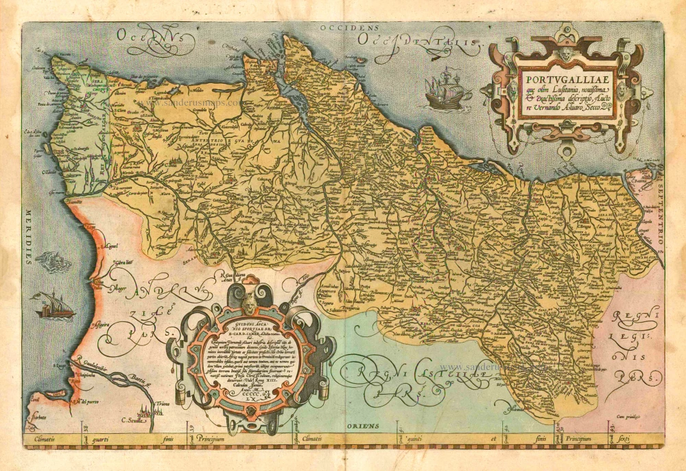
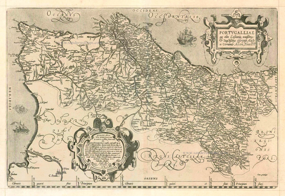
Portugalliae que olim Lusitania, novissima & exactissima descriptio, ... 1601
Portugal by A. Ortelius.
[Item number: 5729]
Very rare!
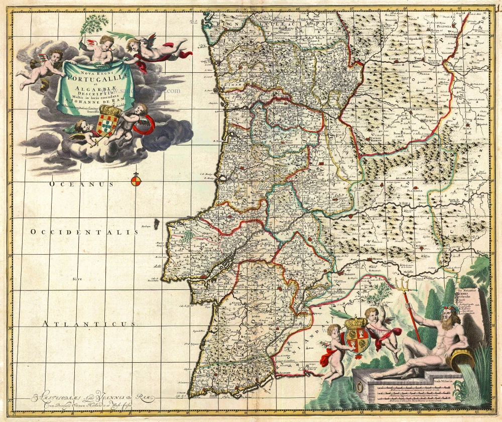
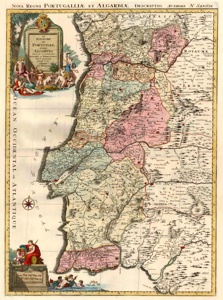
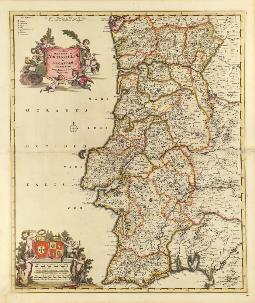
Nova Regni Portugalliae et Algarbiae Descriptio ... c. 1690
Portugal by J. de Ram, published by F. De Wit.
[Item number: 13745]
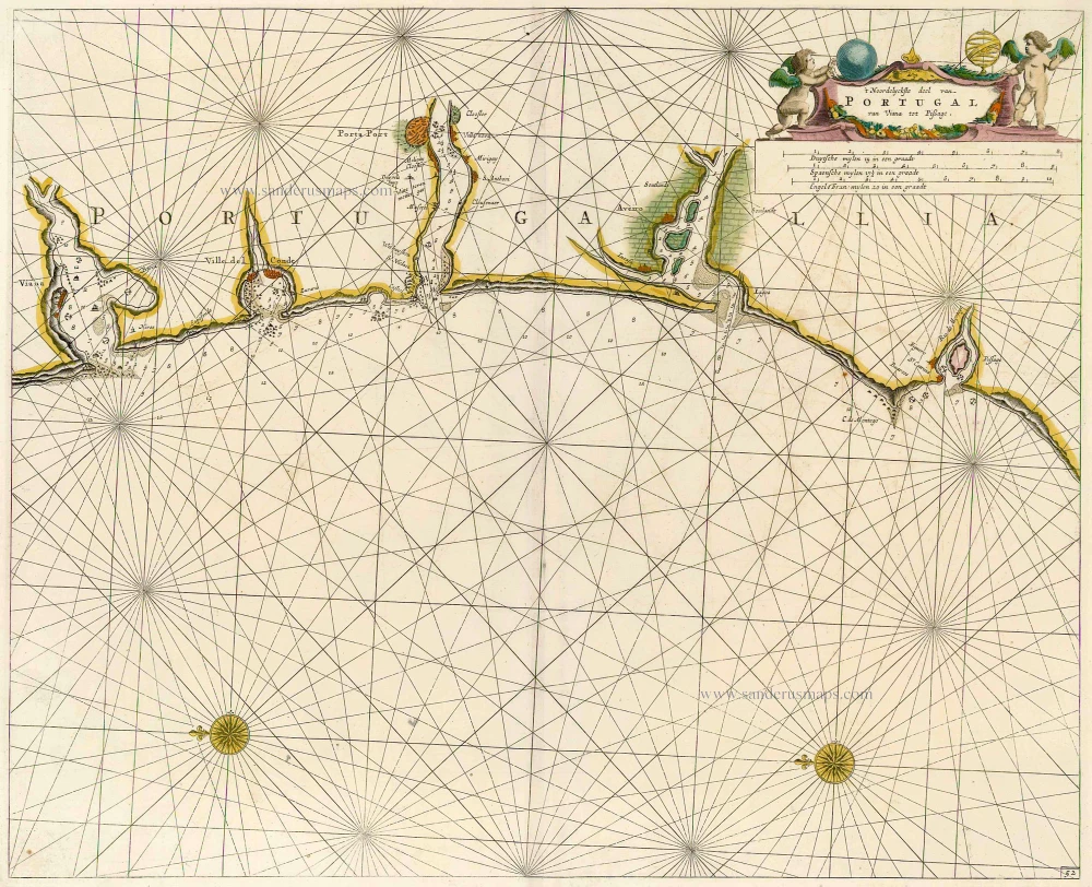
't Noordelyckste deel van Portugal van Viana tot Pissage. 1686
Sea chart of Portugal by Doncker H.
[Item number: 15379]
Portugalliae que olim Lusitania, novissima & exactissima descriptio, ... 1598
Portugal, by Abraham Ortelius.
[Item number: 22917]
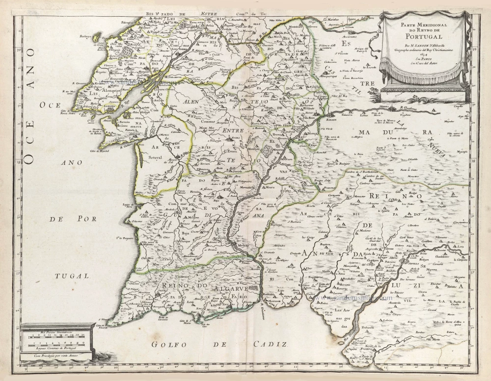
Le Royaume de Portugal et des Algarves ... 1710
Portugal, by Sanson - Covens & Mortier.
[Item number: 23699]
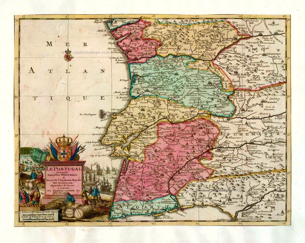
Le Portugal. 1713
Portugal, by Pieter van der Aa.
[Item number: 26086]
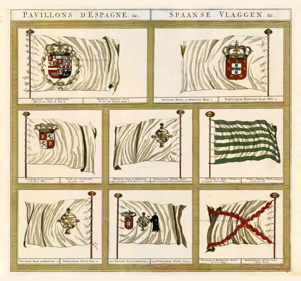
Pavillons d'Espagne. &c. - Spaanse Vlaggen. &c. 1700
Eight flags of Spain and Portugal, by Pieter (Pierre) Mortier.
[Item number: 26708]
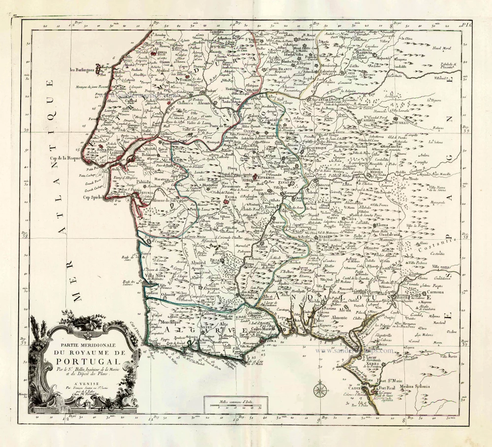
Partie Méridional du Royaume de Portugal. 1776-79
Southern Portugal, by Francesco Santini.
[Item number: 26952]
Novissima Regnorum Portugalliae et Algarbiae Descriptio. c. 1690
Portugal by Frederick de Wit.
[Item number: 28748]
Parte Septentrional do Reyno de Portugal. 1658
Northern Portugal by Nicolas Sanson.
[Item number: 29663]
Parte Septentrional do Reyno de Portugal. 1658
Southern Portugal by Nicolas Sanson.
[Item number: 29664]
Portugallia et Algarbia quae olim Lusitania. 1643
Portugal, by Willem & Joan Blaeu.
[Item number: 30529]
new